Download Agreement, Release, and Acknowledgement of Risk:
You (the person requesting this file download) fully understand mountain climbing ("Activity") involves risks and dangers of serious bodily injury, including permanent disability, paralysis, and death ("Risks") and you fully accept and assume all such risks and all responsibility for losses, costs, and damages you incur as a result of your participation in this Activity.
You acknowledge that information in the file you have chosen to download may not be accurate and may contain errors. You agree to assume all risks when using this information and agree to release and discharge 14ers.com, 14ers Inc. and the author(s) of such information (collectively, the "Released Parties").
You hereby discharge the Released Parties from all damages, actions, claims and liabilities of any nature, specifically including, but not limited to, damages, actions, claims and liabilities arising from or related to the negligence of the Released Parties. You further agree to indemnify, hold harmless and defend 14ers.com, 14ers Inc. and each of the other Released Parties from and against any loss, damage, liability and expense, including costs and attorney fees, incurred by 14ers.com, 14ers Inc. or any of the other Released Parties as a result of you using information provided on the 14ers.com or 14ers Inc. websites.
You have read this agreement, fully understand its terms and intend it to be a complete and unconditional release of all liability to the greatest extent allowed by law and agree that if any portion of this agreement is held to be invalid the balance, notwithstanding, shall continue in full force and effect.
By clicking "OK" you agree to these terms. If you DO NOT agree, click "Cancel"...
I have been really getting the itch to get to the mountains, but, due to time constraints an opportunity to head up to Colorado hasn't been able to make it's way into my schedule. I didn't even know Sierra Grande was accessible until I talked to a co-worker that had hiked it with his son several years ago. I did some research all over the web and there was very little info, and what was there was pretty vague and no where near as detailed as what I am used to on this site. One thing I do know however, this is a first trip report for this peak on this site......I know it is not exciting or spellbinding, but hopefully someone that has looked at this extinct shield volcano and wondered about hiking it can get some good info out of this.
I found out some interesting info about Sierra Grande while searching for hike info, more specifically, Sierra Grande is the easternmost mountain in the U.S. that reaches over 8000 ft above sea level. I thought that was pretty cool. It is also the tallest and , some believe, the most recently active volcano of the Clayton-Raton Volcano field.
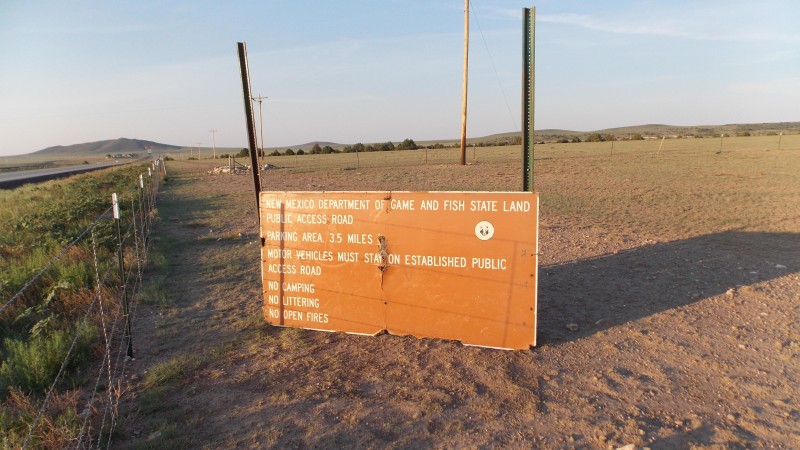
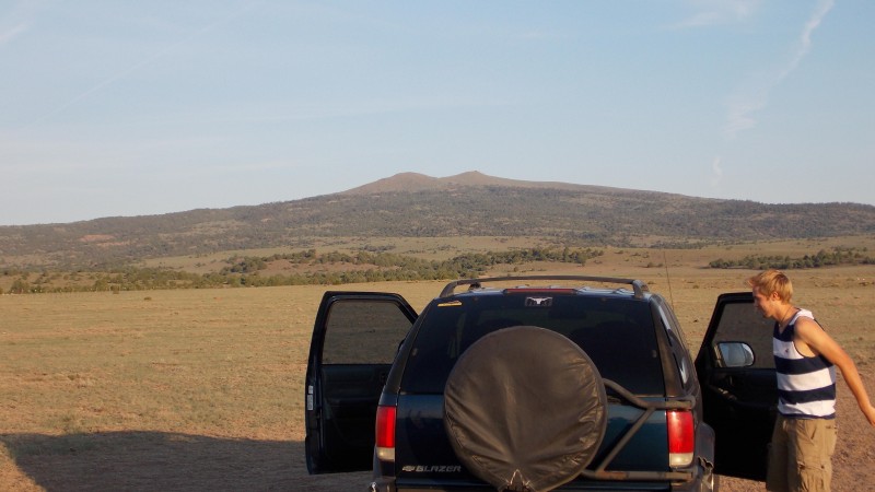
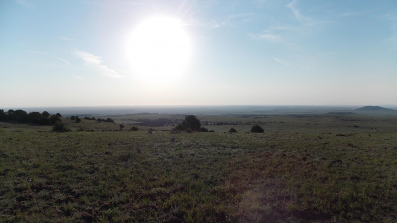
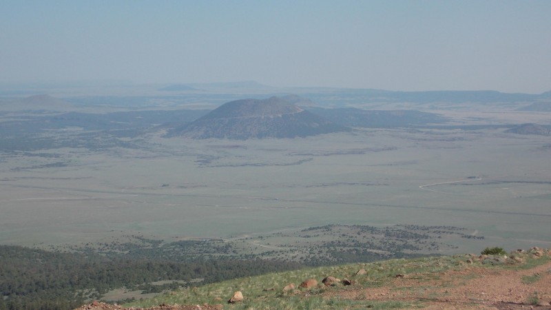
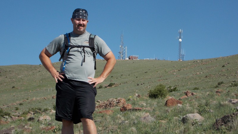
I had wanted to try to get this hike in before my wife and daughters headed up to Ohio to visit my in-laws, but due to my son's baseball schedule, daughters dance recital and practice schedule and work, I had to make this a quick day trip with my son and his girlfriend a couple days after my girls left. We left Borger, TX at about 4:30 am central time and the Garmin had us arriving at the base of Sierra Grande a little before 6:30 am mountain time. After one quick stop in Clayton for gas and restroom break, we made it to the signed gate on the SE side of Sierra Grande. This sign was laying on the ground and we had a hard time finding the right gate. This is the view of Sierra Grande from the gate just off the highway. The gate is at mile marker 391 on highway 87/64 just between a rest area and a roadside restaurant outside of Des Moines, NM. It took us a while to find the gate due to the sign marking the entrance being blown over at some point recently. I set the sign back up, but I didn't have anything to fasten it to the stakes at the gate.
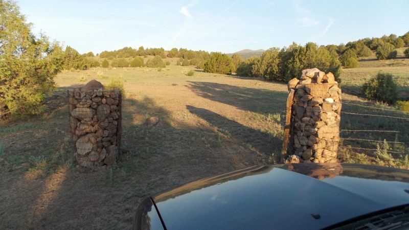
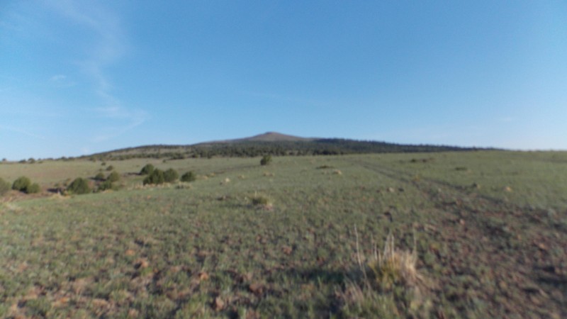
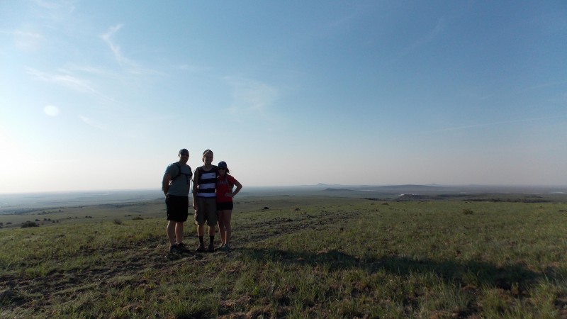
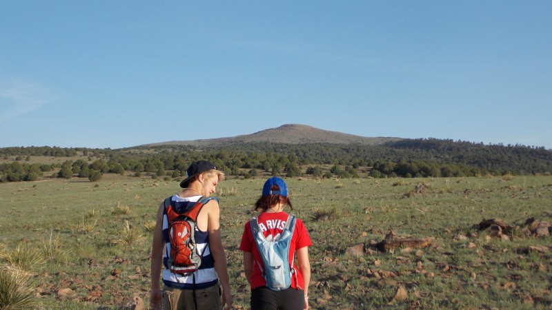
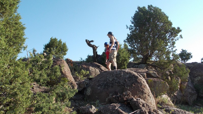
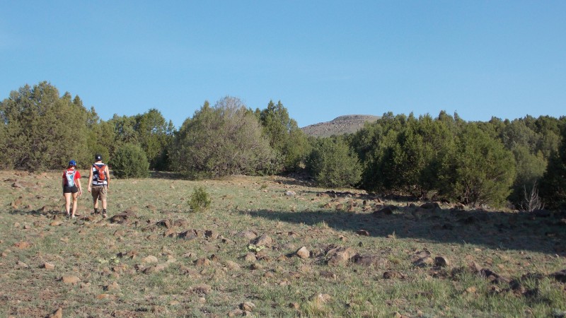
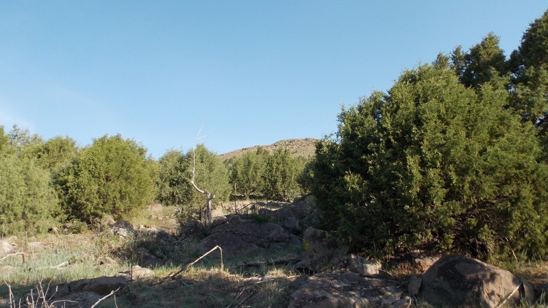
The sign says that the parking area is at 3.5 miles from the gate, so I reset my trip odometer and started up the road. At .9 miles up the rough road there is a fork....I took the left. WRONG! I should have taken the right. Nevertheless, and unbeknownst be me, we continued to head the wrong way, through some really rocky and some decent road until my odometer read 3.5. I did not see a signed parking area like I had read there would be online. But the area were now at was a large clearing and had a good straight view to the summit, so we decided to park off the side of the road, get our packs out and start that way. One of the gates we went through. This is the view of the peak from where we ended up parking. and a view back to the east from where we parked. Our group for the day! Alright, let's do this! IT'S GO TIME! Our view to the E/SE from where we started the hike Cooling off in the shade. Going over one of the rock walls Views back towards our "trailhead"
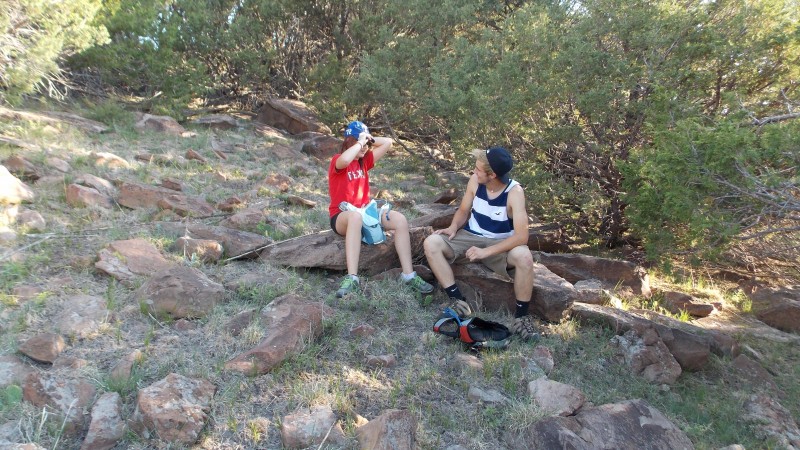
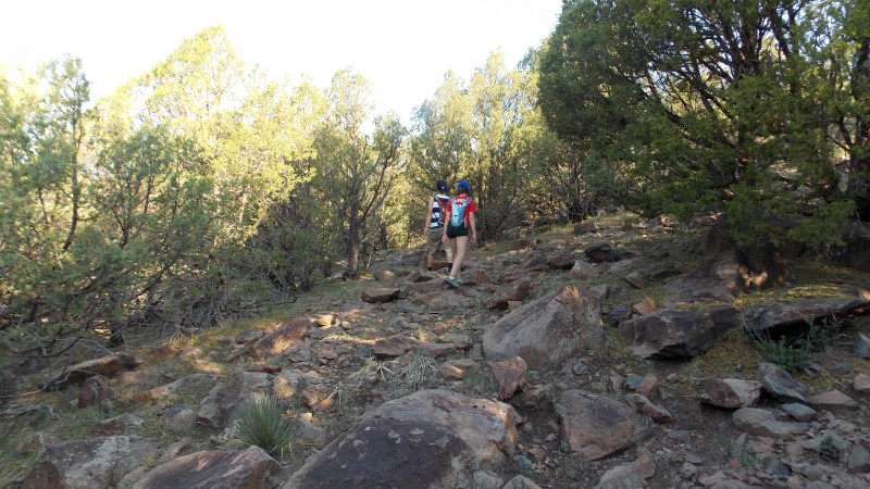
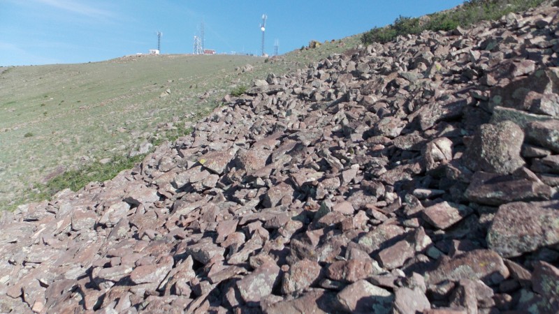
There never really is a trail, so we just picked a line that stayed uphill and we tried to stay out of areas that the juniper trees were thick. The next several pictures are should give you an idea of what we experienced. We also came across several rock wall formations that a person could climb to make the hike slightly spicier...but not much.
Not really a trail, just going uphill and trying to stay in the clearings. This was pretty typical conditions for the day More hike conditions One of the rock wall formations we skirted around
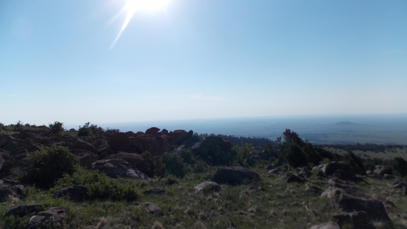
After about an hour into the hike we made it to the first of two false summits. We decided to take a break here and take in some views and catch our breath before heading on up to the true summit. Good views despite the hazy skies Views from the first false summit. Taking a break from the first false summit
From this first false summit we could see the true summit about 200 ft above us and a quarter mile away. The view of the true summit from our false summit rest break.
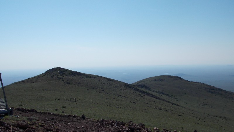
We decided that we really did not care to bag the second false summit, so we chose a line that skirted around the base of the second false summit, went over a small boulder field and then went on up the gentle south slope of the true summit. A small boulder field we chose to cross...just to add a little fun to a rather bland hike. Almost there! Looking down from our bouldering spot.
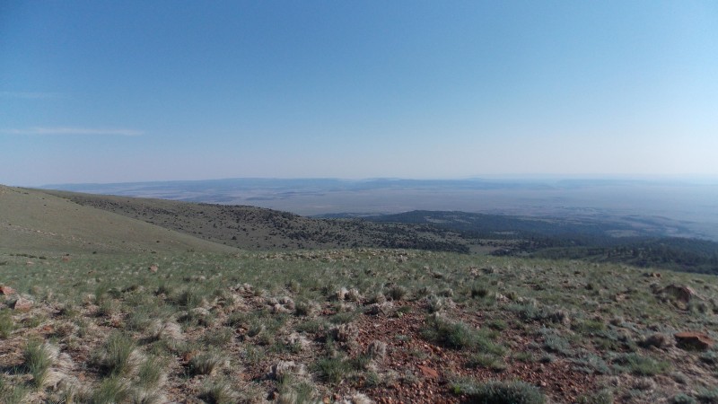
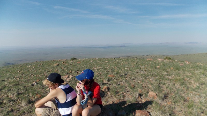
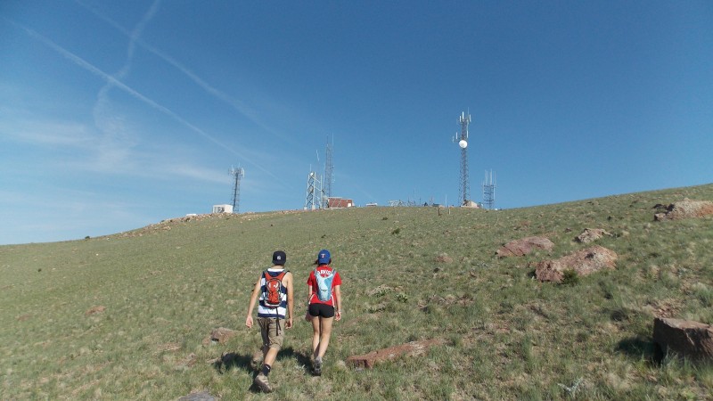
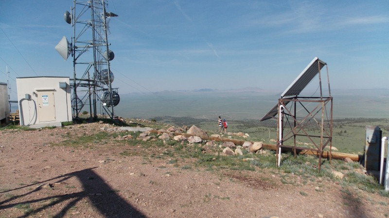
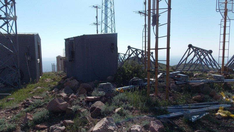
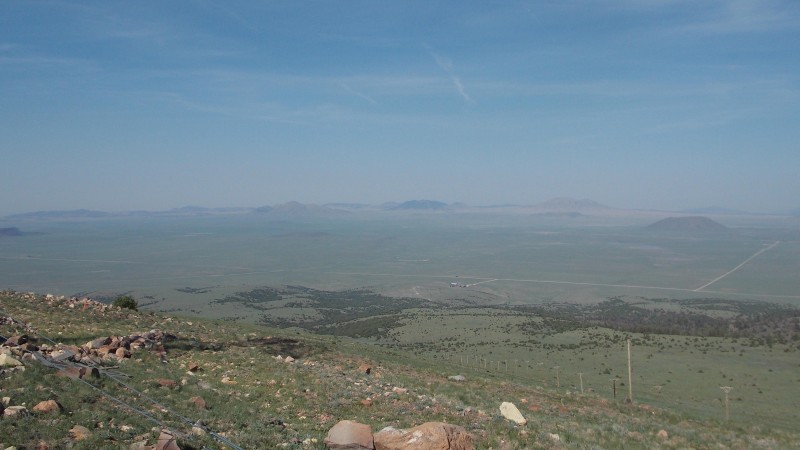
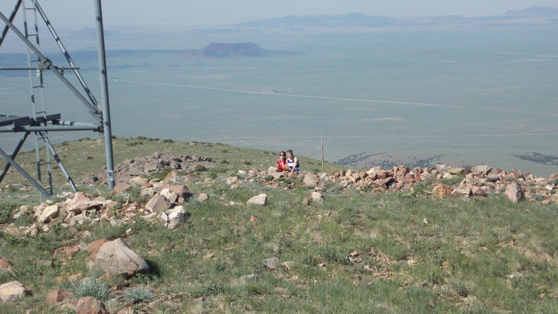
Once on the summit we got some great views of....antennae! Actually, while the antennae were a little annoying, the views all around the summit were actually pretty cool! Summit mess A little cluttered on the summit! Cool view of Capulin Mountain National Monument Views to the West. Probably could see Raton if the skies hadn't been so hazy. Looking back at most of the ascent path. The lovebirds enjoying a snack at the summit
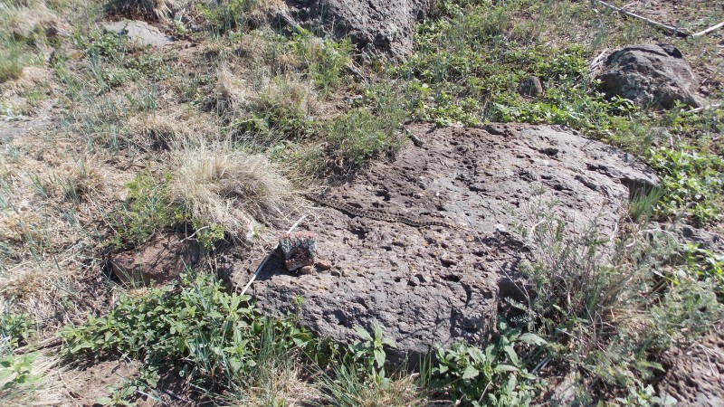
We stayed on the summit for about half an hour. It was fairly nice on the summit, a little breeze and decent temps, but we knew that the forecast was calling for the upper 90s in NE New Mexico and were expected to be near 110 at home. Plus, my son had a couple of ballgames that evening scheduled and Britt had to be at work at 5 that evening also...so we headed down. The descent was uneventful except for almost stepping on either a king snake or a bull snake. Not sure which, someone here might know from the pic.
Forgot MY summit shot, so I had my son take this one as we started doewn the gentle southern slope Our no-legged buddy that I almost stepped on during our descent.
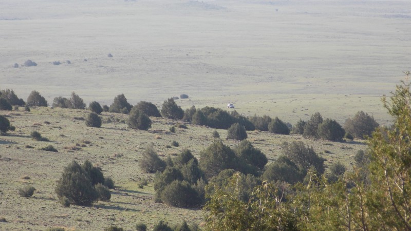
The only other issue we came across on the way down was that we decided to not re-summit the false summit that we came up over....we decided to drop down the gentle slope and skirt along the sub-summits and wrap around back to the Blazer at our "trailhead". We spotted what we thought was the car from the summit and we started heading straight for it...turns out it was just a stray, small juniper bush. We started looking around but, after looking at the summit from where we were and comparing what we saw from what the pics from the morning start showed it was obvious we were too far west! We looked over and sure enough, there was the car a couple of gullies over and about another half-mile of hiking away. Luckily we had plenty of fluids left and we just backtracked around on of the gullies and just dropped down into another and re-ascended to get to the car. Total mileage was about 6.5 miles, time was just a touch over 3 hours...including 30 mins on the summit. Not bad for a quick day trip.
My thoughts and observations for this hike: First off, TAKE THE RIGHT FORK AT .9 MILES IN ON THE ROAD!! I probably ended up on some private land, but none of the gates we encountered were locked and we made sure we closed them behind us when we went through them. Second, this is actually a fun, quick jaunt and makes a great warm-up for bigger things. We saw pronghorns, rabbits, snakes and even saw a small herd of elk on our way out. There are lots of cows too, but we didn't come across them on the hike, just saw some on our way in and out. The sign that marks the gate that you must enter to access Sierra Grande is not fastened to the supports, but the gate is at mile marker 391. If you are heading in from the west and you get to a rest area on the north side of the road, YOU HAVE GONE TOO FAR! SIf you are heading in from the east, the gate is just past the rest area to your left on the south side of the road, if you reach the roadside restaurant, YOU HAVE GONE TOO FAR. The views are really cool from Sierra Grande's summit. Much different, but just as interesting as many of the larger peaks I have done. The plains to mountains transition is visible and I really think that with clear skies the views would have been even more spectacular.
Well, that's all I got. Pretty simple and by no means exciting, but hopefully someone will get some nfo out of this report that they can find useful. Happy hiking!
Thumbnails for uploaded photos (click to open slideshow):
getting out there and doing a peak off most people's radar.
I have some fond memories of doing this one on a warm but windy day over Thanksgiving a few years ago...we tried going right at that fork you mentioned, found it too rocky for a car, went left, and parked at a creek crossing and had to walk from pretty low down. Easy, but long...
Definitely unique summit views--we were able to see Pikes from 160+ miles off!
I would have loved to have had clear skies just to see what other peaks would show up. I knew I would have probably been able to see the Spanish Peaks, Wheeler Peak and maybe Culebra...but Pikes? that would have been awesome!
Everything was pretty far off...Pikes was just a distant, hazy bump rising over the plains. We could see the Culebra range pretty well, probably Wheeler too though that mountain is very remarkable at being obscure, for its height!
Chris beat me to the comment (we were driving a rental car that day), but we were tempted to do that as well.
The locals call it the world's tallest mountain... I have no idea why, but it's a great peak.
This makes two county HP reports in one day. Wow.
Nice work.
I would be interested to know why they would call it that. It was well worth the short drive. Since my time window was so narrow I was hoping it was going to be a hike worth doing, and it turns out that it was very enjoyable. I highly recommend it. (but in cooler weather)
I drove by those mountains several times on the way from TX to CO. Never hiked anything there and Capulin was closed (too early in AM). I just remember these being the first 'mountains' encountered after that long drive across TX, and wanting to get out of that desolate area as fast as possible. The only one I knew of was Rabbit Ears that you could just barely see at the TX border - that landmark always signified I was getting to (or leaving) the Rockies.
Rabbit Ear Mountain does the exact same for me....it shows up, then Sierra Grande is the first ”tall” mountain just before you start to see the 13ers of the Culebra Range and the NM Sangres in the distant West. And then you hit Raton Pass, and BAM! There are the CO Sangres, the Spanish Peaks and awe inspiring beauty. To me it is like a good movie that slowly builds up to a climactic moment. The trip from Borger to anywhere in CO has that build-up as I head further west.
Caution: The information contained in this report may not be accurate and should not be the only resource used in preparation for your climb. Failure to have the necessary experience, physical conditioning, supplies or equipment can result in injury or death. 14ers.com and the author(s) of this report provide no warranties, either express or implied, that the information provided is accurate or reliable. By using the information provided, you agree to indemnify and hold harmless 14ers.com and the report author(s) with respect to any claims and demands against them, including any attorney fees and expenses. Please read the 14ers.com Safety and Disclaimer pages for more information.
Please respect private property: 14ers.com supports the rights of private landowners to determine how and by whom their land will be used. In Colorado, it is your responsibility to determine if land is private and to obtain the appropriate permission before entering the property.