Download Agreement, Release, and Acknowledgement of Risk:
You (the person requesting this file download) fully understand mountain climbing ("Activity") involves risks and dangers of serious bodily injury, including permanent disability, paralysis, and death ("Risks") and you fully accept and assume all such risks and all responsibility for losses, costs, and damages you incur as a result of your participation in this Activity.
You acknowledge that information in the file you have chosen to download may not be accurate and may contain errors. You agree to assume all risks when using this information and agree to release and discharge 14ers.com, 14ers Inc. and the author(s) of such information (collectively, the "Released Parties").
You hereby discharge the Released Parties from all damages, actions, claims and liabilities of any nature, specifically including, but not limited to, damages, actions, claims and liabilities arising from or related to the negligence of the Released Parties. You further agree to indemnify, hold harmless and defend 14ers.com, 14ers Inc. and each of the other Released Parties from and against any loss, damage, liability and expense, including costs and attorney fees, incurred by 14ers.com, 14ers Inc. or any of the other Released Parties as a result of you using information provided on the 14ers.com or 14ers Inc. websites.
You have read this agreement, fully understand its terms and intend it to be a complete and unconditional release of all liability to the greatest extent allowed by law and agree that if any portion of this agreement is held to be invalid the balance, notwithstanding, shall continue in full force and effect.
By clicking "OK" you agree to these terms. If you DO NOT agree, click "Cancel"...
Date Climbed: 6/22/13
Beginning Elevation: 10,332'
Peak Elevation: 13,215'
The Group: Solo
Distance: 11.2 miles
Total Elevation Gain: 3532'
There are already some good trip reports on Hassell Peak, but they either are more ambitious and include additional peaks or they approach from the Woods Creek drainage. This report covers what was supposed to be a relaxed on-trail hike up a low 13er near Denver. I was unable to recruit anyone to go with me, but the trail looked pretty straightforward, so I wasn't really worried about going solo"besides, the Hermann Gulch portion of the trail would be anything but solo.
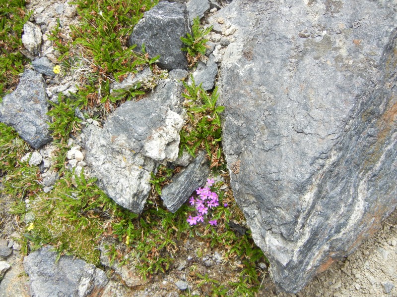
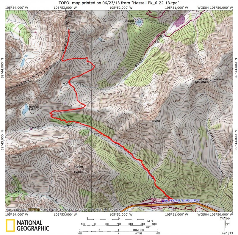
The route begins at the Hermann Gulch Trail Head, exit 218 on I-70. There aren't a lot of advanced signs for the exit (or maybe I missed them), so you have to watch for it. The route follows the Continental Divide Trail (CDT) from the Hermann Gulch Trail Head all the way to the summit. The CDT then continues on to Jones Pass, Berthoud Pass, and beyond. For the first 3 ¼ miles of the route, the CDT coincides with the Hermann Gulch Trail (TR98). From the TH, follow the trail a couple hundred yards to a T junction. The right hand branch goes to Watrous gulch, which can be used for Woods, Parnassus, and Bard. For Hassell Pk, you take the left hand branch, toward Hermann Lake. The Hermann Gulch trail is a "centennial wildflower trail," meaning that there are at least 100 different species of wildflowers that bloom along it. I was a bit early for the flowers (late June); some were just starting to bloom. I would guess that they will peak around mid-July.
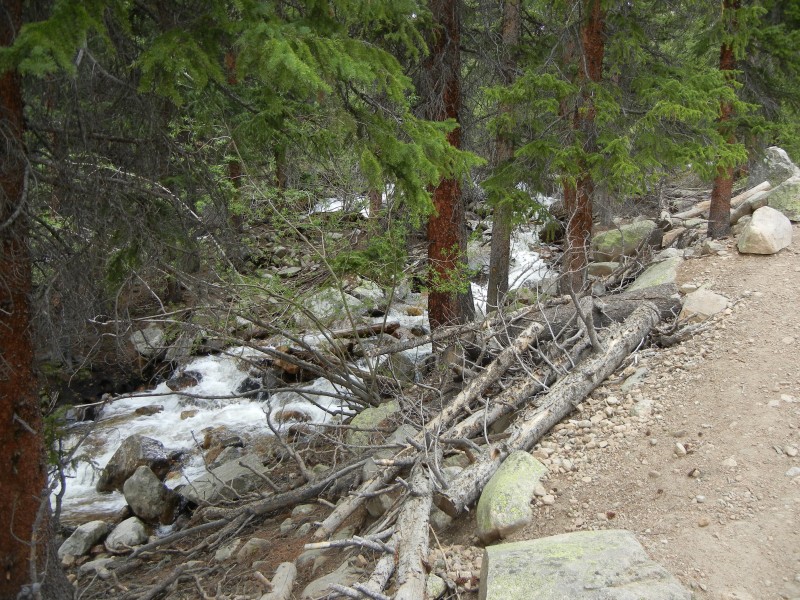
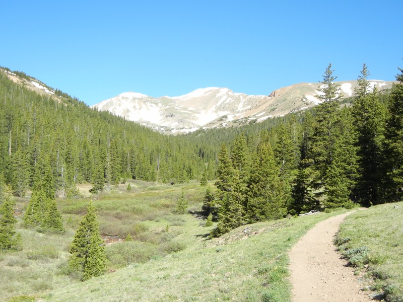
Along with a number of other parties, I followed the trail up Hermann Gulch, towards Hermann Lake. The trail is generally fairly mild, with a few somewhat steep sections. It follows the creek for a while and passes through several open meadows to showcase the wildflowers.
Hermann Creek.
Hermann Gulch Trail, Pettingell Pk in the background.
At about 3 ¼ miles (about 1500' elevation gain), just before the lake, the CDT splits off toward the northeast.
The cutoff for the CDT, toward Jones Pass.
Whereas the Hermann Lake Trail is a wide thoroughfare with heavy traffic, the CDT is just a narrow single track that doesn't seem to get much use. During the entire time I was on the non-Hermann-Lake part of the CDT, the only other people I saw were a couple groups of runners, and this was on a Saturday in late June.
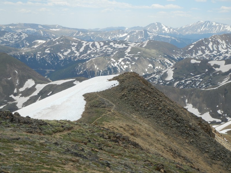
On the CDT, looking back toward Hermann Gulch; the Citadel in the background.
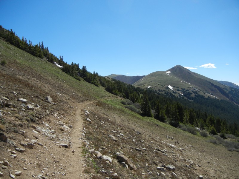
I followed the trail NE up to the saddle between Pettingell Pk and Mt. Machebeuf.
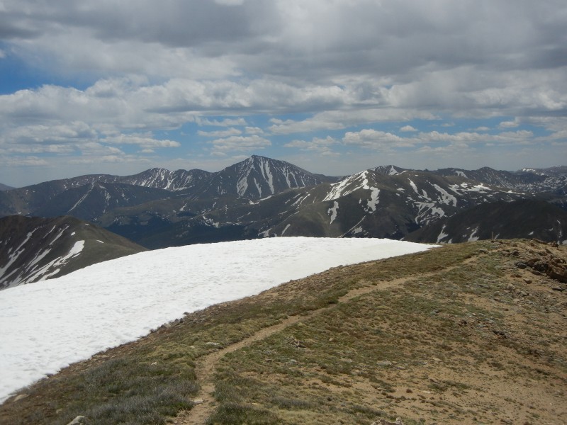
Approaching the saddle; Mt. Machebeuf & Woods Mtn to the right.
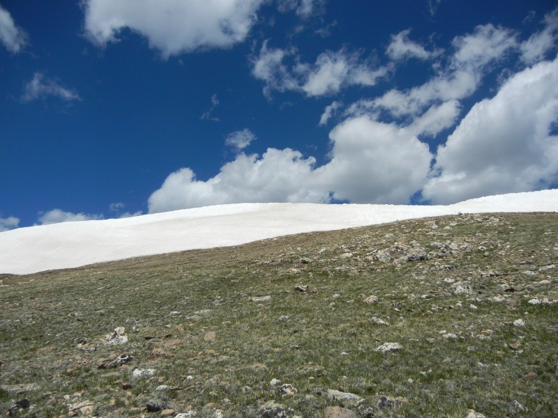
A short section of the trail was snow covered, but it was easily avoided, and it will probably melt out soon. Once I reached the saddle, the rest of the route came into view, and it did have some snow on it, mostly between the saddle and the low point at Woods Creek. It also looked to be longer than I had expected.
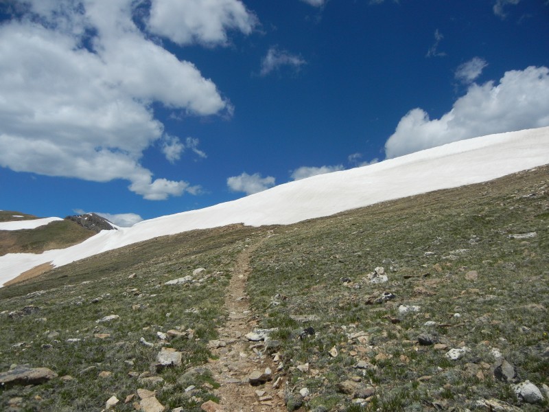
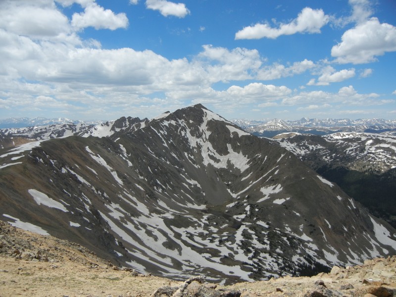
Hassell Peak (high point to the right). Trail is visible starting near the center of the photo and going up and right.
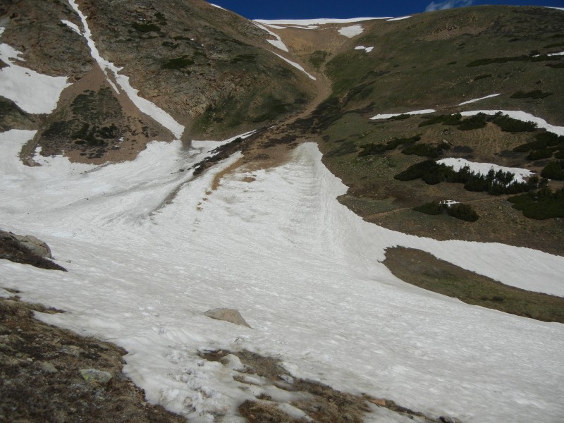
I took a short break and considered cutting things short and just going up Machebeuf, which was snow-free. After dithering a bit, I decided to go for Hassell, and to be willing to turn back if the snow constituted too big an obstacle. I had hiking poles, but no microspikes or ice axe, and I had worn low-cut non-goretex shoes, so I wasn't really ready if the snow got serious. Fortunately, it didn't. From the saddle, I followed the trail down to the NW, traversing a couple small sections of snow, before encountering a sizable snowfield around the low point in the trail. Luckily, the snow was not very steep, and it was soft enough to kick steps; less fortunately, it was also soft enough for some post-holing (shin or knee deep).
Snowfield covering trail as you approach Woods Creek. Trail can be seen emerging from snow a little to the right of center.
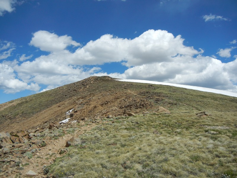
The trail wound its way up to Hassell's south ridge, climbing at a rather gentle rate. At the ridge, the trail was blocked by a wall of snow, which I suppose was the remains of a cornice.
Wall of snow just before the top of ridge.
Fortunately, off to the right there was a low point in the wall, which allowed access to the ridge.
Low point in wall.
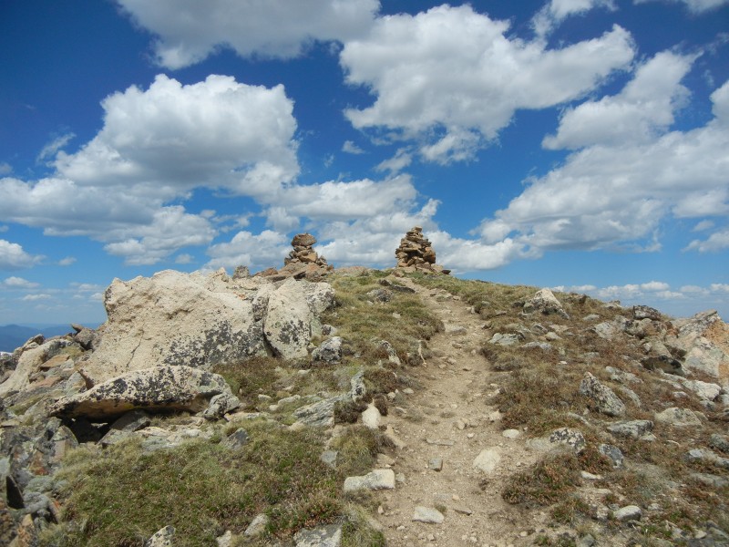
Once on the ridge, I just followed the trail up over one or two false summits to the true summit"or what I hope was the true summit.
Trail toward the "true" summit.
There was still one summit beyond, which looked approximately the same height, but the one I was on had two cairns, so I decided that it must be the true one. (And if it wasn't, so what? It's not like Hassell is on some list that I'm trying to complete.)
Approaching the summit
Pettingell Peak, from Hassell summit.
After a lunch break, I started back down.
View of Torreys during descent of ridge.
Trail descending ridge.
Tougher than me.
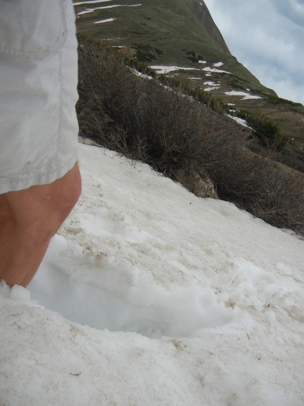
Self portrait, with post hole.
The descent was uneventful"the snow somewhat softer, no people until I got back to the Hermann Gulch Trail, which had plenty of people.
All in all, this is a nice, relaxed hike, long enough for a decent workout, easy enough for (moderately fit) beginners. It's all on-trail; route finding is trivial; the area is scenic; and it's close to Denver. It also has shorter alternatives if you decide to bail out part way through (Mt. Machebeuf, Hermann Lake). Unless you're looking for something really challenging, I'd recommend it"except maybe on a Sunday, when the traffic back into Denver can be pretty brutal.
The route.
My GPS Tracks on Google Maps (made from a .GPX file upload):
I usually figure that the flowers peak in mid or late June, even up high. So any flowers that are blooming now would be a bit early. I haven't followed it too closely, but it's my impression that the weather has been mostly warmer than usual, certainly down here, and also up high--at least in the Front Range.
I just started doing peaks in that area last year. It was nice to find a good group that are so close to Denver.
Caution: The information contained in this report may not be accurate and should not be the only resource used in preparation for your climb. Failure to have the necessary experience, physical conditioning, supplies or equipment can result in injury or death. 14ers.com and the author(s) of this report provide no warranties, either express or implied, that the information provided is accurate or reliable. By using the information provided, you agree to indemnify and hold harmless 14ers.com and the report author(s) with respect to any claims and demands against them, including any attorney fees and expenses. Please read the 14ers.com Safety and Disclaimer pages for more information.
Please respect private property: 14ers.com supports the rights of private landowners to determine how and by whom their land will be used. In Colorado, it is your responsibility to determine if land is private and to obtain the appropriate permission before entering the property.