| Report Type | Full |
| Peak(s) |
Bighorn Mountain RMNP - 11463 |
| Date Posted | 06/29/2013 |
| Date Climbed | 06/08/2013 |
| Author | cougar |
| Bighorn Mountain - South Slope/Ridge |
|---|
|
This is a really fun route I found last April, and did it again this year. For a small mountain, it's a really fun climb with a variety of scrambling and great views. This route melts out sooner than most in spring and it's a good way to get above treeline in early spring, in a secluded setting without postholing, and get some class 3/4/5 scrambling in (you can choose the difficulty depending on lines you take up rock outcroppings). It may also be a decent option on a day with big monsoon storms in the forecast as it's relatively short and mostly below treeline, so a good half-day option. Here's a look at the route - Bighorn's south ridge, as seen from Sundance Mountain. The route mostly follows the ridgeline and goes over the rock outcroppings.  Start at the Lawn Lake TH. Looking straight up, the first objective is to get atop the tower you see. It looks close, but the ascent to this tower is the hardest part of the climb. I chose the forested line angling up from left to right as going straight towards it is bascially vertical cliffs. With some scrambling in the rock bands just below it. 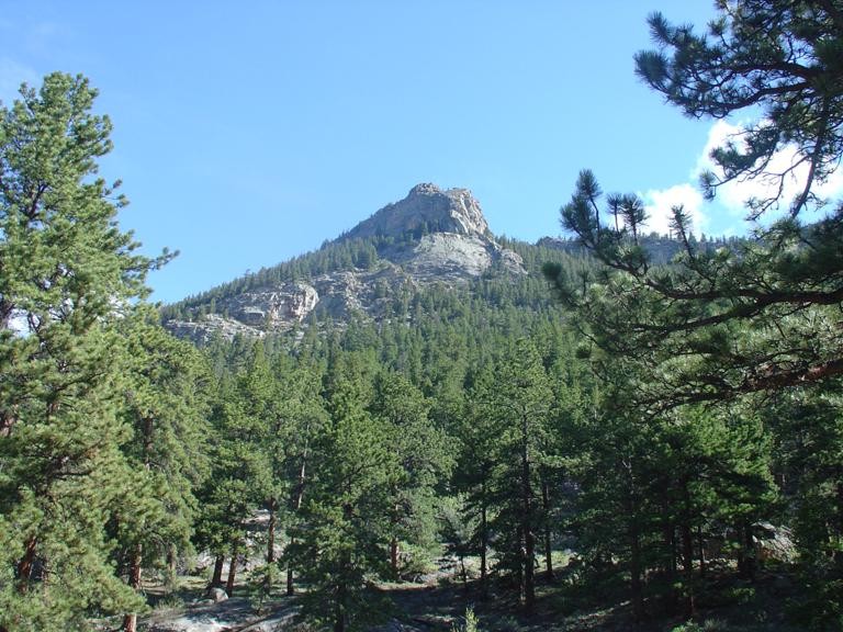 Steep forested slopes interspersed with rockbands and deadfall make the progress a bit tricky. From the trailhead, ascend the switchbacks up the Lawn Lake trail. When you get to the top of the switchbacks, about halfway across the last one, you can break off trail and head up the slope. A couple boulders and small rock outcroppings make for good landmarks here. The easier line is to go west a bit and angle up the slope towards the tower that way. In the forest, it's hard to spot the tower most of the time. The initial route is steep, has some short hops over rock, bushes, and some open areas, and some scrambling. You can keep it to class 3 with careful route finding, but there are harder lines in the immediate area. Persever in the early going, because after reaching the first tower, the route gets progressively easier (less steep, less undergrowth). It's like climbing out of a canyon, then reaching the plateau.  There is an easy line next to this and a ledge traverse. 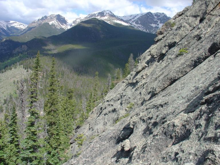 Atop the tower, which is actually a bit of a stretch of rock rim like a canyon rim, you can see the trailhead and wide views. From there you can look north and see the next rock outcropping across the forest, so aim for it - straight south. Beyond that there's a plateau outcropping that looks like a summit, but is just a false summit you gain on the route. Basically this route is like connect-the-dots between rock outcroppings. Bash through forest for a bit, hit a fun rock puzzle, climb it, and continue to the next one. 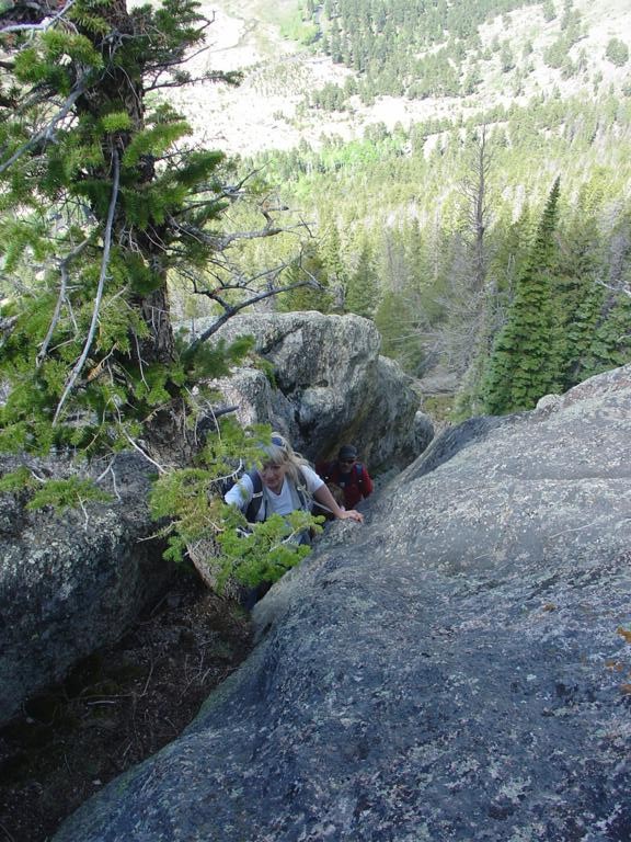 There is a fun class 3 chimney about 20 ft high in the early going. I didn't find it on my first ascent, as there are a variety of ways to get up. It's deeply inset with plenty of holds and a tree growing in the top, but is also very narrow in a spot, so be aware of your pack and boot size. There is a range of climbing options from 2+ to class 5 around these rock outcroppings, just choose a line or go around. The long 'fin' is a cool ledge traverse. Just be aware that the rock can be deceiving, and what looks easy from below can quickly turn into class 5 smooth slab. 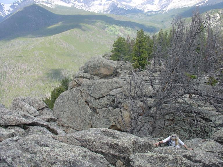 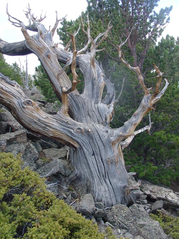  Looking down on ascent route so far. The front side of the fin is a really cool ledge traverse. 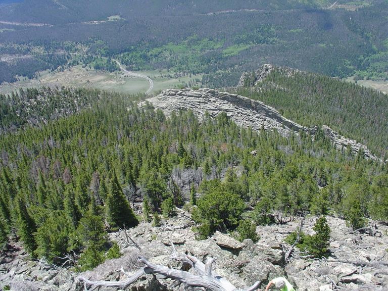 An open rock garden just below treeline:  Beyond the last of the rock sections is an open rock-garden area with far-ranging views and large limber pines. It's a bit sandy and reminds me of the desert. Uphill from here, the route breaks through treeline and it's a short tundra walk to the summit, which is the northernmost rocks up there. Best views of the Mummy Range from this summit as you're right across from all the 13ers up there. This picture isn't the summit but is looking back down from close to the summit:  a summit view: 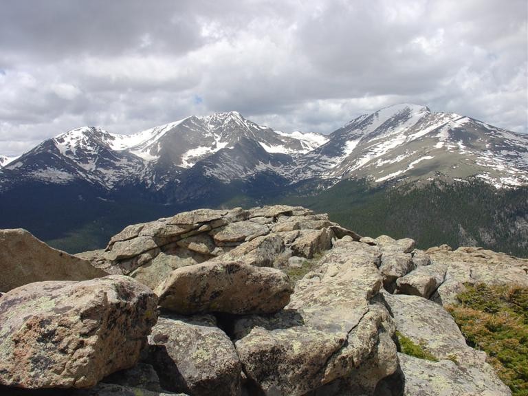 I had planned to go over to Tileston too, but someone was having altitude sickness issues so we descended. It doesn't look like there's actually another summit over there when you're looking at it from Bighorn's summit - but would be pretty easy to get to. So on the descent, head straight west down towards treeline, then angle a bit southwest. There is a dead tree that sticks out like a stained telephone pole - it's in a small meadow just below treeline. Just past this tree and southwest is a forested gully with some deadfall. This seemed to be the most expedient descent route - I used it twice. The first time I found it lower after crossing a talus slope. The gully is choked with deadfall in spots, but is less steep and less blocked with trees and bushes than the surrounding terrain. Eventually it leads down to a flat, open forest floor, and then a short bit of thick forest remains before popping out at the Lawn Lake trail, in the big wide stretch just below the junction with Ypsilon Lake trail. Because of the route finding and rock outcroppings which create quite the diversion, this takes longer than the average 6 mile hike, but still isn't too long. Thumbnails for uploaded photos (click to open slideshow):  initial objective - the first of several rock outcroppings")
 an open stretch of the early part of the climb")
 one of the outcroppings")
 topping out a class 3 chimney")
")
")
 more of the route, another false summit")
")
 Ypsilon Mtn from a desert-like spot")
 a view of the ridge up as seen from Sundance Mtn")
")
")
|
| Comments or Questions | |||
|---|---|---|---|
|
Caution: The information contained in this report may not be accurate and should not be the only resource used in preparation for your climb. Failure to have the necessary experience, physical conditioning, supplies or equipment can result in injury or death. 14ers.com and the author(s) of this report provide no warranties, either express or implied, that the information provided is accurate or reliable. By using the information provided, you agree to indemnify and hold harmless 14ers.com and the report author(s) with respect to any claims and demands against them, including any attorney fees and expenses. Please read the 14ers.com Safety and Disclaimer pages for more information.
Please respect private property: 14ers.com supports the rights of private landowners to determine how and by whom their land will be used. In Colorado, it is your responsibility to determine if land is private and to obtain the appropriate permission before entering the property.


