Download Agreement, Release, and Acknowledgement of Risk:
You (the person requesting this file download) fully understand mountain climbing ("Activity") involves risks and dangers of serious bodily injury, including permanent disability, paralysis, and death ("Risks") and you fully accept and assume all such risks and all responsibility for losses, costs, and damages you incur as a result of your participation in this Activity.
You acknowledge that information in the file you have chosen to download may not be accurate and may contain errors. You agree to assume all risks when using this information and agree to release and discharge 14ers.com, 14ers Inc. and the author(s) of such information (collectively, the "Released Parties").
You hereby discharge the Released Parties from all damages, actions, claims and liabilities of any nature, specifically including, but not limited to, damages, actions, claims and liabilities arising from or related to the negligence of the Released Parties. You further agree to indemnify, hold harmless and defend 14ers.com, 14ers Inc. and each of the other Released Parties from and against any loss, damage, liability and expense, including costs and attorney fees, incurred by 14ers.com, 14ers Inc. or any of the other Released Parties as a result of you using information provided on the 14ers.com or 14ers Inc. websites.
You have read this agreement, fully understand its terms and intend it to be a complete and unconditional release of all liability to the greatest extent allowed by law and agree that if any portion of this agreement is held to be invalid the balance, notwithstanding, shall continue in full force and effect.
By clicking "OK" you agree to these terms. If you DO NOT agree, click "Cancel"...
On Saturday, me and a couple buddies went to check out Pettingel Peak and Herman Gulch. I had been reading about the east ridge after seeing someone mention it in the "beginner scrambles" thread and thought it looked pretty fun. The scenery was also really amazing looking and very serene, which seemed strange to me since it was literally right off of I-70. I have driven past this trailhead probably 500 times in the last 3 years, and had never stopped to check it out. So on Friday, James, Chase and I decided to go scope it out. James moved out recently from California, and had not been up any peaks yet, so that needed to change. I tried to talk everyone into a 530 departure but they werent having it so we settled on 7.
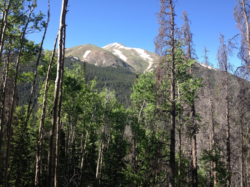
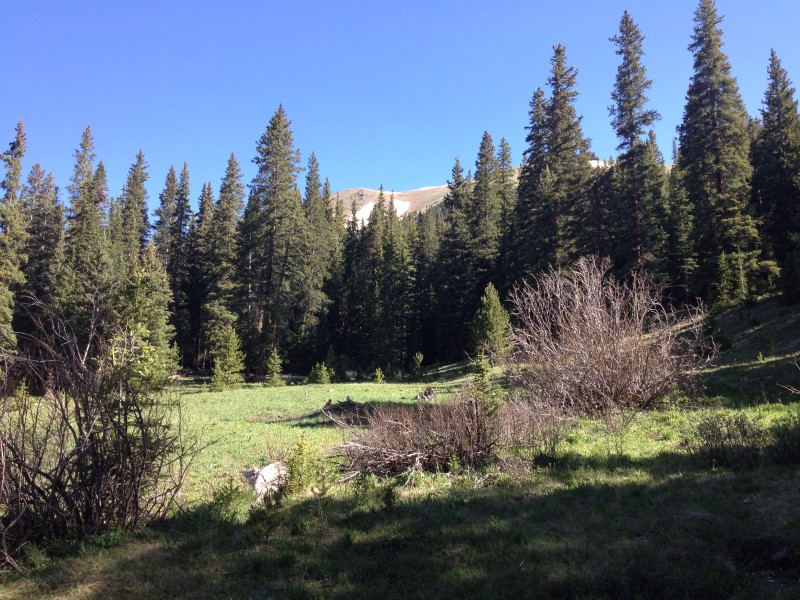
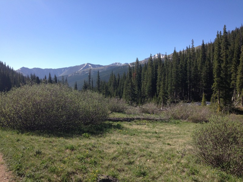
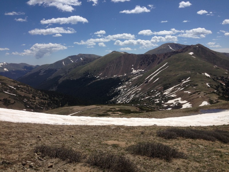
We pulled into the parking lot about 830. Since the weather was supposed to be perfect, we opted for a not quite alpine start. The trail was full of people and lots of dogs as we marched through the woods. The trail goes up fairly steeply for a few hundred feet, and then turns in behind a mountain. This is where the I-70 noise vanishes. The views really open up here and the hike is very pleasant. Lots of other hikers, fishermen and dogs all out enjoying the perfect weather.
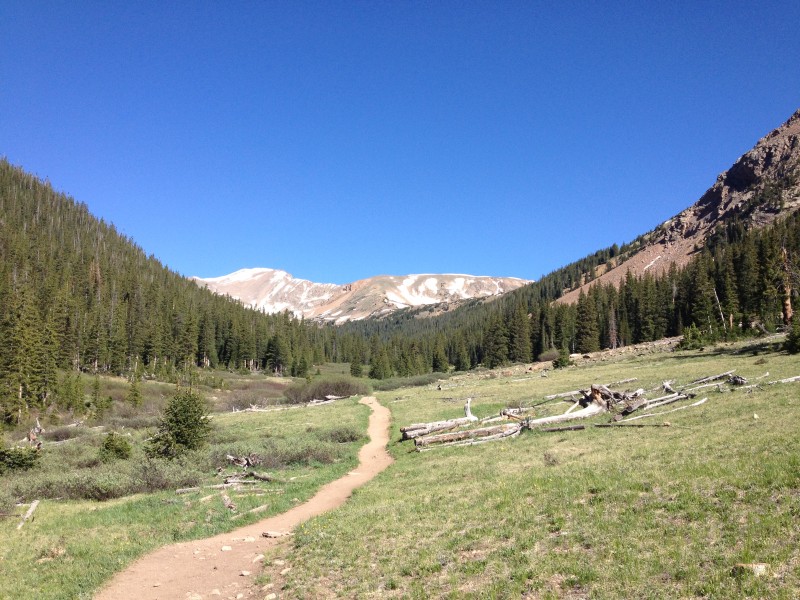
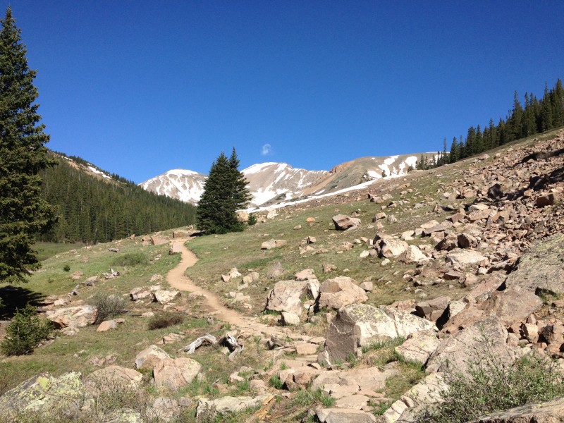
We continued along this trail for a couple miles, before coming to a sign at treeline. This is where you leave the trail and hike up the hill to get to the saddle. Its a fairly steep slog, but it goes by pretty quickly, and the views are outstanding.
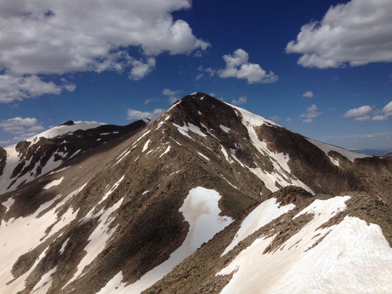
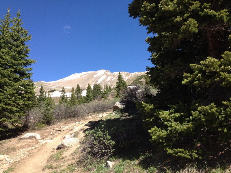
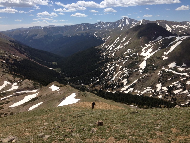
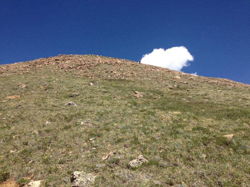
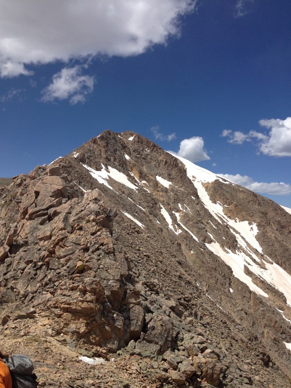
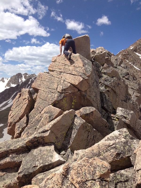
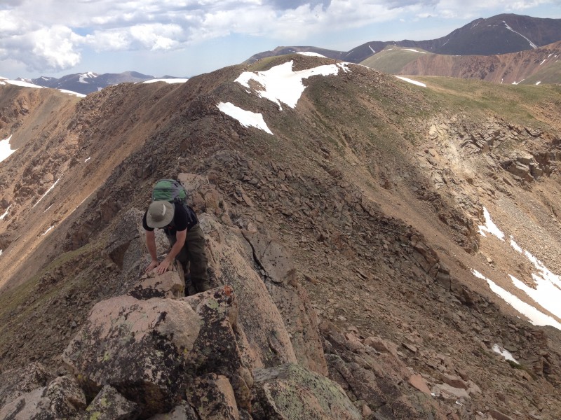
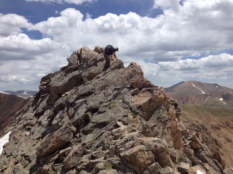
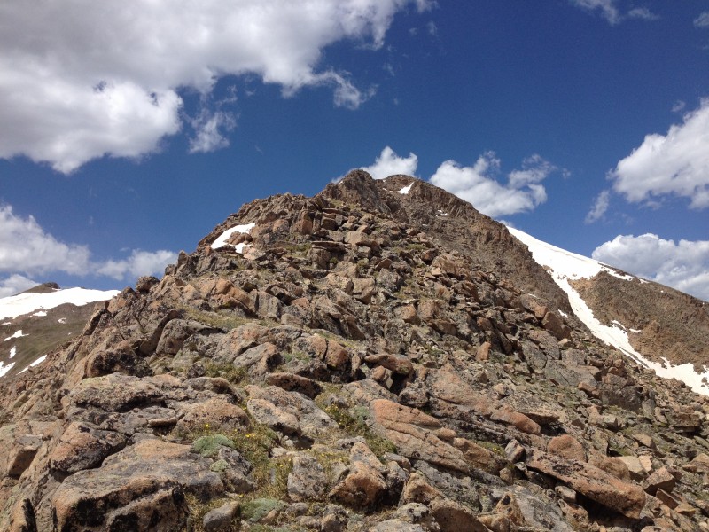
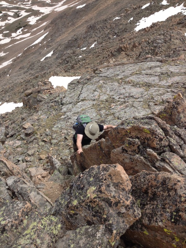
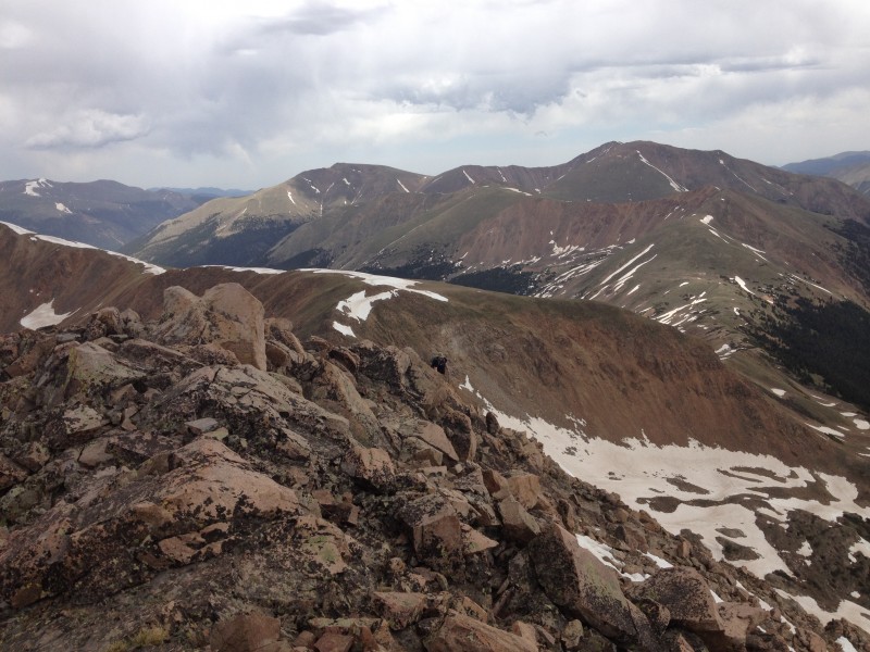
Finally we topped out on the saddle and the fun could begin. We had been debating on going over to tag hassell peak, but there looked to be a fair amount of snow on the route over there, so we skipped it and just went right for the main objective. We didnt bring snow gear so we were hoping that ridge would be mostly melted out. From where we looking from, it looked dry. This ridge would be great for someones 1st scramble, mainly because most of it can be made easier by skirting the ridge or harder by staying on the ridge crest. We tried to stay on the ridge crest as much as we could, which definitely made for more of a challenge but the scrambling is still easy and the exposure is pretty minor, with a couple of exceptions. One snowy section on the ridge crest forced us down to the right to get around it. That sucked, as the rock was pretty loose. Other than that though, the only way to describe the ridge is FUN. solid rock, enjoyable scrambling and some great views.
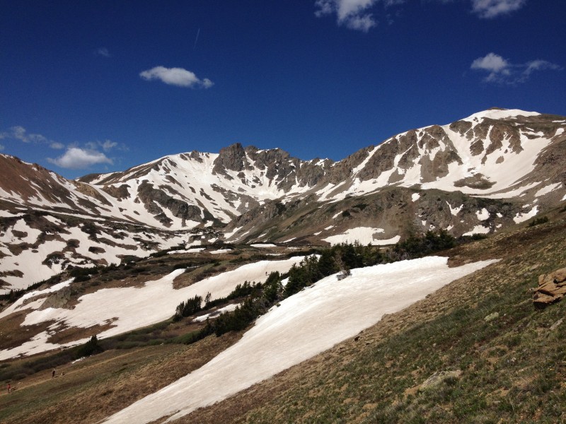
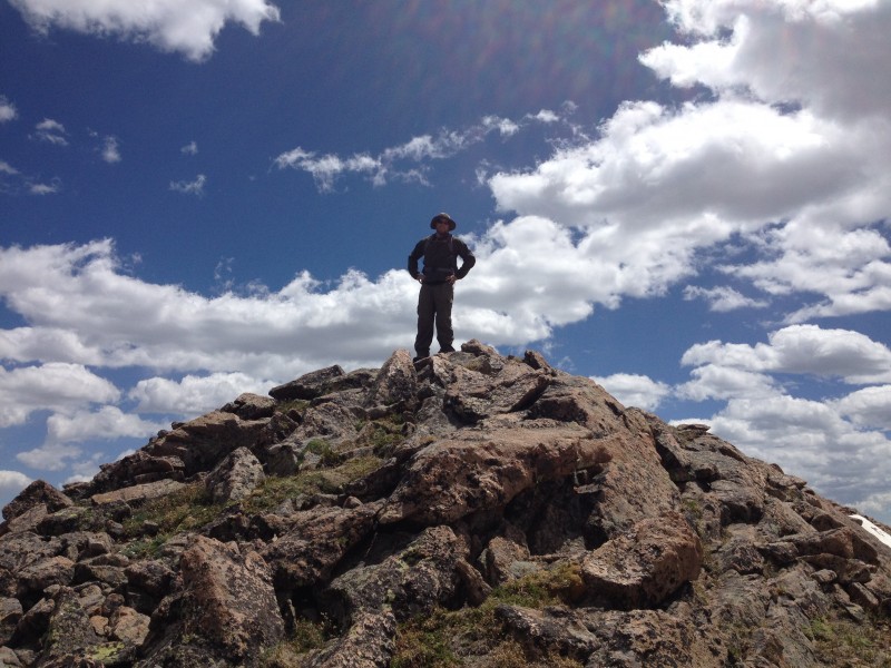
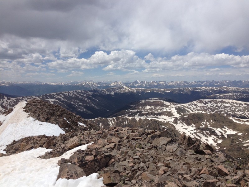
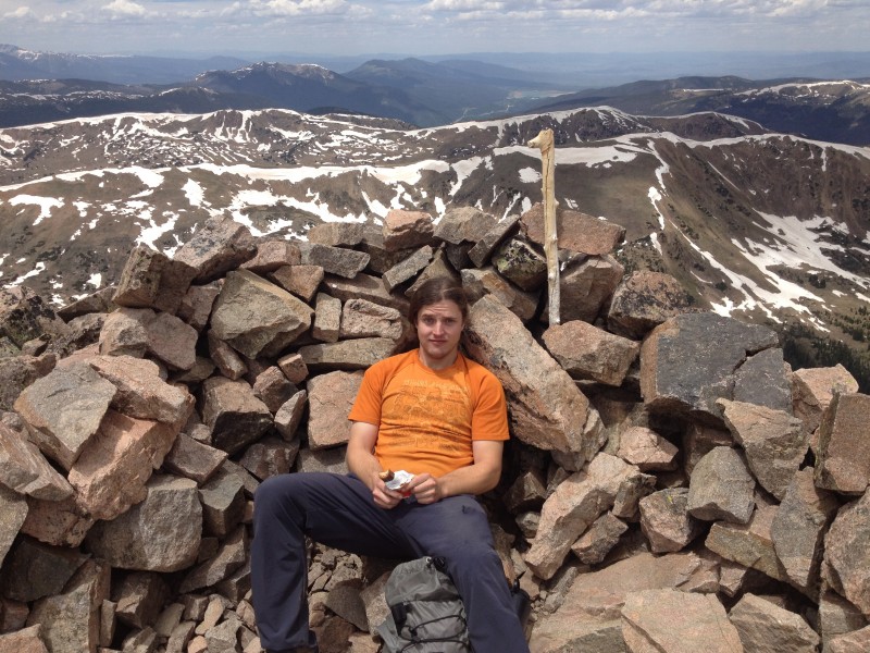
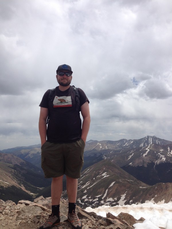
The ridge went quickly and we topped out around 1145 under somewhat menacing looking skies. It was raining off to the east of us and the clouds above looked like they get ugly fast, so we took a couple quick photos and then headed down the standard route, or what we thought would be the standard route.
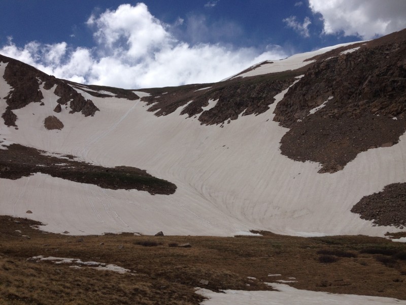
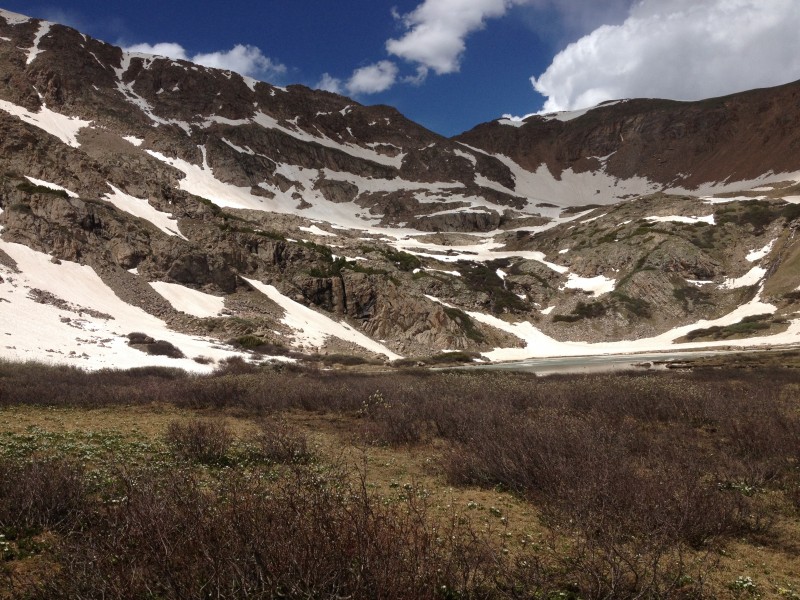
It was still pretty snowy on this side of the peak...I think we ended up missing the standard descent trail and went down in the bigger open bowl, which was would have been a super fun glissade if only I wouldve had an axe. It seemed too steep to go without a brake. Instead, we faced in and tried kicking steps into surprisingly firm snow while trying not to slip. Not fun, but went without incident (other than cracking one of my toenails). We then slogged through a muddy marsh before crossing the creek and finding the main trail again. We passed Herman Lake, which was a pretty amazing place, and joined the masses and their dogs for the hike out.
All in all, a great day with some fun scrambling and awesome scenery.
Thumbnails for uploaded photos (click to open slideshow):
Not sure but there were 3 people coming up the ridge behind my partner and I as we climbed and I'm guessing it was your group. I think you stopped and talked to our friend with his dog on the ridge.
Pettingell is on a longer list of "maybe peaks" for me. Any GPS or Topo track to post? What good source info can you point me toward? This is not in Roach's IPW book, too far south.
Would you call this Class 3?
Thanks, Rick
Caution: The information contained in this report may not be accurate and should not be the only resource used in preparation for your climb. Failure to have the necessary experience, physical conditioning, supplies or equipment can result in injury or death. 14ers.com and the author(s) of this report provide no warranties, either express or implied, that the information provided is accurate or reliable. By using the information provided, you agree to indemnify and hold harmless 14ers.com and the report author(s) with respect to any claims and demands against them, including any attorney fees and expenses. Please read the 14ers.com Safety and Disclaimer pages for more information.
Please respect private property: 14ers.com supports the rights of private landowners to determine how and by whom their land will be used. In Colorado, it is your responsibility to determine if land is private and to obtain the appropriate permission before entering the property.


")
")
")
")
")
")
")
")
")
")
")
")
")
")
")
")
")
")
")
")
")
")
")
")
")
")
")


