Download Agreement, Release, and Acknowledgement of Risk:
You (the person requesting this file download) fully understand mountain climbing ("Activity") involves risks and dangers of serious bodily injury, including permanent disability, paralysis, and death ("Risks") and you fully accept and assume all such risks and all responsibility for losses, costs, and damages you incur as a result of your participation in this Activity.
You acknowledge that information in the file you have chosen to download may not be accurate and may contain errors. You agree to assume all risks when using this information and agree to release and discharge 14ers.com, 14ers Inc. and the author(s) of such information (collectively, the "Released Parties").
You hereby discharge the Released Parties from all damages, actions, claims and liabilities of any nature, specifically including, but not limited to, damages, actions, claims and liabilities arising from or related to the negligence of the Released Parties. You further agree to indemnify, hold harmless and defend 14ers.com, 14ers Inc. and each of the other Released Parties from and against any loss, damage, liability and expense, including costs and attorney fees, incurred by 14ers.com, 14ers Inc. or any of the other Released Parties as a result of you using information provided on the 14ers.com or 14ers Inc. websites.
You have read this agreement, fully understand its terms and intend it to be a complete and unconditional release of all liability to the greatest extent allowed by law and agree that if any portion of this agreement is held to be invalid the balance, notwithstanding, shall continue in full force and effect.
By clicking "OK" you agree to these terms. If you DO NOT agree, click "Cancel"...
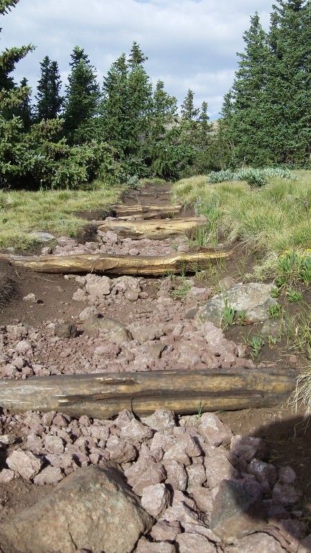
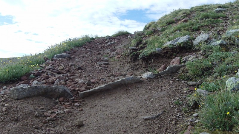
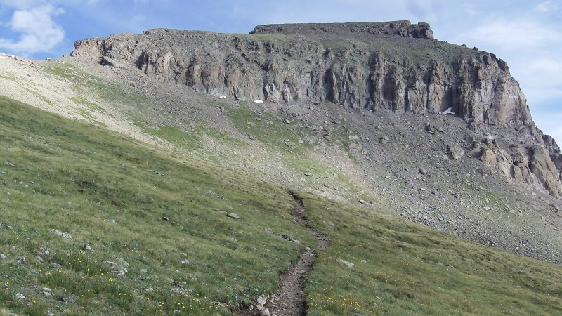
The route described here is the standard route. It's a beautifully constructed and lovingly maintained trail which stays soft and gentle up to 13,800 at the base of the cliff bands -- no route finding or tundra-trampling is warranted.
July 12, 2013 - Summit Day 3 Uncompahgre
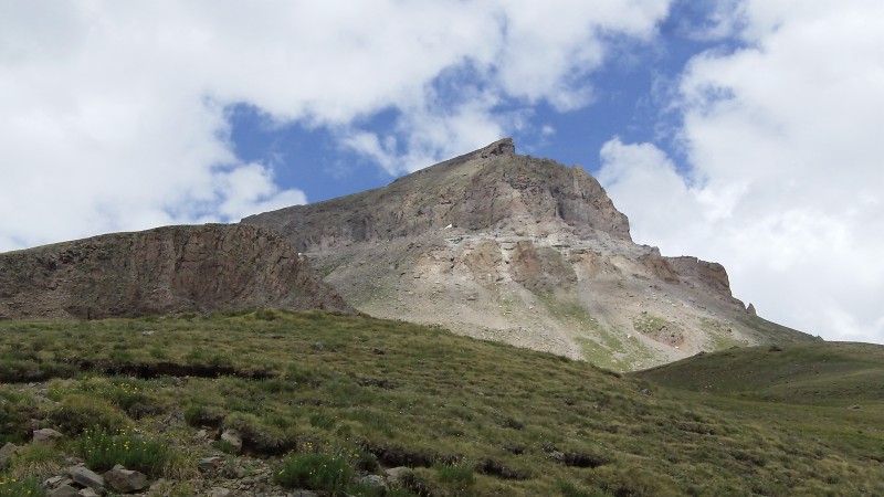
Unc. The peculiar name of this mountain supposedly draws from First Nations words, but the fact it's spelled so strangely suggests the French got hold of the name at some point and mangled it according to their own idiom. Whatever it's called, I've long thought of Unc as one of the iconic Colorado peaks because if its unusual shape and high summit. Last summer I finally gazed upon it from Wetterhorn, and Redcloud, and Sunshine, and... well, Unc is visible from all over this region of Colorado and is always easy to identify.
I'm writing this TR as an ascent only version in order to provide the most useful guide to others. What this means is that you'll see ascent and descent photos mixed together (you can tell by the sun position) but placed in the order they would fall if all the visual material were captured on the ascent.
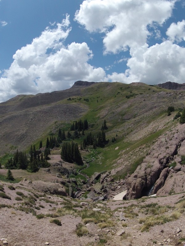
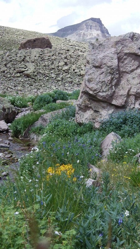
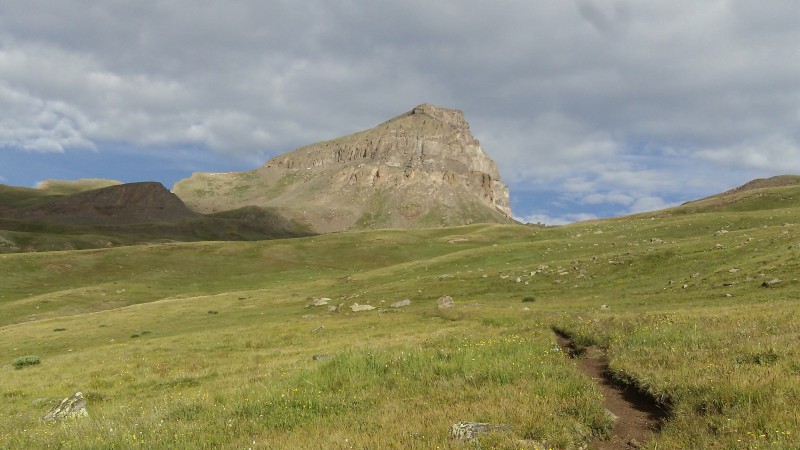
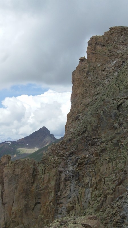
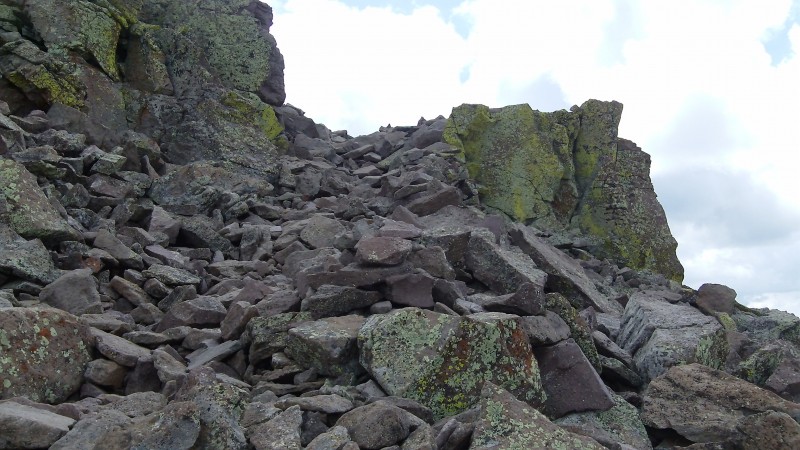
Trail built to withstand erosion Beautiful I sat here for a while just to BE. Unc Mighty Unc Higher elevation erosion dams Lil' bit o' snow Closing in Gendarmes on the Southwest side of route Gendarmes on the Southwest side of route, Wetterhorn
1 min of spliced video snippets of the approach to the cliffs
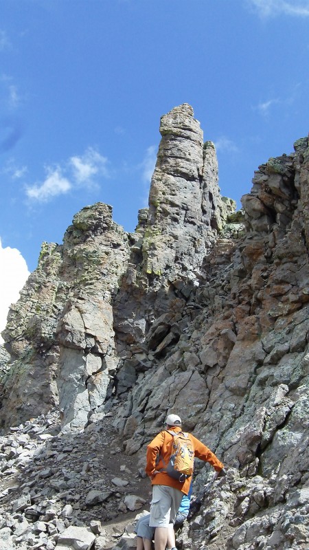
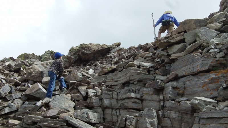
Cliff section Many paths may work here - for the easiest approach you may want to resist the temptation to ascend too early and get farther Crux choices in the crux
Abbreviated video navigating the cliffs
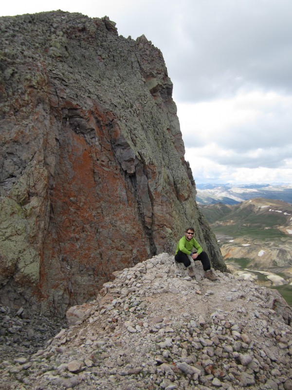
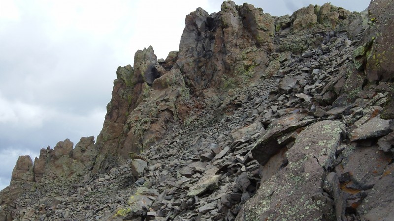
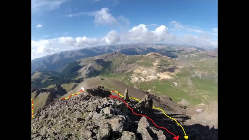
In retrospect, I (and the cairned trail) ascended the cliffs too soon. Looking back down over the cliffs, a gentler route would be to move North beyond the prominent pillar and the subsequent spire to the North. I ended up there anyway, but had to traverse on slope rather than gentler terrain below the pillar and spires. I guess that would be the third/fourth gully rather than the first/second one. Looking South over the cliffs
Short steep sections This kid did it!
The section to the summit after the cliffs is much gentler than the crux (which, by definition, I suppose it would have to be). I'll spare you video of this bit of the ascent and instead drop in some summit panos/sightseeing vids:
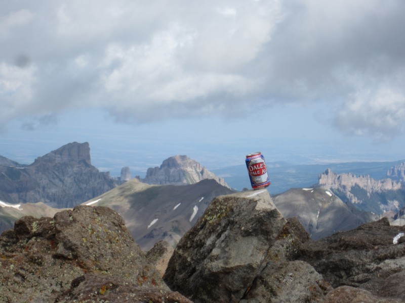
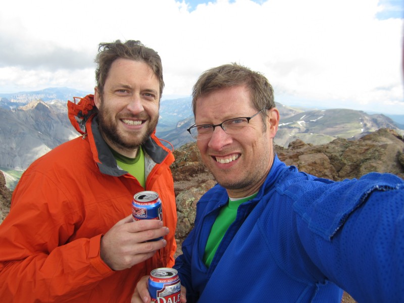
Usain-ing on top of Unc Summit, Precipice in the distance From left - Wetterhorn with Matterhorn in front of it (look for shadow), Coxcomb, Redcliff, "Fortress", Precipice a Best idea I've copied yet...(Unc Summit with Precipice and Dunsinane in background) Good weather, good trail, good company, good beer, good times. Yeah, Young Master William's shirt is inside-out. Thin a
Preceding Report: Seldom-used Northern Route to Tab-Shav-PT 13712 (Browns Lake) - 2013 Summer Trek Rpt 2 of 7 Subsequent Report: San Luis from West Willow Creek (Creede) - 2013 Summer Trek: Rpt 4 of 7
My GPS Tracks on Google Maps (made from a .GPX file upload):
The high point between Redcliff and Precipice is UN 13,241', unofficially called 'Fortress'.
Caution: The information contained in this report may not be accurate and should not be the only resource used in preparation for your climb. Failure to have the necessary experience, physical conditioning, supplies or equipment can result in injury or death. 14ers.com and the author(s) of this report provide no warranties, either express or implied, that the information provided is accurate or reliable. By using the information provided, you agree to indemnify and hold harmless 14ers.com and the report author(s) with respect to any claims and demands against them, including any attorney fees and expenses. Please read the 14ers.com Safety and Disclaimer pages for more information.
Please respect private property: 14ers.com supports the rights of private landowners to determine how and by whom their land will be used. In Colorado, it is your responsibility to determine if land is private and to obtain the appropriate permission before entering the property.