Download Agreement, Release, and Acknowledgement of Risk:
You (the person requesting this file download) fully understand mountain climbing ("Activity") involves risks and dangers of serious bodily injury, including permanent disability, paralysis, and death ("Risks") and you fully accept and assume all such risks and all responsibility for losses, costs, and damages you incur as a result of your participation in this Activity.
You acknowledge that information in the file you have chosen to download may not be accurate and may contain errors. You agree to assume all risks when using this information and agree to release and discharge 14ers.com, 14ers Inc. and the author(s) of such information (collectively, the "Released Parties").
You hereby discharge the Released Parties from all damages, actions, claims and liabilities of any nature, specifically including, but not limited to, damages, actions, claims and liabilities arising from or related to the negligence of the Released Parties. You further agree to indemnify, hold harmless and defend 14ers.com, 14ers Inc. and each of the other Released Parties from and against any loss, damage, liability and expense, including costs and attorney fees, incurred by 14ers.com, 14ers Inc. or any of the other Released Parties as a result of you using information provided on the 14ers.com or 14ers Inc. websites.
You have read this agreement, fully understand its terms and intend it to be a complete and unconditional release of all liability to the greatest extent allowed by law and agree that if any portion of this agreement is held to be invalid the balance, notwithstanding, shall continue in full force and effect.
By clicking "OK" you agree to these terms. If you DO NOT agree, click "Cancel"...
Date: 6/8/13
Start Time: 4:05 AM
Summit: 11:15 AM
End Time: 5:35 PM
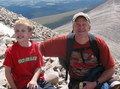
Climbers: Teddy (Ameristrat), Matt (OrthoMatt), Tony (tony1)
Little Bear Peak has got to be the least aptly named fourteener in Colorado. Towering nearly a mile and half over the surrounding valley, it's anything but "Little." Add to that its reputation for being a gruelling, difficult, dangerous, and on occasion, fatal climb, and you can understand why I have always viewed Little Bear as one of the most intimidating fourteeners that Colorado features. Indeed, it wasn't so long ago that I thought I'd be content to never give Little Bear an attempt - that I'd be content to offer my respect - and fear - from afar.
Is this far enough?
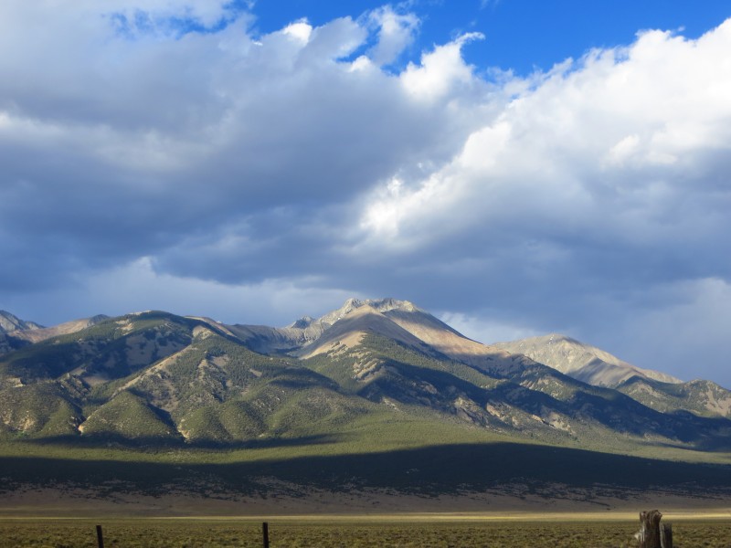
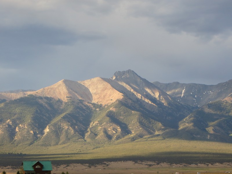
I first ventured into the Blanca group with a climb of Lindsey in late August, follwing it with a scintillating climb up Ellingwood Point and Blanca Peak on a pleasantly dry, late-October weekend with Matt, the Lynx, Tess, and Karthik. As an aside, I feel strongly that the experience I gained on the Southwest Ridge to Ellingwood Point played a huge role in my preparation for this route. Though more solid, a bit less exposed and less difficult at its crux, the relentless exposure and class three ridge climbing to Ellingwood was an excellent learning experience and confidence booster for a route like this one. Upon summitting Blanca, I was enraptured with Little Bear: its two majestic summits and breath-taking east face instantly commanding attention, respect, and awe.
After that trip and intermittently throughout the winter (which, in retrospect, I spent a bit more time skiing and bit less time climbing than I would have liked), I poured over trip reports detailling the trials my fellow climbers have faced in their previous treks up this peak. I shuddered at the accidents I learned of, and read in awe about geojed and co's winter attempt up the Southwest Ridge. It was that trip report that really got me thinking - could there be a viable route for me that avoided the Hourglass?
I then stumbled upon the trip report written several years ago by FCSquid. I have to thank him for taking the time to document this route in such detail. You not only made our scramble across the Momma Bear Traverse simple and less stressful, but also you made it one of the most enjoyable climbs I've done. The meticulous route description you provided really made this trip possible - thank you!
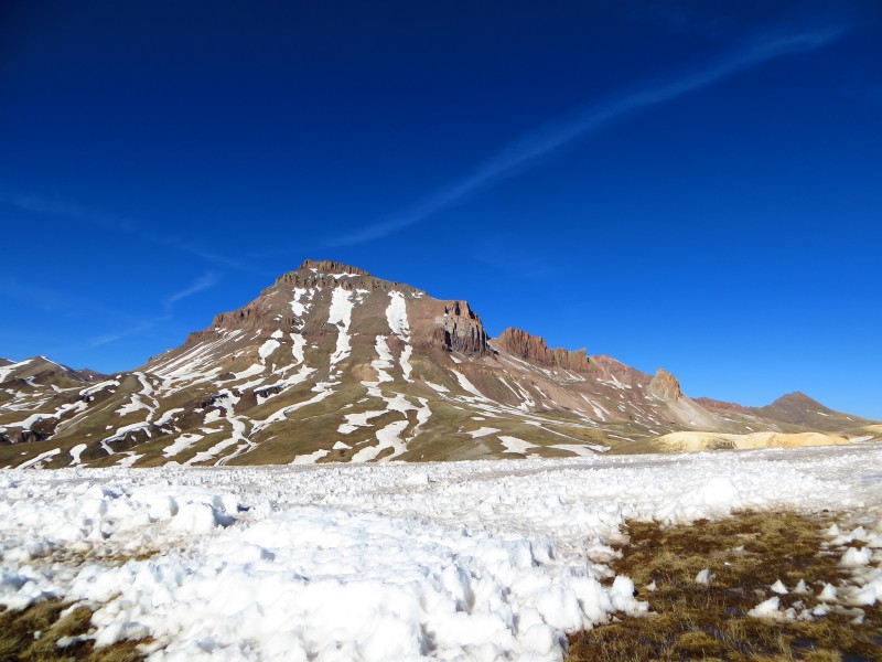
A few weeks ago, Tony and I exchanged some PMs about several climbs for the summer including this one. Matt joined the group, and we kicked off the summer with a warm-up trip to an exciting Wetterhorn, a quickly melting Uncompahgre, and a miserable, postholing, suckfest in between.
Might not look like it, but all of that snow in between us and the ole' Unc was a postholing mess.
We decided on that climb that, if the weather would stay thunder-storm free, we would give Little Bear a shot the following weekend.
Sure enough, the weather cooperated, and we met in Castle Rock on Friday evening to head down to the Tobin Creek Trailhead with a pit stop for some "health food" at Carl's Jr. along the way.
A bit of information about the trailhead: once you get about a mile away, the road turns to definite 4WD - we were in low 4WD some of the time. It's rocky, high clearance is needed, and in spots, it is steep. I had debated driving my (sadly) 2WD Xterra down. Glad I didn't - we would not have made the trailhead, and given that it is about the only part of this road that falls on public land, that would have been bad news bears for Team Southwest Ridge.
We made it to the trailhead around 10:00 and opted to forego tents and fall asleep under the stars instead. I slept incredibly soundly except for a brief spell where I dreamt that a wolf was about to attack me (turns out that Tony snores exactly like I imagine a wolf would growl - horrible thing to wake up to).
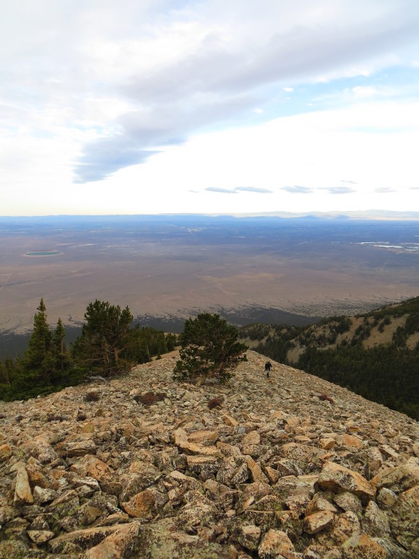
We didn't move very quickly when our alarms broke the silence at 3 AM. A cliff bar, a bowl of oatmeal, and the slowest gear assembly in history later, and we were on the trail just after 4 AM, quickly learning the meaning of the word "bushwhack."
When you cross the Tobin Creek (which was completely dry for us), be sure to head north as Roach states. We strayed too far to the north-east and ended up in steeper terrain with some class 3 scrambling before hitting the ridge at 10,400'. If you are careful to head north after crossing Tobin Creek, you will take more gentle (though still steep) slopes and meet the ridge around 10,000 feet.
We took a break for breakfast # 2 around 11,200' just before breaking out of the trees. We could hear the wind howling through the trees and prayed that it would calm as we approached the summit. As we continued along the ridge, we tried to stay just to the south of the ridge crest to avoid the worst of the wind. This was somewhat successful, and, thankfully, the rock was fairly stable.
The last tree for hours. Or maybe days...
Matt hiding from the wind just below Point 12,800.
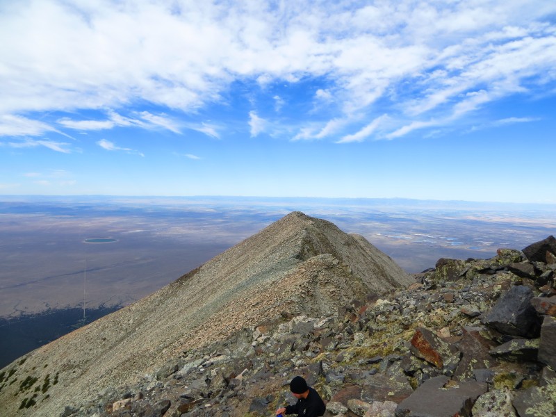
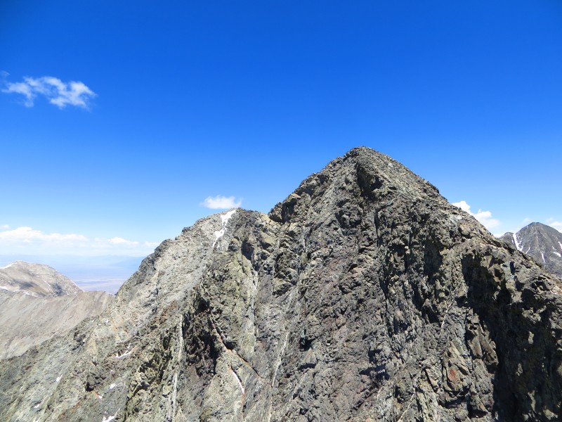
After crossing Point 12,800, you are on or very close to the ridge for the duration of the climb to South Little Bear. Upon hitting Point 13,130, the ridge levels out an undulates slightly to a few points of similar height. After the third point, it drops to a deep notch that welcomes the first view of the drastic exposure to the Northeast side of the ridge which had been steadily increasing in severity from 12,800.
It was at this point that we stashed our trekking poles, microspikes (which were completely unnecessary), and extra water for the descent. Thankfully, the wind had subsided a bit, and the very overcast morning was breaking into a beautiful day.
The blue sky cuts through the clouds. It would remain cloudless until we arrived back at the car that afternoon.
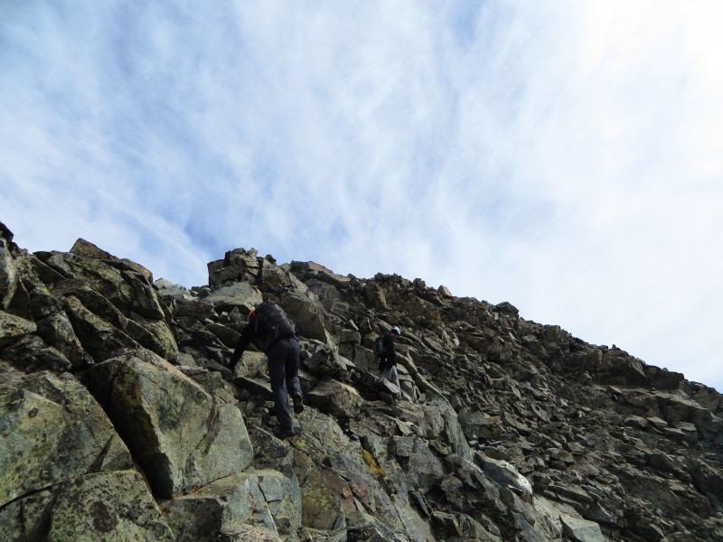
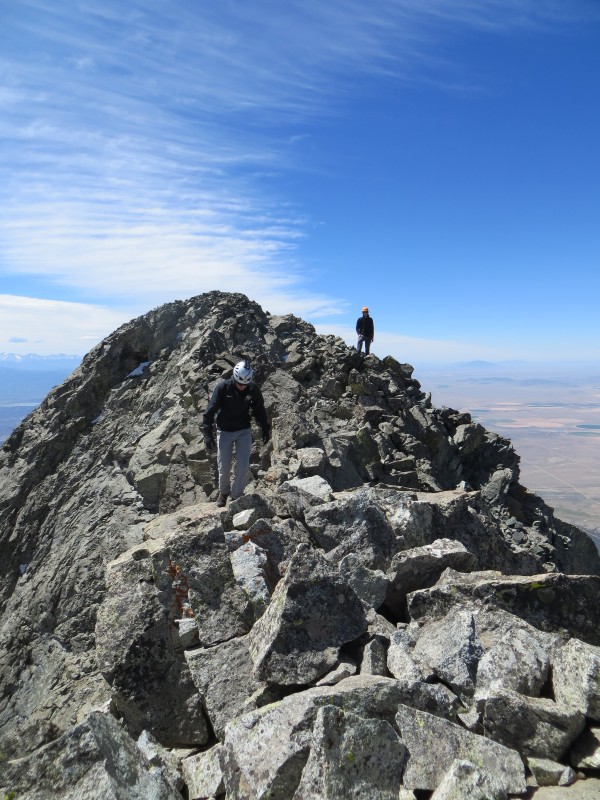
A few hundred feet higher to the next point, and the hiking transitions from nearly all class two to consistent class three. The helmets came on and we continued to work our way slowly to South Little Bear.
Class Three from here on out.
As mentioned in geojed and FCSquid's trip reports, the hardest moves along this path were the knife edge with the "step," and the short, six-foot wall with huge exposure to the left side. Unfortunately, I did not get any pictures of the wall. If Matt or Tony find one, I will add it!
The knife edge looked daunting, but careful surveying showed that handholds and footholds were present (though small) - I'd hate to do this section if it were wet or snow-covered.
The "Knife Edge"
The wall is simple enough, but you must take a very small "leap of faith" over a fissure in the ridge that displays an adrenaline-inducing view of a thousand feet of exposure to the left before navigating handholds and footholds that are not immediately apparent.
I'd call both of these moves borderline class IV - the high-consequence nature of the moves makes them stand out. In particular, while not as exposed, I felt that the "knife-edge" was the most physically difficult move of the climb for me, perhaps, simply because the handholds and footholds I chose were pretty far apart.
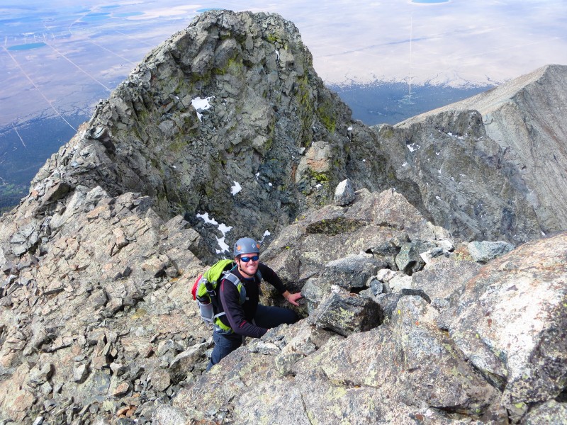
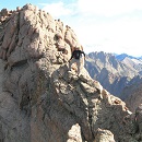
Almost to the summit of South Little Bear. I am pumped!
Following these moves, we quickly summited South Little Bear, and I couldn't help but scamper down a few feet to see what lay ahead.
This is where I felt lucky to have the excellent report that FCSquid provided. I'm not sure what I would have thought upon seeing the traverse without an idea of how to cross it, but having nearly memorized the pictures provided in that report, my immediate reaction was - this isn't so bad!
We dropped to the west side of the ridge just a few feet north of the summit down easy (though exposed) class 3 step-ledges. Be sure to take the exit ledge that leads to a rubble-strewn ridge almost immediately after the fin you have dropped down to avoid. Once on the ridge, the route becomes intuitive.
Not quite this scary looking in real life - looks cool though!
A more accurate representation.
The Exposure on the west face below the ledges.
Staying high on the ridge
One spot I would note as a change from FCSquid's report. Before you drop down to the east side of the ridge (around 2/3 of the way through the traverse), there is a highly exposed and narrow section on top of the ridge. It's easy enough to stay high, but if you're weary from the exposure, you can drop down about 10 feet to a ledge on the west side and then regain the ridge a hundred horizantal feet or so later. We found this to be the easier alternative and used it on the return trip.
The red line is the approximate route you can take on the ledge to avoid the narrow and exposed ridge.
After that deviation, I found the previously mentioned trip report to be a great guide once again. You need to alternate to the east side of the ridge once before the hourglass notch and, soon after regaining the ridge, drop to the west to find a simple class 4 wall to enter the hourglass notch. Be careful to avoid kicking any rocks down from here - anything that falls from this area will become a missile headed directly for the Hourglass. Beyond the notch, it is a simple scramble (albeit loose) to the summit. We'd made it!
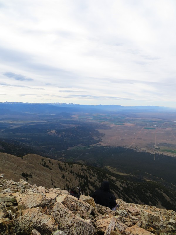
Blanca and Ellingwood from the summit of Little Bear
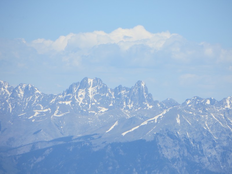
The Crestones still holding snow in their standard routes.
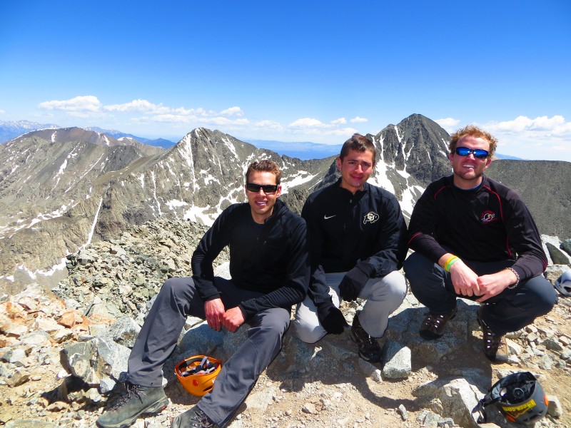
Group summit shot. I forgot the American Flag Bandanna - terrible citizen!
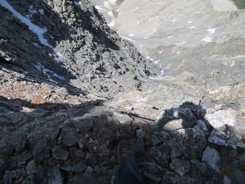
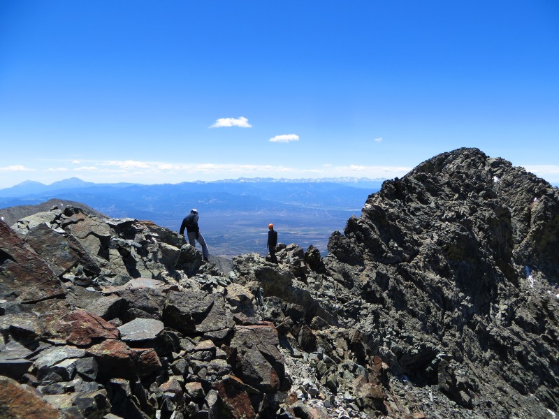
Surveying the eastern exposure on the Momma Bear Traverse
After snapping a few pictures on the summit and admiring Blanca's gnarly connecting ridge to the point on which we stood, we retraced our moves across the Momma Bear Traverse and re-collected our packs - which we'd left on South Little Bear - before descending back to the SW ridge.
A look back at South Little Bear
Up to this point, I would call this route a blast: lots of elevation gain, but some really fun scrambling up high. Below 13,400, Little Bear exacts its revenge.
The hike down on angular, loose, slanted talus, while safe from exposure, is tedious, exhausting, and painful on your feet! Matt and I shared a set of trekking poles and quickly fell behind Tony who had (wisely) decided not to share. I highly recommend bringing trekking poles if only for the descent - it's completely worth the balance they provide. Expect the descent to be obnoxiously slow. It's hard to move much faster that you did on the ascent. The views are nice, though!
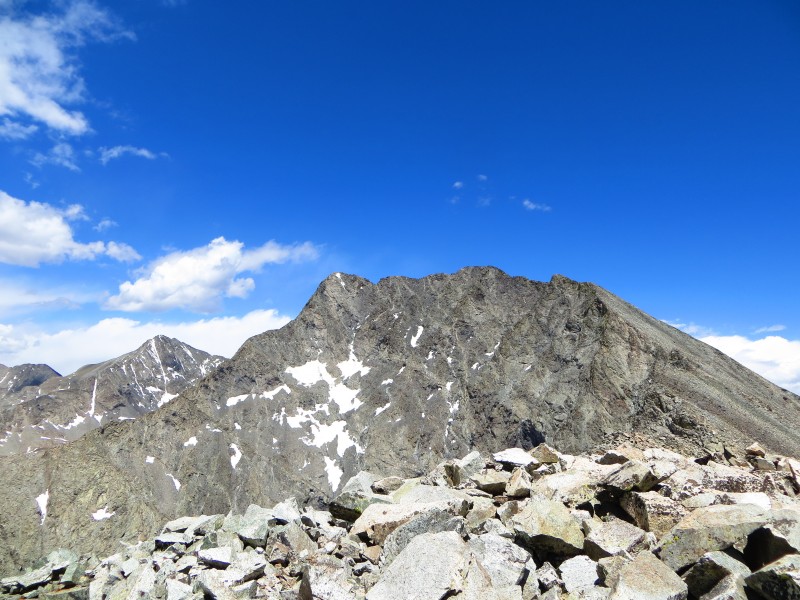
The Momma Bear Traverse from Point 13,130
When descending, also be careful to follow the correct route. We once again ventured too far from the ridge and ended up on the cliffy, class three terrain we'd ascended that morning.
The last half mile to the car seemed to go on forever, but looking back up at Little Bear, it was easy to forget the tedious hike down. We were safe and had the best thing Little Bear could offer us - the memories of another incredible trip to the mountains.
The burrito in Pueblo didn't suck either.
Ameristrat
Clouds building over the Blanca Group. Glad they waited for us to leave before arriving!
Thumbnails for uploaded photos (click to open slideshow):
This report will be very useful for next year or the year after when attempting LB. Looks like a great alternative to the hourglass route. Looks like the route is snow free right now.
Awesome write up, Teddy! I still swear that wasn't me snoring. You probably were almost eaten by a wolf.
For me that knife edge was probably the worst move of the climb as well. I didn't see much in the way of holds and just kind of had to go for it after some hesitation.
We're on for Little Bear in a few weeks (we'll attempt Ellingwood and Blanca the day before to make sure we're feeling solid). I think we're dialed in for the current standard bowling alley approach (yuck) rather than the SW ridge which I hadn't given much consideration until the last couple of weeks.
But now I want to visit the other bear too -- I'll be intently scoping it out from up top. Maybe next year...maybe next year...
Glad to see my old report still has value for people researching the route. That's a serious and committing route, for sure. Good to see everyone made it up and down in one piece.
Thanks for the TR. Makes me want to try the SW ridge route. Did you have any trouble finding the trailhead on the return after you crossed Tobin Creek?
Had a blast on this route - anything I can do to help anyone else on it, let me know!
wineguy - use a GPS if you can and follow your track back. It is very tough to find the TH (there is no trail through fairly thick brush) and finding the car after a long day without a GPS or easy landmarks to guide you (there really are none) would be a pain.
Apart from the slog through talus on the way down, this is one of my favorite climbs. I'd be happy to do it again.
Wish we would have had this in 2006 when I did it. Couple other recommendations:
- Don't wear shorts, unless you want to loose blood during the bushwhack
- cache extra water on the way up near the tree line; coming down the southwest ridge in the summer is long and hot
Caution: The information contained in this report may not be accurate and should not be the only resource used in preparation for your climb. Failure to have the necessary experience, physical conditioning, supplies or equipment can result in injury or death. 14ers.com and the author(s) of this report provide no warranties, either express or implied, that the information provided is accurate or reliable. By using the information provided, you agree to indemnify and hold harmless 14ers.com and the report author(s) with respect to any claims and demands against them, including any attorney fees and expenses. Please read the 14ers.com Safety and Disclaimer pages for more information.
Please respect private property: 14ers.com supports the rights of private landowners to determine how and by whom their land will be used. In Colorado, it is your responsibility to determine if land is private and to obtain the appropriate permission before entering the property.