| Report Type | Full |
| Peak(s) |
Wetterhorn Peak - 14,021 feet |
| Date Posted | 06/15/2013 |
| Date Climbed | 06/11/2013 |
| Author | SolarAlex |
| Additional Members | climb4 |
| Getting my feet wet in the San Juans |
|---|
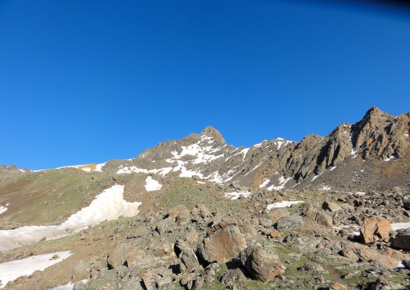 I have been having a hard time getting motivated this spring to get out on some peaks. It had been dawning on me that riding a chairlift all winter really doesnt count as exercise and I wasn't too eager to get back out in the hills and find out just how out of shape I am. I knew I needed to get out for a couple of days to snap out of it and I thought that it would be really cool to see the San Juans. I hadnt been to the San Juans yet. Chase has been telling me forever about Wetterhorn and how awesome it is and how the summit pitch is one of the most fun parts of any 14er, so it was a pretty easy choice. On Monday, Chase and I drove down to Lake City with intentions to climb Wetterhorn and something else that we would decide on after Wetterhorn. Possible options were Uncompahgre, Sunshine Redcloud and Handies. We left Golden around 1 and got to Lake City at about 730. Probably could have made it by 6 but we stopped in BV at Eddyline on the way. We headed up the road to the Matterhorn Creek trailhead. The road was fine until the 2WD trailhead but I wasnt going to try to get up to the 4WD trailhead for the sake of half a mile and 300 feet. We set up camp right near the road in a great open campsite, with the sound of Matterhorn Creek behind us. I have never seen stars like I have in the San Juans. I wish I had a real camera to take pictures that would come close to doing it justice. A lot of my photos have a black mark in the upper right hand corner...thats the result of spiking my camera on the summit of longs. I saw a number of shooting stars, so if that thing about wishing on a shooting star is true, that means the future is looking good for me. We set our alarms for 5 and we were up and moving by 6. The hike up the 4WD road went quickly, and I was glad I hadnt tried to drive it. We passed a couple dudes sleeping on the ground and saw a group of 3 in front of us lugging skis on their packs. We were wondering what they could be trying to ski, since everything looked so bare. We started up the trail and the scenery got better with every step. That basin is one of the most beautiful places I have ever seen. 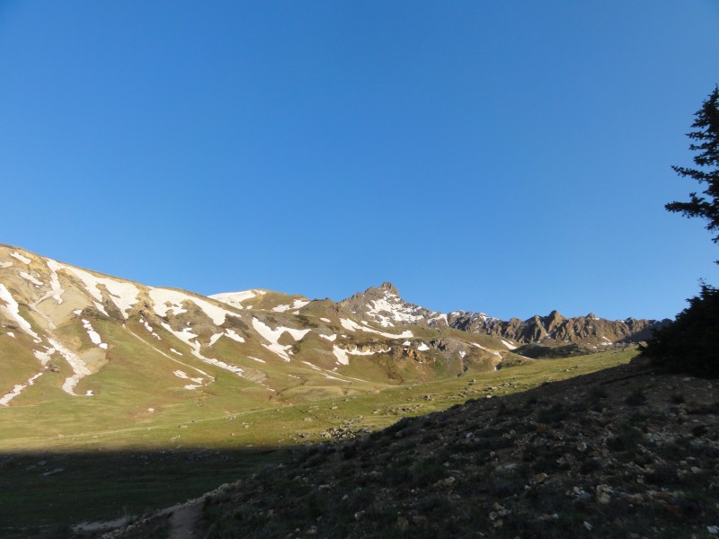 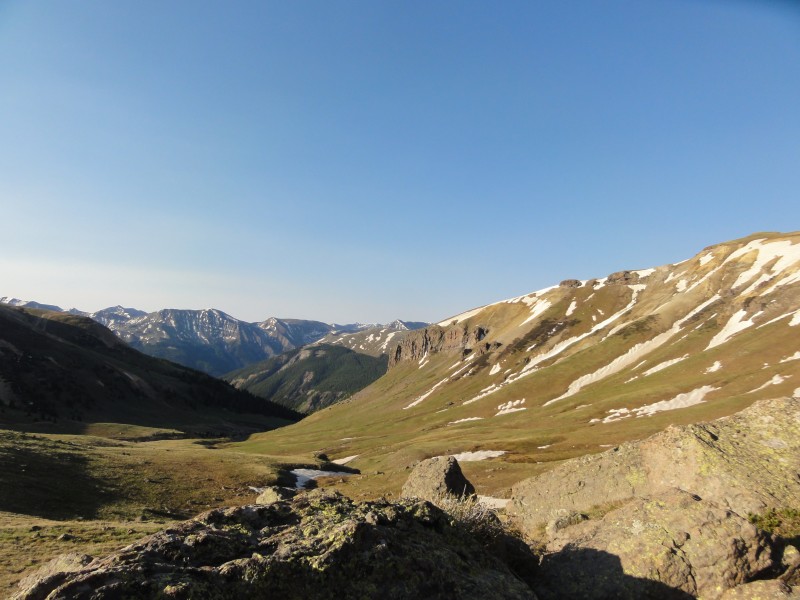 We came to a trail junction where the left was matterhorn trail and the right was the ridge stock trail (i think those are the names). You want to go right here. We almost screwed up since it looks like the matterhorn trail heads towards wetter horn. We continued hiking up through the basin. The ridge between Wetterhorn and Matterhorn looks pretty ferocious. 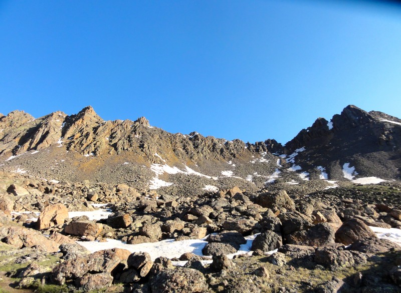 Soon Uncompahgre came into view and looked gigantic. 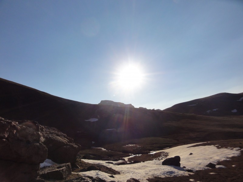 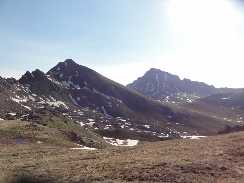 Looking up at Wetterhorn was intimidating, because the peak looks really serious from the basin. I was starting to wonder if I would be able to climb it, but I figured it would be like many other scrambling routes; nowhere near as bad as it looks in the pictures. It sure looks wild from the basin. Still, I figured I could always bail if it was too hard for me, but I hoped that wouldnt be the case. We were making good time through the basin, and soon we were crossing a small snowfield to get to the ridge! Once on the ridge itself, we started getting blasted by the wind. The skiers in front of us were cruising up, even with the wind. 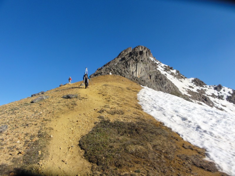 I was getting blown around pretty good on the initial part of the ridge, which wasnt really making me feel super confident about the upper mountain. Images of myself getting blown off the final section danced through my head. Still, the views that were opening up all around us were enough to keep me moving uphill. 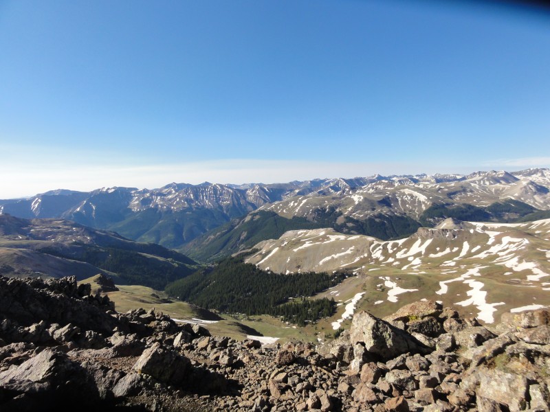 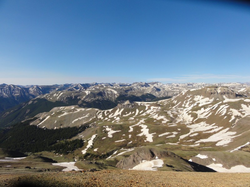 The upper section of the mountain started to look a little more reasonable the closer we got to it. 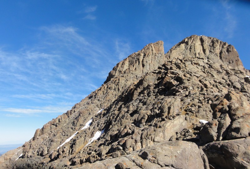 The standard route gully was snowy, so we took a slight variation and went straight up instead...id say it was solid class 3. It was a lot of fun though, and really helped to put my mind at ease. I think we followed the same route that a recent TR mentioned. We scrambled up for a while and soon enough we came to the prow. That thing is impressive. Looks like there could be some cool rock climbing on the face you pass under, but probably not worth lugging all that crap all day for 40 feet of climbing. We crossed a small snowfield without using any traction or gear...the snow was super soft and I would think it will be gone soon. Coming through the notch to the slab we were blasted with wind, but at this point I was psyched for the final pitch. The route had been a blast up to this point and the rest looked to be exciting. 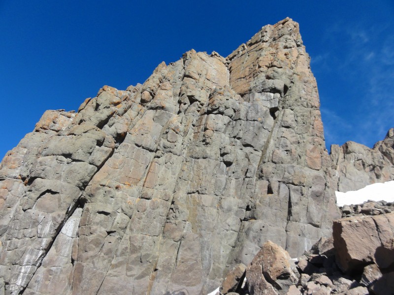 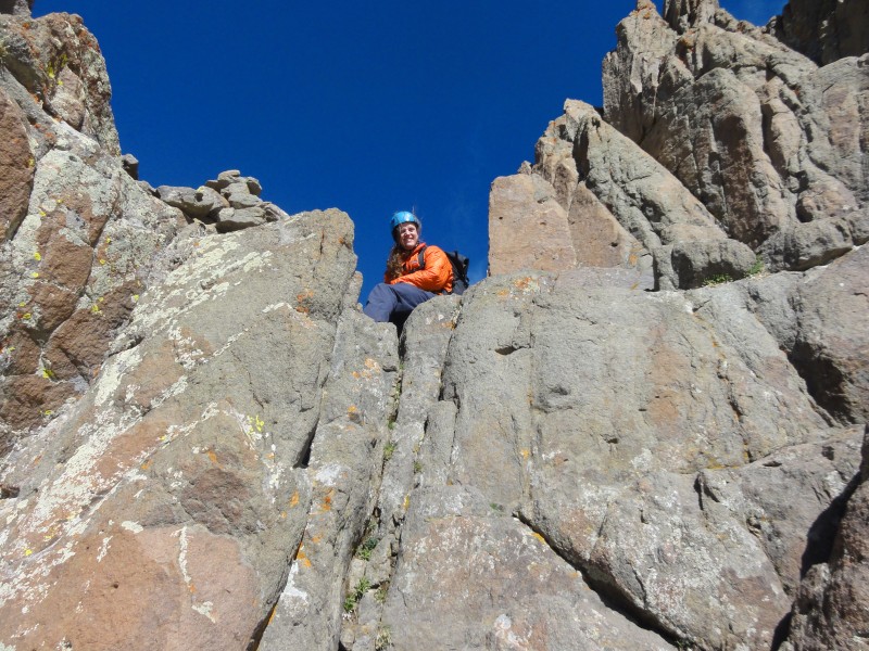 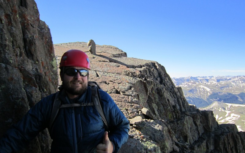 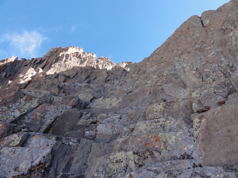 Coming down the angled slab was really cool, and then the route turns the corner to final 150 feet. It looks steep, but it was really not hard at all. Tons of great holds and the rock felt really solid. It is exposed, but its so much fun I hardly noticed. A little more than halfway up, the route turns left, but we ended up going straight up to the summit. It was probably slightly harder climbing but it was really solid and fun. 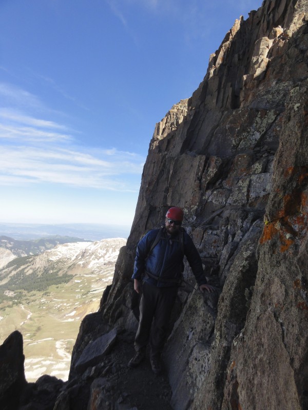 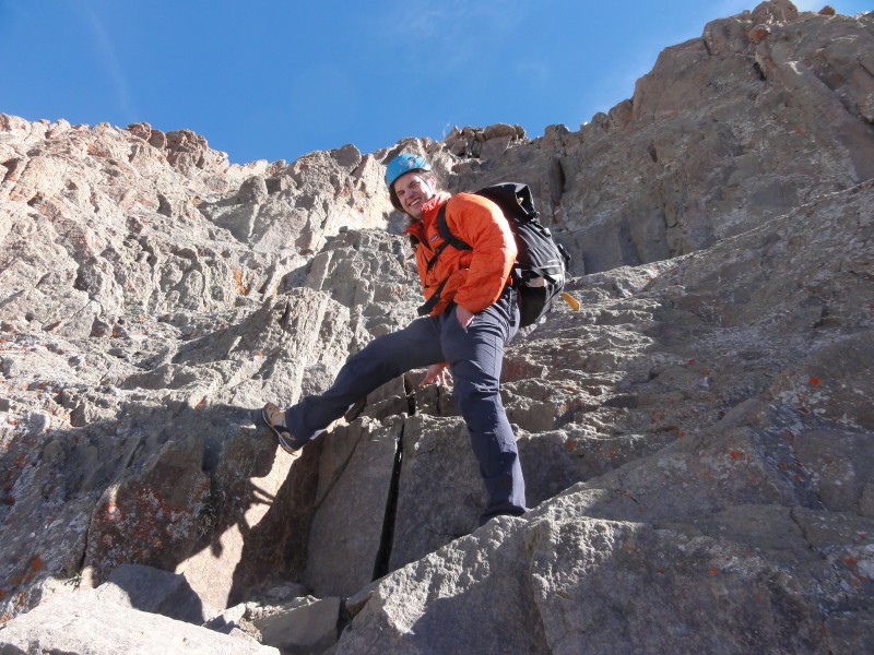 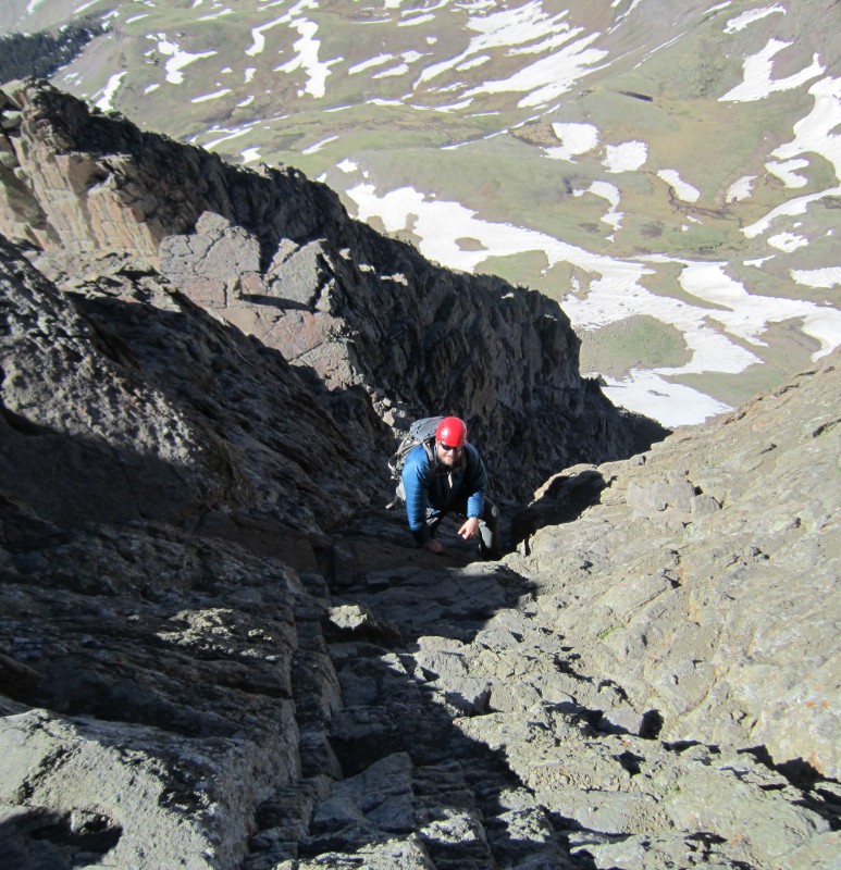 Sure enough, my hands reached the summit before my feet did! Just like chase had said. The views on the summit were incredible. None of the other mountain ranges I have been to have scenery like that. Just tons and tons of jagged, crazy looking peaks as far as the eye can see. It was really awesome. 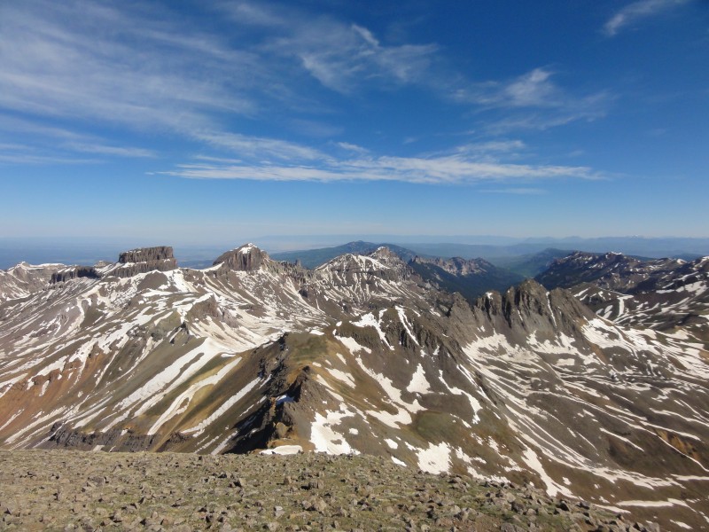 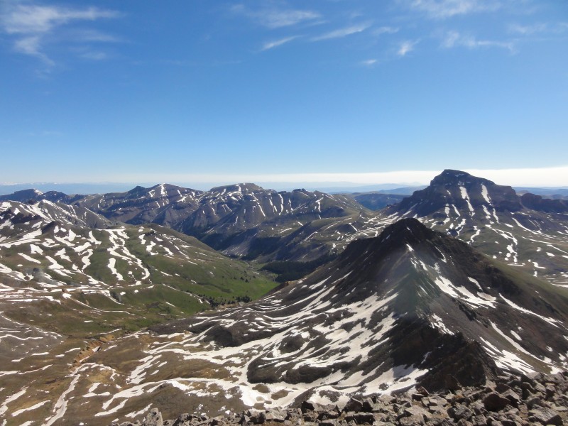 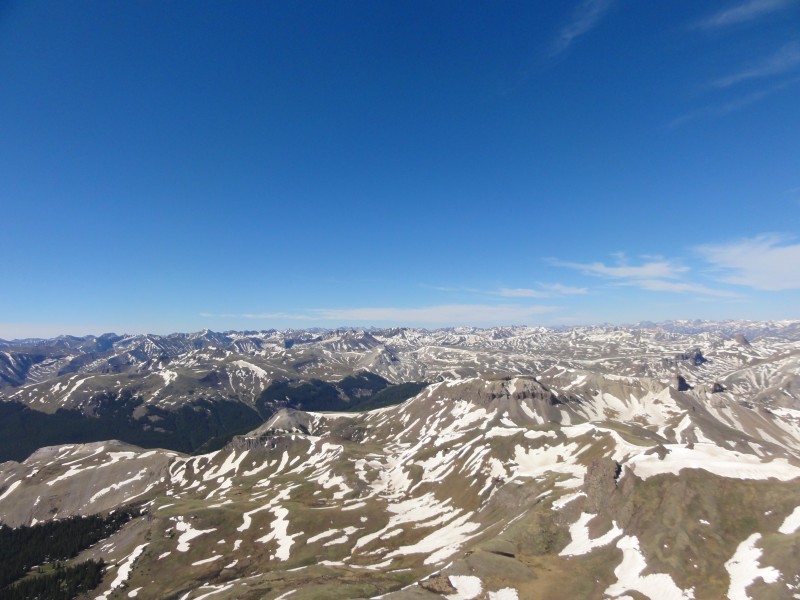 Needless to say, I have a new favorite 14er! The group of skiers was up on the summit when we arrived, waiting for the snow to soften i think. We all started talking and it turns out they were some guys from 14ers... leadville climber, gueza and apski. really cool guys, and some pretty serious skiers. Way gnarlier than ill ever be. I was pretty pleased with getting quandary on my split board. They headed down to ski, while chase and I just chilled out on the summit. Oddly enough the wind was way mellower on the summit. On the way up it had been blasting us so I figured the summit would be windy too. It was weird but much appreciated. 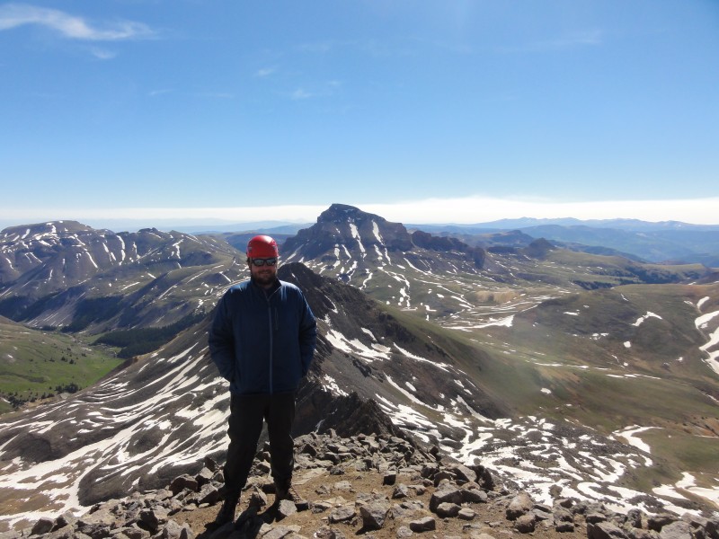 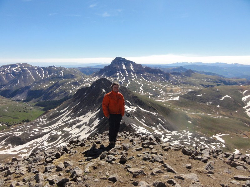 After about an hour of enjoying the scenery and the perfect weather, we started heading down. I found the descent to be a little more difficult than coming up. The route was definitely not as obvious looking at it from above. Still, it wasnt too hard. I just made a point to take my time and be careful. These pictures look pretty dramatic but really its not that steep. 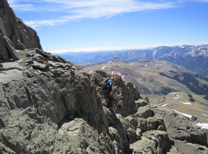 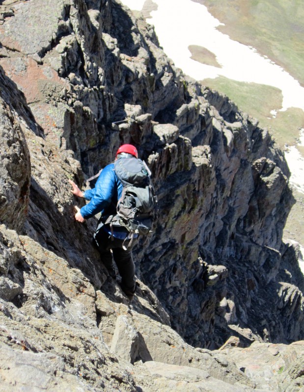  Soon enough we were back at the slab.  The rest of the descent went easily enough and soon we were walking back down through the basin to the car. The hike out was enjoyable as well. We saw a couple of marmots that gave their best effort at getting a snack from us. They were denied. Then the two marmots saw each other and one started squealing and chasing the other one around and then they went under a rock together. Perhaps thats where marmots come from. 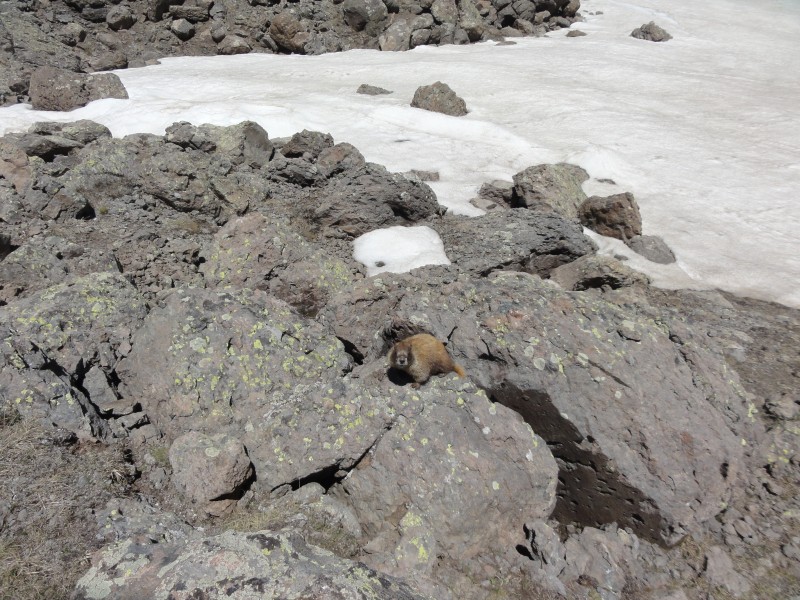 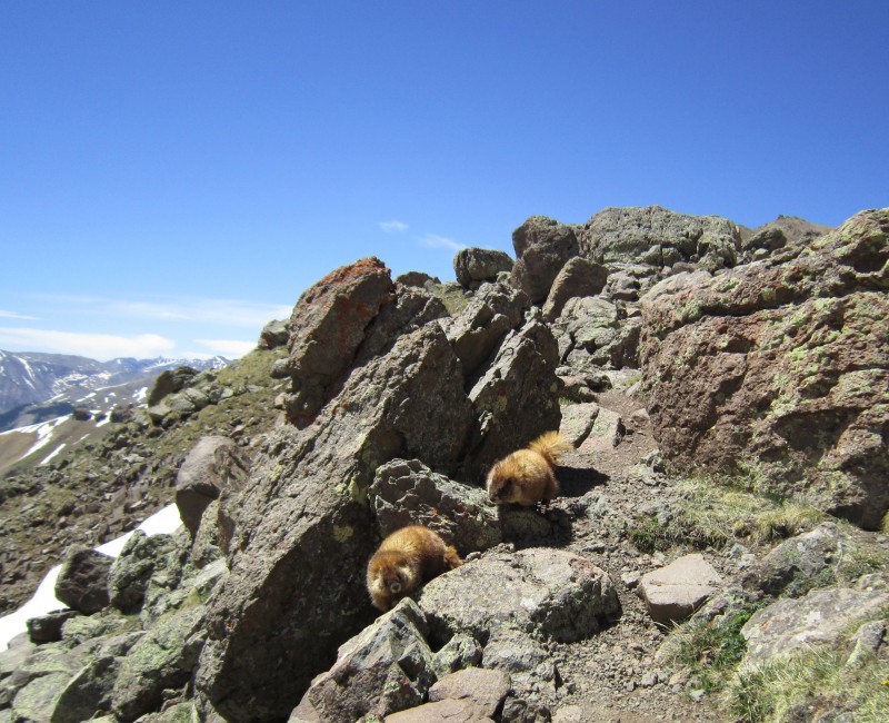 After that, we passed a deer right before hitting the 4wd trailhead. 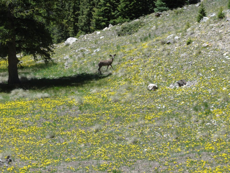 From there, it was just a short walk back to the car, where we packed up our camp and headed into Lake City to eat lunch and decide what would be next. This was probably the most fun hike I have done so far. The camping was great. The approach had phenomenal views all around and the fun part was realllly fun. Lots of scrambling and mostly solid rock. Once again, I found out that everything looks much worse in pictures. If you havent done Wetterhorn, you should get out there and do it. Its awesome!  Thumbnails for uploaded photos (click to open slideshow):  Wetterhorn!")
 looking back towards the trailhead")
 uncompahgre poking out")
")
 wetterhorn-matterhorn ridge")
")
 getting to the fun part")
")
")
")
")
 chase looking down")
 me")
")
")
")
")
")
")
 amazing")
 starting the descent")
")
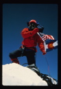
 summit")
")
 chase coming down")
")
 feed me")
")
")
 one last look")
|
| Comments or Questions | ||||||
|---|---|---|---|---|---|---|
|
Caution: The information contained in this report may not be accurate and should not be the only resource used in preparation for your climb. Failure to have the necessary experience, physical conditioning, supplies or equipment can result in injury or death. 14ers.com and the author(s) of this report provide no warranties, either express or implied, that the information provided is accurate or reliable. By using the information provided, you agree to indemnify and hold harmless 14ers.com and the report author(s) with respect to any claims and demands against them, including any attorney fees and expenses. Please read the 14ers.com Safety and Disclaimer pages for more information.
Please respect private property: 14ers.com supports the rights of private landowners to determine how and by whom their land will be used. In Colorado, it is your responsibility to determine if land is private and to obtain the appropriate permission before entering the property.