Download Agreement, Release, and Acknowledgement of Risk:
You (the person requesting this file download) fully understand mountain climbing ("Activity") involves risks and dangers of serious bodily injury, including permanent disability, paralysis, and death ("Risks") and you fully accept and assume all such risks and all responsibility for losses, costs, and damages you incur as a result of your participation in this Activity.
You acknowledge that information in the file you have chosen to download may not be accurate and may contain errors. You agree to assume all risks when using this information and agree to release and discharge 14ers.com, 14ers Inc. and the author(s) of such information (collectively, the "Released Parties").
You hereby discharge the Released Parties from all damages, actions, claims and liabilities of any nature, specifically including, but not limited to, damages, actions, claims and liabilities arising from or related to the negligence of the Released Parties. You further agree to indemnify, hold harmless and defend 14ers.com, 14ers Inc. and each of the other Released Parties from and against any loss, damage, liability and expense, including costs and attorney fees, incurred by 14ers.com, 14ers Inc. or any of the other Released Parties as a result of you using information provided on the 14ers.com or 14ers Inc. websites.
You have read this agreement, fully understand its terms and intend it to be a complete and unconditional release of all liability to the greatest extent allowed by law and agree that if any portion of this agreement is held to be invalid the balance, notwithstanding, shall continue in full force and effect.
By clicking "OK" you agree to these terms. If you DO NOT agree, click "Cancel"...
While Memorial Day weekend feels like the start of the summer season, the lack of conditions reports in the preceding weeks often means packing more gear then you want to carry since you never really know how much snow there is to negotiate. Regardless, "the mountains are calling and I must go" (John Muir).
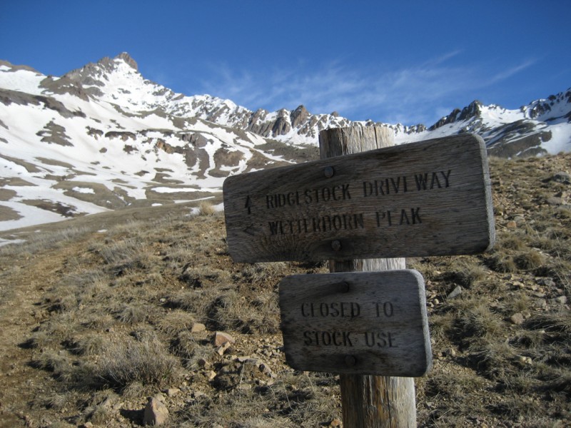
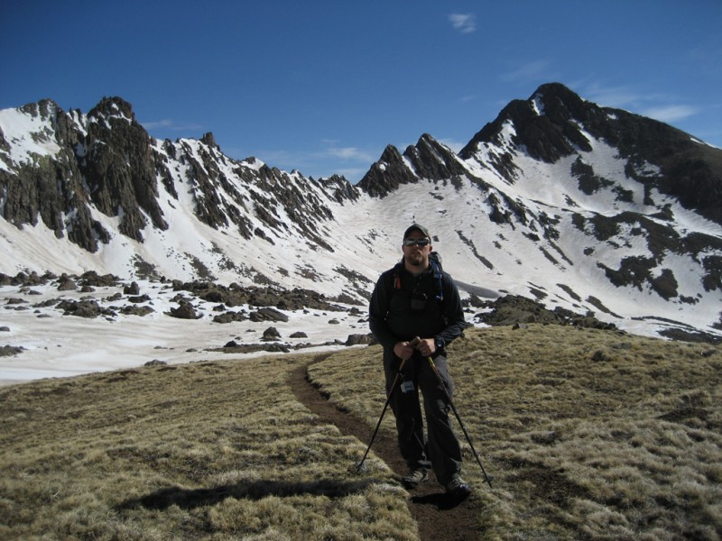
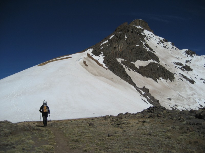
Mark was visiting from PA on his 3rd annual Memorial Day weekend trip and after climbing Hunts Peak in the northern Sangres the day before we drove to Gunnison and stayed at the KOA (great campground). The day of our climb we drove from Gunnison to the Matterhorn Creek 4WD TH which was snow free. We were hiking by 6:45 (later than usual for a 14er ascent, but the forecast showed no chance of storms so we were comfortable with the late start) and enjoyed a leisurely pace to treeline where we ditched the snowshoes (the trail below treeline had minimal snow which could be avoided and we could see snowshoes would not be needed higher up). From there we carried helmet, ax and spikes to the summit.
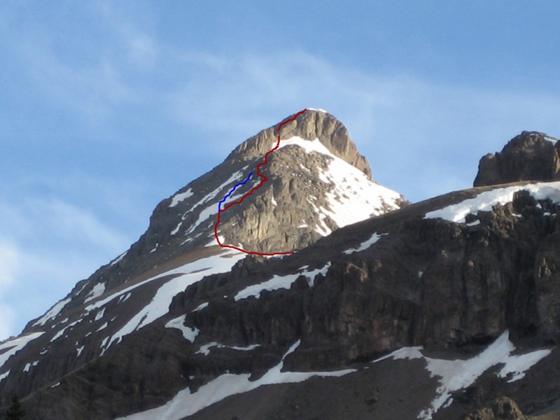
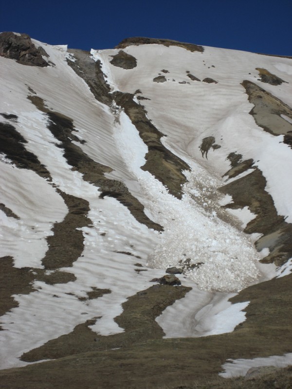
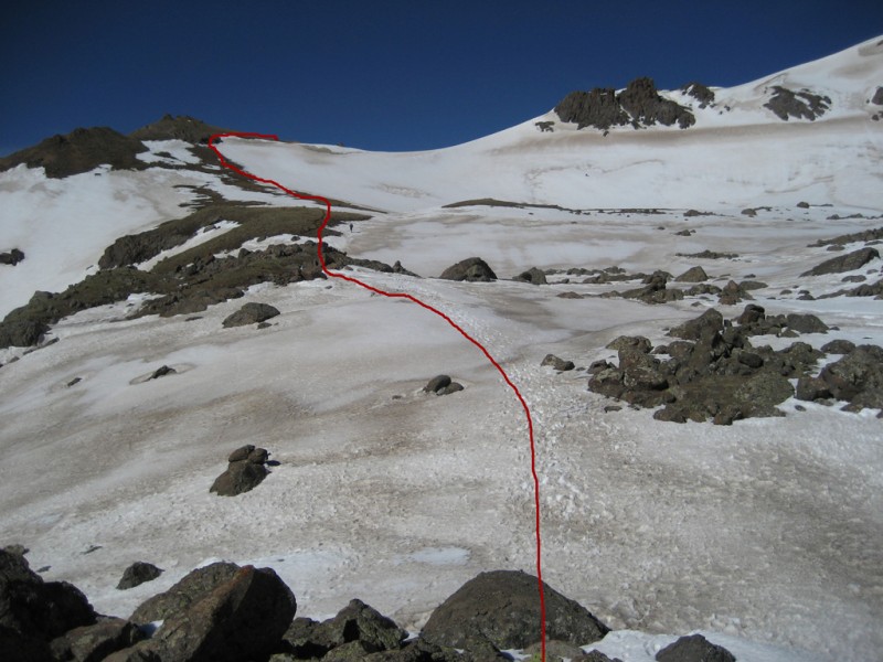
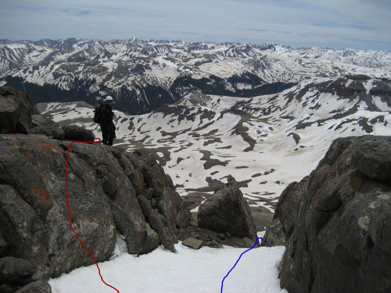
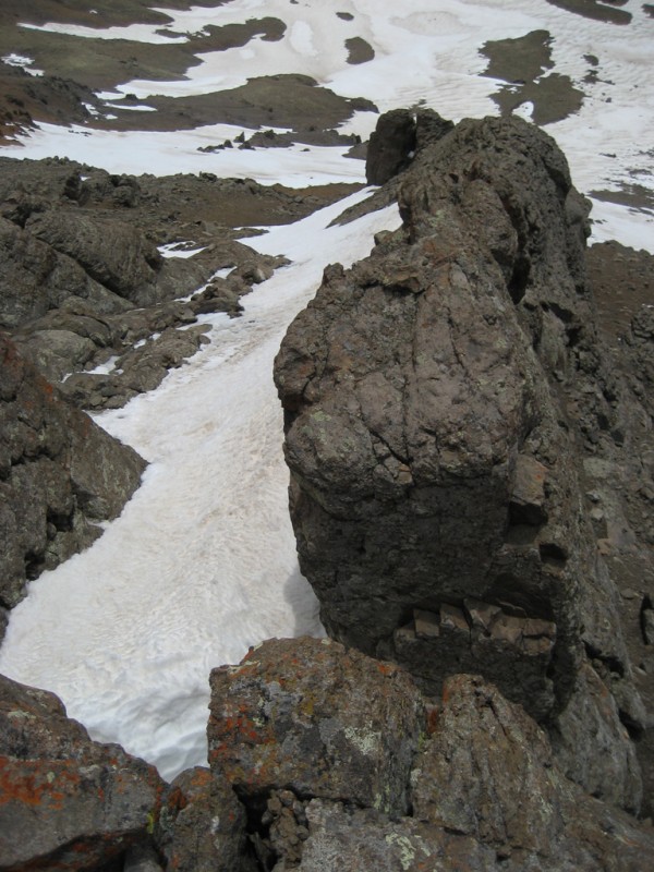
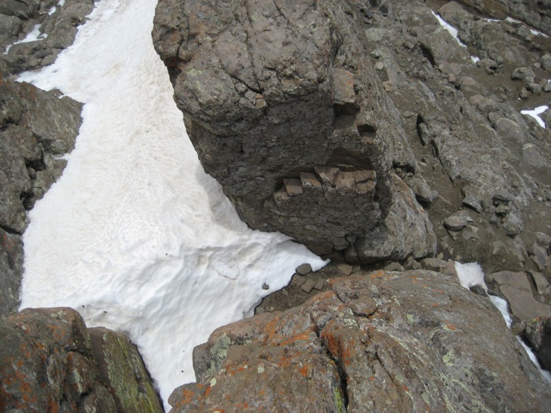
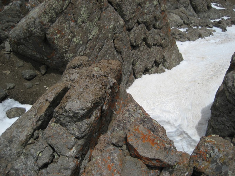
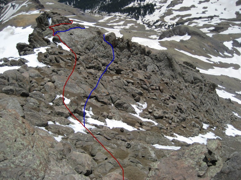
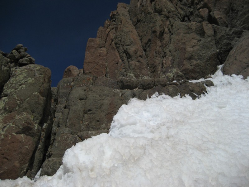
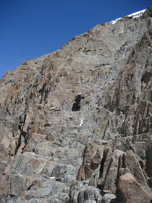
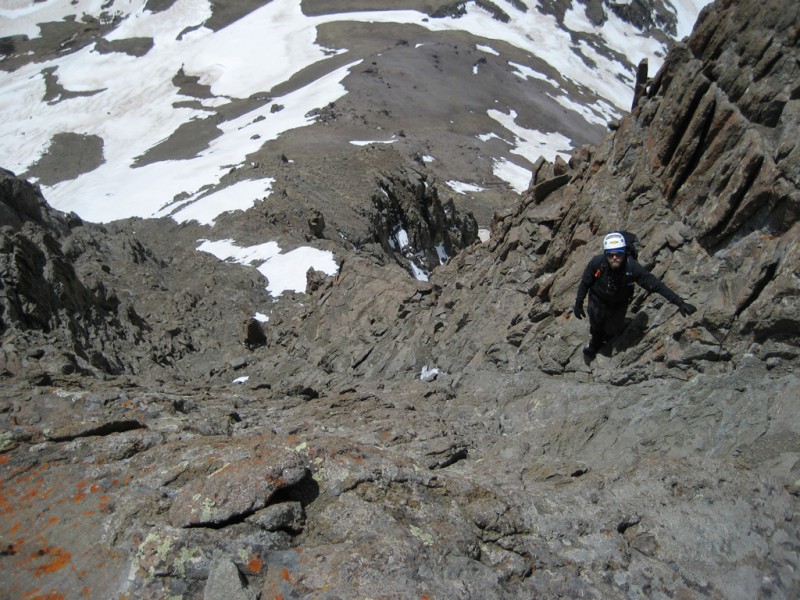
The trail through the basin was largely snow free and snow fields were firm enough to walk on or could be avoided (although the trail through the basin was quite soggy on the descent from the quickly melting snow). Once on the southeast ridge we only encountered snowfields in three areas: 1) on the yellow colored saddle before the scrambling began (poles were sufficient to climb this); 2) in the gully next to the rock rib (see detailed pics below); and 3) next to the Prow. There are numerous trail segments and cairns which seem to lead in a couple directions, but after studying the route description and reading a bunch of TRs route finding was relatively straight forward. The most helpful info I gained from reading TRs (and I completely agree) is that once you past the saddle and start the scrambling section (aka, the fun part) of the ridge stay on or left of the ridge. The pictures and captions below show our route and conditions.
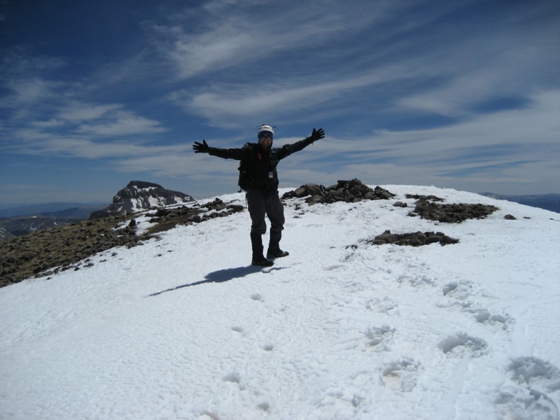
This route up Wetterhorn is probably in my top 5 of the 14ers I've climbed. It's a fun, moderately challenging route (with no crappy sections like prolonged talus fields) and unbelievable scenery. Great weather and climbing with Mark certainly added to the enjoyment and made for a great Memorial Day weekend.
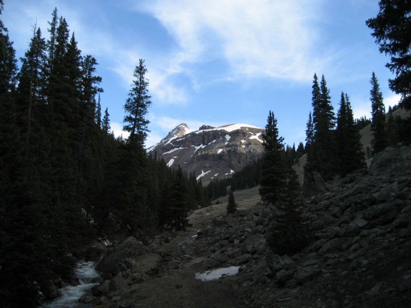
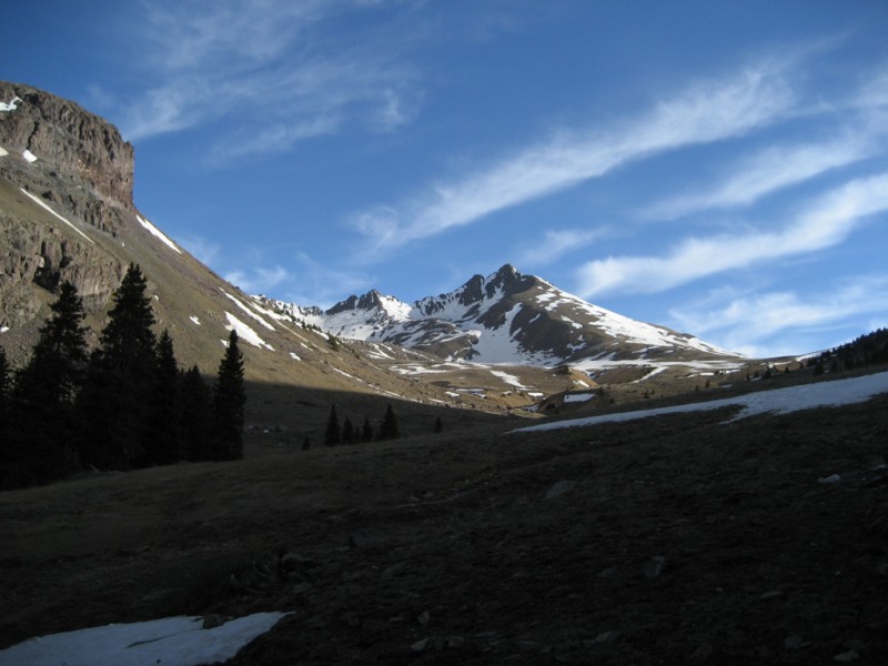
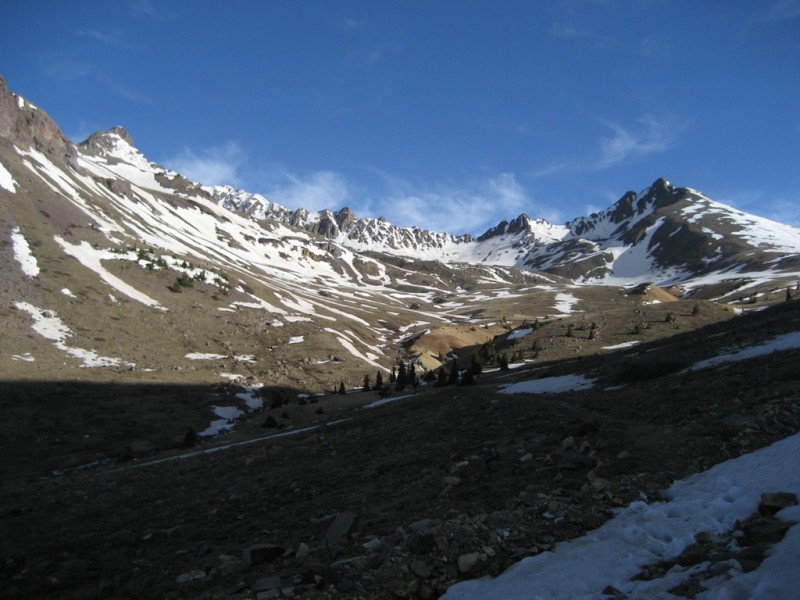
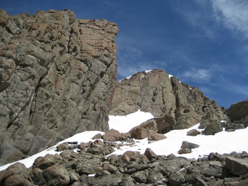
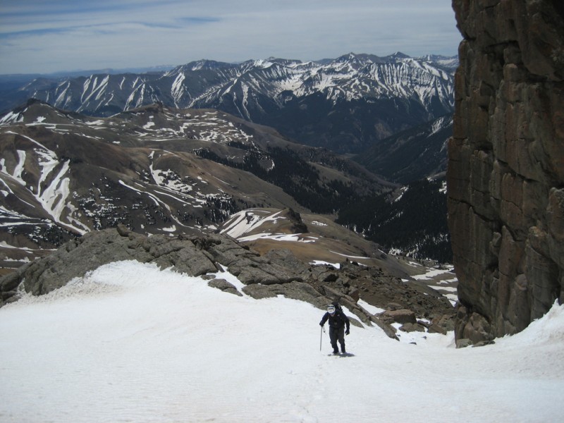
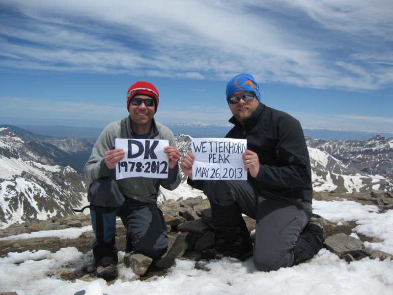
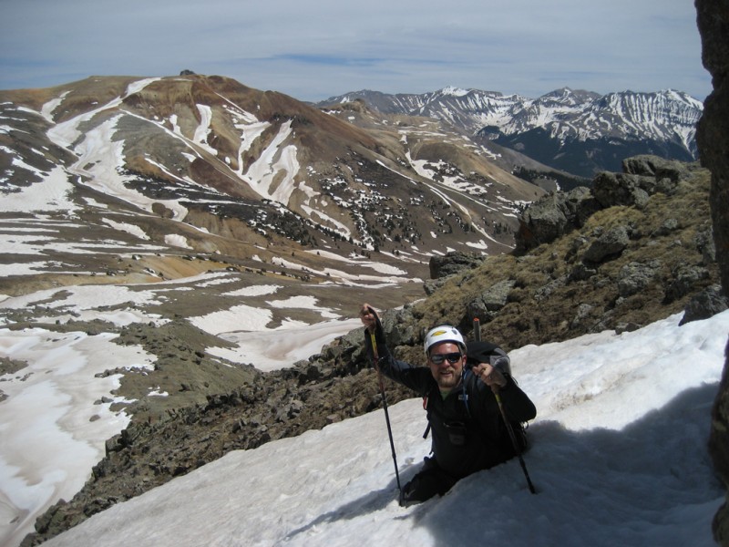
First view of Wetterhorn comes only 3/4 of a mile up trail Zoomed in you can see the large snowfield next to the rock rib and by the prow. Standard route in blue; our route in red. View from treeline just after a stream crossing. First view of the complete Wetterhorn to Matterhorn traverse. Trail junction: left to Wetterhorn; straight to Uncompahgre On the adjacent hill to our left cornices were starting to fall. This one looks recent. Mark pausing to enjoy the view. We gave thanks for the perfect weather. The trail up to the end of Wetterhorn's southeast ridge. Starting up the southeast ridge from the saddle. Approaching the fun stuff! Standard route in blue; our route in red. The gully to the right of the rock rib was full of snow so we stayed right and climbed straight up to the ridge. We stayed left of the ridge and scrambled up this small crack. A few class 3 moves and we were on the ridge where Option 2 (blue line) on the route description joins the ridge. This photo was taken on top of the tall rocks in photo 10 of the RD and looking down the snowy gully next to the rock rib. From the top of the tall rocks looking in the V notch which is Option 1 on the RD From the top of the tall rocks looking at the Option 2 exit from the gully. A little further up the ridge this is looking back at our route compared to Option 1 and 2 of RD (compare to photo 13 of the Approaching the Prow and the last snow crossing. We had ax and spikes so we used them. The notch to the right of the Prow (photo 16 of the RD) that leads to the angled slab. Mark starting up the final scramble to the summit. The angled slab and remaining scramble were snow free and dry. Mark 1/3 of the way up. The exposure directly below the route wan't bad. However, just off to the left it got impressive! Higher up looking down. What a fun way to reach the summit! Mark approaching the ledge 2/3 of the way up. You can continue straight up, but we walked left on the ledge around the corner From the ledge, a good view down the SE ridge We enjoyed the summit to ourselves for an hour. The San Juans are spectacular! Matterhorn with Uncompahgre. This was my first Memorial Day trip since 2006 without my friend Derek Kelley. Derek passed away in an accident on N. Maroon And as always, post holing on the way down is possible (actually, it wasn't bad ... except for this one!)
Thumbnails for uploaded photos (click to open slideshow):
Yall were looking good on the summit when we were coming up the ridge that day! I completely agree with you on this peak - definitely one of the most enjoyable, fun, scenic routes I've done so far.
Caution: The information contained in this report may not be accurate and should not be the only resource used in preparation for your climb. Failure to have the necessary experience, physical conditioning, supplies or equipment can result in injury or death. 14ers.com and the author(s) of this report provide no warranties, either express or implied, that the information provided is accurate or reliable. By using the information provided, you agree to indemnify and hold harmless 14ers.com and the report author(s) with respect to any claims and demands against them, including any attorney fees and expenses. Please read the 14ers.com Safety and Disclaimer pages for more information.
Please respect private property: 14ers.com supports the rights of private landowners to determine how and by whom their land will be used. In Colorado, it is your responsibility to determine if land is private and to obtain the appropriate permission before entering the property.