Download Agreement, Release, and Acknowledgement of Risk:
You (the person requesting this file download) fully understand mountain climbing ("Activity") involves risks and dangers of serious bodily injury, including permanent disability, paralysis, and death ("Risks") and you fully accept and assume all such risks and all responsibility for losses, costs, and damages you incur as a result of your participation in this Activity.
You acknowledge that information in the file you have chosen to download may not be accurate and may contain errors. You agree to assume all risks when using this information and agree to release and discharge 14ers.com, 14ers Inc. and the author(s) of such information (collectively, the "Released Parties").
You hereby discharge the Released Parties from all damages, actions, claims and liabilities of any nature, specifically including, but not limited to, damages, actions, claims and liabilities arising from or related to the negligence of the Released Parties. You further agree to indemnify, hold harmless and defend 14ers.com, 14ers Inc. and each of the other Released Parties from and against any loss, damage, liability and expense, including costs and attorney fees, incurred by 14ers.com, 14ers Inc. or any of the other Released Parties as a result of you using information provided on the 14ers.com or 14ers Inc. websites.
You have read this agreement, fully understand its terms and intend it to be a complete and unconditional release of all liability to the greatest extent allowed by law and agree that if any portion of this agreement is held to be invalid the balance, notwithstanding, shall continue in full force and effect.
By clicking "OK" you agree to these terms. If you DO NOT agree, click "Cancel"...
Mt Dickinson - 11,814 (or 11836 ft, depending on the source) is an unranked 11er deep in the Mummy Range, in the vicinity of Lost Lake. It's mainly the last, easternmost bump above treeline on a ridge coming from Mummy Mtn and is neighbored by Mt Dunraven to the west.
Route: Took the North Boundary trail from Cow Creek trailhead (McGraw Ranch) to the forested east ridge, then bushwhacked for 2.7 miles each way up and down the ridge.
The trip stats for this obscure, unranked 11er:
Round trip mileage : 17 miles (including ~ 1-1.4 mile side trip to West Creek Falls)
Elevation gain: 6300ft (counting elevation gain and loss on the trail into/out of West Creek and Fox Creek drainages which was over 2000 ft round trip but still seems high).
Time: 10 hours round trip
People seen beyond trailhead: 0
17 miles and 6300 ft elevation gain is a lot for one unranked, obscure 11er.
But it was a fun trek into a remote part of the Mummy Range, and a good conditioning/training hike with bushwhacking, uphill on the way back (climbing out of a canyon), and good scenery, in an area I hadn't been before.
The first part leads up a hill then down into a canyon area - gain 500 ft elevation, then lose it all. Different area of Comanche Peak Wilderness and more views than I expected. If you want to get away from crowds and experience a sense of remoteness, this is a nice area. It had a bit of a canyon hike feel to it at times.
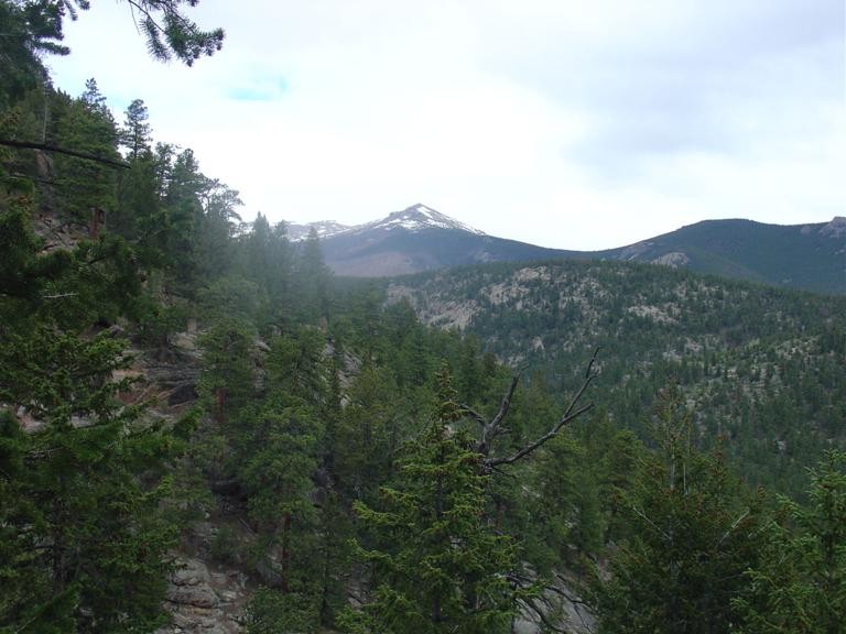
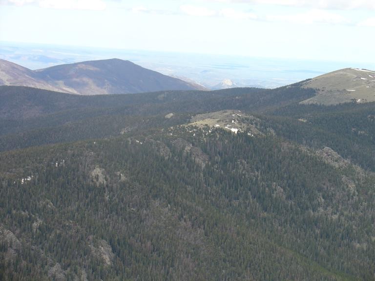
From the top of the first pass, Mt. Dickinson comes into view - and it's a long ways out there. The first picture also shows the forested east ridge I took up in the background (with an unnamed point in the middle). Farther along the trail, different views of Mummy Mtn appear. The Cow Creek fire burn of a couple years ago is also visible throughout and burned the lower slopes of the mountain.
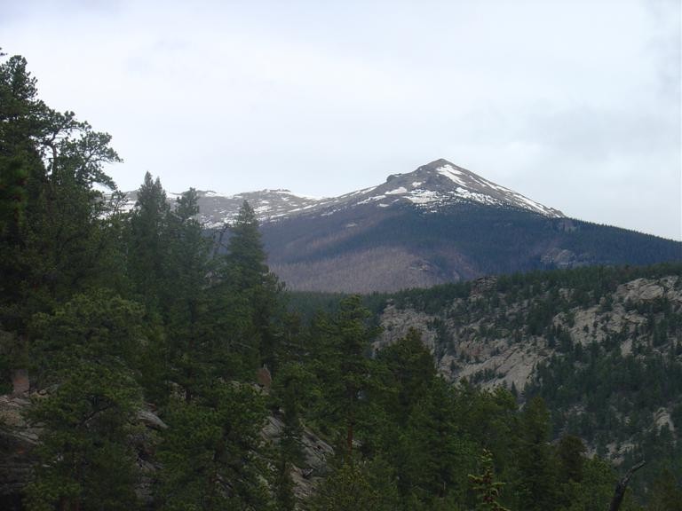
Mt Dickinson seen from near the start of the hike a closer look
Mummy Mountain: Mummy Mountain
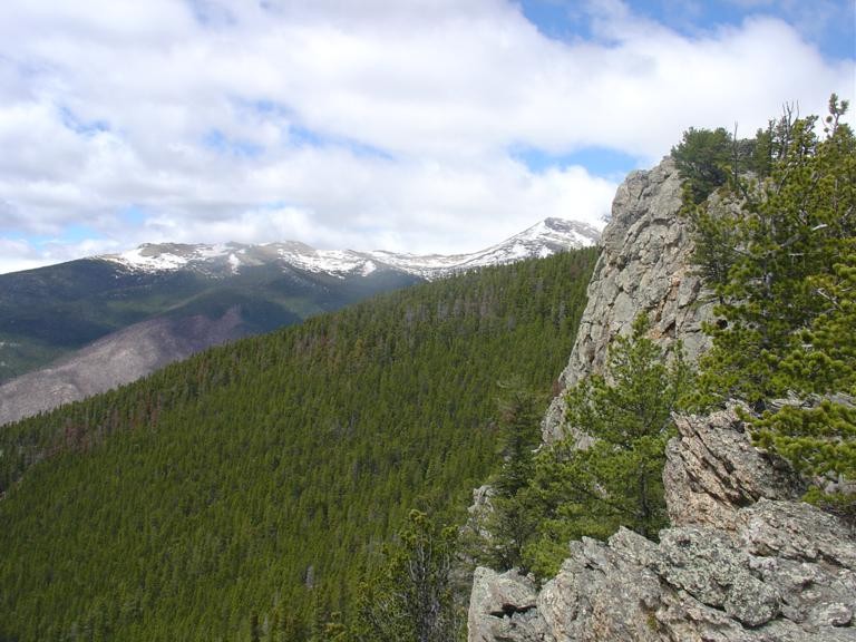
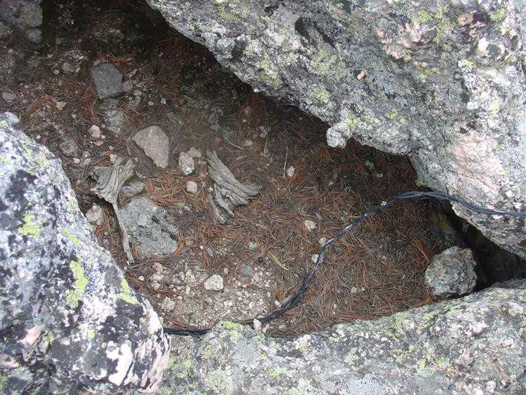
About 4.5 miles up the trail (per the GPS, somewhere around 4 miles or so, elevation 9700 ft), I reach the forested east ridge coming down from Mt Dickinson. I had views of this forested ridge on the way up, it looks mostly like a canyon rim, but with forested slopes. At this obvious rock outcropping overlooking a small gorge, I head off trail straight west. Here is a look at that spot - it's a good landmark as it's the only rocky spot along that part of the trail.
start bushwhacking up the east ridge from here
Mt Dickinson is 2.7 miles west. The bushwhacking is surpringly easy after an initial climb through some small fallen trees. The forest is thin along most of this ridge, and with the steepness less than the trail, it's actually a bit faster going. Up a bit higher, it's mostly groves of limber pine with plenty of open space. Almost looks like a real trail in spots, and there are obvious game trails to follow.
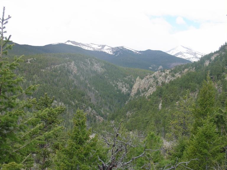
Great views off to the sides as the trees get sparser. There is a cliff on the left at a big rock outcropping, visible from the hike up the trail. This overlooks the whole West Creek Research Area and you can see the route taken so far. Good views of the Cow Creek burn area too, and Mummy Mtn and Mt Dickinson. From here, Mt Dickinson still looks very far away.
view along the ridge not there yet
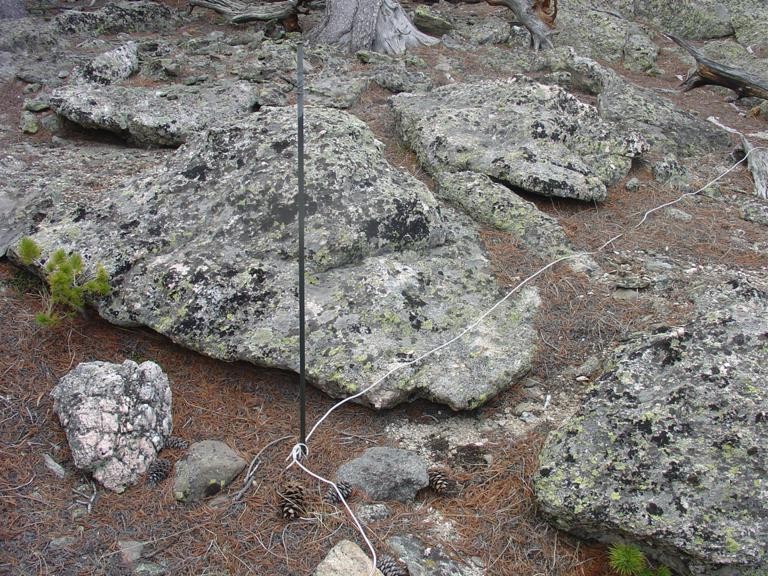
An unusual sight here was what looks like a grounding rod, with about 20 ft of wire tied to it and a spark gap set up in a little rock bowl with some pine needles, almost like someone was wanting a lightning started fire. Odd, maybe some leftover experiment, or a way to spark a fire? The flux capacitor was gone though. This is about a mile and a half or so off trail.
weird wiring
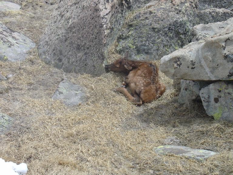
Beyond this spot, the forest gets thicker for a bit, then opens up a little again. Drop to a small saddle and climb up through a bit thicker trees to a meadow area near treeline. The rest is a short climb up tundra, bypassing the wart on the ridge to the top. Near the summit, I stumble across a newborn elk, curled up behind a rock, still with a bit of placenta around the foot. The mother had been watching me climb up earlier, but I didn't see her once I was up there.
newborn elk
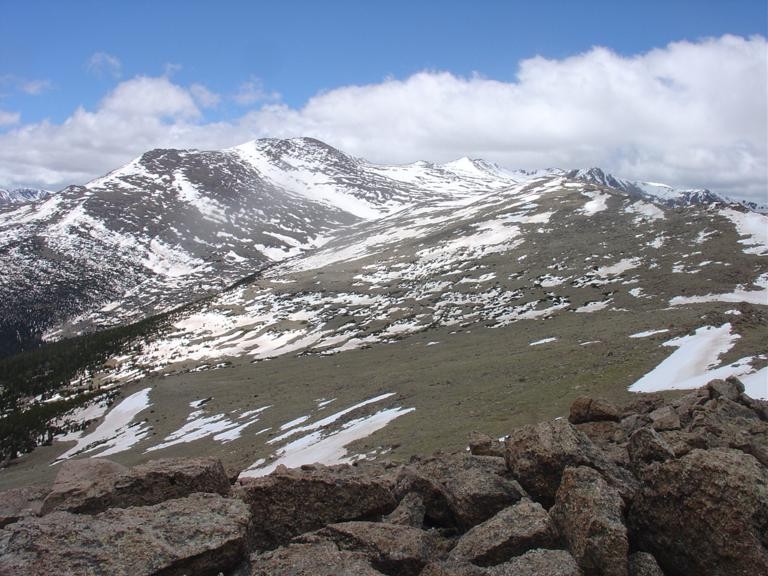
Great views all around from the top, can see pretty far, even Greyrock is visible. Mummy Mtn seems close, and nice to see a different angle of it, but is still about 3 miles or more away. The summit register scroll was wet and pen dried. No signatures since Oct 1, 2012. And another unusual sight here, another experiment? There were small grounding rods, set up in a triangle of sorts, with some thick wire twisted around them. Not sure what these were for.
summit views:
Mummy Mtn seen from summit Greyrock in the distance looking northwest
The High Park Fire burn on White Pine Mountain is clearly visible here, along with Poudre Canyon, Greyrock, the Cow Creek burn, and more.
I resisted the temptation to return a different way, down the Grouse Creek drainage, even though a talus gully and other lines seemed to lead down to an interesting meadow and pond. I just figured the forest was going to be thicker down there, and with it being a long day, the fastest way back would be through the thin forest I had come up on. So I retraced my steps back. I passed what appeared to be the old Husted Trail - have to explore that some other time. I think that may provide another route to Mt Dickinson, but not all the way up the slopes, just in the drainage. I did spot a hidden pond and meadow from the ridge. Took a side trip to West Creek Falls after getting back, then slogged it uphill out of the canyon on the way back. I'm surprised people ride horses on that trail.
10 hrs later, back at the trailhead, and I see the first people since I left it.
There are easier ways to climb this mountain, but I was interested in something a bit harder and doing some exploring. This route was pretty scenic and I like the conditioning for regaining elevation.
Thumbnails for uploaded photos (click to open slideshow):
Great stuff and great pics, interesting ”experiments” going on up there!
Did you encounter snow and much deadfall on the trail itself? It looks less snowy than I anticipated. Thanks!
I love this part of RMNP - very underrated in my opinion. We were doing the Lumpy Ridge loop (with detours to Balanced Rock and Bridal Veil Falls) that day - couldn't ask for better weather.
only a little deadfall at the beginning and towards the end, much less than I expected. Same for snow, only a bit collecting in the upper saddle and very little postholing, most of the snow was firm. The Mummy Range, at least that part of it, seems drier than nearby areas, even on the north facing side. The exception seems to be Ypsilon which looks to be holding its snow on the east face. What's also odd is some of the south facing slopes seemed to be holding more snow than the north (like Sugarloaf).
No picture of the register - it was mostly tattered shreds and bits of paper instead of a scroll or booklet, laying in a marmot toilet, pretty wet even though the tube was closed, and the pen was dried out. Someone from Paris signed it last year.
10720 is on my list next time I do Lookout, may get Crystal with it from Indian trail. Probably in the fall.
Mike: I sent you a PM with a shot of the register I got on the 28th. It was also wet and had a dry pen then.
Cougar: Nice trip!! You were right to not go down the other side. I went up from the Dunraven trailhead on the 28th, left the main trail at Happily Lost Campsite and bushwacked up the hillside; have many scars on the legs to remember the trip from. Nice job on the hike and love the elk.
Given that you move swiftly in all kinds of terrain and sneak up stealthly on elk.
What an adventure! Thanks for taking us along. Dickinson was on my radar for later this summer (along with Dunraven, Dundicking), but your way sounds much more creative.
I was on 10720, less than 10 miles from you when you were doing this. Didn't see you though.
Caution: The information contained in this report may not be accurate and should not be the only resource used in preparation for your climb. Failure to have the necessary experience, physical conditioning, supplies or equipment can result in injury or death. 14ers.com and the author(s) of this report provide no warranties, either express or implied, that the information provided is accurate or reliable. By using the information provided, you agree to indemnify and hold harmless 14ers.com and the report author(s) with respect to any claims and demands against them, including any attorney fees and expenses. Please read the 14ers.com Safety and Disclaimer pages for more information.
Please respect private property: 14ers.com supports the rights of private landowners to determine how and by whom their land will be used. In Colorado, it is your responsibility to determine if land is private and to obtain the appropriate permission before entering the property.


 Mt Dickinson seen from near the start of the hike")
 a closer look")
")
 Mummy Mountain")
 start bushwhacking up the east ridge from here")
 view along the ridge")
 weird wiring")
")
 newborn elk")
 Mummy Mtn seen from summit")
 Greyrock in the distance")
 not there yet")
 looking northwest")


