Download Agreement, Release, and Acknowledgement of Risk:
You (the person requesting this file download) fully understand mountain climbing ("Activity") involves risks and dangers of serious bodily injury, including permanent disability, paralysis, and death ("Risks") and you fully accept and assume all such risks and all responsibility for losses, costs, and damages you incur as a result of your participation in this Activity.
You acknowledge that information in the file you have chosen to download may not be accurate and may contain errors. You agree to assume all risks when using this information and agree to release and discharge 14ers.com, 14ers Inc. and the author(s) of such information (collectively, the "Released Parties").
You hereby discharge the Released Parties from all damages, actions, claims and liabilities of any nature, specifically including, but not limited to, damages, actions, claims and liabilities arising from or related to the negligence of the Released Parties. You further agree to indemnify, hold harmless and defend 14ers.com, 14ers Inc. and each of the other Released Parties from and against any loss, damage, liability and expense, including costs and attorney fees, incurred by 14ers.com, 14ers Inc. or any of the other Released Parties as a result of you using information provided on the 14ers.com or 14ers Inc. websites.
You have read this agreement, fully understand its terms and intend it to be a complete and unconditional release of all liability to the greatest extent allowed by law and agree that if any portion of this agreement is held to be invalid the balance, notwithstanding, shall continue in full force and effect.
By clicking "OK" you agree to these terms. If you DO NOT agree, click "Cancel"...
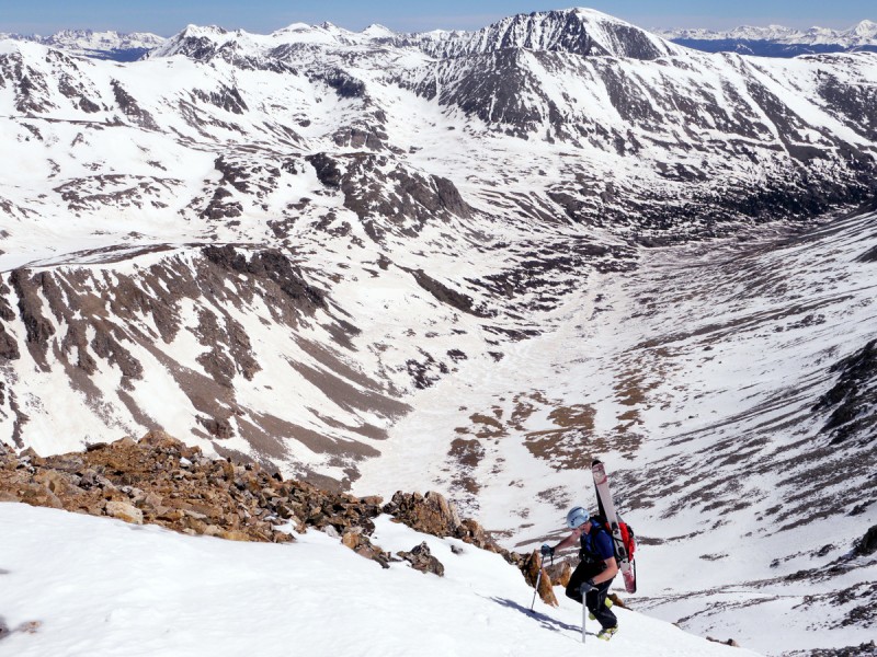
Skiing the N face of Democrat has been on my to-do list ever since I read about it on Stan Wagon's web site, but detailed information was hard to come by until Fritz Sperry's guidebook was published last year. After debating the pros & cons of an approach from Kite Lake we decided to approach from the N and set out from Montgomery Reservoir at 7am. Conditions were almost perfect - sunny, warm, almost no wind, plenty of snow cover but nicely frozen first thing in the morning. The trail was snow-free for the first 1.5 miles but after that we were on snow almost the whole way. We were able to wear sneakers and traipse across frozen snow until we reached the base of the N Face, where we changed into boots and crampons - our skins never came out of our packs. We climbed the leftmost of the gullies in the picture below. The snow was nicely consolidated the whole way up. There was a few feet of exposed rubble at the top of the gully, but otherwise we were on snow all the way to the summit.
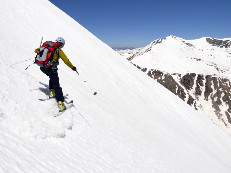
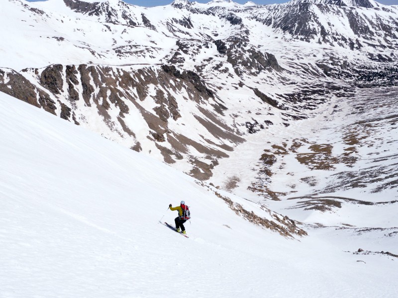
For the descent we dropped in further to the west of our ascent gully and turned skier's right to rejoin our ascent line - that allowed us to avoid the short section of rubble and keep our skis on the whole time. (If we hadn't turned right we'd have ended up in a choke at the bottom of the next gully to the west. This has slid recently and we weren't keen on trying to ski over avalanche debris). The snow was a bit icy for the first couple of hundred feet, but after that it was creamy goodness all the way down for almost 2,000'. Average angle was probably around 40 degrees, maybe reaching 45 degrees in a few spots.
On the way out there was a bit of double-poling across the flats down in the valley, and we had to carry our skis across a few bare sections, but for the most part we were able to ski all the way until the snow ended 1.5 miles from the trailhead.
Some stats:
Left Montgomery Reservoir (11,000') 7am
Base of N Face (12,200', 4.3 mi) 9am
Top of ascent gully (14,000', 5.3 mi) 10:30am
Summit (14,148', 5.5 mi) 10:40am
Top of descent gully (14,050') 11:05am
Base of N Face 11:15am
Back at car 1pm
My GPS Tracks on Google Maps (made from a .GPX file upload):
Next time you might want to consider moving the gondola out of the asteroid field so you can send a clearer transmission.
Caution: The information contained in this report may not be accurate and should not be the only resource used in preparation for your climb. Failure to have the necessary experience, physical conditioning, supplies or equipment can result in injury or death. 14ers.com and the author(s) of this report provide no warranties, either express or implied, that the information provided is accurate or reliable. By using the information provided, you agree to indemnify and hold harmless 14ers.com and the report author(s) with respect to any claims and demands against them, including any attorney fees and expenses. Please read the 14ers.com Safety and Disclaimer pages for more information.
Please respect private property: 14ers.com supports the rights of private landowners to determine how and by whom their land will be used. In Colorado, it is your responsibility to determine if land is private and to obtain the appropriate permission before entering the property.