Download Agreement, Release, and Acknowledgement of Risk:
You (the person requesting this file download) fully understand mountain climbing ("Activity") involves risks and dangers of serious bodily injury, including permanent disability, paralysis, and death ("Risks") and you fully accept and assume all such risks and all responsibility for losses, costs, and damages you incur as a result of your participation in this Activity.
You acknowledge that information in the file you have chosen to download may not be accurate and may contain errors. You agree to assume all risks when using this information and agree to release and discharge 14ers.com, 14ers Inc. and the author(s) of such information (collectively, the "Released Parties").
You hereby discharge the Released Parties from all damages, actions, claims and liabilities of any nature, specifically including, but not limited to, damages, actions, claims and liabilities arising from or related to the negligence of the Released Parties. You further agree to indemnify, hold harmless and defend 14ers.com, 14ers Inc. and each of the other Released Parties from and against any loss, damage, liability and expense, including costs and attorney fees, incurred by 14ers.com, 14ers Inc. or any of the other Released Parties as a result of you using information provided on the 14ers.com or 14ers Inc. websites.
You have read this agreement, fully understand its terms and intend it to be a complete and unconditional release of all liability to the greatest extent allowed by law and agree that if any portion of this agreement is held to be invalid the balance, notwithstanding, shall continue in full force and effect.
By clicking "OK" you agree to these terms. If you DO NOT agree, click "Cancel"...
Two Colorado Centennials worried me most when I signed on to this quest, Dallas and Gladstone. If you polled centennial climbers, you would probably get a lot of responses with Dallas. Certainly Jagged would be up there...maybe Capitol, Thunder, Teakettle, etc. I honestly don't know how many others worried about Gladstone, but I can you tell I did. The Gladstone fear started with Roach discussing the teetor-totter grand piano size boulder on the North Ridge Route, the only route I knew of at the time. Then on my first trip up Gladstone's neighbor Mt. Wilson, a grand piano slab slid at the worst possible time. I've read many Gladstone North Ridge trip reports, and the loose rock is mentioned, but no problems have been reported...but still I was dreading it.
Thanks to a little help from my buddy Dave, I was able to climb Dallas last August. Other than the half hour or so setting up and belaying with a thousand plus feet of air under my slightly soiled pants, it was one of my favorite days in the mountains...and it is now one of my favorite peaks!
Fast-forward to this February, I caught wind that Steve and Britt were discussing a President's Day Weekend attempt on Gladstone via a Ken Nolan/Jason Halladay(Jason has trip report here from 2007) line on the SE Face. I loved the idea of trying this as a snow climb, even though winter and avy concerns would significantly increase the odds I'd be turning back early. After a couple of emails, the trip was set.
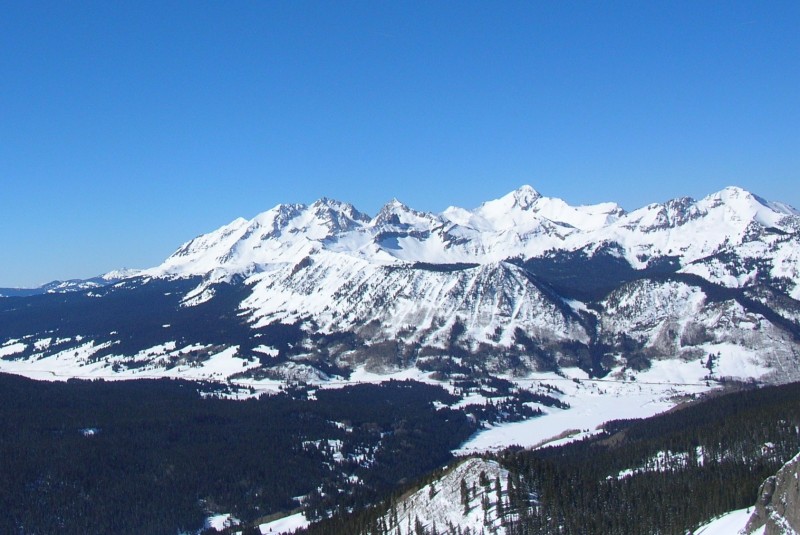
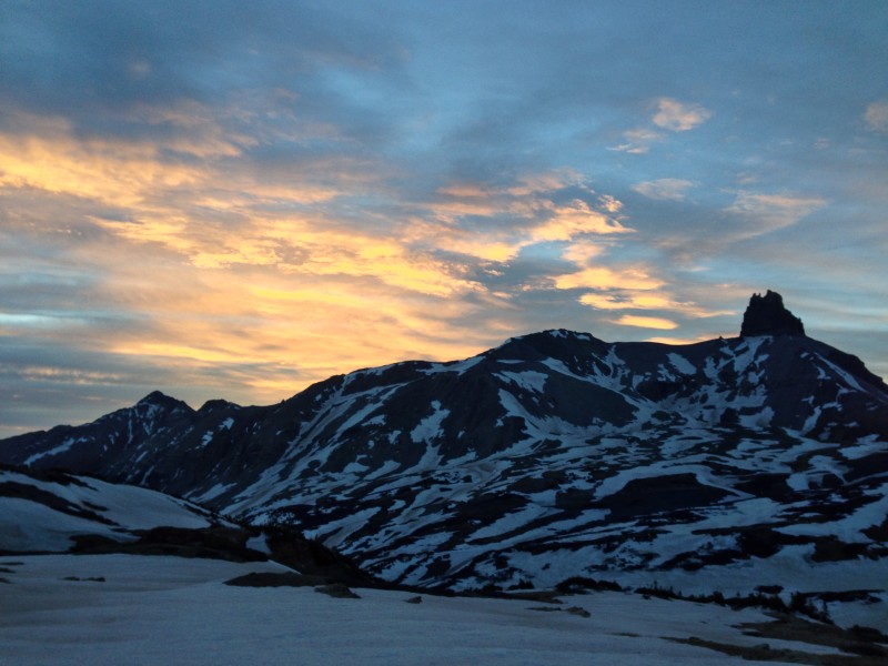
I actually met Steve a day early, for an ill-fated attempt on Vermilion. During that attempt, I got a first glimpse of what I would be in for (Mt. Wilson is the big massif on the left, Gladstone is the pointy peak to its right...with it's steep SE face):
Between getting my arse kicked by Steve, (Superman has his cape, Steve has his snowshoes), 3 hours sleep, concerns regarding my upcoming trip to Mexico, and being intimidated by the view seen above; I backed out of Gladstone. Steve and Britt did give it a valient effort, but they also did not get the prize.
Fast-forward 3 months, here comes another holiday weekend, and here comes another Britt email, Steve and him are giving Gladstone a spring try via the same route...Sweet! Soon Josh and Ryan join the team, we are set!
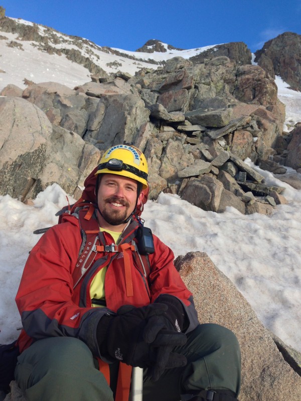
Who: Shawn (Rainier_Wolfcastle), Britt (globreal), Josh (CONative), Ryan (ACERguy007), and Steve (sgladbach)
When: 5/26/2013
TH: Cross Mountain TH @ 10,050 ft
Peak: Gladstone Peak @ 13,913 ft (Ranked #67)
Times: ~3:00am start, ~8:30am Summit, ~ 1:30 Back at TH
Stats: 11.9 miles & 5,216 ft Elevation Gain
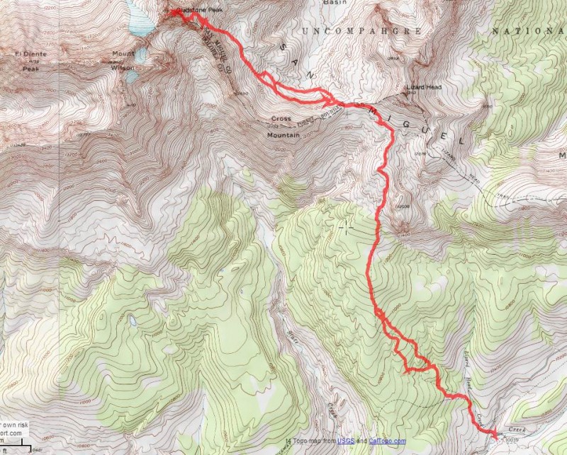
Route: Cross Mntn Trail, to Lizard Head Trail, off trail and up Gladstone's SE Face
I tried to convince my wife to do the crazy holiday weekend 7 hour drive to Telluride with me on Saturday, with promises that she could sleep in and have a nice hike to Lizard Head with our black lab Jolie. While we did our crazy mountaineer stuff, even knowing that she would be doing much of the drive home while I'm passed out after the climb, she accepted!
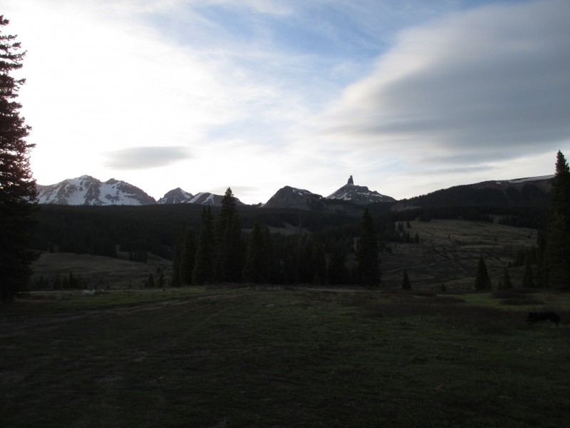
My teamates beat me to the TH (2 miles south of Lizard Head Pass on CO 145) and saw the no camping sign. This was a blessing, as they found a dirt road right across 145 that leads to some trees with fire rings, indicating this is a common camping area. As I get to the campsite, the boys are out practicing with their avy beacons. The sun is fading, but still we get an inviting view of our target, along with some of it's neighbors, (from left to right: Mt. Wilson(14,246), Gladstone Peak(13,913), Cross Mountain (12,703), Pt 12,038, and Lizard Head (13,113):
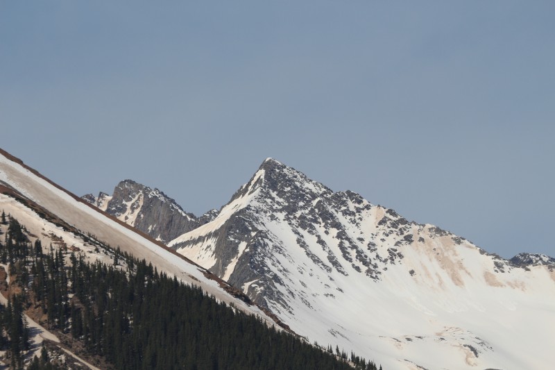
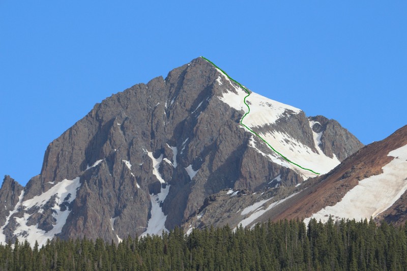
Here is a zoomed in close up of Gladstone taken by Ryan from camp the next afternoon (showing the cliffs of the S/SW Face and the mostly snow covered SE Face, which we planned to climb, Photo Credit: Ryan):
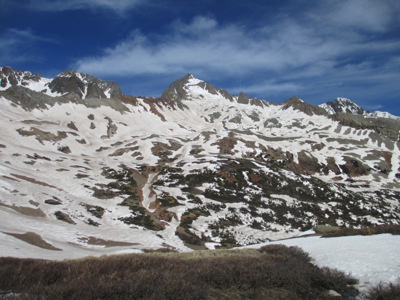
For further beta, here is a zoomed in close up of the East Ridge and NE Face of Gladstone, which was recently climbed and skied by the Mahon's, Chris Davenport, and team (Photo Credit: Ryan):
As the sun faded, we all crashed, trying to get some sleep before our 2 am wakeup call. The plan was to start at 2:30 am, hoping to get firm snow on this SE face before the sun could bake it. We actually got going a hair after 3am, under a brilliantly clear-full mooned sky! Headlamps were optional.
Starting from the Cross Mntn TH, a single trail starts, but soon splits...we took a right on the clearly marked Cross Mnt Trail on the right (pic take on the way out):
Even though the trail is pretty easy to follow (often similar to an old jeep road), we managed to do a little off trail bushwhacking...but probably cut a little distance off with our shenanigans. It was maybe 40% snow covered in the trees, but nothing too deep. Soon we were back on trail and passed this Lizard Head Wilderness Sign (photo taken on way out):
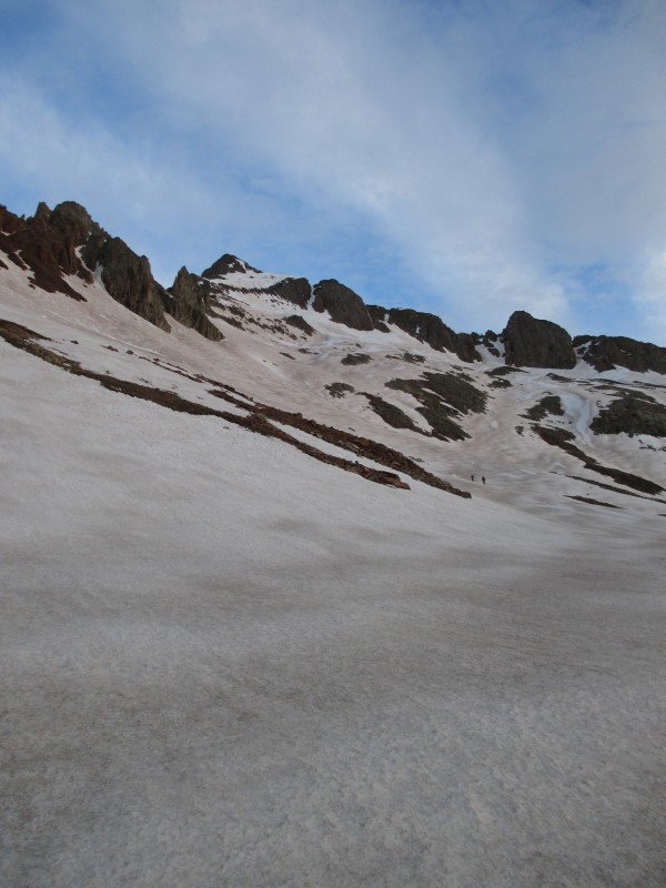
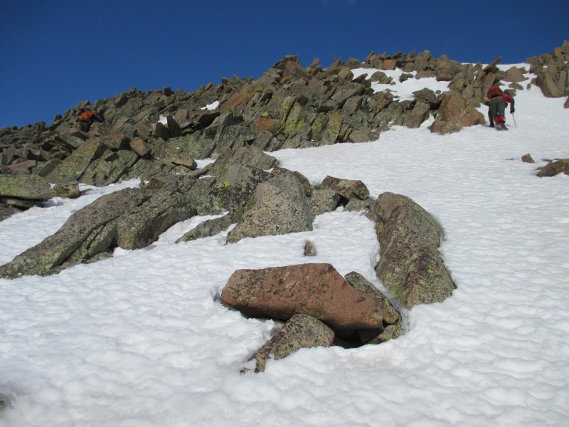
It was closing in on 5am as we broke out of the trees and started approaching Lizard Head. We are now at 12K, but will soon give about 300 of that back droping into the Southern portion of Bilk Basin. This pic taken on the way out shows how far we have to go:
We of course fight the inevitability of our elevation loss by trying to skirt around to the West side of the basin. But we still lose 300 or so feet. Some of us strap on our crampons, Steve of course emerges from a phone booth wearing snowshoes!
Awe yes, sunrise behind Lizard Head (Photo Credit: Britt):
Geez, turn around to watch a sunrise for a sec and Steve and Josh have ran across the basin:
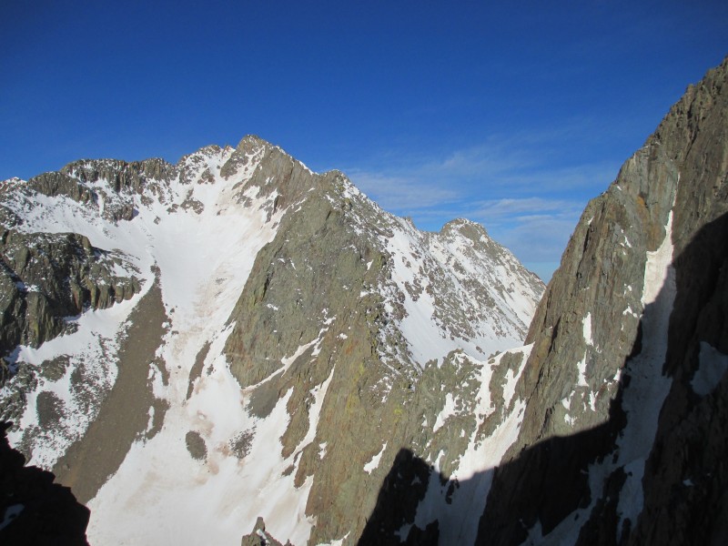
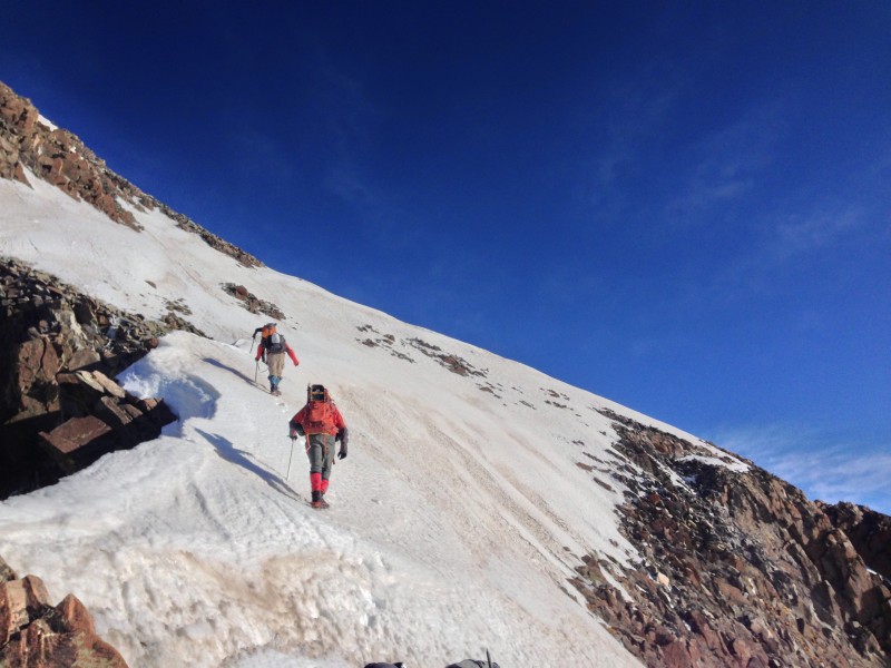
Okay, so here are some route details: in the picture above, the climbers in the distance have about 2,000 ft of elevation gain ahead of them. From there, we stay on the snow to the left of the first rock bands, then move more towards the center of the face...taking a break on the rocks in the center about 2/3rds of the way up. I drew the remainder of the route on this pic (photo credit: Ryan):
More pics:
Getting closer:
Looking back:
A great pic of Josh with Gladstone's summit lurking above (Photo Credit: Britt):
Ice axes come out as the angle steepens (Photo Credit: Britt):
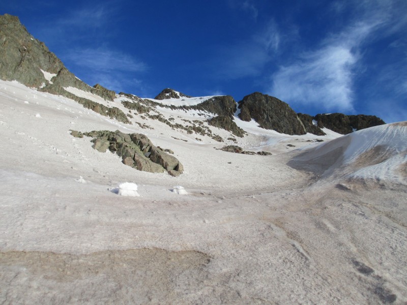
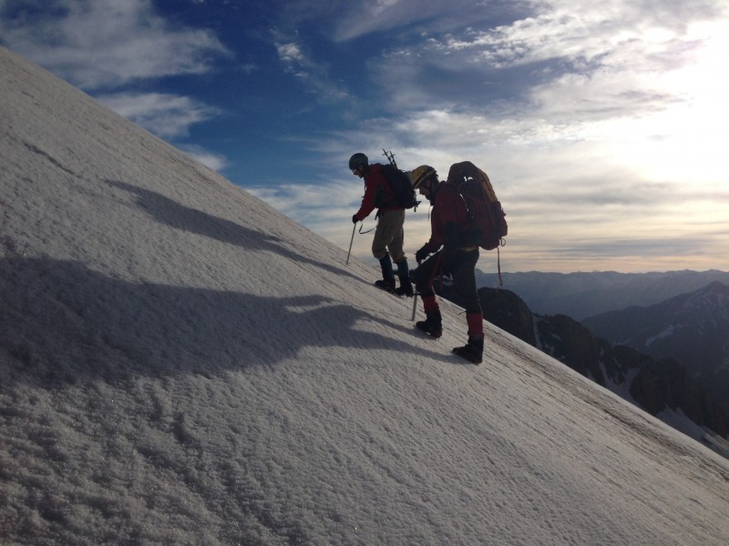
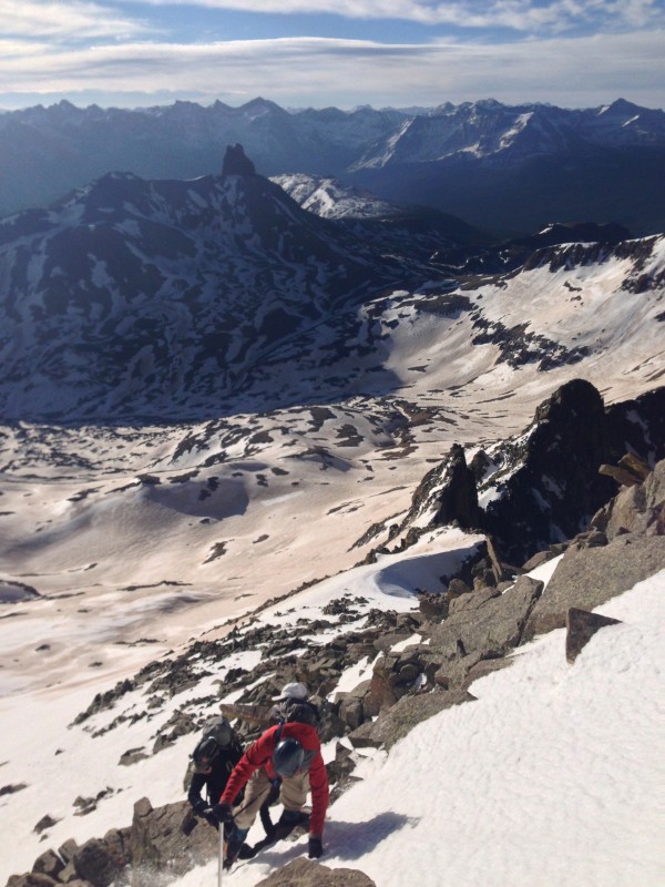
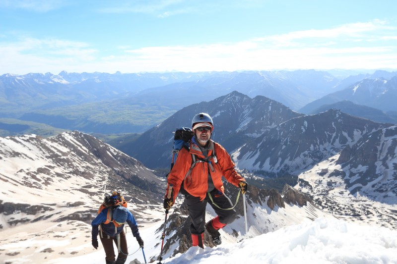
Now we got to the portion we had been wondering about, breaching the upper snowless cliff band on the left side. There was a thin connecting snow band, this is the steepest part of the climb. The snow was firm and I decided to kick in steps. The snow was continuous, but narrow enough in spots that I would have my ice ax in one hand and the other on rock. Steve finally took his snowshoes off and took to the rock on the left...proving this section would be a go come summer.
Here is a pic with Steve in the rocks to the left, Josh heading up the snow on the right:
Here is Ryan in the steepest part, it is no accident that he has daggered his ax all the way in (Photo Credit: Britt):
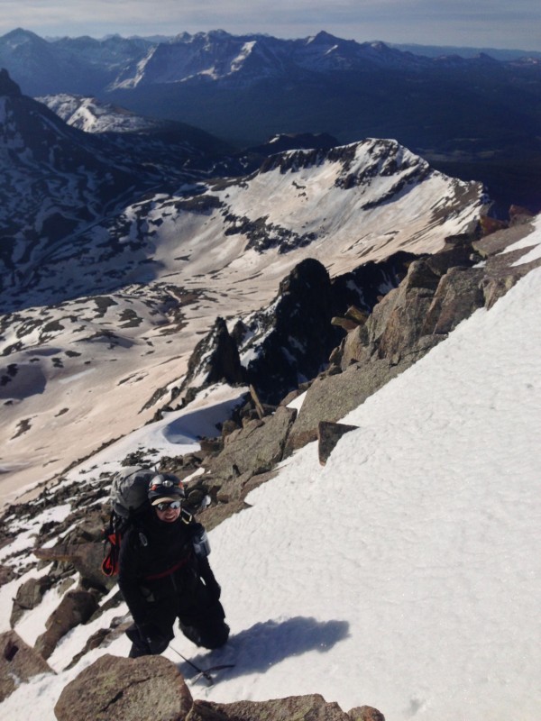
Here Britt has caught both myself and Ryan, I believe I am following the Drunken Monkey Climbing Technique (Photo Credit: Britt):
Now came the suprise. After breaching the cliff band, it appeared from below there was a sort of saddle or ledge that would provide a nice ramp to traverse to our right, over to the ridge. Well, that is sort of the case....the angle does relent, but the ramp was actually a cornice with mucho air below it to the West. We took a brief rest here....mainly to ooooh and aaaah, and take pictures. Here is a pic from my perch of Mt. Wilson, along with the ridge connecting it with Gladstone:
Here is a pic looking up to Gladstone's summit, I am about 3 feet from a 1,500 ft base jump...just forgot the parachute (Photo Credit: Britt):
Plunge ax, step, step, plunge, step, step (not a lot of room to self arrest, Photo Credit: Britt):
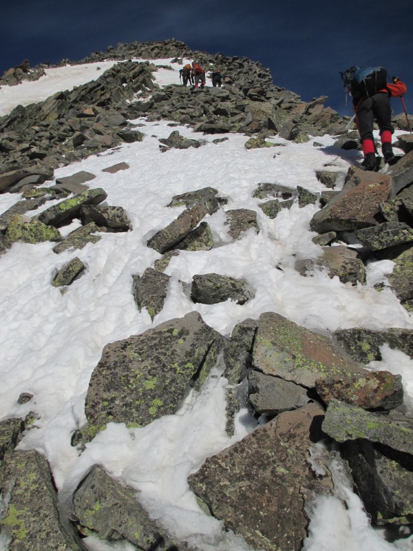
100-150 ft to go on the mostly snow free ridge, crampons removed:
A few more steps (Photo Credit: Britt):
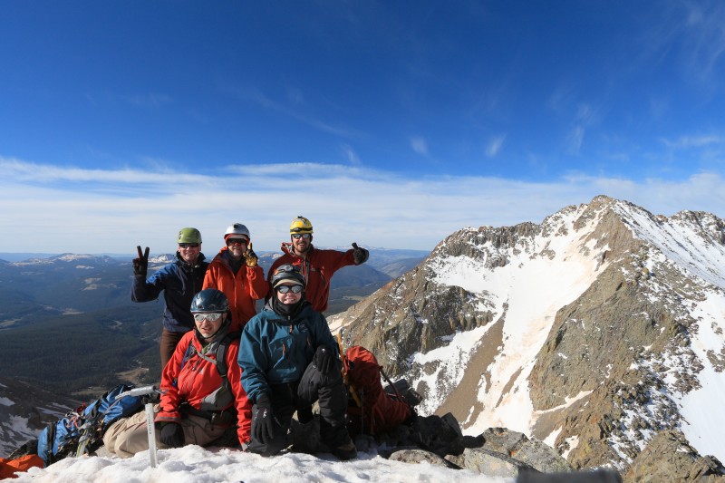
Britt summitting #89 (Photo Credit: Ryan):
Rejoice! I have made it up this elusive beast!
The summit was mostly snow covered, with the Plastic Peanut Butter Jar/Summit Register nowhere to be seen.
Here is a pic of the standard North Ridge, with Wilson Peak in the distance:
Group summit shots (Photo Credit: Ryan):
After some lounging, it was pointed out that we aimed to get up and down early for a reason....so we started heading down. The snow was softening, but more in a helpful than loose scary way...there was some plunge stepping, then some glissading. We all made it down the first 2,000 feet in 35 minutes...which is nice (skiers/boarders are just laughing).
Some of us took a long break before starting the 500 ft regain to the LH/Cross Saddle. I didn't see Steve, but rumor has it he was trying a new route up LH... in snowshoes....
After gaining the saddle, and starting the descent, I ran into my wife and dog coming up the trail. We had a chance to sit and enjoy the views as the boys trucked it down to the TH. From this angle, Gladstone certainly looks like the star attraction...not the neighboring 14ers! Photo Credit: Ryan
What a fantastic day, with a superb Colorado Snow Climb. Thanks guys, you were awesome partners!
Thanks Ryan and Britt for all the awesome photos!
And thank you Josh for the GPS stats, track and elevation chart!
Thanks for reading!
Shawn
Thumbnails for uploaded photos (click to open slideshow):
Does anyone on the forum have a picture of this? It weighed heavily on my mind several years ago but I never encountered it. I enjoyed your report, especially the introspection. This is an interesting route and might be a better route for this peak. The snow seems to take the nastiness out of certain peaks, Thunder and Cathedral in particular.
And no I'm not referring to Jeremy Lin. I'm talking about an easier (and arguably more fun) way to climb Sadstone. Quick story - back in 2003 when I was a youngin' - I climbed Gladstone thinking it was Wilson Peak from Rock of Ages/Silver Pick. I didn't find this out till the summit register.
Looks like you guys had a lot of fun - that entire area of the Wilsons is so cool. Slate Creek/Cross Mountain/Lizard Head Pass provides such friendlier alternatives to the standard routes for Mount Wilson and Gladstone, and Slate Creek/Lizard Head could be one of the more underrated areas of the San Juans.
Congrats. The report was a good read and the route looks better than the northeast ridge -that thing was one of the loosest Jenga block places I have climbed. I will likely repeat your path when I retry it.
Sean...just got around to reading this. Great report on a great day in the mountains! Super memories from that trip. Sure miss Steve though. Thanks for your write up here. I never knew you had the hebe jebbies about this peak. Glad you were able to get past them.
Hope to climb again with you soon.
Britt
Caution: The information contained in this report may not be accurate and should not be the only resource used in preparation for your climb. Failure to have the necessary experience, physical conditioning, supplies or equipment can result in injury or death. 14ers.com and the author(s) of this report provide no warranties, either express or implied, that the information provided is accurate or reliable. By using the information provided, you agree to indemnify and hold harmless 14ers.com and the report author(s) with respect to any claims and demands against them, including any attorney fees and expenses. Please read the 14ers.com Safety and Disclaimer pages for more information.
Please respect private property: 14ers.com supports the rights of private landowners to determine how and by whom their land will be used. In Colorado, it is your responsibility to determine if land is private and to obtain the appropriate permission before entering the property.