Download Agreement, Release, and Acknowledgement of Risk:
You (the person requesting this file download) fully understand mountain climbing ("Activity") involves risks and dangers of serious bodily injury, including permanent disability, paralysis, and death ("Risks") and you fully accept and assume all such risks and all responsibility for losses, costs, and damages you incur as a result of your participation in this Activity.
You acknowledge that information in the file you have chosen to download may not be accurate and may contain errors. You agree to assume all risks when using this information and agree to release and discharge 14ers.com, 14ers Inc. and the author(s) of such information (collectively, the "Released Parties").
You hereby discharge the Released Parties from all damages, actions, claims and liabilities of any nature, specifically including, but not limited to, damages, actions, claims and liabilities arising from or related to the negligence of the Released Parties. You further agree to indemnify, hold harmless and defend 14ers.com, 14ers Inc. and each of the other Released Parties from and against any loss, damage, liability and expense, including costs and attorney fees, incurred by 14ers.com, 14ers Inc. or any of the other Released Parties as a result of you using information provided on the 14ers.com or 14ers Inc. websites.
You have read this agreement, fully understand its terms and intend it to be a complete and unconditional release of all liability to the greatest extent allowed by law and agree that if any portion of this agreement is held to be invalid the balance, notwithstanding, shall continue in full force and effect.
By clicking "OK" you agree to these terms. If you DO NOT agree, click "Cancel"...
Peaks (In order of summit): California Peak - 13,849' (R#84), PT 13,577 (R#205), PT 13,660A (R#168), UN 13,420 - (UR) TH/Route: Zapata/Huerfano TH, North Ridge-California Peak / PT13577 / PT13660A, California Peak Rock Glacier/Lost Lake descent Distance: 9.5mi Elev Gain: 4800' Time: 10:30 (7am - 5:30pm) Technical Gear: Trekking Poles, ice axe (for glissade) Climbers: Geojed (Jed), colokeith (Keith) and his wife Angela Weather: Sunny, temps in the 40's with 50mph SW winds
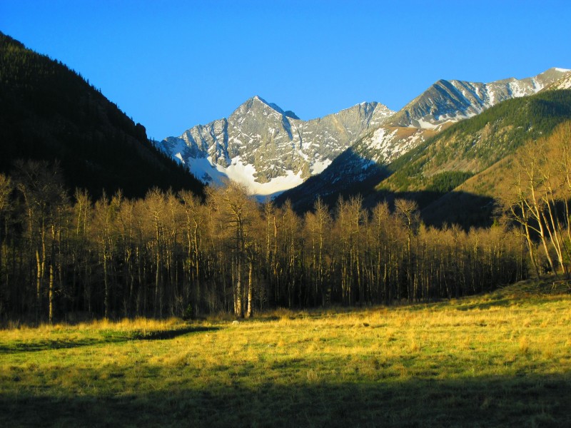
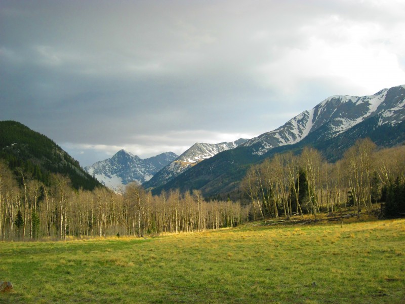
Starting with the Memorial Day weekend I have a 9/80 schedule until Labor Day. This gave me a 4-day weekend that I decided to take advantage of and get another Centennial summit. I was thinking of going for French Mtn but the prospect of crossing N Halfmoon Creek during spring runoff was not appealing. Earlier in the week Colokeith had posted on the forum for conditions on California Peak. So I PM'd him about doing the peak on Friday and it turned out that he and his wife were planning on climbing it on Friday too. So we met up at the Zapata/Huerfano TH around 6:45am. I had brought my snowshoes just in case but as I drove up the road I could easily tell that they wouldn't be needed. So we geared up and set off up the dry trail and quickly reached the first meadow. The low point is where the trail reaches California's N Ridge
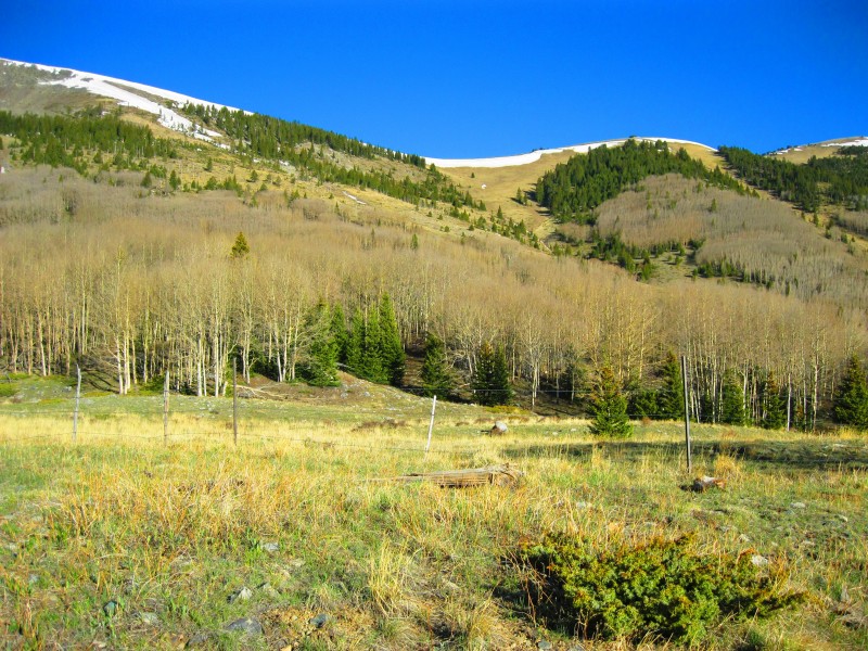
Once the trail reached the upper end of the meadow and went into the pine trees there were good sized snow drifts across the trail. We backtracked a little and connected up steep meadows and the snow free aspen areas until we intersected the trail about 200' below the ridge. Huerfano Peak and Mt Lindsey after re-joining the Zapata Trail
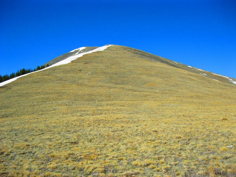
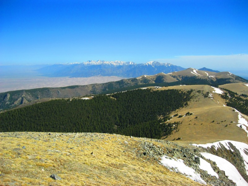
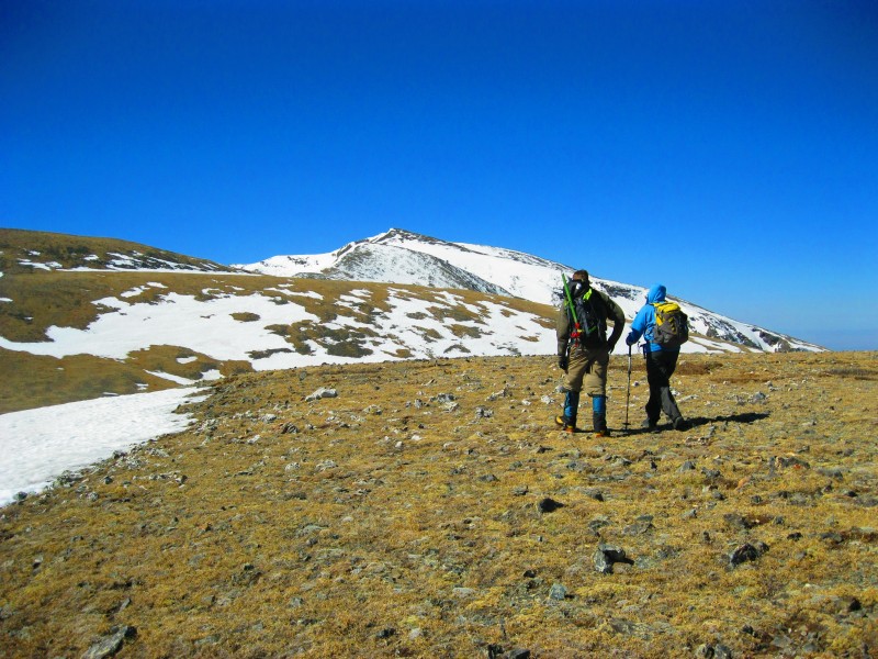
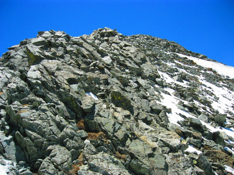
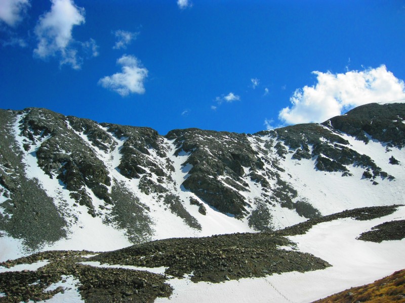
To gain the ridge we had to climb a small snowfield that had some boot prints and actually some bear tracks in it. Once atop the ridgeline we rested at a large cairn. We also met the "blustery" wind that would be our constant companion the rest of the day. After resting for 10min or so and putting warmer gear on we started up the 2mi and 2000' climb of the gentle tundra slopes of California's North Ridge. California North Ridge Tundra
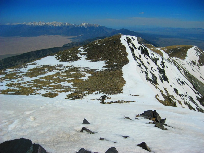
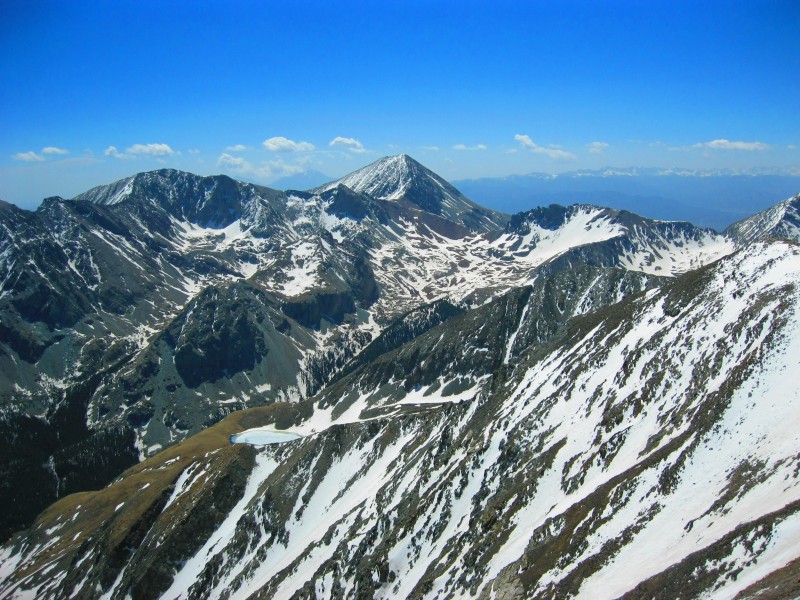
The views back towards the Crestones area and the Sand Dunes were a constant head turner. View North towards the sand dunes and the Crestones
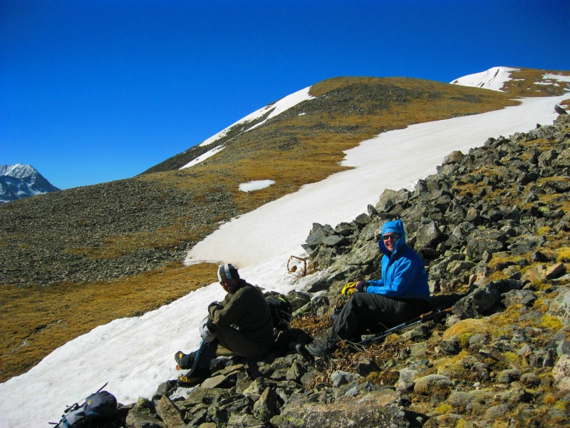
After gaining about a 1000' feet of the ridge we stopped and snacked for a bit and sheltered from the relentless wind. Keith and Angela taking a break
Off again up the ridge
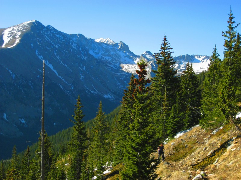
The views across the way towards Huerfano Peak and Mt Lindsey were beautiful. Huerfano Peak, Iron Nipple and Mt Lindsey across the canyon
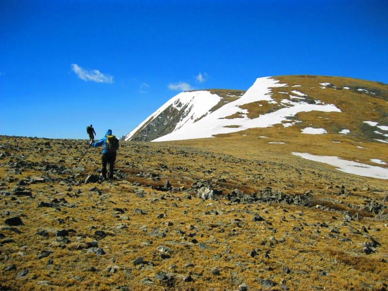
After enduring the many undulations of California Peak's North Ridge we finally were able to see the true summit. Keith and Angela heading up
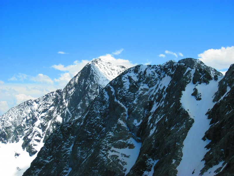
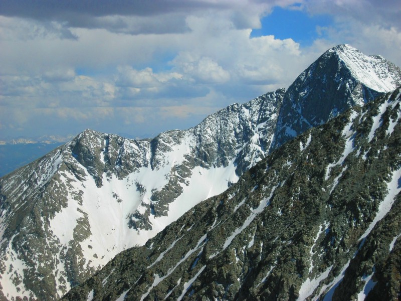
As we got closer to the summit we began to get peeks at the spectacular Blanca Peak and Ellingwood Point. First glimpse of Blanca and Ellingwood past California's west face
And they just kept getting better and better... Views gettin better!
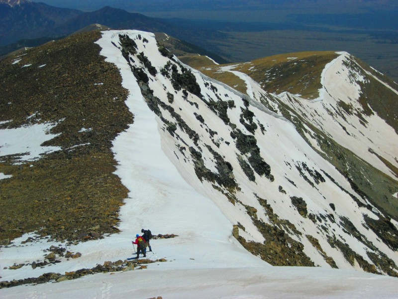
The last 30' to the summit had a snowfield that was easy to boot up. Keith booting up the final snow section
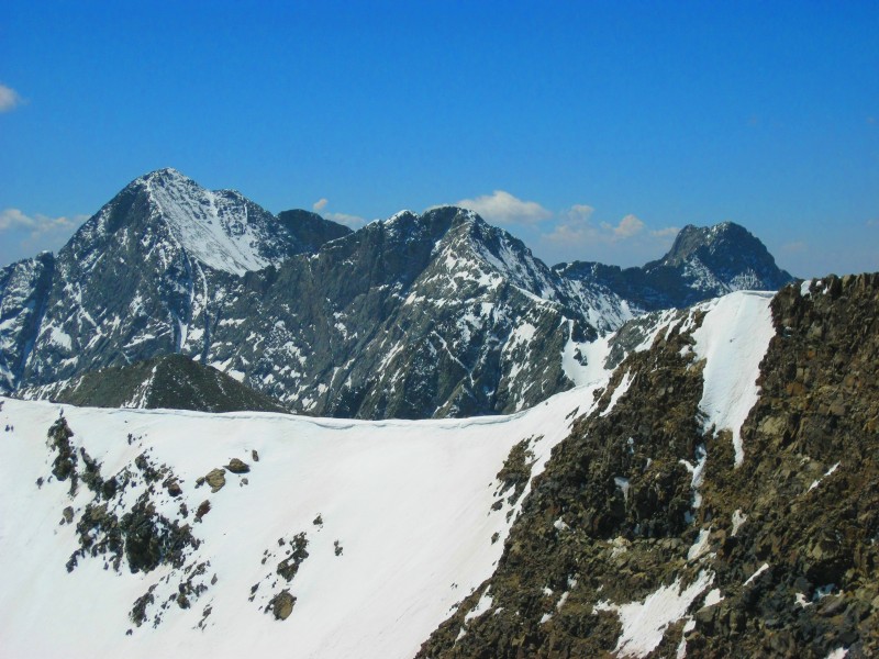
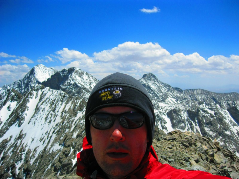
We reached the California Peak's summit at 11AM and fortunately the wind on the summit wasn't too bad. Here we had lunch and gawked and gaped at the seriously mind-blowing views of Blanca, Ellingwood and Little Bear. WOW!
Lindsey Lookin Purdy!
We relaxed on the summit for about an hour and then Keith and Angela headed back down the North Ridge while I kept going to snag PT13,577 and PT13,660A. Keith and Angela heading back down
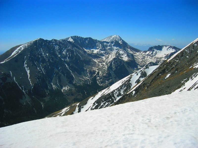
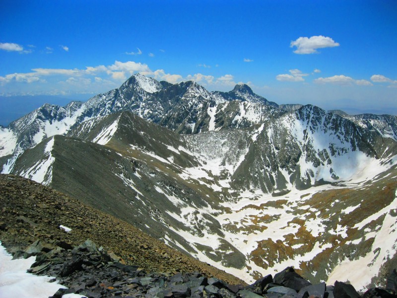
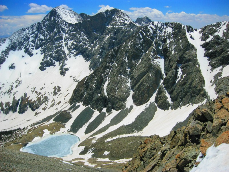
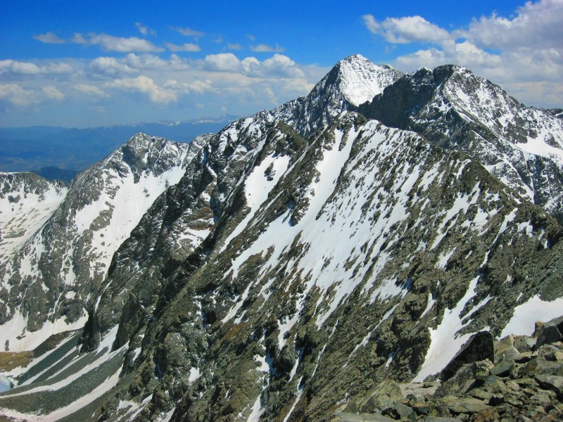
Blanca, Ellingwood and LB Tower over PT13577 (L) and PT13660A (R)
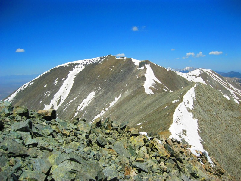
The descent from California was easy and I traversed below the unranked 13420 bump and climbed up PT13577. As I neared PT13577's summit I was getting more and more excited for the views this summit would give me. Looking back at California from PT13577
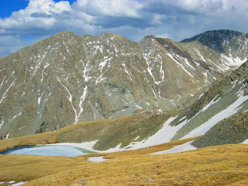
The sight of Blanca and Ellignwood towering over the still-frozen Lily Lake was incredible. Still-Frozen Lily Lake below Blanca Ellingwood's mighty face
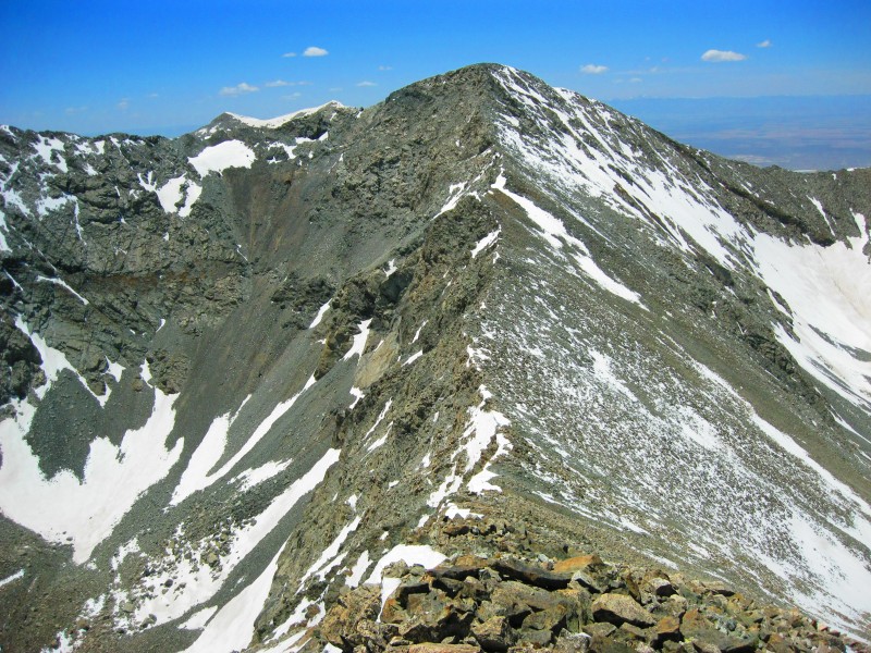
I descended down PT13577's south ridge 200' or so elevation to get a view of the Upper Huerfano Basin along the Lily Lake Trail. I wanted to check out the snow conditions along the trail as I was considering taking it back to the TH instead of going back and dropping UN13420's NE face and descending via California Peak's massive rock glacier. The Huerfano Basin looked a little to snowy for me so I headed back up to PT13577 summit and then set my eyes on PT13660A. It looked like it would be a easy ridge traverse finished with a fun scramble. It did not disappoint. PT13660A lookin mighty fine
Looking up PT13660A from the saddle.
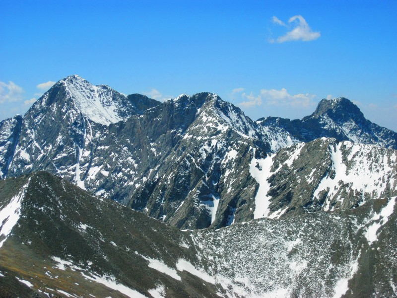
Along the way, more jaw-dropping views of Blanca's mighty west face. Ba-ZING!
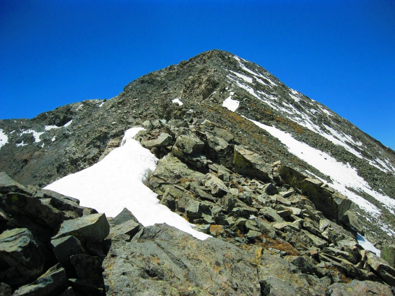
The final 50' up to PT13660A's summit offered some easy and fun Class 3 scrambling. I reached the summit around 2pm. Fun Scrambly easy Class 3 section to reach the summit
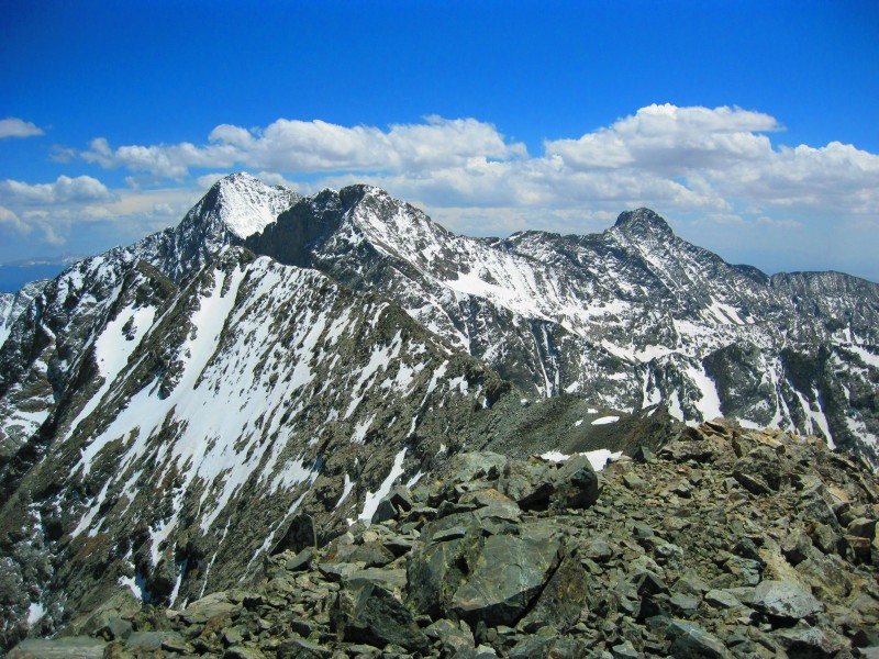
From PT13660A's summit I was truly humbled by the beauty and majesty before me. I bow before you Blanca, Ellingwood and Little Bear! Hummina, Hummina, Hummina! Majestic!
I stayed on the PT13660A's summit for about 30mins. As I was getting ready to leave I texted Keith letting him know that I taking the Lost Lake/Rock Glacier route down to the TH. He confirmed receipt and said that they were at the first meadow and almost back to the car. So I pulled myself away from the spectacular views PT13660A afforded me and headed back down the ridge. I traversed below PT13577 and climbed up UN13420.
Another view of Blanca's west face from UN13420
From here I descended UN13420's east ridge looking for a couloir that would grant me safe descent down to the grassy basin. The first one I reached had snow to the bottom and would be a good glissade except it seemed too steep, had a large rock right in the middle and didn't have a great run out. I chose he next couloir as it had less snow and appeared to be mostly loose talus/gravel to the bottom. Pick your poison. I descended the 2nd from right couloir.
Once down in the basin it was was easy tundra to the icy Lost Lake. Lost Lake w/ Huerfano Peak in background
From Lost Lake I headed towards California's massive rock glacier. I had to glissade down a 100' snowfield to reach the glacier. California's rock glacier
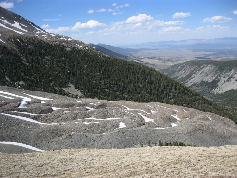
I followed the edge of the glacier down towards the Huerfano canyon and linked up treeless sections until I finally reached the Lily Lake Trail right at the upper end of the large meadow near the Lily Lake TH. I hiked back to the TH and the 1.2mi from the TH back to my car. On the drive out I had a final look at amazing Huerfano Basin.
Fare thee well! Thanks for the AMAZING day!
I contemplated attempting to break Kushrocks Taco Bell record in Walsenburg, but I knew if I did it wouldn't stand for long. He'll either break it while in Alaska or as soon as he gets back from Denali.
What a fun day! Keith, I'm glad our schedules coincided and we were able to have a fantastic day in a one-of-a-kind area.
My GPS Tracks on Google Maps (made from a .GPX file upload):
over to the Blanca group are incredible. And the melt on the peaks south of the sand dunes is too. Looking forward to heading up there myself at some point this summer, especially after this TR!
Your TR of the Zapata access to Ellingwood and Blanca prompted me to follow in your footsteps last year. Guess I'll be doing the same this year - California Peak looks like a lot of fun!
It would have been tough to be one of your college classmates, I bet you were always doing extra credit projects! Congrats on getting California and those extra credit peaks!
Caution: The information contained in this report may not be accurate and should not be the only resource used in preparation for your climb. Failure to have the necessary experience, physical conditioning, supplies or equipment can result in injury or death. 14ers.com and the author(s) of this report provide no warranties, either express or implied, that the information provided is accurate or reliable. By using the information provided, you agree to indemnify and hold harmless 14ers.com and the report author(s) with respect to any claims and demands against them, including any attorney fees and expenses. Please read the 14ers.com Safety and Disclaimer pages for more information.
Please respect private property: 14ers.com supports the rights of private landowners to determine how and by whom their land will be used. In Colorado, it is your responsibility to determine if land is private and to obtain the appropriate permission before entering the property.