Download Agreement, Release, and Acknowledgement of Risk:
You (the person requesting this file download) fully understand mountain climbing ("Activity") involves risks and dangers of serious bodily injury, including permanent disability, paralysis, and death ("Risks") and you fully accept and assume all such risks and all responsibility for losses, costs, and damages you incur as a result of your participation in this Activity.
You acknowledge that information in the file you have chosen to download may not be accurate and may contain errors. You agree to assume all risks when using this information and agree to release and discharge 14ers.com, 14ers Inc. and the author(s) of such information (collectively, the "Released Parties").
You hereby discharge the Released Parties from all damages, actions, claims and liabilities of any nature, specifically including, but not limited to, damages, actions, claims and liabilities arising from or related to the negligence of the Released Parties. You further agree to indemnify, hold harmless and defend 14ers.com, 14ers Inc. and each of the other Released Parties from and against any loss, damage, liability and expense, including costs and attorney fees, incurred by 14ers.com, 14ers Inc. or any of the other Released Parties as a result of you using information provided on the 14ers.com or 14ers Inc. websites.
You have read this agreement, fully understand its terms and intend it to be a complete and unconditional release of all liability to the greatest extent allowed by law and agree that if any portion of this agreement is held to be invalid the balance, notwithstanding, shall continue in full force and effect.
By clicking "OK" you agree to these terms. If you DO NOT agree, click "Cancel"...
Hunts Pk - 13,071 ft
West Ridge from South Rock Creek TH
Mileage: ~5.5 miles
Elevation Gain: 3450 ft
Start Time: 8am
Finish Time: 12:30pm
Solo Ascent
It has been a while since a trip report has been written for Hunts Pk, and some updated TH beta is definitely needed. That is one of the reasons that I'm writing this TR because it is one of the more confusing THs I've ever had to find. The other reason is because this truly is a gem that few people know about. Not even the people in Salida or BV knew which peak I was talking about when I mentioned Hunts (I know this is the kind of comment that makes 13er climbers sound like hipsters, guilty as charged). The West Ridge route is short and steep so be prepared for a slog. However, it makes for a good spring conditioning hike, and the views of the Southern Sawatch and Northern Sangres are definitely worth the trip.
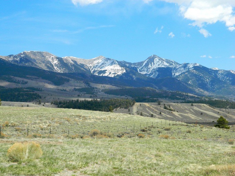
Hunts Pk seen from Poncha Pass
Below is the trailhead discription given in the other trip reports. My additions are in bold.
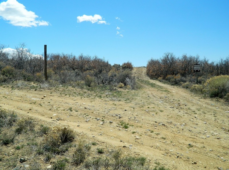
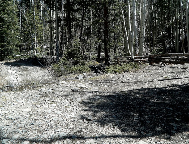
"Driving south on US-285, turn east at an unmarked dirt road approximately 4.6 miles south of Poncha Pass. This road requires a high-clearance vehicle soon after the turn from the highway. Turn right at a signed fork between the Rock Creek (FS-980) and Deckers Creek (FS-948 ) roads. Continue on to another signed junction that marks the fork between the North Rock Creek (FS-980) and South Rock Creek (FS-982) roads The sign is no longer intact. Look for the smaller sign on the right that specifies FS-982. See image below; turn right for the South Rock Creek road.
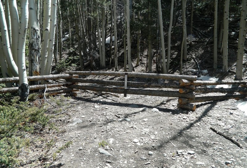
Here's where things get confusing with the extra roads all about; a GPS with waypoints isn't a bad idea. Generally, seek the most beaten paths, and you should do okay very good advice. You can also try to identify your surroundings because you'll want to make sure that your road makes crossings of both Rock Creek and Yankee Creek. Just after one of the creek crossings, there will be a sign for entry into the Rio Grande National Forest. This is the route you want to follow Sparse parking is available until you enter the forest. Continue through the forest for ~.5 miles until you reach a double creek crossing. DO NOT cross this creek. There is a small parking area to the right and a log fence with a sign that reads "No Motor Vehicles." Park here. The trail to Hunts Pk is behind this fence"
Sign is missing from the post. Stay right at this fork. Take this road into Rio Grande National Forest Parking area. Trail is behind this fence. Do not cross this creek. The trail is to the right behind the fence.
I decided to spend this weekend in Nathrop with my parents since they were leaving the next week for a trip through the Utah National Parks and would miss Mother's Day. However, after looking at the weather forecast for Saturday, I really wanted to sneak away from the family for a little bit and get a hike in. I spent about half of my Friday at work trying to decide on a destination and finally landed on little-known Hunts Pk.
On my drive to the trailhead, I was never completely certain that I was going the right way because of all the unidentified roads (if you want to call them that, more like large game trails) that branch off FS-982. Just after one of the creek crossings, I inadvertantly startled a herd of about 40 antelope. I made an attempt to get my camera, but those guys can cover ground quickly and were soon too far away for a good shot. Even after I got to the log fence described above, I still wasn't 100% sure that I was headed the right direction until much further down the trail.
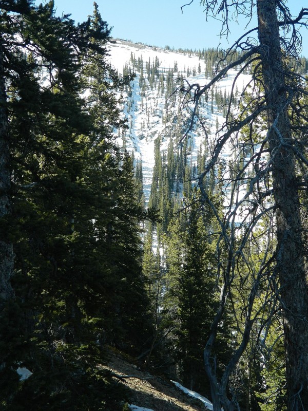
The trail starts off gradually as it heads east through the forest with S Rock Creek parallelling it on the left. It is a wide trail since it used to be an old road that is now obviously closed off. The route becomes a little steeper before reaching an unmistakable switchback to the north. There is a cairn at this switchback indicating that this is the where you leave the trail and begin bushwhacking your way up the Northwest Slopes to gain the West Ridge. However, these slopes appeared to still be heavily loaded with snow, and a wet avy slide path was visable. Therefore, I stayed on the road for another ~.25 miles as it turned north and chose to bushwhack up the North Spur of the West Ridge. This is the route that I would recommend for others considering this route. The north spur appeared a little less steep and definitely had less snow to deal with than the Northwest Slopes. At this point, there is no other option but up, and up will happen very quickly. It's about 1000 vertical feet of bushwhacking to reach treeline and gain the top of the ridge. The snow here was patchy but mostly avoidable and still pretty solid as it hadn't been exposed to the morning sun for long.
Wet avy slide path on North facing slope.
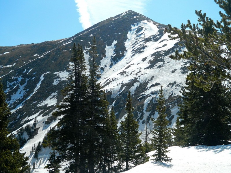
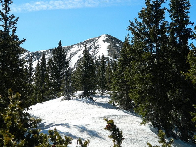
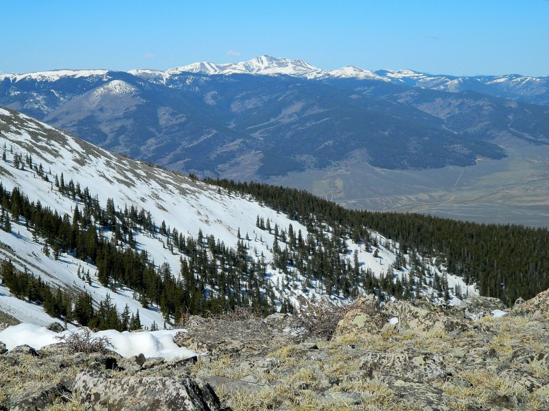
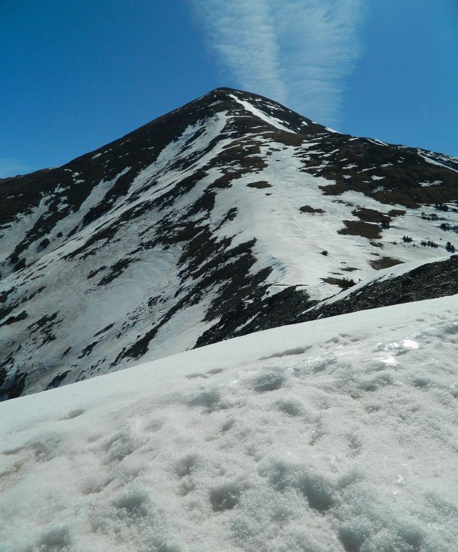
After topping out on the ridge, I was rewarded with my first view of Hunts' summit and a very impressive view across the valley towards Mt. Ouray and Mt. Antora. From here, follow the ridge south to meetup with the West Ridge itself at a small peak in the ridge. Then it's a straightforward 1000 ft tundra stroll to the summit.
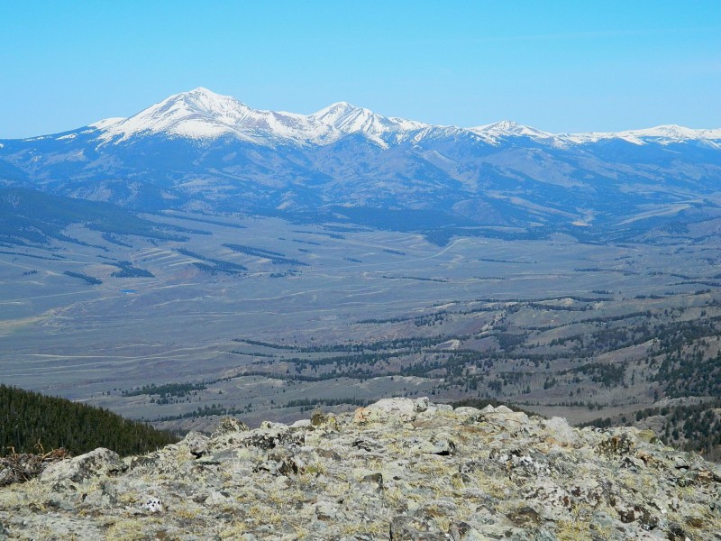
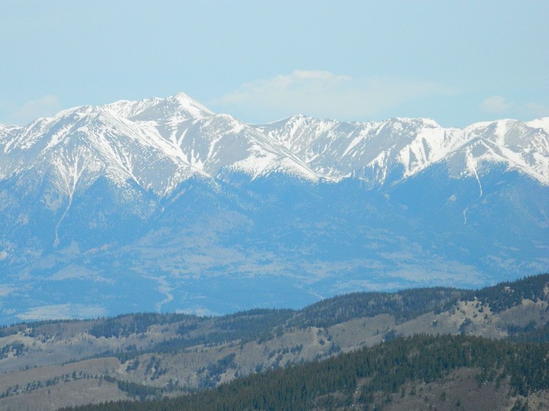
Hunts Pk from the northern spur of the west ridge. This false peak must be gained in order to reach the west ridge Mt Ouray in the distance Southern Sawatch Range Mt Shavano - The Angel is in! Mt Antora Hunts Pk from the west ridge
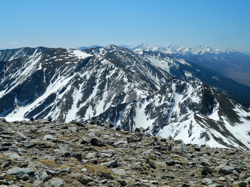
To be perfectly honest, there is nothing special about the hike itself. The route stays mostly Class 1, and other than being steep in sections, it's pretty easy. What makes this a nice peak are the views from the summit. Not only can you see every 14er from Harvard down to Blanca, but you also get spectacular views of the Arkansas Valley, San Luis Valley, and Wet Mountain Valley. I was fortunate to have a picturesque day to enjoy this summit. The clouds were sparse and the typical spring winds were non-existant.
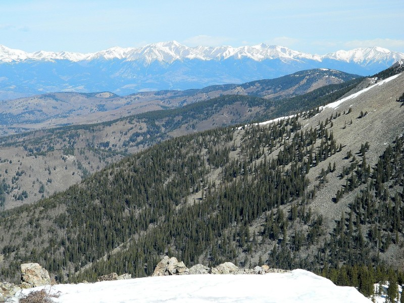
Looking down the Sangres
I was surprised to see a register on the summit. Only a few pages had been filled up since it was placed there in 2007, and the most recent entry was from back in October.
One last note: I don't usualy bring trekking poles once the weather warms up, but I was glad to have them for the descent. I chose to descend the same route that I had ascended, and the poles were very useful on the then half-melted snow patches and steep scree below the ridge. I'd recommend them for a spring descent on this route. I brought snowshoes, but never used them. Other than a few short sections of postholing on the road, they were unnecessary.
Thumbnails for uploaded photos (click to open slideshow):
I drove past Hunts several times over the past couple of weeks and kept telling myself that I need to get in there. I had a map all printed out to get it last spring and just didn't get there. Great to see someone else visited this lonely peak. :)
Nice report.
Those roads look a lot more navigable in the daytime than around dusk..
How far were you able to make it up the road? A fallen tree defeated our sawing efforts and snapped my tow strap about 1/2 mile before the turnoff.
Hunts has incredible views and is a great early season hike.
Thanks for posting!
This one has just jumped on my list for NEAR future hikes! Image #9 had me contemplating why I am still sitting at my desk and not out there right now! Thanks for posting!
Caution: The information contained in this report may not be accurate and should not be the only resource used in preparation for your climb. Failure to have the necessary experience, physical conditioning, supplies or equipment can result in injury or death. 14ers.com and the author(s) of this report provide no warranties, either express or implied, that the information provided is accurate or reliable. By using the information provided, you agree to indemnify and hold harmless 14ers.com and the report author(s) with respect to any claims and demands against them, including any attorney fees and expenses. Please read the 14ers.com Safety and Disclaimer pages for more information.
Please respect private property: 14ers.com supports the rights of private landowners to determine how and by whom their land will be used. In Colorado, it is your responsibility to determine if land is private and to obtain the appropriate permission before entering the property.

 First summit since October? Probably not, but maybe...")