Download Agreement, Release, and Acknowledgement of Risk:
You (the person requesting this file download) fully understand mountain climbing ("Activity") involves risks and dangers of serious bodily injury, including permanent disability, paralysis, and death ("Risks") and you fully accept and assume all such risks and all responsibility for losses, costs, and damages you incur as a result of your participation in this Activity.
You acknowledge that information in the file you have chosen to download may not be accurate and may contain errors. You agree to assume all risks when using this information and agree to release and discharge 14ers.com, 14ers Inc. and the author(s) of such information (collectively, the "Released Parties").
You hereby discharge the Released Parties from all damages, actions, claims and liabilities of any nature, specifically including, but not limited to, damages, actions, claims and liabilities arising from or related to the negligence of the Released Parties. You further agree to indemnify, hold harmless and defend 14ers.com, 14ers Inc. and each of the other Released Parties from and against any loss, damage, liability and expense, including costs and attorney fees, incurred by 14ers.com, 14ers Inc. or any of the other Released Parties as a result of you using information provided on the 14ers.com or 14ers Inc. websites.
You have read this agreement, fully understand its terms and intend it to be a complete and unconditional release of all liability to the greatest extent allowed by law and agree that if any portion of this agreement is held to be invalid the balance, notwithstanding, shall continue in full force and effect.
By clicking "OK" you agree to these terms. If you DO NOT agree, click "Cancel"...
Part I: Peaks Climbed: Round Mountain, Mt. Frissell (Connecticut's highpoint in on Frissell's SW Slope) Start Time: 9:30am End Time: 10:21am Total Mileage: 2.7 miles Total Elevation Gain: 1050ft.
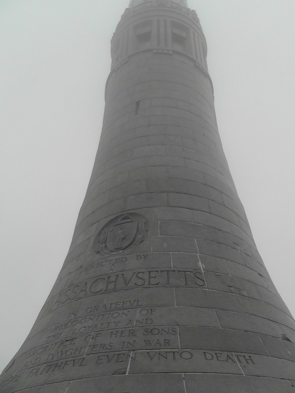
Part II: Peaks Climbed: Mt. Greylock (Massachusetts highpoint) Start Time: 2:15pm End Time: 4:00pm Total Mileage: 5 miles Total Elevation Gain: 2500ft
.
Forward: I thought I lost the pictures from this little escapade on a busted sandisk card, thankfully (2 months later) I stumbled upon them saved in the wrong location. Hooray for disorganized "My Documents" folders! And knowing a certain gimpy Connecticut resident has some highpointing in mind, I figure it might be time to finish this for his use.
I know there are some, like me, on this website who enjoy the traveling experience of chasing state highpoints. For many of the states the challenge is not so much the hike or climb, but navigating to the destination. The other major obstacle is finding beta on a particular route to the highpoint. The Highpointer's organization offers a curt list of the 50 highpoints and links SummitPost for figuring out the "how-to's" of an individual highpoint. For some locations, SummitPost is a great resource, and in other situations it fails. In the case of Mt. Greylock what is the point on providing information on hiking 1560 miles as an option? Go ahead, read it. I'll wait. Maybe I'm just an old, humorless Curmudgeon who needs to yell at the local kids to get off my lawn rather than critique a waste of space.
I know what you're thinking. "Why are you criticizing someone for wasting space on a webpage when you proceed to post this crap?" Point taken.
In any case, I found this to be a good situation to add to available beta for both Connecticut and MA's highpoints, especially since there are no Trip Reports on either peak for frequent users of this website. (Plus, I need a source of procrastination at Portuguese language school in Brasilia; wasting your time in reading this seemed like the only feasible option. My apologizes in advance.)
Let's begin!
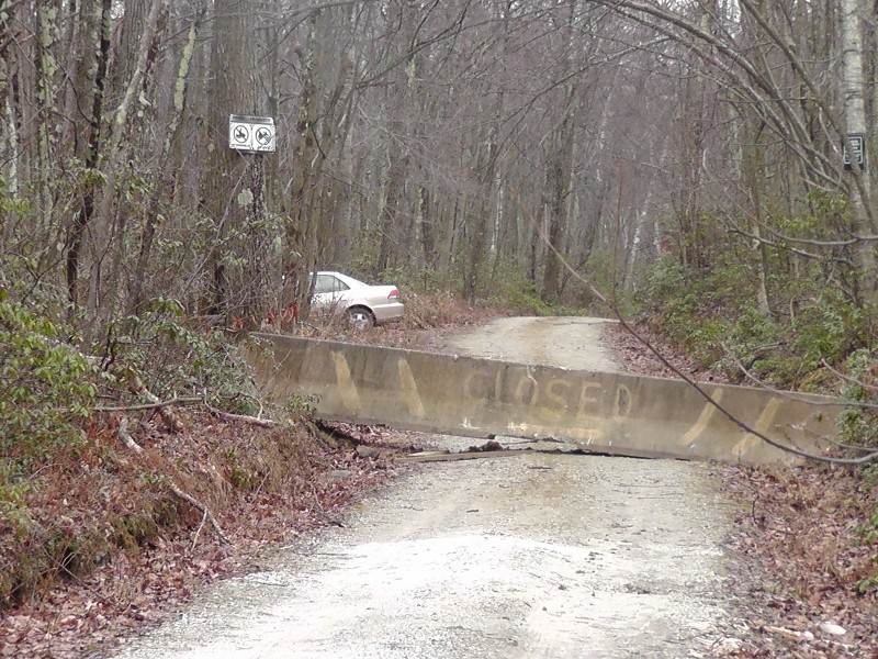
It is entirely doable to bag the Connecticut and Massachusetts highpoints in a few hours as they're separated by less than 60 miles. It's also entirely possible that the weather will suck the entire time because New England is stuck in a perpetual overcast where the sun doesn't shine. I was coming from NYC and decided my best route was to hike Mt. Frissell first before continuing on to Mt. Greylock. If there's one thing I would stress to any potential highpointers interested in hitting both of these peaks in one day is that you want to access Mt. Frissell from the North (Massachusetts side), not the South (Salisbury, CT, side). There is an impassable concrete barrier blocking vehicles from crossing the state line so the only choice is to return by the same way. Since the south route through Salisbury is marked as a restricted road with private property on either side of the road. There is little point in traveling this way; respect the property rights. Plus, this road is rougher than its northern counterpart which is better maintained (and partially paved) by the Massachusetts Department of Conservation and Recreation.
Also an important note for perspective climbers: This is a frequented area for hunters. I crossed paths with one guy carrying a rather large shotgun; he said it was Duck season so I assume his goal was to obliterate it into a bunch of feathers. Thankfully, I left my festive Christmas costume at home and donned a highly visible burnt orange fleece.
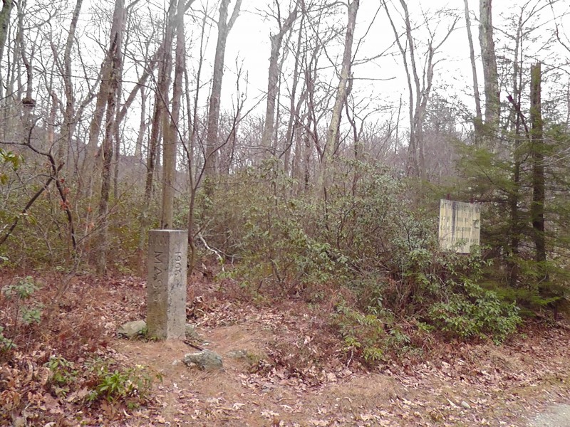
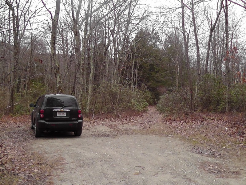
As long you run into the barrier, you're in good shape and at the trailhead, which is located on the West side of the road. You can even hike Bear Mountain (we'll get to that later) from here. Good luck driving your car around or through this State marker. Trailhead (and adjacent MA parking lot) is just barely north of this. Parking Lot & TH
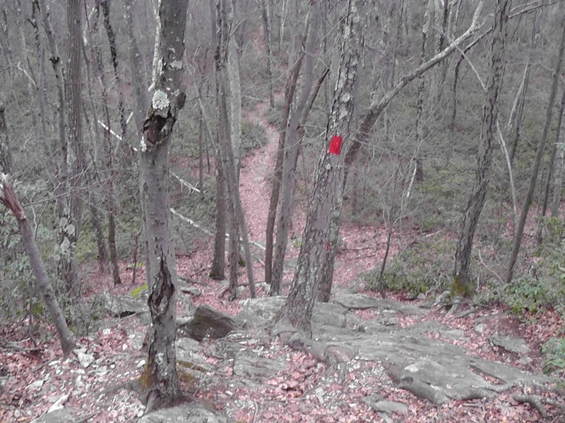
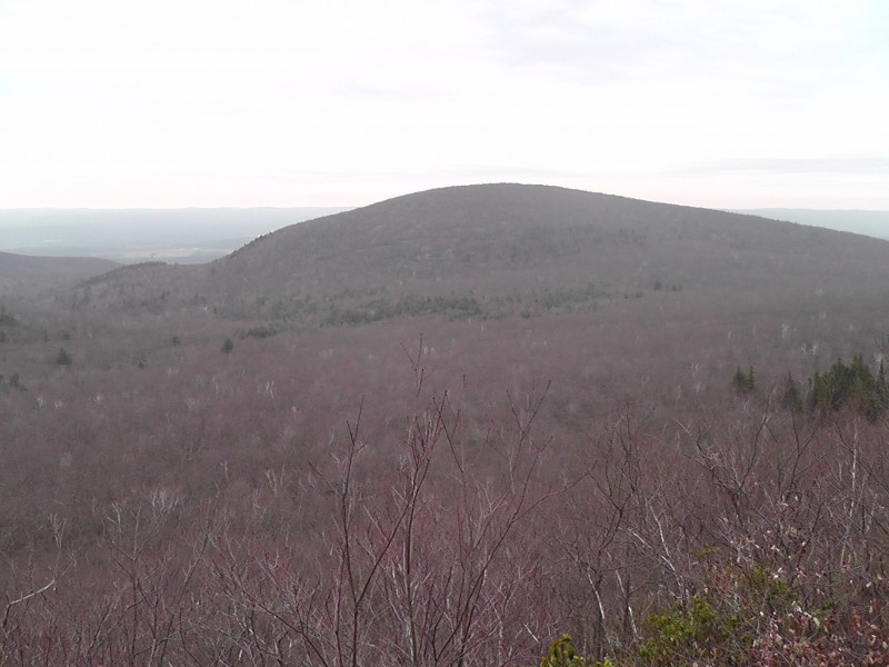
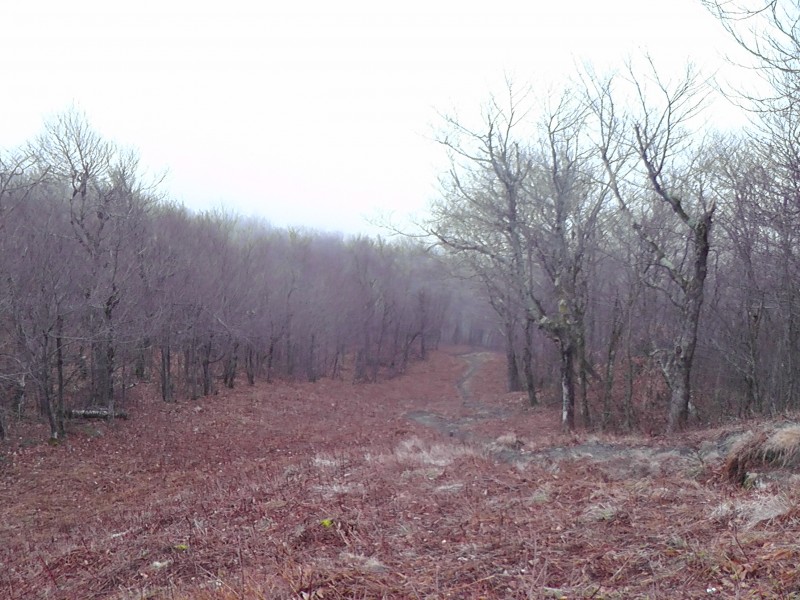
It's a quick hike on the trail before reaching a fork which offers two potential options, although each one leads to the same end goal - Mt. Frissell. The left option goes up and over Round Mountain and offers some class 2 hiking, the trail to the right circumvents Round Mountain and the subsequent gain/loss of elevation. Both options reconnect near a lake which lays between the Round Mountain - Mt. Frissell saddle. Being the BA that I am, I took the more adventurous option over Round Mountain... The fact that I didn't know (yet) the other trail went to Frissell wasn't a factor whatsoever. Plus, I need to be able to complete the list and check all the boxes of CT/MA mountains to look super-duper awesome. The trail up Round Mountain quickly becomes a steeper anticipated, class 2 climb where the route-finding can become an unexpected task given how the density of the brush obscure the route over the rocks. Conversely, the trees do offer a decent handhold now and then. The Massachusetts Department of Conservation and Recreation was kind enough to install small, red tags on trees along the way to help cairn the route; looking up goes a long way to fix any route finding difficulties. The partial route up Round Mtn. The red tags are more helpful than expected
The summit of Round Mountain is surprisingly rocky and devoid of the foliage in the valley. The goal of Mt. Frissell lies straight ahead and there are rock cairns dotting the route down to the saddle. This portion, a borderline Class 2 trail, is easier and shorter than getting up Mt. Frissell. On the saddle is where I encountered the hunter and learned this was a popular area for hunters in the Fall & Winter months. He also told me about the other route circumvents Round Mountain. Taken from Round Mtn... Yeah, the thick foilage makes it impossible to dechipher the route up Mt. Frissell
The route up Mt. Frissell mirrors that of Round Mountain - it becomes an unexpectedly steep Class 2 where the trees offer good handholds and the red markers cairn the route. Taken from Mt. Frissell. Still impossible to see the standard trail
The "crux" of Mt. Frissell is easily spotted with the yellow sign posted on the tree, although it's not the summit; the summit lies maybe 100 yards to the right complete with a summit register. Enjoy that one and all 2,454 feet of Mt. Frissell's summit. Approaching Mt. Frissell summit junction. Summit is to the left, CT highpoint to the right. Again from Mt. Frissell. Too bad everything is brown and dead
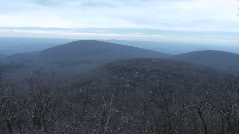
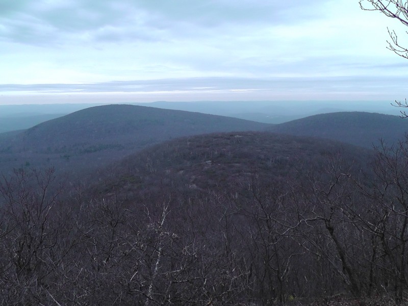
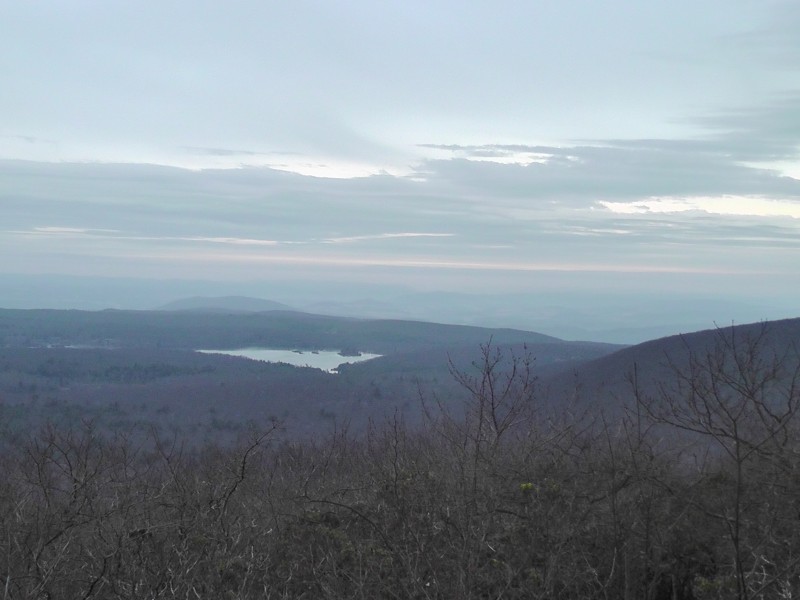
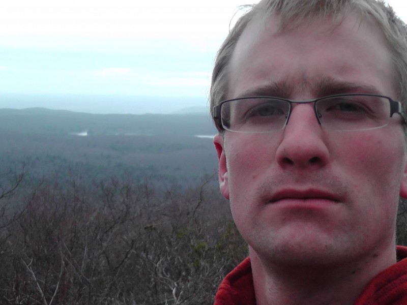
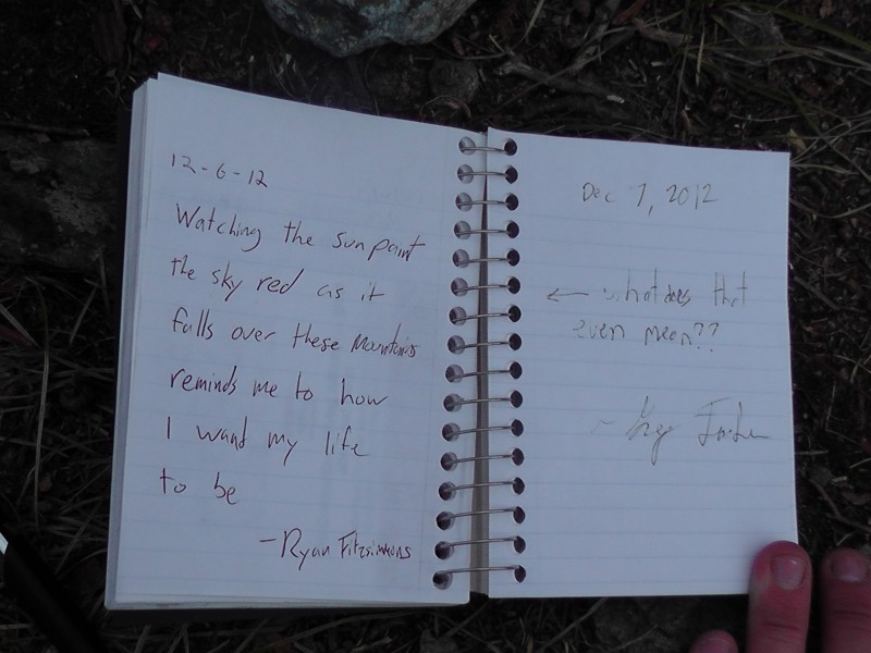
However, this isn't the Connecticut highpoint as Mt. Frissell's actual summit lies in MA. To reach the highpoint requires backtracking to the yellow sign posted on the tree which also serves as a fork in the trail. Head the opposite direction and take a .2 mile hike to the highpoint marked by a large cairn, summit register, and a sign. Beware that the trail doesn't end at the highpoint and continuing will lead into New York. I enjoyed the dead trees, took some photos and I paid tribute to Connecticut's very own with his signature move. If you don't understand, it's probably better that way. En route to highpoint; looking SE into CT At CT Highpoint looking into NY's Taconic Mountains with Catskills in far background
And no highpoint is complete without this shot. Ladies... BAM! Imaned! Anyone can climb a highpoint, but can you do it with style?
Usually I don't sign summit registers because, well, what's the point? Do I sound like a Curmudgeon again? This one, however, was begging for a response. I'm kinda of a dick. I blame that on NYC's influence (My wife would like me to add that I was a dick before moving to
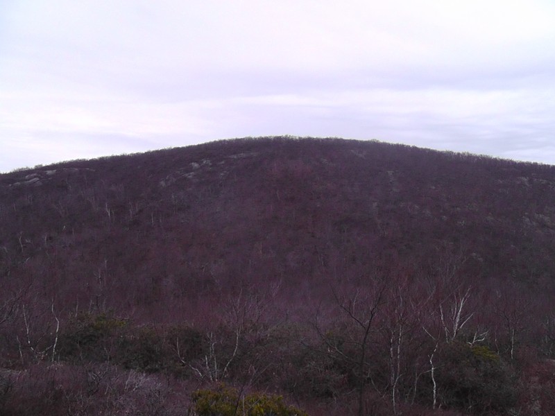
The route back was nothing more than retracing my steps over Round Mountain. Since it'd been far too long since I had the pleasures of hiking or even walking on a non-concrete surface, the Class 2 was therapeutic. I may be mentally deranged for saying that, but I can't say NYC or DC offer anything more than urban hiking and tourist dodging - a difficult sport in Midtown, mind you. I snapped a photo of Bear Mountain which is the highest peak entirely in the state of CT, although still shorter than Frissell's SW slope thus why it's not considered the highpoint. Feel free to climb it if you want to have all your bases covered against the highpoint elitist snobs. Bear Mtn. taken from Round Mtn. Only people who compelete the list of 73 would consider climbing this. Or Darrin Nicholas.
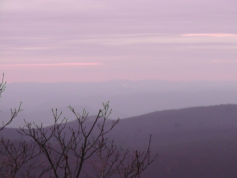
It's too bad I wait until December for this partially due to a recovering ankle, partially due to a lack of desire/fear, but there is no doubt that this area would offer excellent photos in it's Fall colors. Heck, it even looks great on a blue-bird summer day. I would highly recommend it during October as the foliage alone would make it worth it.
(courtesy of greensleeves.typepad.com)
(courtesy of coloradoguy.com)
Onward to Mt. Greylock(by driving in the opposite direction thru Salsibury since my Honda Accord was unable to scale the Class 3 road barrier)
(courtesy of Massachusetts Department of Conservation and Recreation)
The drive to Mt. Greylock doesn't get much better. It's a short drive, relatively straightforward and takes you through some towns that have been in existence before the French American War. Pop Quiz: What was the impact of the War on America? Classic New England geography and architecture, just perfect. The hardest decision is figuring out a plan of attack on Mount Greylock as the options are endless. Just look at the map below. For the octogenarians, driving to the summit possible. Be forewarned that the road is open Memorial Day through early November as road conditions are unmaintainable during the winter months. Apparently superstorms named Sandy close the road even earlier in the year. Hiking options vary from short and little altitude gain to short and steep gains to long and gradual gains. And let's not forget the super-long option of the entire Appalachian Trail. I also read it offers great options for skiers and snowshoes; a simple good search proves that.
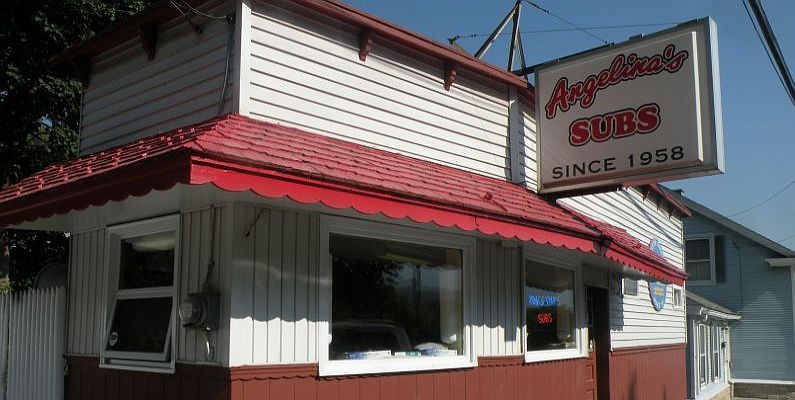
My intended route was the Thunderbolt Trail (directly East of the summit on the above map) due to the deteriorating weather conditions, which I tried to wait out to no avail, the sun setting very early, and the Thunderbolt most closely mirrored the Manitou Incline. The latter reason came back to bite me. More on that later. Getting to the town of Adams was no problem although finding the trailhead took some time as it's in an obscure part of the town. Part of the challenge for many state highpoints is navigation; this was no different even though Massachusetts provides a decent map. Thankfully, a local at a sub shop provided the need directions and an awesome hot pastrami sub. Being delivered all with the Bostonian accent was just icing on the cake.
Highly Recommended
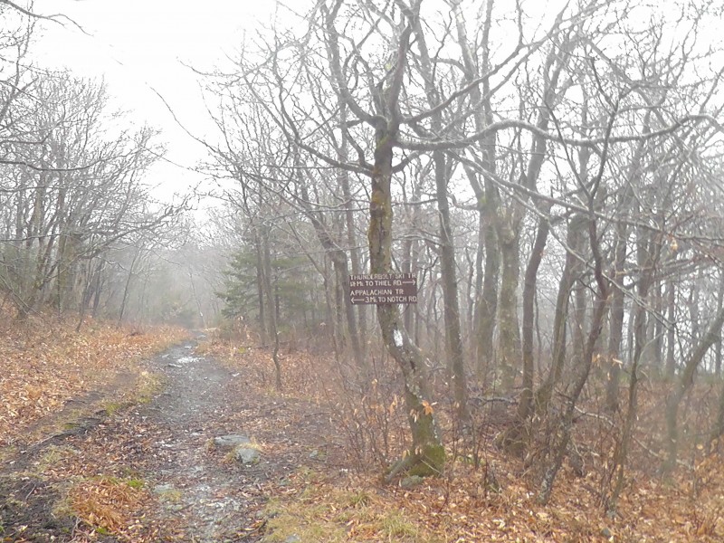
The road to the Thunderbolt TH was closed so that meant either parking at the barrier and hoofing it or going to a nearby trailhead and connecting with the Thunderbolt en route. I choose the later starting at the TH on Gould Rd - I'll take scenery, even of leafless trees, over road walking any day... I blame the Lake Como Rd. The diversity of route options can easily turn this into a labyrinth with no signs posted at trail junctions, so bring the park map. The first part of the hike to the junction of the Thunderbolt trail is fairly easy going - the path is wide and it gains only moderate elevation. This changes quickly, however, as the trail becomes substantially steeper as it heads up to the ridge, gaining nearly 1700ft to the ridge then about another 300ft to the summit. The raining conditions made the steepness difficult as the Thunderbolt trail become a mud slide and only become worse on the decent. It also prevented me from taking any meaningful pictures as the cloud ceiling rested incredibly low. Thankfully, the trail is easy enough to follow as the CCC (thank for funding this with your taxes, Grandpa) cut a large trail out through the thicket of trees for skiers. Even in low visibility, it would be next to impossible to get off route, plus there were signs posted at various points naming various sections of the route.
The best Colorado comparative route of the Thunderbolt would be a cross of the Manitou Incline and Mount Morrison. Thunderbolt Trail. Thank you FDR and the CCC
The two biggest takeways from research and experience I can offer for Mt. Greylock are these: Angelina's subs are awesome. Poor weather conditions during November - April are the norm. This became even more pronounced the higher I got with the ground becoming increasingly covered in verglas ice. Initially, I was thankful to reach the junction of the Appalachian Trail - the first time I've been on it in my life, sadly - as the slickness was less of a concern. Turned out I only lured myself into a false sense of security as the upcoming part of the trail near the summit was mostly paved; ice skates would have been the only sufficient mode of transportation. Instead, I ended up having to grab onto the metal railings and pull myself up the walkways. The suddenly windy summit ridge - I estimated 40MPH - just blew me across the road. Trail Junction of the Thunderbolt and Appalachian Trail. The beginning of the Slip'N'Slide
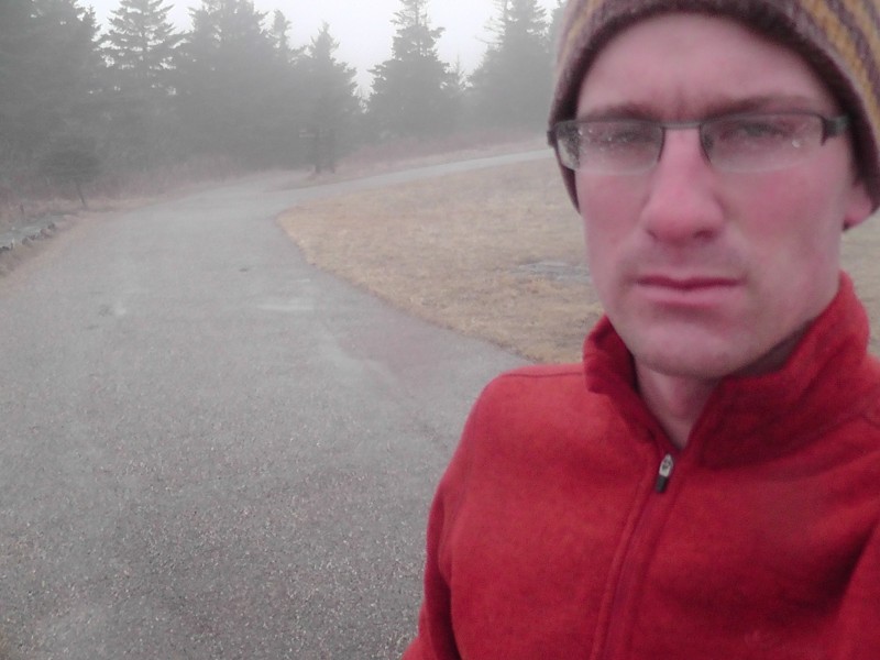
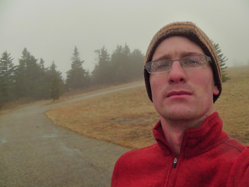
With only one slip (on the way up), I made the summit. Now I was able to enjoy marvelous views of... well nothing. It was cloud cover and a socked in summit tower with an ice rink. And of course staying with tradition I had to snap an Imaning shot. Not sure if I quite pulled it off however as I just look like the angry German I am. War Memorial Tower. Ice Rink included around it's base Heroic Summit Shot I was likely listing down the mountain side on the iced over pathway
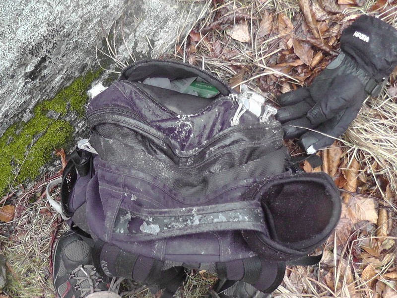
Becoming increasingly cold and wet, I figured I mind as well skate back to the descent route knowing fully well that I'd take a few spills along the way. Sadly, I underestimated the number of falls I would take. My ice cube of a backpack should have told me to expect more. Ice Ice Baby. Wow what a terrible reference to a terrible musican.
On the 1500ft vert. descent, I estimate I landed five times on my ass and one other slip where I slid 15 feet. Good times. Anyways, since my pictures are ineffective at capturing the route, I included a few taken on a better day to give a clearer image of the route.
Similar to Frissell, this would be another awesome hike in any other condition than what I did it in... as long as it's not socked in. I would highly recommend it as it offers a plethora of route options to suit your needs...even starting from flippin' Georgia.
Fall:
Winter (with snow):
Spring:
And if you get lucky, you might come across the 65 year old guy I met sitting in the Trailhead parking lot the entire time drinking beer and smoking pot who will be more than willing to share. Fun Fact: First time I'd ever been offered pot in my life.
He'll also share his desire to get a divorce from his wife and move to Colorado. On second thought, I think I'll take the baggage of hunters instead.
Thumbnails for uploaded photos (click to open slideshow):
This brings back some memories... 3/21/2013 2:32pm
It was a decade and a half ago, on these two mighty summits, that my illustrious (LOL) mountaineering career began! Including a too-late-in-the-day, desperate attempt up the Thunderbolt trail in late December with most of the trail coated in snow and ice...
You're right--both of these summits are far more beautiful in clear and/or summer conditions. Hope you got some enjoyment out of them nonetheless!
Reading this made me hungry! I recently summited Philadelphia's highpoint in order to obtain a Harry's Italian hoagie, although it should be stated that the aforementioned sandwich likely pales in comparison to Angelina's.
Congratulations on some slippery summits. What we lack in terrain we make up for with shit falling from the sky with considerable frequency.
PS - I'll look for your tribute during my May summit bid. My sherpa might carry it out, if his environmentalist ass feels so inclined.
The New England highpoints offered more of a playground that I expected and I came away fairly impressed by its offerings; these two rank as some of the better highpoints I've done, especially in comparison to Delaware. Add that in to the food offerings and awesome accents, and it's no contest.
I know many Coloradans love the fall colors in the state when the aspens begin to change, but for anyone who has the pleasure to experience Autumn anywhere in the Appalachians it trumps Colorado colors. Granted, the tradeoff is that everything looks dead during the winter months.
That's my new favorite Greg-ism! Way to get this report out promptly, buddy. Do me a favor...write up a Greys report from July and post it in January. #helpful
I grew up at the base of Mt. Greylock and I've hiked it at least 50 times and probably driven to the top a couple hundred more. Ahh, I remember many parties on that mountain.
Angelina's... oh my
Caution: The information contained in this report may not be accurate and should not be the only resource used in preparation for your climb. Failure to have the necessary experience, physical conditioning, supplies or equipment can result in injury or death. 14ers.com and the author(s) of this report provide no warranties, either express or implied, that the information provided is accurate or reliable. By using the information provided, you agree to indemnify and hold harmless 14ers.com and the report author(s) with respect to any claims and demands against them, including any attorney fees and expenses. Please read the 14ers.com Safety and Disclaimer pages for more information.
Please respect private property: 14ers.com supports the rights of private landowners to determine how and by whom their land will be used. In Colorado, it is your responsibility to determine if land is private and to obtain the appropriate permission before entering the property.


 This is my attempt at being Ansel Adams (or just an excuse for having absolutely no idea what this was supposed to be)")
 Pointless Picture")