Download Agreement, Release, and Acknowledgement of Risk:
You (the person requesting this file download) fully understand mountain climbing ("Activity") involves risks and dangers of serious bodily injury, including permanent disability, paralysis, and death ("Risks") and you fully accept and assume all such risks and all responsibility for losses, costs, and damages you incur as a result of your participation in this Activity.
You acknowledge that information in the file you have chosen to download may not be accurate and may contain errors. You agree to assume all risks when using this information and agree to release and discharge 14ers.com, 14ers Inc. and the author(s) of such information (collectively, the "Released Parties").
You hereby discharge the Released Parties from all damages, actions, claims and liabilities of any nature, specifically including, but not limited to, damages, actions, claims and liabilities arising from or related to the negligence of the Released Parties. You further agree to indemnify, hold harmless and defend 14ers.com, 14ers Inc. and each of the other Released Parties from and against any loss, damage, liability and expense, including costs and attorney fees, incurred by 14ers.com, 14ers Inc. or any of the other Released Parties as a result of you using information provided on the 14ers.com or 14ers Inc. websites.
You have read this agreement, fully understand its terms and intend it to be a complete and unconditional release of all liability to the greatest extent allowed by law and agree that if any portion of this agreement is held to be invalid the balance, notwithstanding, shall continue in full force and effect.
By clicking "OK" you agree to these terms. If you DO NOT agree, click "Cancel"...
| The Sawatch Beauty |
Route: Standard summer route (Northwest Slopes) from Winfield
Distance: ~11 miles
Elevation gain: ~3,800 feet
Time: 7.30am to 4pm (8.5 hours)
Participants: Jeff (SurfnTurf), Ben (BenFromtheEast), John (fepic1), Natalie (nkan02)
It has been a mild (ok - snowless) winter so far and there were numerous reports that Winfield TH has been accessible. After several false starts to attempt the peak in the last couple of weeks, the day was picked, and the crew congregated at the CR 390 turnoff the morning of. I was relieved to see that John was driving a big pickup truck that would get us to the TH in case the road gets rough, but my Subaru made it to Winfield on its own without any major problems. After our attempt to drive any further than 0.2 miles past Winfield in John's truck was quickly abandoned, we regrouped, geared up and finally started hiking the road around 7.30am. It was a brisk morning (-1F at 6am), but we expected a beautiful blue bird day with mild winds.

Jeff in the early morning light - switching from microspikes to snowshoes less than a mile in

The Apostles - we got a word that a much more ambitious crew were attempting them on the very same day. Tough peaks in winter, or in any season for that matter.

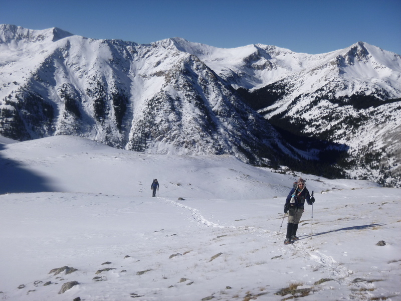
Heading uphill near the end of the tree line

John, Ben and Jeff heading up & up
Higher in the basin (near 12k), a previously sizable snowshoe trench has petered out to a lone snowshoe track. We were hoping to see an owner at some point in the day, but never had a chance to say hello. The track seemed to go in the right direction though, so we proceeded.

Ben and Jeff in the upper basin
Soon thereafter, Jeff, Ben and John decided to abandon their snowshoes and switched back to microspikes. I decided to keep mine for traction, as during the early morning gear transition from car to car, I managed to leave out my microspikes. Soon it became clear that snowshoes were needed more for floatation than for traction, as without them, the post-holing commenced!

John, Jeff and Ben are putting in extra effort to make it work without snowshoes

The upper basin

The views

Postholing finally stopped and people were able to start walking normally

Missouri, Bel/Ox and Harvard from the saddle
The final ridge to the summit

John is celebrating reaching the summit ~12pm

John on the summit

Ben is approaching Huron summit. Browns peak in the background.
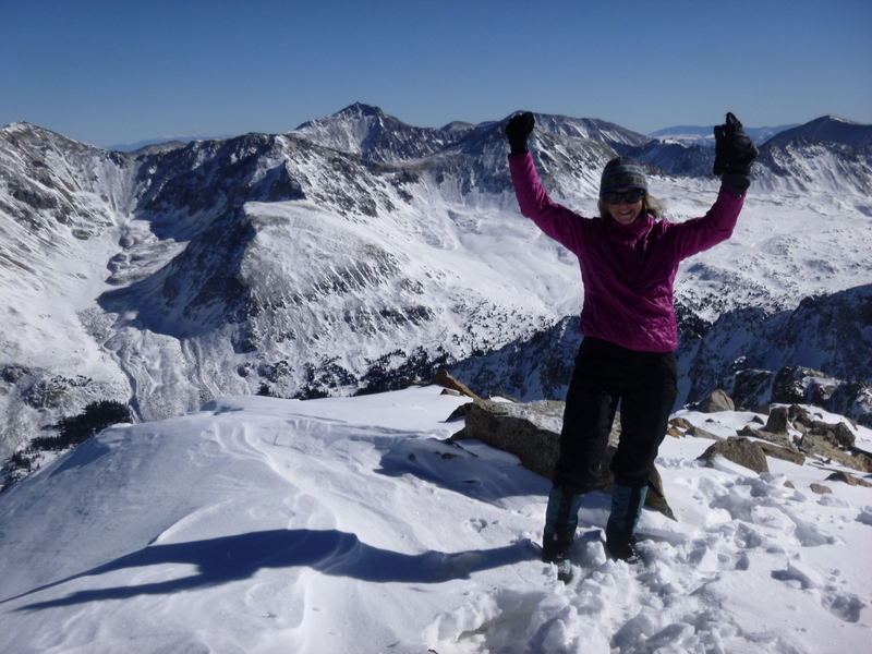
Natalie on the summit (photo credit - John)

Jeff is goofing off on the summit

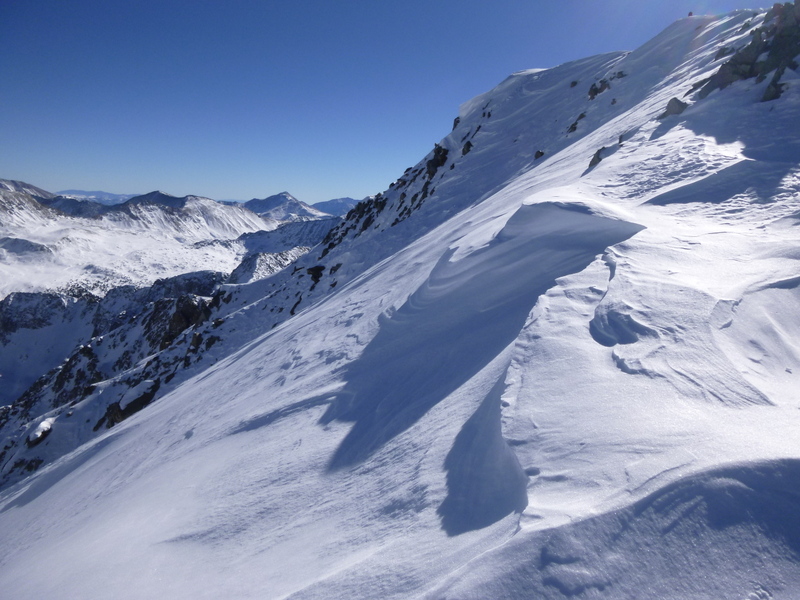
The amazing summit views from Huron. It is a beautiful thing.

North-facing couloirs look nicely filled


I don't have a summit picture of Ben, as he was too sad from dropping his lunch (a big chunk of the summer sausage) into the said couloir. I am just happy that he did not drop my camera there as well. Jeff basically pulled Ben from the brink of the abyss as it looked like he may try to follow his lunch. Ben, take heart - you'll make the day of some lucky marmot.

After goofing around and soaking in the views, we started the descent at about 1pm.

John is leading the way.

Brief glissading opportunities awaited

Huron Peak

Enjoying the views

Hiking out of the basin
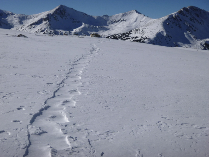
Our snowshoe track appears to be windblown by early PM

Enjoying the day so far (L-R: Ben, Jeff, John)

Winter Apostles

Hiking out

My GPS Tracks on Google Maps (made from a .GPX file upload):
|
Caution: The information contained in this report may not be accurate and should not be the only resource used in preparation for your climb. Failure to have the necessary experience, physical conditioning, supplies or equipment can result in injury or death. 14ers.com and the author(s) of this report provide no warranties, either express or implied, that the information provided is accurate or reliable. By using the information provided, you agree to indemnify and hold harmless 14ers.com and the report author(s) with respect to any claims and demands against them, including any attorney fees and expenses. Please read the 14ers.com Safety and Disclaimer pages for more information.
Please respect private property: 14ers.com supports the rights of private landowners to determine how and by whom their land will be used. In Colorado, it is your responsibility to determine if land is private and to obtain the appropriate permission before entering the property.