Download Agreement, Release, and Acknowledgement of Risk:
You (the person requesting this file download) fully understand mountain climbing ("Activity") involves risks and dangers of serious bodily injury, including permanent disability, paralysis, and death ("Risks") and you fully accept and assume all such risks and all responsibility for losses, costs, and damages you incur as a result of your participation in this Activity.
You acknowledge that information in the file you have chosen to download may not be accurate and may contain errors. You agree to assume all risks when using this information and agree to release and discharge 14ers.com, 14ers Inc. and the author(s) of such information (collectively, the "Released Parties").
You hereby discharge the Released Parties from all damages, actions, claims and liabilities of any nature, specifically including, but not limited to, damages, actions, claims and liabilities arising from or related to the negligence of the Released Parties. You further agree to indemnify, hold harmless and defend 14ers.com, 14ers Inc. and each of the other Released Parties from and against any loss, damage, liability and expense, including costs and attorney fees, incurred by 14ers.com, 14ers Inc. or any of the other Released Parties as a result of you using information provided on the 14ers.com or 14ers Inc. websites.
You have read this agreement, fully understand its terms and intend it to be a complete and unconditional release of all liability to the greatest extent allowed by law and agree that if any portion of this agreement is held to be invalid the balance, notwithstanding, shall continue in full force and effect.
By clicking "OK" you agree to these terms. If you DO NOT agree, click "Cancel"...
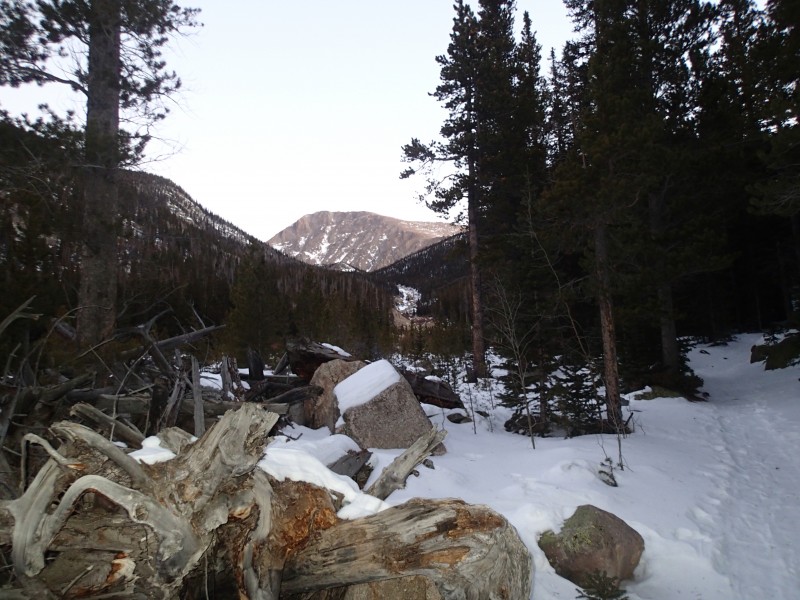
So far the winter of 2012-2013 has had very little snow fall. I have been taking advantage of that to climb some of the more remote peaks in Rocky Mountain National Park. Two weeks ago I climbed Mummy Mountain. View of Mummy Mountain, climbed that one two weeks ago
At that time the Lawn Lake trail had a great track put in most of the way to the Black Canyon Trail junction. Not much had changed since then so I figured that Fairchild could be done in a day.
I started hiking a little before 6 a.m. under the light of my headlamp. Microspikes were very helpful as there were at least four or so iceflows covering the trail. This was the largest, half-way across it really angled down hill. A slip here could lead to significant hurt. One of several ice flows across the trail
Shortly after the last ice flow, the trail had been drifted over and it was time for snowshoes. Time for snowshoes This was shortly after the two campsites along the trail.
Soon I arrived at the Black Canyon Trail junction where two weeks ago I cut to the right. This time I went straight and walked on top of the Roaring River for 50 yards or so. Roaring River covers the trail just past the Black Canyon trail junction
After the ice, I had about 3/4 of a mile of trail breaking to get to frozen Lawn Lake. Frozen Lawn Lake
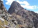
This is really a beautiful basin. I was up here two summers ago to fish. Did not catch anything but it was an enjoyable day nevertheless. I hiked along the side of the lake and soon Fairchild came into view. Fairchild Mountain
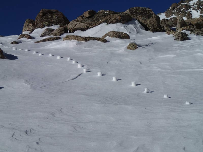
It still looked far away but I still had plenty of time and the weather was spectacular. Not a cloud to be seen and the winds were light. As I started climbing up from the lake, I was unable to follow the trail but the snow was quite firm lending itself to easy travel. Came across some interesting snow sculptures. Strange snow sculptures - Aliens?
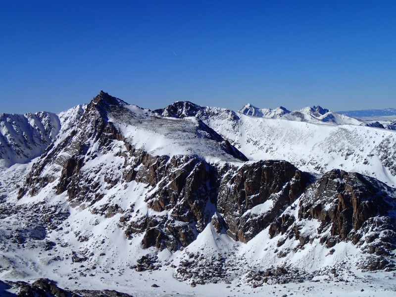
Soon enough I made it to the saddle named "The Saddle." I wanted a less steep route to the summit so did not cut the left any earlier. Along the ride the view of the Desolation Peaks was impressive. Desolation Peaks
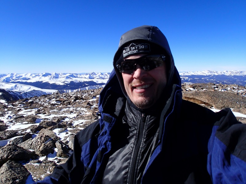
I stopped to eat lunch part way up the ridge. Hot soup and Triskets was a great picnic in the park. Fueled up, I hike the remaining 300' or so to the summit. Here is a view of Hagues and Mummy. Hagues and Mummy from the Summit
I reached the summit at 1:00 p.m. The temperatures were quite mild for January and the winds were light. Thanks for reading!
The hike down was quite nice. I basically followed my tracks to Lawn Lake and picked up the trail. The sun went down shortly after the Ypsilon Lake trail junction so out came the headlamp. I arrived back at the trail head about 6 p.m. making for a 12 hour day. I you believe the RMNP sign at the Lawn Lake trail head, I hiked about 20 miles. I estimate just under 5000' of climb. Now to find some food.
Thumbnails for uploaded photos (click to open slideshow):
I wonder if they could be footprints from a previous hiker, packed down during their hike, and then the unpacked snow around them eroded from the wind? I seem to remember someone else's TR where that happened and it looked pretty weird. Nice job! That's a great area; I've been up there several times but never in the winter. It looks so much different. Thanks for sharing! :D
Looks like you had a very rewarding day. I enjoyed your report and pictures - the one of Desolation Peaks is beautiful! Nice Blue Sky Marathon hat, by the way. That was a hot day.
Caution: The information contained in this report may not be accurate and should not be the only resource used in preparation for your climb. Failure to have the necessary experience, physical conditioning, supplies or equipment can result in injury or death. 14ers.com and the author(s) of this report provide no warranties, either express or implied, that the information provided is accurate or reliable. By using the information provided, you agree to indemnify and hold harmless 14ers.com and the report author(s) with respect to any claims and demands against them, including any attorney fees and expenses. Please read the 14ers.com Safety and Disclaimer pages for more information.
Please respect private property: 14ers.com supports the rights of private landowners to determine how and by whom their land will be used. In Colorado, it is your responsibility to determine if land is private and to obtain the appropriate permission before entering the property.