Download Agreement, Release, and Acknowledgement of Risk:
You (the person requesting this file download) fully understand mountain climbing ("Activity") involves risks and dangers of serious bodily injury, including permanent disability, paralysis, and death ("Risks") and you fully accept and assume all such risks and all responsibility for losses, costs, and damages you incur as a result of your participation in this Activity.
You acknowledge that information in the file you have chosen to download may not be accurate and may contain errors. You agree to assume all risks when using this information and agree to release and discharge 14ers.com, 14ers Inc. and the author(s) of such information (collectively, the "Released Parties").
You hereby discharge the Released Parties from all damages, actions, claims and liabilities of any nature, specifically including, but not limited to, damages, actions, claims and liabilities arising from or related to the negligence of the Released Parties. You further agree to indemnify, hold harmless and defend 14ers.com, 14ers Inc. and each of the other Released Parties from and against any loss, damage, liability and expense, including costs and attorney fees, incurred by 14ers.com, 14ers Inc. or any of the other Released Parties as a result of you using information provided on the 14ers.com or 14ers Inc. websites.
You have read this agreement, fully understand its terms and intend it to be a complete and unconditional release of all liability to the greatest extent allowed by law and agree that if any portion of this agreement is held to be invalid the balance, notwithstanding, shall continue in full force and effect.
By clicking "OK" you agree to these terms. If you DO NOT agree, click "Cancel"...
I don't have photos of some of the steeper sections, but I did wear a helmet cam, so some of those scenes are only available in the video.
7 Aug - Took train down to Manchester, then flight to Geneva. Surprised to find out Geneva is very much a French city, I was expecting German. Met a guy from Pennsylvania in the hotel who gave us half his pizza, we were starving. I think he wanted to stay up late talking about college football, but we had to get to bed and didn't want to start off the trip too tired. So after spending enough time chatting to repay him for the pizza, we made our way to the room and went to sleep.
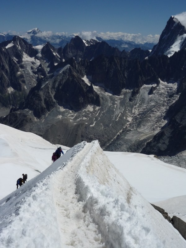
8 Aug - Took shuttle to Chamonix. The van was full of other Americans, oddly. We arrived at the hotel (de l'Arve), spread out all our stuff in the back lobby, packed up into our backpacks, and headed off to buy some food and fuel. Snell's in Chamonix is perhaps the ultimate outdoor gear store. They don't mess around with running clothes and kayaks and big tents. Just axes, ropes, crampons, and packs as far as the eye can see. Then up the Aiguille du Midi, which was a very packed cable-car (telepherique) ride and took about 90 minutes or so, mainly standing in line. Got to top, looked out over the descent ridge from Aiguille du Midi down to Col du Midi, and was very glad we didn't have to go down it, since my partner had never worn crampons before. Access gate from the Aiguille du Midi
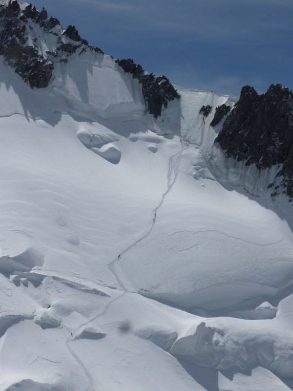
It is basically the thinnest, steepest ridge of snow that is possible. Any thinner or steeper and it would collapse. We went over to catch the cable car to Point Helbronner (for our reservation at the Torino hut), and found out that we had arrived too late for the last car. While it would be possible to walk over, it would basically be the entire Vallee Blanche Traverse, and I didn't want to embark on that without knowing the route better, or having more time before the sun set. It was my first trip to the Alps, after all, in August, so the route wandered considerably through some large crevasses. Luckily my mobile phone worked, so I made a series of calls to the Torino hutkeepers (who didn't speak English) to try to cancel reservation, and called Cosmiques Refuge and luckily got a reservation to stay there for the night. Guess we have to do the ridge after all.
Got geared up in the tunnel and roped together. It would be Karl's first time on crampons, other than some practice in the sheep fields of Yorkshire. There was a guy in his mid 50's going down before us, basically by sitting down and sliding forward a bit at a time. No hat, no gloves. He was going VERY slowly, and his guide behind him didn't seem to think anything of it. We waited about 25 minutes for him to get to a spot that was wide enough for us to pass.
We started out, and after stepping out from the platform, you are immediately on a walkway that is exactly 2 boot-widths wide. Either side falls off very sharply for hundreds, if not over a thousand feet. I had seen video of the ridge before and thought that the angles were distorted by a fisheye lens and looked steeper than they would be in real life. Nope, it was just as exposed as it looked in the videos. We slowly inched our way down, with me holding a few loops of rope in my left hand to try to stabilize Karl if he stumbled. A fall forward wouldn't be terrible, but if one of us fell to the side the only solution is for the other person to jump off the opposite side.
Steep and narrow
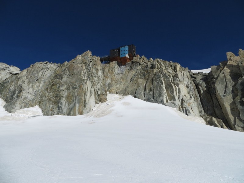
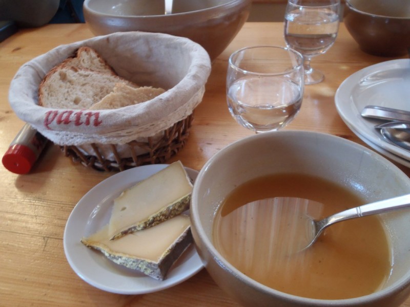
We made it down the ridge, and into Col du Midi, a wide, flat glacier. We crossed over to the Cosmiques Refuge, making good time. We arrived just before the last dinner service, which was soup, a chicken & pasta dinner, and a small dessert. Pretty good, especially considering that all the food has to be helicoptered in. Cosmiques Refuge Dinner - and a Bowl of Pain
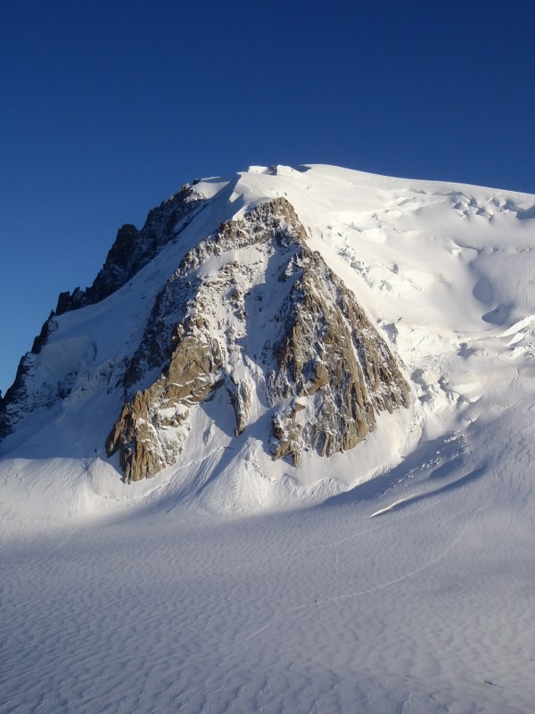
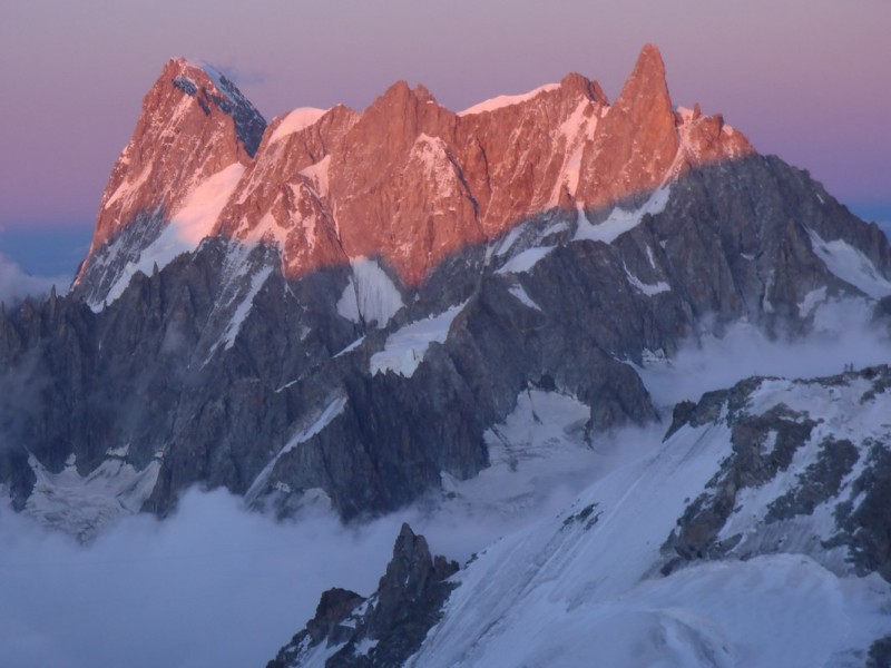
We found our assigned bunks with amazing views of Mont Blanc du Tacul (13,937'), particularly the Pyramide du Tacul, and were very happy to be where we were. Our breakfast zone was at 7am, so we hoped to get some sleep.
Mont Blanc du Tacul and the Pyramide
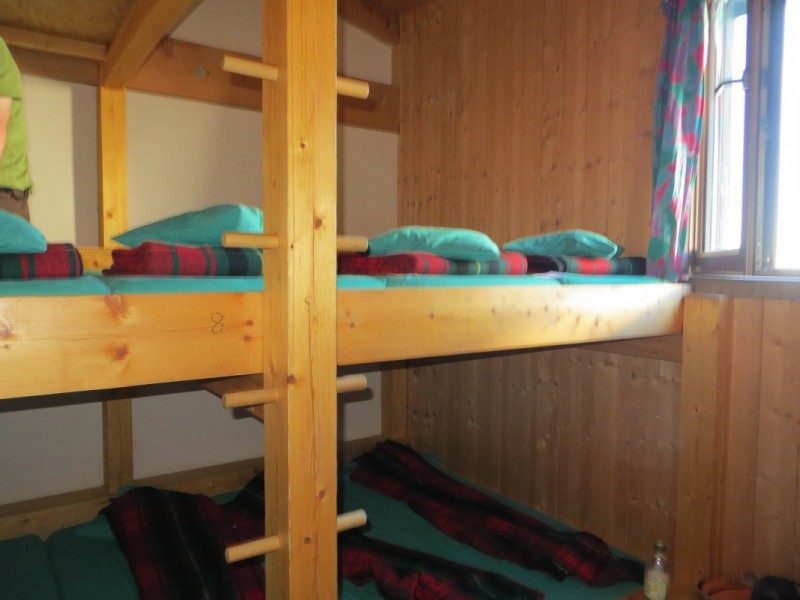
The ascent from sea level to 11,800' in one day resulted in pounding, dreadful headaches and insomnia. To add to it, a French guy came in around 10pm and read his newspaper by headlamp right next to me (lamp in my eyes), and then laid the newspaper on my feet when he was done. Classy. I got up to use the loo and saw the 1am wake-up folks gearing up and getting ready to go. I was glad to crawl back up the ladder to my little bunk and try to sleep. Cosmiques Bunks
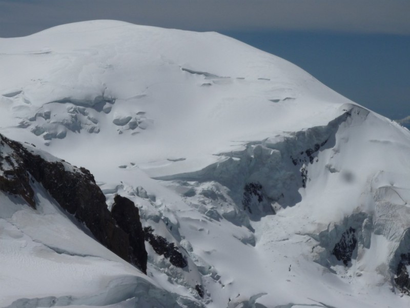
9 Aug- Woke up at 7am and went for breakfast. Crusty bread, hot chocolate, and a little granola. Not too bad. We got our gear sorted, roped up, and headed out to the base of Mont Blanc du Tacul. The scale of it was deceptive. Since we could see the top it certainly didn't look like 2,000 vertical feet, but that just means it is pretty steep. We roped up and started the walk over to the base of the mountain. Since Mont Blanc du Tacul is the first of the three mountains in the "Trois Monts" route up Mont Blanc, there was a pretty clear and defined trail going up. Route up MB du Tacul
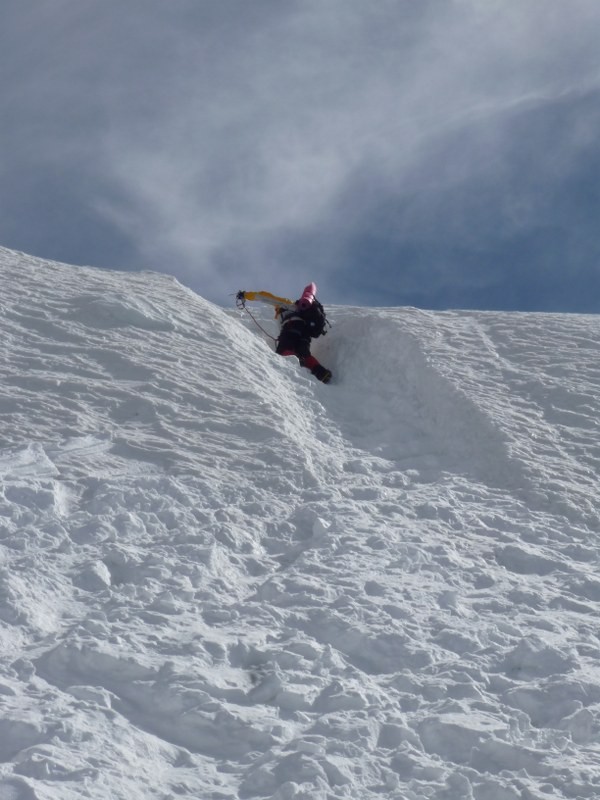
Almost immediately the route got steep, and then stayed steep. There were two extra-steep sections, with a sort of trough cut through the near-vertical section to make it passable. I got up it and then set a quick hip belay for Karl since it was his first time walking uphill in crampons! The steep bit
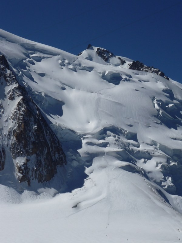
Near 13,000' we were getting a bit winded, and were looking for a good spot to stop for a few minutes. I kept thinking that "just beyond the next rise" there would be a flat spot to rest, but there wasn't. When the track finally leveled out and traversed sideways, it was directly underneath a large overhanging serac, definitely not a place to stop. We kept moving quickly under the serac, mindful of the icefall and avalanche just a few weeks earlier which had killed nine climbers nearby.
Large serac
We made it to the large, broad shoulder of MB du Tacul, and stopped for a minute to catch our breath. Judging by the copious urine stains on the snow, it appeared to be a very popular spot to stop for everyone else, too! We moved up a little higher off the Trois Mont route towards the proper summit, then found a spot to sit down, melt some water, and have lunch. The views were amazing, probably the most scenic lunch break I've ever taken, with Mont Maudit and Mont Blanc to one side, Aiguille du Plan and Dent du Geant on the other.
Upper section of Mont Maudit Mont Blanc, seen from MB du Tacul
With perfect weather we started our descent. We didn't encounter many people the entire day, but did cross paths with a few people at one of the icy bottlenecks. The snow around had softened in the afternoon sun, but inside the deep trench cut into the vertical snow it was quite icy. I slipped a little bit, and used my pick to stab the walls of the trench to keep from sliding further. After we passed through we watched a solo climber carefully making his way through the gap. As he did so, a pair of faster climbers came through, and right at the narrowest part, kind of shouldered him aside to get through, rather than wait a minute or so. It wasn't the end of the "out of my way!" attitude that we'd see, more on that later.
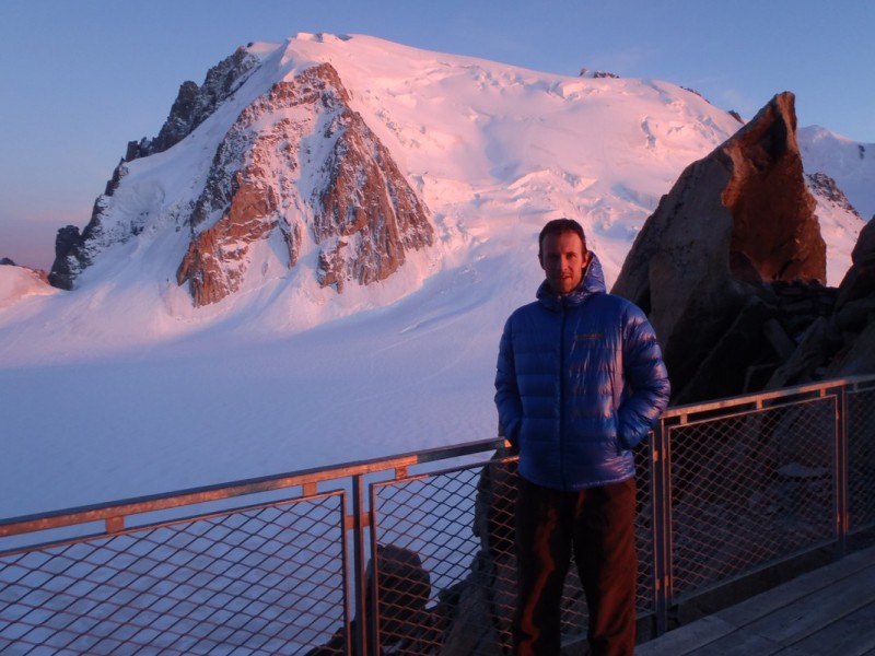
We made it back down to the Col du Midi, and sat down to melt water. It's about 5 Euro ($7) for a 1.5L bottle of water, so we wanted to melt as much as possible. We fired up the JetBoil and sat in the snow for a good 45 minutes cooking water and enjoying the view. Dent du Geant and Grandes Jorasses Cosmiques Refuge deck with MB du Tacul
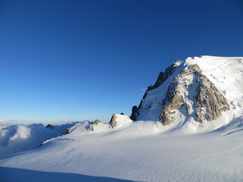
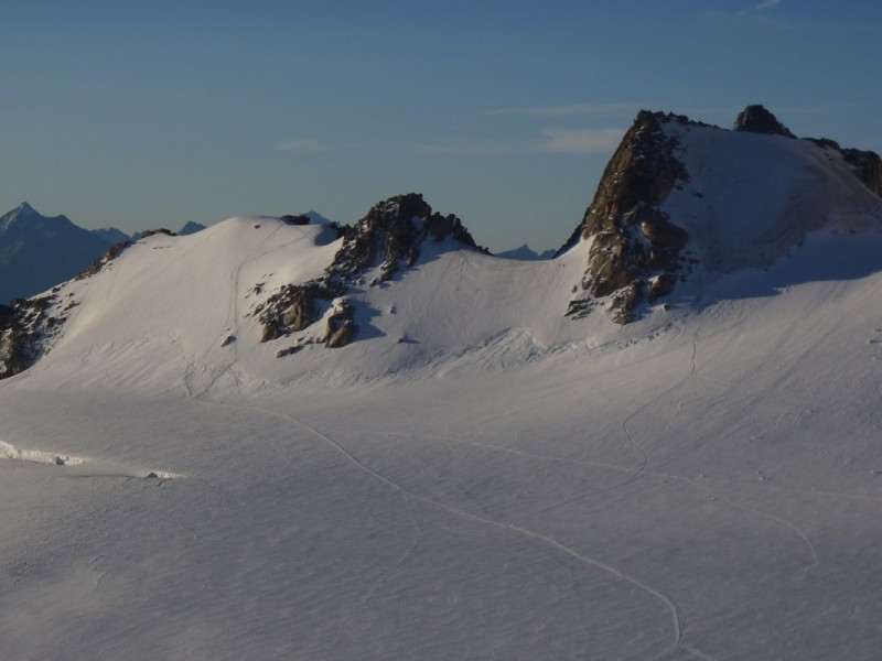
10 Aug - After yesterday's workout, but with a much better night of sleep, we decided to take it easy to save our strength for the upcoming summit attempt. So we traversed across the Col du Midi towards Pointe Lachenal . MB du Tacul with Pointe Lachenal on left Pointe Lachenal
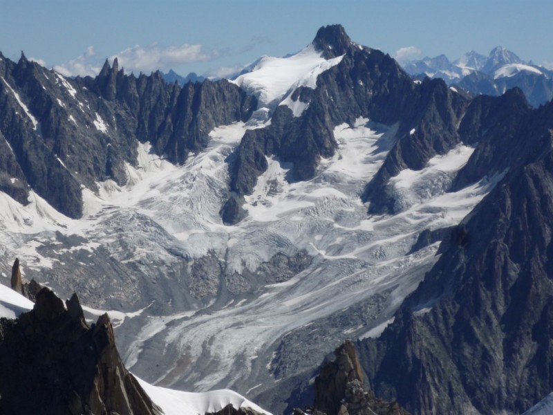
There were good views out to Pont Helbronner in Italy, and all the broken glaciers of the Vallée Blanche Traverse. We saw one party enter the crevasse-ridden Traverse, and it looked like there was quite a bit of crevasse-hopping and careful ropework to stay safe. Point Helbronner (Italy)
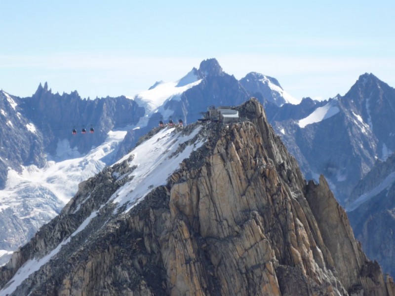
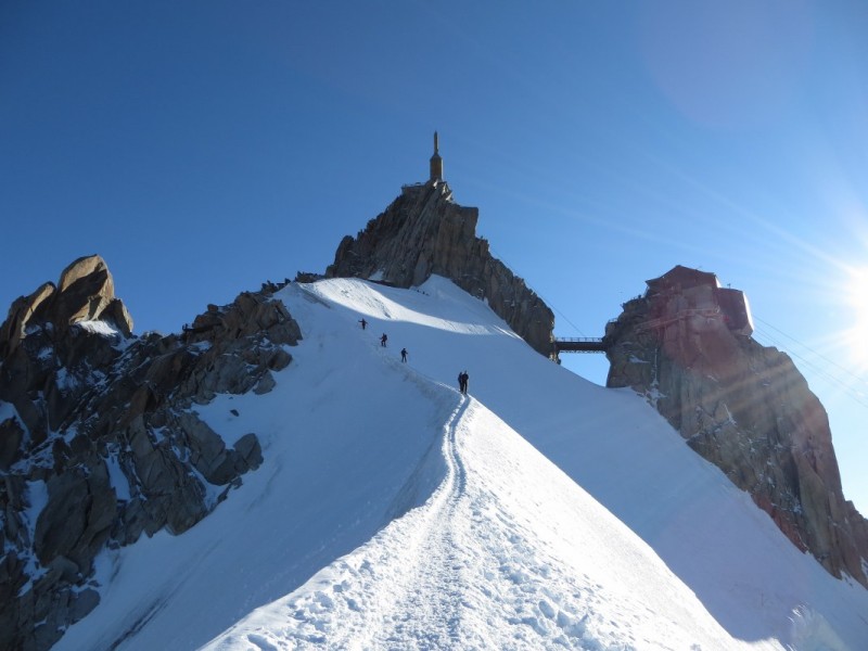
We headed uphill to Pont Lachenal, but the grade got a bit too steep for us to feel comfortable. At this point we were right at the angle where frontpointing (pied en avant) and French technique (pied a plat) intersect, and were using our axes in low-dagger. I felt solid on the firm snow, but Karl was a little shaky on the steep slope, especially considering the even steeper ice beneath us, so we downclimbed a few hundred feet and then made our way back to the base of the Aiguille du Midi for the ridge climb up. Aiguille du Midi
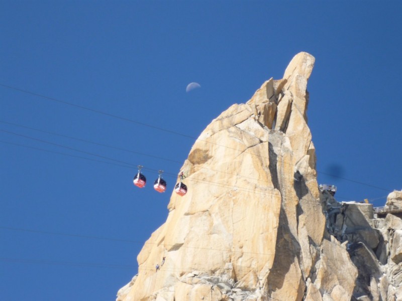
The ridge was taller than I remember, but just as steep and narrow. We made slow but steady progress, and had made it to the top of the ascent, with just about 20 yards of the narrowest part of the ridge remaining. A guide directed his 2 clients to start out across the ridge, rather than waiting the 45 seconds (literally, we timed it later) it would take us to clear the ridge. We had to stop mid-ridge and try to not fall (or cause the other group to fall) as they tried to squeeze around us. The first guy was ok, but the middle lady was very unsure of herself and definitely leaned into us and held on as she went by. Why they couldn't have waited 45 seconds (the ridge was clear behind us), I don't know. I think it took longer since they had to try to squeeze around us than it would have taken just to wait. Cable cars and moon near Aiguille du Midi
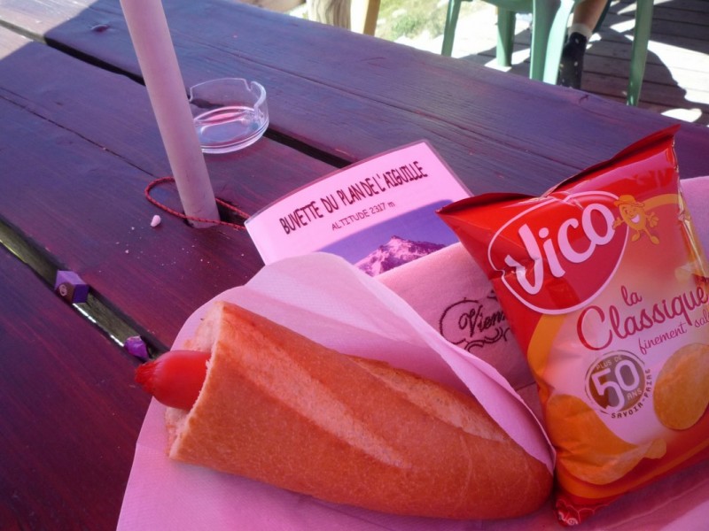
We made it back up, took off all our gear, and were looking forward to a lunch at the top of the station. The cable-car operator informed us that there were too many people up on top and we had to descend immediately. So we shrugged our packs back on, and skipped lunch, once again. We waited in line for about 30 minutes, then were on the car. We stopped off about halfway down for lunch at the Plan de l'Aiguille (7723'), and both pounded 2 French hot dogs (sausage in a hole drilled into a baguette), and French fries (pommes frites).
French hot dog
We made it back down to the hotel, and discovered that I was missing my camera. I ran back to the Midi cablecar station before they closed, but no one had turned it in.
That evening we met Mark, who was to be our guide for the main ascent, and talked a little about the climb. The forecast was good, and after our two nights up high and a successful climb up over 14,000' without any altitude problems, we were feeling fairly confident. We sorted and repacked our gear, then tried to get some sleep, as we knew the next night would be very short.
The report continues in PART TWO (of THREE).
Thumbnails for uploaded photos (click to open slideshow):
Thanks for the breathtaking TR. I just finished reading it and almost want to start over right away. I hope to make it to the Alps in the next few years myself, and reports like this are invaluable. Looking forward to the next two!
That sign wasn't there last time I was up there. It tells me that there must have been some folks in street shoes that wondered down the knife ridge. YIKES! Nice report.
Great report! Headed to Chamonix for two nights in June/July for our honeymoon. Don't think we alloted enough time to climb Mont Blanc before we head to Zermatt... so I'll live vicariously through your trip reports!!
I've made two trips to Chamonix in the past year. First in August to climb Mont Blanc and also to get up to the Mer de Glace. The second trip was last week to ski the Vallee Blanche. I've become somewhat obsessed with the area. I really enjoyed your write up and photos. They bring back great memories. :D
Caution: The information contained in this report may not be accurate and should not be the only resource used in preparation for your climb. Failure to have the necessary experience, physical conditioning, supplies or equipment can result in injury or death. 14ers.com and the author(s) of this report provide no warranties, either express or implied, that the information provided is accurate or reliable. By using the information provided, you agree to indemnify and hold harmless 14ers.com and the report author(s) with respect to any claims and demands against them, including any attorney fees and expenses. Please read the 14ers.com Safety and Disclaimer pages for more information.
Please respect private property: 14ers.com supports the rights of private landowners to determine how and by whom their land will be used. In Colorado, it is your responsibility to determine if land is private and to obtain the appropriate permission before entering the property.