Download Agreement, Release, and Acknowledgement of Risk:
You (the person requesting this file download) fully understand mountain climbing ("Activity") involves risks and dangers of serious bodily injury, including permanent disability, paralysis, and death ("Risks") and you fully accept and assume all such risks and all responsibility for losses, costs, and damages you incur as a result of your participation in this Activity.
You acknowledge that information in the file you have chosen to download may not be accurate and may contain errors. You agree to assume all risks when using this information and agree to release and discharge 14ers.com, 14ers Inc. and the author(s) of such information (collectively, the "Released Parties").
You hereby discharge the Released Parties from all damages, actions, claims and liabilities of any nature, specifically including, but not limited to, damages, actions, claims and liabilities arising from or related to the negligence of the Released Parties. You further agree to indemnify, hold harmless and defend 14ers.com, 14ers Inc. and each of the other Released Parties from and against any loss, damage, liability and expense, including costs and attorney fees, incurred by 14ers.com, 14ers Inc. or any of the other Released Parties as a result of you using information provided on the 14ers.com or 14ers Inc. websites.
You have read this agreement, fully understand its terms and intend it to be a complete and unconditional release of all liability to the greatest extent allowed by law and agree that if any portion of this agreement is held to be invalid the balance, notwithstanding, shall continue in full force and effect.
By clicking "OK" you agree to these terms. If you DO NOT agree, click "Cancel"...
With: Margaret Thomas, Billy Mattison, Tammy Argenbright, Karen Wolfe-Mattison
This trip took us to Kathmandu followed by fifteen days of trekking in the Khumbu Region of Nepal's Himalayan mountains. Our itinerary included stops in the villages of Surke (2,300m), Lukla (2,886m) Monjo (2,800m), Namche Bazaar (3,440m), Tengboche (3,867m), Pheriche (4,243m), Lobuche (4,930m), Gorak Shep (5,164m), Dingboche (4,260m), Pangboche (3,895m), Phortse (3,900m), and Khumjung (3,790m). Notable high points included Everest Base Camp-ish (5,303m/17,500ft), and Kala Patthar (5,545m/18,300ft). On the return, we hiked to Ama Dablam Base Camp (4,485m/14,800ft) and to point below Camp 1 on Ama Dablam at 4,909m/16,200ft. The route to EBC tracked due north along the Dudh Kosi (river). Past Namche Bazaar, we headed northeast along the Imja Khola river, then north paralleling the Khumbu Khola and Lobuche Khola rivers to the Khumbu Glacier.
Our departure from Kathmandu started out on a dubious note when we were advised it had been 4 days since any flights had landed in Lukla due to heavy fog, with no prospect of flights landing over the next two or three days. Little did we know this seemingly unfortunate piece of news would provide us with a memorable trek into the most popular region of Nepal.
Options for getting out of Kathmandu and sticking with our original itinerary were very limited if we couldn't get to Lukla within the next day or so to meet up with our support group. The only option that made sense was to spend an additional $500 per person to hire a helicopter to Surke, a very small village 1.25 miles south and 2,000ft below Lukla.
We left the Yak & Yeti hotel 6 hours after our planned departure time and arrived at Kathmandu's airport to a shit show like no other I have ever experienced in an airport - four days worth of trekkers who decided to wait out the fog and fly to Lukla rather than pull the trigger on an alternative. We were whisked through the airport, past security and throngs of frustrated travelers, to a truck straight out of an Indiana Jones movie. By the time this heap of rubber and metal was loaded with people and gear, two of us were left standing on the rear bumper while holding on to the tailgate as it sped past grounded planes to the helicopter tarmac. An hour later we were sailing over wide open valleys of rice and potato fields, contouring along steep canyon walls, and buzzing ridgelines on our way to Surke. We landed in an angled field amidst 50 or so trekkers trying to get back to Kathmandu. Our guide and one sherpa were waiting for us.
We quickly assembled our packs and hit the humid, muddy and steep trail. An hour and fifteen minutes and a couple pounds of sweat later, we arrived at Lukla. We met the remainder of our support staff that evening. The next morning we were on the trail toward Mt. Everest. Our detour put us one day behind schedule. We made up the time by foregoing an acclimatization day in Namche Bazaar. The scenes below followed:
One of the many bridges we would cross Our first glimpse of Everest, Lohtse, and Nuptse Typical Nepal village Wild Horses beneath Ama Dablam Khumbu waterfall Stupa among giants High alititude graveyard Mt. Crumpet Pumori and Khumbu Glacier Mt. Everst from Kala Patthar Ama Dablam above Pangboche Nuptse On the trail to Kala Patthar More Himalayan splendor Ama Dablam base camp At 16,000' on Ama Dablam's SW ridge Kang Tega Everest Base Camp on a snowy morning Just another 7,000 meter peak Namche Bazaar Shangri-La is back there somewhere A sherpa with a sense of style Tangboche Camp at Gorak Shep Nepalese children Everest and the Khumbu Ice Fall Porter carrying an incredible load Raging river Kathmandu One last image
Our biggest concern with the itinerary we chose was the prospect of trekking with 10,000 of our closest friends. The benefit of having Lukla closed for six days was that we saw relatively few trekkers on an otherwise busy route. We had most of the villages and tea houses to ourselves. It wasn't until we approached Namche Bazaar on the return that we began to see trekkers en mass. Khumjung, the largest village in the region and home to the Khumjung School founded by Edmund Hillary in 1961, was a virtual ghost town.
We experienced unexpectedly good weather in Nepal the entire trek. We had no rain and only one 24-hour period of snow at Gorak Shep. The snow made for a beautiful climb to Kala Patthar. Most days saw blues skies with little wind. Clouds formed in the afternoon much like they do in Colorado during July and August but they generally cleared out by nightfall. Our night in Gorak Shep was the coldest - somewhere between 15 and 20 degrees F. On the return to Lobuche from EBC, we heard a rumbling reminiscent of a freight train or tornado. We observed a slide off of Nuptse's west ridge. We estimated the avalanche ran 4,000 vertical ft. We heard this sound several times on the trek but saw only one slide.
A few anecdotes:
- Kathmandu is generally a filthy, polluted city of over 1 million people, most of which are Hindu. There are dogs everywhere. The Bagmati River which runs through the city is incredibly polluted, even though it holds much religious significance to the Hindus. Public cremations along its banks are a daily occurrence. We saw and smelled several cremations at fairly close range during our stay. Traffic in the city is best described as controlled mayhem. Don't even think about drinking the tap water even in the best hotels. A three-star hotel in Kathmandu would seem like a pretty nice place to stay but if you want something better than a run down Motel 6, five-star is the only way to go. The Yak & Yeti (rated five-star) has a lot of history, particularly among the climbing community, but there are several other hotels in Kathmandu rated five-star that are certainly as nice if not nicer. The Yak & Yeti has a terrific breakfast buffet included in the price of the room. Don't be surprised if you see someone of climbing notoriety at the hotel. David Breashears was there during our stay for a speaking engagement (I think) in Kathmandu. We saw him but did not meet him.
- Kathmandu has some excellent pizza places. Our favorite is Fire and Ice in the Thamel district. It's within walking distance of the Yak & Yeti. Another good restaurant in the same area is Garden of Dreams. There's a small entrance fee but it includes a self-guided tour of the gardens and adjacent buildings. Give yourself a half hour or so to complete the tour before dinner.
- We could only handle Kathmandu for a day or two. After that, we had to get the hell out of there and head for the hills. Generally speaking, Kathmandu is a safe city to tour, even at night.
- As you get away from Kathmandu and closer to the mountains, buddhist influences increase. Tangboche is home to a beautiful buddhist monastery with terrific views of Ama Dablam. Ama Dablam has a more impressive presence than Mt. Everest IMO. It certainly holds greater religious significance to the people of Nepal than Everest.
- English is widely spoken throughout Nepal and other parts of Asia we visited.
- While we camped all but one night during the trek, there are many villages along the route with places to stay if tent camping is not your thing. Eating areas at the inns run the gammit from very nice to unfinished plywood benches and floors. Rooms are similar to what you'd experience at a hunting lodge. Most inns have showers but the availability of warm water diminishes the higher you go. Most in our group took one shower a week.
- Trekking routes are primarily yak trails. These trails are the main routes for commerce in the Himalaya. Yaks, mules and porters carry all of the commercial goods in the region. Our route included many ups and downs in elevation - particularly below treeline - in some cases more than 1,500ft. Our net elevation gain was a bit more than 11,000ft but our overall elevation gain was much greater. Treeline in the Khumbu is 4,242m/14,000ft. Snowline is 4,848m/16,000ft.
- Notable peaks observed: Everest, Lohtse, Lohtse Shar, Cho Oyu, Nuptse, Pumori, Ama Dablam, Lingtren, Khumbutse, Peak 38, Kang Tega, Kang Tega East, Kyashar, Kusum Kanguru and Kusum Kanguru north and east summits (lowest at 6,367m/21,011ft).
- Surprisingly, there were significantly more women trekking alone than men.
- The trek to "Everest Base Camp" doesn't get you to the actual base camp. If you want to visit the true base camp, it's a half mile past and two hundred feet lower than the typical stopping point.
- The Liquid Bar in Namche Bazaar was a favorite watering hole for our group. A decent bottle of wine is hard to come by anywhere in Nepal. For that matter, we didn't find a good bottle of wine anytime during our entire stay in Asia, including Thailand and Singapore. On the other hand, decent beer was available in every village.
- Dried yak crap is the primary fuel used in stoves to heat inns and tea houses. Rooms at the trekking inns are not heated.
- Our trip also took us to Thailand for some beach time and diving as well as Singapore for big city action. Phuket, Thailand is a gem of place; clean and safe. The water is warm and the beer is cold. Visit it before you die. That is if you don't mind Russians and Swedes - they're all over Phuket Island. Singapore is a clean, trendy, uber modern city/state of 5,000,000 people. It's an architects dream - more western than many US cities. Singapore's airport may be the most modern in the world. The city is carved out of the Malaysian rain forest making it a sour topic for environmental interests but efforts to reintroduce trees and other foliage throughout the city is nothing short of incredible. We were told crime is virtually nonexistent. Apparently, Singapore has had one armed robbery in recent months and that guy has a date with the hangman. Chewing gum is generally illegal in Singapore as is spitting in public, while it's legal for a 16-year old to hire a prostitute in certain areas of town.
Thumbnails for uploaded photos (click to open slideshow):
Its hard (almost impossible) to capture the size and vastness of the Khumbu and your pictures did a damn fine job of it! Looks like an absolutely fantastic trip. Glad you were able to make it happen. Love the Khumbu!
Thanks for putting together such a detailed and interesting report. This is definitely a must read for anyone contemplating a Himalayan trekking experience.
Thanks for sharing your incredible photos - looks like the trip of a lifetime!
Caution: The information contained in this report may not be accurate and should not be the only resource used in preparation for your climb. Failure to have the necessary experience, physical conditioning, supplies or equipment can result in injury or death. 14ers.com and the author(s) of this report provide no warranties, either express or implied, that the information provided is accurate or reliable. By using the information provided, you agree to indemnify and hold harmless 14ers.com and the report author(s) with respect to any claims and demands against them, including any attorney fees and expenses. Please read the 14ers.com Safety and Disclaimer pages for more information.
Please respect private property: 14ers.com supports the rights of private landowners to determine how and by whom their land will be used. In Colorado, it is your responsibility to determine if land is private and to obtain the appropriate permission before entering the property.
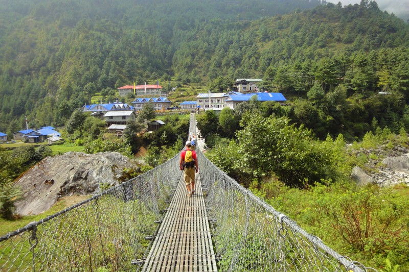


 One of the many bridges we would cross")
 Our first glimpse of Everest, Lohtse, and Nuptse")
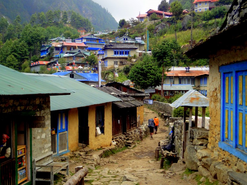
 Typical Nepal village")
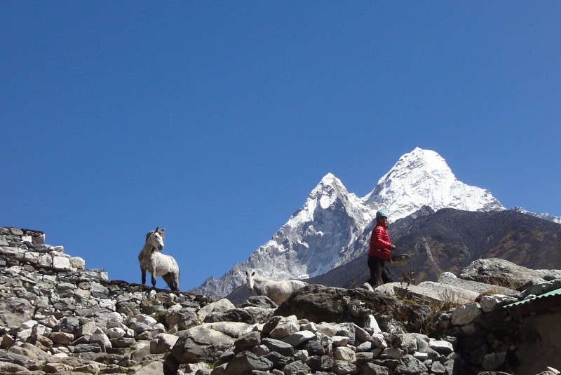
 Wild Horses beneath Ama Dablam")
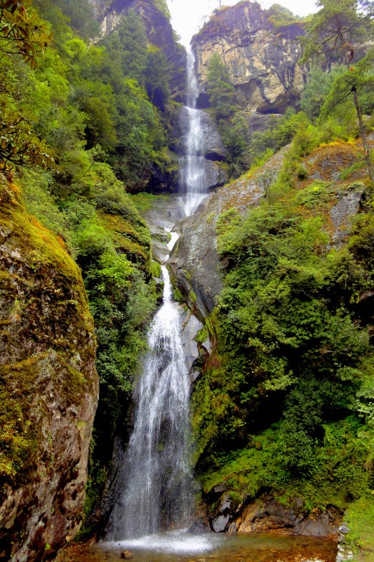
 Khumbu waterfall")
 Stupa among giants")
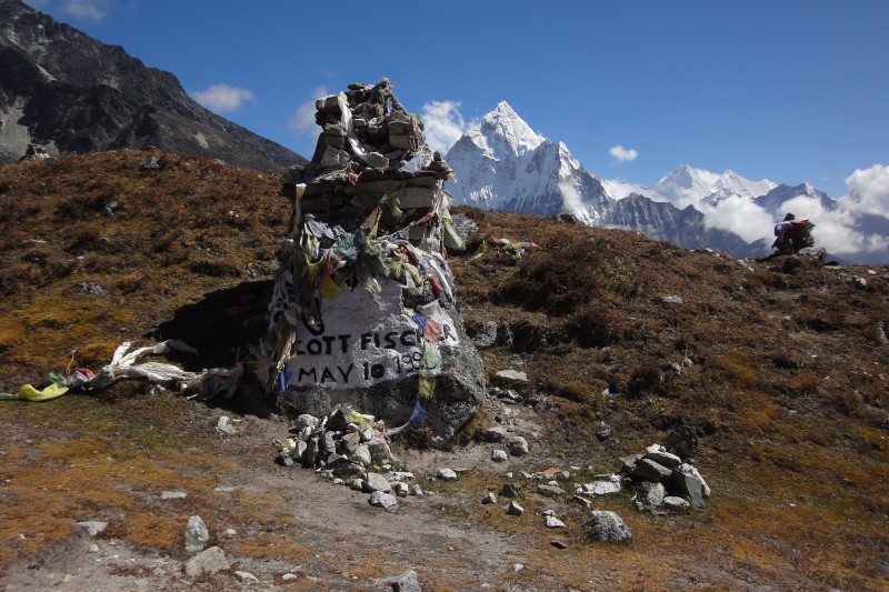
 High alititude graveyard")
 Mt. Crumpet")
 Pumori and Khumbu Glacier")
 Mt. Everst from Kala Patthar")
 Ama Dablam above Pangboche")
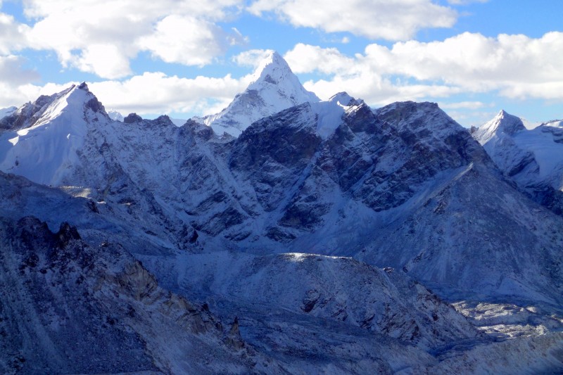
 Nuptse")
 On the trail to Kala Patthar")
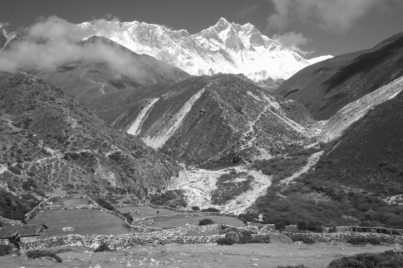
 More Himalayan splendor")
 Ama Dablam base camp")
 At 16,000' on Ama Dablam's SW ridge")
 Kang Tega")
 Everest Base Camp on a snowy morning")
 Just another 7,000 meter peak")
 Namche Bazaar")
 Shangri-La is back there somewhere")
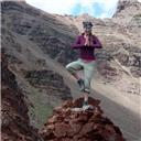
 A sherpa with a sense of style")
 Tangboche")
 Camp at Gorak Shep")
 Nepalese children")
 Everest and the Khumbu Ice Fall")
 Porter carrying an incredible load")
 Raging river")
 Kathmandu")
 One last image")