Download Agreement, Release, and Acknowledgement of Risk:
You (the person requesting this file download) fully understand mountain climbing ("Activity") involves risks and dangers of serious bodily injury, including permanent disability, paralysis, and death ("Risks") and you fully accept and assume all such risks and all responsibility for losses, costs, and damages you incur as a result of your participation in this Activity.
You acknowledge that information in the file you have chosen to download may not be accurate and may contain errors. You agree to assume all risks when using this information and agree to release and discharge 14ers.com, 14ers Inc. and the author(s) of such information (collectively, the "Released Parties").
You hereby discharge the Released Parties from all damages, actions, claims and liabilities of any nature, specifically including, but not limited to, damages, actions, claims and liabilities arising from or related to the negligence of the Released Parties. You further agree to indemnify, hold harmless and defend 14ers.com, 14ers Inc. and each of the other Released Parties from and against any loss, damage, liability and expense, including costs and attorney fees, incurred by 14ers.com, 14ers Inc. or any of the other Released Parties as a result of you using information provided on the 14ers.com or 14ers Inc. websites.
You have read this agreement, fully understand its terms and intend it to be a complete and unconditional release of all liability to the greatest extent allowed by law and agree that if any portion of this agreement is held to be invalid the balance, notwithstanding, shall continue in full force and effect.
By clicking "OK" you agree to these terms. If you DO NOT agree, click "Cancel"...
Chiefs Head Peak via Sandbeach Lake and Mount Orton
Route: SE Slopes via Mount Orton Round trip distance: ~15 miles Round trip elevation gain: ~5300 feet Car to car time: a touch more than 10 hours Party: Me and Andy
After hiking with a fairly static set of partners over the last few years, I've recently had the opportunity to meet up with some new people and share some very enjoyable days in the mountains. Andy was one of the first people to respond to my "looking for partners" post here on 14ers.com, and we immediately hit it off. Our first outing was to the Indian Peaks to do "Quarter to 5 Peak", the fun north ridge of Neva and Mount Jasper. We followed that up with an attempt of Mount Meeker that we aborted due to wind and then last week, seeking a lower/easier day, we did a tour of Frozen, Green and Blue Lakes in upper Glacier Gorge.
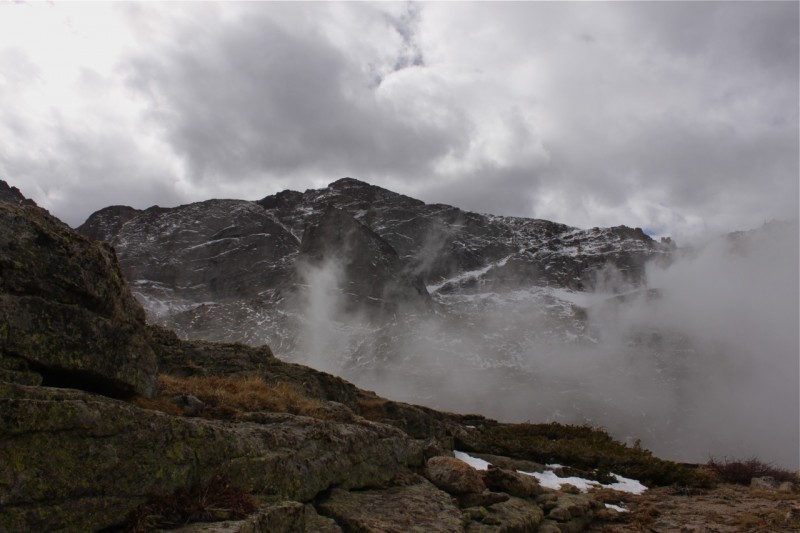
While I'd visited Black Lake a couple of times before, this was the first time Andy or I had been any higher and we were both blown away by the scenery. Longs, Pagoda and McHenrys were certainly all impressive, but it was Chiefs Head that really grabbed my attention. We'd previously discussed Chiefs Head as a possibility for the nebulous future, but the way it called to us, particularly from Blue Lake, demanded that we figure out a way to summit it as soon as possible.
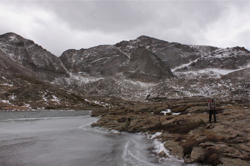
From 10/24/12 - Andy at Blue Lake
From 10/24/12
Four days later, Andy emailed me proposing Chiefs Head from Sandbeach Lake on Tuesday. Thanks to underemployment's innate flexibility and a relatively mild weather forecast, I was quickly in.
Upon arriving at they Lyons park and ride on Tuesday morning, I transferred my stuff to Andy's car and we made our way to the Sandbeach Lake Trailhead. It should be noted that the Wild Basin entrance station was not yet staffed when we arrived shortly before seven.
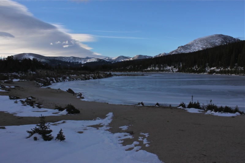
We made good time up the pleasant if unremarkable trail to Sandbeach Lake with the first 1.5 miles or so being dry and the remainder being packed snow interspersed with icy patches. The sandy shore provided a fine setting for adjusting layers and having a quick snack (a currant-toffee cookie for me - cleaning out the freezer has never been more delicious).
This is why we try not to lose our ND grad filters
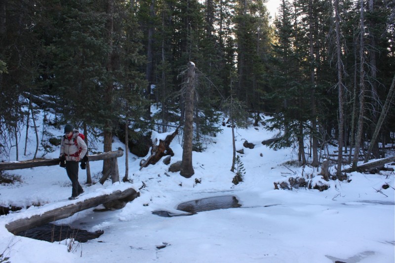
Stream crossing on the way to the lake
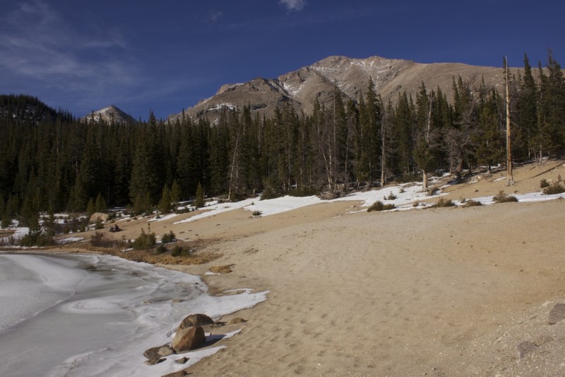
Sandbeach Lake
From the northern shore of the lake we set out towards Mount Orton through snow ranging from ankle to calf deep. For the first portion of this ascent we were able to roughly follow the snowy shadow of a social trail up to a cluster of cairns maybe a third of the way up the ridge. From here we ended up heading east through tree and snow covered slopes to gain the ridge slightly south of Orton, but on the way down we discovered that we would have been able to ascend open, grassy slopes directly to Orton had we instead ventured slightly north. Once on the ridge crest, we opted not to bypass Orton and instead scampered up to its summit and paused to ponder the remaining grunt up to Chiefs Head.
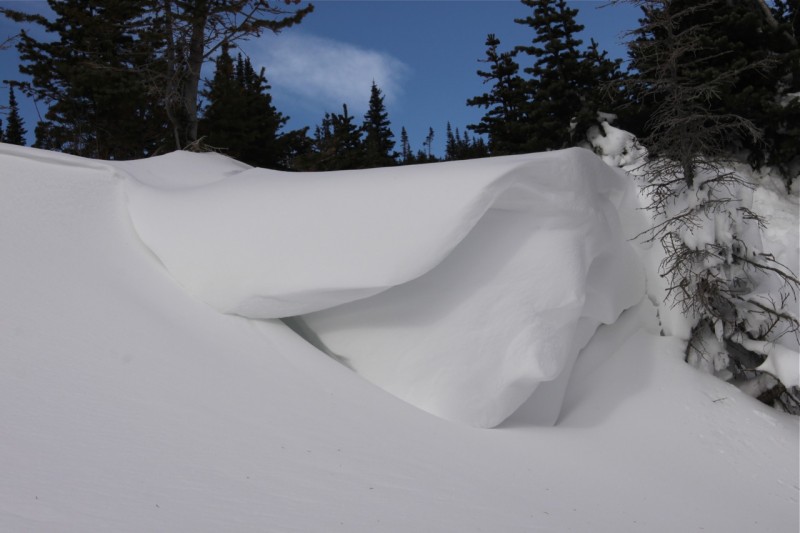
Snow art
Not a terrible place to be
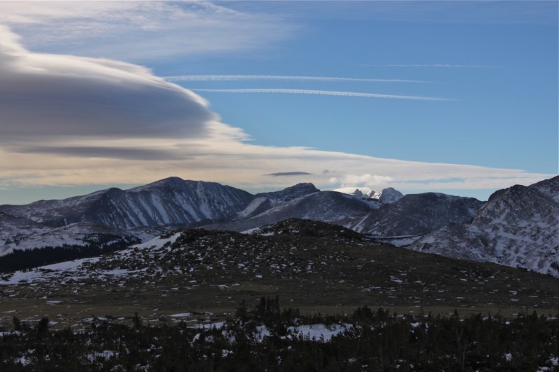
Looking south towards the Indian Peaks
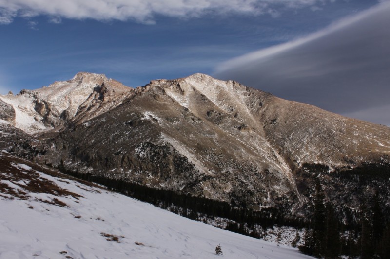
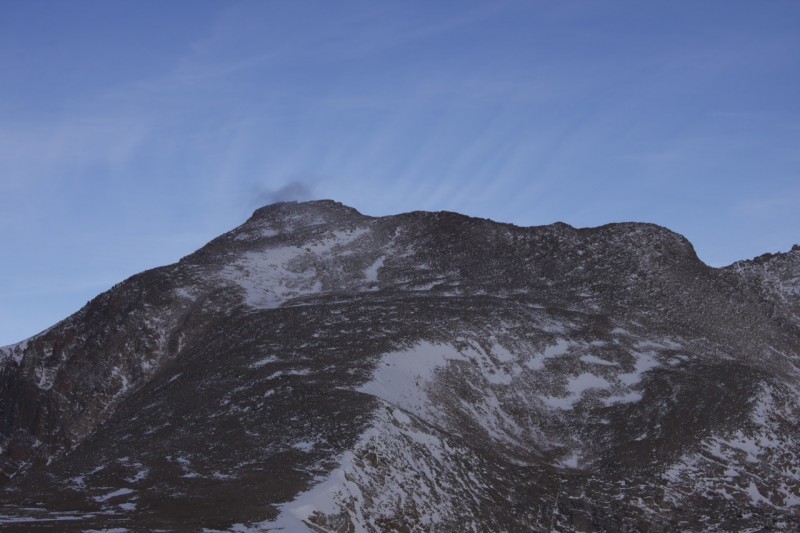
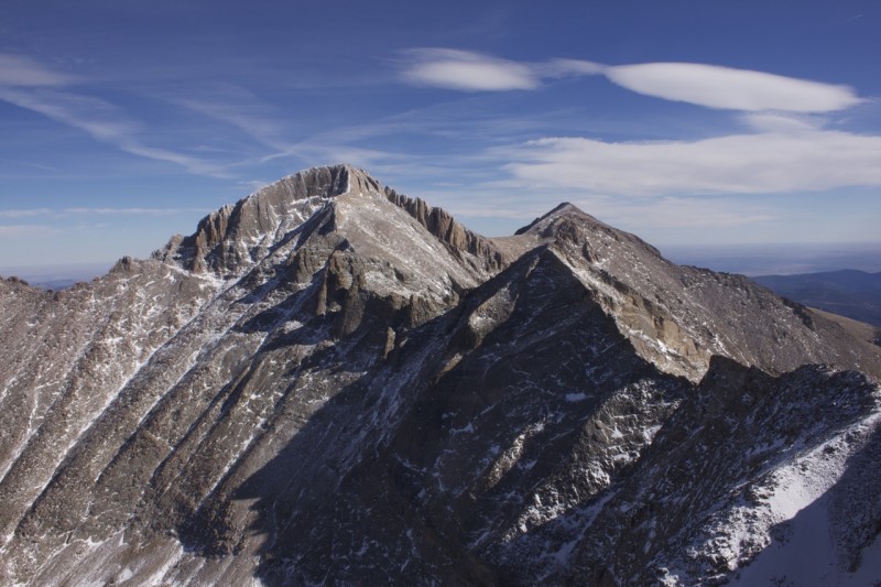
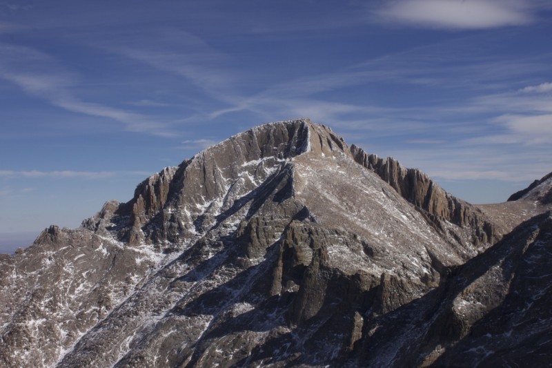
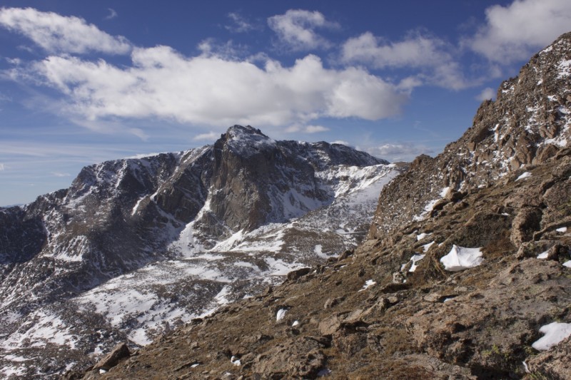
I suppose I see where the name comes from
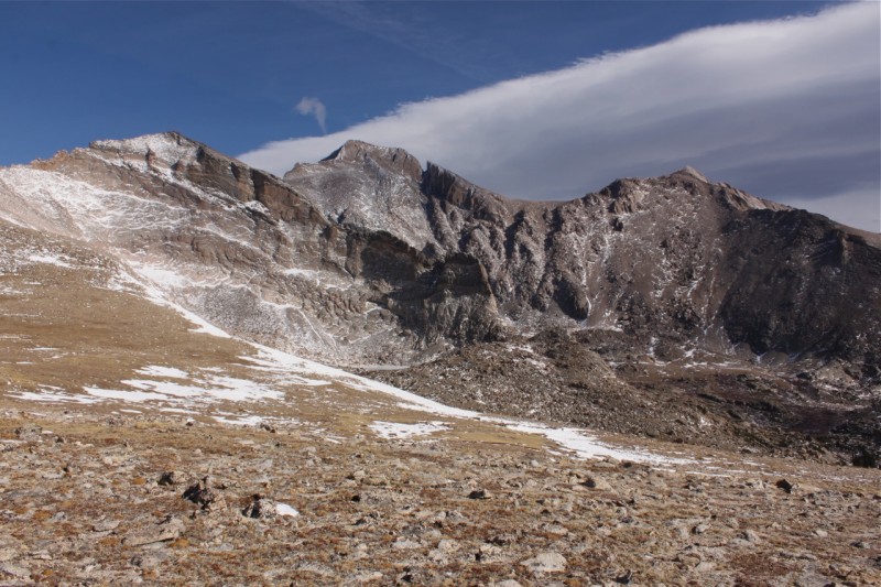
From this point, there's really not much to say about the remainder of the route. Our ascent up one of several reasonable looking lines was anything but exciting, however the views were decidedly not terrible.
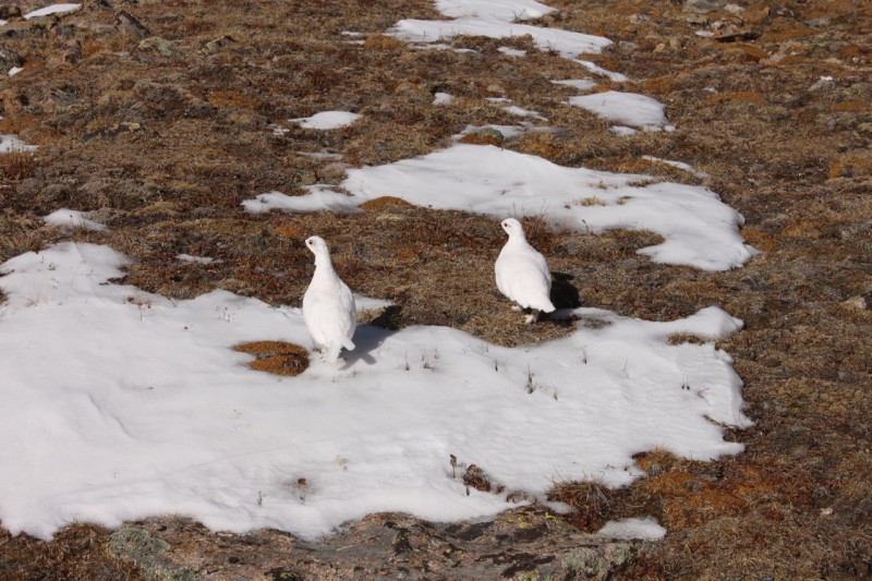
I would have blindly walked within a couple feet of these if they hadn't moved
Pagoda's rugged west ridge
A nice excuse for a breather
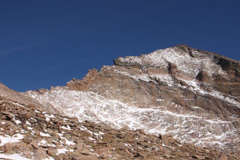
We hit the ridge a few hundred feet east of the summit so we slowly picked our way past several annoying false summits. This was the only part of the day where we were fully exposed to the predicted "breeze" with a bonus of being pelted with blobs of snow seemingly flying up out of Glacier Gorge.
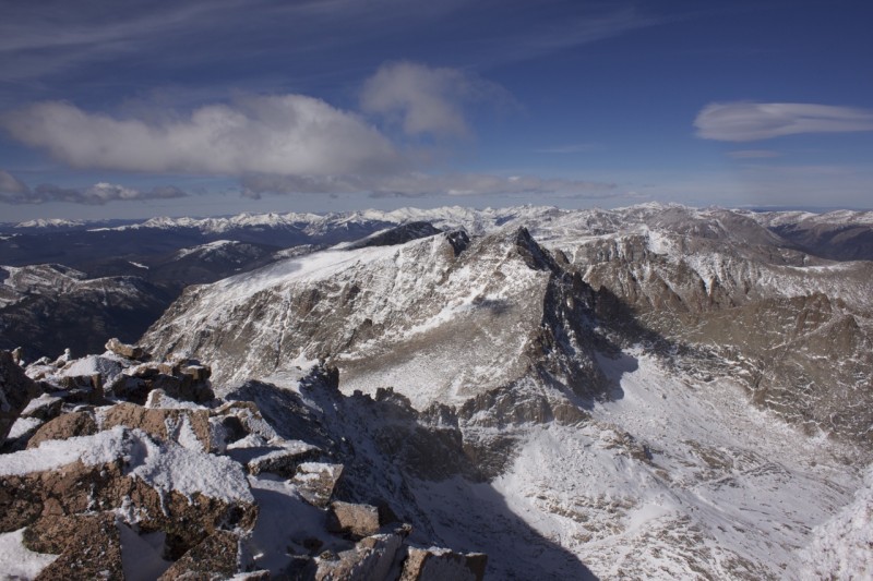
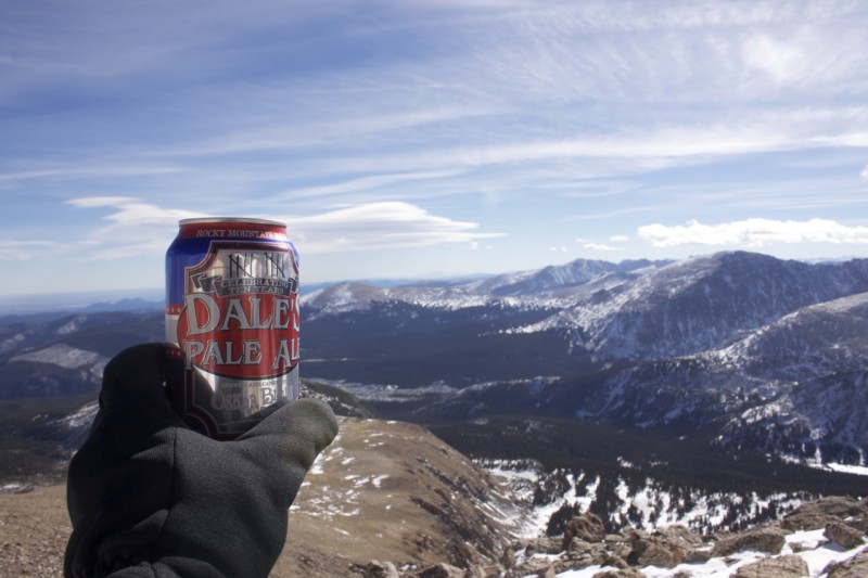
Eventually we reached the true summit where the register was unfortunately wet and its pages were frozen together. Luckily, the views remained not terrible. We spent a few minutes taking pictures before retreating down out of the wind.
Still not terrible
With a little more zoom, in case anybody is interested
Andy approaches the summit
Hard to believe we were way down there less than a week ago
Looking towards McHenrys
Mount Alice
Our descent was relatively uneventful, with nice snow conditions for plunge stepping below Mount Orton. Back at Sandbeach Lake we saw a trio of hikers, the only other people we would see all day. The remaining forested trail to the car was slightly tedious and fairly slushy, but interesting conversation helped greatly.
Life ain't bad
On the way down, Mount Alice demands attention
Sandbeach Lake in the afternoon
All in all, it was a pretty nice day with good company in a spectacular setting. Getting Chiefs Head done before shorter days and snowier conditions set in was very satisfying and I am already looking forward to bagging some of the surrounding peaks next year (or later this fall if the dry conditions persist). Thanks Andy for the great day, and thank you all for reading!
Thumbnails for uploaded photos (click to open slideshow):
Nice to see new perspectives on Wild Basin--it's great this time of year with the lack of people! Thanks for the picture of Blue Lake-haven't been up there yet.
Thank you all for the kind words! 11/1/2012 7:57pm
geojed: I totally agree - been up three times already this year and still have so much left to explore
dillonsarnelli: thanks - it really is a great mountain with its spectacular views, imposing north face and wide variety of routes.
Alpine: Alice is indeed spectacular if somewhat reclusive. Definitely one to visit soon.
Floyd: Having seen that shot in several trip reports (including yours), I felt that a little imitation was appropriate. I do believe that trail runners plus gaitors would have been fine, but I was in backpacking boots as I've pretty well destroyed my trail runners.
ctlee: Blue Lake is well worth the trip, as are Frozen and Green. I will certainly return there some summer as we were unable to properly evaluate the accuracy of the lake names this time with both Blue and Green being more frozen than was Frozen, if that makes any sense.
Wooderson: thanks - the construction on the road up to bear lake made me initially hesitant to go up there but it ended up being totally worth it. Tough to beat, indeed.
Thanks for the great report and route info re: my PM. And the pics from a less visited area were not terrible either. Congrats!
Caution: The information contained in this report may not be accurate and should not be the only resource used in preparation for your climb. Failure to have the necessary experience, physical conditioning, supplies or equipment can result in injury or death. 14ers.com and the author(s) of this report provide no warranties, either express or implied, that the information provided is accurate or reliable. By using the information provided, you agree to indemnify and hold harmless 14ers.com and the report author(s) with respect to any claims and demands against them, including any attorney fees and expenses. Please read the 14ers.com Safety and Disclaimer pages for more information.
Please respect private property: 14ers.com supports the rights of private landowners to determine how and by whom their land will be used. In Colorado, it is your responsibility to determine if land is private and to obtain the appropriate permission before entering the property.


 From 10/24/12 - Andy at Blue Lake")
 From 10/24/12")
 This is why we try not to lose our ND grad filters")
 Stream crossing on the way to the lake")
 Sandbeach Lake")
 Snow art")
 Not a terrible place to be")
 Looking south towards the Indian Peaks")
 I suppose I see where the name comes from")
")
 I would have blindly walked within a couple feet of these if they hadn't moved")
 Pagoda's rugged west ridge")
 A nice excuse for a breather")
 Still not terrible")
 With a little more zoom, in case anybody is interested")
 Andy approaches the summit")
 Hard to believe we were way down there less than a week ago")
 Looking towards McHenrys")
 Mount Alice")
 Life ain't bad")
 On the way down, Mount Alice demands attention")
")
 Sandbeach Lake in the afternoon")


