"Wigwam Park Peak" : 11,180'
Wigwam Tower Exploration : ~10,806'
UN 10620 : 10,620'
Trip Mileage : 13.5 Miles
Trip Elevation : 3,900'
Trip Time : 8.25 Hours
Just two weeks prior, Brian Thomas, vonmackle (Cameron) and I spent a great day out collecting a couple of the unnamed peaks anchoring the ridge north of Refrigerator Gulch. We ran out of time to do the full sweep all the way to Wigwam Park Peak, meaning I was forced to leave the poor little thing as an orphan. With iffy weather coming in for this weekend, I figured it was a good time to run back out and grab it. Brian and Clay were both in for another LCW bushwhack romp. Since it felt like a long way to go for just this little 11er, we decided to add in a side trip to Wigwam Tower and UN10620 on the way down.
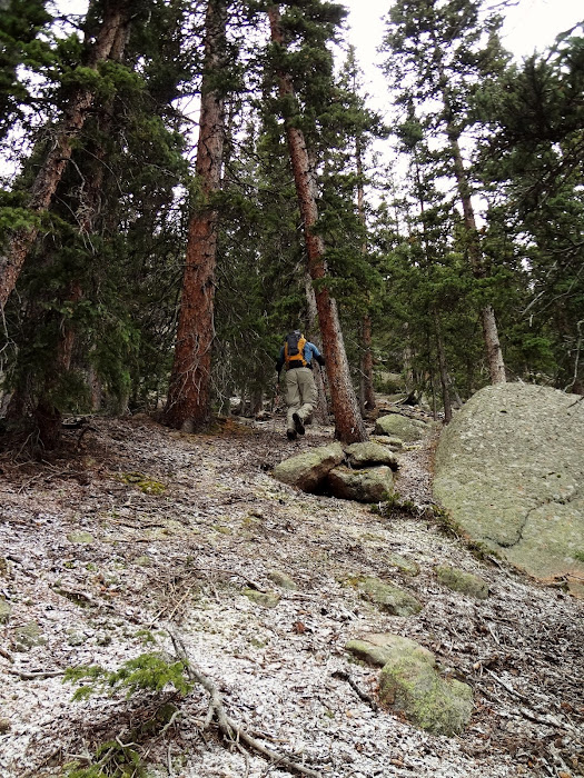
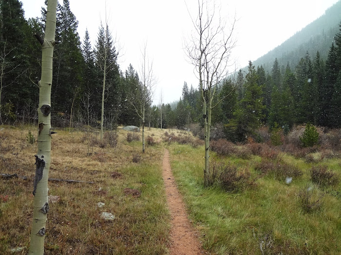
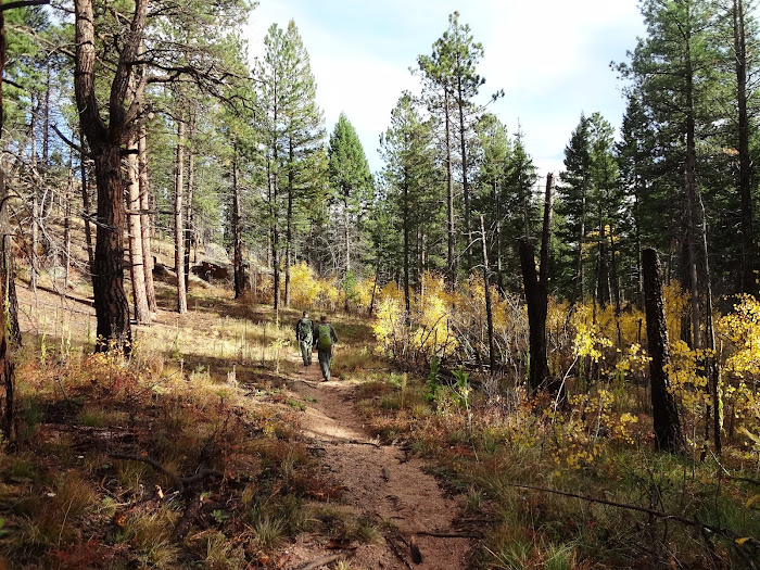
We started from the Wigwam Trailhead, about 1.5 hours from Denver. By the time we were packed up and on the trail, it was around 8:00AM. The weather was clear, and the temps were nice for hiking at around 40-45 degrees. The first 3.5 miles follows the Wigwam Trail as ascends west bound towards Wigwam Park. The trail rides the border of the burn area just briefly, then follows the creek up. The trail nice and defined, and the mellow ascent (~500 per mile) makes it a nice warm up for the day ahead.
We arrived in Wigwam Park (9,500') and took a quick break at the Goose Creek/Wigwam Trail intersection...during which we noticed the first snow flakes of the day beginning to fall. Wigwam Park has a couple very impressive beaver dams. Unfortunately, of all the times I've been to this area I've yet to catch a peak at one of the critters. From the intersection, we followed the Goose Creek Trail south for less than a quarter mile, then angled SW and began the steep bushwhack up to the summit ridge of Wigwam Park Peak. The ridge is only .65 miles away, but over 1500' of gain is required. A good bit of huffing and puffing is needed here, although the terrain is quite clear of dead fall. As we ascended we started to come across a light layer of snow. By the time we hit the ridge top, the flakes really began to take shape. Although it is nice to go to the mountains without snowshoes, I'll admit I was happy to see the white stuff again. We made a quick detour to the north (untrue) summit (class 3), finally making our way south to the true center summit. (Class 2) We didn't relax for too long, as the wind was picking up and making for a chilly summit.

Starting out along Wigwam Creek, riding the edge of the burn area from the Hayman fire.

The trail is nice all the way to Wigwam Park, 3-3.5 miles in from the trailhead.

Aspen trees hanging on to their fall colors along the Wigwam Trail.

Wigwam Trail.

Arriving at the beaver dams in Wigwam Park. This is also the intersection of Wigwam Trail and the Goose Creek Trail. The slope we would be ascending is on the far left.

Wigwam Park.

Starting the steep bushwhack from Wigwam Park to Wigwam Park Peak.

Looking back down, snow approaching Buffalo Peak in the distance.
Here comes the white stuff! Near 11K, almost to the top of the .65 mile, 1600' slope.

Topping out on the north summit, weather blocking out the views of McCurdy Mountain in the distance.

"True" summit of Wigwam Peak from the north summit.
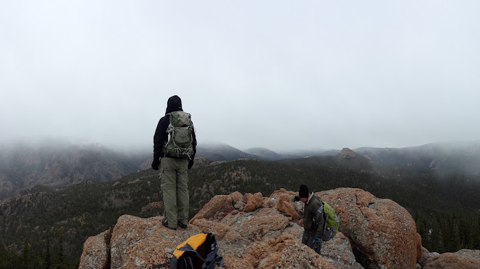
Derek and Brian on the summit of Wigwam Park Peak, McCurdy, UN11180, UN11230 and UN10926 all in the distance.

UN 10620 (little bump on the distant ridgeline) patiently awaiting our arrival.
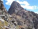
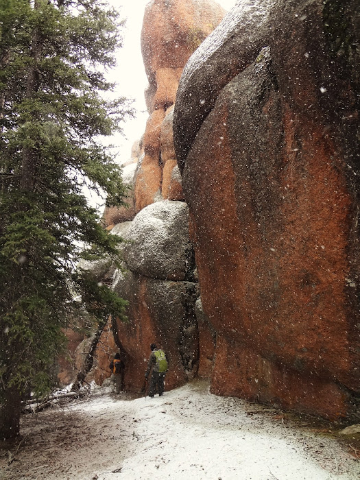
To make a loop out of the day, we decided to follow Wigwam Park Peak's south ridge as it dropped down to Keystone Buttress and Wigwam Tower. These two formations are not actual peaks, but are known for technical routes on their east faces. Although we did not have any gear, I wanted to check out the western side of the formations and see if there were any casual (< class 5) routes to ascend. Making it off of Wigwam Park Peak and to the base of the formations was an interesting trek, passing around some massive walls that almost seemed like a maze. We were able to find easy ways through the area, keeping the elevation gain/loss at a minimum. We caught the first west side views of Wigwam Tower and Keystone Buttress through the snow as we descended towards them. It was quite obvious even from a distance that Keystone Buttress would be impossible without gear, but we thought Wigwam Tower might be climbable. We spent 20-30 minutes playing around the area, but never found a route up that we deemed safe enough to try with wet rock. Playing it safe, we headed west towards UN10620.
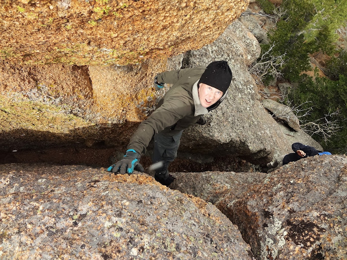
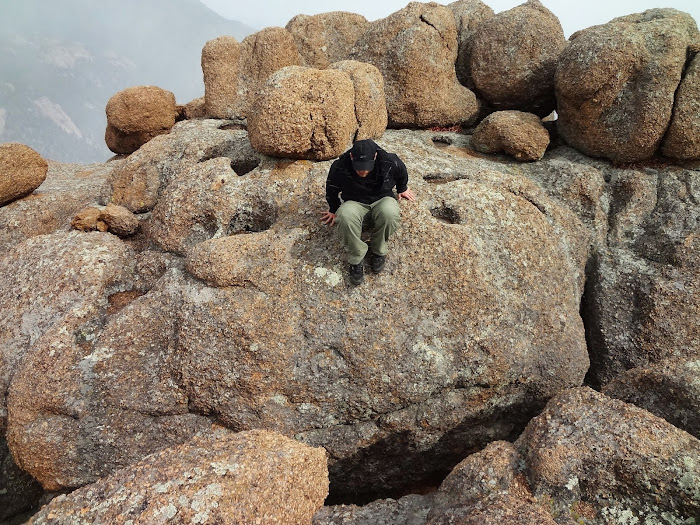
I had already climbed UN10620 a couple years prior, but the summit area was so much fun that I was excited to head up again. We took a quick break in the meadow area between Wigwam Tower and UN10620, then ascended the 600' west up to the summit rocks. The 600' isn't too steep, but the dead fall here is pretty bad. Worse than I remembered, in fact. (Sorry about that, guys.  ) To reach the true summit, there are two options (that I have found, at least) and both are accessible from the east side. One is a "boost" option, which is awkward but keeps the difficulty at class 3. The other is a mini chimney that is a bit more difficult, but not very exposed. The best plan is to use the chimney as the ascent, then the boost as the descent. There are two leaps of faith up just below the true summit, but these are avoidable if you search around a bit. The weather was better on this summit than on Wigwam Park Peak, so we spent a bit more time here. (We spent a little while trying to reach the summit register which had fallen about 15-20 feet down a crack, but we were not successful.) Even for my second ascent, I really enjoyed this little peak. I could even see myself coming back for a third trip. ) To reach the true summit, there are two options (that I have found, at least) and both are accessible from the east side. One is a "boost" option, which is awkward but keeps the difficulty at class 3. The other is a mini chimney that is a bit more difficult, but not very exposed. The best plan is to use the chimney as the ascent, then the boost as the descent. There are two leaps of faith up just below the true summit, but these are avoidable if you search around a bit. The weather was better on this summit than on Wigwam Park Peak, so we spent a bit more time here. (We spent a little while trying to reach the summit register which had fallen about 15-20 feet down a crack, but we were not successful.) Even for my second ascent, I really enjoyed this little peak. I could even see myself coming back for a third trip.

Brian working his way down the south slopes of Wigwam Park Peak towards Wigwam Tower as the snow starts to pick up.
Interesting wall maze just south of the summit.

Wigwam Tower and Keystone Buttress appear out of the white.

Exploring the area, trying to find ascent options. For 2 bonus points, find Clay.

Southern wall of Wigwam Tower.

Descending through aspens from Wigwam Tower to the creek.

Skies clear up as we arrive at the creek, Keystone Buttress and Wigwam Tower looming in the distance.

Refuel time.

Clay in front of UN10620's summit area.

Imposing walls separating us from an easy ascent.

Brian and Clay on the "boost" option.
Brian on the "chimney" option.

Summit of 10620.

Wigwam Tower and Keystone Buttress (L) and Wigwam Park Peak (R) from UN10620.

Clay over a "leap of faith".
Derek choosing a landing spot before leaping.

My odd gift of being able to find balloons in wilderness areas continues on the descent. If only I could HARNESS this power....
Snow reappearing as we descend.
...and disappearing again, just shy of the trailhead.
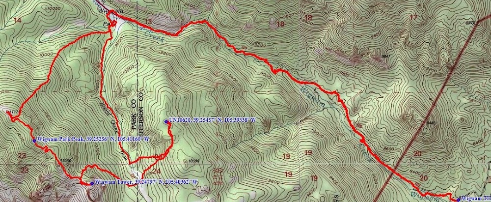
Final map of our day.
For our descent, we descended back down the 600' of annoying dead fall and met up with the Goose Creek Trail. We followed the trail north about 1.5 miles until we reached Wigwam Park. From there, it was an easy stroll back out along the Wigwam Trail. We saw two backpackers a couple miles from the trailhead, but that was it during the course of the day. Surprising, because now is definitely a great time of year to get out and enjoy the LCW!
--D
My GPS Tracks on Google Maps (made from a .GPX file upload):
View on the Map
|