Download Agreement, Release, and Acknowledgement of Risk:
You (the person requesting this file download) fully understand mountain climbing ("Activity") involves risks and dangers of serious bodily injury, including permanent disability, paralysis, and death ("Risks") and you fully accept and assume all such risks and all responsibility for losses, costs, and damages you incur as a result of your participation in this Activity.
You acknowledge that information in the file you have chosen to download may not be accurate and may contain errors. You agree to assume all risks when using this information and agree to release and discharge 14ers.com, 14ers Inc. and the author(s) of such information (collectively, the "Released Parties").
You hereby discharge the Released Parties from all damages, actions, claims and liabilities of any nature, specifically including, but not limited to, damages, actions, claims and liabilities arising from or related to the negligence of the Released Parties. You further agree to indemnify, hold harmless and defend 14ers.com, 14ers Inc. and each of the other Released Parties from and against any loss, damage, liability and expense, including costs and attorney fees, incurred by 14ers.com, 14ers Inc. or any of the other Released Parties as a result of you using information provided on the 14ers.com or 14ers Inc. websites.
You have read this agreement, fully understand its terms and intend it to be a complete and unconditional release of all liability to the greatest extent allowed by law and agree that if any portion of this agreement is held to be invalid the balance, notwithstanding, shall continue in full force and effect.
By clicking "OK" you agree to these terms. If you DO NOT agree, click "Cancel"...
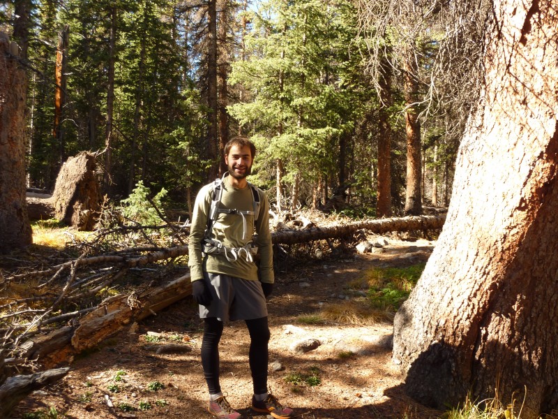
Although my thoughts have been turning to winter, the beautiful fall weather offered a chance to explore another 14er without resorting to snowshoes/skis yet, so I recruited mattb528 to hike/run San Luis Peak in the San Juans.
Matt
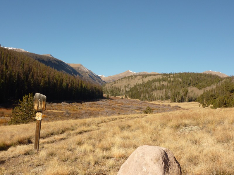
We spent the night at Gunnison and set out for the trailhead on Saturday morning. The drive from Gunnison was surprisingly long but mostly on good dirt roads that can be navigated by any 2WD with careful driving. Our hike began up the scenic Stewart Creek drainage.
San Luis trailhead
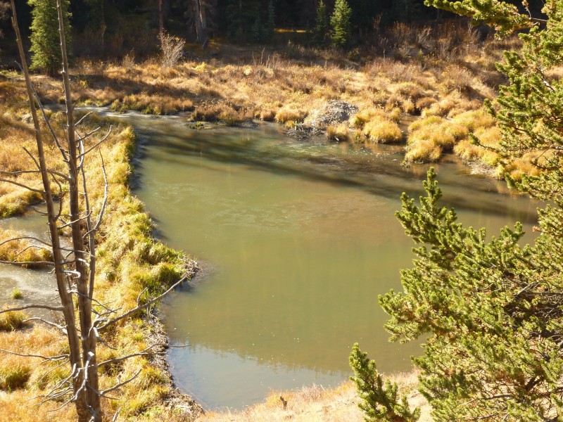
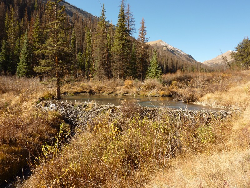
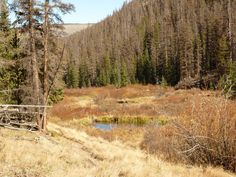
The trail gently inclined beside Stewart Creek, which was dammed by a series of scenic beaver dams.
Stewart Creek beaver dam
Beaver dam
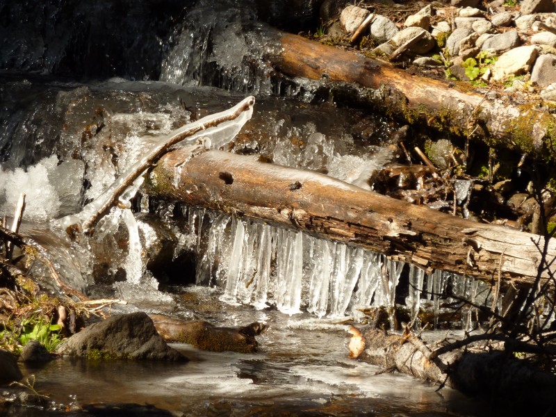
Eventually, the trail crossed Stewart Creek, with some early season ice showing in shaded areas.
Icy Stewart Creek
Icicles
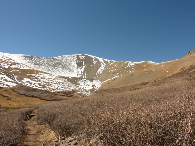
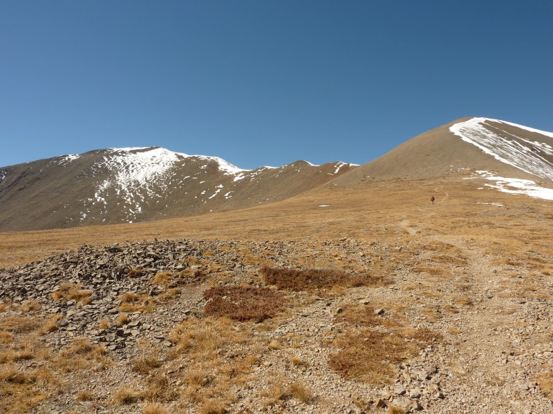
After a few miles of easy hiking, we saw the slope to mount the ridge to the summit. The switchback trail which ascends the left slope in the picture, was the only steep hiking in the day. There was a bit of snow on the trail but it was easily navigated without extra traction.
Slope to the summit ridge
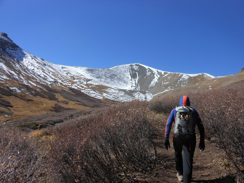
Dave headed up the trail
The summit (on the left) and the rest of the route was displayed after we topped the slope. We met another 14er climber, AlabamaTLC on his way down. We would be chatting with him later back at the trailhead. (nice to meet you!)
Summit ridge
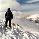
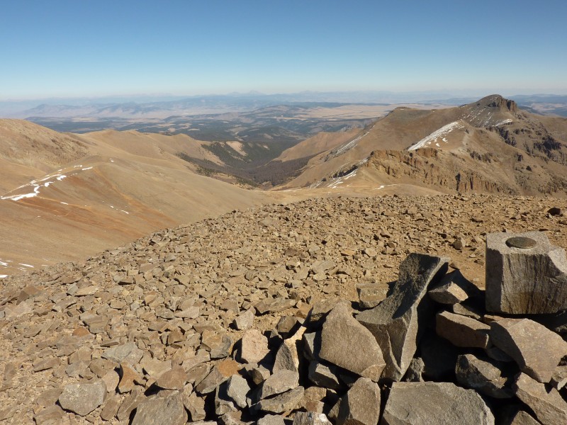
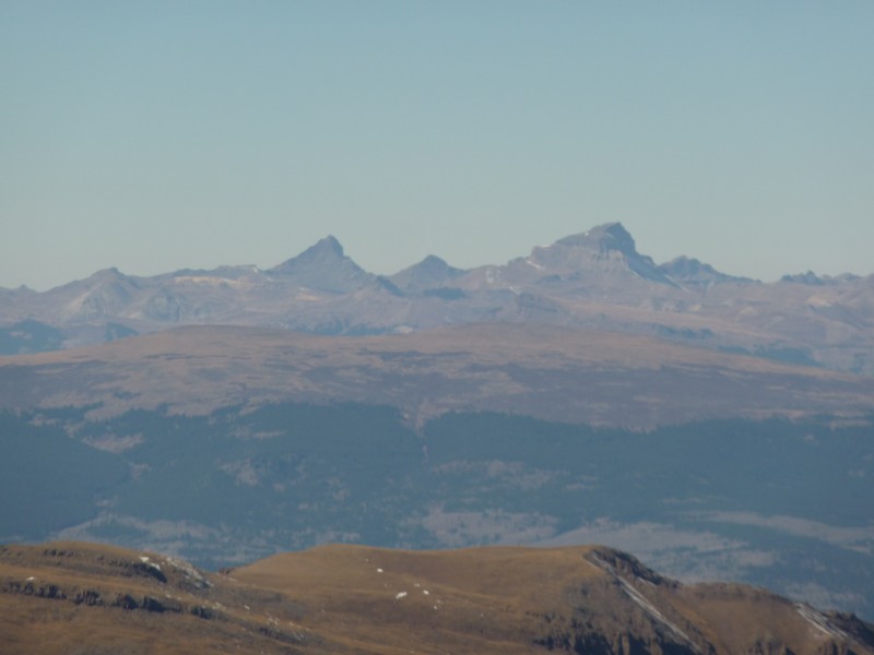
The remainder of the hike went quickly, with a pause to cover up from the increasing winds. The summit was sheltered from the wind and provided us with great views including Uncompahgre & Wetterhorn in the distance. The survey marker on San Luis is on a loose block that resembles a concrete cinder block. That was a new sight for me.
Summit block
Uncompahgre & Wetterhorn
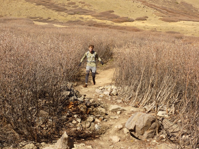
We enjoyed an easy trail run on the gentle descent.
Matt showing some crazy trail running speed
After another tour of the many beaver dams, we chatted up AlabamaTLC and then retired to Gunnison for dinner. What a great hike to wrap up the fall!
More beaver dams
Thumbnails for uploaded photos (click to open slideshow):
Some of the beaver dams out there are quite the engineering feat. I remember seeing some along Cochetopa Creek that were terraced and being so fascinated by them. Great report and pictures!
Enjoyed chatting with you and Matt... 10/12/2012 2:42am
Dave, nice job on the trip report and great pictures. If it had not been for that wind, the day would have been perfect!! Regardless, the 5 of us that were out there that day enjoyed every last second. Thanks for the mention within the report. It was very kind of you. I still cannot believe how FAST you and Matt got up to the summit, from the top of the slope/first saddle, and down to the trailhead, arriving only 10 minutes behind me. I should have taken a picture of you and Matt at the trailhead, upon your return...what a sight. Again, nice job and I hope to run across you and Matt again.
I was the guy in orange coat with gold and black dogs (Grace and Molly). Met you just above timberline; I was with MichaelJ. Thanks for sharing the good pics.
Firey Bear, the trail up San Luis was a fun, mild incline for running (better with a lighter pack). You gotta try a run with Matt. He was killin' me, but the scenery allowed me to ignore him and enjoy myself. :lol:
Glad the TR was helpful. San Luis was very enjoyable for us, I hope your hike is fun too. :)
Caution: The information contained in this report may not be accurate and should not be the only resource used in preparation for your climb. Failure to have the necessary experience, physical conditioning, supplies or equipment can result in injury or death. 14ers.com and the author(s) of this report provide no warranties, either express or implied, that the information provided is accurate or reliable. By using the information provided, you agree to indemnify and hold harmless 14ers.com and the report author(s) with respect to any claims and demands against them, including any attorney fees and expenses. Please read the 14ers.com Safety and Disclaimer pages for more information.
Please respect private property: 14ers.com supports the rights of private landowners to determine how and by whom their land will be used. In Colorado, it is your responsibility to determine if land is private and to obtain the appropriate permission before entering the property.


 Matt")
 San Luis trailhead")
 Stewart Creek beaver dam")
 Beaver dam")
 Icy Stewart Creek")
 Icicles")
 Slope to the summit ridge")
 Summit ridge")
 Summit block")
 Uncompahgre & Wetterhorn")
 Matt on the summit")
 Dave's summit pic")
 Matt showing some crazy trail running speed")
 Dave headed up the trail")
 More beaver dams")