Download Agreement, Release, and Acknowledgement of Risk:
You (the person requesting this file download) fully understand mountain climbing ("Activity") involves risks and dangers of serious bodily injury, including permanent disability, paralysis, and death ("Risks") and you fully accept and assume all such risks and all responsibility for losses, costs, and damages you incur as a result of your participation in this Activity.
You acknowledge that information in the file you have chosen to download may not be accurate and may contain errors. You agree to assume all risks when using this information and agree to release and discharge 14ers.com, 14ers Inc. and the author(s) of such information (collectively, the "Released Parties").
You hereby discharge the Released Parties from all damages, actions, claims and liabilities of any nature, specifically including, but not limited to, damages, actions, claims and liabilities arising from or related to the negligence of the Released Parties. You further agree to indemnify, hold harmless and defend 14ers.com, 14ers Inc. and each of the other Released Parties from and against any loss, damage, liability and expense, including costs and attorney fees, incurred by 14ers.com, 14ers Inc. or any of the other Released Parties as a result of you using information provided on the 14ers.com or 14ers Inc. websites.
You have read this agreement, fully understand its terms and intend it to be a complete and unconditional release of all liability to the greatest extent allowed by law and agree that if any portion of this agreement is held to be invalid the balance, notwithstanding, shall continue in full force and effect.
By clicking "OK" you agree to these terms. If you DO NOT agree, click "Cancel"...
I got busy and it took me a while to get this report out (we hiked in August). But better late than never!
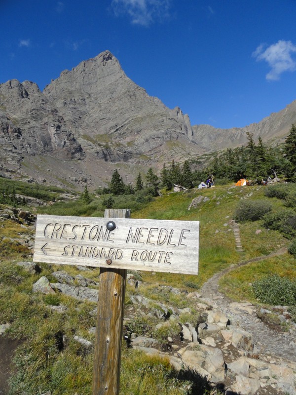
Day 1: Crestone Peak
Left Denver at 3:15pm
In bed at base camp by 11:30pm
Up at 4:30, hit the trail by 5:30am
Summit at 10:15
Back to camp by 2:30
From base to base (9 hours) including all breaks and summit time on top.
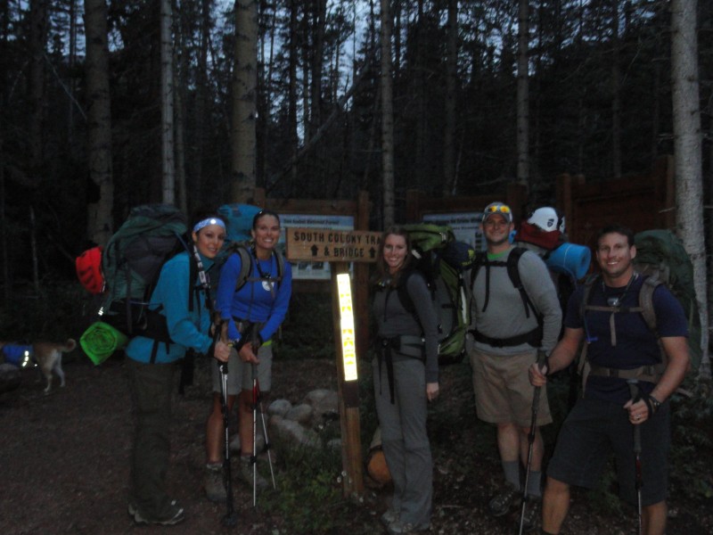
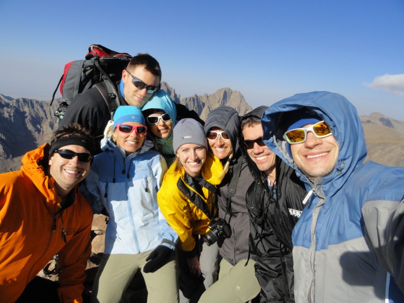
We met up with Kushrocks, Marie123, SummitKathy and seanadams1 in Westcliff and then drove up the 4wd South Colony road together. We drove our "Super" Subaru (as Ryan likes to call it) up the 4wd road with no major problems. We drive a Subaru Forester 2004. We did bottom out once coming back down, but it could have been avoided if we had crawled a little slower over that section. Good pic of everyone, too bad the pic was blurry
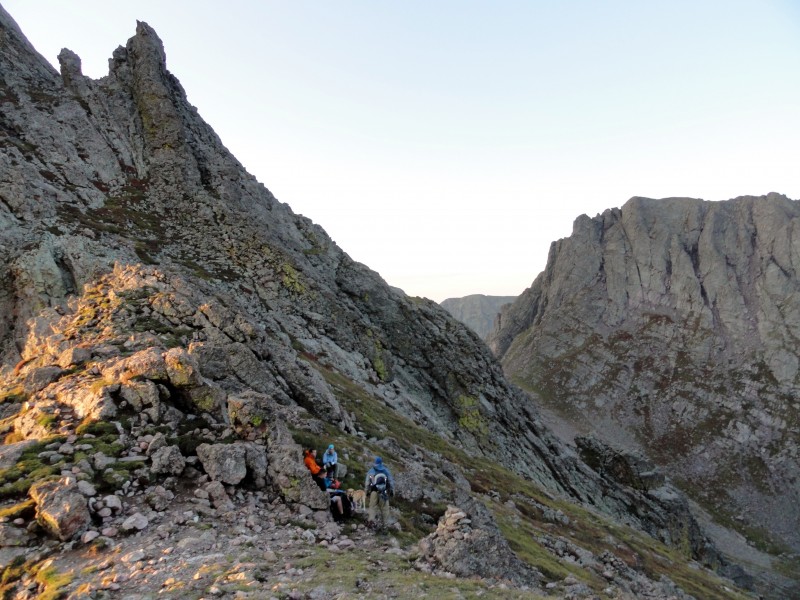
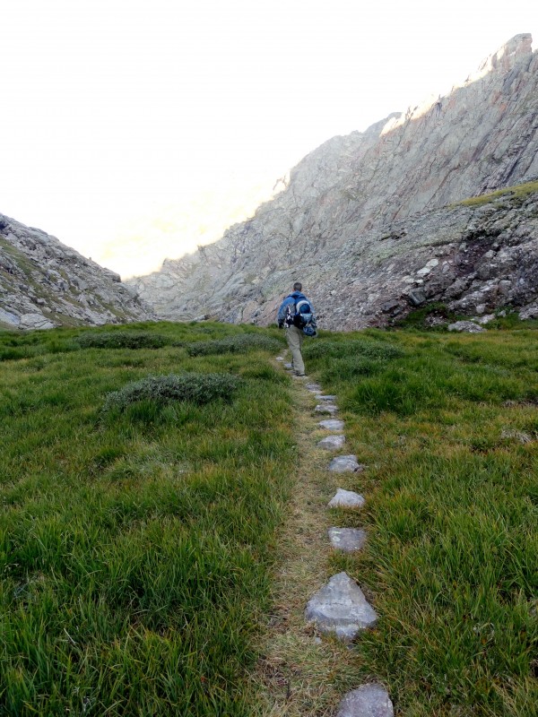
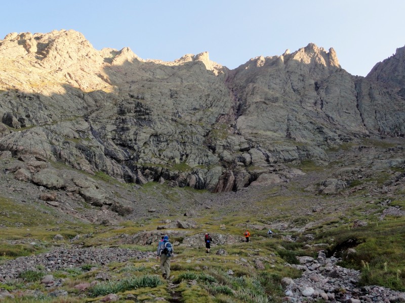
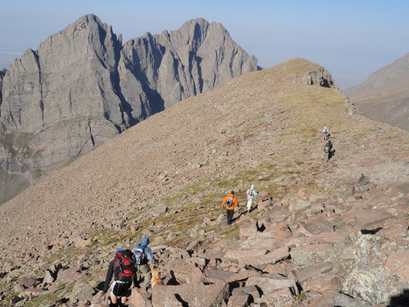
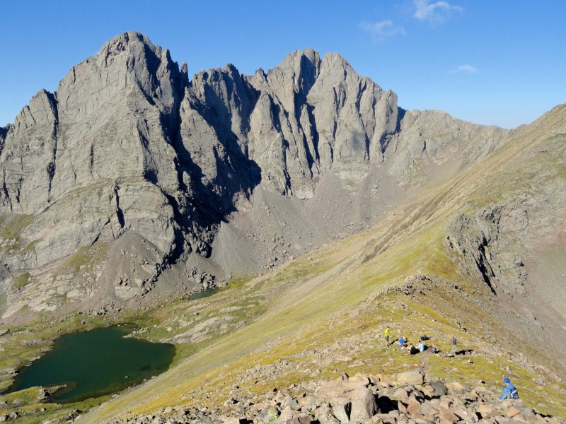
The 6 of us hiked in to base camp with headlamps. I can't remember how long it took us, but if I had to guess, it was about 2 1/2 hours. We quickly set up camp and filtered water and were in bed by 11:30 pm. The next morning we discovered that some of our food got nibbled on by rodents. Beware of the mice. They are sneaky little turds. Our food was in ziplocks, in a plastic bag, in our overnight pack and hanging in a tree and they still got in. No one else had a problem though and we still had enough food, so all was well. We hit the trail by 5:25am and it was a little slow going at first with a few of us having stomach sickness. We took it easy and made a goal to get over Broken Hand Pass first and then see how we were feeling. Once we descended into the valley after the pass, we pressed on as we were feeling a bit better than the morning. The valley by Cottonwood Lake went by quickly and provided us a chance to refuel and gain a quicker pace before we reached the red gulley.
stopping at the top of the pass to refuel Hiking to Cottonwood Lake The red gulley comes into view
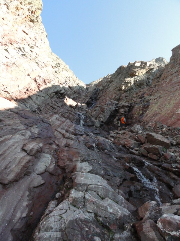
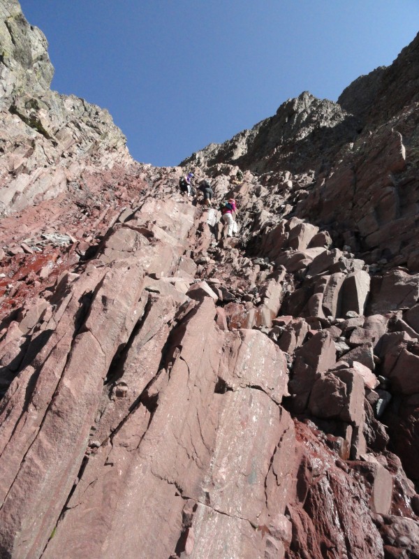
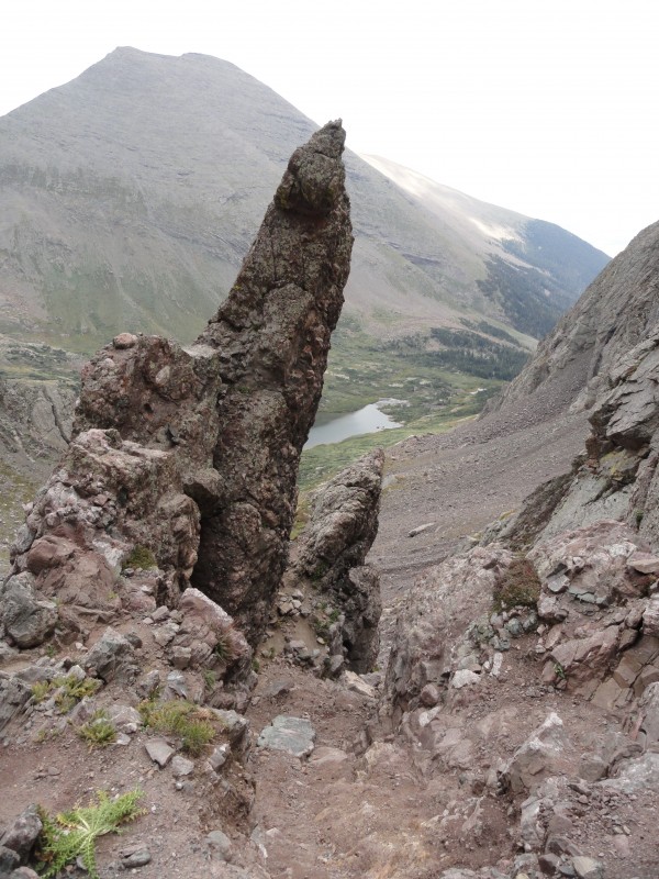
The Red Gulley...... to sum it up, LONG.
All in all I had the hardest time in our group. I can't quite remember, but I am guessing it took me about 3 hours to ascend. It felt like it would never end.
The first thing that took us all by surprise was how much water was running through it. It was more like a water fall and we couldn't figure out where it was all coming from.
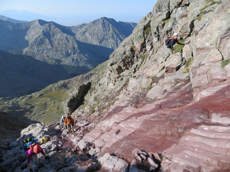
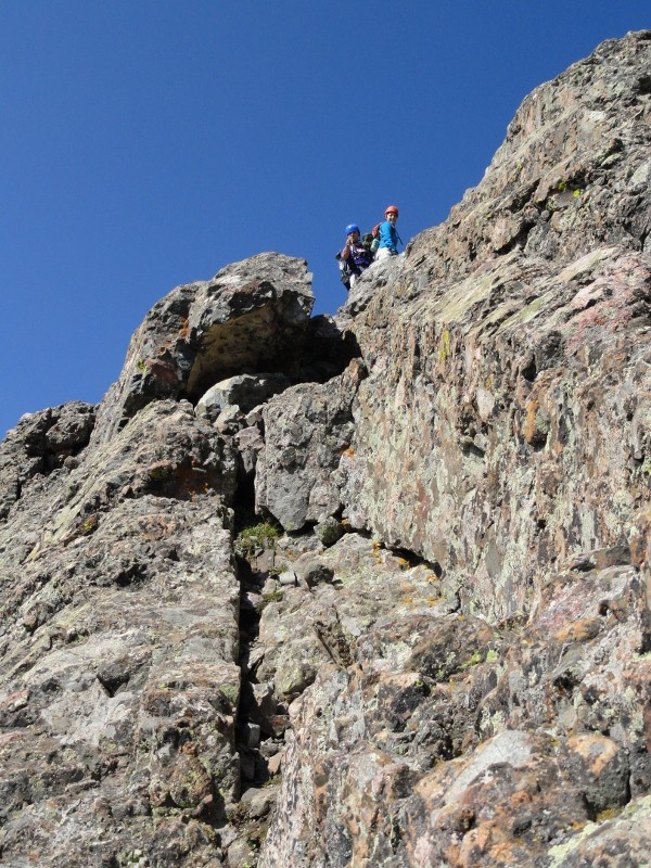
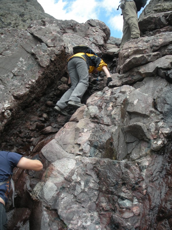
I feel like the red gulley could be broken into 3 sections. The first part was smooth rock and you encounter having to make a decision to choose either left up the smooth rock or right up a Class 3+ to low 4 short section. Our group seemed to be split down the middle on which side they preferred. I attempted the left smooth rock first but got scared off by not having anything to hold on to, so I returned back down to the right side and went up the climbing section. I think this is one of the harder moves on this route but it was very short. the smooth section with the crux climbing section on the right infront of Sean Photo by: kushrocks Taking a break
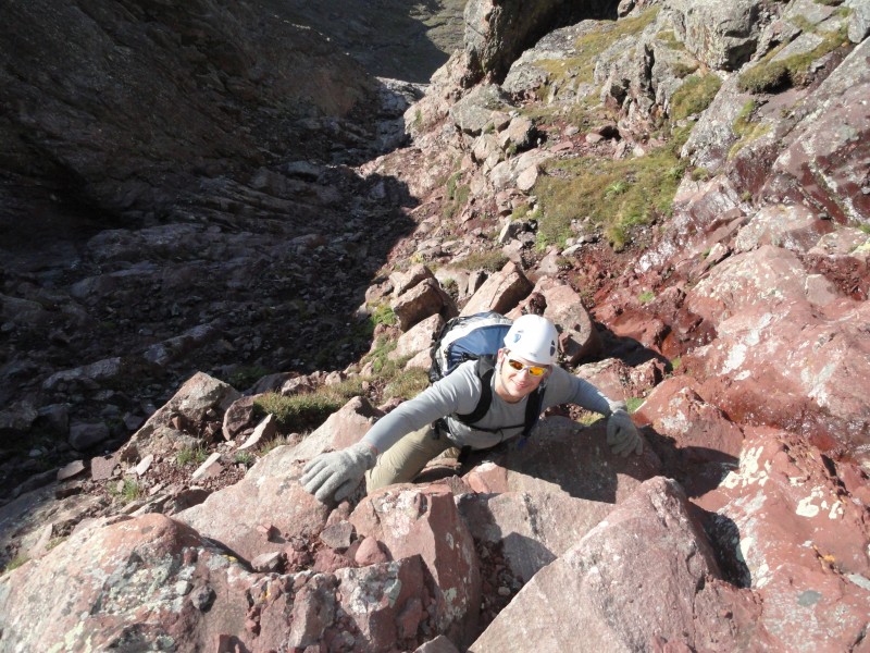
The second section seemed to be the steepest part of the gully with sections of looser rock on the right and sections of more stable rock on the left. We chose to scramble far left on good stable rock. This part to me seemed to be the most exposed part of the gulley. By exposure I mean steeper stable rock not airy cliffs. Matt climbing up a steeper section
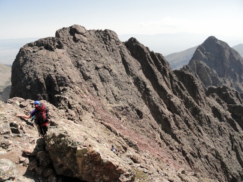
Once above the good scrambling, the third part of the gulley didn't seem as steep and it was just a matter of time and patience before finally topping out at the notch. I thought the top third of the gulley was the easiest part (but it was still not easy, just easier than the lower half)
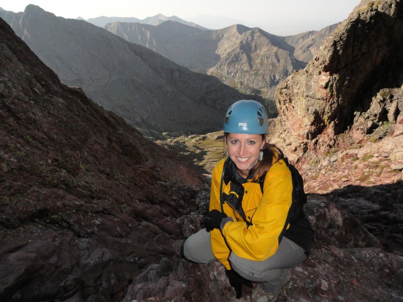
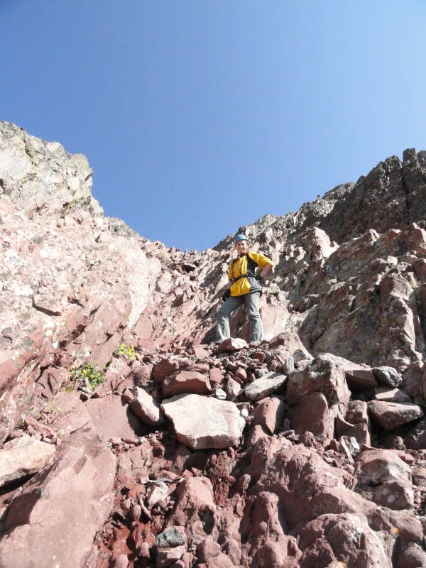
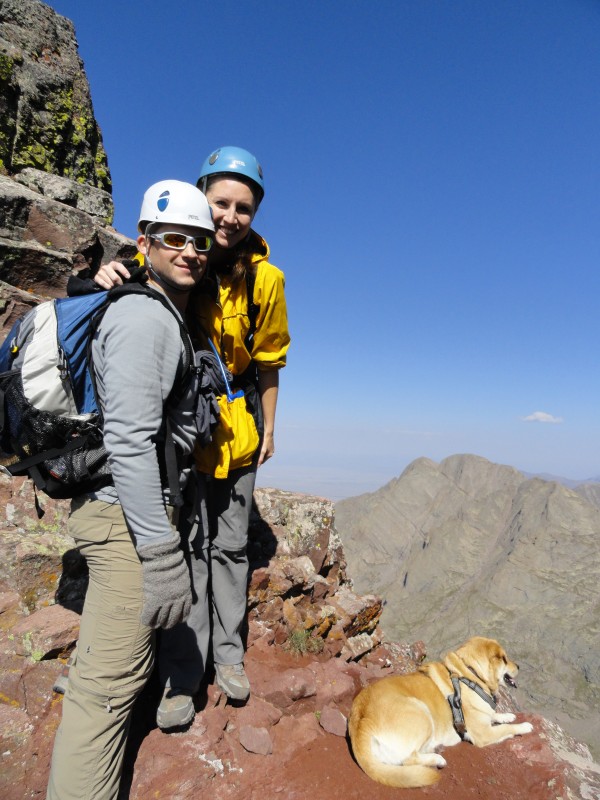
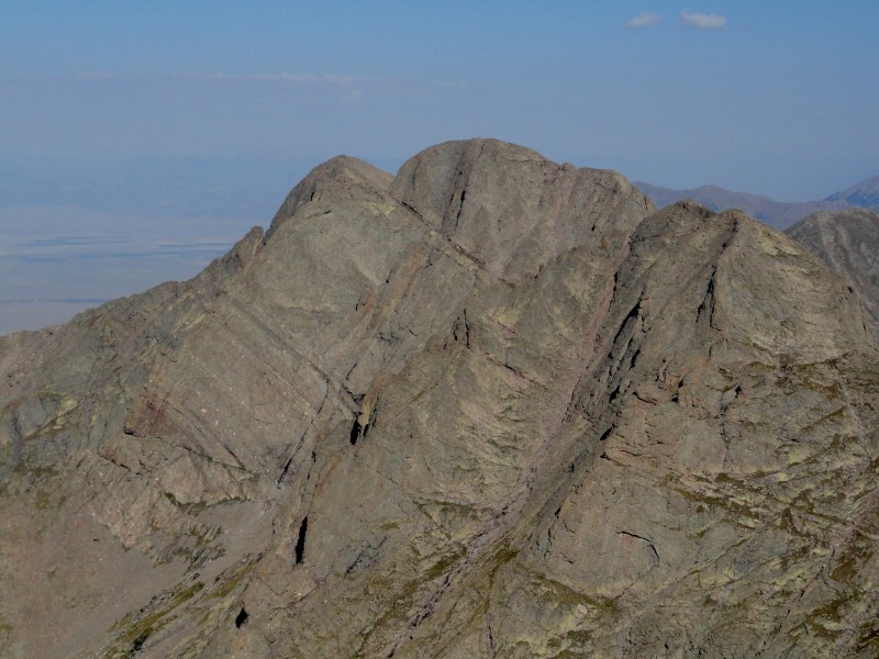
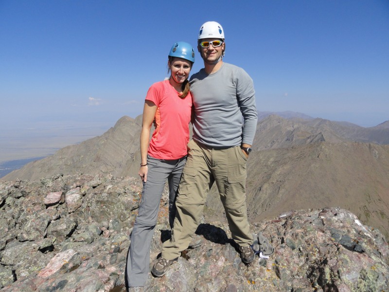
From my perspective, I think that the red gulley was triple the length of the trough on Longs. It's the best thing I can compare it to. I wasn't mentally prepared for how long it was even though I had read reports of its length. Over halfway up the gulley, I had a mini freak out moment where I wasn't sure if I could handle this peak or if I would be able to safely get off the mountain. I was mentally exhausted and let out a few emotions for a minute and then I was good to go and continued to the top. For the first time I felt I finally found my max skill level on a peak. Crestone pushed me to my limit. I asked my husband to stay below me the whole way to make me feel safer if I were to slip or need any help with my moves. I ended up being fine, but it was still peace of mind for me knowing he was there. Thanks Matt! I felt Crestone was harder than the Class 4 route up Lindsey I had done a few weeks prior. For me though it was about 3 hours of straight scrambling (class 3) vs 1 hour on Lindsey (class 3 & short class 4) so it is all relative. I was pry more mentally exhausted from focusing on my moves for that long of a stretch. The moves really weren't all that bad; but when adding the length, it increased the difficulty for me. Me & Matt at the Notch, with Sophie. (Kit Carson and Challenger are in the background) Challenger & Kit Carson (climbed summer 2011)
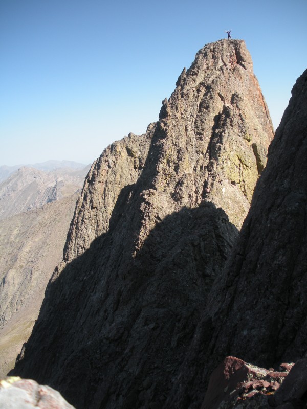
We finally made it to the notch. While our group was waiting for me and Matt, Kushrocks decided to hit up East & Northeast Crestone. When we got to the notch I asked "Where is Ryan?". They pointed to the spire and said casually, "He's over there". I about crapped my pants when we saw what he was free climbing. Good job Ry! That was very impressive. I think I held my breath the whole time as I watch you scramble down. Glad you made it off safely! Ryan on NE Crestone (photo by SummitKathy)
Back to the report, once at the notch you scramble left up solid rock. We traversed on some exposed ledges and then made a final scrambling push to the summit being careful not to make a mistake as we were tired and ready to be on top.
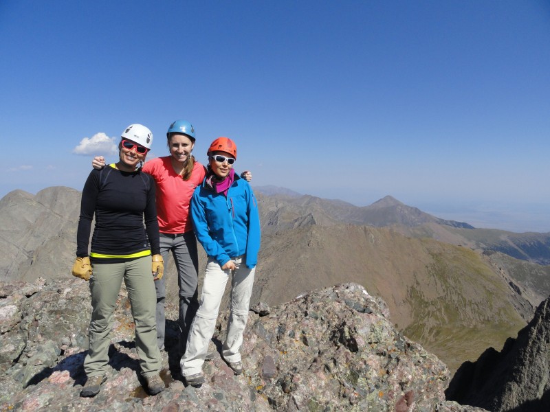
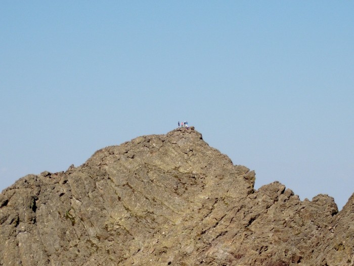
It was about 10:15am when we summited. The weather was phenomenal! Sunny, blue sky, and absolutely no wind. The summit is small, rocky and exposed, but very stable. We had the top all to ourselves. I think the snow report 2 days prior might have scared off other groups. We could see another group of people on the Needle. It was an awesome experience to be atop of such a challenging peak that made us work for our reward. Congrats to everyone in our group including Sophie (the wonder dog)! Me and Matt The girls;, Kathy, me and Annie Our group on Crestone Pk taken from Crestone Needle (photo by: TheOtherIndian)
We stayed for about 20 minutes and then headed out. We actually didn't cross the exposed ledges on the way back over to the gulley. There was a better trail that was easier to spot from above. It also seemed easier and less exposed than the ledges that we crossed to get to the summit. It eventually led us back into the red gulley. I was so worried about getting back down this peak that I asked my group if I could be in the middle so I would have people above and below me in case I ran into any problems. They assured me that everything would be ok and I trusted their comments as we pushed on. The descent was WAY better that the ascent. As I was going down I remember thinking to myself, "Was this the section that scared me on the way up? That wasn't so bad". It is weird how the ascent and descent seemed to be so different from each other. When we reached the crux of the gulley (that short rock climbing section) I had Sean below me as my spotter giving me feet placement tips while Matt was above me helping guide my way down. I was grateful to have such awesome people in my hiking group. On the descent - Crestone Needle is in the distance on the right Kathy & Sean carefully downclimbing Downclimbing the crux. Photo by: SummitKathy
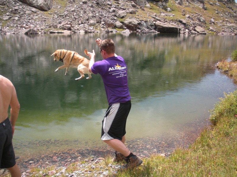
Once passed that section it was only a matter of time before we were back in the valley again by Cottonwood Lake. It only took about 1 ½ hours to descend the gulley. I was feeling great and decided to take advantage of the flat trail and quicken my pace. While me and Matt went ahead of the group, Sean had decided to take a plunge into the lake to cool off and Sophie got thrown in against her will. Flying dog!
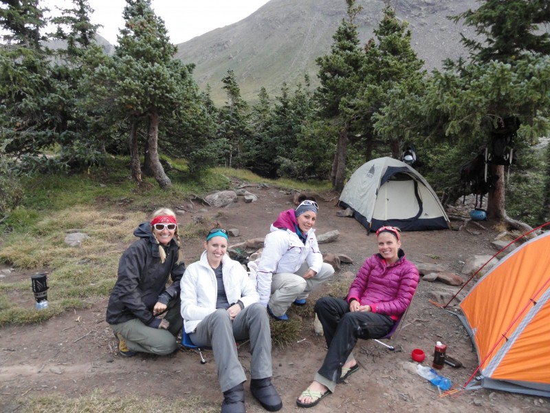
We all met back up again at the top of Broken Hand Pass and about that same time SummitKathy's other friends had just come off the Needle and joined up with us. Perfect timing! They had originally planned on hiking the Peak with us but got into camp too late the night before and decided in the morning to make an attempt for the Needle since the distance was shorter. Glad we bumped into each on the way down. We all hiked back down to base camp together and arrived at 2:30pm making that a 9 hour hike from base to base! Once we got back, everyone crashed for an afternoon nap. Then about 5pm we started dinner and the 50% chance of rain that was predicted finally came in. We had some good laughs and hunkered down under a tree as we ate our food. Then a full rainbow appeared! It was beautiful and I took this as a sign that everything was going to be ok. It was very encouraging for me to see after such a challenging day and I was so grateful that our trip was successful and our party made it back safely. Descent down Broken Hand Pass With Humboldt in background (our next days challenge) The girls at camp (Krista, me, Annie and Kathy)
Day 2: Humbolt
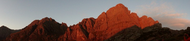
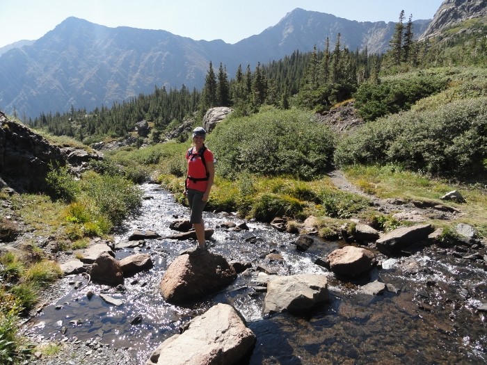
Shortly after leaving our base camp at 6:20am, we crossed the stream and headed up the good trail. Before the switchbacks, the sunrise gave an amazing alpenglow on The Needle. I captured this 180 panorama.
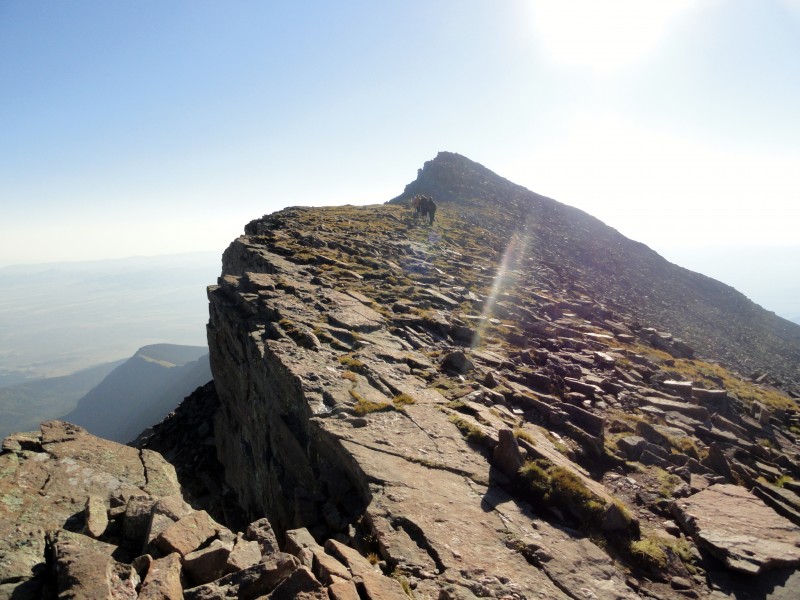
We trekked up the switchbacks to the ridge, then took a quick break to refuel for the rest of the route. Compared to our Crestone climb the day before, Humboldt was a piece of cake! The only thing that caught me a little off guard was how much Class 2 scramble we had to do before the summit. It was pretty fun though and soon enough we were on top. It only took us just under 2 hours to top out on Humboldt. Our pace was quicker than expected for how sore and tired we felt after Crestone. It was windy on the summit and pretty chilly. We stayed long enough for photos and a few snacks. Again we had the whole summit to ourselves. This time though we had a group of 8 on this adventure. I've never hiked in a group this big and I loved it! Ascending Humboldt Our group of 8! Good job Matt on getting everyone in the picture)
Descending down Humboldt was fast and easy. The sun heated up and soon we were all in shorts, t-shirts and tanks. We arrived back at camp just before 10:30am. Total time was 4 hours RT including all stop and summit breaks. We packed up our gear and were headed out of base camp by 11:15. The hike with heavy packs was just as hard going out as it was hiking in. It seemed to take longer too...but I always feel hiking in the dark with headlamps seems to go by faster. We were back at the cars and driving out before 1pm. What an excellent trip with weather that couldn't have been better considering that 2 days prior we were preparing for snow and packing micro spikes. Glad it turned out the way it did! Descending Humboldt The glorious Crestones! I can't believe we hiked that yesterday! The river crossing Our base camp right next to Crestone Needle
I want to also thank my hiking group Matt, Ryan, Annie, Kathy and Sean for helping me summit Crestone and make it back down to camp safely. It was my 23rd 14er and the hardest one I have done so far. It was also great meeting summitkathy's friends. I'm so pleased with how well our trip went. This group was a blast! Matt and I had such a great time with ya'll and look forward to more trips in the future.
Thumbnails for uploaded photos (click to open slideshow):
It was all a mental battle heading up that gully. You're too hard on yourself.... you killed that peak! It was such a pleasure hiking with you two. I hope it works out that we get to do it again sometime. Thanks for posting!
Crestone Peak is pretty sweet, as far as 14ers go, and it looks like you guys had an awesome day for it! The Needle is a bit tougher, but with a bit more experience under your belt, you're gonna love it--less duration than the Red Gully, steeper, and very fun solid class 3.
The views in that area are so amazing! I had the chance to do Humboldt this year and can't wait to get back for the Crestones. Good job pushing through on the Peak!
I think you should rename this trip report "The Flying Dog." It was great as always to get out with you guys. As Kathy said don't be so hard on yourself, you did great. Annie and I really enjoy climbing with you all so hit us up anytime especially if its a fun peak like the Crestones.
P.S. You forgot to add the part about how some dumbass (me) brought the wrong tent poles. :oops:
Nice report! was scouring the site looking for some good beta on the gully. Breaking it up into three's is a different perspective that I haven't read yet. Every bit helps!
Caution: The information contained in this report may not be accurate and should not be the only resource used in preparation for your climb. Failure to have the necessary experience, physical conditioning, supplies or equipment can result in injury or death. 14ers.com and the author(s) of this report provide no warranties, either express or implied, that the information provided is accurate or reliable. By using the information provided, you agree to indemnify and hold harmless 14ers.com and the report author(s) with respect to any claims and demands against them, including any attorney fees and expenses. Please read the 14ers.com Safety and Disclaimer pages for more information.
Please respect private property: 14ers.com supports the rights of private landowners to determine how and by whom their land will be used. In Colorado, it is your responsibility to determine if land is private and to obtain the appropriate permission before entering the property.