Download Agreement, Release, and Acknowledgement of Risk:
You (the person requesting this file download) fully understand mountain climbing ("Activity") involves risks and dangers of serious bodily injury, including permanent disability, paralysis, and death ("Risks") and you fully accept and assume all such risks and all responsibility for losses, costs, and damages you incur as a result of your participation in this Activity.
You acknowledge that information in the file you have chosen to download may not be accurate and may contain errors. You agree to assume all risks when using this information and agree to release and discharge 14ers.com, 14ers Inc. and the author(s) of such information (collectively, the "Released Parties").
You hereby discharge the Released Parties from all damages, actions, claims and liabilities of any nature, specifically including, but not limited to, damages, actions, claims and liabilities arising from or related to the negligence of the Released Parties. You further agree to indemnify, hold harmless and defend 14ers.com, 14ers Inc. and each of the other Released Parties from and against any loss, damage, liability and expense, including costs and attorney fees, incurred by 14ers.com, 14ers Inc. or any of the other Released Parties as a result of you using information provided on the 14ers.com or 14ers Inc. websites.
You have read this agreement, fully understand its terms and intend it to be a complete and unconditional release of all liability to the greatest extent allowed by law and agree that if any portion of this agreement is held to be invalid the balance, notwithstanding, shall continue in full force and effect.
By clicking "OK" you agree to these terms. If you DO NOT agree, click "Cancel"...
Dates: Sept. 28-30, 2012
Peaks climbed: Cloud Peak, Washakie County HP
Climbing partners: Doug and Arthur Harris
Distance: 23 miles roundtrip
Gain: ~4500'
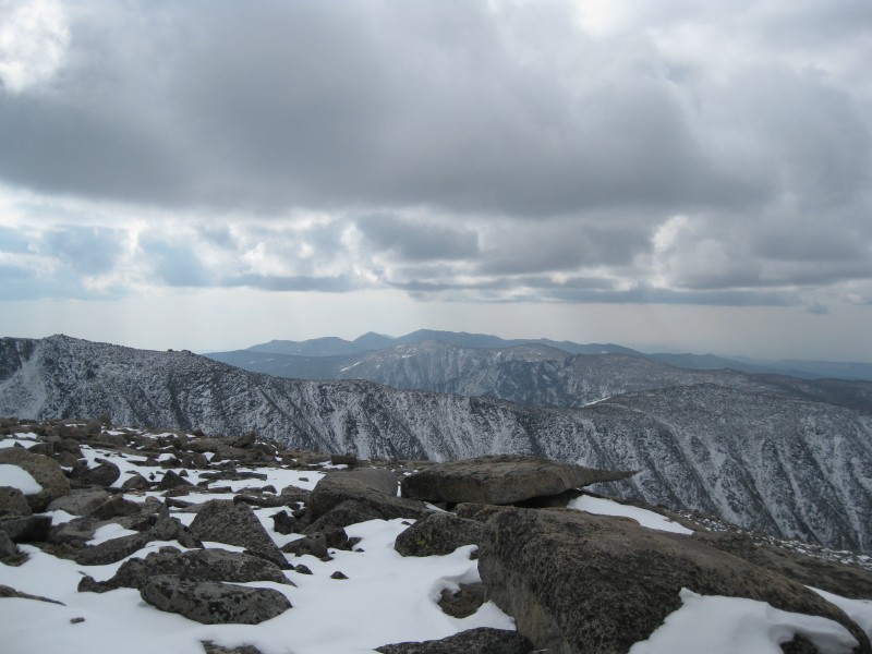
Wyoming, like Colorado, has three Ultras: the Grand Teton--which needs no introduction--and Gannett Peak, prized summit of state highpointers and experienced mountaineers alike. And then there's Cloud Peak. Nestled deep within northern Wyoming's Big Horn range, it is a peak at once both rugged and mild, both remote and accessible. Its lofty heights are surrounded by alpine meadows, craggy cliffs, hidden tarns, high rocky plateaus, and the Great Plains over a mile and a half below to the east. For us peakbaggers, it is the highpoint of the Big Horns, Johnson and Big Horn counties, and is probably the single most prominent summit in Wyoming. As I was to discover, Cloud Peak would live up to its name...
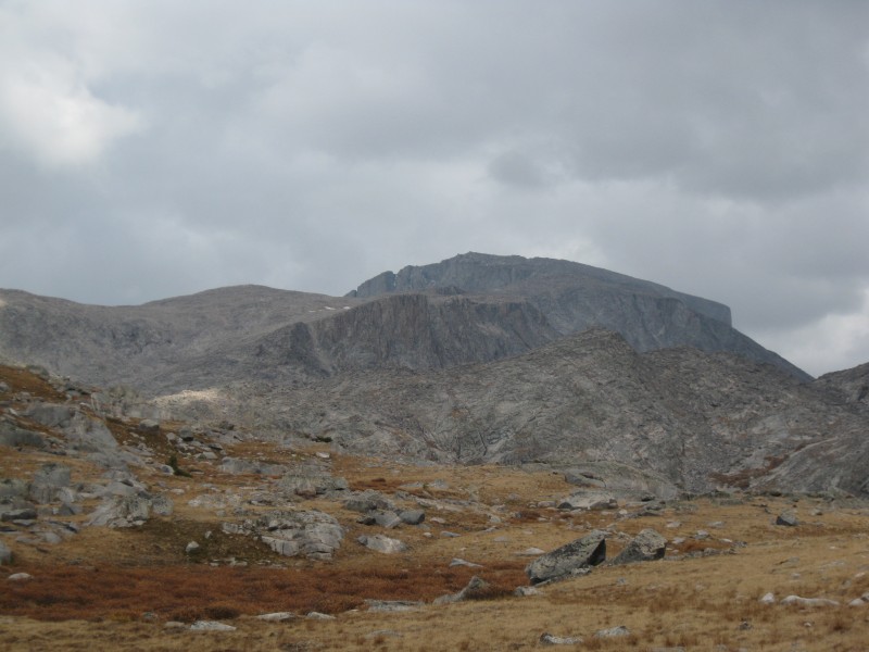
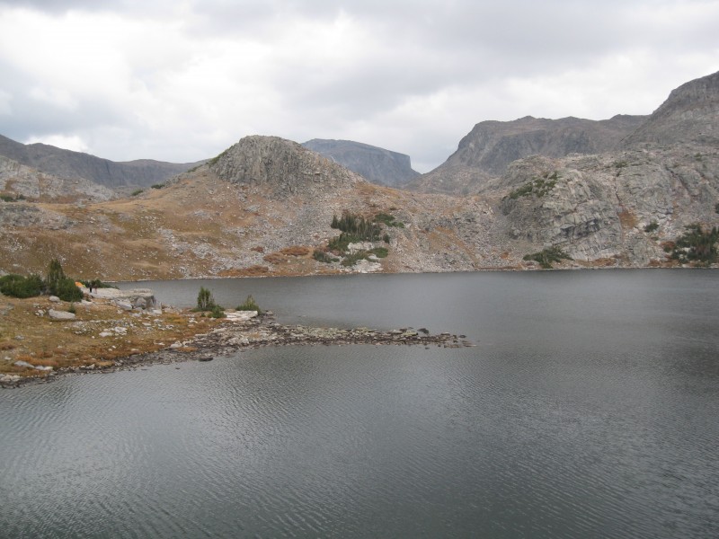
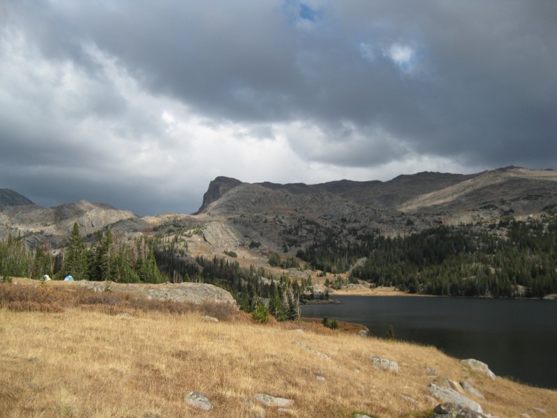
Cloud from near Mistymoon Lake
I had made plans to climb Cloud with Doug and his son Arthur, who'd completed the lower 48 state highpoints at an impressive 9 years old; several others expressed interest in joining us, but they ultimately were unable to come due to other commitments. So it was that I met Doug and Arthur on a Friday afternoon in late September, just after a grueling anatomy exam, and we began the long drive north.
We spent the long hours on the road in conversation, making brief stops in Wheatland, Douglas, and Buffalo. We were uncertain about the weather forecast--it showed great conditions in Buffalo and Worland, but rain, snow, and thunderstorms in the high country--and so had decided to hike in a few hours Friday evening and make a summit attempt Saturday. After passing what seemed to be a thousand deer on the side of the highway, winding our way deep into the moonlit mountains, and driving down a long, washboarded dirt road, we arrived at the trailhead at 11 PM. A half hour later, we had packed up, and we began the long hike in.
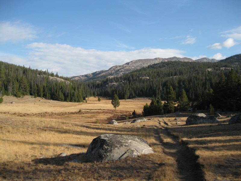
Beautiful, rolling meadows on the approach (taken on the hike out)
The Mistymoon Lake trail #063 was wide and easy, and the miles melted away quickly as we briskly walked through dark forests and moonlit meadows. Aside from a brief moment where we worried we'd gotten on the wrong trail, we had little trouble finding the way. Once we'd reached Lake Helen, however, we were all too ready to drop our packs and camp. We found a pleasant spot on a grassy bench overlooking the lake, and by 2 AM or so, we'd set up our tents. Still over five miles from the summit, and with a less-than-ideal forecast, we didn't have the luxury of sleeping in; alarms were set for 5 AM, and we grabbed what little sleep we could.
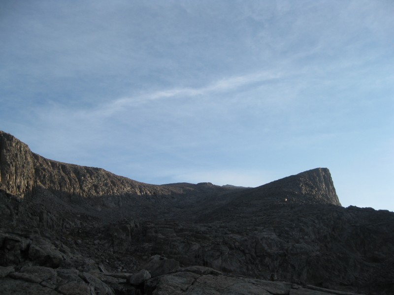
I awoke to bitter cold; frost lined the inside of my tent. I'd packed the night before, so the hardest part was getting out of my cozy sleeping bag, and by 6 AM we were once again on the trail as light began to grow in the eastern sky. Perhaps an hour later, we'd reached Mistymoon Lake, where several trails met. Picking up the Lake Solitude trail #038, we wound around the west side of the lake and over a low ridgeline to the north. At last, we could see the peak we'd come to climb. I was heartened to see that the upper reaches looked free of snow. A gradual, gray sunrise slowly lit the skies and clouds above.
Sunrise painting the clouds as we start the climb up Cloud
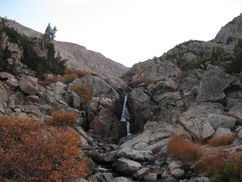
From here, we dropped down into a broad, grassy valley through which flowed the meandering Paint Rock Creek. At the Falls, we could not find an obvious way up, so we simply crossed the river and charged straight up the hillside until we found the continuation of the climber's trail.
Paint Rock Falls
The trail was at first easy, crossing patches of meadows and surmounting rocky buttresses, with cairns leading the way. We paused in a large meadow where the trail split, and I explored our options while Doug and Arthur filtered water. The left option looked to lead up the broad gully we were aiming for, while the right option petered out in a minute or two. Left, it was...
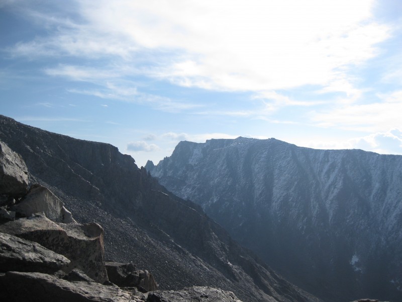
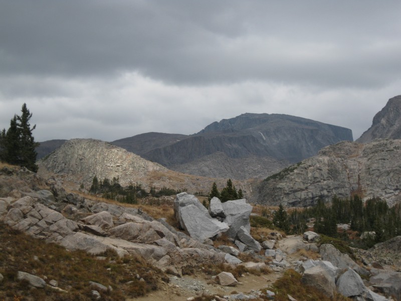
A view of much of the route up Cloud Peak. We're still a long ways off... Somebody has way too much time on their hands!
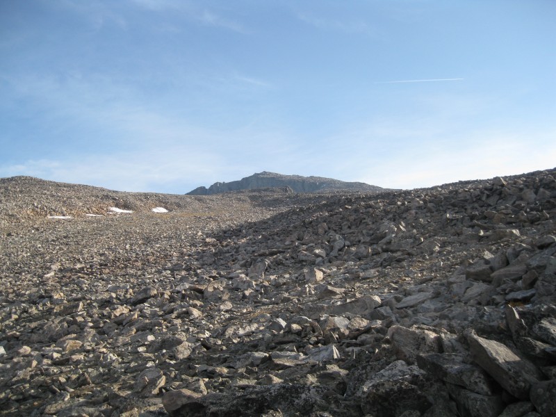
After passing through more brief meadows and rocky notches and gullies, we were up into the higher basin inset into Cloud's west ridge. While the route purportedly went straight up the middle of the basin, we found cairns leading up the broad ridge to the right, and decided to follow them. It proved to be a fun and easy scramble up talus and boulders, setting the tone for much of the remaining climb: consistently fairly stable rock with a good, grippy surface. Being a native New Englander, I was in my element, and we made good uphill progress.
In the base of the broad gully leading to the ridge. Cloud's summit is barely visible
At the top of the gully, the terrain again eased, and our goal looked much closer (though it was still a good mile off). The boulder-hopping was easier here, and there were some grassy patches that made for easier hiking. We were surprised to find even some brief trail segments!
Near the top of the gully, still about a mile off Views opening up behind us to the west
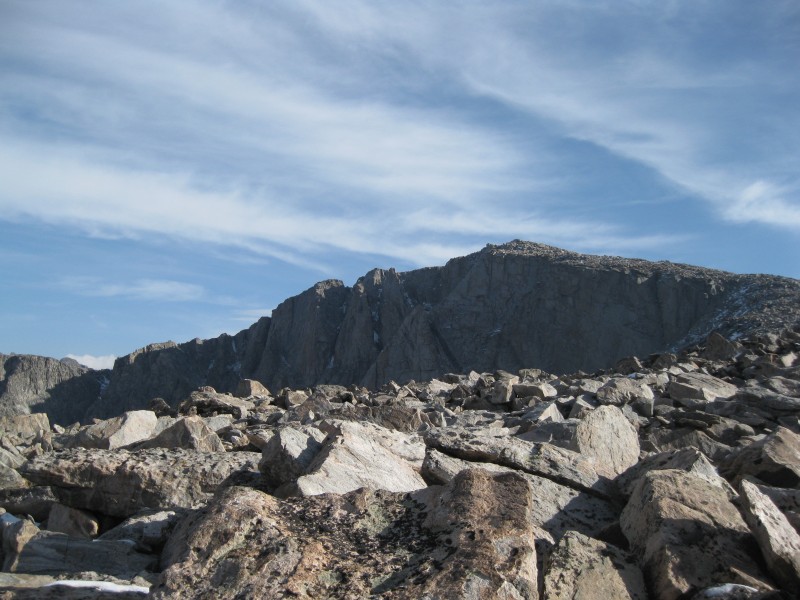
A few quick steeper sections of hillside, and we were certifiably on the ridge at last. Just ahead lay the "knife edge" of the route; it proved to be anything but, with probably a good 50 feet of safe terrain. All the same, we could now see down the steep north side of the ridge, which held several inches of snow.
Rugged terrain near the crest of the ridge Cloud Peak showing its impressive west face as we draw closer Looking back on the "knife edge"
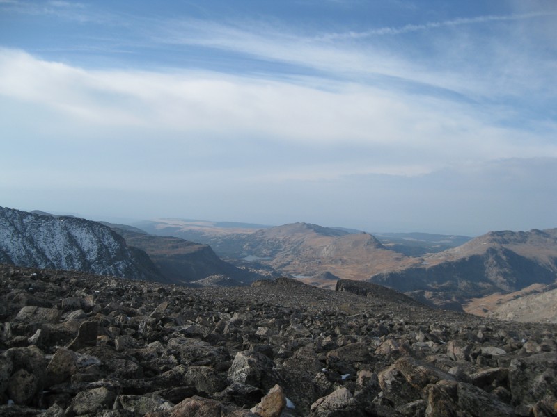
Once we'd crossed, we could see that the last 700' of uphill held a bit of snow, but nothing that was likely to bar progress. I was far more worried about the building clouds. Above us, the skies were a benign blue criss-crossed with high, wispy clouds; to the west were grim, gray overcast skies. Now with some views to the east, we could see a line of gradually-building puffy clouds were building along the crest of the range. We knew we had some time, but we would have to make haste. Poor Doug was feeling rather under the weather from some sort of bug, but valiantly pressed onward.
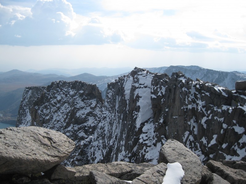
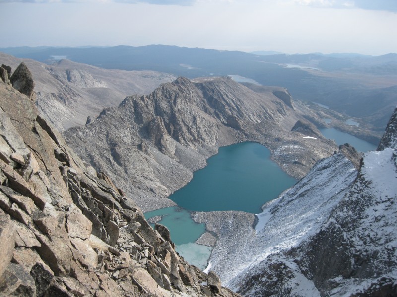
With only 200' to go, I pressed on ahead, working to avoid the snow and trying to pick out the highest jumble of boulders. I topped out on a ridge and abruptly came to a sheer drop-off to the east. Far below the snowy, cliffy ramparts of the mountain lay several impressive glacial tarns, and beyond, the barren grasslands of northern Wyoming far beyond and below.
The sheer eastern side of the mountain Glacier Lake, just below the summit
Checking my GPS, I realized the summit had to be mere feet away, and once I'd clambered up a few rocks, I could see it at last.
There's the top!
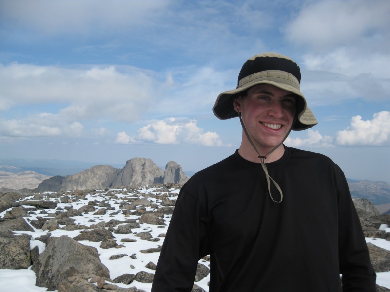
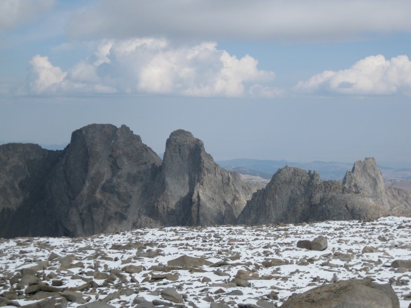
After a few more steps and hoisting myself atop the summit boulder, there was nowhere higher to go. I was surrounded by a small sea of snow-covered boulders, on the crest of a broad range that rose out of the haze of the surrounding lowlands. To the north, Black Tooth Mountain--the range's other 13er, and a far tougher peak--stabbed the sky. It was a blatant reminder of the difficulty of many of Wyoming's 13ers, a list that would put the 14ers to shame in terms of difficulty.
Made it! MUFFINS, YEEEEE Black Tooth Mountain, the indomitable other 13er in the Big Horns
Doug and Arthur reached the summit only a few minutes after I did; with the building clouds overhead, our victory was short-lived. After all, we still had to descend. Above us, it seemed as though mother nature was undergoing an internal struggle between summer and fall, and we knew it would be unwise to wait around for the outcome. We began the long journey down, hoping to get as low as we could before bad weather hit.
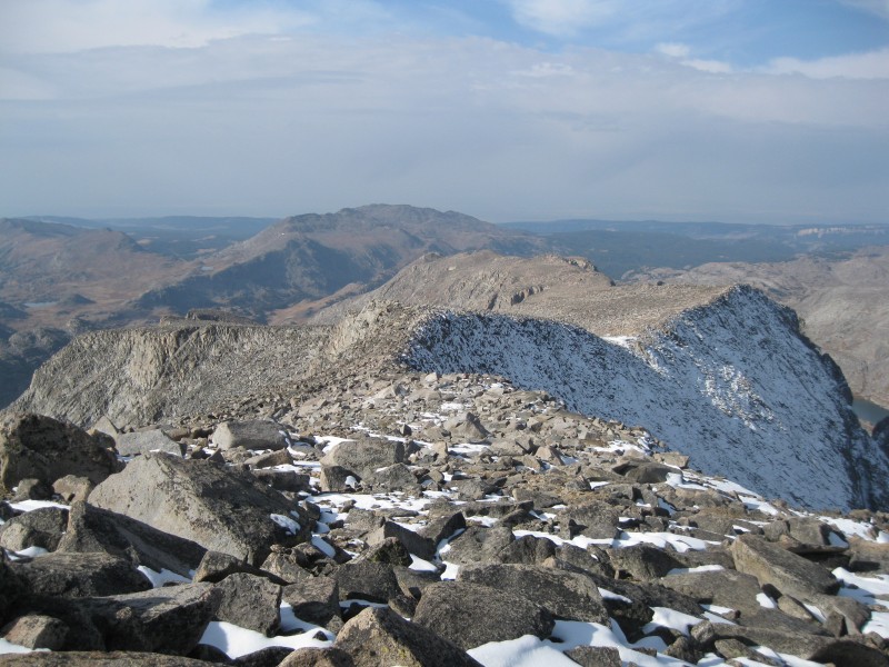
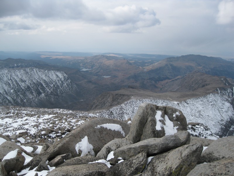
From the summit, showing nearly the entire upper half of the route. Lake Helen is the most distant lake Snowy ridges to the south
We made slightly better time back to the "knife edge", where Doug picked up his pack he'd stashed there. To this point, we'd seen nobody else on the mountain that day, so we were rather surprised to suddenly spot a climber making his way toward us on the ridge! The climber turned out to be from Gillette, climbing with a buddy who was several minutes behind him. Neither had ever been this high, and it showed; one guy was wearing jeans, and both looked woefully underprepared. We wished them luck and pressed onward, hoping they wouldn't learn their lesson the hard way...
It was about this time that fall won out over summer; light flurries fell from the sky for a few minutes, then stopped. The clouds above also took on a more benign demeanor. We kept heading down, not wanting to push our luck, but still breathed a mental sigh of relief. Soon back at the top of the broad gully, we decided to try descending right down the middle, and the route proved a good choice. We were all starting to feel the effects of sleep deprivation at this point, so we had to take short breaks every half hour or so, but were still making great time.
Wyoming, masquerading as Alaska Fall high country scenery
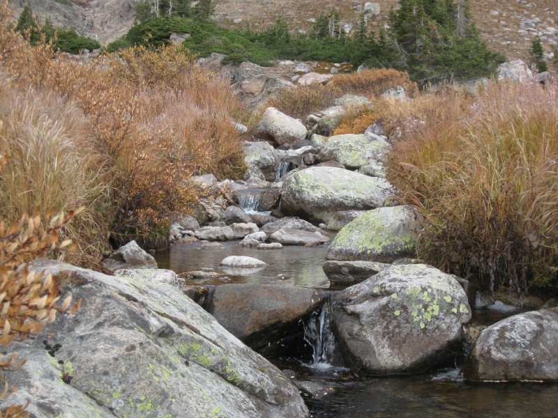
We were soon back at Paint Rock Falls, which I took a few minutes to inspect and play around on.
Riparian beauty
Then, it was time to cross the broad valley and make our way up the few hundred feet of hillside. We separated on the climb up, and I ended up waiting several minutes for them to pop up from behind a slope, only to discover they'd somehow snuck past me! No matter...we were back on gentler ground, and were soon rounding the bend of Mistymoon Lake.
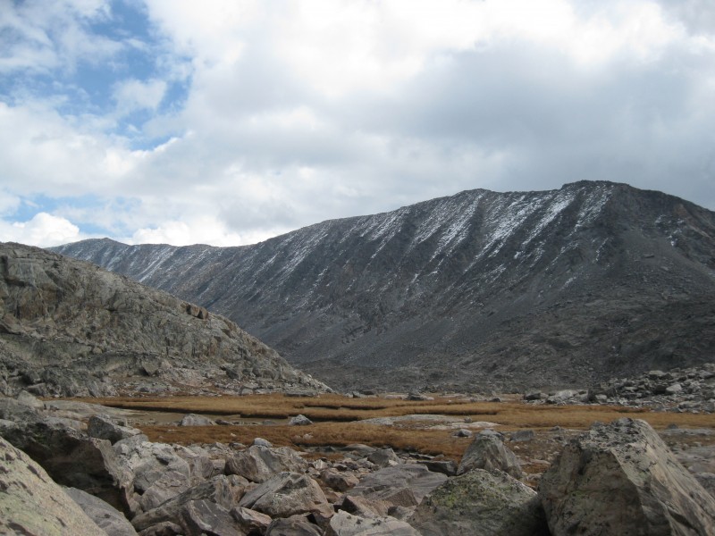
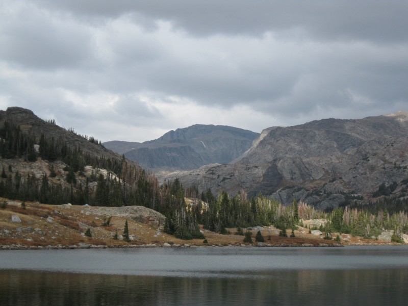
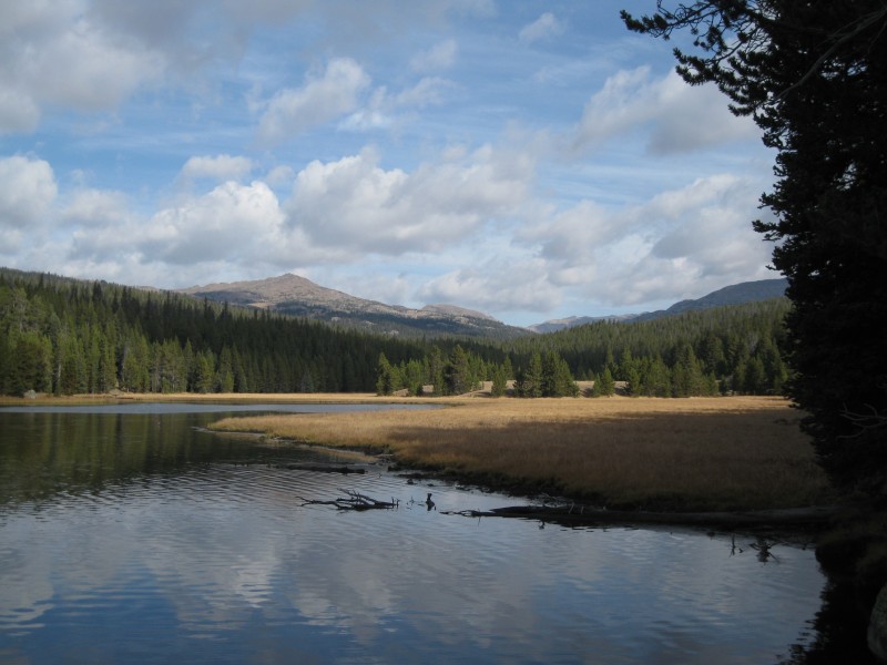
Mistymoon Lake, with Cloud in the background
We had maybe a mile to go, but the time dragged on, and even our conversation ground to a halt as we focused on getting back to camp, putting one foot in front of the other. My brain was pretty fried at this point, and random medical terminology kept flitting through my head. I needed sleep, badly.
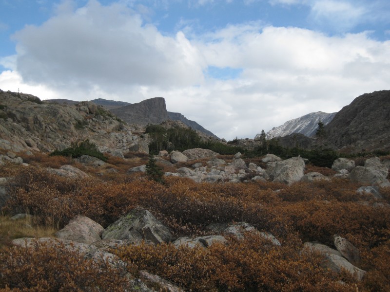
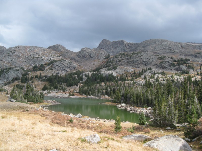
Grim skies, and grimmer summits Lake Marion
Finally, around 2:40 PM, we staggered into camp--what a beautiful sight! I dropped my gear, changed back into my approach shoes, and used my last remaining energy to walk a few minutes around the lake for a few more pictures.
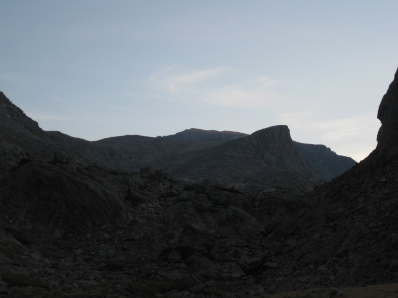
Cloud from near camp Lake Helen
Then, I crawled into my tent and slept like the dead.
We awoke a few hours later, feeling at least somewhat more refreshed. We ate dinner (noodles for Doug and Arthur, delicious animal crackers for me), then played cards a while until it grew too dark to see. I lost most of the games; perhaps I'd used up all my luck that day in getting to the summit and back safely. As darkness fell, I crawled back into my sleeping bag, and made a futile attempt at studying. It took a surprisingly long time to fall asleep, but I eventually dozed off to the sound of moose calling in the distance.
The next morning dawned chilly and clear, or so it appeared from the window of my tent looking south. However, Cloud Peak's spell was not so easily broken; thick, non-threatening clouds still hung in the sky in every other direction. We broke down camp and were on the trail by 8 AM. This time, we could relax a bit and were not quite so pressed for time...
A parting shot of Cloud on the hike out
Now able to see the trail we'd hiked in on two short days ago, our spirits were high. We were particularly hoping to see some "meese" in the meadows and streams alongside the trail, but would ultimately be disappointed. But the day was early, the skies not overly foreboding, and the miles back to the car were growing fewer. Finally, West Tensleep Lake was in sight, and we were soon walking the easy trail along its shores.
West Tensleep Lake
Just a few short minutes later, we walked the last few steps to the car. We quickly packed up gear and were driving out ten minutes later. Back on US-16, we could finally enjoy some of the mountain scenery we'd passed through in the dark Friday night; it was quintessential Wyoming high country.
I'd found out that an easy Wyoming county highpoint lay just off the highway near the crest of the range, so Doug was kind enough to stop and let me tag the few candidate points there (Arthur had made him promise he wouldn't get involved with county highpoints!). Tagging the three points involved a half hour, hopping a few unposted barbed-wire fences, easy bushwhacking through relatively open forest, and some nice views through the trees of the surrounding high mountain plateau. I returned and we drove down into Buffalo.
We weren't sure where to eat, but we spotted the Clear Creek Cantina and decided to give it a try--Mexican food was sounding mighty appealing about then! The food was tasty and plentiful, and the restaurant was well-kept and rustic; I'd recommend it. We watched the Buffalo Bills and the Pats battle it out on the big screen, and Doug got some death glares from the locals when he cheered on the Patriots.
After one last stop at the large Maverik gas station near the highway to get some tasty milkshakes, we began the journey south, admiring the Big Horns on our right--northern Wyoming's own little Front Range. The time on the drive back passed quickly, and we were back in metro Denver by 7 PM. Not too shabby, all told! Doug and I parted, talking about future plans to do more climbs together.
Cloud Peak proved not to be a terribly difficult peak from a technical standpoint, but it was a change of scenery that felt far closer to my early memories of Yellowstone than to the regular climbs I've done in Colorado. It is a wonderful introduction to the high country of Wyoming, lacking the lengthy approach to Gannett, or the technical challenges of the Grand. Go, if you can...
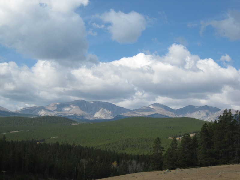
The magnificent Big Horns
Thumbnails for uploaded photos (click to open slideshow):
...missing out on the weekend's San Juan festivities.
I'm glad this worked out for you all.
I'll have to find someone to repeat your adventure next summer.
Great TR, as usual, Chris.
Can, in fact, take you to some cool places, specially when you aren't chasing county high points.
Looks like a fun area. I've heard horror stories of biblical proportions regarding the mosquitos down there? Too late in the year to deal with them I presume?
Good to know even people from Wyoming hate the Patriots.....
Your report brings back a lot of good memories... Cloud Peak was my first 13er and the Bighorns are a special area for me. I'd love to go back there some day and experience it again. Those views from the summit are truly spectacular.
That's an awfully long day on practically no sleep! But looks like it was all worth it. Thanks for a great write-up on a very cool peak and a highly underrated area.
We did our first mountain backpack at Mistymoon. 5 nights over July 4, 2004. I carried a tripod, an empty snapple bottle (my ashtray) and a bunch of other heavies. It snowed six inches the first night too but we survived.
The Melius guide makes reference to a grave on the summit. But the summit is huge and I didn't really check it out. Melius also mentions a plane wreckage visible near the summit. And he is not confusing Cloud with Bomber Mountain because he references that wreckage later in his book.
I inspected both versions of his guide, checked all of his sources and could not find info on the grave or the wreckage. Maybe the grave is under the huge summit cairn?
I spoke to the head ranger, the librarian and the historian in Buffalo - no dice. I guess I'll have to go back and poke around myself.
The area north of Cloud Peak - ”Wilderness Basin” - is loaded with tarns (16?). I think the first ascents of Black Tooth and Woolsey went through there.
Some people say the Cloud Peak Wilderness is the best kept secret in the West. I'm surprised it doesn't get more Colorado traffic with Buffalo being only six hours away.
James--wish you could've made it, but I think you did the right thing. After all, Cloud (unlike Rainier) will always be there! Tell Heather I said hi too...
Matt--you and James should totally make a trip up there next summer, you'll love it. What adventures did you end up getting up to in the San Juans?
Jblyth--it's a great change of pace, you shuld go if you get the chance. If you're a strong hiker and don't mind the distance, you could probably do the whole thing in 12-14 hours.
Brian--bugs were a non-issue, luckily. I could see that area being pretty buggy in early/mid summer
Papillon--that's really interesting there might be a grave on the summit...didn't see anything when I was up there, but we didn't have long to linger. And Black Tooth looks like a wicked tough ascent...would love to see a good TR on it!
Deuces--ton of prominence to be sure...Gannett and the Grand are similar. I love that feeling of being in a ”sky island”; it's tough to find that on most Colorado peaks!
Chi Transplant--I'm working on the Ultras as well, though it'll be a few decades before I finish! It really is a great microcosm of American climbing and peakbagging, and a tough and worthy list. Hope you make it up to Cloud soon!
Yeah, I don't know what to make of it. The only thing I have not done is contact the author. I struck out everywhere in town.
re: bugs
In my experience (16 backcountry nights in the Cloud Peak Wilderness), they are pretty bad after July 1. I like the last week of June for my trips up there but have never done anything in the fall.
It is too bad the weather was not better. At least you got the million dollar view looking down at the glacier.
I take it ”10215” was the short scramble from Powder River Pass?
A third of the way done with the Ultras 10/4/2012 3:46pm
Hey Chris, that was a blast! You are a fast hiker and it wasn't easy to keep up, especially still being hammered by the flu. It did seem to be a crime against humanity to return back before 2AM... we should have added another peak to the expedition. :twisted: The ultras contain some amazing peaks and climbing all of the CONUS list is a far more difficult endeavor than the 48 state high points or the Colorado 14ers. We look forward to some of the more difficult ones such as Olympus, Cleveland, and the Grand. Hopefully we can knock off 5-10 of them a year and finish in another five years.
For anyone interested, we are contemplating a trip to do the Montana Ultras (including McDonald and Cleveland) starting on July 3rd next summer. Send me a PM if you are interested in this week of adventures.
Papillon--actually, the Washakie COHP isn't UN10215, but rather an unremarkable pair of rocky prominences on a small unranked hill, and a liner along a ridge. Ironically, there's a large lookout tower a few miles to the west, and several cool-looking summits a few miles to the east, but so it goes sometimes with those silly highpoints. Would've been a cool area to spend a half-day in if we'd had more time...
...for giving me yet another area to add to the list! Looks like a fun day out.
Caution: The information contained in this report may not be accurate and should not be the only resource used in preparation for your climb. Failure to have the necessary experience, physical conditioning, supplies or equipment can result in injury or death. 14ers.com and the author(s) of this report provide no warranties, either express or implied, that the information provided is accurate or reliable. By using the information provided, you agree to indemnify and hold harmless 14ers.com and the report author(s) with respect to any claims and demands against them, including any attorney fees and expenses. Please read the 14ers.com Safety and Disclaimer pages for more information.
Please respect private property: 14ers.com supports the rights of private landowners to determine how and by whom their land will be used. In Colorado, it is your responsibility to determine if land is private and to obtain the appropriate permission before entering the property.