| Report Type | Full |
| Peak(s) |
Mt. Sneffels - 14,155 feet |
| Date Posted | 07/17/2008 |
| Modified | 10/01/2012 |
| Date Climbed | 07/17/2008 |
| Author | summitbound |
| Mt. Sneffels- Yankee Boy Basin |
|---|
|
After an epic day on El Diente the previous day, we were ready for a nice easy end to our weekend so we had Sneffels planned. Yankee Boy Basin is simply gorgeous. Everywhere you turn there is green and more waterfalls than you can count. We didn't get to experience this until the return trip as it was dusk by the time we left Ouray. This is a shot of the famous C section of the road (on the way back down of course). Just past here there is a pretty good rut in the road that will challenge lower clearance vehicles. The area in general, appeared to have been subjected to numerous large avalanches, the debris fields were impressive. 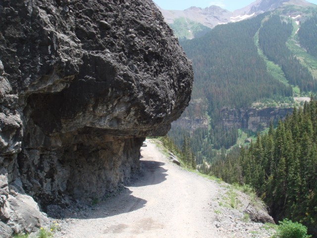 I didn't pay a lot of attention to exactly where the road conditions deteriorated, but I did see a fair number of vehicles stopped at the Governor /Yankee boy basin intersection and by the time we reached the parking lot with the restrooms we only saw higher clearance 4x4s. This is a shot of us getting ready in the morning.. messy aren't we? 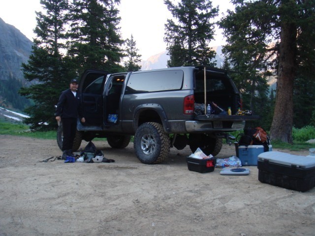 High clearance 4x4s can continue up the road about another 1 mile or so. You can see in this picture where we stopped and backed up into the snowfield blocking any further progress. Just a stroll along the road from here up to the lake. After this snow field there is one other sizeable one that will stop vehicle traffic but other than those two the road is dry. 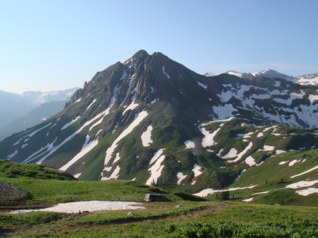 This is a shot from the lake area looking up the road towards the trailhead. You can get a general idea of the amount of snow still up there. On the lower portion of the trail you do cross a couple of snow fields but you hardly notice them. Once you make the turn to head up Lavender Couloir there is a snow field on the initial slope that you have to navigate but it's been pretty well kick stepped so no snow gear required for it. 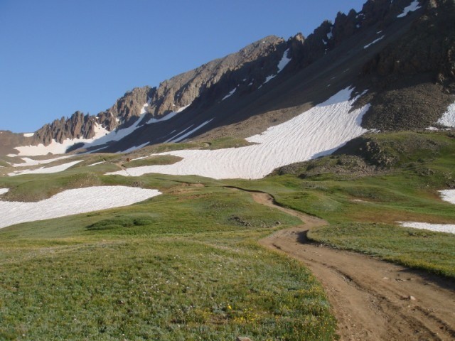 I could not pass up a chance to post this extremely rare picture of the elusive marmot. This photograph is copyrighted, and pending negotiations with National Geographic for the distribution rights, I may be able to retire. 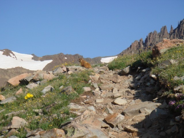 This is near the cornice looking back down the lavender. There were a couple of people in front of us and several time they knocked rocks loose but were very courteous and always yelled "rock" out and they were far enough ahead that they never reached up. 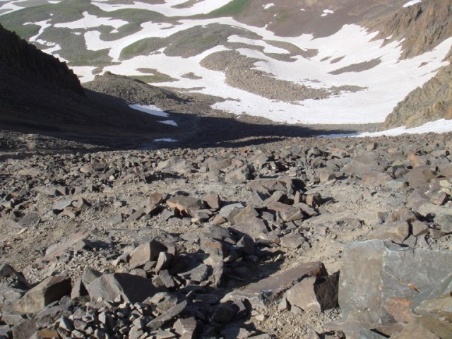 This is a shot of the cornice that remains. We stubbornly hung to the high side of it (bottom right of the picture) and actually had to put on our crampons to make up. It was solid ice, our crampons barely gave us any perch and ice axes would not bit without considerable effort. The much easier way to get past it is to head for the rocky knoll in the middle, where numerous people have blazed an easy path. 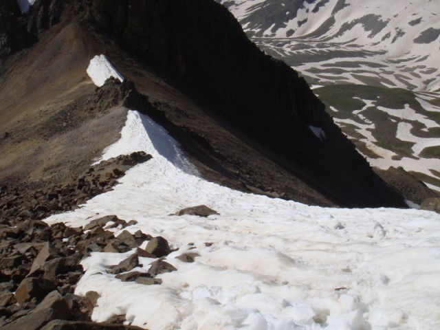 This is a view looking up the gully. About half way up, the gully still retains a considerable amount of snow. You can see it near the top of the picture. We ran into a couple of local guys at the TH who didn't think bringing our snow gear was necessary. This is where they stopped and turned around. 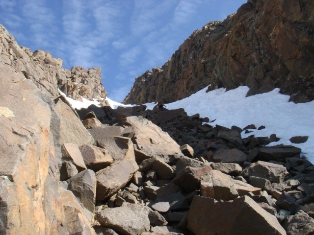 This is looking back down the gully as you can see, still full of snow. About ¼ of the way up the snow we met up with a group of 4 perched on one of the rocky ledges. They only had one ice ax between them and were taking turns using it to individually reach the summit. 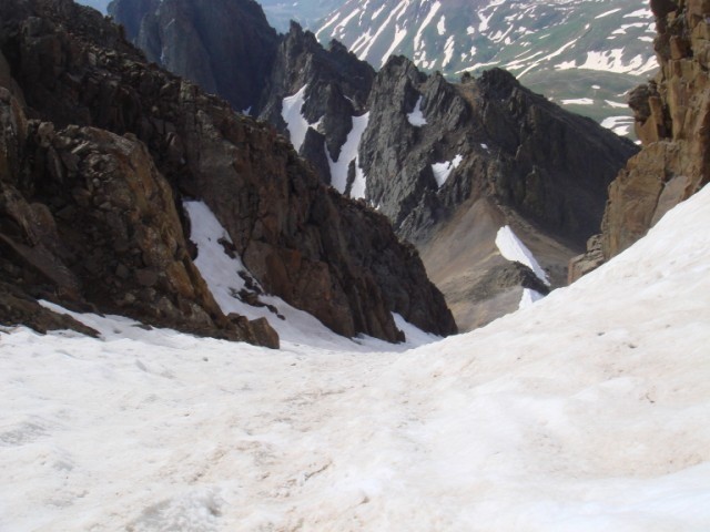 It's a beautiful view in all directions from the top. We got great pics of Dallas Peak, the Wilson group where we had just come from and blue lakes far below us.  This is lovenit on the knife edge. The ridge is solid and it's all mental. You'd have to really not be paying attention to run into problems. Still its exposed and if you have a phobia of it, probably not the right place for you. 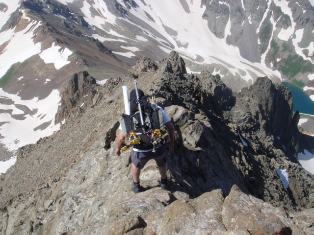 This is looking back up part of the ridge towards the summit of Sneffels. This portion is all good solid rock and pretty straight forward scrambling. 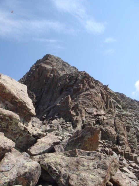 This is part way down the ridge looking at the entire Lavender Couloir. You can see the small snow field at the base as well as the cornice at the top. Also a good look at the valley. 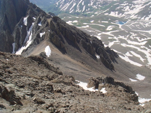 Past the knife edge you scramble beside, between and sometimes over all the rocky spires on the ridge. The trail is sometimes easy to follow and other times you just keep heading in the right general direction. 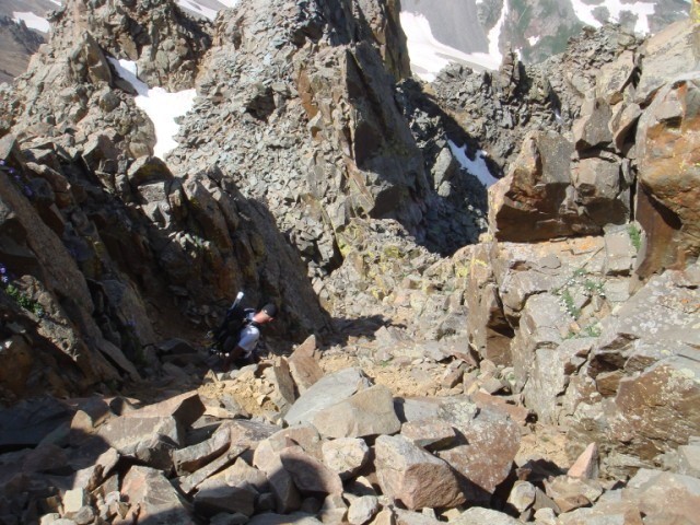 Maybe halfway down the ridge we spotted this coulior. Picture it looking up it from the midway point. Lovenit had wanted to go up it on our ascent, but I talked him out of it, not being familiar with the area, and not knowing where it really went. Now we knew so we geared up and headed down. The snow conditions were spectacular. 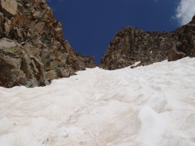 A cool shot looking down from my perch at lovenit near the bottom of the coulior. I was surprised at how steep it is vs. how it looks in the pictures. 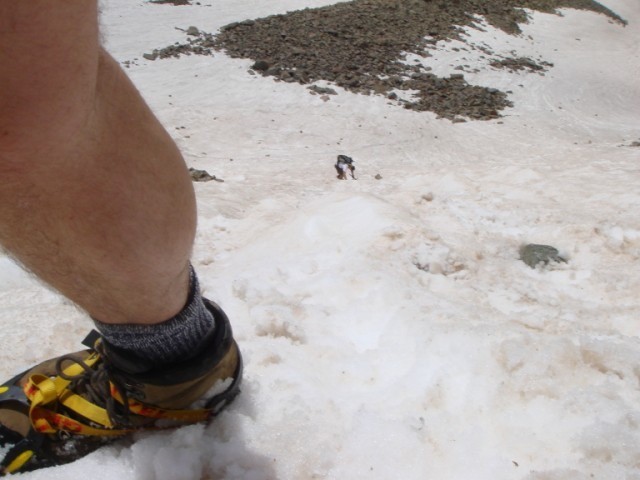 A more expansive view of the ridge and the coulior we descended. 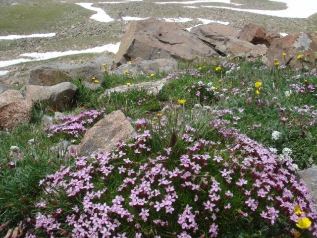 And a final parting photo of the wildflowers that cover the area. A great weekend of hiking in the San Juans. There really is nothing to compare this area to..it's just amazing. 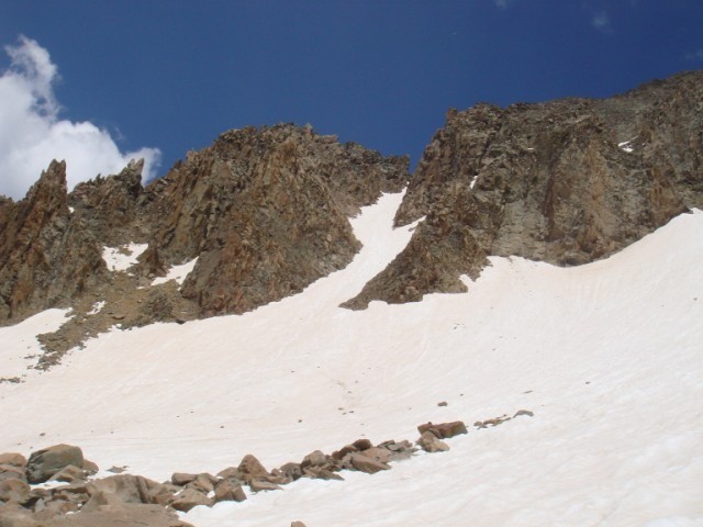 Thumbnails for uploaded photos (click to open slideshow):
|
| Comments or Questions |
|---|
|
|
Caution: The information contained in this report may not be accurate and should not be the only resource used in preparation for your climb. Failure to have the necessary experience, physical conditioning, supplies or equipment can result in injury or death. 14ers.com and the author(s) of this report provide no warranties, either express or implied, that the information provided is accurate or reliable. By using the information provided, you agree to indemnify and hold harmless 14ers.com and the report author(s) with respect to any claims and demands against them, including any attorney fees and expenses. Please read the 14ers.com Safety and Disclaimer pages for more information.
Please respect private property: 14ers.com supports the rights of private landowners to determine how and by whom their land will be used. In Colorado, it is your responsibility to determine if land is private and to obtain the appropriate permission before entering the property.

