| Report Type | Full |
| Peak(s) |
Wetterhorn Peak - 14,021 feet |
| Date Posted | 09/08/2007 |
| Modified | 10/01/2012 |
| Date Climbed | 09/08/2007 |
| Author | summitbound |
| WetterhornUmcompahgre- Matterhorn Creek |
|---|
|
Ring...ring....ring. Hello? What's up man? You know it's already Sept right? Yeah.. so? SO?! we have not gotten in nearly enough summits this year. So true!, let's go. That's how this trip got started. My family had planned a weeklong trip out to visit relatives and since I had just started a new job, I didn't have enough vacation earned to go with them. Seeing that I had a free weekend I called up Lovenit who had just gotten back from a long stretch up in the Northwest Territory. He was game for anything, of course then there is always the question of what peaks to tackle. Almost exactly a year ago to the weekend Lovenit and I were down in the San Juan's hiking Red Cloud, Sunshine, and Handies. We also had Wetterhorn and Uncompahgre on the list, but bad weather forced us to leave them for another time. No time like the present I guess. As is typical with my schedule I was not able to leave Denver until after work and did not arrive in Lake City to meet up with Lovenit until 9:30pm. I found him at the town park walking laps for cancer, I guess he thought he needed a warm up for the weekend to come, or maybe he just enjoys the punishment, just kidding it's a great cause . It was already late so we made tracks up to the Matterhorn trailhead. The road up Engineer Pass is smooth sailing up to the turnoff for Matterhorn trailhead, after that the road is narrow bumpy but passable. I didn't ever need 4x4 but having a high clearance vehicle was sure nice. It was 10:30pm by the time we rolled into the upper parking lot and found a level spot to park our trucks. We readied our packs before crashing in the back of our trucks. Typical night before the hike for both us, lay there, look at the clock, nope not time yet, lay there some more, look at the clock again, still not time. I heard people leaving from about 3am up until we finally got up at 5am. We double checked our packs had some breakfast and hot coffee before hitting the trail at about 6am. The first mile or so of the hike parallels the river and is just below tree line. As we made our way up the valley we came to the first junction where we took the right fork. Just a note here, but IMO the signs in this area are not very intuitive. They list everything thing by number so be sure and print out Bills route description! 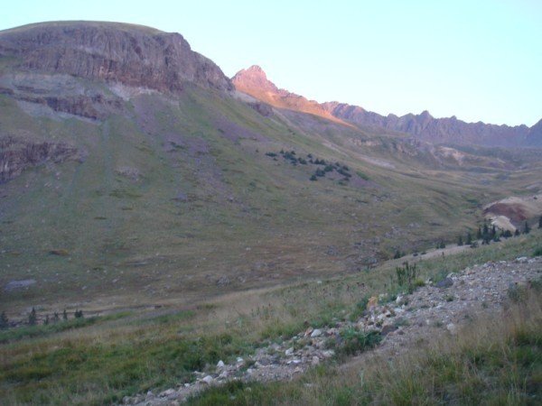 Matterhorn dominates your view for most of hike, until you get far up into the valley and then Wetterhorn finally reveals itself.  And if you look the other direction, even just the tip of uncompahgre demands your attention, this is one big mountain, we had it planned for later in the day so I kept eyeballing how far away it was. The entire day it was hazy and it made for some interesting pictures. After you top out in the valley you get to do some fun hiking through the boulders until you eventually hit the start of Wetterhorn's ridge line.  You can see the unmistakable yellow band and the distinct ridge line of Wetterhorn The hike up the yellow band was "not so fun". 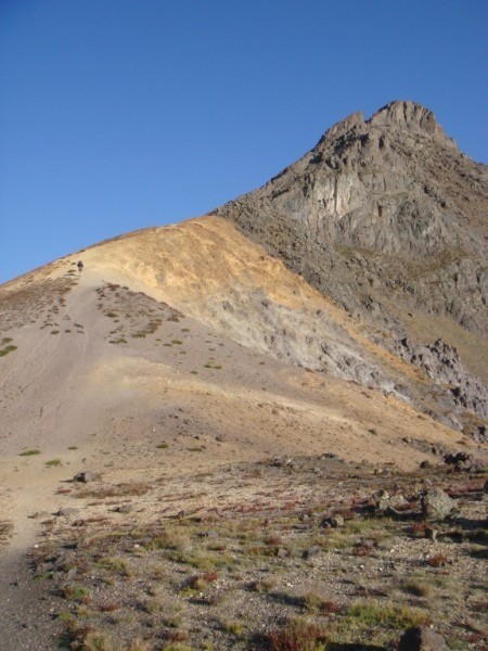 The combination of the steep slope, hard packed dirt, and tiny ball bearing rocks all over made for one interesting section of the trail. I kept slipping and really had to watch my footing.  This is where the hiking stops and the scrambling starts. If you look closely you can make out lovenit near the shadows middle of the picture. 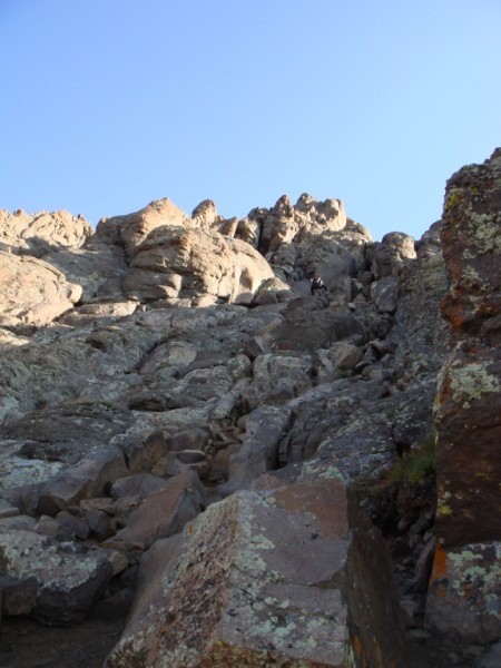 The pitch get steeper the further up you go, just lots of fun scrambling, again lovenit is near the top. There was nothing technical in this section. You do have to pay attention and pick your route and there is at least one point where you need to cross over to the next gully in order to stay on the easiest route. If you get off route you can quickly find yourself out of the class 3 climbing. 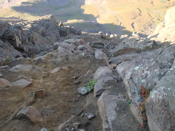 This is a view looking back down one of the gullies. You can see its pretty solid with lots of hand and foot holds to choose from. There are loose rocks to watch out for but overall not bad. 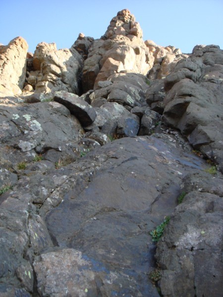 More steep gullies to climb 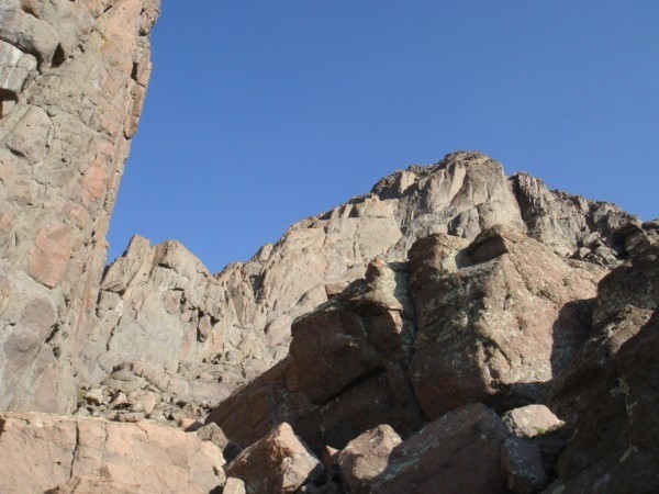 This picture is below the distinctive notch you can see when viewing Wetterhorn from a distance, it's also the place where you cross over to the most serious section of the climb.  Lovenit after climbing through the notch surveying the most technical section of the climb. This is the point where you have to make your own judgment call on how difficult it is. As you can see it is steep and the run out if you slipped is bad news. 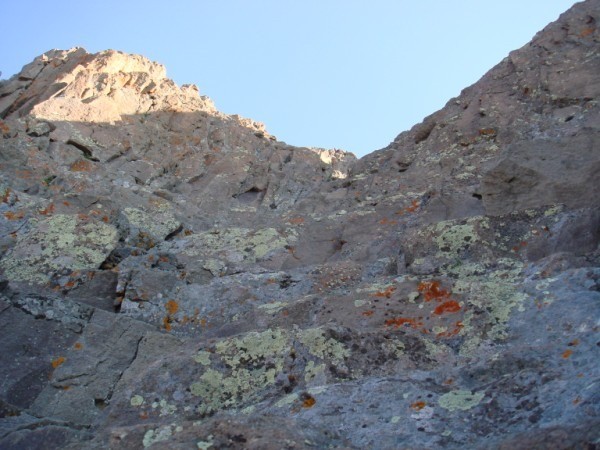 This is what he is looking at. 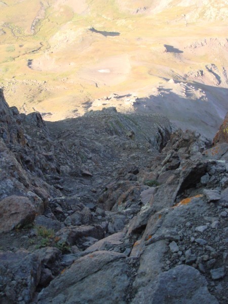 This is looking back down. Not a good place to make a mistake, but on the flip side there are numerous handholds and foot holds and the angle looks worse in the picture than it really is. 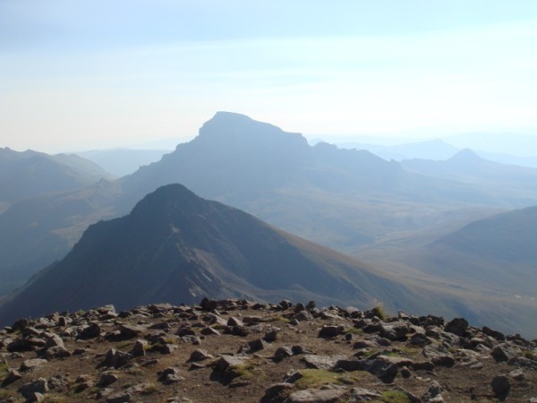 On the summit at about 9:30am, 3 1/2 hours from the TH. This is looking over at Uncompahgre, Matterhorn is the front most peak and you can tell it's still a very hazy day. Wow Uncompahgre is it a loooong way away. 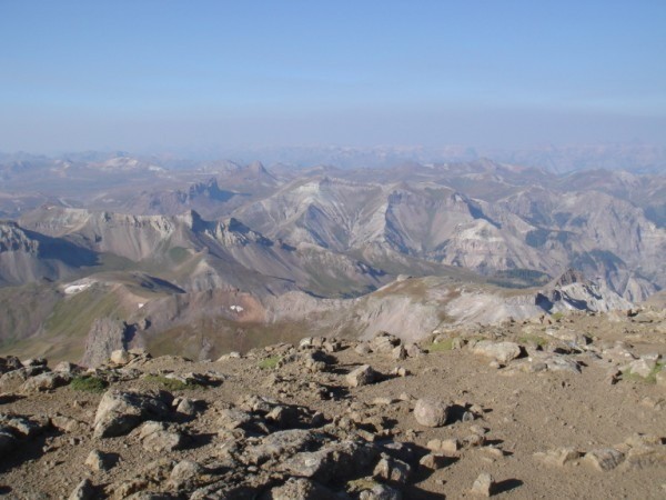 Looking the opposite direction, you just have to love the San Juans!! 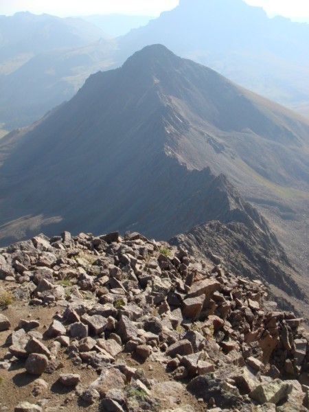 If you are feeling really adventerous, maybe try the connecting ridge to Matterhorn 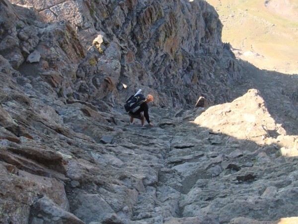 Lovenit making his way back down the steepest section. This picture gives you a better idea of the angle. 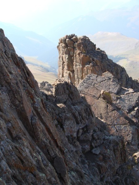 Looking at the notch, if you have the time, it's a fun to climb these spires 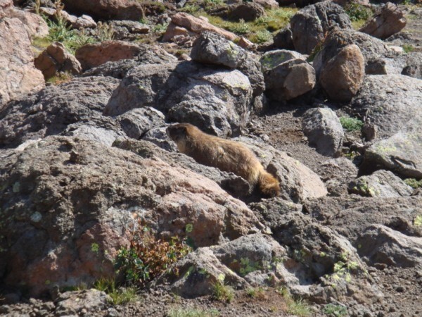 Back down in the valley and the critters were posing for pictures. 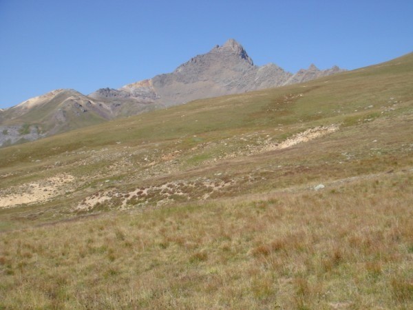 Looking back at Wetterhorn as we cross the meadow just below the ridge line connecting Wetterhorn and Matterhorn.... Uncompahgre here we come!! Thumbnails for uploaded photos (click to open slideshow):
|
| Comments or Questions |
|---|
|
|
Caution: The information contained in this report may not be accurate and should not be the only resource used in preparation for your climb. Failure to have the necessary experience, physical conditioning, supplies or equipment can result in injury or death. 14ers.com and the author(s) of this report provide no warranties, either express or implied, that the information provided is accurate or reliable. By using the information provided, you agree to indemnify and hold harmless 14ers.com and the report author(s) with respect to any claims and demands against them, including any attorney fees and expenses. Please read the 14ers.com Safety and Disclaimer pages for more information.
Please respect private property: 14ers.com supports the rights of private landowners to determine how and by whom their land will be used. In Colorado, it is your responsibility to determine if land is private and to obtain the appropriate permission before entering the property.

