Download Agreement, Release, and Acknowledgement of Risk:
You (the person requesting this file download) fully understand mountain climbing ("Activity") involves risks and dangers of serious bodily injury, including permanent disability, paralysis, and death ("Risks") and you fully accept and assume all such risks and all responsibility for losses, costs, and damages you incur as a result of your participation in this Activity.
You acknowledge that information in the file you have chosen to download may not be accurate and may contain errors. You agree to assume all risks when using this information and agree to release and discharge 14ers.com, 14ers Inc. and the author(s) of such information (collectively, the "Released Parties").
You hereby discharge the Released Parties from all damages, actions, claims and liabilities of any nature, specifically including, but not limited to, damages, actions, claims and liabilities arising from or related to the negligence of the Released Parties. You further agree to indemnify, hold harmless and defend 14ers.com, 14ers Inc. and each of the other Released Parties from and against any loss, damage, liability and expense, including costs and attorney fees, incurred by 14ers.com, 14ers Inc. or any of the other Released Parties as a result of you using information provided on the 14ers.com or 14ers Inc. websites.
You have read this agreement, fully understand its terms and intend it to be a complete and unconditional release of all liability to the greatest extent allowed by law and agree that if any portion of this agreement is held to be invalid the balance, notwithstanding, shall continue in full force and effect.
By clicking "OK" you agree to these terms. If you DO NOT agree, click "Cancel"...
Route:
Rockdale (2WD) Trailhead at 9940'
North Face of Pear, Traverse to PT 13517, Northeast Face Descent
Appx 13 miles and 4500' vertical
Introduction:
These peaks lie on the Continental Divide near Winfield between the Centennial Thirteeners Emerald Peak and North Apostle, but if you come expecting the usual Sawatch talus heaps, you will be surprised. This stretch of the Divide is an extension of the Three Apostles, and offers a surprisingly rugged stretch of ridge high on the Chaffee-Gunnison County boundary. There are many of these pockets of rugged peaks in the Sawatch if you know where to look for them.
I had first seen this pair of peaks when I climbed Missouri, Iowa and Emerald in my first summer as a Colorado resident over 8 years ago. I came back to climb "Silver King Peak" (aka "Magdalene Peak") in 2008, and once again the rough ridge of "Pear Peak" caught my eye. It took a while to get back, but finally I decided to go and explore this ridge a couple of weekends ago - another one of those "hidden gems" with little information. Of course in the years since I had first visited, I had switched to a lower clearance vehicle and was waiting for the right weather window to allow for the longer day I would now be facing, and September typically provides some great weather for long days.
Clohesy Lake and Pear Peak
The Climb:
In unusual fashion, this hike started out with putting on my sandals - usually a footwear choice saved for the end of hikes. That is because with the lower clearance vehicle, I now had to ford the creek on foot, another reason to wait until September as it can be quite high in spring. The crossing wasn't bad, if you stay to the left it was only ankle deep and had a few large rocks to keep out of the cold morning water. I switched to my boots and hiked up the 2.5 mile road to the 4x4 trailhead. The walk went quick, and soon I was at Clohesy Lake. I bypassed the trail that heads left up Missouri, and instead followed the lower Pear Lake Trail closer to the lake. It continued though the forest and frost covered willows to near tree line before I finally stopped for a break in the sun. Along the way I got a nice preview of the ridge crest and some notches and towers that might make things interesting later.
Preview of Notches on Traverse
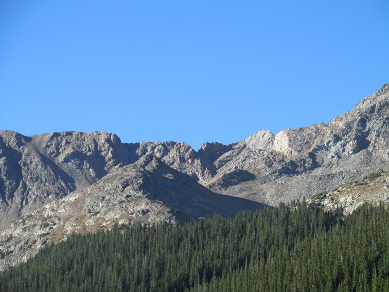
I wasn't sure what the best way up Pear Peak would be, I could go all the way to the pass and take the ridge, or try and find my way up the north face.
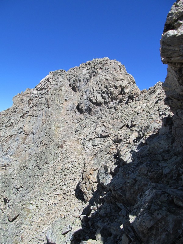
North Face of Pear
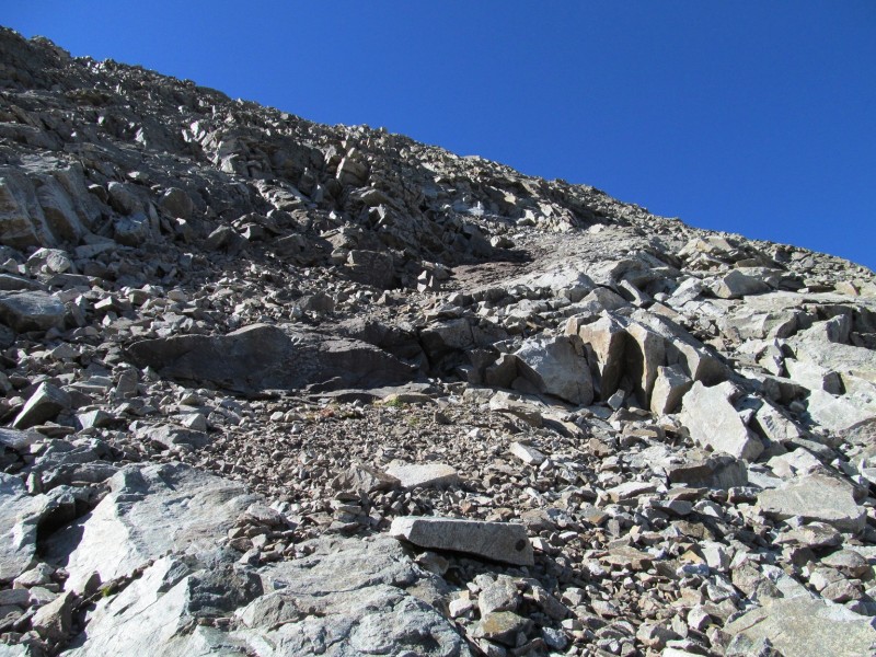
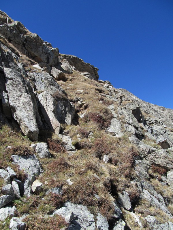
I decided to give the north face a try, and started up initially loose talus, before meeting a nice scrambly headwall.
Headwall Scrambling
There was some good solid scrambling before I found myself on a right trending ramp that had some nice solid slabs mixed with talus.
Ramp
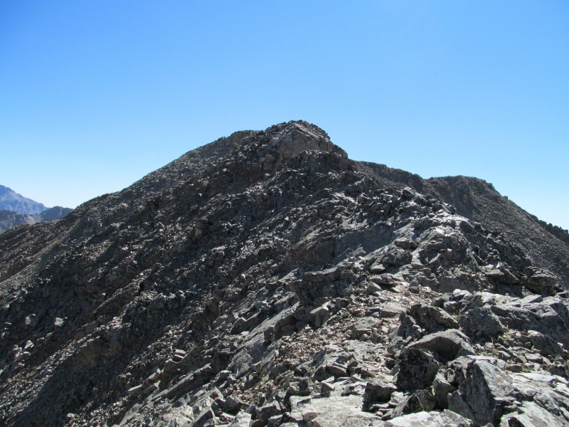
At the top of the ramp, some more scrambling over large boulders was required to reach the ridge a little short of the true summit. From the crest, I followed the nice narrow ridge with some light scrambling to the highest point.
Final Ridge to Summit
Some nice views from the summit, this is one of the lower summits in the area, and the views of the surrounding higher peaks (such as Emerald) are great:
Emerald from Summit
The traverse from here, like from below, looked like it might have some interesting notches and towers and I was glad the weather was going to be good as I wasn't sure what the bail options would be. The initial descent went easily on class 2 terrain until a steep step involved some easy scrambling before some easier terrain led to a wide grassy section.
Class 2+ on Descent off Summit
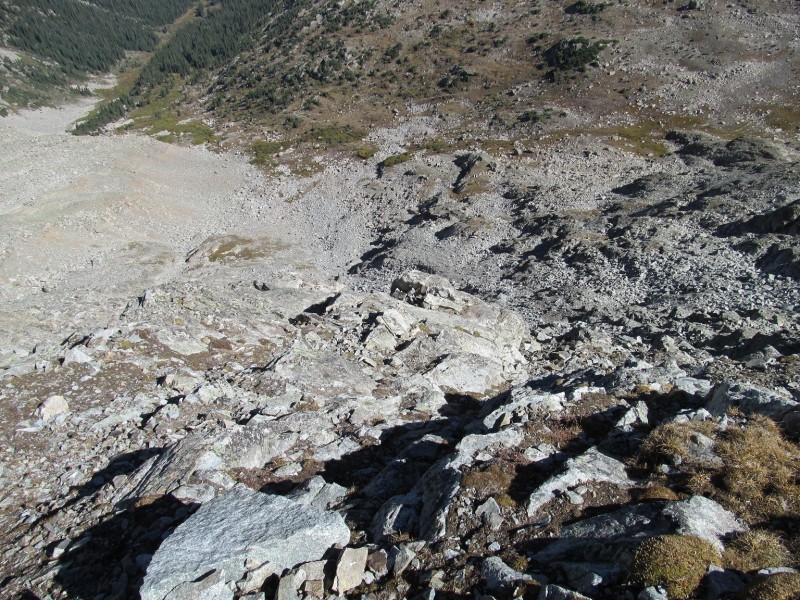
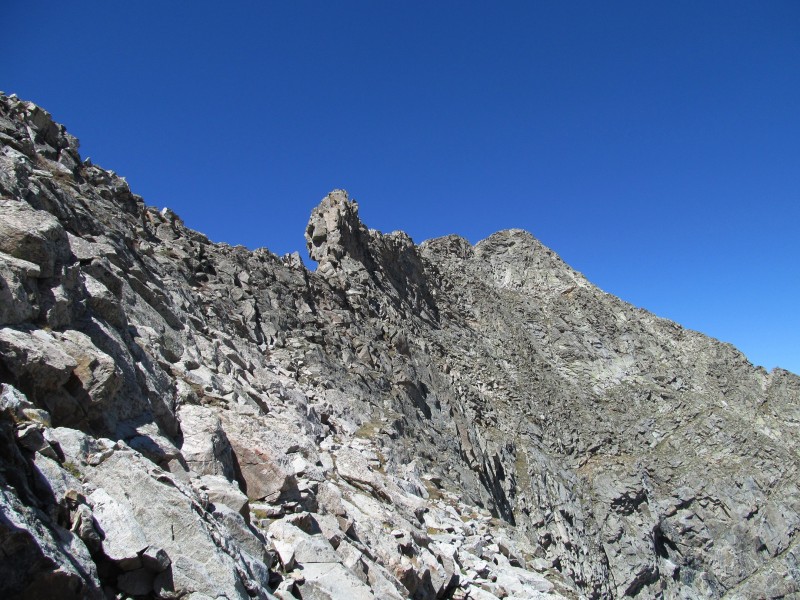
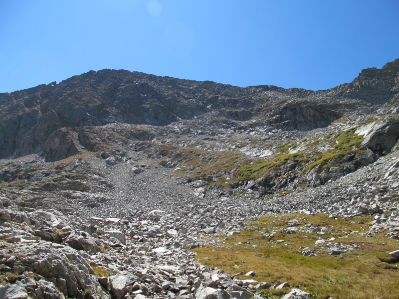
From here I saw a steep talus gully back to the main trail that would be the easiest route on Pear, although perhaps tediously loose, but it would keep the route no harder than 2+. Beyond this point came the most difficult looking stretch of ridge.
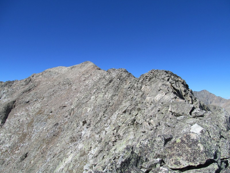
Looking Ahead to the Notches and Towers
First some reasonable class 2, then a short step to a notch (with another bail gully) and ahead were the towers and notches I had seen before.
Starting out of First Notch
Surprisingly, there were class 2 ledges all across the left (SW) side of the ridge that could be used to bypass the most difficult sections, occasionally a class 3 move would be required on a short rib to get to the next ledge. This section went surprisingly well with good route finding, just keep trying to find the easiest way and you will be fine.
Looking Back at Pear (notice talus bailout at left)
This got me past the most difficult looking of the notches, and towards the prominent tower (PT 13220 on the maps).
Up and Over Tower
Looking Back Again (bailout more clear)
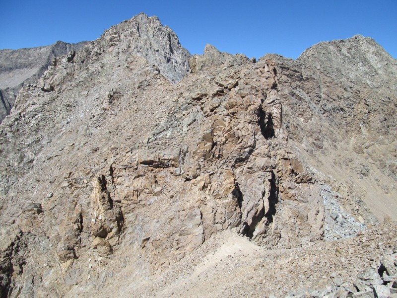
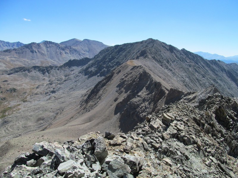
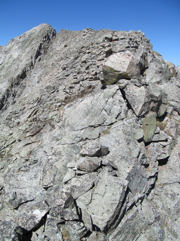
Some class 3 scrambling up and over this tower and the terrain eased once again, but by now I could see the final ridge on PT 13517, and an ominous looking notch near its summit.
PT 13517 Summit Ridge
Along the way, I kept a careful eye out for bail options in case it wouldn't go, and found something that may have worked, but also looked to have a potential difficult headwall partway down to return to easier terrain. Luckily, it would not be needed, but future climbers may need to be more wary of weather and use it, so it is definitely something to study from above just in case.
Apostles from Ridge
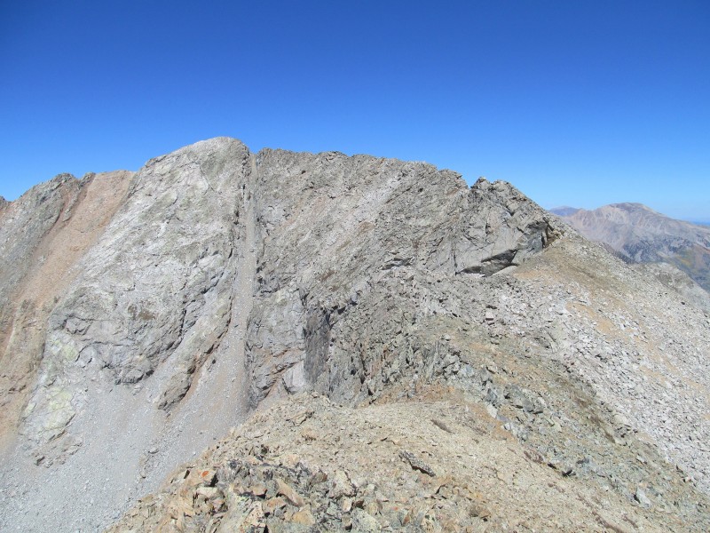
Before the final ridge I took another short break, and then followed the airy class 3 ridge. There was some class 4 as well, but I think had I chosen a different line I could have avoided it.
Some Class 4
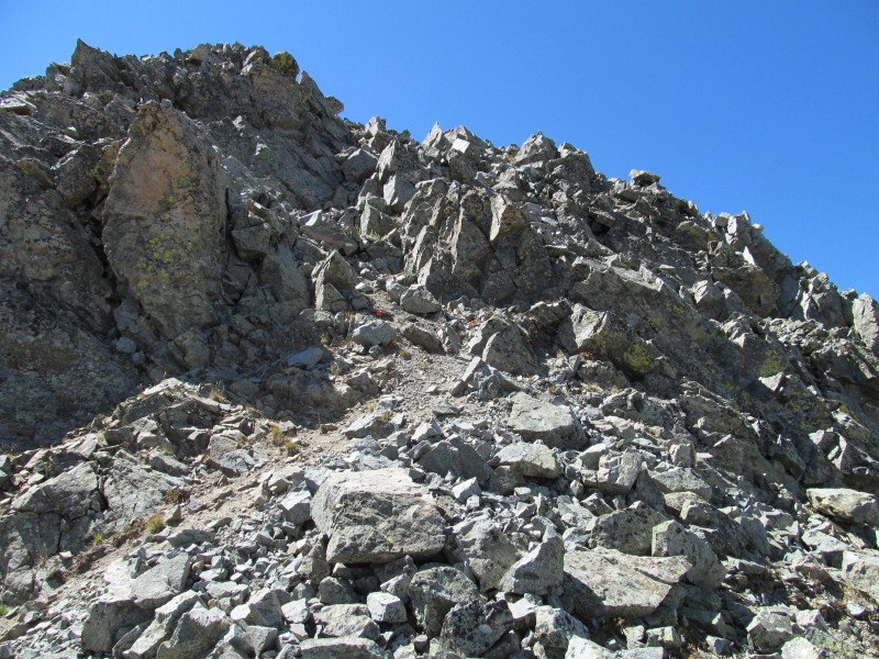
This part was pretty fun and the rock quality was good. The final notch that had looked so ominous earlier, now revealed a class 2+ blocky gully to its right that would make the going smooth to the summit.
Class 2+ Finish
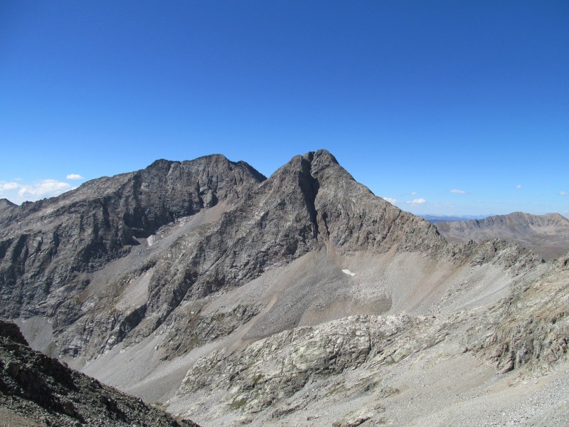
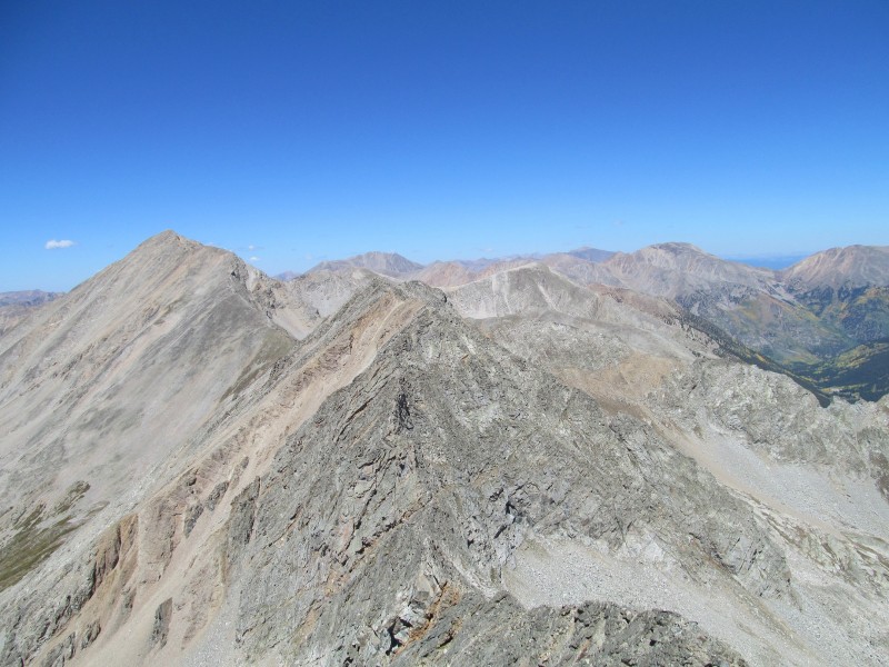
The views were great, especially of the rough connecting ridges that radiate off of this peak. There are three, the one I had ascended, the one connecting to North Apostle, and the one connecting to PT 13472 - a soft ranked peak between PT 13517 and Huron. Now all I had to do was find a safe descent and yet another journey into an unknown Sawatch traverse would be a success.
Apostles from PT 13517
Ridge to Huron from PT 13517
I started towards PT 13472, even contemplated climbing it, but decided against it as the ridge looked like it could get fairly tough - besides its easier from the other side. I traversed a series of ledges towards the saddle, and then started zig-zagging my way through grassy ledges to the basin below.
Descending to Saddle
A few times it looked like I might get cliffed out, but I could always find another ledge to keep my progress. The ledges were wide and felt comfortable despite some exposure in a few spots. Once or twice I made a quick class 3 move or two to make my way to the next ledge down, but in general this route is class 2, or 2+.
Grassy Ledges on Descent
Some class 2 talus boulders and I was down into a hanging basin below, and made good progress across the grass to a clearing that followed a stream.
At this point the gully became all willows, and I traversed into the trees. The trees were steep and interspersed with plenty of deadfall and even a few cliff bands to negotiate. It was the most direct way back to the trail, but not the best route. The better option would have been a different gully farther to the right (opposite side of a hill that separates them) that was an old slide path that looked fairly clear of willows and deadfall from above. If you were to use this as an ascent of PT 13517, that would be the way to do it.
Descent of Northeast Face
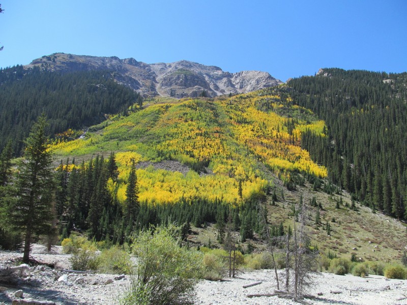
My route had a little more deadfall at the base to navigate, then some willows to cross the creek and find the Pear Lake trail back to Clohesy Lake, the road, the creek crossing (still cold!), and my car. Along the way, the early signs of fall made for a pleasant hike. As much as hiking a road can be annoying, the beauty of the early fall colors made up for it.
Fall Color on Road Out
Epilogue:
I've said in trip reports before, but the Sawatch is far from the boring range that some like to portray it as. There may be a large number of "talus heaps" that can get tedious at times, but there are plenty of great scrambling ridges out there if you know where to look. This is one of them, and it was one of the more enjoyable peak parings in this part of the range. Most of the "good stuff" is north and west of CO 82 in Hunter Fryingpan or the northern Collegiate Peaks Wilderness area or farther north in the Holy Cross Wilderness, but between these peaks and the Apostles, the Winfield area gives you a nice taste too. Don't be fooled by all those complaints about Columbia's West Face, the Sawatch is a fun place to play and explore, I hope my trip report will encourage you to get out there and see for yourself the wonders this range hides. Thanks for reading.
Thumbnails for uploaded photos (click to open slideshow):
and I'm sticking to that statement... Nice write-up Mike, always nice to see one of your TRs on the lesser traveled. If I don't get back into that range soon, I'll be living there after all this RMNP/Gore is completed. Good luck again on the finisher this weekend.
I've had Pear and the surrounding peaks on my radar for this fall, if I could squeeze it in somehow. Just didn't know how the ridges would go. So thanks for all the photos and descriptions!
Thanks for the comments, glad to know people find this stuff useful 8)
rajz- There lots of good obscure Sawatch 13ers, check out the Hunter Fryingpan and Holy Cross Wilderness area for some ”good stuff”.
Scot- Glad you enjoyed the TR, maybe if I write enough of these Sawatch scramble reports I will get you to ”see the light”, let me know when you are ready for that Lincoln Creek Loop.
Otina- I didn't know how the ridges would go either, but sometimes its fun being the ”guinea pig” on these routes.
Ben- There seemed to be many options on that north face, maybe even some that might fill with snow in spring?
Derek- Not too many of these kind of trips that I get to post before you, glad to pay back the favors all of your TRs have done for me!
Hey Mike, a couple years later and I finally used this report. On Oct 30 I climbed 13517, Pear, then Magdalene. With plenty of snow around, it was good to know in advance that difficulties on the 13517 to Pear ridge could be bypassed on the south/SW (snow free) side.
I did drive up to Clohesy Lake in the 4Runner. Creek crossing was only a foot or two deep and the road not too rough. As you know, I've already hiked that road once in January, in tennis shoes. :)
Also, if you went over the top of 13220 you'll find it as a soft-ranked peak on LOJ. I didn't notice that until I was up there myself, but I see you didn't check it off as climbed.
Thanks for writing this up.
Caution: The information contained in this report may not be accurate and should not be the only resource used in preparation for your climb. Failure to have the necessary experience, physical conditioning, supplies or equipment can result in injury or death. 14ers.com and the author(s) of this report provide no warranties, either express or implied, that the information provided is accurate or reliable. By using the information provided, you agree to indemnify and hold harmless 14ers.com and the report author(s) with respect to any claims and demands against them, including any attorney fees and expenses. Please read the 14ers.com Safety and Disclaimer pages for more information.
Please respect private property: 14ers.com supports the rights of private landowners to determine how and by whom their land will be used. In Colorado, it is your responsibility to determine if land is private and to obtain the appropriate permission before entering the property.


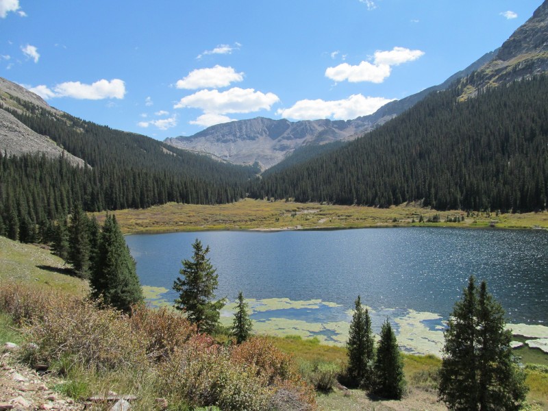

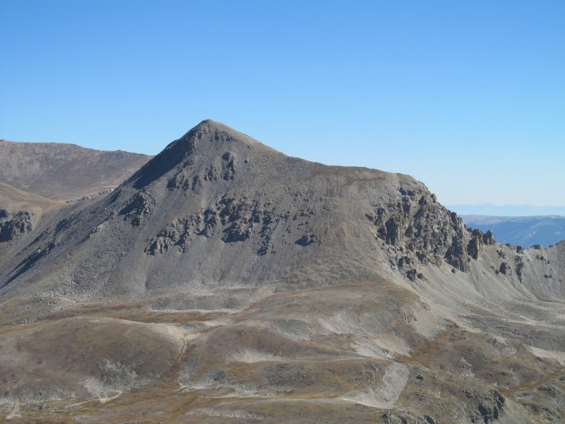


 Clohesy Lake and Pear Peak")
 Preview of Notches on Traverse")
 North Face of Pear")
 Headwall Scrambling")
 Ramp")
 Final Ridge to Summit")
 Emerald from Summit")
 Class 2+ on Descent off Summit")
 Looking Ahead to the Notches and Towers")
 Starting out of First Notch")
 Looking Back at Pear (notice talus bailout at left)")
 Up and Over Tower")
 Looking Back Again (bailout more clear)")
 PT 13517 Summit Ridge")
 Apostles from Ridge")
 Some Class 4")
 Class 2+ Finish")
 Apostles from PT 13517")
 Ridge to Huron from PT 13517")
 Descending to Saddle")
 Grassy Ledges on Descent")
 Descent of Northeast Face")
 Fall Color on Road Out")


