Download Agreement, Release, and Acknowledgement of Risk:
You (the person requesting this file download) fully understand mountain climbing ("Activity") involves risks and dangers of serious bodily injury, including permanent disability, paralysis, and death ("Risks") and you fully accept and assume all such risks and all responsibility for losses, costs, and damages you incur as a result of your participation in this Activity.
You acknowledge that information in the file you have chosen to download may not be accurate and may contain errors. You agree to assume all risks when using this information and agree to release and discharge 14ers.com, 14ers Inc. and the author(s) of such information (collectively, the "Released Parties").
You hereby discharge the Released Parties from all damages, actions, claims and liabilities of any nature, specifically including, but not limited to, damages, actions, claims and liabilities arising from or related to the negligence of the Released Parties. You further agree to indemnify, hold harmless and defend 14ers.com, 14ers Inc. and each of the other Released Parties from and against any loss, damage, liability and expense, including costs and attorney fees, incurred by 14ers.com, 14ers Inc. or any of the other Released Parties as a result of you using information provided on the 14ers.com or 14ers Inc. websites.
You have read this agreement, fully understand its terms and intend it to be a complete and unconditional release of all liability to the greatest extent allowed by law and agree that if any portion of this agreement is held to be invalid the balance, notwithstanding, shall continue in full force and effect.
By clicking "OK" you agree to these terms. If you DO NOT agree, click "Cancel"...
| Report Type |
Full |
| Peak(s) |
Wilson Peak - 14,021 feet
|
| Date Posted |
09/18/2012 |
| Date Climbed |
09/16/2012 |
| Author |
gonzalj |
| Wilson Peak via Silver Pick/SW Ridge |
Well it had been 2 months since my failed attempt at wilson peak and I had another opportunity to attempt this majestic peak with Dan_Suitor and was hoping that since I wasn't solo this time that my luck would change. We started off with an early 5:20 am start even though the weather forecast looked perfect and the weather all weekend had been perfect, but anyway I was excited for this one. As we make our way up treeline and start entering in the basin right before sunrise, everything was going well and even though we didn't set any speed records, we managed to make our way up the basin and past the rock house to where the trail merges with the road and actually find plenty of cairns and the trail pretty easily eventually taking us to the rock of ages saddle in 2 and a half hours (not bad I'm thinking as I chipped off 15 minutes from my previous time). And now, where the interesting terrain begins as I'm staring at the wilson/gladstone ridge, where I was forced to turn around right before that saddle last time. After putting our helmets on and taking a second to admire that wilson/el diente traverse view from ROA we start making our way on the trail that leads up to the wilson/gladstone saddle. What I found is that the previous time where I had to turn around probably less than 0.25 mile away from the saddle I went too high that last time and got myself into some sketchy terrain with loose rock, exposure, etc. and this time we saw a trail go right below the loose rock outcropping and were just fine making our way quickly to the saddle.
At this point we're looking at the route description right after photo 15 in the SW ridge route where we have 2 options to either stay closer to the ridge and climb more class 3 terrain or drop down 100' feet down a trail and then start making our way back to the ridge. At this point in time we decided to drop the 100' because we saw the trail going down and it looked "easier" than option 1 of more scrambling. Well after about 10 minutes of cursing at this somewhat ridiculous loose trail I guess I learned my lesson and we started making our way up the trail towards the ridge (needless to say on the way back we did the class 3 climbing and stayed closer to the ridge and even though it was more "technical" climbing, it was definitely a lot more fun and solid). Making our way towards the false summit, there was some loose rock & exposure, but overall it really wasn't bad and fairly straight forward class 2 hiking up towards the false summit. There was 1 point halfway up the ridge where we saw two trails split off with one going just below the ridge and the other trail going lower down and a bit further from the ridge. We initially chose the second trail that was further away from the ridge and after hiking in about 50 feet and looking at a gully that we needed to ascend, Dan tried ascending to no success at all and after releasing plenty of loose rock down the steep slope we decided to make our way back to that initial junction (which was right by a little saddle that you reach on the ridge and can see both the terrain looking north towards silver pick basin and south towards Telluride & lizard head) and take the higher trail that was closer to the ridge and very shortly after that found ourselves crossing the trail directly above this loose gully. After that, it was short timing before we reached the false summit. At first sight, with the exposure on the left and looking at the gully that's in photo 18 of the route description and the climbing to the right of the "crack" (that's in photos 18 & 19) there was some intimidation factor, but shortly after analyzing the terrain we decided to stay right of the "crack" and avoid the gully on the left and just climb up. After a few short seconds on downclimbing, that intimidation was totally gone and it was replaced with excitement. The hand & foot holds were very solid and the climbing was fun and before I knew it I was above the area with "crack"and making my up the last part to the summit. What a fun peak.
At this point, during this special weekend where Jeff & Greg had just finished the 14ers (major congrats to you two!!) and the whole weekend was a memorial finisher weekend for our friend Rob, I felt happy to be able to summit and dedicate this to Rob & Chris and sad due to the tragic events that occurred in the weeks prior. RIP Rob & Chris...
Thumbnails for uploaded photos (click to open slideshow):
 wilson/gladstone ridge")
 lizard head")
 Rob & Chris tribute")
 silver pick basin")
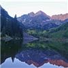
 sneffels range")
 Gladstone Peak, Mt. Wilson & El Diente")
 Silver Pick Aspens")
 6 of clubs")
|
Caution: The information contained in this report may not be accurate and should not be the only resource used in preparation for your climb. Failure to have the necessary experience, physical conditioning, supplies or equipment can result in injury or death. 14ers.com and the author(s) of this report provide no warranties, either express or implied, that the information provided is accurate or reliable. By using the information provided, you agree to indemnify and hold harmless 14ers.com and the report author(s) with respect to any claims and demands against them, including any attorney fees and expenses. Please read the 14ers.com Safety and Disclaimer pages for more information.
Please respect private property: 14ers.com supports the rights of private landowners to determine how and by whom their land will be used. In Colorado, it is your responsibility to determine if land is private and to obtain the appropriate permission before entering the property.
 wilson/gladstone ridge")
 lizard head")
 Rob & Chris tribute")
 silver pick basin")
 sneffels range")
 Gladstone Peak, Mt. Wilson & El Diente")
 Silver Pick Aspens")
 6 of clubs")