Download Agreement, Release, and Acknowledgement of Risk:
You (the person requesting this file download) fully understand mountain climbing ("Activity") involves risks and dangers of serious bodily injury, including permanent disability, paralysis, and death ("Risks") and you fully accept and assume all such risks and all responsibility for losses, costs, and damages you incur as a result of your participation in this Activity.
You acknowledge that information in the file you have chosen to download may not be accurate and may contain errors. You agree to assume all risks when using this information and agree to release and discharge 14ers.com, 14ers Inc. and the author(s) of such information (collectively, the "Released Parties").
You hereby discharge the Released Parties from all damages, actions, claims and liabilities of any nature, specifically including, but not limited to, damages, actions, claims and liabilities arising from or related to the negligence of the Released Parties. You further agree to indemnify, hold harmless and defend 14ers.com, 14ers Inc. and each of the other Released Parties from and against any loss, damage, liability and expense, including costs and attorney fees, incurred by 14ers.com, 14ers Inc. or any of the other Released Parties as a result of you using information provided on the 14ers.com or 14ers Inc. websites.
You have read this agreement, fully understand its terms and intend it to be a complete and unconditional release of all liability to the greatest extent allowed by law and agree that if any portion of this agreement is held to be invalid the balance, notwithstanding, shall continue in full force and effect.
By clicking "OK" you agree to these terms. If you DO NOT agree, click "Cancel"...
Point 11,773
Point 13,016
Point 13,051
Silver Mountain 13,714
Point 13,618
Point 13,100
Sheep Mountain 13,168
September 09, 2012
~23.6 Miles, ~7,400 Gain.
TH: Fall Creek TH (2WD, ~4.5-5 Hours from Denver)
Point 11,590
September 08, 2012
~2.2 Miles, ~600 Gain.
I hope Al accepts my apology for bailing on him, but after Longs, my body was in no shape for a 3 day Sangre 13er-a-thon. Recovering Friday helped and I met up with Ryan at Kenosha Pass Saturday afternoon to start our 4-5 hour drive to the northern San Juans.
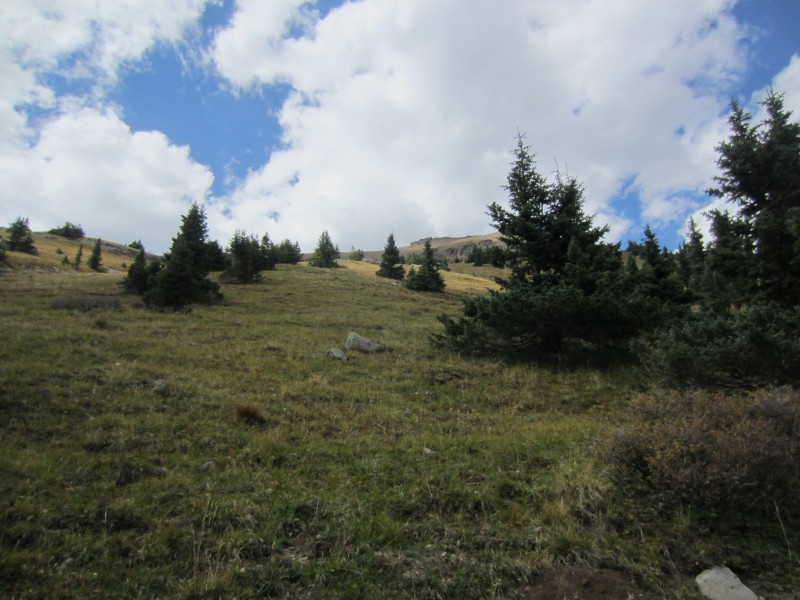
Driving went quick and we had enough daylight to sneak in an 11er. It felt good to stretch out even if it was a short 2 mile RT hike to the summit. We hiked directly up Point 11,590's southeast ridge from the Fall Creek trailhead parking lot. Some class 2 talus hiking was required near the summit.
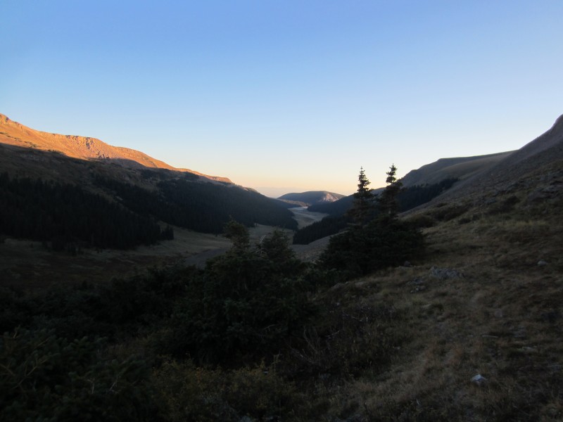
Hunters crowded the parking lot so Ryan and I camped about a mile below the trailhead. The alarm went off early, we woke up and started hiking up the Fall Creek trail at 4:35 AM. The frigid air was welcoming as we followed the groovy trail up the valley. To make sure we didn't overshoot the summit of Point 11,773, we hiked up the Fall Creek trail ~1 mile before starting up the steep west slopes of 11,773. After climbing up the steep west slopes, we hiked south on the flat summit plateau along 11,773's north ridge. Travel was somewhat slow due to plenty of downed timber.
Being dark, we didn't expect to find the register but we did at 5:30 AM. From the summit of 11,773, we hiked directly west to re-intercept the Fall Creek trail. Next time, I would follow the Fall Creek trail until the trail starts heading down towards the falls and then hike directly east to the summit. This would save time by not having to hop over dead trees.
Back on the Fall Creek trail, we hiked up the valley on the trail to ~11,700. Since the trail veered away from Point 13,016 at 11,700, we continued following the main stream to ~11,800 until we could hike east up a steep grassy slope to Point 13,016's south ridge. Once on the ridge, it was a talus hop to the summit where we arrived at 7:45 AM. Outstanding weather.
Sunrise from Fall Creek.
Looking down Fall Creek valley. Our first 11er is in the distant sun.
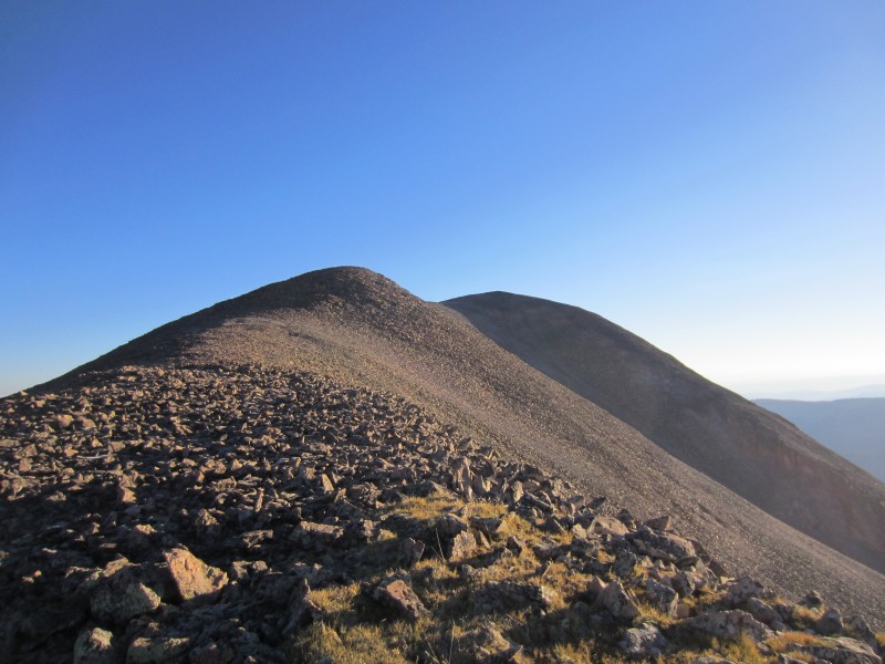
Grassy slopes up 13,016.
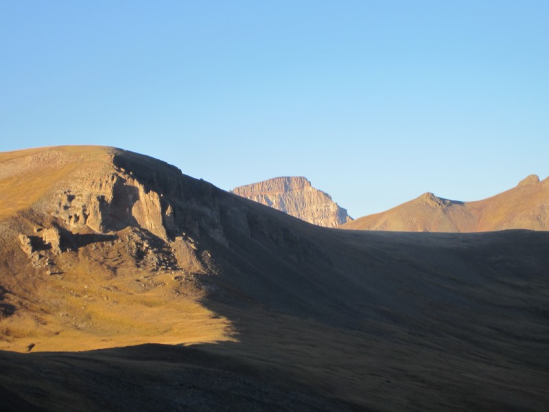
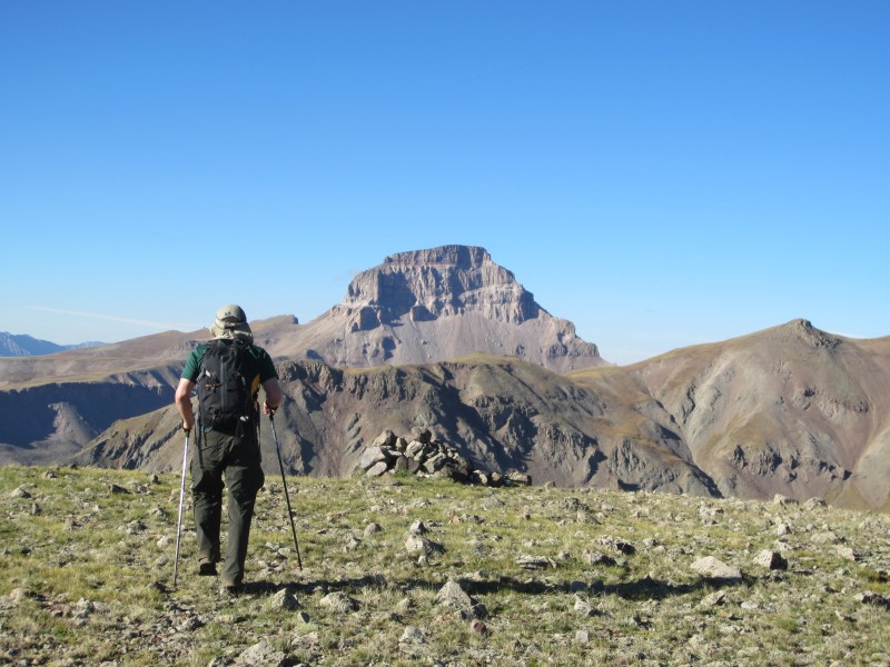
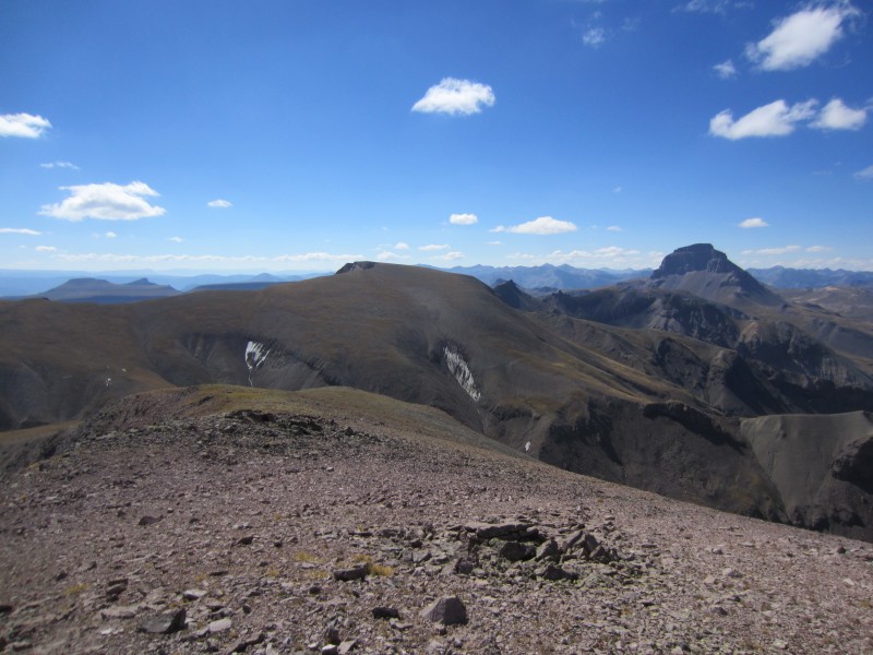
First view of Uncompahgre with 13,051 in the foreground.
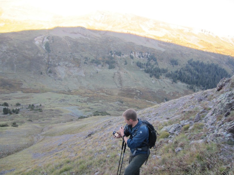
Ryan making his way up the steep west slopes of 13,016.
The talus summit ridge up 13,016.
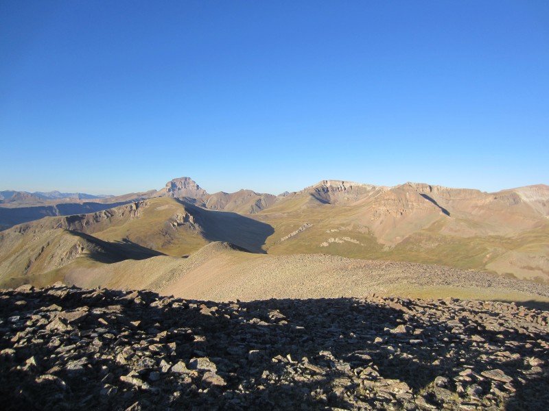
Uncompahgre, 13,051 and Silver from the summit of 13,016.
After a break on the summit, we traced our steps back down the south ridge and bypassed Point 12,809 on the west side. Grassy slopes led the way down 12,809 and back up 13,051. For me, I seemed to struggle up the northern grassy slopes of 13,051; I was still stretching out from Longs.
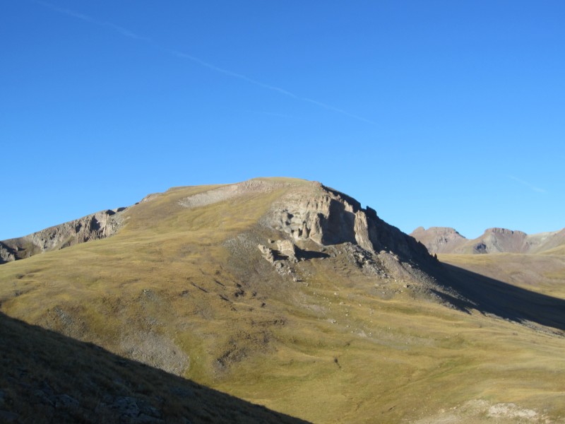
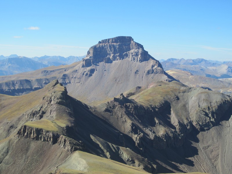
The summit of 13,051 arrived quickly at 9:00 AM and another break was in order. Silver Mountain from the summit of 13,051 looked intimidating. The views of Uncompahgre were outstanding and is one of the best views of Uncompahgre's, and as far as I know, still unclimbed north face.
Grassy summit of 13,051.
Ryan making his way up 13,051. 13,016 is in the background.
Summit of 13,051.
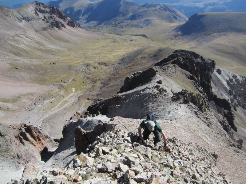
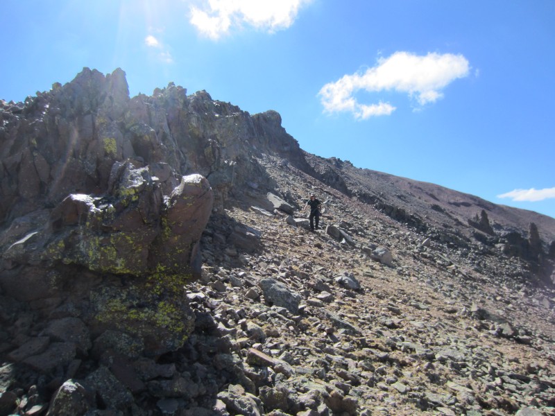
Grassy slopes down 13,051's west ridge lead us to the 13,051-Silver saddle. From the saddle, we headed up Silver's east ridge which was the crux of the day. A dark brown colored cliff band appeared to block easy access to the summit. We bypassed the hardest part of the brown band by staying on the north side of Silver's east ridge. Finding the path of least resistance through the band wasn't difficult and some minor scrambling (2+) was required to reach the top of the band.
On Silver's east ridge.
Minor scrambling through the brown band.
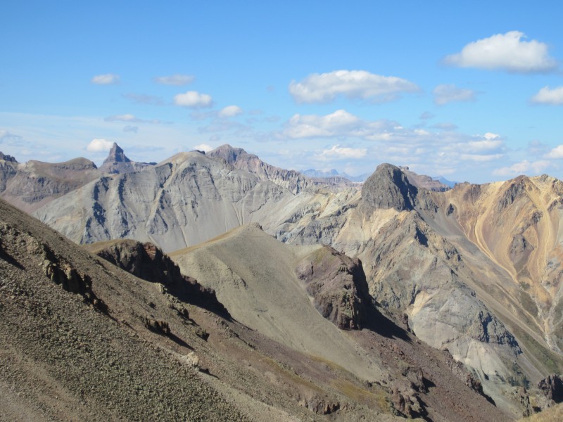
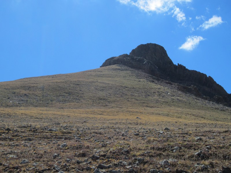
Once on top of the brown band, a chossy white colored band still needed to be climbed to reach the summit. The last section up the white band was steep and loose and the climbing didn't exceed 2+. We arrived on the summit of Silver at 10:00 AM and absorbed the fine views of Uncompahgre, Wetterhorn and the Coxcomb group.
Looking up the chossy white band.
Ryan working his way up the white band.
Uncompahgre from the summit of Silver.
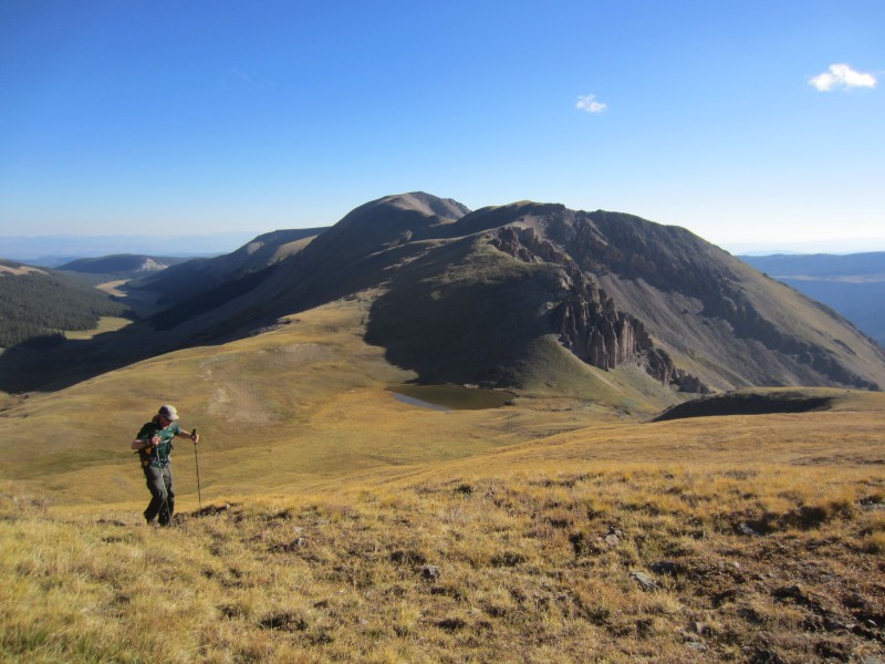
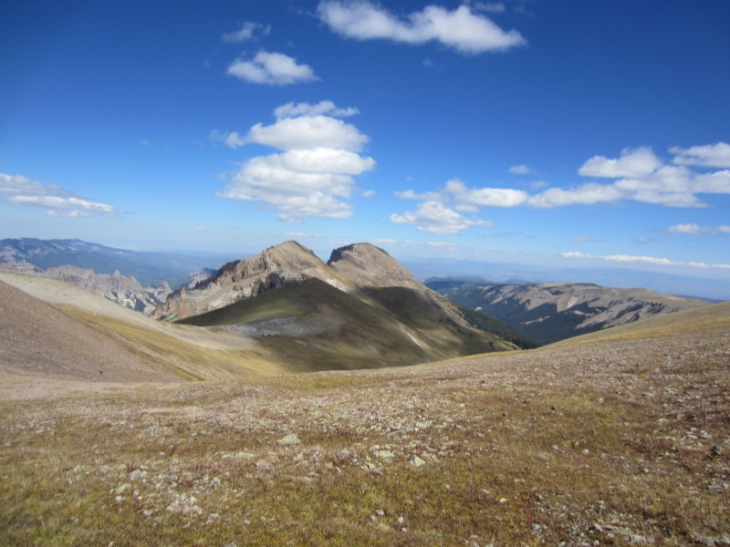
At this point, I was starting to feel much better. It only took a few miles to stretch out. From the summit of Silver, we descended Silver's grassy north ridge and up Point 13,681's grassy south ridge. Travel was fast and we arrived on the summit of 13,681 at 10:45 AM.
The Coxcomb group from the traverse between Silver and 13,681.
Silver and Uncompahgre from the summit of 13,681.
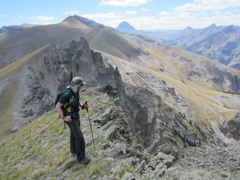
Since things went so smoothly, we decided to keep moving toward our next objective 13,100 which appeared a long distance away. From the summit of 13,681, we headed north staying on the west side of the ridge. The talus was a bit obnoxious through this section as we headed towards Point 13,503. We were not very excited about having to ascend 13,503, but it was certainly the best option to avoid further scree torture.
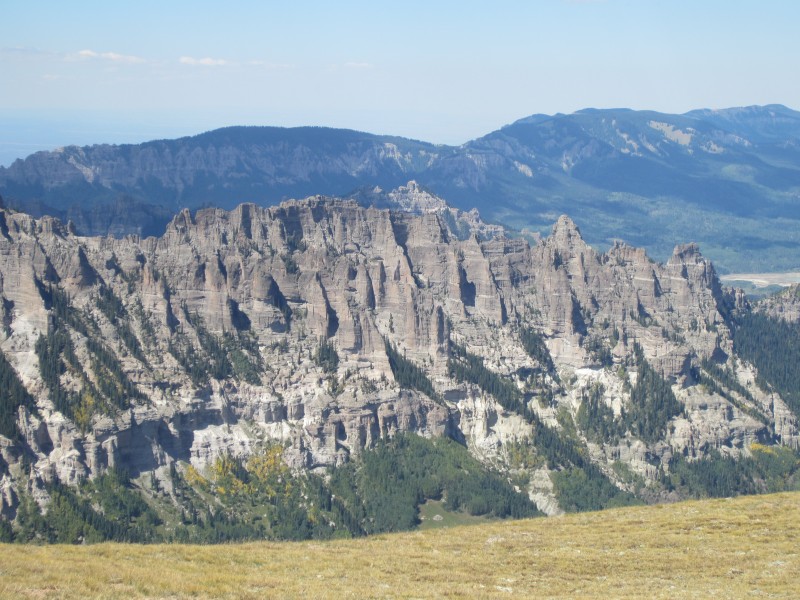
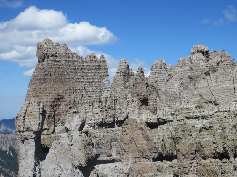
Up and over 13,503, we descended 13,503's north ridge and encountered a short 10-15 foot band that required a short section of class 3 scrambling. Once at the base of this short cliff band, it was grassy travels towards 13,100. ~.9 miles from Point 13,503 and while working our way up the south ridge of 13,100, we discovered and explored a hoodoo garden. We ended up taking a 30-40 minute detour exploring these towers of choss. Although deceivingly solid, I have no desire to climb them. A very unique area. We even managed to scramble up to a neat arch that was hidden in a rock buttress on 13,100's south ridge.
Crappy talus on the west side of the ridge just north of 13,681.
Short cliff band on the descent of 13,681's north ridge.
Point 13,100 and Sheep far in the distance.
Start of the hoodoo garden.
Hoodoo garden.
Hoodoo garden.
Neat arch in 13,100's south ridge.
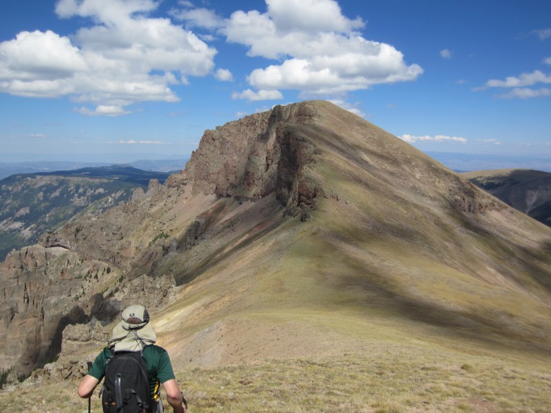
Despite our detour, we arrived on the summit of 13,100 in decent time around 12:45 PM. The weather was holding out perfectly and we only had one more summit to bag. The traverse over to Sheep Mountain was easy on grassy slopes and we arrived on the summit of Sheep at 1:30 PM where we were greeted by a friendly hunter from Iowa. After a short break, we returned to the Sheep-13,100 saddle, and started down grassy slopes heading west towards Little Cimarron Creek.
Ryan on 13,100's south ridge.
Heading toward Sheep.
Neat rock.
Wetterhorn, Coxcomb and Redcliff from the summit of Sheep.
Word on the street mentioned a possible trail down from the saddle but we couldn't locate it. We intercepted the Little Cimarron Creek trail without any trouble and started our long hike to the Little Cimarron Creek TH. The hike never seemed to end and we both underestimated how long our trek was to the trailhead. We arrived at the Cimarron Creek trailhead around 4:10 PM.
The grassy descent from the Sheep-13,100 saddle.
Our plan was to save 80 bucks on gas by only taking one vehicle and avoid a 4 mile car shuttle back to the Fall Creek trailhead. Ryan and I were hoping to thumb a ride back to the other trailhead but some sick part of me actually wanted to do the run. Before I was about to start running, a van drove by, I stuck my thumb out but wasn't lucky enough to get a ride.
Since there was no reason for both of us to run back up the road, Ryan decided to wait at the packs as I made the run back to the car. Making sure I had the car keys, I started my run back to the car. A 4 mile, 1,300 gain run was a little rough after a 19 mile day but I really enjoyed it. I returned to my car at 4:50 PM, hacked a bit, and made the drive back down the road to rescue Ryan. A fine day, extreme hoodoos and outstanding weather.
Route Map.
Thumbnails for uploaded photos (click to open slideshow):
is indeed there, on the south side of the drainage. I wish I had had a bluebird day there in July to knock all those out, but the weather gods had other ideas; including a lighting strike on 11773 when we were debating whether we should climb it. Thanks for the report.
Aaron- That would make sense the trail would be on the south side of the stream. I bet it goes to that cabin below 13,100. Was the junction pretty easy to find from Little Cimmaron trail?
inthemtns- They have done tons of work on the downed timber. We were thinking how impressive it was that they used a hand saw on all of those trees. Some of them were huge. It's a great trail now!
...were fantastic. Thanks for the trip and beasting up the road in a pretty ridiculous time, all things considered. The Music group might have to wait until next season for me.
Nice trip. When I did Sheep/13100 over Memorial Day weekend this year, I was just in awe over the hoodoos you could see at the 13100/Sheep saddle. One of the most unique views in the state.
Out of curiosity, when we did this trip in May, we had to battle a ton of downfall on the Little Cimmaron River trail. It was horrible. Was all of that removed for you guys? I take it was, or you would have mentioned it. Perhaps you saw the remnants.
In fact, as we walked in that day, we heard four trees tumble or snap. None were close to us, thankfully.
Caution: The information contained in this report may not be accurate and should not be the only resource used in preparation for your climb. Failure to have the necessary experience, physical conditioning, supplies or equipment can result in injury or death. 14ers.com and the author(s) of this report provide no warranties, either express or implied, that the information provided is accurate or reliable. By using the information provided, you agree to indemnify and hold harmless 14ers.com and the report author(s) with respect to any claims and demands against them, including any attorney fees and expenses. Please read the 14ers.com Safety and Disclaimer pages for more information.
Please respect private property: 14ers.com supports the rights of private landowners to determine how and by whom their land will be used. In Colorado, it is your responsibility to determine if land is private and to obtain the appropriate permission before entering the property.


")
")
")
")
")
")
")
")
")
")
")
")
")
")
")
")
")
")
")
")
")
")
")
")
")
")
")
")
")
")


