Download Agreement, Release, and Acknowledgement of Risk:
You (the person requesting this file download) fully understand mountain climbing ("Activity") involves risks and dangers of serious bodily injury, including permanent disability, paralysis, and death ("Risks") and you fully accept and assume all such risks and all responsibility for losses, costs, and damages you incur as a result of your participation in this Activity.
You acknowledge that information in the file you have chosen to download may not be accurate and may contain errors. You agree to assume all risks when using this information and agree to release and discharge 14ers.com, 14ers Inc. and the author(s) of such information (collectively, the "Released Parties").
You hereby discharge the Released Parties from all damages, actions, claims and liabilities of any nature, specifically including, but not limited to, damages, actions, claims and liabilities arising from or related to the negligence of the Released Parties. You further agree to indemnify, hold harmless and defend 14ers.com, 14ers Inc. and each of the other Released Parties from and against any loss, damage, liability and expense, including costs and attorney fees, incurred by 14ers.com, 14ers Inc. or any of the other Released Parties as a result of you using information provided on the 14ers.com or 14ers Inc. websites.
You have read this agreement, fully understand its terms and intend it to be a complete and unconditional release of all liability to the greatest extent allowed by law and agree that if any portion of this agreement is held to be invalid the balance, notwithstanding, shall continue in full force and effect.
By clicking "OK" you agree to these terms. If you DO NOT agree, click "Cancel"...
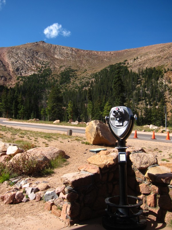
Route: Pikes Peak Highway on a bicycle
Distance: 25 miles starting in Manitou Springs (50 miles roundtrip)
Ascent Time/Total Time: 3h45m / 4h47m (excluding breaks)
The fee is the normal $12 but I know there is a coupon out there for a couple bucks off.
I've always wanted to ride it so I made the drive down on September 11 to ride and remember. Having ridden the Mt Evans Highway six times previously, I thought I had a good idea of what to expect. But Pikes is much harder....
I started in Manitou Springs to make the ride a little more difficult. This wasn't really necessary as the ride is already very difficult and doesn't need to be made any harder. I consider myself a good road rider, but this route is seriously steep and long and sustained and kicked my arse. A triple chainring is advised (I wished all day I had one). For others wanting to attempt this route, I recommend starting a little higher. There are some good parking spots a couple miles past the fee booths, at Crystal Creek Reservoir, and Glen Cove Inn.
Charming Manitou Springs
From the Glen Cove Inn
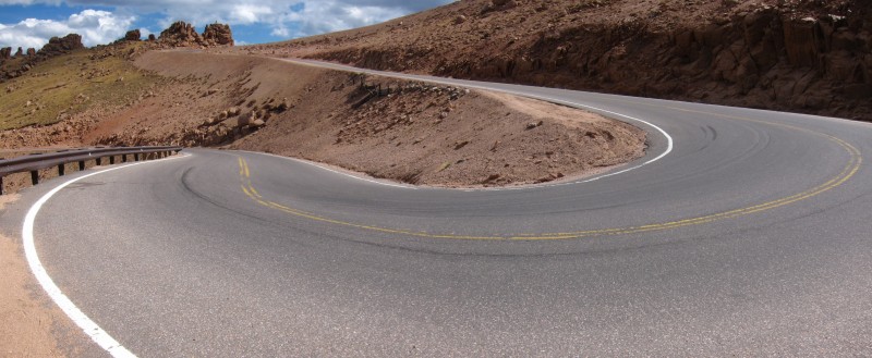
The road surface is new and in excellent condition from top to bottom. Anyone who's ridden Evans knows the road is in bad shape and beats you up when you ride it. Pikes, however, is as smooth as butter and makes for a very enjoyable descent.
I had heard the Pikes Highway was much steeper than the Evans Highway and this is true. And not only is Pikes steeper, but the grade eases in only a few places above 9000', so the last vertical mile of climbing is a grind, to say the least. I don't typically take breaks when riding, but on Pikes I had to take three. In fact, I can easily say this is the hardest singular paved road bike climb I have ever done, is the hardest in Colorado, and one of the hardest in the US. There are few climbs in the world as long, as high, and steeply sustained as Pikes. The Mt Evans Highway is much easier. Mauna Kea comes to mind as something as hard or harder than Pikes (although I have not done Mauna Kea). Pikes is no joke.
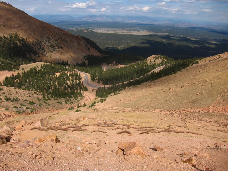
Switchbacks
Looking down the switchbacks
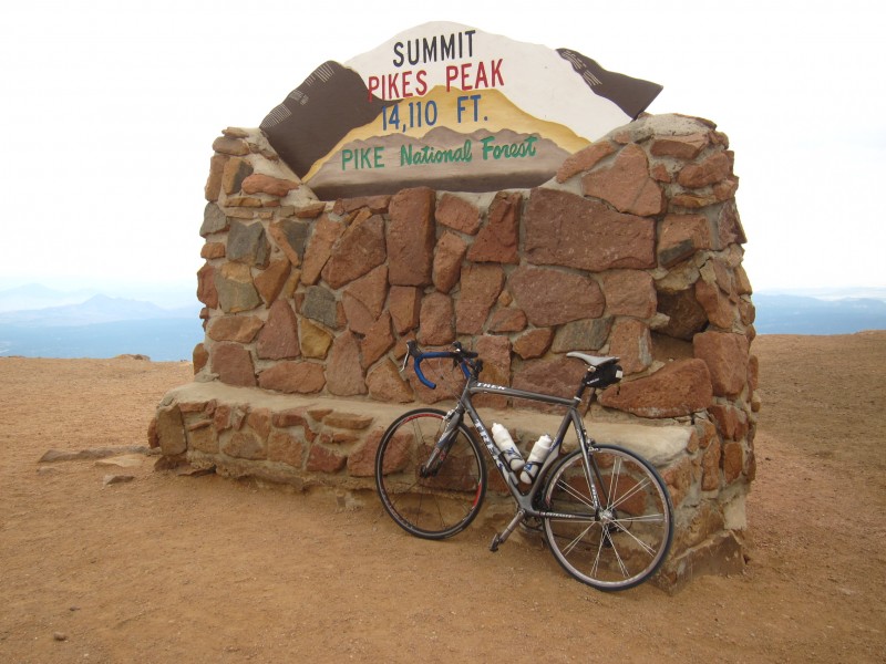
Dark clouds started to move in but I made the summit at 12:20pm (after starting at 8:10am). To compare, I've done the Mt Evans Bicycle Race (from Idaho Springs and 27 miles) in 2h40m. Pikes took me over an hour longer and is two miles shorter. Of course, I'm not in my then-racing shape, but I'm not bad now either.
On the summit
I had been thinking a lot about the events of 09/11/01 a lot on the ascent and it motivated me to keep pushing. And I thought about the many thanks that need to go out to military, police, fire, and all EMS for what they do. Thank you!
America the Beautiful
When you ride to 14k', the descent becomes non-trivial and must be planned for. It is cold riding a bicycle at those speeds down a 14er, so I donned my two small riding coats, leg and arm warmers, and full-finger gloves for the descent. I was warm enough and made the descent in around an hour.
If you are looking for a big challenge and a unique way to add to your Colorado mountain resume, Pikes Highway on a bicycle is a big one. Having ran Barr Trail in a single push on two separate occasions now, I can say Pikes Highway from Manitou Springs on a bicycle is comparable in difficulty. Of course, on a bike you benefit from the passive riding on the descent, but the climb itself was harder in my opinion on a bike.
Thanks for reading.
Pikes from Crystal Creek Reservoir
Thumbnails for uploaded photos (click to open slideshow):
I wondered how long it would be before someone put up a report on this! Hoping the experiment went well and they keep it open to bikes. Well done, Tory, and a fine way to spend a somber day.
And I can't imagine why they wouldn't open it to bikes. More revenue, and as already seen on Evans, the impact on auto traffic is minimal. The people at the booth made it sound like things have gone well so far and 89 bicycles went up on a recent weekend day alone.
The former tells about a statistical index used for difficulty, combining distance, elevation, and height climbed. It does put Pikes up there, soundly under Mauna Kea (which isn't entirely paved, though). I've done Haleakala, and did stop a couple times for pictures, but actually thought it wasn't bad because of the overall gentle grade. Pikes seems like a great U.S. contender.
The latter list is more world-focused. I was actually looking for stats on the Santiago-Mendoza highway, but hadn't seen a bike opinion of it. Some other burly routes on there though.
...
How was the descent? That's the worst part of Evans (the road heaves/cracks)!
I was in RMNP during the last Ride The Rockies bike tour and I have to say those folks have my respect! Just wondered if you've ever biked Trail Ridge road and if so how did it compare to Pikes?
I meant to (and then forgot) to touch on the road surface quality in my TR. Because the Pikes Highway is newly paved, the surface is in impeccable shape and makes for a very enjoyable and fast descent. We all know Evans is pretty rough and gives quite a pounding on the descent; Pikes is as smooth as butter. 8)
And ya, I guess my claim to being maybe the hardest in the world is uninformed, as I have never ridden anywhere else but the States. For the US, I agree that Mauna Kea would be harder than Pikes.
I did a double crossing of Trail Ridge a few years ago, about 85 miles from Estes Park to Grand Lake and back. Trail Ridge is not as steep and has only about half the elevation gain (for a single crossing) as Pikes. Trail Ridge and Independence Pass are pretty easy compared to Pikes, believe it or not.
That international list is pretty interesting. Some of those listed are deserving, while others are rated way too high or shouldn't be on the list at all. The Edelweiss Century in Wyoming is not a single climb and some others are way too short to be on the list (Col de Cougar at under 4 km). I haven't done Mt Washington but it is so short and low I can't imagine it being anywhere near as difficult as Pikes. Just my opinion though.
I'm hoping to ride it this month if everything works out. I'll probably use a fully rigid mountain bike, just because I mostly ride MTB any more. I've wanted to do this for a long time. Actually I've ridden it a couple times in the past - one time there was a race from the old ski area to the summit.
Really cool to see them doing this pilot program. I hope it works out and becomes a permanent deal.
Thanks again for your excellent report.
Caution: The information contained in this report may not be accurate and should not be the only resource used in preparation for your climb. Failure to have the necessary experience, physical conditioning, supplies or equipment can result in injury or death. 14ers.com and the author(s) of this report provide no warranties, either express or implied, that the information provided is accurate or reliable. By using the information provided, you agree to indemnify and hold harmless 14ers.com and the report author(s) with respect to any claims and demands against them, including any attorney fees and expenses. Please read the 14ers.com Safety and Disclaimer pages for more information.
Please respect private property: 14ers.com supports the rights of private landowners to determine how and by whom their land will be used. In Colorado, it is your responsibility to determine if land is private and to obtain the appropriate permission before entering the property.