Download Agreement, Release, and Acknowledgement of Risk:
You (the person requesting this file download) fully understand mountain climbing ("Activity") involves risks and dangers of serious bodily injury, including permanent disability, paralysis, and death ("Risks") and you fully accept and assume all such risks and all responsibility for losses, costs, and damages you incur as a result of your participation in this Activity.
You acknowledge that information in the file you have chosen to download may not be accurate and may contain errors. You agree to assume all risks when using this information and agree to release and discharge 14ers.com, 14ers Inc. and the author(s) of such information (collectively, the "Released Parties").
You hereby discharge the Released Parties from all damages, actions, claims and liabilities of any nature, specifically including, but not limited to, damages, actions, claims and liabilities arising from or related to the negligence of the Released Parties. You further agree to indemnify, hold harmless and defend 14ers.com, 14ers Inc. and each of the other Released Parties from and against any loss, damage, liability and expense, including costs and attorney fees, incurred by 14ers.com, 14ers Inc. or any of the other Released Parties as a result of you using information provided on the 14ers.com or 14ers Inc. websites.
You have read this agreement, fully understand its terms and intend it to be a complete and unconditional release of all liability to the greatest extent allowed by law and agree that if any portion of this agreement is held to be invalid the balance, notwithstanding, shall continue in full force and effect.
By clicking "OK" you agree to these terms. If you DO NOT agree, click "Cancel"...
Report Type
Full
Peak(s)
Mount Ida - 12880
Chief Cheley Peak - 12804
Cracktop - 12766
Mount Julian - 12928
Terra Tomah Mountain - 12718
Mount Ida - 12,880
Chief Cheley - 12,804
Cracktop - 12,766
Mount Julian - 12,928
Terra Tomah Mountain - 12,718
Mileage ~14.5
Elevation ~7300 (per Nicks GPS)
Approximate route (by Mike)
Several weeks ago I sent out an invitation to several of the FCTR who I thought could get out for a weekday climb in RMNP. Nick and Mike were both on board with getting out and hitting some highpoints. After several emails back and forth, we finally settled on the 12ers along the Continental Divide, just southeast of Milner Pass. We met in Loveland at 4:50 am and made it to the Poudre Lake TH just after 6 am. Along the drive I started to wonder how fast these guys were planning to go. I thought, surely they don't plan to run the route, do they? I quickly found the answer to this question - yes. They took off up the trail running in their Pearl Izumi sponsored gear and lightweight running packs, while I huffed and puffed far behind with a hiking pack full of too much stuff and my trekking poles. So I got to play caboose for the day.
The trail up to Mount Ida was some of the most enjoyable single track I have been on, and anyone considering some alpine running should seriously consider this trail. Most maps show the trail ending just beyond the trail split to Fall River Pass/Visitors Center, but it is well-maintained for another couple miles. Only the last mile or so to the summit of Ida was off-trail.
The views to the west of the Never Summers were some of the best I've seen. The last couple times I've been up to the Mummies, the smokey skies obscured any hopes I had of viewing this seldom visited range.
The Never Summer Mountains
Once we reached the summit of Ida, our ridgeline run towards Terra Tomah was pretty straight forward.
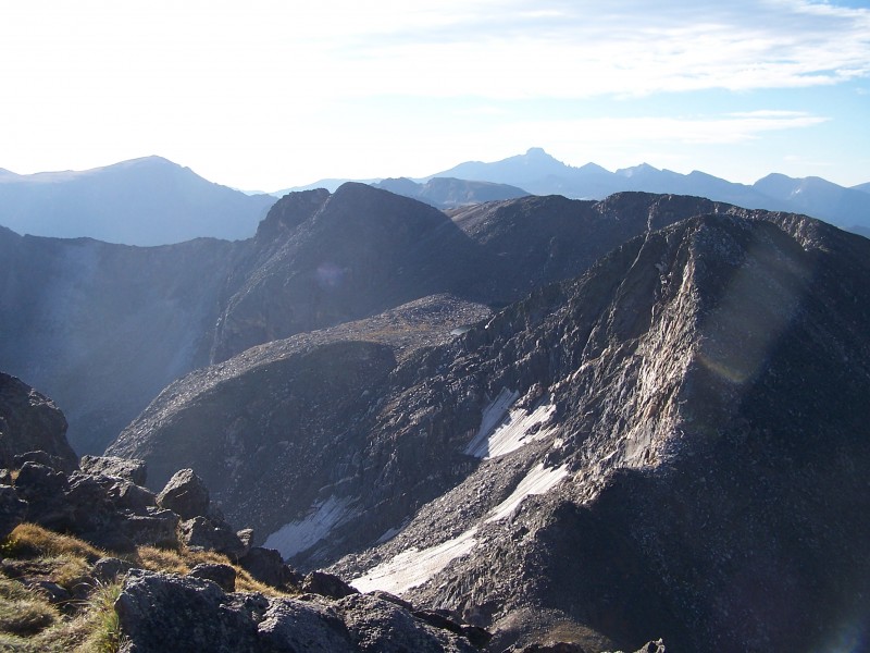
Ridgeline towards Chief Cheley and co.
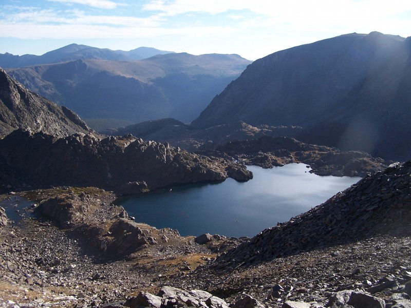
Highest Lake and the surrounding area would make for some great exploring and camping.
Lake Azure View of Ida from Chief Cheley Gentle beginnings to Cracktop
The ridgeline along Cracktop is considered the crux of the route, as it provided for some enjoyable 3rd class scrambling along a narrow ridge.
Mike scrambling along Cracktop Nick and Mike along Cracktop Mike along Cracktop Highest Lake embraced by Chief Cheley
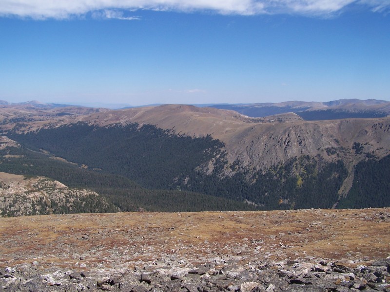
Once we hit Julian, it was an easy boulder hopping/tundra stroll to the Terra Tomah highpoint.
Our final objective, Terra Tomah
I haven't heard too much about Forest Canyon, other than it is very dense with lots of deadfall. But there is something about it that intrigues me. Nick and Mike didn't want anything to do with it, and I couldn't exactly blame them. But maybe someday I will find someone who is dumb enough to go down there with me.
Forest Canyon
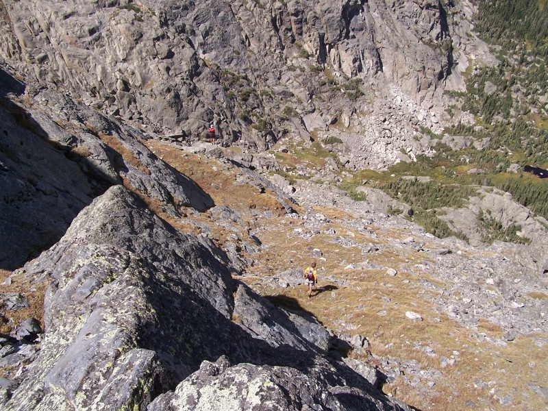
Mike and I were both interested in seeing some of the lakes below, while Nick was fairly set on heading back the way we came, more or less. With a little persuasion, Nick agreed, and we were off scouting for a way down Terra Tomah. This would turn out to be the crux of the day.
Starting the descent
The first few moves had me a little nervous, but once we got into a gulley that looked like it would go, my nerves settled down. I have always been a bit slower on the downclimbing, and the problem with that is then I become the most liable for causing rockfall on my partners, thereby slowing me down even more. But for the most part, I was able to keep up with them as they scouted for the easiest way down. It was a combination of loose rock gullies, 4th class rock slabs, and grassy ledges. As we got closer to the valley below, the grade slowly mellowed out and we were able to move more quickly.
Nick and Mike far below "I'm not worried about the water, we're pretty high up." - Nick Our descent route (blue), Nick diverted a couple times (red).
Once we were down to the lakes, our only concern was getting back the easiest way possible. All that was left was a steep hike out towards Pt. 11,819 and a tundra hike back to the trail. The Gorge Lakes area is definitely worth exploring over a long weekend.
Nick and myself Love Lake Love Lake (lower left), Arrowhead Lake (right), Terra Tomah (upper left), Julian (upper right)
Once we made it back to the trail, Nick and Mike took off running again, while I jogged slowly behind and soaked up the scenery. It was pretty fun being the caboose for the day. Thanks for the company guys.
Link to Mike's report: http://frontrangerambler.blogspot.com/2012/09/rmnp-circle-peaks-tour.html
Thumbnails for uploaded photos (click to open slideshow):
Nice report Steph. I would love to get up in that area this fall but doesn't look like schedules will allow it. Thanks for posting, those lakes would make for an excellent weekend. And regarding Forest Canyon - I agree with your partners, that's all you.
The day I realized GPS's were worth a damn 9/10/2012 9:34pm
was the day I first attempted this loop. Thanks for the memories Stephanie. My brother and I summited Ida in a thick fog, got severley disoriented and nearly ended up in Grand Lake (we travelled via an iphone compass). We saw a shitload of moose, which was cool, and thankfully, didn't end up in Forest Canyon. That place intrigues me as well. Kane's writeup on SP makes it even more intrigueing. If you want to set up a car shuttle sometime and explore it after descending Terrah Tomah, please let me know. Place looks like a gigantic black bear den.
Thanks for the beta on a classic RMNP loop. Great shots and scenery.
That first picture you have titled for Highest lake is actually Azure, which is absolutely gorgeous to visit along the shoreline.
If I were to do Forest Canyon, I'd start from Forest Canyon pass and come out at the pool. I mean if the deadfall is so bad, at least I'll always be going down.
Is there two Mad Mike's on this site? That doesn't look like the Mad Mike I know, and I don't think he has a website!
I think you met the Co Springs Mad Mike on LB a couple of winters back.
Thanks for the report, Steph, and a great day! We both love having you along, and if you weren't, it would just be me tagging way behind Nick as usual.
-- Madbuck (likely named after my insatiable quest for $, status, and worldy goods! Though I seem to be going about it all wrong. Would like to meet MadMike though!)
Madbuck. I knew it was 'mad' something. Both of you move pretty fast, so it must be something with your name.
Thanks for the comments, everyone. Guess I have been MIA in the trip report section lately, mostly from being pretty tired of the I70 and Denver traffic, so I've been sticking with RMNP, IPW, and Snowy ranges. And thanks for the correction on Azure, Chris. I'd love to spend more time up there, that's for sure.
Brian, you read my mind on wondering if Forest Canyon is a giant bear den. I kept thinking of the movie, The Grey, only with bears instead of wolves.
Thanks for the beta, I've wanted to hike this one for a while, probably up-and-back the same way though, or keep going east and have a shuttle at Bear Lake.
Caution: The information contained in this report may not be accurate and should not be the only resource used in preparation for your climb. Failure to have the necessary experience, physical conditioning, supplies or equipment can result in injury or death. 14ers.com and the author(s) of this report provide no warranties, either express or implied, that the information provided is accurate or reliable. By using the information provided, you agree to indemnify and hold harmless 14ers.com and the report author(s) with respect to any claims and demands against them, including any attorney fees and expenses. Please read the 14ers.com Safety and Disclaimer pages for more information.
Please respect private property: 14ers.com supports the rights of private landowners to determine how and by whom their land will be used. In Colorado, it is your responsibility to determine if land is private and to obtain the appropriate permission before entering the property.


 Our peaks for the day (from Summitpost via Mike)")
 Approximate route (by Mike)")
 The Never Summer Mountains")
 Ridgeline towards Chief Cheley and co.")
 Lake Azure")
 View of Ida from Chief Cheley")
 Gentle beginnings to Cracktop")
 Mike scrambling along Cracktop")
 Nick and Mike along Cracktop")
 Mike along Cracktop")
 Highest Lake embraced by Chief Cheley")
 Our final objective, Terra Tomah")
 Forest Canyon")
 Starting the descent")
 Nick and Mike far below")
")
 Our descent route (blue), Nick diverted a couple times (red).")
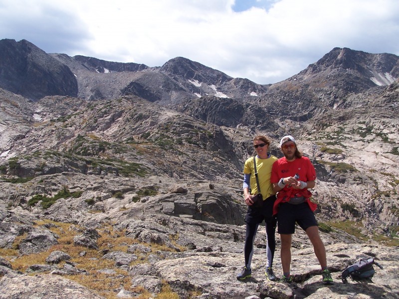
 Nick and myself")
 Love Lake")
 Love Lake (lower left), Arrowhead Lake (right), Terra Tomah (upper left), Julian (upper right)")


