Download Agreement, Release, and Acknowledgement of Risk:
You (the person requesting this file download) fully understand mountain climbing ("Activity") involves risks and dangers of serious bodily injury, including permanent disability, paralysis, and death ("Risks") and you fully accept and assume all such risks and all responsibility for losses, costs, and damages you incur as a result of your participation in this Activity.
You acknowledge that information in the file you have chosen to download may not be accurate and may contain errors. You agree to assume all risks when using this information and agree to release and discharge 14ers.com, 14ers Inc. and the author(s) of such information (collectively, the "Released Parties").
You hereby discharge the Released Parties from all damages, actions, claims and liabilities of any nature, specifically including, but not limited to, damages, actions, claims and liabilities arising from or related to the negligence of the Released Parties. You further agree to indemnify, hold harmless and defend 14ers.com, 14ers Inc. and each of the other Released Parties from and against any loss, damage, liability and expense, including costs and attorney fees, incurred by 14ers.com, 14ers Inc. or any of the other Released Parties as a result of you using information provided on the 14ers.com or 14ers Inc. websites.
You have read this agreement, fully understand its terms and intend it to be a complete and unconditional release of all liability to the greatest extent allowed by law and agree that if any portion of this agreement is held to be invalid the balance, notwithstanding, shall continue in full force and effect.
By clicking "OK" you agree to these terms. If you DO NOT agree, click "Cancel"...
The Mighty Mighty Crestones: NW Couloir and Peak - Needle Traverse
Peak: Crestone Peak - 14,294', Crestone Needle - 14,197', East Crestone - 14,290'?, Northeast Crestone - 14,260' TH/Route: S. Colony Lakes TH - Via NW Couloir and Peak-Needle Traverse Distance: ~12mi Elev Gain: 5600' Time: 10:45 (5:15am - 4:00pm) Technical Gear: Brain Travelers: Me, Myself, and I Special Thanks:Zambo and his fantastic TR on the Peak-Needle Traverse
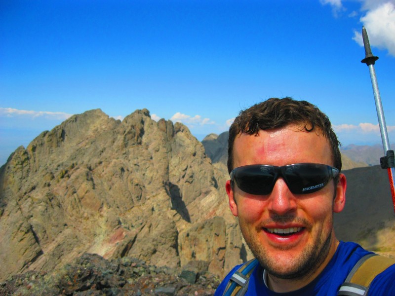
On my last 9/80 Friday off for the year I was able to get away for the day and climb some of the most amazing peaks in Colorado. To top it off, and much to my wife's delight, I was even able to get back home in time to tuck my 2 boys in for bed!
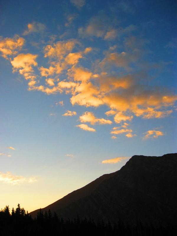
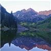
The alarm rang at 1:20AM and I was on my way by 1:45AM. Made it to the TH around 5AM, had a quick breakfast of Chocolate Graham Crackers and Milk (YUM!) and headed up the trail under a full moon by 5:15AM. With the moonlight I didn't even need to use my head lamp. I passed, and unintentionally freaked out, one person right after the TH. (Amazingly, this was the only person I would come near the whole day until I got back down to South Colony Lake on my descent.) I cruised up the road and trail to the lower lake arriving @ 6:30AM, just in time for the classic sunrise on the Needle that never seems to get old no matter how many times you see it. Classic Crestone Needle sunrise Sunlit clouds above Marble Mountain
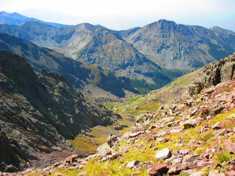
I continued up to the Upper Lake whereupon I thrashed through the willows to get around the right side of the lake and onto the grassy ramp that headed up towards the head of the basin. Clouds on the horizon cast shadows on the Needle, adding to the incredible drama of its East Face.
After I crested the ramp, I had to lift my jaw off the ground as I gazed upon the astonishingly beautiful view before me. What came to mind was that this is Colorado's version of the "Trango Towers" of Pakistan. CO's Trango Towers?: Dramatic East Face of Needle - E & NE Crestone Amazing!
I kept taking pictures as I traversed loose talus on my up to the head of the basin. "Enter Superlative Here"
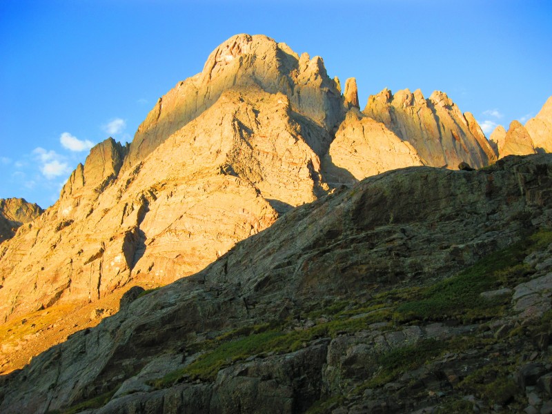
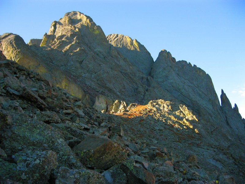
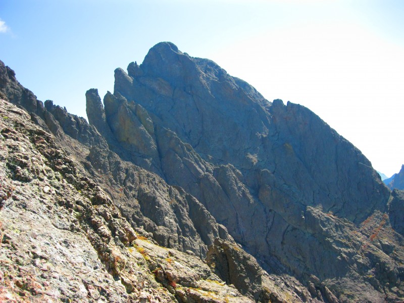
I crested the ridge on the west side of the Bears Playground and got my first view of "The Peak". I followed a use trail and cairns up the ridge to an area of really loose talus/gravel. Here I spotted cairns that went to the right/West leading to a convenient ledge that took me across to the NW Couloir. Morning on Crestone Peak
This was my first view of the NW couloir. First look at NW Couloir
I ascended the center of the couloir until a headwall forced me to the right side of the couloir. I then stayed on the right side of the couloir the rest of the way, easily finding mostly Class 3 ledges to climb and some short Class 4 sections. The center of the couloir had a little bit of water running down it and lots of loose gravel/cobbles. The ledges/cracks I climbed were for the most part really solid. Good handholds and footholds were easy to find. I loosed 2 or 3 rocks during my ascent but fortunately none of them travelled far and no one else was in the couloir either. Looking up the NW Couloir
From high up in the couloir I had seriously sweet views of nearby Kit Carson and Mt Adams. Kit Carson Peak, Columbia and Mt Adams
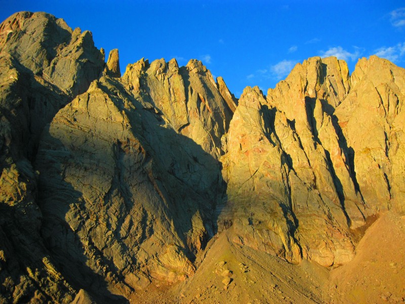
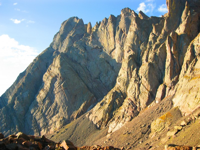
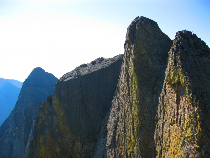
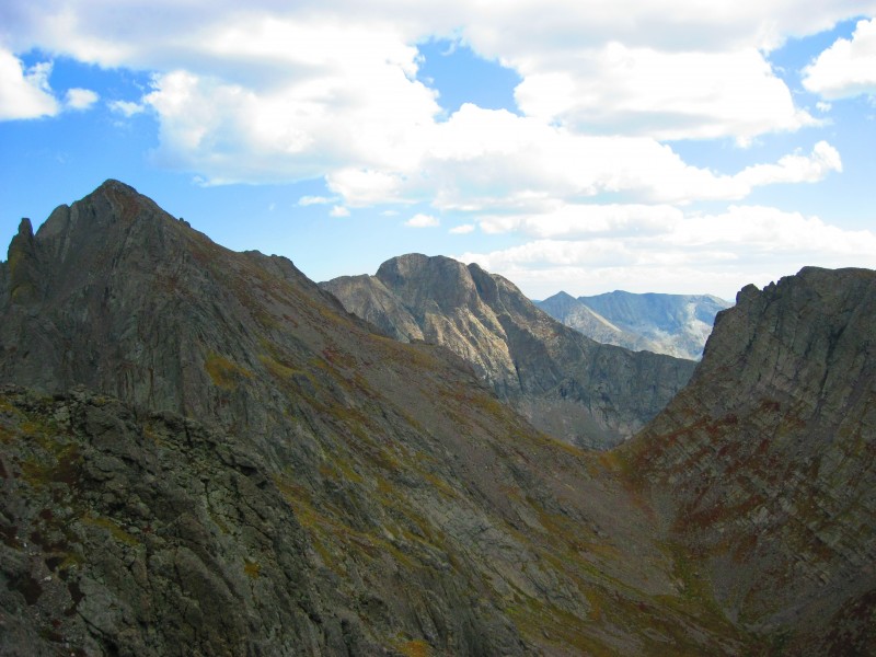
It took about 30mins to climb the NW couloir and I set my eyes on my first objective - NE Crestone. It looked steep but really fun. Solid Crestone Conglomerate made it a quick and easy Class 4/5 climb to its airy perch and a unique view of East Crestone and Crestone Peak, my next objectives. Crestone Needle and East Crestone from NE Crestone Crestone Peak from NE Crestone
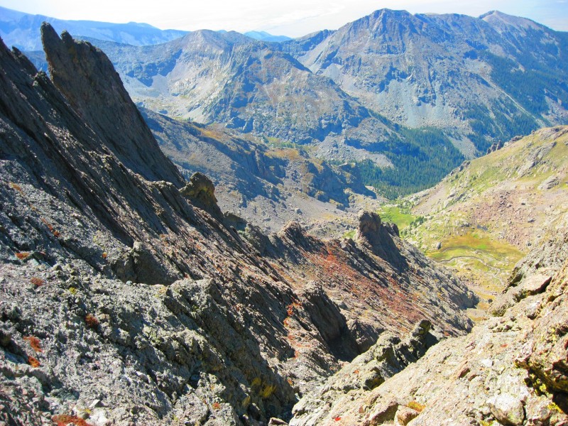
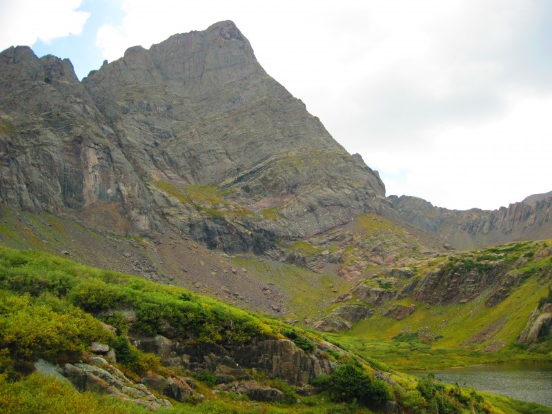
I descended NE Crestone back to the top of NW Couloir and climbed the last 20' to the saddle between East Crestone and Crestone Peak. East Crestone was an easy Class 2/3 scramble that gave me great views of Upper South Colony Lake's emerald waters shimmering below Humboldt Peak. Upper South Colony Lake and Humboldt Peak
After enjoying the views for 10min or so, and questioning whether East Crestone had the same elevation as Crestone Peak. I headed over to Crestone Peak's true summit. When I looked back at East Crestone and NE Crestone it looked like East Crestone was as high as the true summit of Crestone Peak. My guess is that it's probably a couple feet shorter, definitely not 34' as the topo map suggests.
I had the summit all to myself the whole hour I was up there. It was very peaceful under clear skies and light winds. Here, I was able to ponder and reflect on Chris' recent death on the North Buttress Route on Crestone Peak. For some reason, I halfway expected to see his name in the summit register. When I didn't see it the reality of his death hit me. RIP Chris and Rob. NE Crestone and East Crestone from Crestone Peak's summit
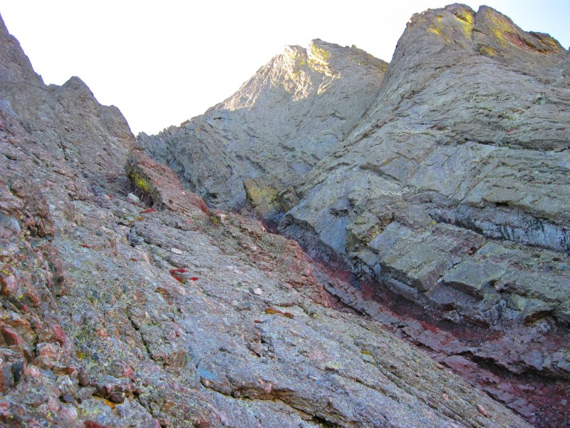
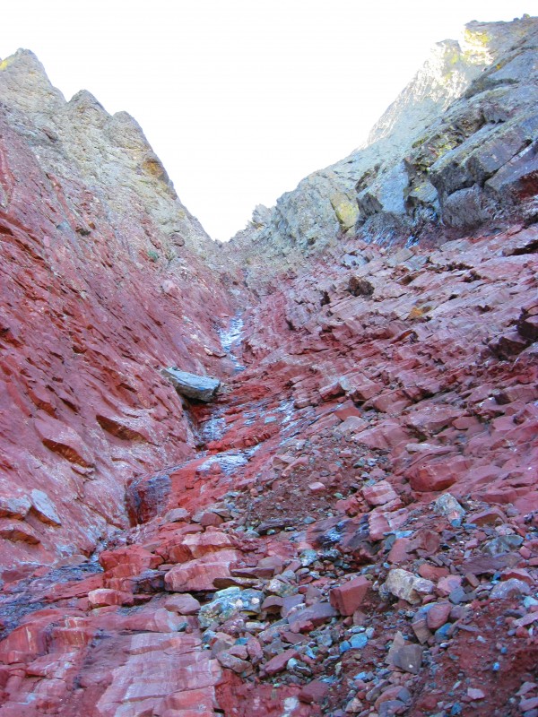
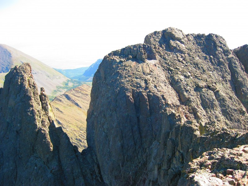
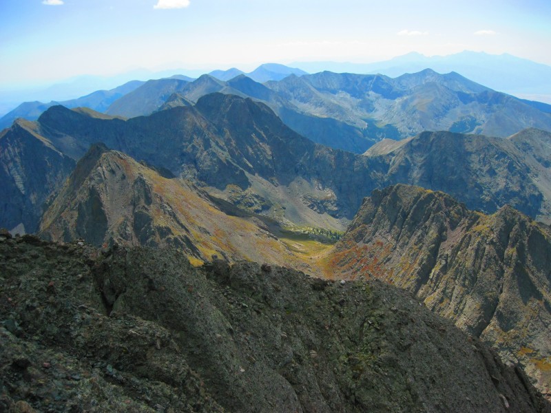
After calling my wife and letting her know I made it to Crestone Peak's summit and that I was beginning the traverse to the Needle I headed down the VERY loose upper reaches of the Red Gully. I got to the turn-off for the traverse and began following the nice cairns towards the Black Gendarme. The Traverse! Picturesque Cottonwood Basin
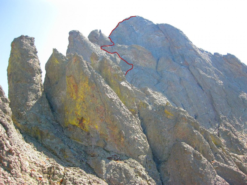
The Class 5.2 section at the base of the gully by the Black Gendarme was only 10ft or so long. I tested the cord that someone had left there just in case I needed it but I never actually used it. The moves were easy and quick. The Z ledges and gullies to Crestone Needle above the Black Gendarme
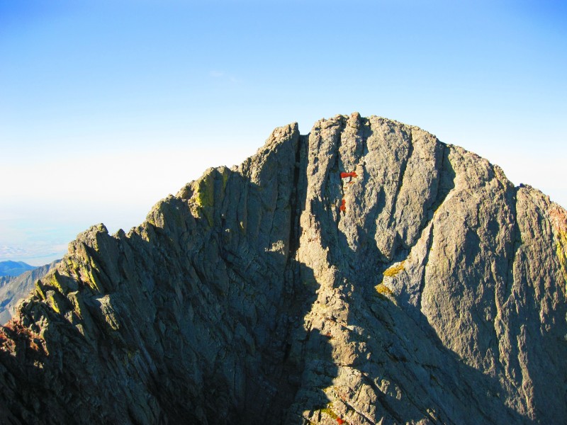
I climbed the rest of the way up the gully and made the 180deg switchback onto the short but easy knife edge section. This led to the rib that led to the "Z" ledges and gullies leading to the final "crux" climb to the summit. Route finding was pretty easy and logical once onto the ledges. Looking down from the beginning of the "Z" ledges
When I arrived at the base of the "crux" section I looked up the face to scout out a route. Unfortunately, the sun couldn't have been in a WORSE place for me. It was directly in my eyes and made it hard to scout out the route and handholds I would take up the face. Then, not more than thirty seconds after I cursed the sun for being in that horrible position, a nice little cloud formed over Crestone Needle's summit and blocked out the sun. Hallelujah! With the crux face now visible I began to climb the crux. I climbed directly up the face. From other TR's I had read they went to the climber's left and ascended. The direct ascent was steep and almost vertical, but the handholds and footholds were so big, solid, and numerous that I didn't mind the steepness. Furthermore, I was so concentrated on the face in front of me I didn't even notice the exposure. It went by really fast (~1-2mins) and only felt like it was ~30' of real climbing before I got to a nice ledge. From there it was 40' of easy Class 3 to the summit, which I reached 1:30 from Crestone Peak.
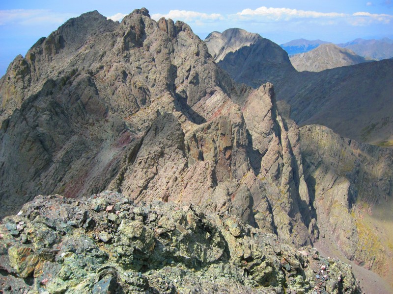
The views back across to "The Peak" were pretty cool. Here again I had the summit all to myself for the ~1hr I was up there. It was pretty special.
While I was on the summit I heard some voices drifting over the wind. I kept looking around for the people it was coming from and I finally spotted them. They were a couple climbers who had just reached the top of the wrong "Red Gully." They were in the East Red Gully on Crestone Peak. I yelled over to them and our conversation went something like this:
Me: What peak are you climbing?
Them: Crestone Peak.
Me: What route are you taking?
Them: Standard.
Me: You're in the WRONG Red Gully!
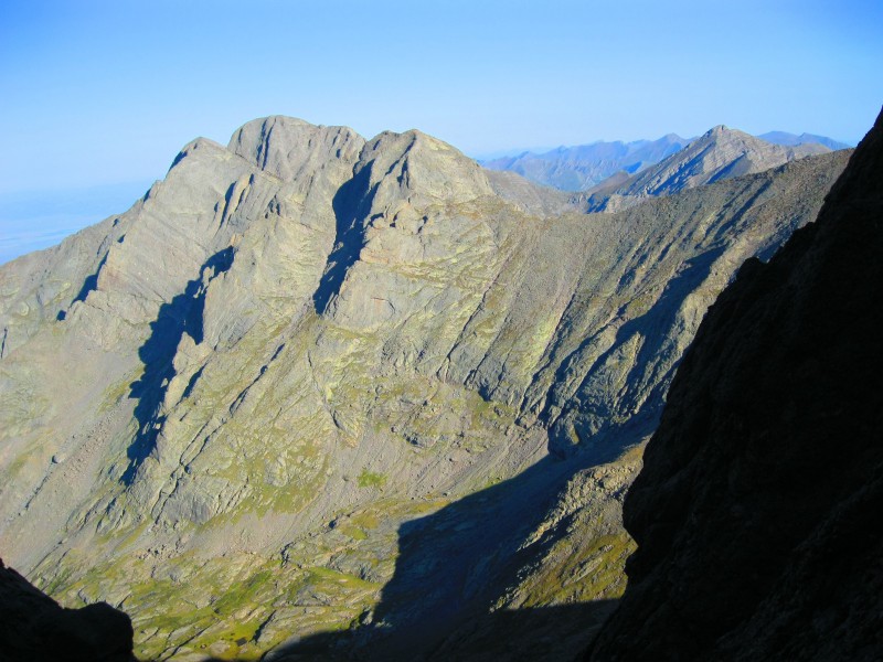
I told them to descend 300' or so and then traverse the grassy ledges to the correct Red Gully. Hopefully they made it. I tried to see Crestone Peak's summit from BHP and I sorta thought I could see someone on the summit so maybe they did make it. Crestone Peak and Kit Carson from Crestone Needle. Wrong Red Gully is Center Left I did it! Looking south from Crestone Needle
I began to descend the couloir below the "Technical Only" sign and made it about 200' down before I began to think this was the wrong couloir as it was too much on the West Face. So I climbed back up to the summit ridge and descended the gully on the South Face. I picked my way down the surprisingly steep West/East gullies and made it to Broken Hand Pass in about an hour from the Needle's summit. Pico Asilado on descent from Needle
Now began the most dangerous/treacherous part of the day: the descent off BHP. I slipped on the hard-packed dirt/gravel/scree no less than 3 times! I am soooooooooo glad I didn't climb up this way. That would've sucked! The NW Couloir route was much, much better.
Anyways, I made it down to S. Colony Lake by 3PM, where I saw the first people since the TH, and sped back to the TH by 4PM. Farewell Crestone Needle. RIP Chris and Rob.
Stopped by Subway and scarfed down a Meatball Marinara Sub w/ extra sauce and made it back home just as my wife was getting our boys ready for bed.
What an awesome day of solo solitude, on some AMAZING peaks. Probably my favorite 14ers so far.
I dedicate this climb and summits to Chris and Rob. They were on my mind the whole day. RIP brothers.
Cheers,
Jed
P.S: If you've read this far I'll give you a "pre-route" beta/secret. If you find yourself driving towards Westcliffe at a very early hour while all restrooms are closed to you and Nature isn't just "calling" you but is BANGING on the door , there is a nice bathroom that is open 24/7 (not sure about winter though). After you turn right on 69 and are heading south, you'll want to turn right on Hermit Rd. There is a brown (double entendrè? ) N.F. sign for Hermit Rd and Hermit Lake access at the intersection. Go down the hill about 1000' or so and there will be a playground on your right. There is a nice bathroom right by the parking area for the playground. An added plus is that there is a nice street lamp optimally placed to shine through the skylights in the bathrooms. Luxury I tell you.
Thumbnails for uploaded photos (click to open slideshow):
This TR is awesome! Congrats on your summits and thanks for the beta. If the weather holds I may be doing these this weekend. Hopefully I go up the right Red Gully :shock:
Beautiful colors this time of year ... 9/11/2012 10:21pm
Your ”conversation” with the fellow climbers reminds me of when we did the traverse Needle to Peak totally in the fog. We were on East Crestone Peak and realized it was the wrong summit. Unable to see anything, one of our group let out an expletive and exclaimed ”this is not it!”. From out of the fog came a voice asking, ”are you looking for the summit of Crestone Peak?”. We said yes, and he replied, ”well, I'm on it, but I can't see you so I can't tell you how to get here”. :lol: We eventually made it there and had quite a laugh about it all, and then descended the NW couloir. Thanks for posting. Nice report. Happy trails! :D
That first shot is absolutely amazing. Looks like a work of art with the color disparity.
Caution: The information contained in this report may not be accurate and should not be the only resource used in preparation for your climb. Failure to have the necessary experience, physical conditioning, supplies or equipment can result in injury or death. 14ers.com and the author(s) of this report provide no warranties, either express or implied, that the information provided is accurate or reliable. By using the information provided, you agree to indemnify and hold harmless 14ers.com and the report author(s) with respect to any claims and demands against them, including any attorney fees and expenses. Please read the 14ers.com Safety and Disclaimer pages for more information.
Please respect private property: 14ers.com supports the rights of private landowners to determine how and by whom their land will be used. In Colorado, it is your responsibility to determine if land is private and to obtain the appropriate permission before entering the property.