Download Agreement, Release, and Acknowledgement of Risk:
You (the person requesting this file download) fully understand mountain climbing ("Activity") involves risks and dangers of serious bodily injury, including permanent disability, paralysis, and death ("Risks") and you fully accept and assume all such risks and all responsibility for losses, costs, and damages you incur as a result of your participation in this Activity.
You acknowledge that information in the file you have chosen to download may not be accurate and may contain errors. You agree to assume all risks when using this information and agree to release and discharge 14ers.com, 14ers Inc. and the author(s) of such information (collectively, the "Released Parties").
You hereby discharge the Released Parties from all damages, actions, claims and liabilities of any nature, specifically including, but not limited to, damages, actions, claims and liabilities arising from or related to the negligence of the Released Parties. You further agree to indemnify, hold harmless and defend 14ers.com, 14ers Inc. and each of the other Released Parties from and against any loss, damage, liability and expense, including costs and attorney fees, incurred by 14ers.com, 14ers Inc. or any of the other Released Parties as a result of you using information provided on the 14ers.com or 14ers Inc. websites.
You have read this agreement, fully understand its terms and intend it to be a complete and unconditional release of all liability to the greatest extent allowed by law and agree that if any portion of this agreement is held to be invalid the balance, notwithstanding, shall continue in full force and effect.
By clicking "OK" you agree to these terms. If you DO NOT agree, click "Cancel"...
Campsite: just below Moon Lake, elevation 11,200 Hours to campsite from TH: 4.30 h (Saturday) Hours to summit from campsite: 5 h (Sunday)
I would like to start quoting Gerry Roach on his 14er book when he describes this approach: "this is a rougher, seldom used alternative to the popular Capitol Creek Approach". And YES, I totally agree with this statement.
Mike and I climbed this peak about 10 years ago. By then I only had a few 14ers and not as much experience with mountain climbing. Capitol was my number 10th. As I got more and more peaks, I always thought Capitol Pk was not one of the hardest 14ers, I always ranked it in 6th or 7th place, it is funny how sometimes memory erases the let's call it "scary" parts of a climb. Anyway, I was just curious to know how it would feel to climb it again having done all the other 14ers. So here we go.
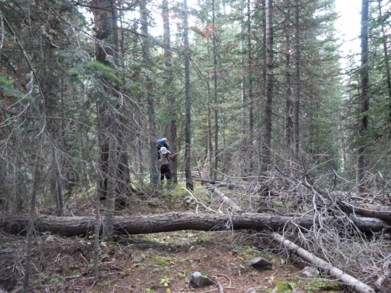
We started at the West Snowmass Creek on Saturday afternoon. The plan was to hike to Moon Lake, but we would soon discovered how difficult this trail and route finding would be. The first 3 miles are very easy, the trail is nice and straightforward to follow. The problem starts when you hit the meadow where the cows reside. At that point, we had read in Roach's guide and also in some other trip reports that the trail goes to the east side of the creek (we would later realize this is not true, and it does not happen till you reach 10,700 feet approximately, which is about another mile). Anyway, we made our way through some trees, bushes, you name it. What was funny is that somebody had placed purple plastic trash bags in some of the trees as a means of route finding (?). Picture below shows what we went through in some of the areas, we ended up with brushes and scratches in our legs and arms.
Bushwhacking through the trees
After about 10,700 feet the trail becomes very clear and it is nice again, this is the part where it supposedly crosses to the east side (the side we were already on), so from there it was steep but quite easy to follow.
On the East side of the creek
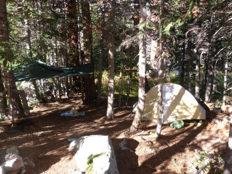
We finally made it to our campsite (a nice area by the way) just before dark. Ate dinner and went to sleep.
Campsite at 11,200 feet
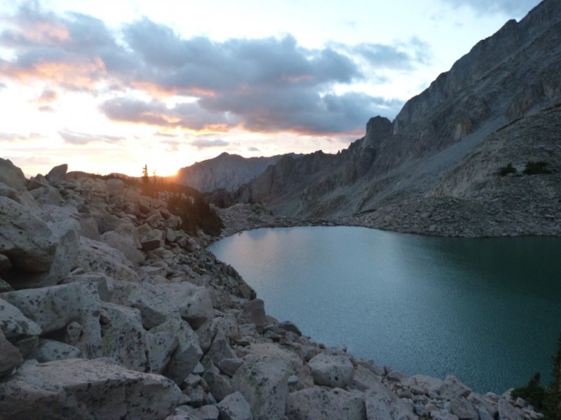
The initial plan was to hike to Moon Lake, but with our heavy packs, night coming fast and the trail not being that clear through the huge talus we decided it was better to camp lower. So, in the morning we woke up at around 5am, had breakfast and started hiking up to the lake at about 5.45am. There was no apparent trail but we made it to the lake in about 45 minutes, in the dark it was a bit slow.
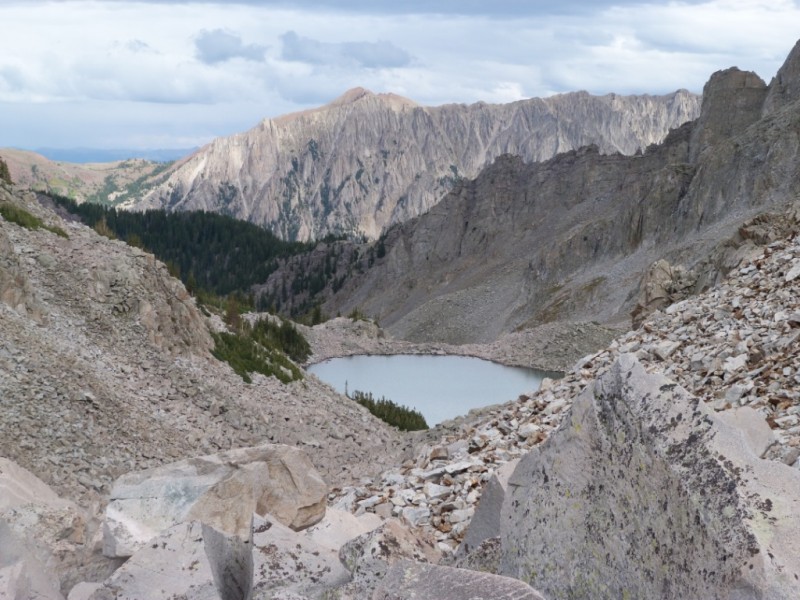
Moon Lake
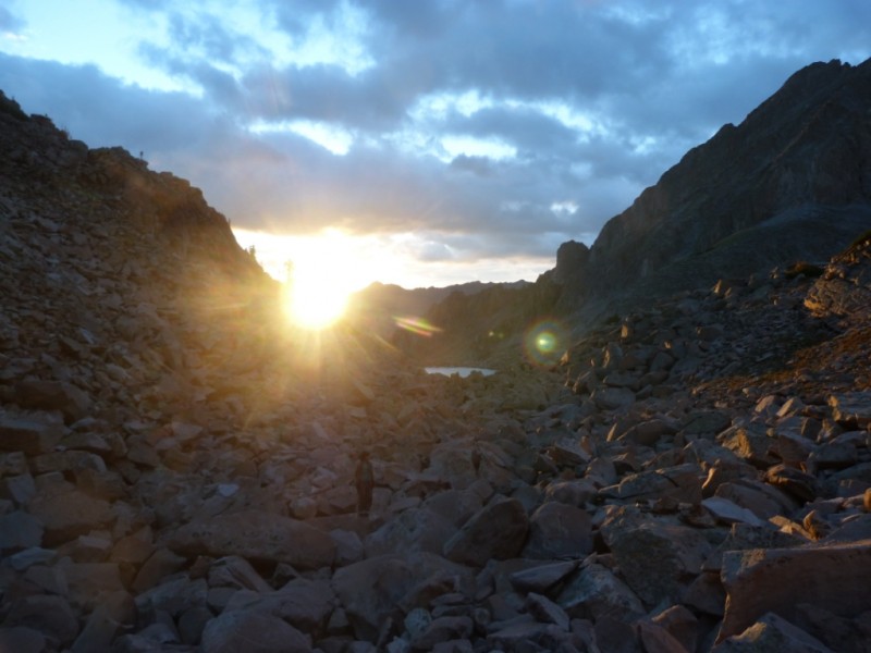
The moon was setting as we approached Moon Lake and the sun was on the rise...
Moon Lake sunrise
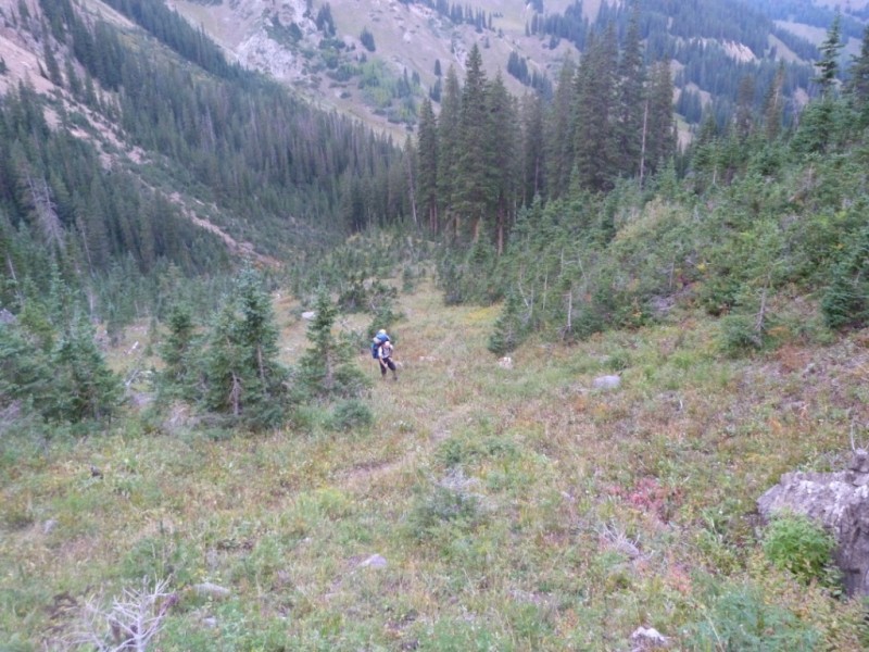
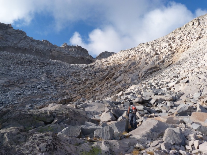
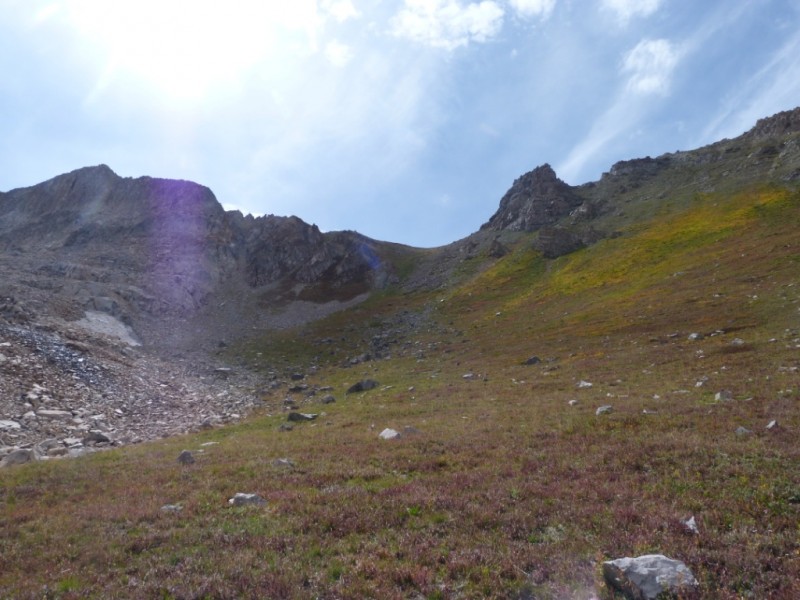
Once in the lake we kept going southwest up the basin, till we intercepted the standard route. We were not aware at that point that we were in the standard route till we met a hiker coming down. We were surprised how quiet that route was even on a busy weekend like Labor Day. The next picture shows the route up (on standard route). We kept to the right because there were some huge rock slides on our left.
Going up the basin
We finally saw K2 in the distance.
K2 in the distance
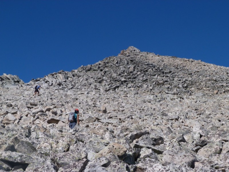
It took 3 hours and a half to get to this point, including eating some snacks and filtering some water in one of the creeks. Maybe longer than we thought, but considering we had to do some route finding this was about right. We stopped many times to look at the map and decide which line (of huge talus) to take.
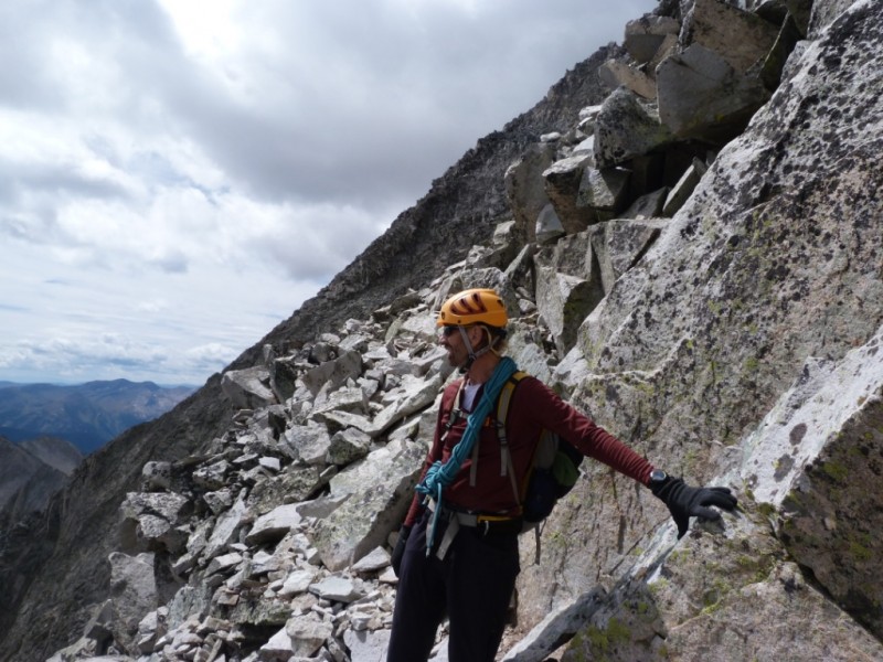
On our previous climb we went to the top of K2, but this time we decided to go around to the right side as described in the standard route. I think we contoured it a little bit higher, but it did not feel expose or difficult. It is funny because according to my recollection of 10 years ago, this is the point were I was most scared, K2 was the crux of the climb for me. Now it did not feel this way (climbing 14ers get you used to loose rock!), instead another perception changed as I will tell later.
This picture shows me scouting the route to decide if we were going up or down.
K2 approach
This is me going down to by-pass K2.
K2 approach
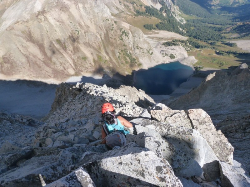
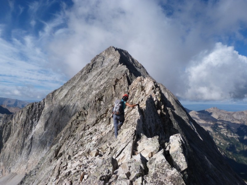
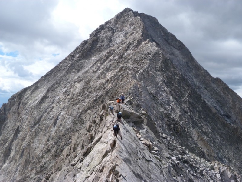
From here we quickly encountered the infamous knife-edge ridge. My recollection from the time before is that it was not too scary, maybe that was because the day we climbed it there were clouds all around us and of course I could not see the drop. This time I have to admit it terrified me a little, I looked down and probably I shouldn't have; I am not afraid of heights, but that is a heck of a drop! This is me going on the left side trying to walk the first part.
On the knife-edge ridge
Later I decided to sit on my butt and move along (my arms felt that the day after). No picture for this one, Mike was concentrated as well following me.
After the knife-edge ridge, the route was pretty straightforward (compared to what we had already done earlier in the day), so we just kept going from cairn to cairn and making it up. We met Debbie and her partner on the way up (they were coming down), they remembered us from our hike to Culebra last year. Good luck on the remaining of your 14er quest!
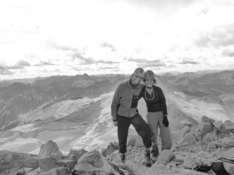
We made it to the summit at about 11am. Our total time from K2 to summit it was 1 hour and a half, which is faster than we thought it would take. Somehow the camera went black and white, still a cool shot.
Summit of Capitol Pk.
We met a nice couple on the summit (Sarah and ? sorry I forgot your name). After spending an hour on the summit (weather was perfect) we decided to all go down together to minimize rock kicking on each other. I took some pictures as we were all descending. Another group of 3 caught up with us as well.
On the way down, hold on...
Our summit friends
Knife-edge getting busy
The trip back to K2 took us about the same time, maybe a little faster. This time we took a lower contour line.
Contouring K2
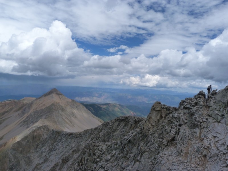
Clouds were approaching, so we decided to continue down the talus field. We soon were at the basin where you can see Daly pass and the standard route. And the sun was shining again.
Daly Pass
Moon Lake was pretty from here.
Moon Lake
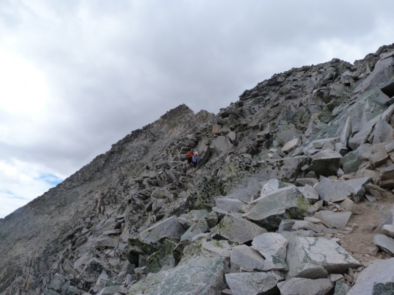
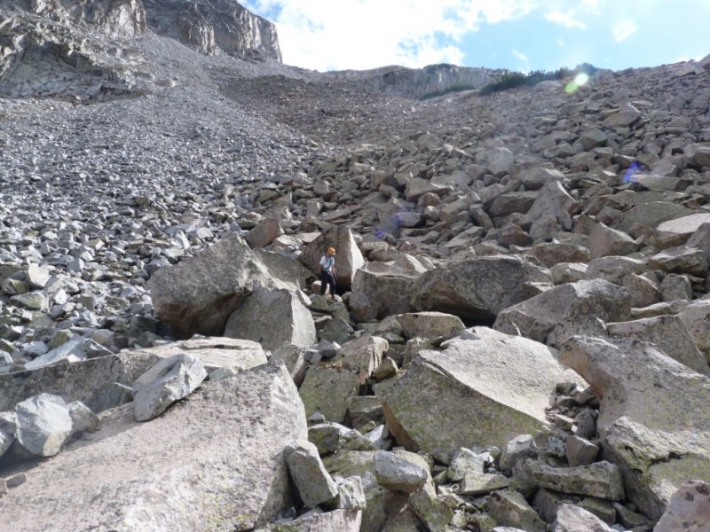
And more boulder hoping, and more... our legs were starting to hurt here.
Hopping Boulder, is it ever going to finish?
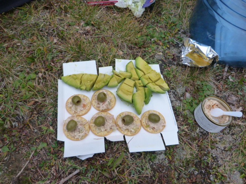
Finally back at camp, after 11 hours of hiking on boulders. Hors d'oeuvres were delicious!
Mmmmhhh...
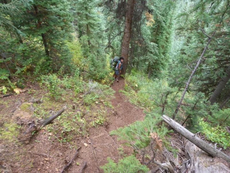
The next morning we slept in, had a hearty breakfast, packed camp and headed down the trail. This time we did cross to the west side on a log bridge across the creek and on this side the trail was much much better.
West side of the creek
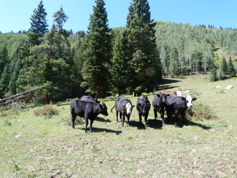
Once it gets to the cow pasture it gets confusing again (those cows are making a big mess!). Oh, and you have to make sure you don't step on cow poop! From the pasture the trail is straightforward again. It took longer to backpack back than to summit Capitol Pk!
What are you looking at?
So, in conclusion: yes I think Capitol peak it is one of the hardest 14ers now that I revisited it. More than difficult is that it is very demanding, the approach is long (either side you take), lots of talus and boulder hoping and of course, there is some exposure, mainly on the knife-edge ridge. My advice would be to do this peak by its standard route, unless you have already done and want to explore another route. The West Snowmass Creek is a pretty approach (except for the cows and don't get me wrong, I like animals but when they are in the right place!).
Thumbnails for uploaded photos (click to open slideshow):
Yeah, this is one mountain I'd love to get back on someday! It is simply a phenomenal climb! My past impression is that Capitol is overrated in difficulty however. It definitely is demanding, but I didn't feel the ”hard” parts were all that bad. I'd love to do it again like you and see if I still feel the same way. Nice report on a different route! Thanks for sharing! :D
Yeah, that Moon Lake approach can be pretty wild. Nice going back after it. That summit shot is great! Looks like an old film shot.
You guys sure eat well, btw!
Very cool report. Just never get tired of that beauty.
Caution: The information contained in this report may not be accurate and should not be the only resource used in preparation for your climb. Failure to have the necessary experience, physical conditioning, supplies or equipment can result in injury or death. 14ers.com and the author(s) of this report provide no warranties, either express or implied, that the information provided is accurate or reliable. By using the information provided, you agree to indemnify and hold harmless 14ers.com and the report author(s) with respect to any claims and demands against them, including any attorney fees and expenses. Please read the 14ers.com Safety and Disclaimer pages for more information.
Please respect private property: 14ers.com supports the rights of private landowners to determine how and by whom their land will be used. In Colorado, it is your responsibility to determine if land is private and to obtain the appropriate permission before entering the property.