| Report Type | Full |
| Peak(s) |
Sunlight Peak - 14,061 feet Windom Peak - 14,089 feet |
| Date Posted | 09/03/2012 |
| Modified | 10/06/2012 |
| Date Climbed | 08/28/2012 |
| Author | DanielL |
| Rails, trails, and summits: Part 1 - Sunlight and Windom Peaks |
|---|
Last week, my sister and I took two friends down to Durango to climb the Chicago Basin group. This trip is unique from most 14er climbs because the nearest vehicle access to Chicago Basin is about 16 miles away, and the most common approach is by taking the Durango & Silverton train. Anyways, we set off from Denver on Sunday, August 26th, and rolled into Durango at about 6:30 pm, picked up our tickets which we reserved in advance, and headed over to McDonalds. I could hardly wait for the next morning to arrive....Day One: Durango & Silverton Train to Needleton, 6-mile hike to Chicago BasinThe Durango & Silverton train was totally worth it! The ride was fun, the views were great, and the staff were very friendly and helpful. 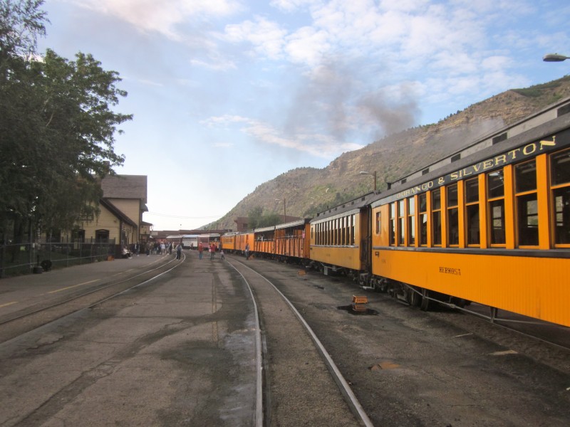  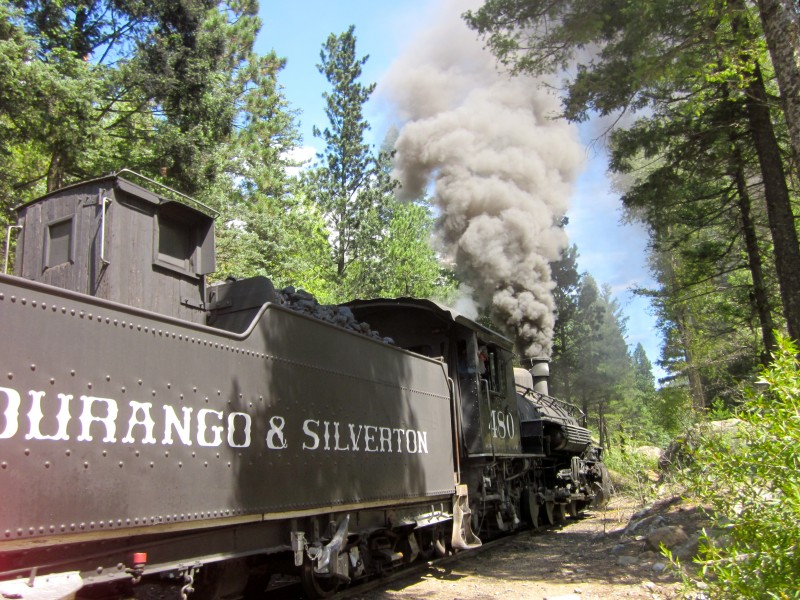 We took off from Needleton just before 12:00 and steadily climbed up to the basin, carrying our large multi-day packs. The Needle Creek trail was quite gentle, averaging about 500 vertical feet to the mile. Just before 3:00, we reached the start of Chicago Basin, hiking through gentle rainfall.  We found a suitable campsite about halfway across the basin, set up camp, ate a hot, delicious meal! We spent the rest of the day playing card games until dark, and then we climbed into our sleeping bags. Day Two: Sunlight and Windom PeaksWe set out at about 5:45 am from our camp, briskly walked across the basin, and took off up the trail to Twin Lakes. This trail is in very good condition, and we got to the lakes just before 7:00, and took a quick break. From here, we got a great view of Sunlight: 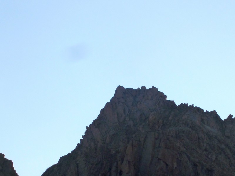 We continued on the great trail up the headwall above the Twin Lakes, and quickly gained the high basin between Sunlight and Windom. Three cairns stood like sentries at the entrance:  We decided to climb Sunlight, the more difficult peak, first, and stayed left as we entered the basin. The trail momentarily disappears, but there are plenty of cairns as the route crosses the basin. We got off route once or twice, but before too long, we reached the red gully below the Sunlight Peak-Spire saddle. 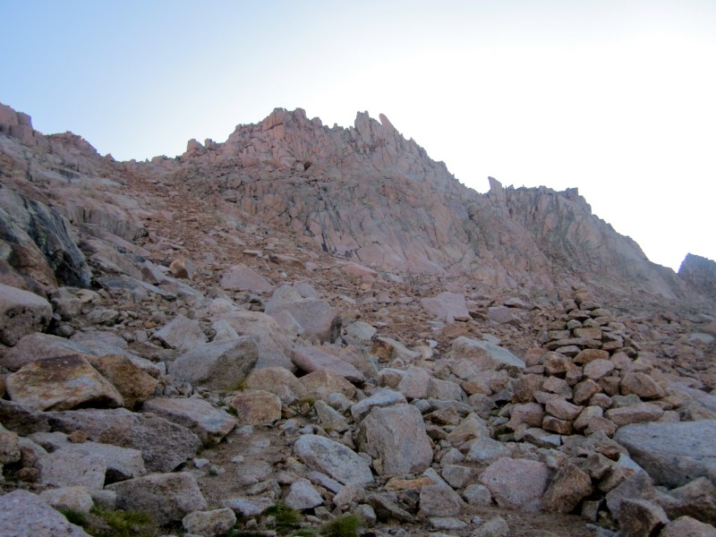 The red gully is a bit loose, but there is a trail all the way up to the saddle. As we climbed, we caught a breathtaking view of the Twin Lakes and Mt. Eolus to our left: 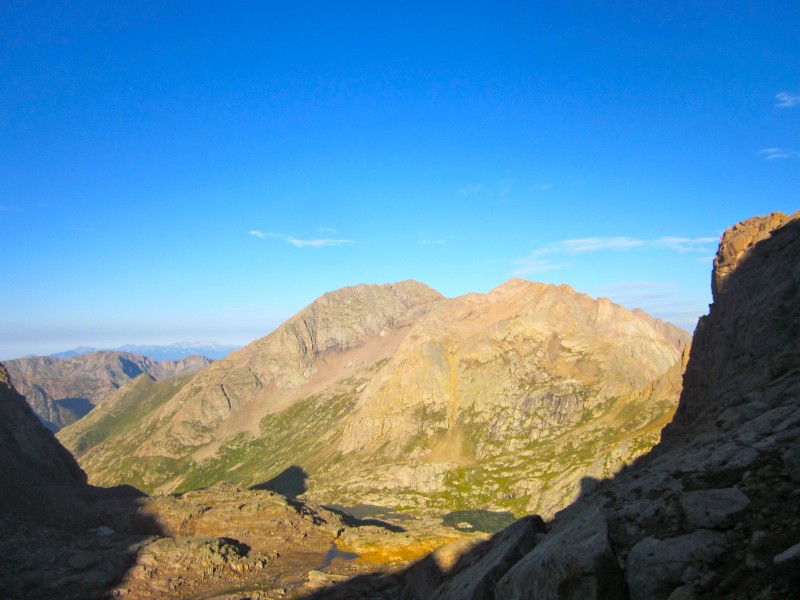  We kept climbing steadily and reached the Peak-Spire saddle at about 8:45. From here, the route turns left and climbs up to a notch, shown in the photos below: 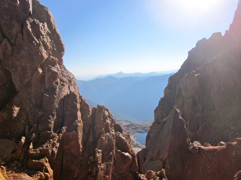 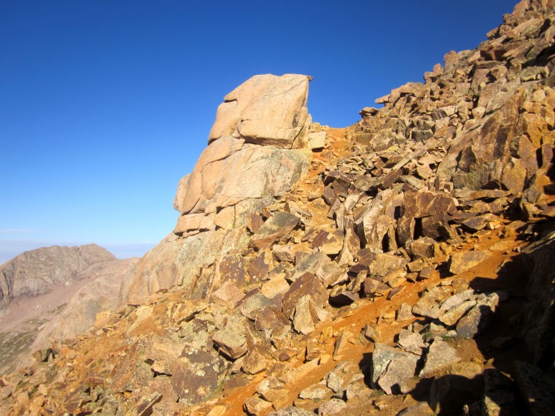 From this notch, the summit is close but the climbing gets much more involved. We studied the next part of the route, which traverses across the South Face to a ridge at the other side. There are two "correct" routes to take - both start traversing under some cliffs described in the route description on this site, but one climbs back to the ridge crest and involves some Class 3 scrambling before the end of the face, and the other is Class 2 and stays low until near the end of the face, when it climbs back up to meet the upper route. We didn't follow either route very well, and spent some time finding a decent route across the face. 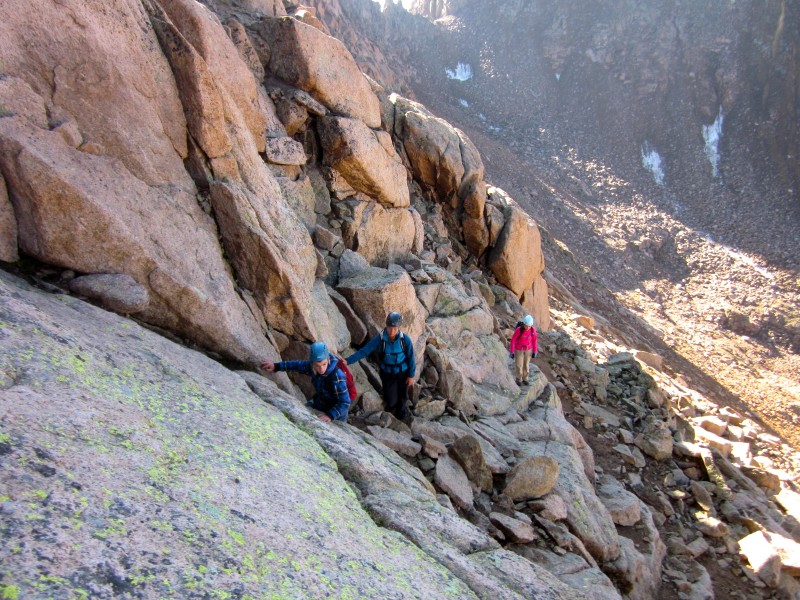 However, both routes eventually come to the same place at the end of the face, where the route turns right and starts climbing up steep, difficult Class 3 rock. 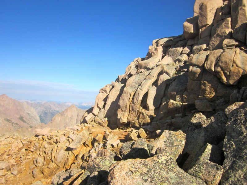 We climbed up this rock, and then the climbing got easier as we followed cairns to a hole in the ridge:  We climbed through this hole, and there the summit was, half a minute's scramble away! 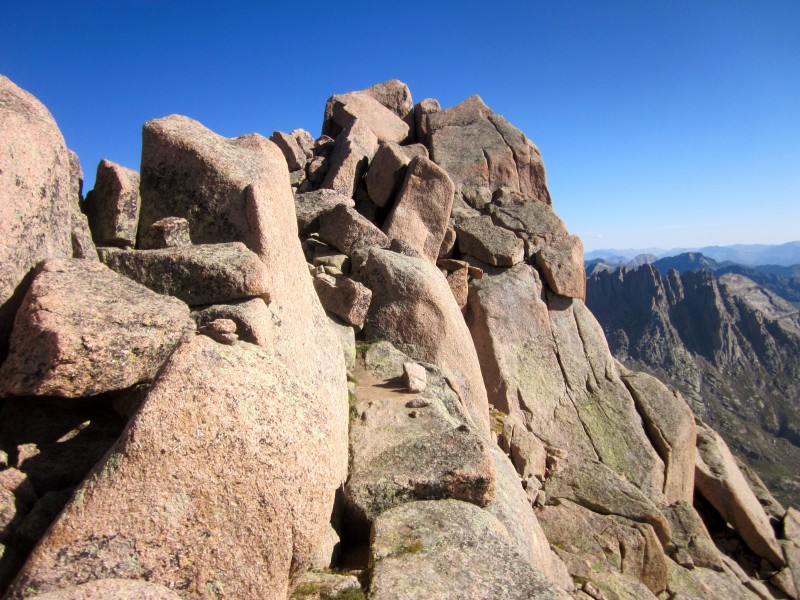 We walked up to the summit register and benchmark, which are placed below the short Class 4 crux pitch to the true summit. I scrambled up the gigantic boulders, adrenaline rushing because of the exposure, and reached the tippy-top of Sunlight Peak! 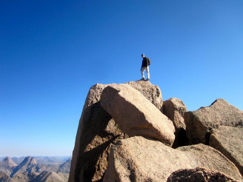  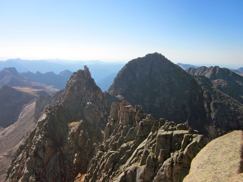 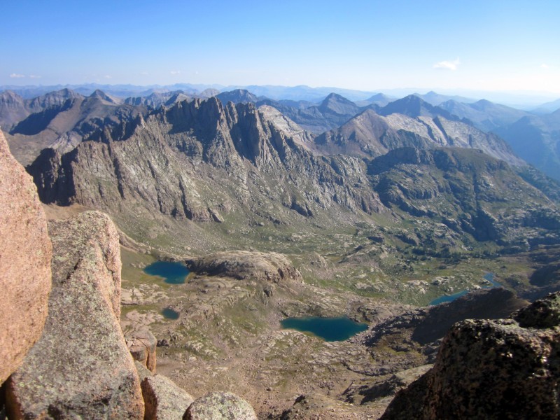  At this point, it was just after 9:30, but the weather was holding out, so we decided to traverse over to the saddle 800' below Windom's summit, and make a final decision from there. We retraced our route back down the South Face, and just before the Peak-Spire saddle, we saw our first goats: 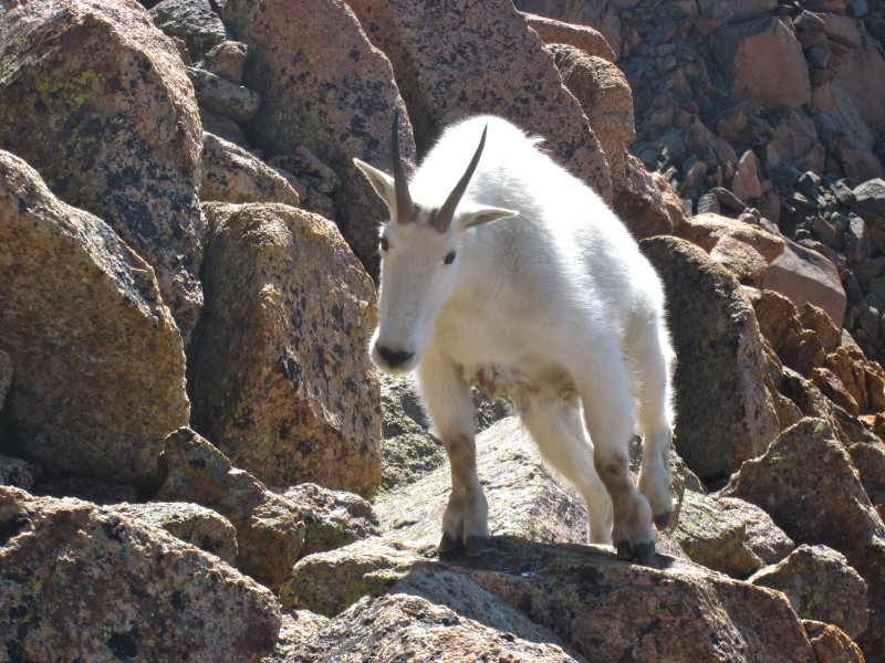 They left my view temporarily, but as I rested against a rock, I looked up and there they were, four feet above me!  After examining us and deciding that we could continue on, they started climbing up again, and we reached the saddle and descended the gully. We reached the large cairn where the trail turns right out of the gully and noticed a smaller cairn to our left, followed it and found a good route above some rock ledges in the middle of the high basin. Clouds began developing over us, and we sped up our pace, reaching the saddle on Windom's West Ridge just before 11:30. 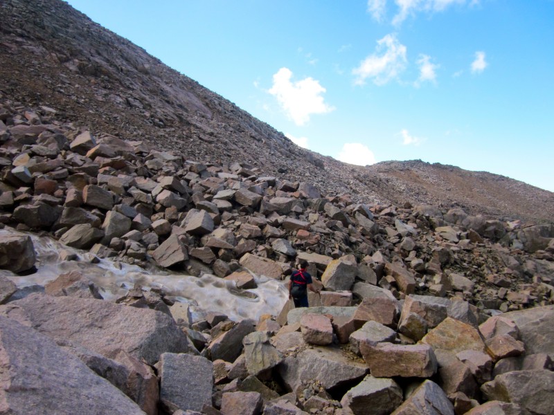 The dark clouds continued forming overhead, but we didn't want to turn around after being this close, so we decided to risk it and go for the summit. As we climbed, the clouds broke up temporarily and we were glad for our decision. At about 13,800', there is a distinct notch in the ridge. From here, the summit is just a short scramble away:  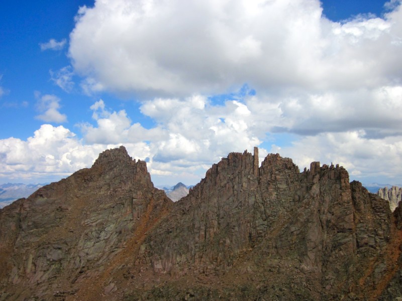 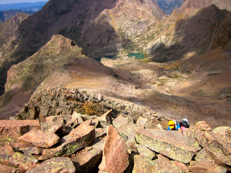 We kept scrambling mixed Class 2 and 2+ terrain, and at 12:05, reached the blocky summit of Windom Peak! 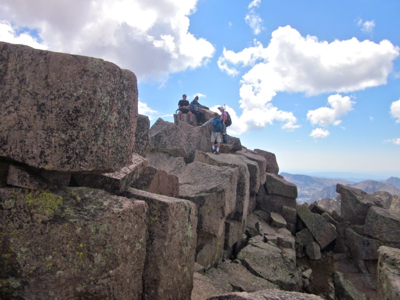 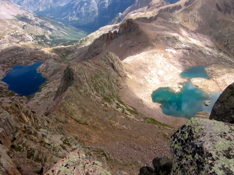 We didn't stay long on the summit, and we got off the mountain quickly as the clouds started rebuilding. Before long, we were back in Chicago Basin. Instead of rain, the weather cleared up and the sun came out, brightening up the rich colors of the basin and making the remainder of our journey even more pleasant. 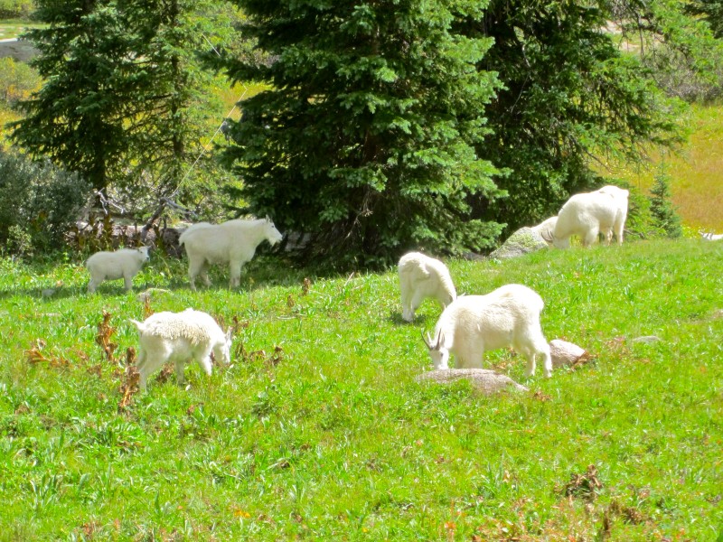 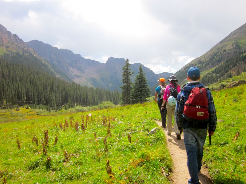 Soon, we were back at our camp. We prepared and ate another hot, delicious meal, played more card games until dark, and enjoyed a good, long sleep after a big day of hiking. Stay tuned for Part 2 of this report....... Thumbnails for uploaded photos (click to open slideshow):
|
| Comments or Questions | |||||||||
|---|---|---|---|---|---|---|---|---|---|
|
Caution: The information contained in this report may not be accurate and should not be the only resource used in preparation for your climb. Failure to have the necessary experience, physical conditioning, supplies or equipment can result in injury or death. 14ers.com and the author(s) of this report provide no warranties, either express or implied, that the information provided is accurate or reliable. By using the information provided, you agree to indemnify and hold harmless 14ers.com and the report author(s) with respect to any claims and demands against them, including any attorney fees and expenses. Please read the 14ers.com Safety and Disclaimer pages for more information.
Please respect private property: 14ers.com supports the rights of private landowners to determine how and by whom their land will be used. In Colorado, it is your responsibility to determine if land is private and to obtain the appropriate permission before entering the property.