Download Agreement, Release, and Acknowledgement of Risk:
You (the person requesting this file download) fully understand mountain climbing ("Activity") involves risks and dangers of serious bodily injury, including permanent disability, paralysis, and death ("Risks") and you fully accept and assume all such risks and all responsibility for losses, costs, and damages you incur as a result of your participation in this Activity.
You acknowledge that information in the file you have chosen to download may not be accurate and may contain errors. You agree to assume all risks when using this information and agree to release and discharge 14ers.com, 14ers Inc. and the author(s) of such information (collectively, the "Released Parties").
You hereby discharge the Released Parties from all damages, actions, claims and liabilities of any nature, specifically including, but not limited to, damages, actions, claims and liabilities arising from or related to the negligence of the Released Parties. You further agree to indemnify, hold harmless and defend 14ers.com, 14ers Inc. and each of the other Released Parties from and against any loss, damage, liability and expense, including costs and attorney fees, incurred by 14ers.com, 14ers Inc. or any of the other Released Parties as a result of you using information provided on the 14ers.com or 14ers Inc. websites.
You have read this agreement, fully understand its terms and intend it to be a complete and unconditional release of all liability to the greatest extent allowed by law and agree that if any portion of this agreement is held to be invalid the balance, notwithstanding, shall continue in full force and effect.
By clicking "OK" you agree to these terms. If you DO NOT agree, click "Cancel"...
I was originally planning on climbing the Crestones with a buddy of mine but he had to bail so I decided to do a solo trip. Figured I'd try to do Wetterhorn on Sunday followed by San Luis on Monday.
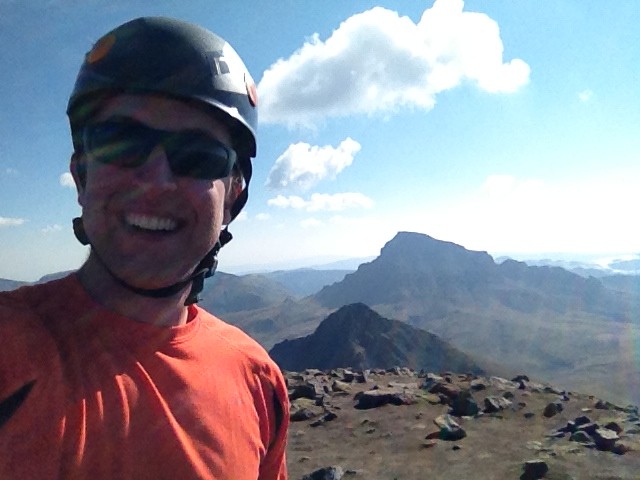
So far, Wetterhorn is in my top 3 climbs, it is a great peak and the scrambling is nothing short of awesome; I found the rock to be solid and the exposure wasn't too scary.
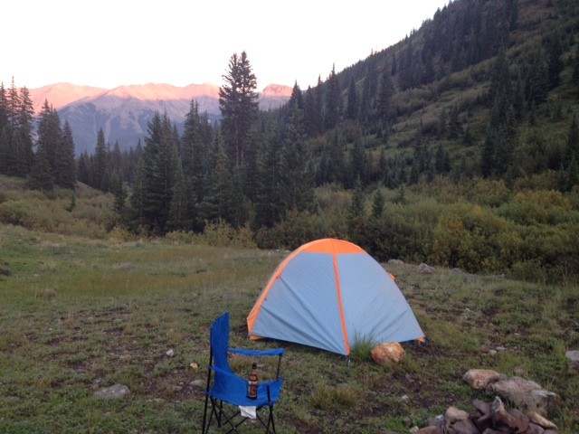
I started out by driving 6 hours to the Matterhorn creek trailhead (before it becomes 4 wheel drive) and set-up camp around 7pm on Saturday. Campsite I woke up around 6 and was hiking by 6:30. Starting out was nothing short of miserable, not because of the hike but the bota bag sippin' and IPA the night before got to me (can't hang like I used to) and I have a tendency of starting out too fast on 14ers.
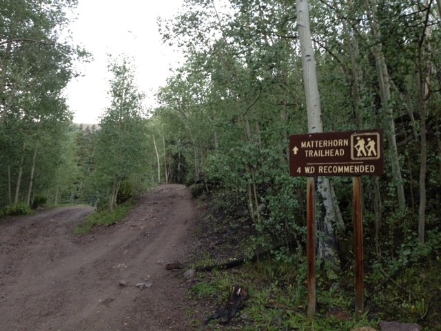
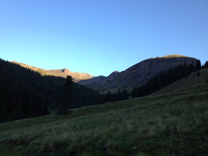
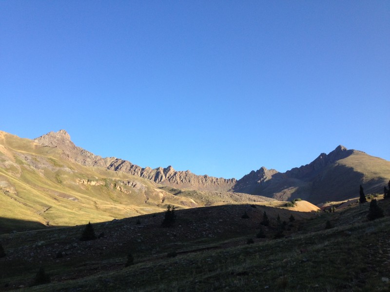
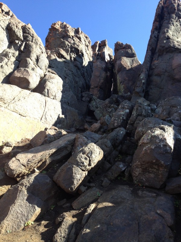
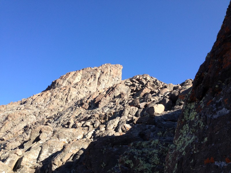
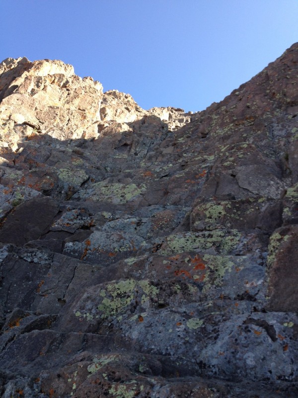
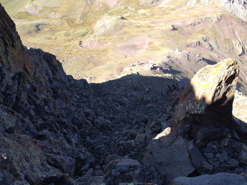
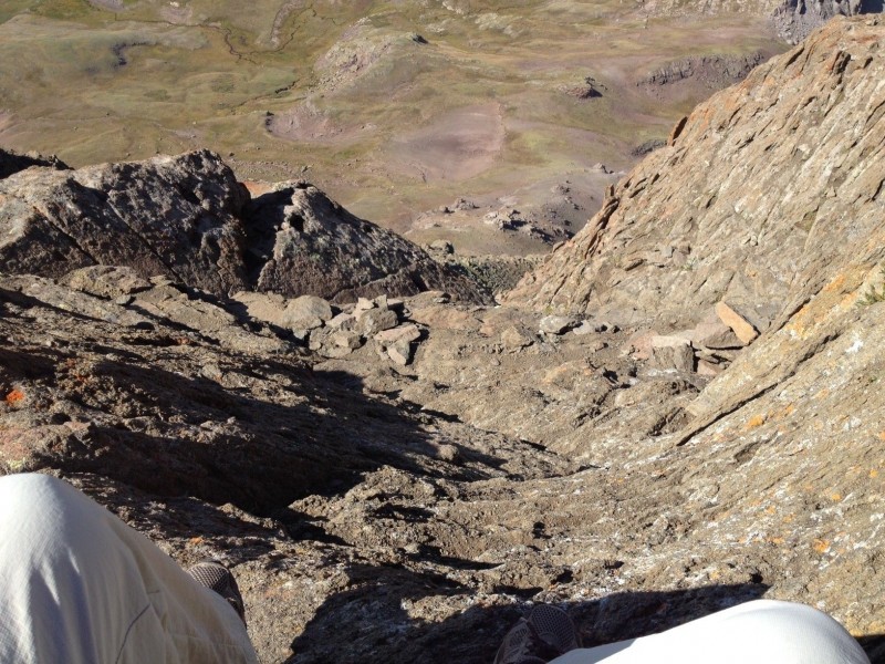
I started out by walking up the 4 wheel drive road to the gate, which took about 10 minutes.4 wheel drive road After getting to the gate, you walk along Matterhorn creek and ascend into a nice valley. Valley You exit this valley by walking through some forest and this leads to another valley. From here you, you can see Wetterhorn for the first time and you ascend into a high mountain basin. Wetterhorn/Matterhorn View The hike is pretty gradual. From here, you hike into the middle of the basin and skirt through and around rocks and boulders. The view from Wetterhorn here is inspiring and as you gain the slope, you can see the yellow dirt; a real "pleasure" to descend on the way down. After climbing to the saddle, go up the yellow dirt and you can see the backside of the route, basically class 2 with an occasional class 3 move, the exposure here is minimal. You will see the Ship's Prow but must skirt a rock rib before getting to it. The summit is close. Climb into the east notch (right) and carefully descend the slab immediately on the other side of the notch. You will now see the final summit pitch, basically a staircase/ledge system to the top. Staircase/Ledges Yes this area is exposed but I found it to be comparable to the homestretch on Longs or the exposure on the Eolus summit push. However, the rock on Wetterhorn is solid and easy to climb, and the stairs/ledges are fairly wide. Decent Exposure You will top out abruptly and realize how rewarding the climb was.
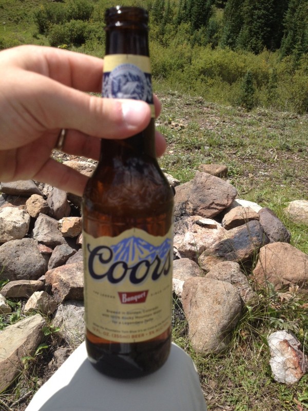
After chugging a beer (joking) on top, carefully descend the staircase/ledge system and go back the way you came. Route finding wasn't too bad on Wetterhorn, most of the moves are obvious and the route is mostly well cairned.
Ok, now that you're down, chug a beer.
Thumbnails for uploaded photos (click to open slideshow):
I wanted to try to get Wetterhorn in this summer, but looks like it might have to wait. Thanks for the trip report and photos--I'm already looking forward to trying to get it in next year!
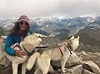
HikingSibes, I saw you guys going up the mountain, as I was coming down(by the sheep). Really glad the weather cooperated for you guys, did the dog make it up???
Caution: The information contained in this report may not be accurate and should not be the only resource used in preparation for your climb. Failure to have the necessary experience, physical conditioning, supplies or equipment can result in injury or death. 14ers.com and the author(s) of this report provide no warranties, either express or implied, that the information provided is accurate or reliable. By using the information provided, you agree to indemnify and hold harmless 14ers.com and the report author(s) with respect to any claims and demands against them, including any attorney fees and expenses. Please read the 14ers.com Safety and Disclaimer pages for more information.
Please respect private property: 14ers.com supports the rights of private landowners to determine how and by whom their land will be used. In Colorado, it is your responsibility to determine if land is private and to obtain the appropriate permission before entering the property.


")
")