Download Agreement, Release, and Acknowledgement of Risk:
You (the person requesting this file download) fully understand mountain climbing ("Activity") involves risks and dangers of serious bodily injury, including permanent disability, paralysis, and death ("Risks") and you fully accept and assume all such risks and all responsibility for losses, costs, and damages you incur as a result of your participation in this Activity.
You acknowledge that information in the file you have chosen to download may not be accurate and may contain errors. You agree to assume all risks when using this information and agree to release and discharge 14ers.com, 14ers Inc. and the author(s) of such information (collectively, the "Released Parties").
You hereby discharge the Released Parties from all damages, actions, claims and liabilities of any nature, specifically including, but not limited to, damages, actions, claims and liabilities arising from or related to the negligence of the Released Parties. You further agree to indemnify, hold harmless and defend 14ers.com, 14ers Inc. and each of the other Released Parties from and against any loss, damage, liability and expense, including costs and attorney fees, incurred by 14ers.com, 14ers Inc. or any of the other Released Parties as a result of you using information provided on the 14ers.com or 14ers Inc. websites.
You have read this agreement, fully understand its terms and intend it to be a complete and unconditional release of all liability to the greatest extent allowed by law and agree that if any portion of this agreement is held to be invalid the balance, notwithstanding, shall continue in full force and effect.
By clicking "OK" you agree to these terms. If you DO NOT agree, click "Cancel"...
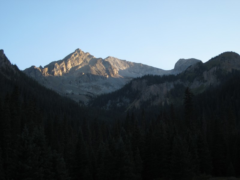
If there is one thing I've learned beyond peradventure while hiking 14ers, it is that non-standard routes are non-standard for a reason. The West Snowmass Creek approach to Capitol Peak described below has several disadvantages over the standard approach: your boots will get soaked crossing West Snowmass Creek, there is more elevation gain, you will likely spend a portion of your time bushwhacking through thick pines, and good campsites are limited. Nevertheless, if you want to enjoy some solitude on your way to K2, or if you want to snap some good photos of Capitol from the east, this route might be up your alley.
My route (click on image for a larger, clearer view).
The gentle introduction of this route follows the splendid Maroon-Snowmass Trail for roughly 1.25 miles until the West Snowmass Trail branches off from it. At this point, you might as well plan on getting wet feet. Even with the low water-levels this year, I couldn't find a decent stream crossing; I finally just resolved myself to soggy boots and forded it. The West Snowmass Trail is fairly easy to pick back up once you cross the creek, and it can be easily followed for the next two miles until it reaches a horsecamp (look for the gigantic tent to the south of the meadow). Along this portion of the trail I ran into a handful of riders on horseback, but was alone other than that. Near the horsecamp, the West Snowmass Trail continues west, but the route to Moon Lake veers south toward Clark Peak and follows the West Snowmass Creek along its east bank.
The West Snowmass Trail.
Point 12,903 and Clark Peak. Unless you're lucky enough to remain on the faint climber's trail, there is considerabl
A climber's trail apparently leads all the way to Moon Lake, but I had a rough time following it. I would find it, follow it for a spell, and then it would disappear. I'd then pick up a game trail and follow that until it disappeared. I would then have to fight through downed trees and thick pines for twenty minutes. Then I'd pick up the trail again and repeat the process. It didn't help that it was dark for a good portion of my hike in, but even in daylight I think it would be difficult to remain on the supposed trail all the way to Moon Lake. As long as you keep following West Snowmass Creek, however, you'll be able to find a passable route. You will likely encounter some Class 2+ boulder-hopping from time to time. You might, as I did, encounter a bear (he was about 35 yards away when I spotted him"as soon as I sternly said "Don't get too close, buddy!" he ran off). You might, as I also did, be befriended by a bat circling your headlamp eating moths. He actually scared me more than the bear--I swear his wing brushed my nose at one point! What you probably won't encounter are other human beings. I saw one headlamp hiking out beneath me at one point, but that was the only person I saw from the horsecamp to Moon Lake (and actually, until I got to K2).
I had left the Maroon-Snowmass trailhead at 5:30 p.m. I stopped to set up my bivvy at 9:30 p.m. and was in my sleeping bag by 10 p.m. I camped below Moon Lake at around 11,100 ft. Don't go all the way to Moon Lake if you plan on camping; the best soft, flat spots to pitch a tent or bivvy are between 10,900 and 11,100 from what I could tell.
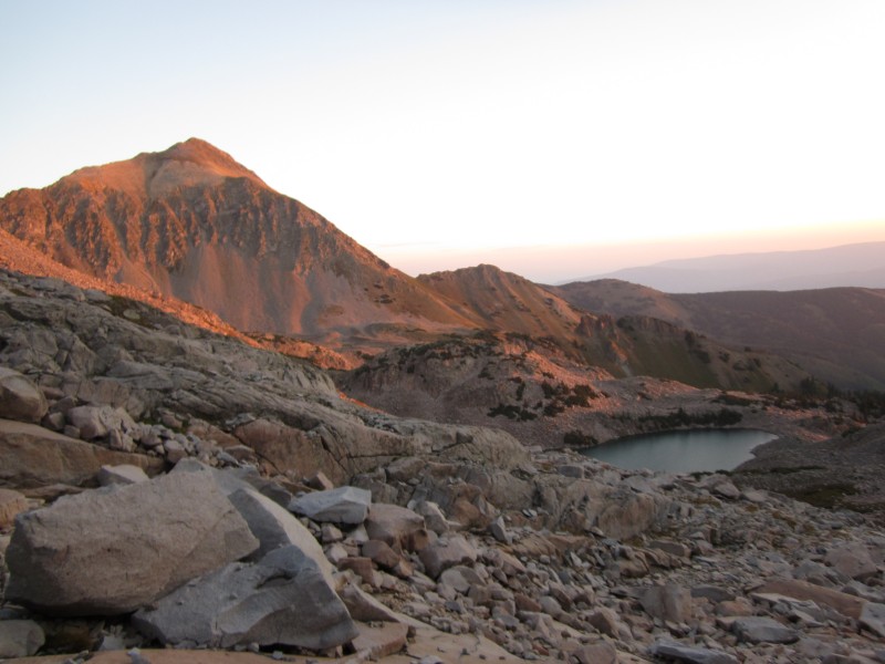
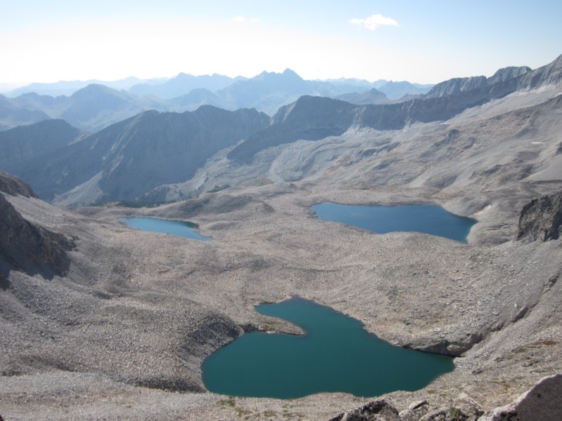
I set out from my campsite the next morning at 5:30 a.m., scrambled up a boulderfield to Moon Lake, and steripenned some water as it was just starting to get light out. Now, the approach to K2 from Moon Lake described in Gerry Roach's Colorado's Fourteeners takes you north around Moon Lake, then west toward the Mount Daly-K2 saddle and up a basin toward K2. However, if you head south around Moon Lake and then continue south, you can also climb a basin that leads to a saddle between Clark Peak and an unnamed summit about halfway between Clark Peak and K2. This saddle offers excellent views of K2 and Capitol Peak, but at a price. The ridge from the unnamed peak toward K2 is full of gendarmes and did not look possible to cross, so instead I had to cross over a spur ridge that leads from the unnamed peak toward Moon Lake and then do some precarious Class 4 downclimbing on loose rock to get back into the other basin decribed by Roach. I thought it was a small price to pay for the views, but it certainly ate up some time.
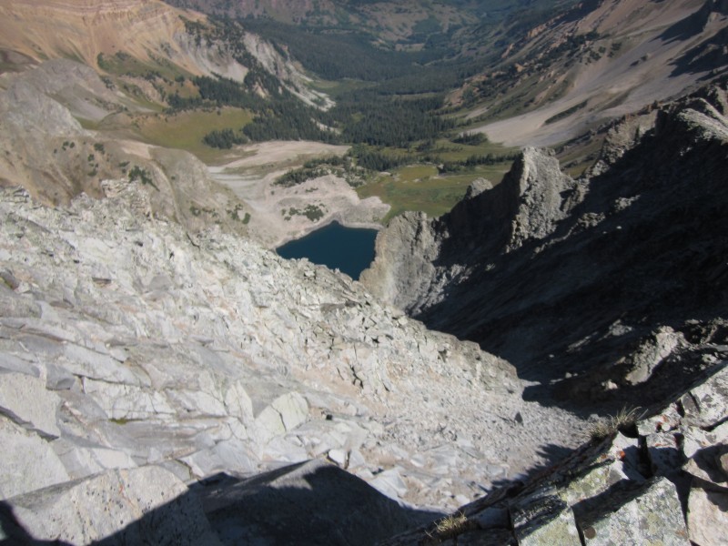
Mount Daly and Moon Lake at sunrise.
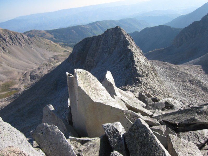
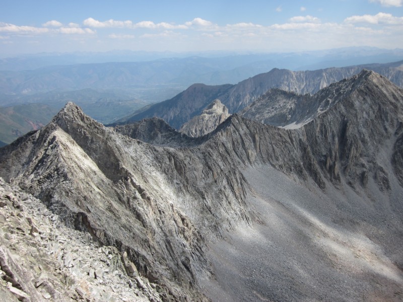
Looking back down the basin south of Moon Lake. This spur ridge running northeast from the K2-Clark Peak saddle creates two
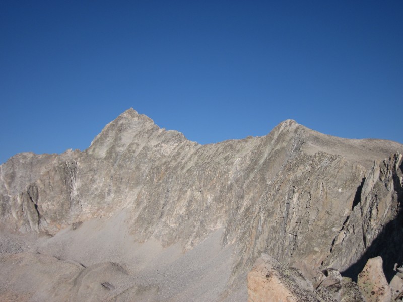
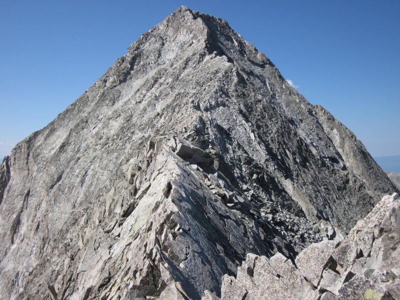
Capitol Peak and K2 from the east.
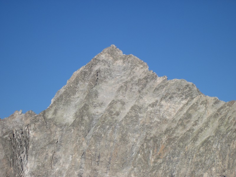
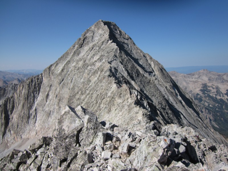
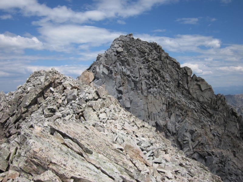
A closer view of Capitol.
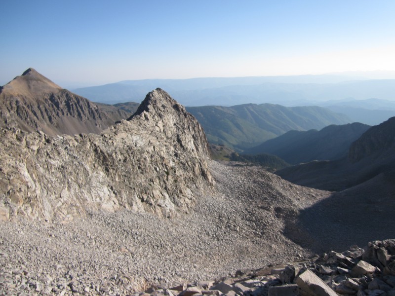
Looking down the spur ridge. The basin on the right was my ascent route; that on the left is the normal route from Moon Lake
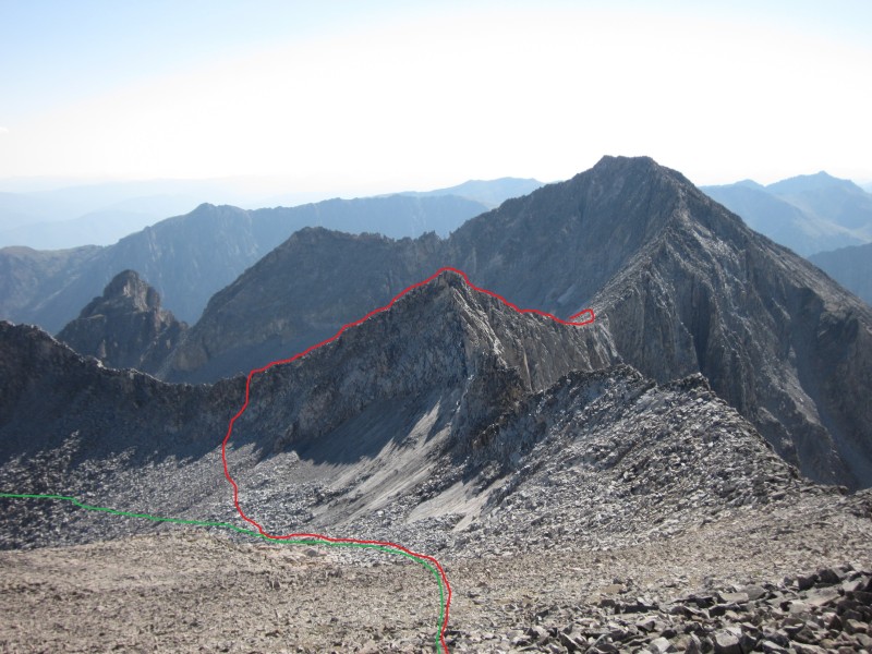
Near K2, looking back. The red line marks my route from Moon Lake; the green line is the more expedient route, but does not
The hike up the basin towards K2 was straightforward, and I arrived there at about 10 a.m. This was much later than I wanted to arrive at K2, and I had some regrets about my morning photo detour. As I approached K2, I ran into several descending parties. Some had summitted, but many had only went as far as the Knife Edge. There was certainly no shame in that. Indeed, as I stopped to apply sunscreen just underneath K2, I started to have doubts about whether my own courage would hold. Exposure is not my thing, so I knew the Knife Edge would be a challenge.
I thought about skirting K2, but then decided to summit it to get a good view of Capitol. I was at the top of K2 at 10:30 a.m. From what I can tell, summitting K2 is no more difficult than skirting it; you'll have to do some Class 4 moves either way. The worst part about summitting K2 is the Class 4 downclimbs you'll have to make to get down toward the connecting ridge to Capitol. In all honesty, these were probably the most technical moves I had to make all day--actually even had to gaston for a bit down a vertical crack. I definitely regretted not having had more rock-climbing experience at that point! The exposure wasn't bad there, but a fall would have sent me tumbling down a gully toward Capitol Lake.
K2.
Pierre Lakes from the top of K2.
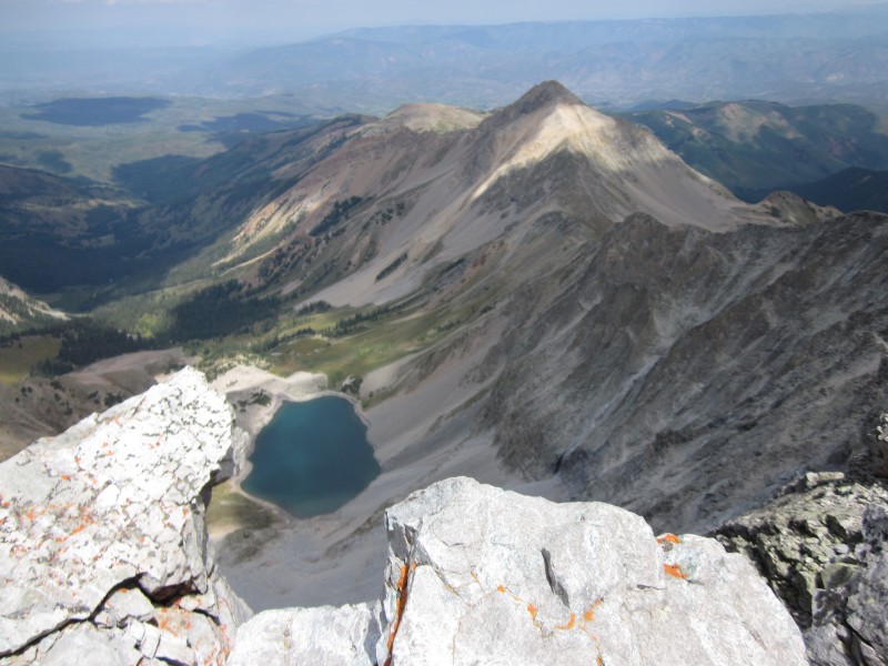
Looking down at Capitol Lake from the top of K2.
Capitol Peak from K2.
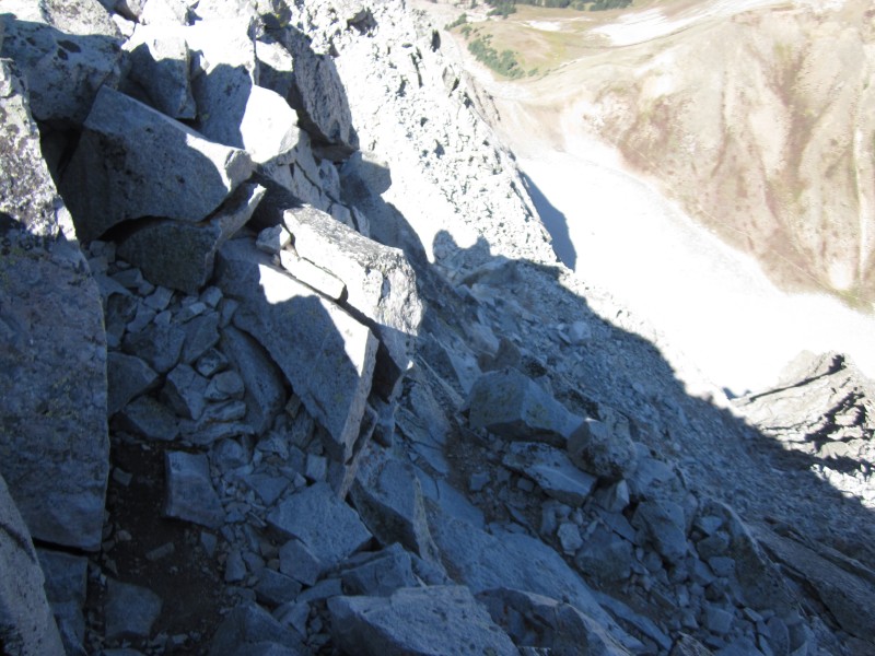
The Class 4 downclimb from K2 toward the connecting ridge. Technically, this was the most difficult part for me.
Just past K2 I bumped into a large party that included SurfNTurf, bergsteigen, and some other 14er.com members. I chatted with them briefly, and they all seemed so energized and proud to have summitted Capitol. Only later that day would they have learned about their good friend RJansen77's tragic and fatal fall on nearby Hagerman Peak. My heart goes out to them for experiencing such a painful postscript to their victory on Capitol.
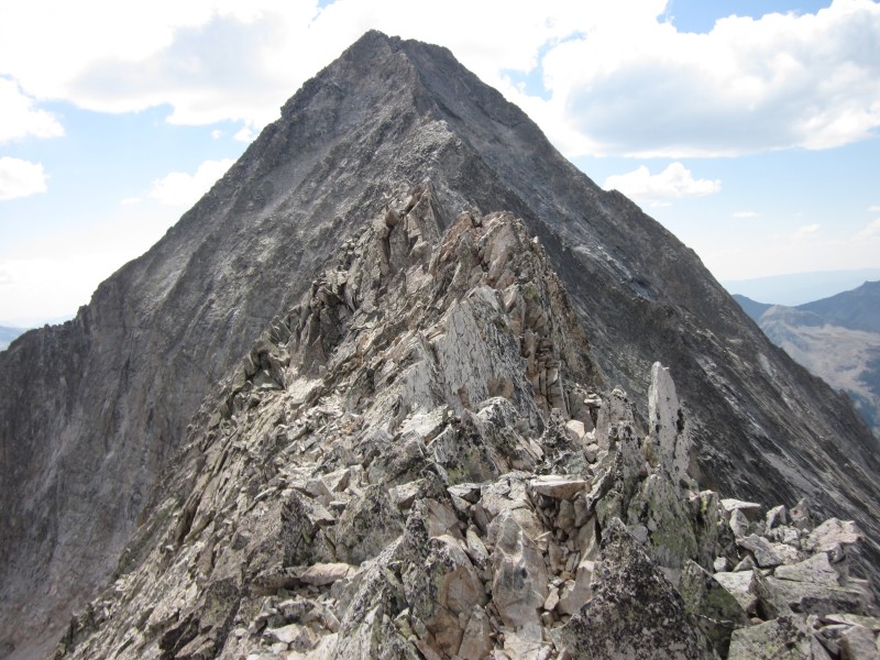
Before I knew it, I was facing the Knife Edge. Now, I am certainly not one of those exposure-resistant souls who could tiptoe across the whole thing. In fact, there probably aren't too many of you on this forum with a greater fear of heights than I have. I grew up on the flat, sandy soil of Arenac County, Michigan, so even a set of stairs seems pretty exposed to me. However, as long as you can try to ignore the exposure, the Knife Edge was actually pretty easy and fun. It was fairly non-technical, the rock was very solid, and I only had to butt-scoot on two brief sections (which surprised me . . . I planned that my ass would be hugging that ridge for dear life!). In fact, the Knife Edge ended up being my favorite part of the Capitol experience, and I felt safer on the connecting ridge between K2 and Capitol then I did either before or after it. I have a YouTube video below showing probably the most exposed section (excuse my being out of breath--I was getting tired by this point).
The Knife Edge.
On the other side of the connecting ridge. Still a long way to go with plenty of Class 3 and 4 moves on loose rock.
I reached the end of the connecting ridge at 11:30 a.m., exactly an hour after standing on top of K2. Rather than crossing the rock-fall prone gullies of the standard route, I stayed just below the ridge crest for most of the way. The rock was much looser here than on the connecting ridge, and there were plenty of Class 4 moves to make to reach the summit. I had heard from others that the remainder of the route past the connecting ridge was time consuming, but I was surprised that it took me 1.5 hours to gain 400 vertical feet over a quarter of a mile. I was taking my time on the loose rock and did not knock a single one down, but I still felt that this was excruciatingly slow--even for me. I didn't reach the summit until 1 p.m. Thankfully the weather held. I spent less than 5 minutes on the summit. I knew the descent back to K2 would be equally time-consuming, and the clouds were starting to stack.
Looking back across the connecting ridge toward K2 and Clark Peak.
Capitol Lake from the summit.
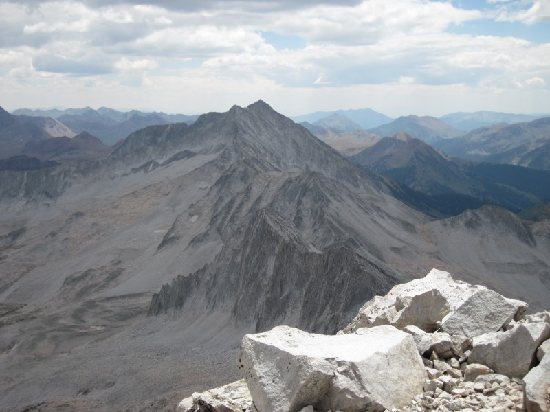
Snowmass Mountain.
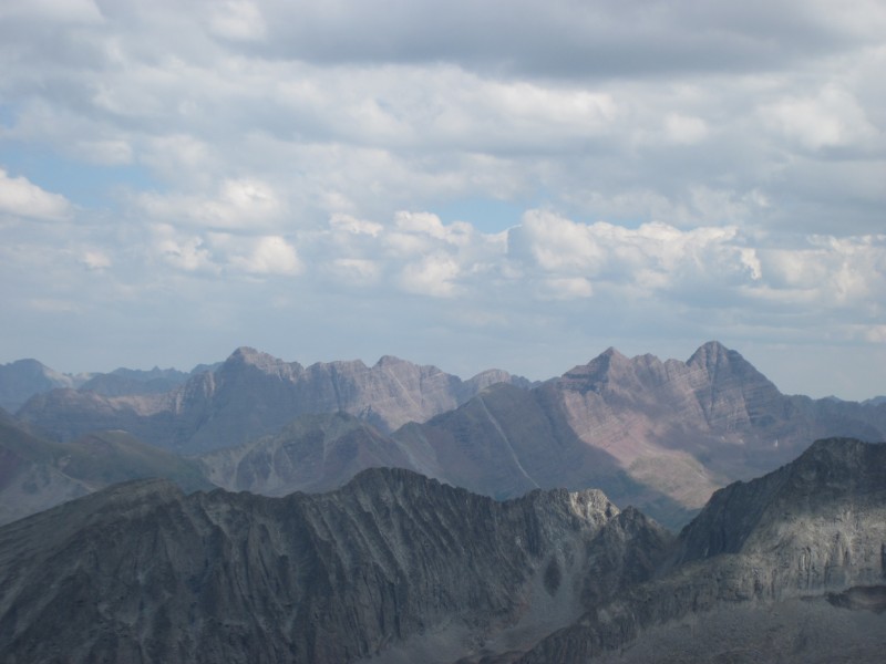
Pyramid Peak and the Maroon Bells.
Looking back at Capitol from the connecting ridge with K2.
I descended down the standard route from Capitol, as I wanted to avoid some of the Class 4 downclimbs closer to the ridge crest. I had to be wary of rockfall from a brother-sister team who had briefly bumped into me on the summit and had decided to descend down the ridge crest. They were a lot faster than I was, but this also meant they didn't take any time to concern themselves with knocking rocks down toward me. And, if the two of you read this, it's not only polite, but also a necessary safety precaution, to yell "Rock" when you kick a 50 lb. boulder down a gully toward a fellow hiker. I let them get way out in front of me after that.
I made it to the beginning of the connecting ridge at 2 p.m. Crossing back over the Knife Edge was just as fun, and this time I only had to butt-scoot once for about 4 ft. That made me pretty proud. Back at K2, I skirted around its west side. This really didn't save me any work . . . I still ended up having to do some serious work to get past it. I was below K2 at 3 p.m., and took a 40 minute break there to text family and friends. So, from just beneath K2 to the summit of Capitol and back took me just under 5 hours--certainly no speed record. But the exposure and loose rock made me very deliberate and dilligent about hand- and foot-holds . . . both for my safety and others.
Past the Knife Edge, looking at K2.
Climbing back down the basin to Moon Lake was a chore--tons of boulder-hopping. I made it to Moon Lake by 5:30 p.m. and was then able to soak my feet in its cold waters for 20 minutes or so. I thought about taking a swim as I had in Clohesy Lake the week previous, but didn't quite have the energy. I was at my campsite by 6:30 p.m., ate a quick freeze-dried meal, and then began night bushwhacking exercises back toward the Maroon-Snowmass trailhead. Feet got soaked again crossing West Snowmass Creek. I didn't make it back to my car until 11 p.m.
Sadly, my summit of Capitol was dampened when I returned to Denver and learned of the tragic death of Robert Jansen on nearby Hagerman Peak the day before I summitted Capitol: LINK. I had met Rob a few months previously at a 14ers event in Denver, and we had swapped stories about hiking in the Sangre de Cristo range. He was an experienced mountaineer and skilled rock climber who made my feable attempts look like child's play; he was also one of the nicest, friendliest guys I've ever met. His death leaves the world poorer, not just in terms of great mountaineers, but in terms of great human beings.
Back at Moon Lake.
Both mentally and physically, this is certainly the hardest 14er I've summitted--arguably maybe even the hardest thing I've ever done in my life. The approach was rough on both the ascent and descent due to the bushwhacking. The resulting Class 4 downclimbs from my photo detour were challenging. And, of course, the route from K2-Capitol was exposed, time-consuming, tiring, and mentally exhausting. Past the connecting ridge, staying on the ridge crest of Capitol resulted in sustained Class 3 and Class 4 moves. From K2 onwards, my arms did as much to propel me as my legs, and my arms and shoulders had never been as sore after a 14er as on this one (which is actually pretty cool!).
So, my advice for Capitol. First, unless you like solitude as much as I do or are just dying to get a nice photo of Capitol from the east, stick to the standard approach to Capitol Lake. Second, leave an hour or two earlier than you think you need to; the route from K2 to the summit and back takes a lot of time, and your weather might not be as favorable as mine. Third, put some time in at an indoor rock-climbing facility before this one, or at least review some of the technical holds demonstrated in Freedom of the Hills. I only did the latter, but that really helped out on some of the Class 4 downclimbs. Lastly, always know your limitations, but keep in mind that even old, fat, alcoholic couch-potatoes like myself can summit Capitol with some experience, research and training.
I'll have to reflect for a few more days on whether Capitol was my favorite 14er to date. It took a lot out of me mentally and physically, and I feel like a left a bit of my soul up there. But it was certainly my most memorable 14er to date. Only my solos of Longs Peak in 2010 and Mount of the Holy Cross via the Halo Ridge in 2011 even come close.
Thumbnails for uploaded photos (click to open slideshow):
Thanks for documenting a nifty if demanding route! For someone who dislikes exposure, you certainly took some on with the downclimb off that spur ridge. Props for tenacity, too, for slogging all the way out after dark.
Well done man. As a former Michigan progeny myself (Bay County), I share your natural aversion to exposure. Working on it one class 3 at a time, but have this one in my sights for next fall! Thanks for the info.
Great report, thanks for posting! 8/30/2012 5:22am
It is always fun to explore non-standard routes, I have been looking at this route for a while. I did the standard route many years ago and would like to repeat this 14er by a different route.
Like you, I thought the knife-edge rigde was the easiest part (once you pass it :wink: ) and K2 (both climbing it or going around) were the most difficult parts of the hike.
Thanks again for posting such a good report and congratulations!
I approached from Moon lake when I did Capitol as well, the approach was a bit more difficult as you said, but I dont regret it at all! Thanks for detailing the other route up from the lake as well, that is a pretty good view of Capitol! Well done sir! Keep up the good climbing!
Really enjoyed your account of the route less-traveled. Quite an accomplishment! You mentioned probably my 3 best-loved mountains: Longs and HC are very special to me for a variety of reasons, but Capitol... well, what a magnificent peak! Great shots and super descriptions! Thanks for your post! :D
We also tried the Moon Lake approach, lost the trail (and my ice ax :( , got to K2 and found it so snow bound we couldn't get over or around it and turned back :cry: . We returned later up the standard approach and finally summited the thing. A very special place indeed!
I just got back from my trip to Moon Lake, and my experience was very similar to yours. In fact, had I read your report before I left, I might have changed my mind. But at least it's nice to see that I'm not the only one that had issues route finding on this one. Misery loves company, right? Anyway, great report! Very detailed!
Was having trouble finding beta on this moon lake connector. Thanks
Caution: The information contained in this report may not be accurate and should not be the only resource used in preparation for your climb. Failure to have the necessary experience, physical conditioning, supplies or equipment can result in injury or death. 14ers.com and the author(s) of this report provide no warranties, either express or implied, that the information provided is accurate or reliable. By using the information provided, you agree to indemnify and hold harmless 14ers.com and the report author(s) with respect to any claims and demands against them, including any attorney fees and expenses. Please read the 14ers.com Safety and Disclaimer pages for more information.
Please respect private property: 14ers.com supports the rights of private landowners to determine how and by whom their land will be used. In Colorado, it is your responsibility to determine if land is private and to obtain the appropriate permission before entering the property.

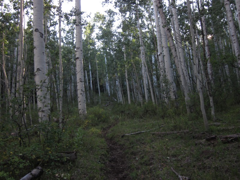


 The West Snowmass Trail.")
 Point 12,903 and Clark Peak. Unless you're lucky enough to remain on the faint climber's trail, there is considerabl")
 Mount Daly and Moon Lake at sunrise.")
 Looking back down the basin south of Moon Lake. This spur ridge running northeast from the K2-Clark Peak saddle creates two")
 Capitol Peak and K2 from the east.")
 Near K2, looking back. The red line marks my route from Moon Lake; the green line is the more expedient route, but does not")
 K2.")
 Pierre Lakes from the top of K2.")
 Looking down at Capitol Lake from the top of K2.")
 Capitol Peak from K2.")
 The Class 4 downclimb from K2 toward the connecting ridge. Technically, this was the most difficult part for me.")
 The Knife Edge.")
 On the other side of the connecting ridge. Still a long way to go with plenty of Class 3 and 4 moves on loose rock.")
 Looking back across the connecting ridge toward K2 and Clark Peak.")
 Capitol Lake from the summit.")
 Snowmass Mountain.")
 Pyramid Peak and the Maroon Bells.")
 Looking back at Capitol from the connecting ridge with K2.")
 Past the Knife Edge, looking at K2.")
 Back at Moon Lake.")
 A closer view of Capitol.")
 Looking down the spur ridge. The basin on the right was my ascent route; that on the left is the normal route from Moon Lake")
 My route (click on image for a larger, clearer view).")