Download Agreement, Release, and Acknowledgement of Risk:
You (the person requesting this file download) fully understand mountain climbing ("Activity") involves risks and dangers of serious bodily injury, including permanent disability, paralysis, and death ("Risks") and you fully accept and assume all such risks and all responsibility for losses, costs, and damages you incur as a result of your participation in this Activity.
You acknowledge that information in the file you have chosen to download may not be accurate and may contain errors. You agree to assume all risks when using this information and agree to release and discharge 14ers.com, 14ers Inc. and the author(s) of such information (collectively, the "Released Parties").
You hereby discharge the Released Parties from all damages, actions, claims and liabilities of any nature, specifically including, but not limited to, damages, actions, claims and liabilities arising from or related to the negligence of the Released Parties. You further agree to indemnify, hold harmless and defend 14ers.com, 14ers Inc. and each of the other Released Parties from and against any loss, damage, liability and expense, including costs and attorney fees, incurred by 14ers.com, 14ers Inc. or any of the other Released Parties as a result of you using information provided on the 14ers.com or 14ers Inc. websites.
You have read this agreement, fully understand its terms and intend it to be a complete and unconditional release of all liability to the greatest extent allowed by law and agree that if any portion of this agreement is held to be invalid the balance, notwithstanding, shall continue in full force and effect.
By clicking "OK" you agree to these terms. If you DO NOT agree, click "Cancel"...
Mountain and Route: Crestone Needle via South Face (Standard Route)
Date: 08/25/12
RT Mileage: 11.4 mi
Vertical Gain: 4519 ft
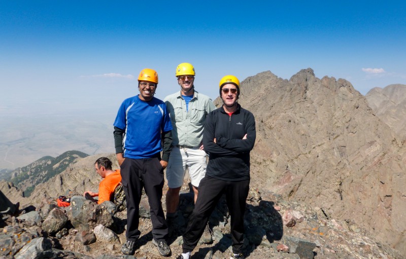
Party: Rob (Waggs), Chris (cbrobin) and Karthik (theotherindian)
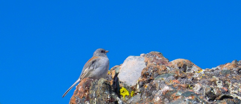
Wildlife: Deer, unidentified bird, big fat marmot
Plans for the weekend evolve over the week, sometimes evolution takes a giant leap. After planning for the Crestones, the San Juans, the Elks maybe and then back to the crestones, plans came a full circle in a few days. When Waggs and cbrobin finally decided to attempt the Needle, I decided to jump in and try to get as far as the weather permits.
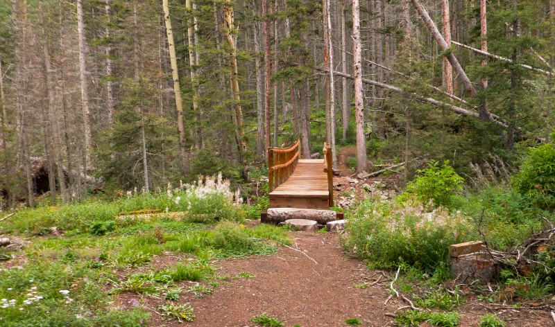
I drove down to South colony lakes on Friday night. Based on previous TRs, I had a good feeling of making it to the upper TH in my Impreza and I did make it - both up and down. However, I don't think my car liked that road very much. While I had no issues with traction, there were definitely lots of spots and rocks waiting to gnaw on the underside of the car. Yes, it is possible to make it to the upper TH in an Impreza or Outback, but I wouldn't necessarily advocate it, not if you have other options - strong legs or hitch a ride.
I drove in late to the TH, ate and tried to sleep in the back of my car. Some very inquisitive folks decided to check out if I was their friend by probing inside my car with headlamps twice. Turns out, I wasn't. After another few bouts of restless sleep, we got up at 4 and were on the trail by 4:30am as planned.
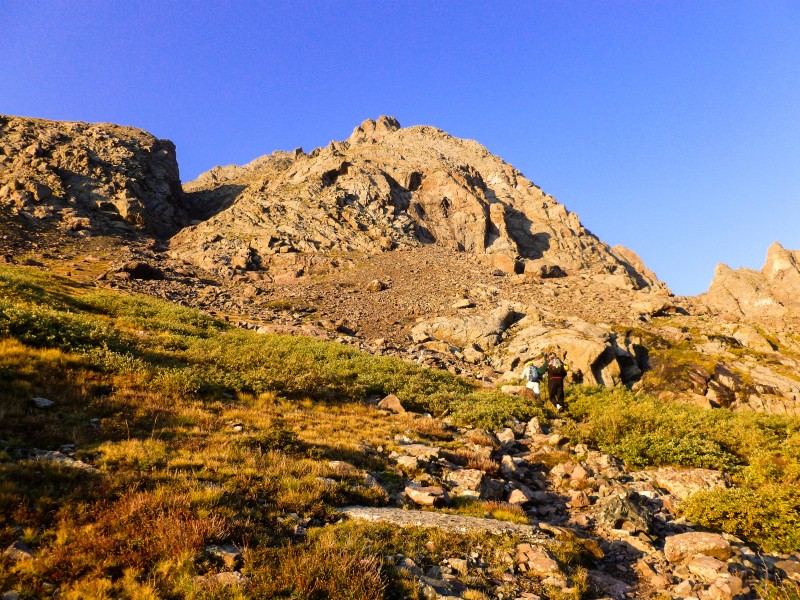
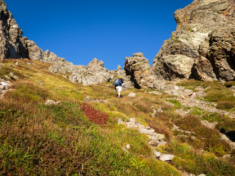
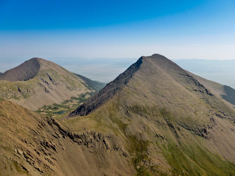
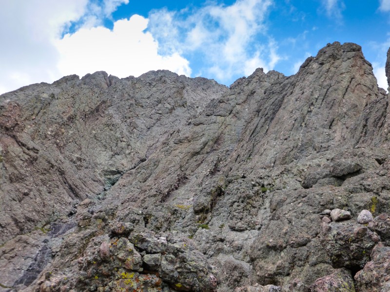
The walk up the road to the old 4wd TH went fast and then the trail to the lake felt much better on a great trail. We found ourselves near the lakes just in time for the sunrise to light up the face of the Needle. A brief pit stop and we were on our way hiking up the worst part of the route up Broken Hand pass. It is loose, it is painful, it is steep. The only solace up this short hike to the pass is the views around - of the imposing Needle and the bump that is Humboldt towering over the lakes below.
Sunrise lightens up the destination Green above the lake Views around Broken Hand pass
We passed a few tents along the way and another gentleman attempting the Crestone peak trailed us for a while and eventually passed us. Rob's initial plan was to make a go - no go choice based on the weather once we gain broken hand pass. But the weather left no choice for us. It was such a wonderful day that not continuing further would be a crime against the Needle.
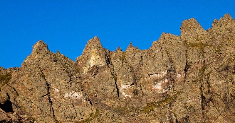
More jagged views Looking back - Humboldt
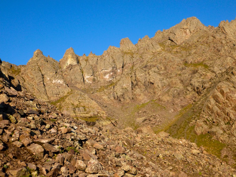
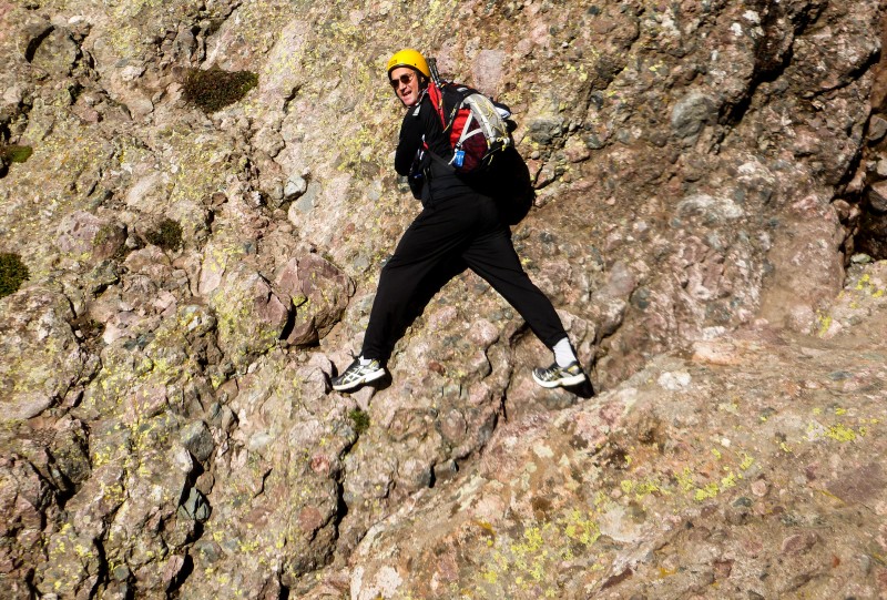
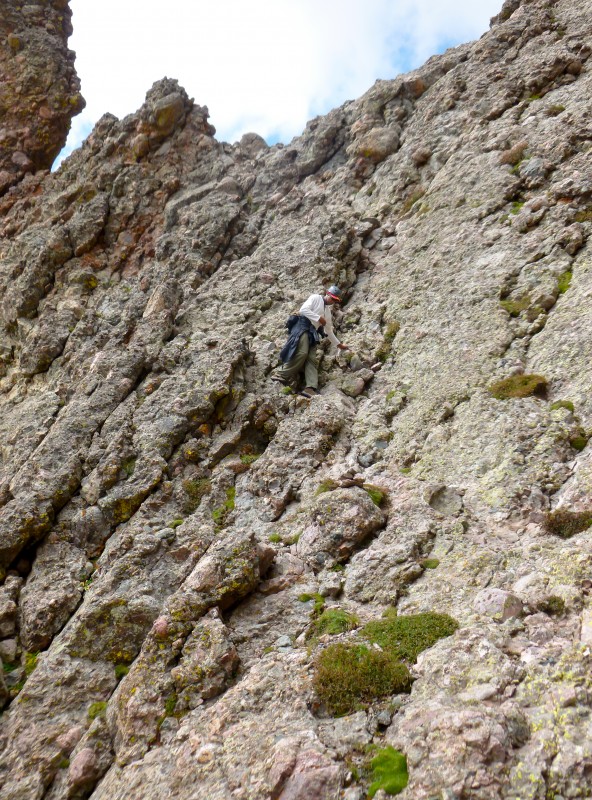
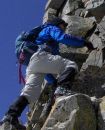
A traverse on the back side of broken hand pass, followed by a slightly dicey downclimb (due to the wet rocks) and roughly 400 feet of gain and we found ourselves at the base of the east gully. Given our start time, I was happy that there was no one else ahead of us in that steep gully. The gully was every bit what everyone describes it as, steep fun climb with plenty of handholds and solid rocks. As we approached the dihedral, there is a very obvious path that goes in the general direction of the west gully - grassy strip going in between two huge rocks. Maybe this will lead you to the west gully easily but this is NOT the path described in the route info on 14ers.com. One should go about 100 feet vertical above this and cross over. The route from up here to the summit was very well cairned but I can clearly see how route finding can be messy if it wasn't cairned. (okay, I seriously don't know how a dihedral looks or how it looks on the Needle. I have tried to look at dozens of photos but can't recognize it with eyes open, close or squinted - maybe I'm geometrically challenged)
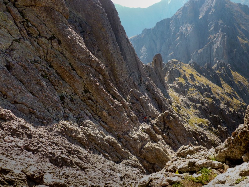
Pondering the way up Deep down - East gully
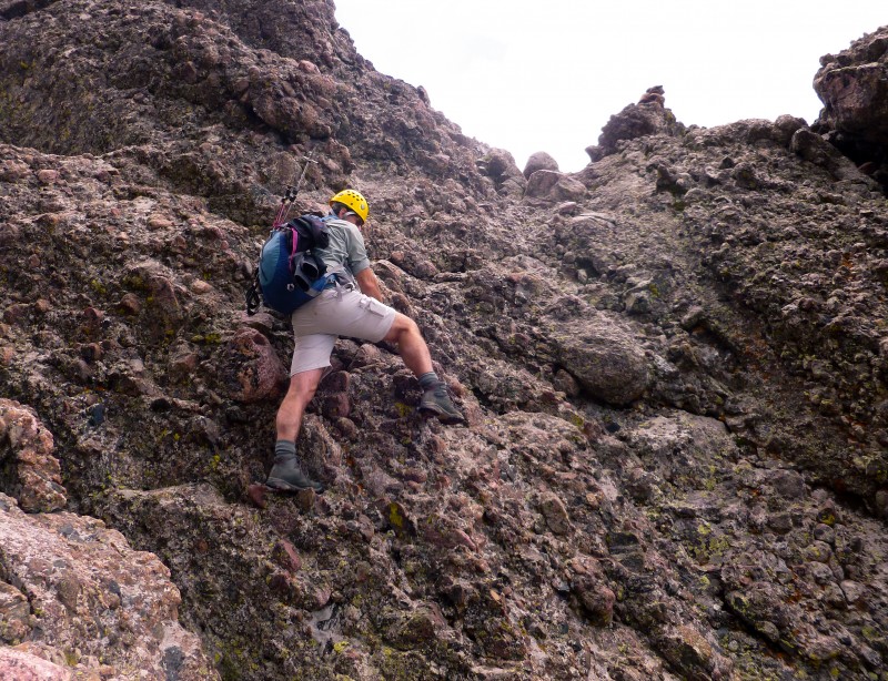
The cross over from the east gully to the west gully felt like the hardest part of the route. Slightly exposed, with water flowing in between, some huge steps required to pull oneself up - all contribute to the difficulty of this cross over - apparent or otherwise. We ran into two other guys who had started from camp and had an early summit and also saw another group coming up the east gully.
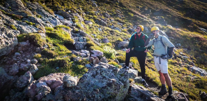
Chris posing just after the crossover Just before leaving east gully - hikers far below
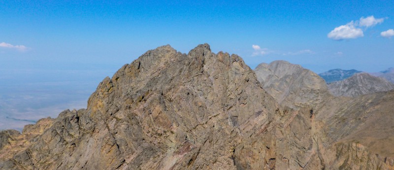
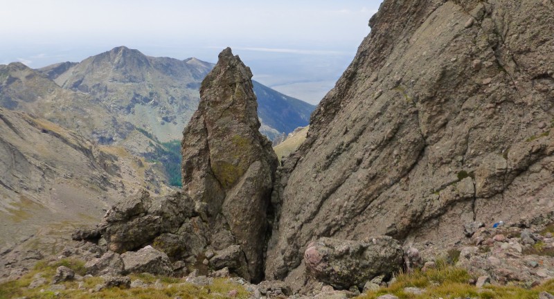
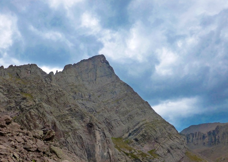
Once we crossed over to the west gully, I felt the rocks were much looser there than the east gully along with some scree and going up seemed to confirm it. After a bit of ascent, for some reason my GPS showed we were in between the two gullies. We eventually reconnected with the west gully and climbed up the last 100 feet or so up to the ridge and views of the Peak, Humboldt, sand dunes and the Blanca massif.
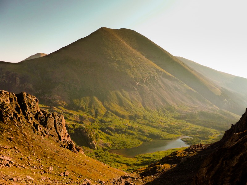
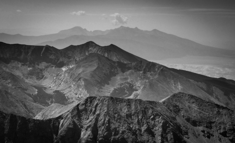
Views in the west gully Humboldt stands symmetrical The Peak watches silently
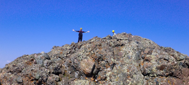
We topped out around 10:30am, six hours from the car greeted by Mr. Chirpy. The views all around were worth it and it was great to see the sand dunes from up high. Photo session, grub session ensued. The other party behind us eventually summitted and a solo hiker Terence summitted right behind them. Another solo hiker completed the traverse. We stayed on the summit for about 45 minutes and then stated heading down.
Hey! Summit all for us! Team shot - Crestone Needle summit - Great partners for a great peak Looking at Blanca et al. ... and the dunes
I was apprehensive of the scree and loose rocks and sure enough early into the hike I knocked a basketball sized rock into the gully. A short while later, someone from another party knocked down a baseball sized rock and it hit my pack, bounced off and zipped down. I decided to let the others pass and keep a safe distance from them so I don't send anything tumbling down. Chris and especially Rob patiently waited for me on most of the descent route. We went down guided by colored tapes and cairns. The crossover between the gullies was as much 'fun' as it was going up. The solo hiker Terence caught up with us at this point and hiked down with us all the way to the car.
Looking back up the west gully Terence finds his way down We did that face??
The downclimb after the gullies was largely monotonous and our tired legs weren't particularly having a blast. My dislike for loose rock and scree was reinforced again by broken hand pass and after some hiking we found ourselves at the lower lakes.
Rob having fun on the small ascent back to BHP The Needle is happy to pose - one for the clouds The Needle is happy to pose - one for the river
From here, Rob decided he would lead us back to the car by the standard route of Humboldt which he had done a few weeks ago. The trail back to the old TH via the Humboldt route was fantastic, soft wet ground with greenery and both sides and it shaved off 0.6 miles on the way back. What more can you ask of a shortcut? Back at the car Rob played host and supplied cold beer and Dew which were greatly appreciated! A pleasant day in the mountains with great partners and the weather gods smiled upon us!
Happy to see the end!
After a great day in the mountains, the drive back home was a remarkable experience. I have driven the SH 67-96-69 combo about five times now, always in the dark in sleep deprived state and I really hated how curvy and desolate those roads were. However, in the warm glow of the setting sun, these roads seemed like paradise with all the farm lands, blissfully munching cattle and horses, brightly colored farm equipment, mountains in the distance. Scenes from 'A Good Year' flashed by my window side making my desk job seem unimportant.
Maybe the universe is too fond of freak occurrences, maybe it just acts on a whim. At the end of what I thought was a wonderful day, I saw reports of an accident in the Elks. I learned the next day that Rob Jansen had left us. I'll always remember him as the guy smiling blissfully hauling up 40-50lbs on the Como road.
Rest in peace Rob, the rocky mountains will surely miss you.
My GPS Tracks on Google Maps (made from a .GPX file upload):
Your pictures are amazing! The color you captured turned out way better than any of mine. We actually hiked Crestone Peak the same day and actually summited at 10:30 as well! We could see people on the Needle. That must have been you! Very cool. Could you see us? It almost looks like your Crestone Peak pics captured us on the top but I cant completely tell. Thats so awesome! It is amazing how well the weather turned out that day. Congrats on such an intense peak.
Rob's initial plan was to make a go - no go choice based on the weather once we gain broken hand pass. But the weather left no choice for us. It was such a wonderful day that not continuing further would be a crime against the Needle. You got that right!
Chris and especially Rob patiently waited for me on most of the descent route. I was in a groove as we crossed back to the East Coulior and didn't want to wait. I did stop after the Dihedral. What is a Dihedral anyway.?? Two hedrals??
The trail back to the old TH via the Humboldt route was fantastic, soft wet ground with greenery and both sides and it shaved off 0.6 miles on the way back. What more can you ask of a shortcut? Your map shows we really saved some time and I found a campsite I would like to use.
Lindsey next!
:)
We actually hiked Crestone Peak the same day and actually summited at 10:30 as well! We could see people on the Needle. That must have been you! Very cool. Could you see us? We were watching you. So close and yet so far.
Awesome job, great to see you progressing so well Karthik!
Caution: The information contained in this report may not be accurate and should not be the only resource used in preparation for your climb. Failure to have the necessary experience, physical conditioning, supplies or equipment can result in injury or death. 14ers.com and the author(s) of this report provide no warranties, either express or implied, that the information provided is accurate or reliable. By using the information provided, you agree to indemnify and hold harmless 14ers.com and the report author(s) with respect to any claims and demands against them, including any attorney fees and expenses. Please read the 14ers.com Safety and Disclaimer pages for more information.
Please respect private property: 14ers.com supports the rights of private landowners to determine how and by whom their land will be used. In Colorado, it is your responsibility to determine if land is private and to obtain the appropriate permission before entering the property.