Download Agreement, Release, and Acknowledgement of Risk:
You (the person requesting this file download) fully understand mountain climbing ("Activity") involves risks and dangers of serious bodily injury, including permanent disability, paralysis, and death ("Risks") and you fully accept and assume all such risks and all responsibility for losses, costs, and damages you incur as a result of your participation in this Activity.
You acknowledge that information in the file you have chosen to download may not be accurate and may contain errors. You agree to assume all risks when using this information and agree to release and discharge 14ers.com, 14ers Inc. and the author(s) of such information (collectively, the "Released Parties").
You hereby discharge the Released Parties from all damages, actions, claims and liabilities of any nature, specifically including, but not limited to, damages, actions, claims and liabilities arising from or related to the negligence of the Released Parties. You further agree to indemnify, hold harmless and defend 14ers.com, 14ers Inc. and each of the other Released Parties from and against any loss, damage, liability and expense, including costs and attorney fees, incurred by 14ers.com, 14ers Inc. or any of the other Released Parties as a result of you using information provided on the 14ers.com or 14ers Inc. websites.
You have read this agreement, fully understand its terms and intend it to be a complete and unconditional release of all liability to the greatest extent allowed by law and agree that if any portion of this agreement is held to be invalid the balance, notwithstanding, shall continue in full force and effect.
By clicking "OK" you agree to these terms. If you DO NOT agree, click "Cancel"...
After having taken my son and his cross country team for a hike up Pikes Peak last year, I had enough interest from the kids wanting to do another team hike this Summer. I decided to do something a little more secluded, scenic, but hopefully not quite as long as the trip was at Crags Campground last year. Mt. Ouray has been a 13er I have been eyeing for myself for quite a while. The summit pictures looked amazing and the route seemed simple enough. The many TRs I had looked at from site members gave me all the info I needed, so I made the decision that it would be our summit goal for this trip.
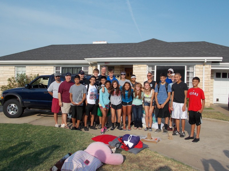
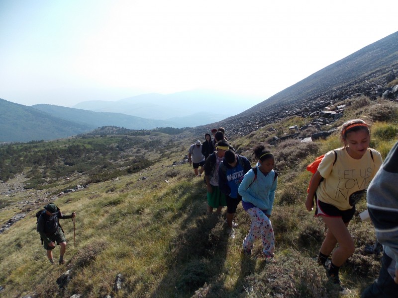
In June, I reserved us some tent sites at Heart of the Rockies RV Park and Campground, just west of Poncha Springs and starting getting a head count of how many kids were interested in participating in what became our 2nd annual cross country team hike. Eleven of our boys and five of the girls wanted to go! So glad there was still so much interest since very few of the kids have ever done something like hike a mountain. We set the date for the hike for August 18th and headed out from my house in Texas to head for the high country. Our group getting ready to head to Colorado!
We left with a grand total of 22 people...20 were going to attempt the hike and the other 2, my dad and my sister's father-in-law, both of whom recently retired, were going to hang out at camp, check out Salida, Buena Vista and the area and help prepare our campfire dinners at camp. (and they did a great job!)
We arrived at the campground at about 4 pm on Friday, the 17th and set up camp. We had an early dinner, let the kids explore the area on the north side of the campground and we all turned in to the tents at about 9 pm, knowing that a 4:30 am wake-up call was going to get there very quickly. And it did.
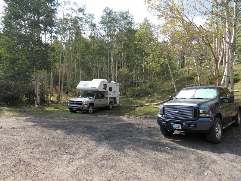
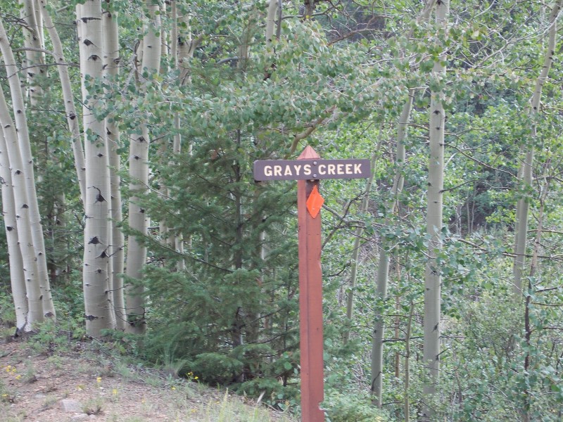
Everyone woke up excited, and after a quick fresh fruit, granola and yogurt breakfast, we loaded up into our 3 vehicles and headed out for Gray's Creek trailhead. The road to the TH is in pretty good shape and just about any vehicle can make it to the Gray's Creek pull off. We arrived at the trailhead at about 5:45 am, the sky was just getting light enough to see that the skies were pretty hazy, but there was not a cloud in the sky. After checking everyone's packs, making sure everyone had everything they needed, we hit the trail at 6:08 am! The trail starts just to the left of the parking area and can be hard to see in the dark or without doing your research. If you look closely at the picture of the parking area you can see a few of our hikers to the left of the camper truck...they are coming off the trail, so that may be able to give you a good reference as to where the trail is. The parking area for Gray's Creek TH. Room for just a few vehicles, but there is also room on the side of the road righ When coming from Poncha Springs, this sign is just a few yards past the TH parking area...if you see this sign, you just pass
The start of the trail.
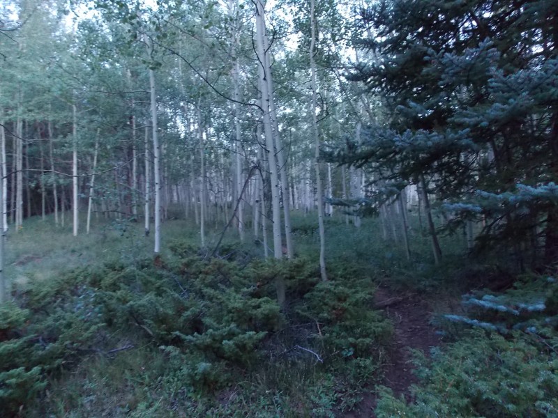
The trail is actually fairly well defined, especially below tree line, and winds through a large aspen grove for a very large portion of the hike until you begin to get around 11,500 ft or so. The well defined trail while winding through the aspen Typical trail conditions while below tree line
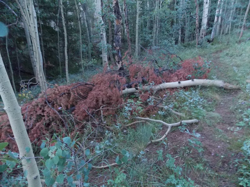
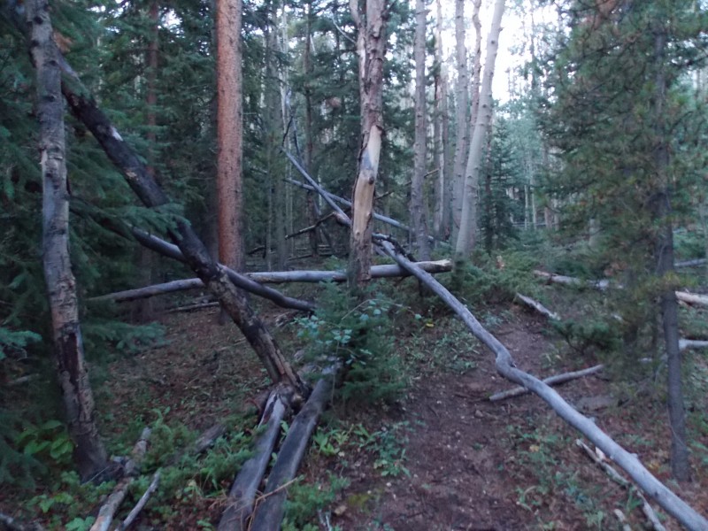
I had gotten some feedback from some of our site members while doing my research that there was quite a bit of fallen trees on the trail due to a big wind storm earlier this year...they weren't kidding! There were many places that the trail had to be "adjusted" to avoid trees of all sizes. You also cross the creek, or smaller feeder streams, about 5 or 6 times through the early part of the hike. Most crossings have at least some type of log or branch bridge to help. Some examples of some of the treefall we came across. Lots of ducking, dodging and diverting to avoid the trees ...and more treefall One of the creek crossings while below treeline
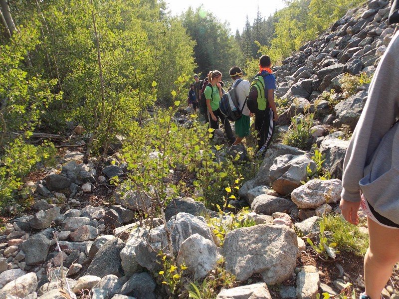
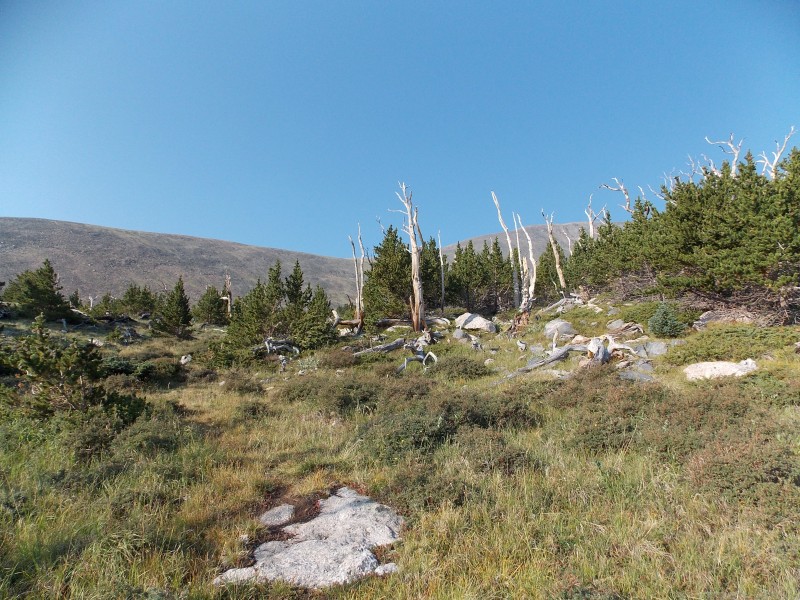
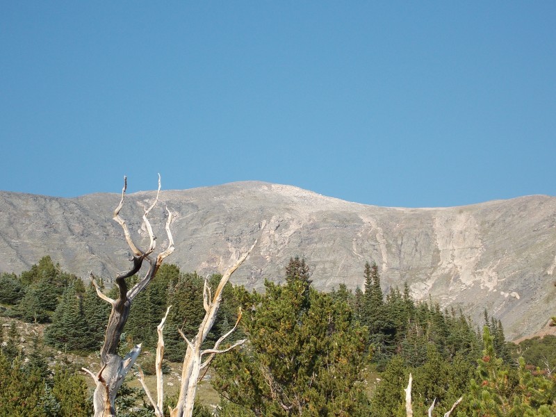
Once you work your way past the large aspen grove, the trail channels you into a narrow, rocky gulley for about 500-600 ft of elevation gain. Once you start getting to the top of the gulley, you start to see the beginnings of the old, bristlecone pine forest that welcomes you into the eerily, but aptly names Devil's Armchair. Looking up at the start of the rocky gulley More typical conditions in the gulley The rocky gulley continues up Almost to the top of the gulley, notice the bare, ancient bristlecones at the top
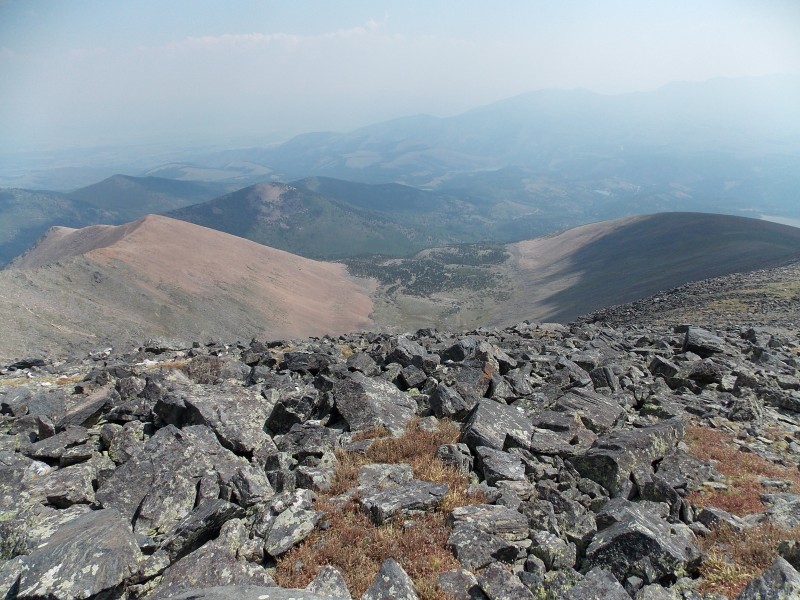
Once at the top of the gulley the view of the summit of Mt. Ouray is amazing...pictures do not do it justice. Ah, finally the summit is in view.
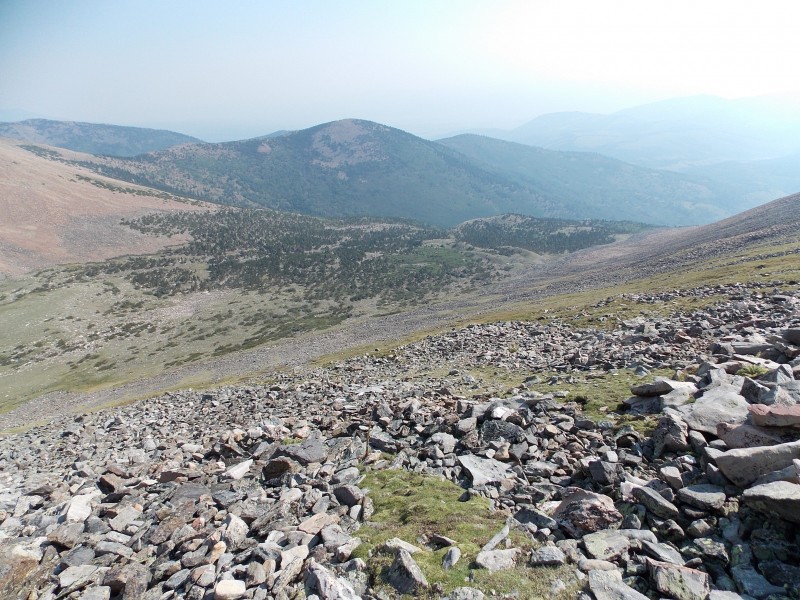
Once we got to the bristlecone forest, we took a break and took a quick look at what lay ahead. We could see trail continue on to the south and then west towards the slope up to the SE ridge...this where things got more interesting for us.
We followed the trail until we got to where it was very rocky at the base of the SE ridge...we were able to pick out a couple of cairns, so we followed them but we quickly discovered that 1)the trail had pretty much disappeared and 2) We could not see any more cairns.
At this point we took a quick break, our adult hikers convened a short meeting, and we decided to just try to switchback across the steep, but fairly decent slope up towards the ridge crest. The routes we decided to take. Ascent is in red. Descent is green
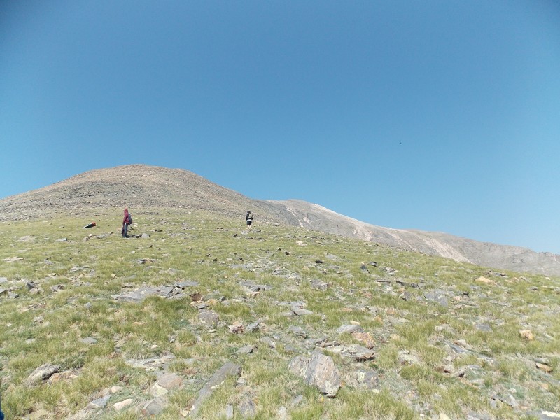
The grassy slope was pretty steep, we tried to avoid most of the rocky areas and after about half a mile of hiking, we made the ridge crest. Starting up the steep, grassly slope of the SE ridge. Still heading up.... A little bit of rock we traversed on the way up the slope. Still going The view down into Devils Armchair once we made it to the ridge crest.
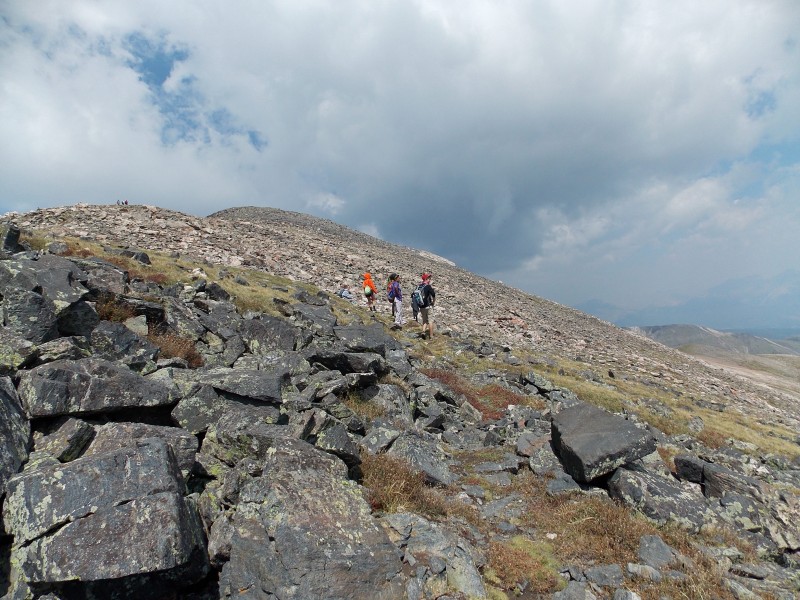
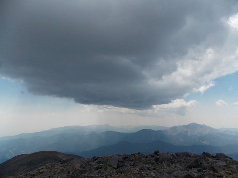
Once on the ridge crest we were able to find the trail again and after a quick snack and rest break, we started to make the push for the summit. The clouds were beginning to pop up, but nothing menacing was around. The trail is very well defined and easy to follow from the top of the SE ridge all the way to the summit. A look up the SE ridge to the summit Rocky trail conditions on the summit ridge. Looking up at the remainder of the hike to the summit.
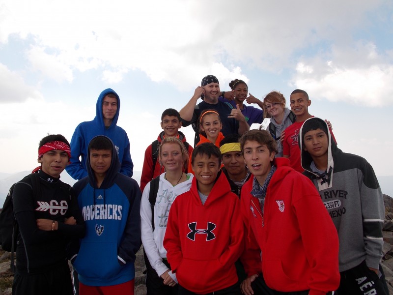
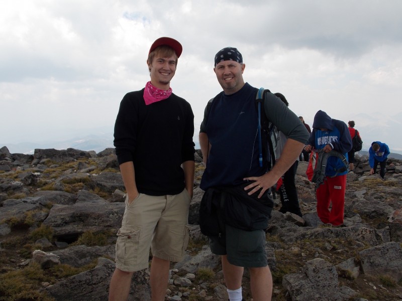
Finally, at just a little before noon, I finally made the summit...several of the kids had already made it and were enjoying the views. Only a few were behind me and out of our group of 20 that went on the hike, 19 made the summit. The only one that could not make it stopped at about 13,500 ft. due to injured foot that a car had fallen on after slipping off a jack and also a bum back...but he still did a great job to make it that far. Our group on the summit of Mt. Ouray, 13,971 ft!!! Well, most of the group. Another father/son shot for the family album! We still enjoy these times together. The Mt. Ouray summit marker Looking down into Devil's Armchair from the summit of Mt. Ouray
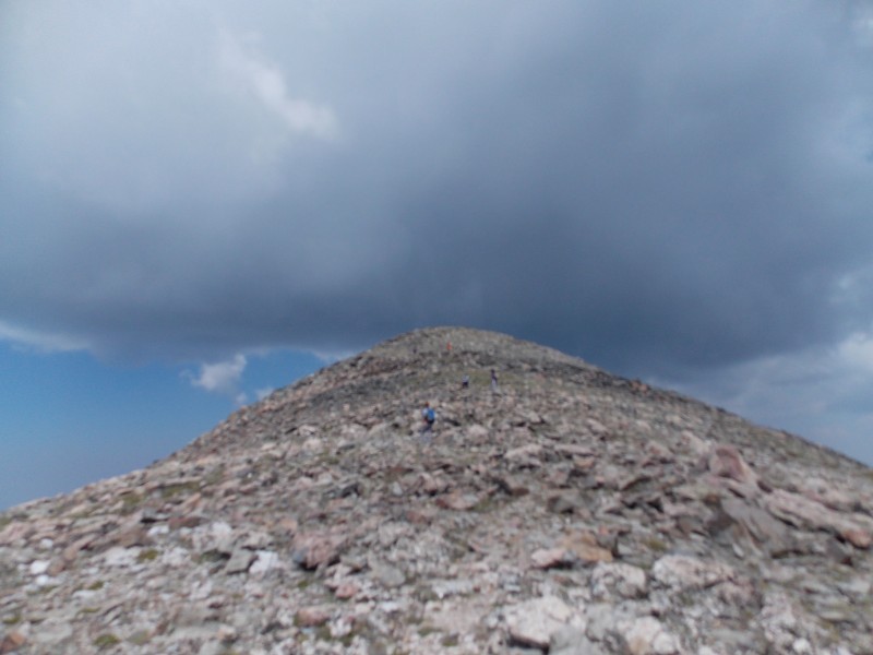
We spent about 40 minutes on the summit, and since it was so stinking hazy this particular day, summit shots of the surrounding area are pretty much worthless...I was looking forward to the great views of the Sangre de Cristo Range, the Sawatch to the north and even the San Juans and Pikes Peak...oh well, still a great time, just not as scenic at the top as I had hoped. I noticed a few rusty cans as I cam up to the summit, and as I left I detoured a little and noticed what looked like an old mine opening. Not sure if that is what it is, but it was pretty interesting to check out. Maybe someone who reads this report can enlighten me as to if that was indeed an old mine. I think this is an old mine. Lots of rusty tin cans and looks like rocks were put there to keep people out. Any input from Clouds were beginning to look more menacing as we started down.
Now for my thoughts and insights for this hike:
The trail head is easy to access, the hardest parts about getting to Grays Creek TH is making sure you don't miss the pull-off and then finding the trail at the TH. But it is pretty obvious. There is a lot of treefall at this time. We tried to move some of the smaller trees off to the side, but most were either too big for us to move, or were wedged to where we couldn't budge them. There is plenty of time during the early part of this hike that water is available. About a third to a half of the trail below treeline is within earshot of Grays Creek. The trail below treeline is faily well defined...there are a few times that it becomes a little vague, but stopping and looking closely will allow you to find the trail fairly easily. Once you get past the bristlecone pines and start getting above treeline, the trail becomes very faint and cairns are hard to see. We just picked a line up the grassy slopes and headed almost straight up to the ridge crest. You should not have to get on anything above a class 2 at all..and you should be able to keep it class 1 if you are careful in picking a good line. We dropped off on the descent a little too far east and ended up on a slightly rockier, looser line, but it was never anything beyond class 2. The trail is great once you get to the final phase of the ascent along the ridge. It has a lot of gentle switchbacks and is never too steep or loose. I wish I could elaborate more on the summit views, but they just weren't there as I had hoped on this particular day...but from the summit panorama Bill has on Mt. Ouray's page, I am sure they are magnificent on a clear day.
Overall. this is a great hike and the views of the summit from inside Devil's Armchair are great, it has a big summit and we did not see another person outside of our group during the entire 10 hour hike...very unusual for a Saturday, I thought. I recommend this hike for anyone wanting a secluded hike that isn't too difficult or too far from civilization. Well worth the trip...now what to take the kids on next year. hmmmmm.......
Thumbnails for uploaded photos (click to open slideshow):
Must've taken a good amount of planning and logistics to move 22 people from Texas to the summit of Ouray, what a cool outing you guys had. Too bad you didn't get those infamous views from the top, but it sounds like it was a success at the end of the day. Glad to see those clouds held as well. Amazing the difference between pic 23 and 24 with regards to weather.
We had a great time last year when we did Pikes Peak and the kids showed lots of interest in doing it this summer and now they keep asking what we are going to do next year! :D No complaints here! I guess the hazy skies were from the wildfires off to the west in CA and UT. I was really looking forward to those views, I may have to try Antora...it looks like it may have some great views too. The weather did change fairly quickly after about 1 pm. We heard a little bit of thunder coming from the south once we were right at treeline.
My first exposure to hiking was with my cross country team in high school. My coach would take us on trips to high peaks during the summer. I'm very grateful for it, because it resulted in my lifelong love for hiking. So nice work, those kids will remember it forever!
Awesome thing to do as a team. Last year it was my motivation to let the kids doing something together that would help build the team's unity and cohesion. It is now something the kids look forward to and I think in the long run it not only is a great team building event, it also helps their performance on the course.
Caution: The information contained in this report may not be accurate and should not be the only resource used in preparation for your climb. Failure to have the necessary experience, physical conditioning, supplies or equipment can result in injury or death. 14ers.com and the author(s) of this report provide no warranties, either express or implied, that the information provided is accurate or reliable. By using the information provided, you agree to indemnify and hold harmless 14ers.com and the report author(s) with respect to any claims and demands against them, including any attorney fees and expenses. Please read the 14ers.com Safety and Disclaimer pages for more information.
Please respect private property: 14ers.com supports the rights of private landowners to determine how and by whom their land will be used. In Colorado, it is your responsibility to determine if land is private and to obtain the appropriate permission before entering the property.