Download Agreement, Release, and Acknowledgement of Risk:
You (the person requesting this file download) fully understand mountain climbing ("Activity") involves risks and dangers of serious bodily injury, including permanent disability, paralysis, and death ("Risks") and you fully accept and assume all such risks and all responsibility for losses, costs, and damages you incur as a result of your participation in this Activity.
You acknowledge that information in the file you have chosen to download may not be accurate and may contain errors. You agree to assume all risks when using this information and agree to release and discharge 14ers.com, 14ers Inc. and the author(s) of such information (collectively, the "Released Parties").
You hereby discharge the Released Parties from all damages, actions, claims and liabilities of any nature, specifically including, but not limited to, damages, actions, claims and liabilities arising from or related to the negligence of the Released Parties. You further agree to indemnify, hold harmless and defend 14ers.com, 14ers Inc. and each of the other Released Parties from and against any loss, damage, liability and expense, including costs and attorney fees, incurred by 14ers.com, 14ers Inc. or any of the other Released Parties as a result of you using information provided on the 14ers.com or 14ers Inc. websites.
You have read this agreement, fully understand its terms and intend it to be a complete and unconditional release of all liability to the greatest extent allowed by law and agree that if any portion of this agreement is held to be invalid the balance, notwithstanding, shall continue in full force and effect.
By clicking "OK" you agree to these terms. If you DO NOT agree, click "Cancel"...
Mountain and Route: Longs Peak and Mt. Meeker via Loft Date: 08/12/12 RT Mileage: 13.9 mi Vertical Gain: 5713ft Party: Prasanna and Karthik (theotherindian) Wildlife: Persistent marmot near Clark's arrow, rat inside Agnes Vaille Hut, pikas, some sparrows(?), funny sounding raven at the peak
Should we go Saturday? Or Sunday? Is 30% chance of rain all day worse than 30% chance of rain after noon? Is loft better than Keyhole? OMG, there's no GPX file for Loft route!
Longs had been my first 14er attempt two years ago. As a newbie hiker, I managed to haul up cans of Red Bull, assorted trail mix, gallons of water and non stretch jeans pantaloons upto Keyhole. I was, as I remember, terrified by the exposure on the other side of Keyhole and had to turn back a few hundred feet into the ledges because both me and my jeans were exhausted and could take no further boulder hopping. In many ways, I still blame this experience for my lack of courage to try anything class 3 for over 2 years.
After much deliberation, my friend Prasanna (not a 14er member) and I decided to give the loft route on Longs a go on Sunday. Prasanna had previously summited via keyhole and had returned with a lightning nightmare. To our pleasant surprise the weatherman decided there shall be no rain whatsoever on Sunday.
I'd estimated it was 4.4 miles to the base of the Loft couloir from the TH and was expecting it to take about 3.5-4 hours based on my usual pace. Armed with Derek's GPS tracks, we started from the TH just before 2am and to our surprise found ourselves close to Chasm lake and by the base of the couloir only two hours into the hike with a few breaks for meteor watching. We did catch 3-4 meteors zooming by close to the moon.
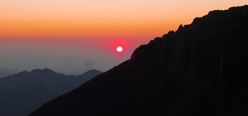
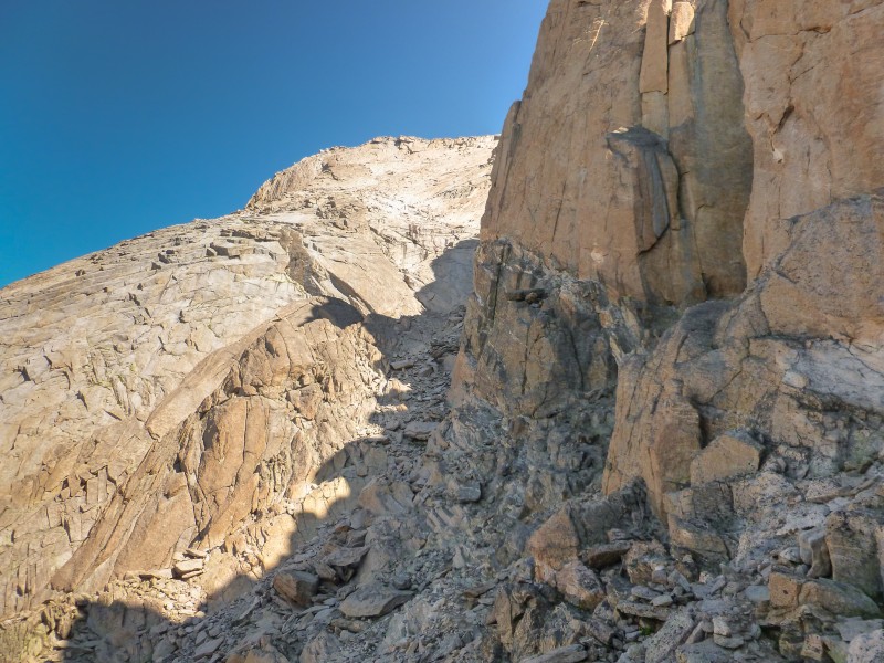
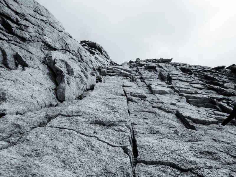
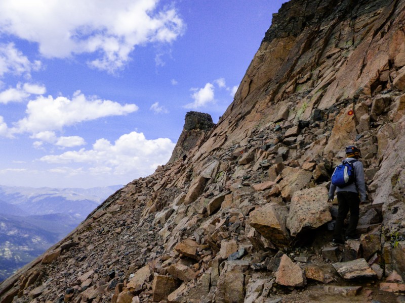
I'd hoped there would be twilight by the time we start ascending the loft couloir. But it was not to be. We were the first hikers on the Loft route for the day and decided to continue on with our headlamps but did notice a few other headlamps taking the loft route at the Chasm junction. After some easy scrambling near the top of the Loft couloir, we landed at the exit ramp. By this time, the sun decided to show up and two other hikers had passed us and were heading up to Meeker.
The sun rises late Somewhere in between the loft couloir Lighting up the terrain Just before the exit ramp
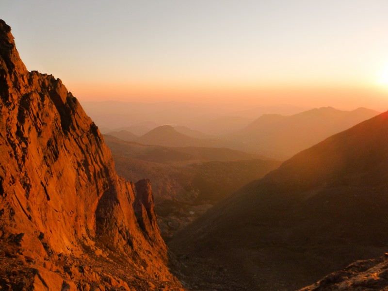
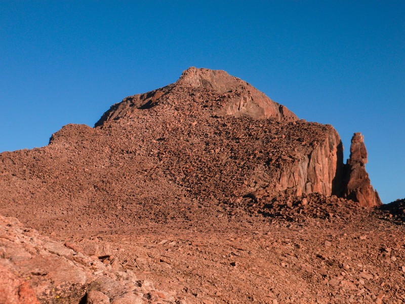
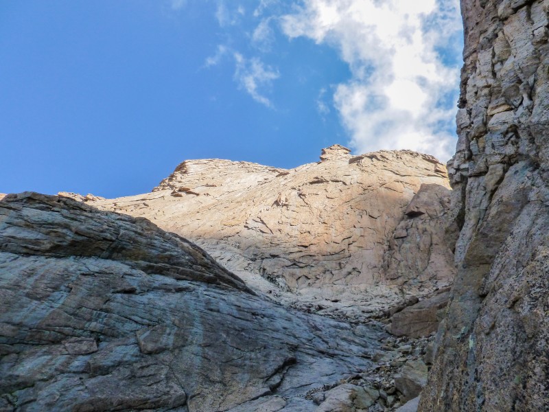
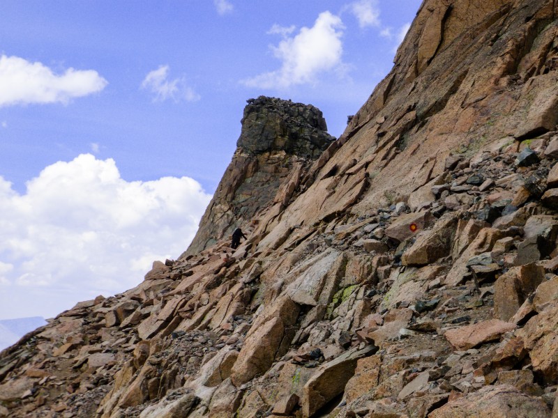
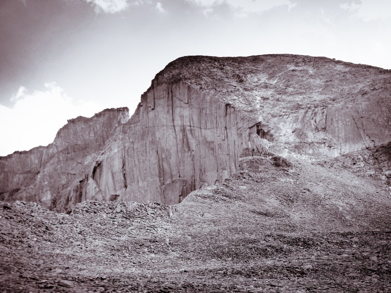
After some off route talus hopping/scrambling like headless chickens for the last 400 feet, we found ourselves at the Loft. I thought Longs looks like an idiot from this angle and that it's PR managers had done exceedingly well to show the world the Diamond face of it.
First view of Longs
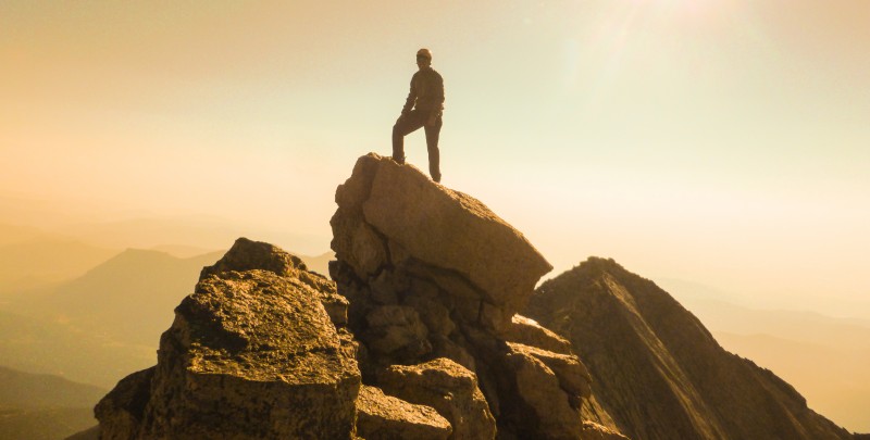
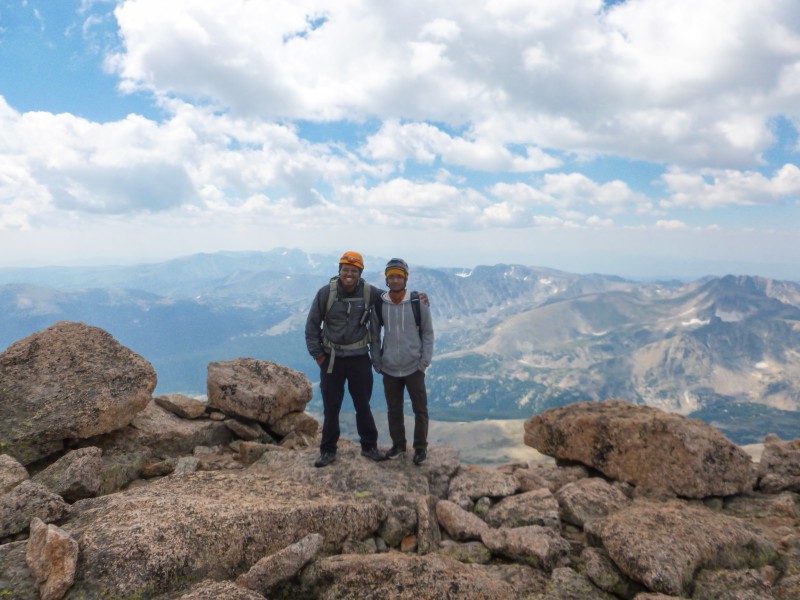
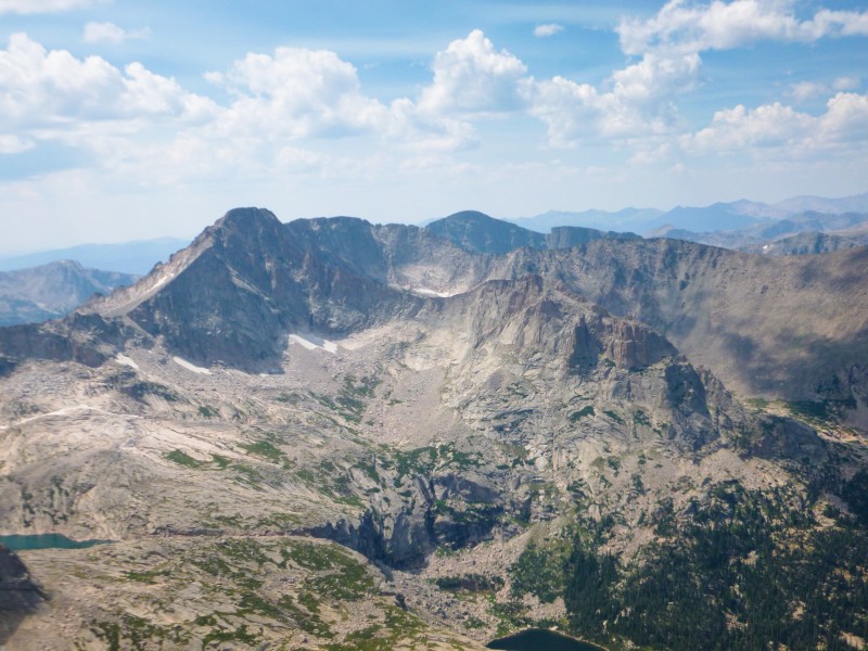
We trudged up the loose trail up Meeker, took a turn and scrambled up to the summit ridge. What I initially thought was the summit block turned out to be lower than another block a few feet away. We kept to the left of the ridge to get closer to the summit block and took turns hopping on to it for the photo op. The hike down to the saddle was quick and we met lots of other Meeker summitters on the way.
Mt Meeker summit shot
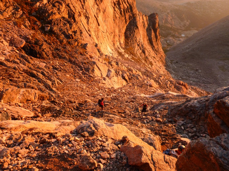
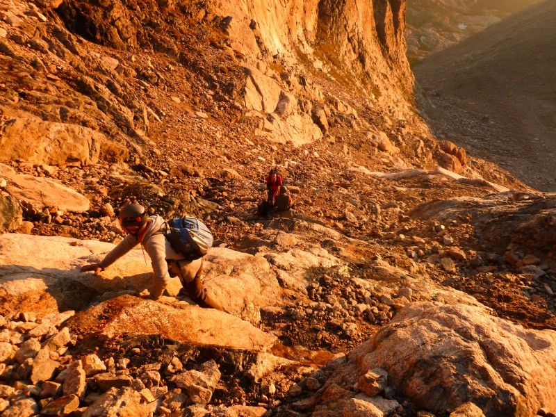
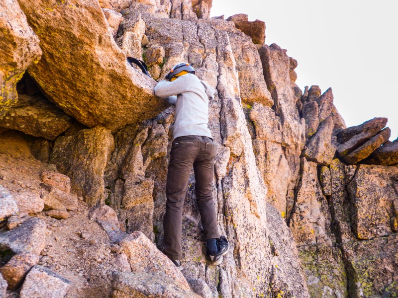
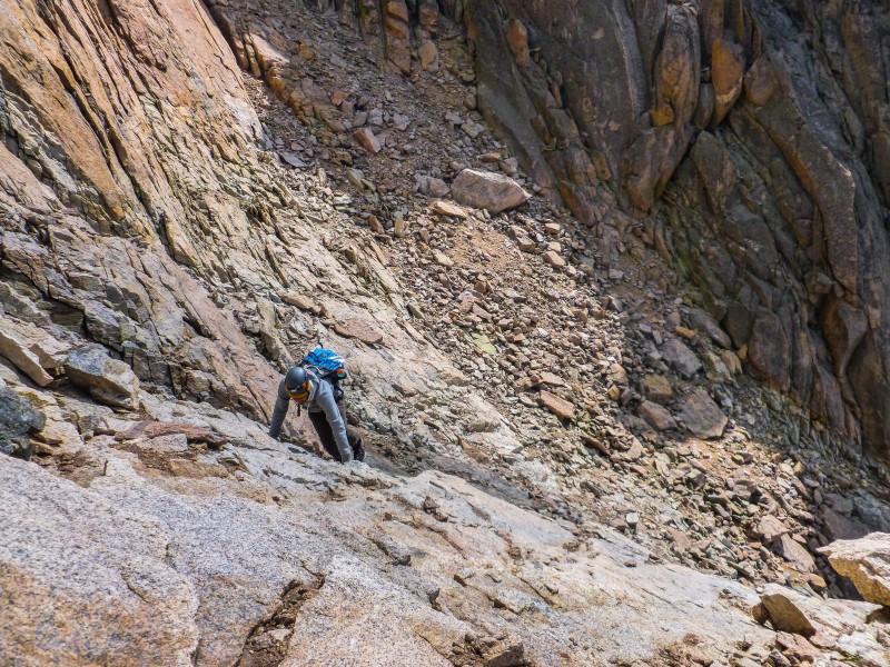
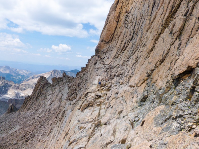
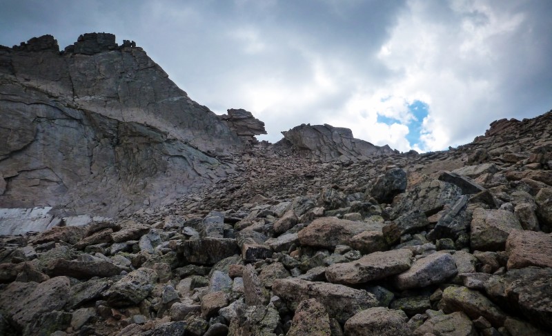
As we were heading towards the marker (tape on a stick) in the northwestern corner of the Loft, we met a few other hikers, going in both directions. The downclimb here is the only 0.2 mile stetch of the entire hike that is not cairned. And this was the only part of the hike I was concerned about since the description says there might be some Class 4ish moves involved and I don't even understand what that actually means. Anyway, they turned out to be small jumps from one level to another with occasional use of both hands. All of the downclimb could be done facing out. However, to add spice to our boring lives, a full grown marmot decided to make a guest appearance right at the crux of this route. He had the audacity to come very close to us, was not really scared by our frightened angry shrieks, didn't budge much even when we threw small stones in his general direction. The only recourse we had was to hurry down what was supposed to be the crux of the route and my only regret is everything seems pretty hazy now.
Some downclimbing
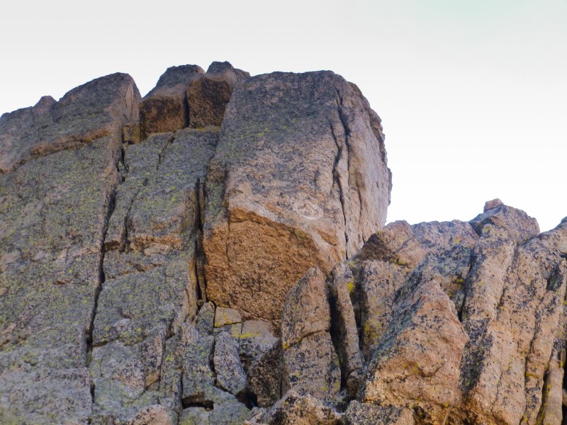
I had read a dozen blogs and TRs about Clark's arrow the previous night and was pretty determined to find it. Right after the down climb, you turn around a huge boulder and turn back and you can marvel at Clark's graffiti. Its not big, its not bright. Too close, and it blends in with the rock texture, too far and you can hardly make it out. When you are just the right distance from it, the arrow will present itself to you!
Mr. Clark's artwork
We stuck to going from cairn to cairn with some scrambling in between and landed at the homestretch to meet the pretty ladies and angry men hiking in from the other side of Longs. I felt the hike up the last bit of Keplinger's was the most grueling part of the day.
The route ahead Looking back behind Longs The Palisades(?) And that famous rock! Near the top of Keplinger
A short scramble up the slippery homestretch and we were on top of Longs, the tallest point in Colorado north of 70.
Homestretch is steep. Don't attempt it people Team shot on Longs summit
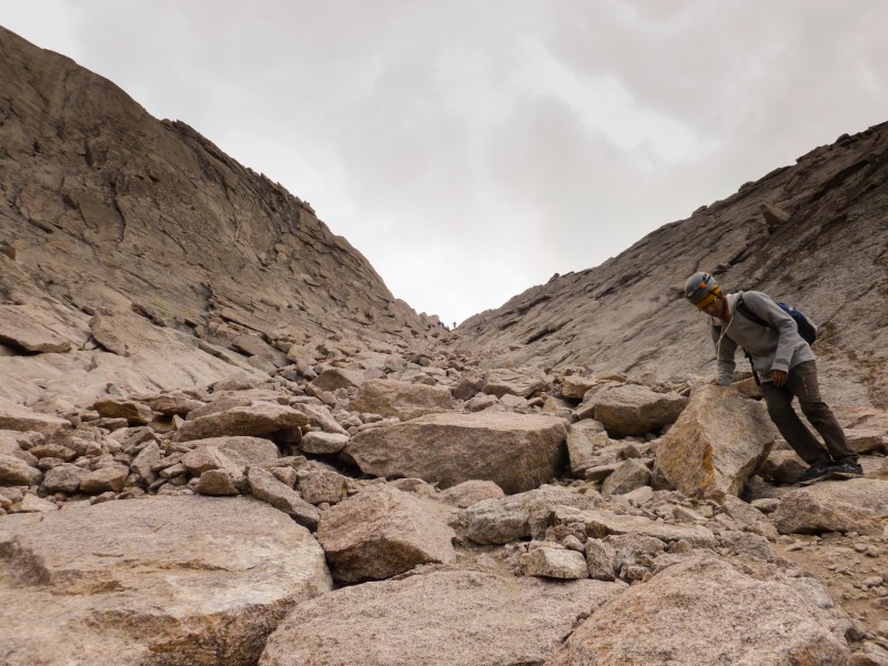
After the customary photo session, refuelling, we started hiking down from the summit exactly at noon. The downclimb through the homestretch and narrows were monotonous. Our sore legs didn't appreciate much of the boulder hopping. The trough was even more brutal on them.
The not so narrows Never ending trough Long way to Keyhole The ledges Westward views
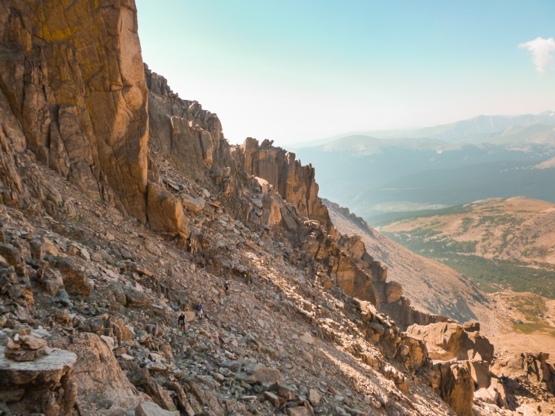
The boulder field and the subsequent hike to the car were long and needless to say largely uninteresting but exhausting. After going through the Boulderfield thrice (twice in my previous attempt), I have developed a healthy dose of disrespect for it. I dont see the point of a Boulderfield in the location that it is in the grand scheme of things.
Keyhole and Boulderfield Precious Diamond
The very concept of having to walk 5 miles from the Boulderfield to car with not much views and no scrambling makes it a zombie walk. We eventually got back to the car about 16 hours after we started. I'd overcome some of the demons plaguing me and Prasanna had made his second summit of Longs, the only 14er apart from Bierstadt he has set foot on.
In summary Longs peak is a great peak, Loft route is a great route. From a newbie perspective, sure, Loft involves a bit more effort than the standard route, but I'll do anything to avoid descending the trough again. And Meeker can be tagged along the way and it is not much effort to do so. A fun but longish day!
My GPS Tracks on Google Maps (made from a .GPX file upload):
You guys had a great day in the mountains and your pics are terrific. I conjecture that the hike from the boulderfield back to the Longs Peak trailhead is the primary inspiration for the phrase ”death march back to the car.”
I can completely understand not wanting to ever descend the trough again. Have gone down it twice now, once at 23 and once at 35, both times I thought my knees were exploding. Great job on that route!!
I missed this report when it was posted. Great combo! Hopefully the GPX file was of use. I am now thoroughly convinced that there are two ways through the tough spot. I recall having the same experience as you my first time, then I had a tougher move down a large boulder another time. Sounds like your way is the much better way. Glad you had a good time. We'll have to get out again soon.
--D
Caution: The information contained in this report may not be accurate and should not be the only resource used in preparation for your climb. Failure to have the necessary experience, physical conditioning, supplies or equipment can result in injury or death. 14ers.com and the author(s) of this report provide no warranties, either express or implied, that the information provided is accurate or reliable. By using the information provided, you agree to indemnify and hold harmless 14ers.com and the report author(s) with respect to any claims and demands against them, including any attorney fees and expenses. Please read the 14ers.com Safety and Disclaimer pages for more information.
Please respect private property: 14ers.com supports the rights of private landowners to determine how and by whom their land will be used. In Colorado, it is your responsibility to determine if land is private and to obtain the appropriate permission before entering the property.