Download Agreement, Release, and Acknowledgement of Risk:
You (the person requesting this file download) fully understand mountain climbing ("Activity") involves risks and dangers of serious bodily injury, including permanent disability, paralysis, and death ("Risks") and you fully accept and assume all such risks and all responsibility for losses, costs, and damages you incur as a result of your participation in this Activity.
You acknowledge that information in the file you have chosen to download may not be accurate and may contain errors. You agree to assume all risks when using this information and agree to release and discharge 14ers.com, 14ers Inc. and the author(s) of such information (collectively, the "Released Parties").
You hereby discharge the Released Parties from all damages, actions, claims and liabilities of any nature, specifically including, but not limited to, damages, actions, claims and liabilities arising from or related to the negligence of the Released Parties. You further agree to indemnify, hold harmless and defend 14ers.com, 14ers Inc. and each of the other Released Parties from and against any loss, damage, liability and expense, including costs and attorney fees, incurred by 14ers.com, 14ers Inc. or any of the other Released Parties as a result of you using information provided on the 14ers.com or 14ers Inc. websites.
You have read this agreement, fully understand its terms and intend it to be a complete and unconditional release of all liability to the greatest extent allowed by law and agree that if any portion of this agreement is held to be invalid the balance, notwithstanding, shall continue in full force and effect.
By clicking "OK" you agree to these terms. If you DO NOT agree, click "Cancel"...
Trailhead: Fourth of July TH
Route: South Arapaho Traverse to North Arapaho
Partners: Andrew and Jessica
Start Time: 5:30am (from Fourth of July Mine)
Finish Time: 12:30pm
I knew that if I didn't get up to the mountains this past weekend, it would be two straight weekends without getting into the backcountry, and I would be having serious mountain withdrawl. So after my flight home from St Louis landed (I was there for three days for a friend's wedding) at around 5pm, I hurried back to Longmont and exchanged my luggage and dress clothes for my camping and climbing gear. I grabbed a quick bite for dinner headed for Eldora where two friends were waiting for me, camped at the Fourth of July Mines. I left my apartment around 6:45 and the drive felt like a race against the sunset (I was hoping to make it to camp before it got too dark because my partners had tied a bandana near the trail where their tent was located). Flying up the 4-mile dirt road to the trailhead, I arrived at 8pm, just after the sun dropped behind the mountains. There was still plenty of light left though, and I quickly headed up the trail. After about thirty minutes of hiking, I succumbed to the fact that it was getting too dark and I needed my headlamp the rest of the way even though I was getting close. To my great relief, fifteen minutes later the beam of my headlamp caught glimpse of the neon green bandana tied to two trekking poles just off the trail before the mine, I had located camp. After I had set up my tent, we sat under the clear night sky and enjoyed the impressive Perseid Meteor Shower for about an hour before retiring to our tents, ready for an early start the next morning.
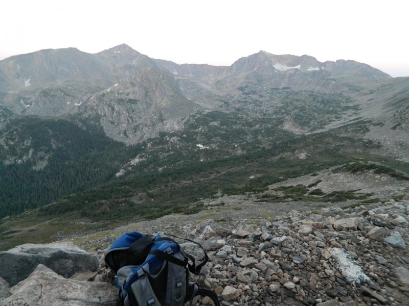
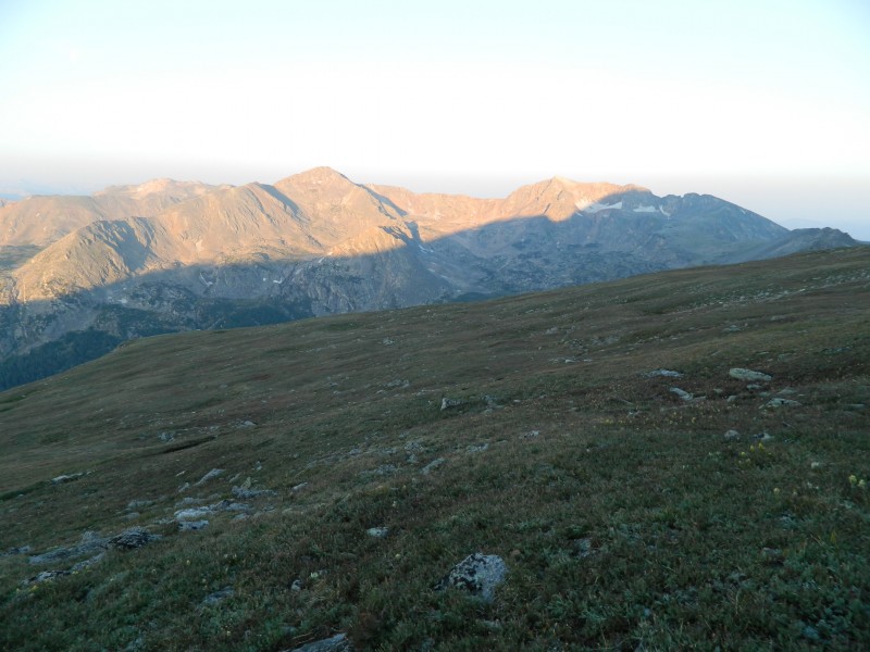
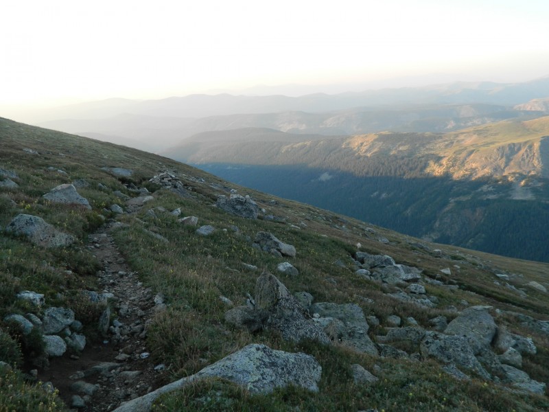
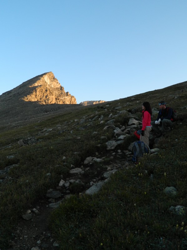
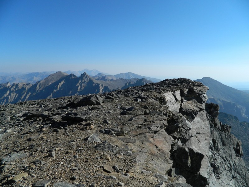
Hoping to be the first ones on the trail, we arose around 5am and hit the trail by 5:45. Headlamps were never really needed because the sun quickly lit up the eastern sky, shining upon Jasper and Neva Peaks as we worked our way up the slope to the glacier overlook in the saddle between South Arapaho and "Old Baldy." Jasper (L) and Neva (R). South Arapaho's pointed profile comes into view as we near the saddle. Sunlight reaches Jasper and Neva. Haze lingers in the foothills. Looking back at the Glacier Trail.
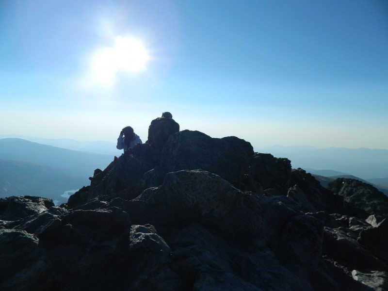
This spot provides one of my favorite views among many in the Indian Peaks, especially in the early morning sun. We stopped here for some quick photos and to shed some layers before the short class II push for the summit.
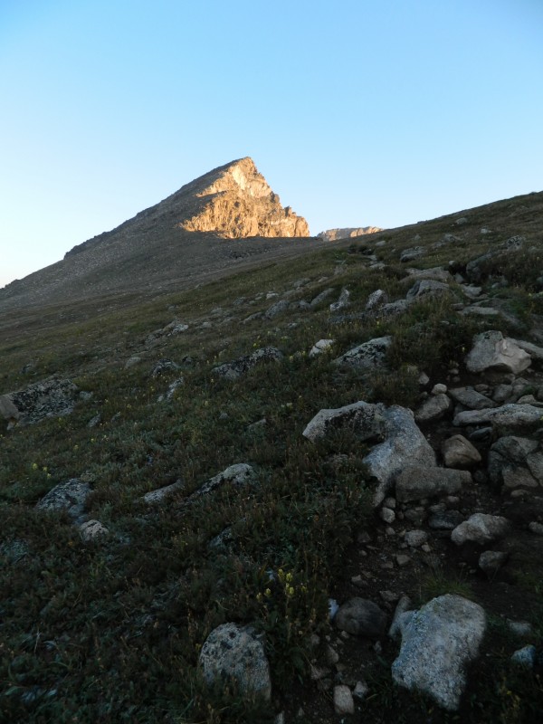
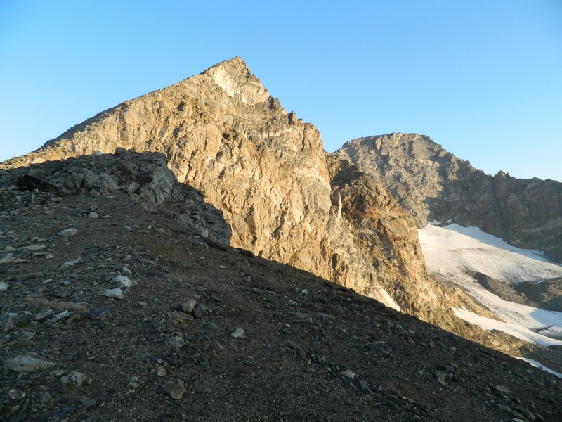
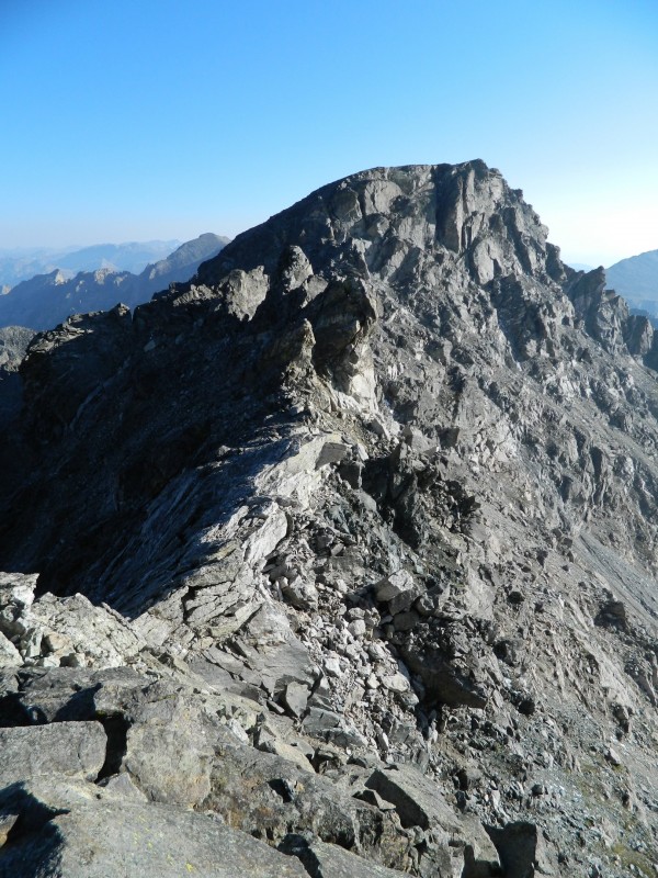
Our crew takes a quick rest just before the saddle. South Arapaho (L) and North Arapaho (R). Looking at the traverse to North Arapaho from the summit of South Arapaho.
After about fifteen minutes spent on the summit eying the traverse, we started getting cold (it was still only 7:30am) and decided to push onward. Nearly the entire route stays to the left of the ridge or on the ridge itself. Do not venture on the right (east) side of the ridge or the people of Boulder will be very upset upset with you and put you in time out.
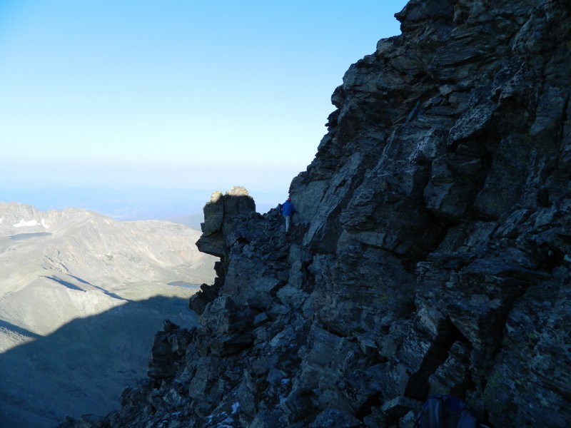
Shortly after descending off the summit of South Arapaho, we dropped down from the ridge reach a section of ledges. Nothing terribly difficult here, but there is a little bit of exposure.
Making my way across ledges early in the traverse.
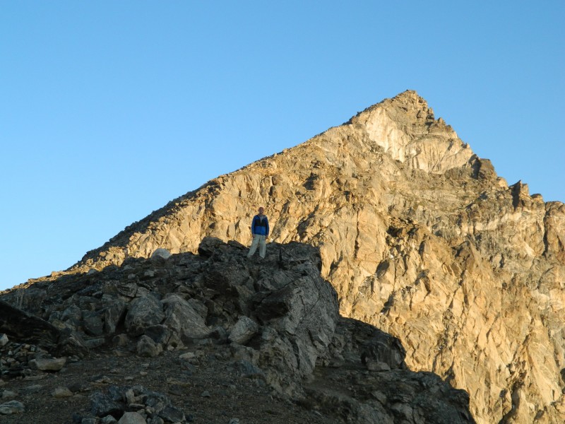
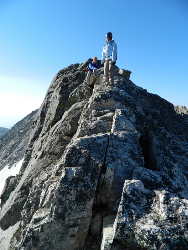
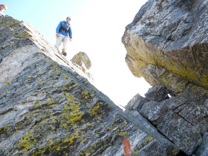
After the ledges, the route regains the ridge until you reach the crux of the route, a low class IV move directly over the large rock slab. Faded orange arrows will direct you, but the route is pretty straightforward. To be honest, I thought this section was a bit overrated. However, I am tall, and I could see how this section may be difficult for a shorter individual. The hand holds are pretty widely spaced, and the foot holds are worn from frequent use.
Preparing to ascend the crux block. Climbing the crux block
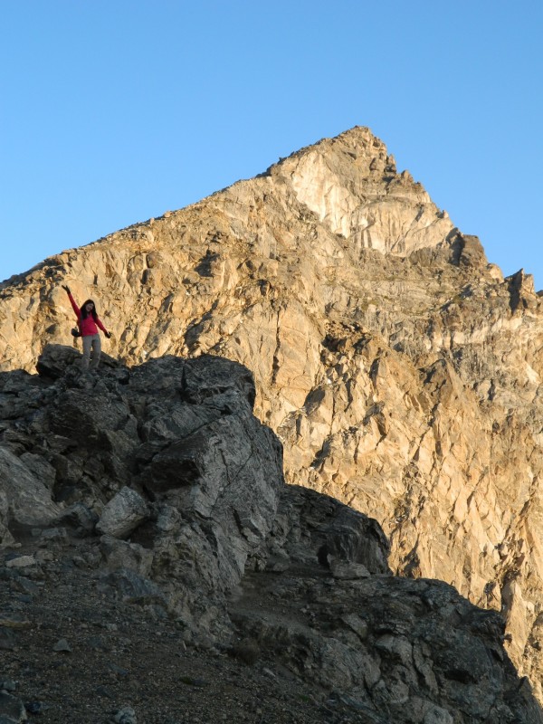
Immediately after the crux block is a short ridge section with pretty good exposure on both sides.
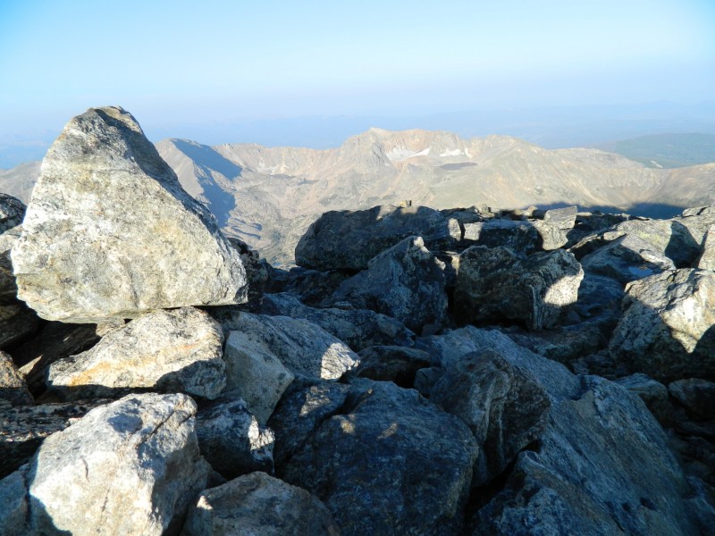
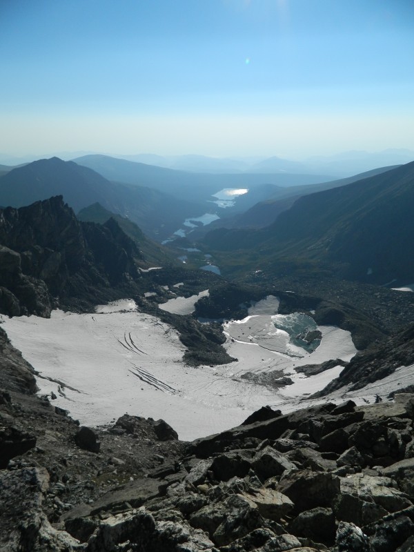
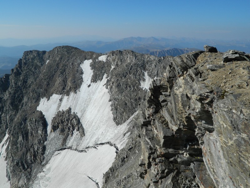
The remaining route along the ridge to North Arapaho. Mini knife edge just after the crux block. Arapaho Glacier and the Boulder Watershed. NO TRESPASSING!
The last section of the traverse is a class II gully that looks down on the east side of the traverse towards Arapaho Glacier. The gully wasn't too loose, but we took it one at a time just in case.
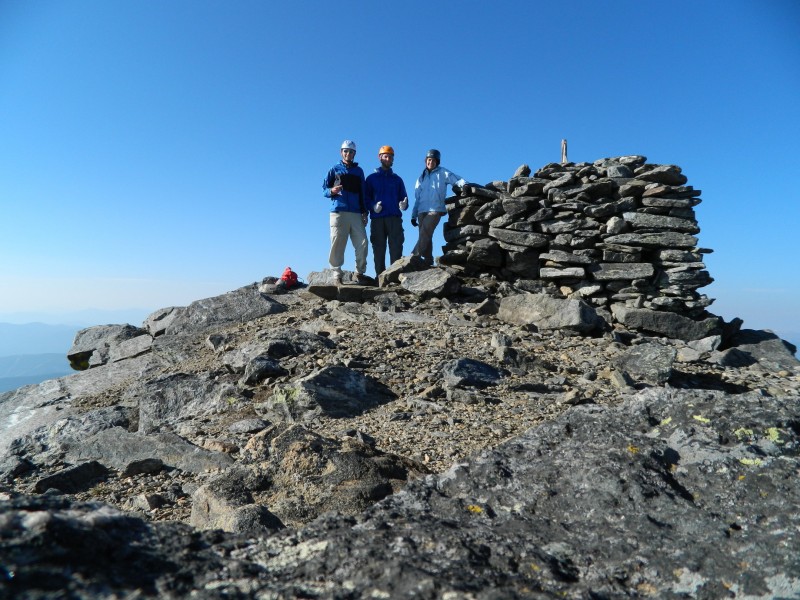
After the gully the route flattens out significantly and all that remains is a short jaunt to the summit. We summitted about an hour after we left South Arapaho.
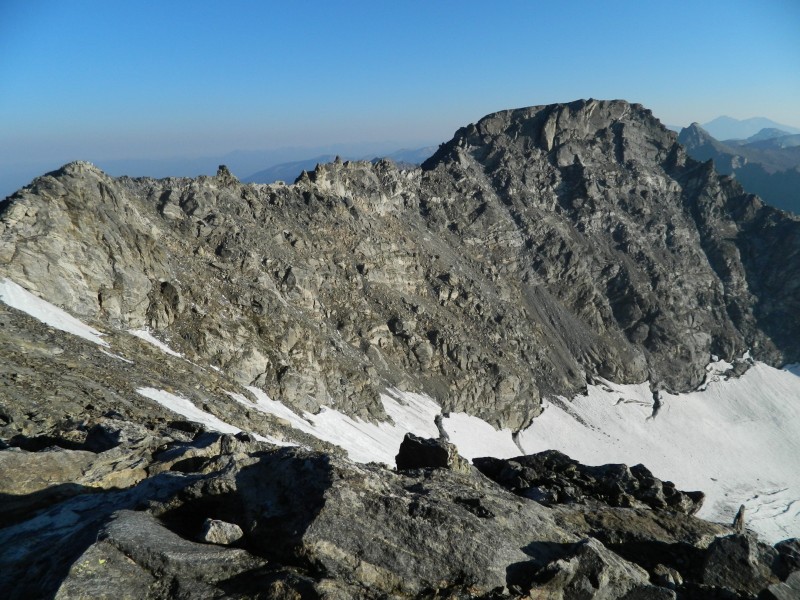
Group summit shot on North Arapaho Standing on the man-made summit. Looking North toward the rest of the Indian Peaks and the Longs Peak massif in the distance Looking back at South Arapaho from North Arapaho.
The return trip across the traverse was basically the same. However, at the crux block, I decided to try something fun and turn it into a "leap of faith" rather than a downclimb. Fun, but completely unnecessary.
Kids, don't try this at home
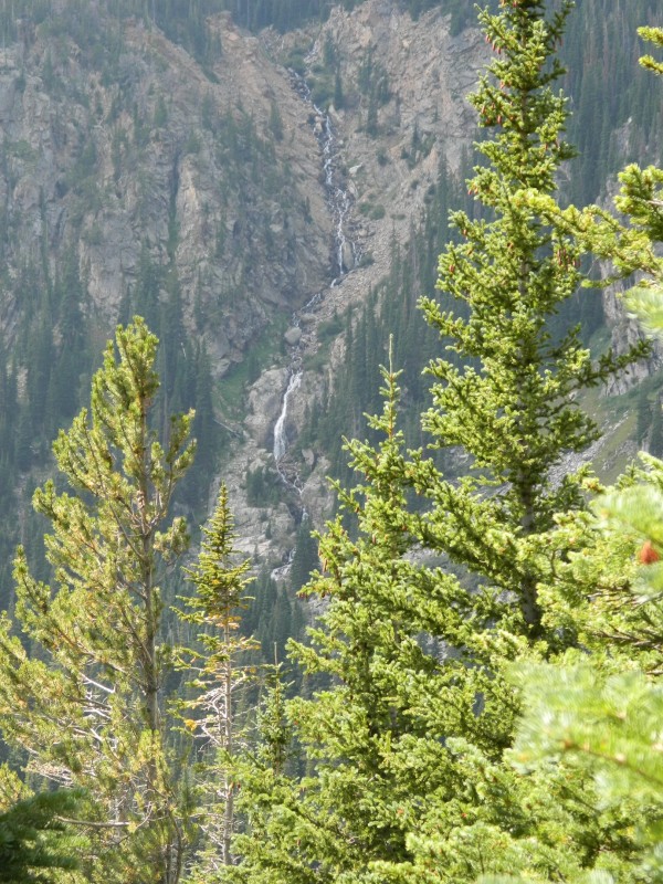
After resummitting South Arapaho, we quickly made our way down the trail to camp. We packed up our things, mine in a 40L pack, and Andrew's in an 85L pack (he must have thought he was on a five-day trek and not an overnighter) and hiked the remaining 2 miles back to the trailhead. I enjoyed the views of the waterfall across the valley which went unseen in the dark the day before.
Waterfall across the valley on our way back to the trailhead.
On our hike out we reflected on how glad we were to have made the short pack trip in the day before. It not only allowed us to get a head start on the traverse, but we were also able to take in the Perseid meteor shower from an excellent locale.
The adventure came to an end back in Nederland where we enjoyed pizza and beer at Backcountry Pizza.
Thumbnails for uploaded photos (click to open slideshow):
Summit Lounger and I did this route last Friday. Twas my last mountain tour before leaving the state for S Dakota...and it was a fun and worthy short day tour.
I know & understand the withdrawals. Luckily I feed the addiction vicariously with reports like these. Thanks for giving me a fix.
i want to climb this route so badly, it looks amazing. thanks for the pictures and info! great job!!!
Caution: The information contained in this report may not be accurate and should not be the only resource used in preparation for your climb. Failure to have the necessary experience, physical conditioning, supplies or equipment can result in injury or death. 14ers.com and the author(s) of this report provide no warranties, either express or implied, that the information provided is accurate or reliable. By using the information provided, you agree to indemnify and hold harmless 14ers.com and the report author(s) with respect to any claims and demands against them, including any attorney fees and expenses. Please read the 14ers.com Safety and Disclaimer pages for more information.
Please respect private property: 14ers.com supports the rights of private landowners to determine how and by whom their land will be used. In Colorado, it is your responsibility to determine if land is private and to obtain the appropriate permission before entering the property.