Download Agreement, Release, and Acknowledgement of Risk:
You (the person requesting this file download) fully understand mountain climbing ("Activity") involves risks and dangers of serious bodily injury, including permanent disability, paralysis, and death ("Risks") and you fully accept and assume all such risks and all responsibility for losses, costs, and damages you incur as a result of your participation in this Activity.
You acknowledge that information in the file you have chosen to download may not be accurate and may contain errors. You agree to assume all risks when using this information and agree to release and discharge 14ers.com, 14ers Inc. and the author(s) of such information (collectively, the "Released Parties").
You hereby discharge the Released Parties from all damages, actions, claims and liabilities of any nature, specifically including, but not limited to, damages, actions, claims and liabilities arising from or related to the negligence of the Released Parties. You further agree to indemnify, hold harmless and defend 14ers.com, 14ers Inc. and each of the other Released Parties from and against any loss, damage, liability and expense, including costs and attorney fees, incurred by 14ers.com, 14ers Inc. or any of the other Released Parties as a result of you using information provided on the 14ers.com or 14ers Inc. websites.
You have read this agreement, fully understand its terms and intend it to be a complete and unconditional release of all liability to the greatest extent allowed by law and agree that if any portion of this agreement is held to be invalid the balance, notwithstanding, shall continue in full force and effect.
By clicking "OK" you agree to these terms. If you DO NOT agree, click "Cancel"...
Longs Peak has probably been at the top of my 14er wishlist since i started hiking these mountains last year. I frequently see longs when i drive to boulder. It just looks so huge, much bigger than anything around it. I had always thought longs would be too hard for me...i remember looking at the pictures of the narrows and the ledges when i first joined 14ers last year, and just thinking there would be no way i could get up there. It looked really, really scary. Still, i really hoped that one day i would be able to do it.
The weather forecast for wednesday looked stellar...0% chance of storms and calm winds. Almost seemed too good to be true for early august. I have now done a few class 3 routes and felt that i was up for the challenge on longs. Chase, Annie, Will and I decided to go up and give it a shot. We left Golden at 2:15am, and instantly hit construction on 93. We detoured, picked up will in boulder, and made it to the ranger station around 4. no parking spots, so we ended going about 1/4 mile down the road. After some waffling, we hiked up the road and hit the trail at 430.
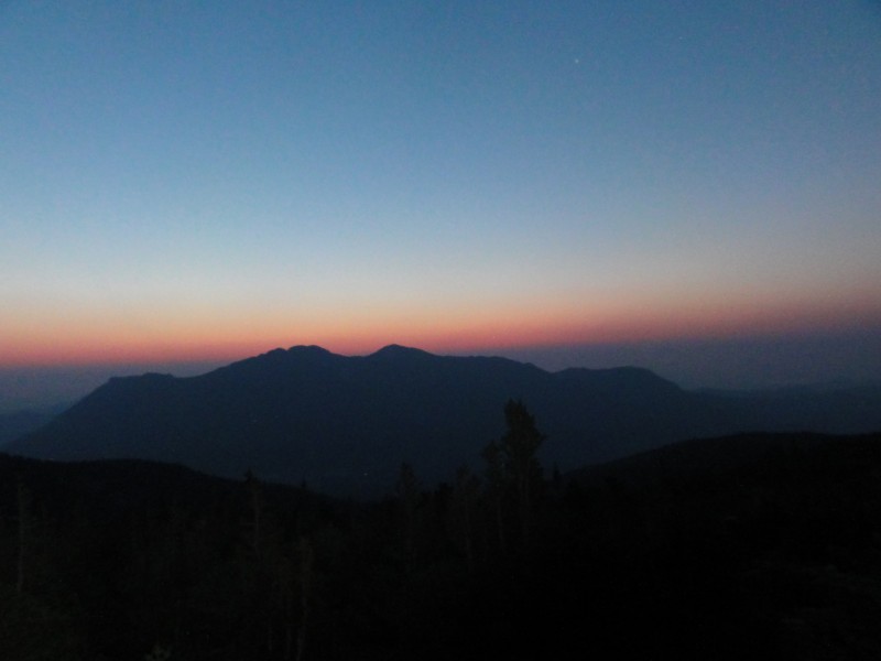
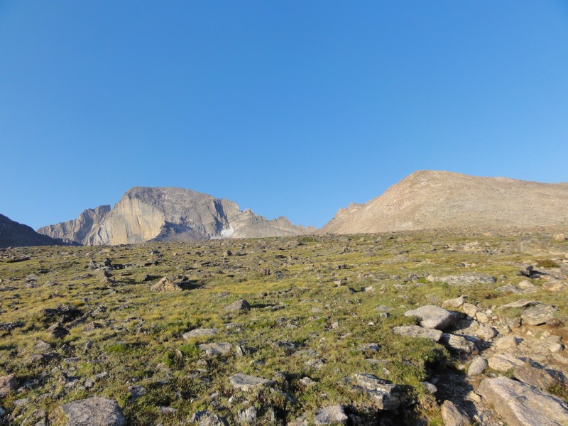
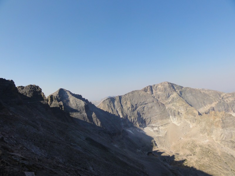
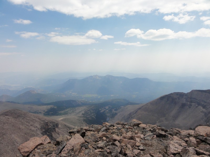
The trail through the forest is so mellow and gentle you almost find yourself wishing it would be steeper. no such luck though, as its an easy walk through the woods to treeline. We made it to treeline right as the sun started coming up...not sure what the mountains are to the east of longs, but they made for an awesome sunrise.
sunrise
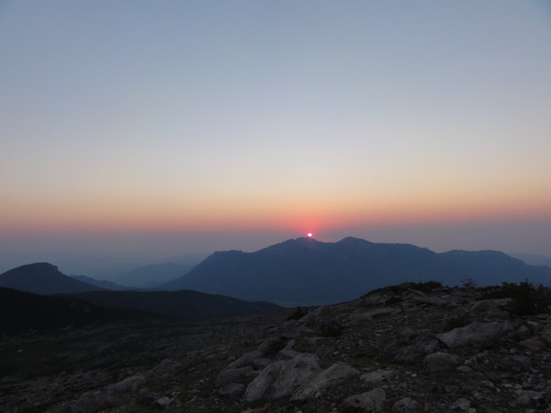
Turning back to longs, the alpenglow on the diamond was amazing. I have never seen a face like the diamond in my life...pictures really dont do justice to how huge it is. The fact that people actually climb this thing blows my mind.
the diamond
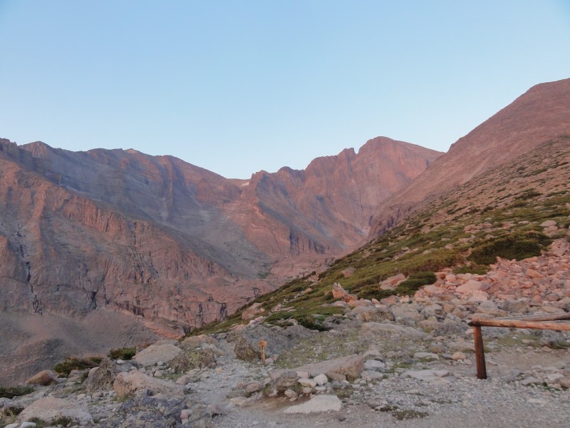
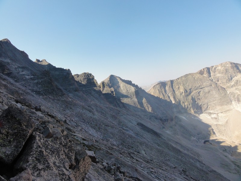
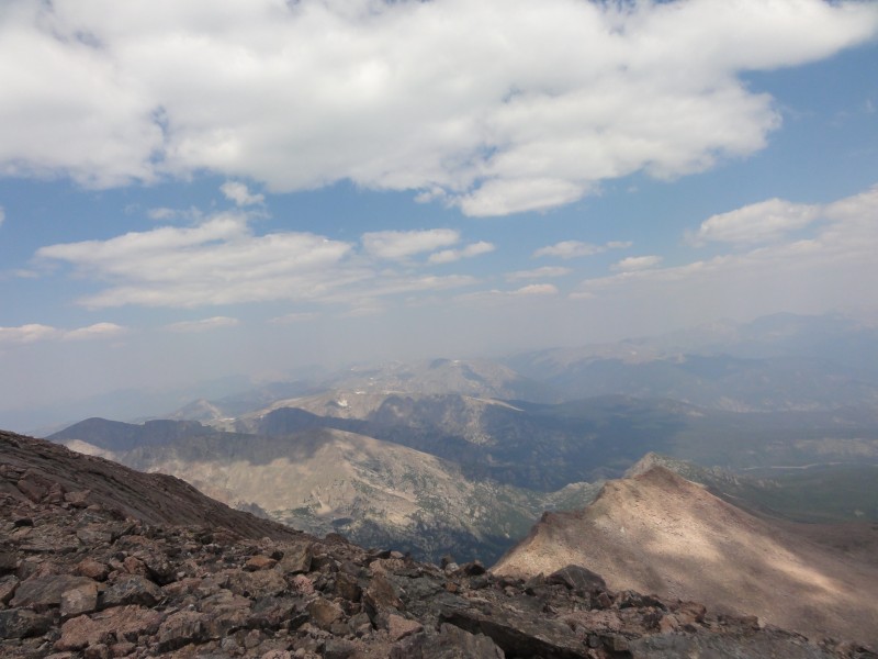
Continuing onward, we hit granite pass and looked at the sign that said it was 3.3 miles to the summit of longs. I really wished i hadnt seen that sign. Hiking to the boulderfield was easy going on a great trail. Pretty soon we could see the keyhole and i started getting excited. I was ready for something different after 6 miles of walking.
The keyhole looks so cool from a distance, and it just gets better as you get closer.
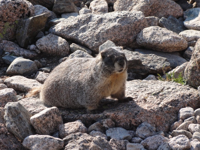
We came to the campsites, where we took a quick breather and a couple of us elected to use the solar toilet. We noticed a lady set her pack down, and almost immediately a marmot poked his head out of the rocks. It was comical to watch him creep up to the pack, looking around to see if anyone was paying attention. We called out to the lady and she managed to save her pack. the marmot slunk off to the boulders to wait for his next mark. i wouldve gotten away with it too if not for you meddling kids!
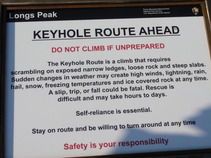
There is a sign at the keyhole that proclaims the danger of longs, but apparently a lot of people dont take it seriously. Throughout the day, i was blown away by how unprepared people were. Jeans, tennis shoes, wifebeaters, no packs, tiny water bottles etc etc etc. We saw one group below granite pass that had 1 small backpack between 5 people. They were headed up at 430 in the afternoon. self reliance is essential
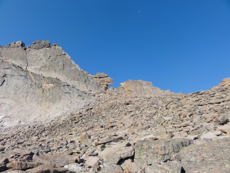
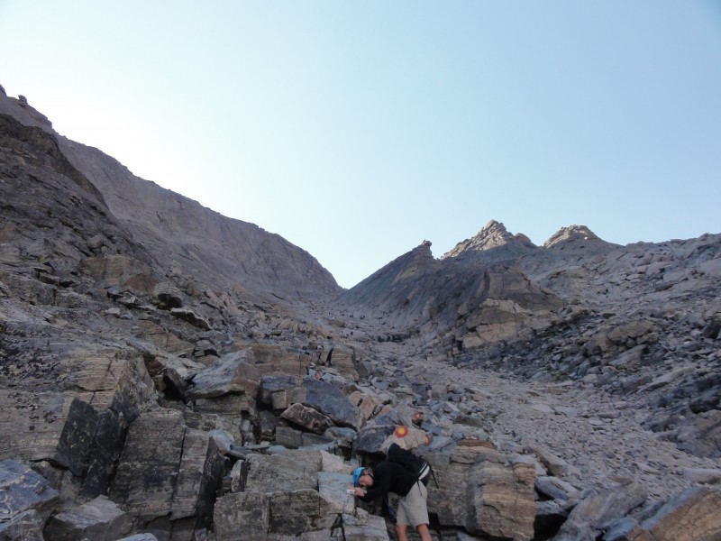
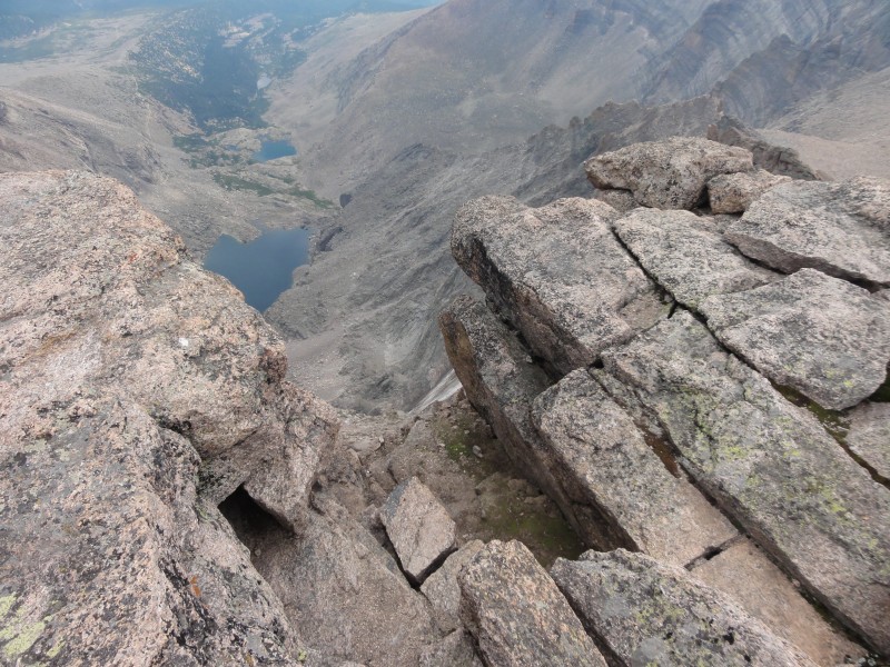
I found the hike through the boulderfield to be kind of fun...after reading countless trip reports of people complaining about the endless slog through the boulders, i was expecting it to suck. But there were plenty of cairns and big stable rocks to walk on. Coming up to the keyhole, we stopped to check out the little stone hut.
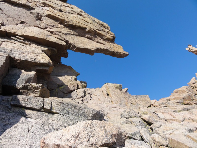
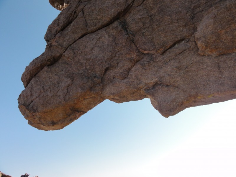
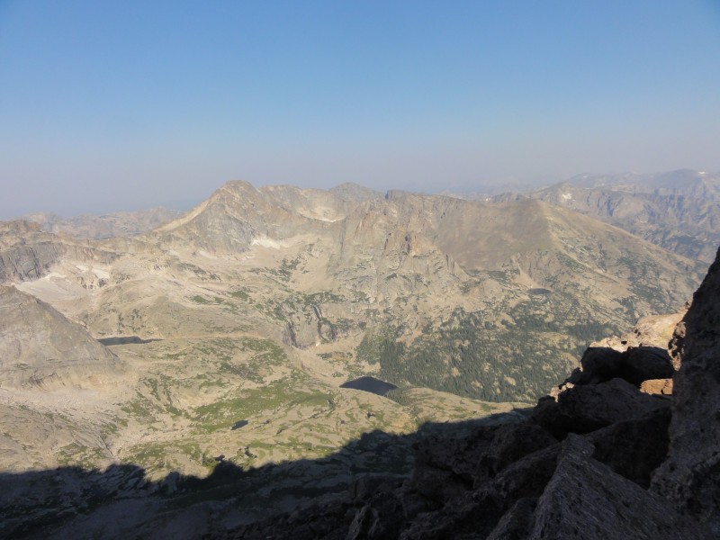
Coming through the keyhole was one of the more impressive sights ive seen in the mountains. It was just breathtaking. The keyhole is really well named...it really does feel like you are passing through a little keyhole. The huge over hanging piece of rock that forms the keyhole is spectacular. keyhole! glacier gorge
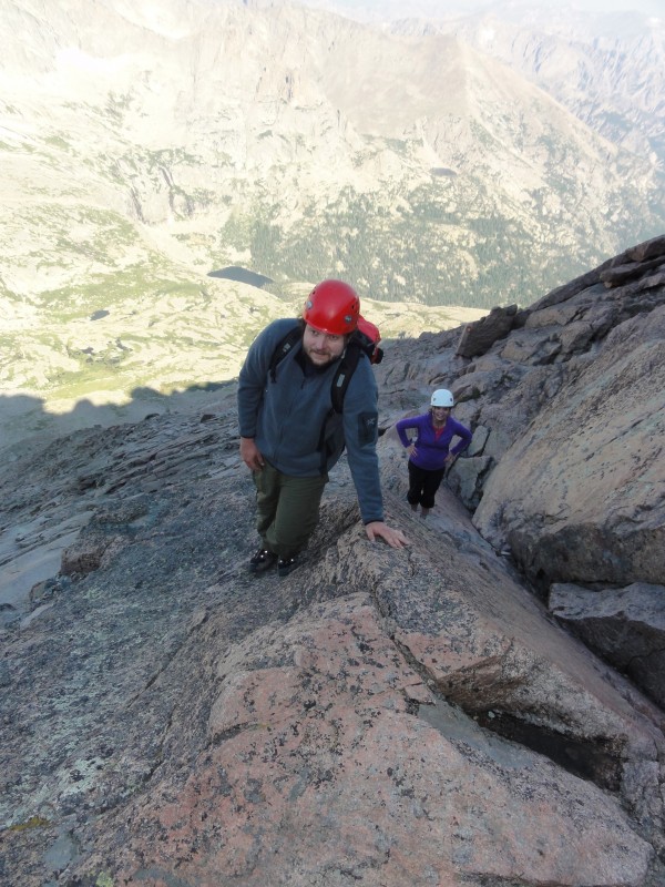
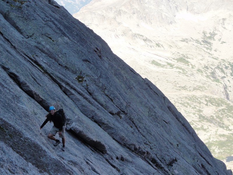
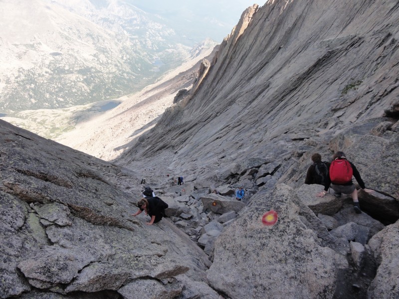
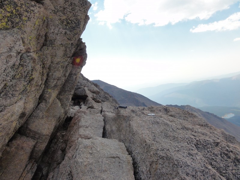
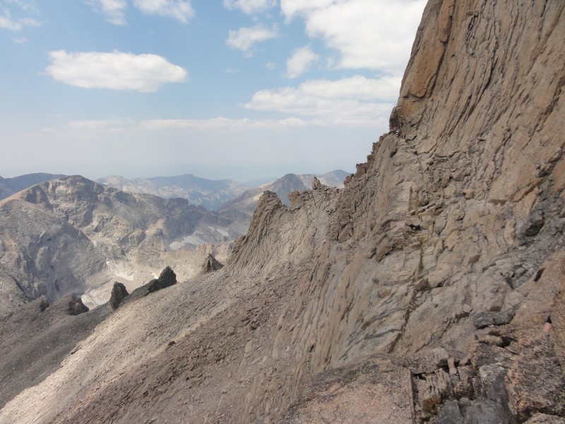
So now the real route begins, over the ledges. As we started out, i realized that the ledges were nowhere near as difficult or exposed as pictures had led me to believe. It gets a little narrow in spots, but for the most part its plenty wide. The rock with the metal bars is very easy to get around...i didnt feel like i needed to use the bars. The route finding is extremely easy thanks to the bullseyes. The only real hazard i noticed was the polished rock in some places. I found it slippery in my trail runners, but most of it was avoidable. Pretty soon we were staring up the trough! most exposed section of ledges
The trough is big, and looks pretty difficult, but once you get going, its very easy. There are bullseyes every 20 feet or so. We all took different paths, with chase and will (rockclimbers) opting to play around on the slab the right side of the trough. I just tried to stay where it was most solid, which was generally 'off route' but id say there is no right or wrong way up the trough. just whatever feels best and gets you to the top. trough me and annie in the trough chase picking a much harder line
The most challenging part of the whole route is at the top of the trough. The chockstone is a big, imposing rock blocking an easy exit. We went around it to the right on a slab, but there is an equally easy way to the left. If you were shorter, i could see it being more difficult, but we all made it up and over no problem. chockstone
Next came the dreaded narrows. I fully expected to be scared shitless right here. But, much like the ledges, they really arent that narrow. There are a couple of narrow spots and there is expsoure, but the moves required are little more than walking. I couldnt believe how calm i felt. We walked across, climbed the little wall at the end and we were at the base of the home stretch. narrows most exposed section of narrows
The home stretch looks impossibly steep and difficult in pictures, but in reality its not bad. There are some very polished sections of rock, which are slippery, but they are avoidable. We worked our way up, generally staying on the left crack. Chase, wearing approach shoes, just walked right up, barely using his hands. I had more trouble in my well worn trail runners, but it was not difficult. When I reached the final 20 feet of the homestretch, i realized that i was about to summit longs peak. I pushed up and over onto the huge summit of longs and felt elated. My goal had been realized.
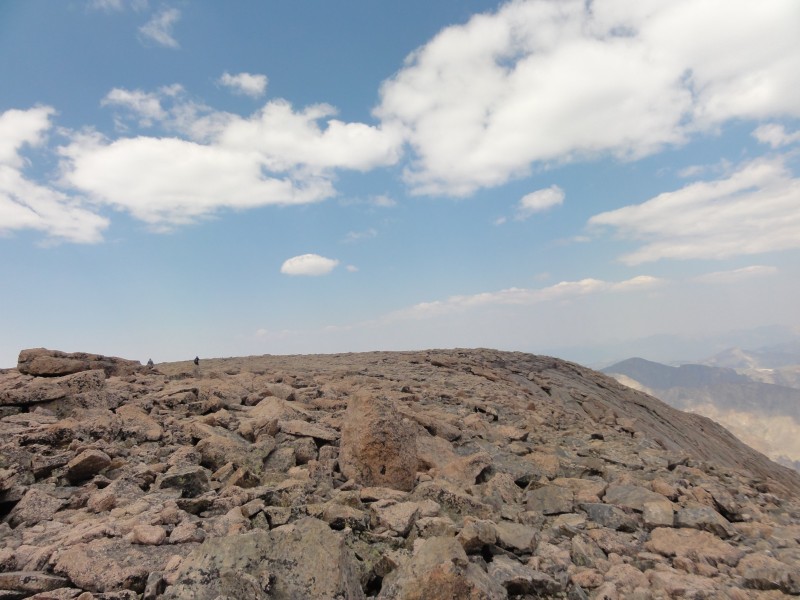
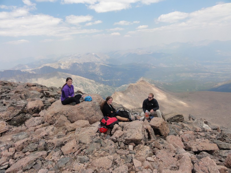
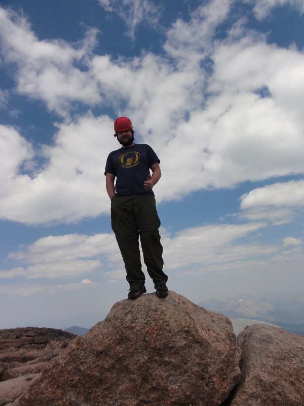
you really could play football up here crew relaxing me and keith richards on the summit block peering down the diamond (i think)
We summitted in about 6.5 hours from the car, with a 20 minute break in the boulder field. We took our time, since the weather was perfect. We sat on the summit for about 40 minutes, had some food, took some photos, and just relaxed. Walking from one end of the summit to the other takes a surprising amount of time. During the summit block photos, i had my camera and chases in my hands and managed to fumble both of them. Luckily the only damage was to mine, and it was minor.
Coming down was uneventful, just long. The homestretch is easy going, just watch for the polished granite. the hardest move going down is the same as going up: the chockstone at the top of the trough. I went around to the right and was basically able to walk around it, with a biggish step down. Once we came through the keyhole the difficulties were over. We started the slog through the boulderfield (which seemed much longer on the way down), down to granite pass, down to the forest and finally to the ranger station. one last walk down the road to the car and we had made it. 12 hours car to car.
A few random observations/thoughts
- we were the only people wearing helmets. seemed like we didnt really need them, but i prefer to keep my brain intact
-there was a bag of poop on the ledges. several more on the length of trail. Also lots of horse doodoo on the trail in the woods.
-had it rained for 10 minutes, a lot of people would have been in major trouble.
-narrows/ledges are generally wide enough that there can be 2 lanes of traffic
-the last half mile to the ranger station seemed to take a lifetime
Thumbnails for uploaded photos (click to open slideshow):
Nice pictures. You actually have some good beta for people wondering what certain pictures or portions look like, and I think your observations are spot on too.
This reminds me of when I did Longs, and it holds a special place in my heart. Great stuff! Thanks for posting. Why does the trip back down seem to take so much longer?
Your report almost echos mine (climed in 2009) The only difference is there was no keyhole sign when I did it and we didn't wear helmets.....but it if were to do it again, I def would wear one... esp through the trough. I too thought the chokestone was the most difficult part of the whole hike. Exposure on longs isn't nearly as bad as people talk it up to be. Great finish!
Such a good feeling to finally climb a peak that you've been wanting to for a long time. Great job. Also nice to see that at least a few people are prepared. Thanks.
Congratulations on a job well done! 8/9/2012 8:57pm
Great report on a beloved mountain! Super photos too! Your one at sunrise has the Twin Sisters silhouetted FYI. Nice alpine glow on the Diamond at Chasm Jct too! :D
This is insane, you and me have basically had the same experiences haha. I joined and started 14ers last year as well, and I'm planning to do Longs for my 21st this weekend! Congrats on the summit and great weather! Here's to hoping for good weather this weekend!
A group of us plan to do Long's 3 weeks from tomorrow, Labor Day Weekend so your report and photos were very interesting and helpful. We are concerned about the crowds but plan to start by 2:30am. We had debated on helments but we do plan to take and wear them as well. Thanks again and congrats!
I've discovered over the years that you should plan on reaching the Ranger Station by 3am. Although on rare occasion a slower day offers a spot later, whenever I've gotten there by or before 3am I've always found a spot - sometimes right in front of the station itself. Good luck! :D
And thanks for the info! As someone who hasn't summited Longs (but feels ready to) the picutres of ledges and narrows look intimidating, but knowing they can accomodate 2 lane traffic makes me feel better about attempting. Thanks for clearing that up and also other misconceptions about the route.
The morning view has Baldpate Mtn(L) Twin Sisters Peak(mid) and Twin Sisters Mtn(R). Always a beautiful view. Nice report! I hadn't seen the Keyhole sign. I guess I need to get up there this year.
Caution: The information contained in this report may not be accurate and should not be the only resource used in preparation for your climb. Failure to have the necessary experience, physical conditioning, supplies or equipment can result in injury or death. 14ers.com and the author(s) of this report provide no warranties, either express or implied, that the information provided is accurate or reliable. By using the information provided, you agree to indemnify and hold harmless 14ers.com and the report author(s) with respect to any claims and demands against them, including any attorney fees and expenses. Please read the 14ers.com Safety and Disclaimer pages for more information.
Please respect private property: 14ers.com supports the rights of private landowners to determine how and by whom their land will be used. In Colorado, it is your responsibility to determine if land is private and to obtain the appropriate permission before entering the property.


")
 sunrise")
 the diamond")
")
")
")
 self reliance is essential")
 i wouldve gotten away with it too if not for you meddling kids!")
")
")
")
 keyhole!")
")
 glacier gorge")
")
 most exposed section of ledges")
")
 me and annie in the trough")
 trough")
 chockstone")
 narrows")
 most exposed section of narrows")
")
 chase picking a much harder line")
 you really could play football up here")
 crew relaxing")
 me and keith richards on the summit block")
")
 peering down the diamond (i think)")
")