Download Agreement, Release, and Acknowledgement of Risk:
You (the person requesting this file download) fully understand mountain climbing ("Activity") involves risks and dangers of serious bodily injury, including permanent disability, paralysis, and death ("Risks") and you fully accept and assume all such risks and all responsibility for losses, costs, and damages you incur as a result of your participation in this Activity.
You acknowledge that information in the file you have chosen to download may not be accurate and may contain errors. You agree to assume all risks when using this information and agree to release and discharge 14ers.com, 14ers Inc. and the author(s) of such information (collectively, the "Released Parties").
You hereby discharge the Released Parties from all damages, actions, claims and liabilities of any nature, specifically including, but not limited to, damages, actions, claims and liabilities arising from or related to the negligence of the Released Parties. You further agree to indemnify, hold harmless and defend 14ers.com, 14ers Inc. and each of the other Released Parties from and against any loss, damage, liability and expense, including costs and attorney fees, incurred by 14ers.com, 14ers Inc. or any of the other Released Parties as a result of you using information provided on the 14ers.com or 14ers Inc. websites.
You have read this agreement, fully understand its terms and intend it to be a complete and unconditional release of all liability to the greatest extent allowed by law and agree that if any portion of this agreement is held to be invalid the balance, notwithstanding, shall continue in full force and effect.
By clicking "OK" you agree to these terms. If you DO NOT agree, click "Cancel"...
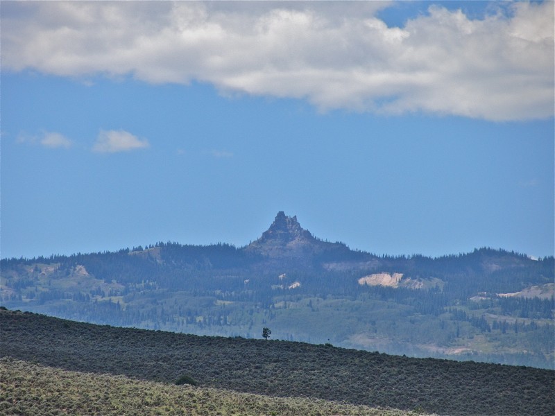
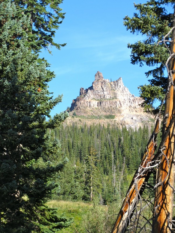
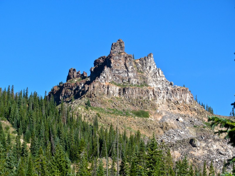
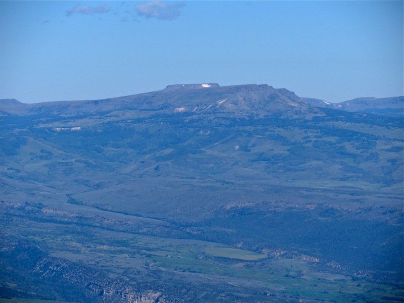
Castle Peak, seen just off CO 131 Castle Peak, 11,300' (CO Rank #1644)
3040' prominence (CO Rank #20)
6.5 miles, ~2200' gain
After four straight weekends of packing in--all solid trips featuring interesting peaks--I was ready for a day hike, maybe some car camping for a change. Routines make us boring, predictable, and who wants that? Lucky for me, Chris (ChrisinAZ) was looking to escape his first week of med school drudgery and he tossed me some ideas for peaks less traveled. We'd both had our eyes on mysterious Castle Peak for a long time, so we decided to hit it up. The first step always involves gathering beta, but this one proved a challenge. Go ahead, google "Castle Peak." Add whatever search terms and exclusions you like. There's a 9er in California. There's an impressive 11er in Idaho. Even Colorado has a 14er named Castle Peak. Good luck finding any beta on hiking this peak beyond a single thread on the LoJ forums. (Chris has now fixed this; his SP page is linked below) I'd like to send a big shout out to John K, who graciously provided us beta on which roads to access the peak (some are gated). Thanks very much!
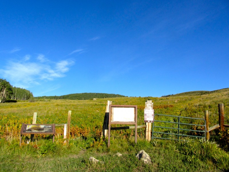
Chris has also posted a detailed report on LoJ, which tells the story well. For the record, I'll repost his description on how to access the TH: Exit I-70 at CO-131 N. Go about 3.6 miles north to a left turn onto Horse Mountain Rd (shown as Milk Creek Rd on many maps), which has a mileage sign at the turnoff. Follow this well-graded road to a right turn to continue on Horse Mountain Rd (39 44.560 N, 106 42.378 W). The road from here on necessitates high clearance, if not 4WD, and there are few places to pull off or turn around. Follow the main track of the road as it dips down into a drainage and re-emerges. The next turn of note is at 39 45.606 N, 106 46.072 W, where the road splits at a Y junction at a sign--go right. Continue to a left turn at 39 46.480 N, 106 46.612, and follow this road ~3/4 mile to its end at a small parking lot and information stand with room for a few cars to park. TH and boundary of Castle Peak Wilderness Study Area
Anyway, we headed out from Denver, stopping in Dillon for some Chimayo (nothing New Mexican about it) burritos, my JJ's #1 for the summit, and a sixer of Happy Camper. The turnoff from CO 131 came quickly enough, and as darkness fell, we were within a few miles of the TH. While the road isn't too rough, there are some DEEP potholes lurking under overgrown grass, and I bottomed the FJ at least once. Drive with caution, and it's no problem, but I would not want to be on this one when wet. It's no Lead King Basin road, but it's rutted and would be slicker than snot.
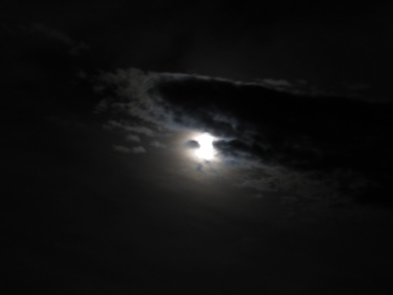
We arrived, set up my tent, admired the moonlit views of the Vail Valley with I-70 below, and then Chris dove inside to study for a while. Having no interest in protein transport mechanisms (I don't have to know that anymore), I pulled out my chair, cracked an IPA, put on some Railroad Earth, and got mellow. Then, the moon and the clouds started dancing, so I started playing around with the camera.
I don't have special photo editing software or a tripod, but this one looks cool to me.
After about 45 minutes of childlike fun, my reverie was interrupted by headlights coming up the road. WTF? This is an isolated peak with no beta, right? Well, ignorance has never stopped brovilles before, and they were headed right for us. A shiny Ford Escape lurched and jerked to a stop about 15 feet from me. Three very (very!) drunk guys spilled out, one nearly landing on his face. I turned off my headlamp, stood in the shadows and listened. This had to be good. This was a new species of broville--very preppy, wearing Abercrombie and J Crew-looking clothes, big shiny watches, and using words that might show up on the SAT verbal section instead of in a smoke shack at Breck. What makes them brovilles? I listened... They'd abandoned two of their friends about a mile back because the car was bottoming out, but left them with some beer, so they'd be ok. "Where are we, anyway?" was asked, but not answered, at least twice. They kept stumbling around, eventually finding the wilderness info sign. "WE'RE GONNA CLIMB CASTLE PEAK! LET'S F**KING DO IT!!!!" They grabbed a flashlight, headed through the gate, then quickly returned. They'd forgotten their beers. After a quick cooler trip, they were off, and disappeared over the hill within 10 minutes. They were so drunk that they never noticed me after I turned on my headlamp and walked straight toward them (within 10 feet or so), thinking I might warn them it's a few miles and a couple thousand feet up. Oh well! I went to sleep, and they were gone in the morning.
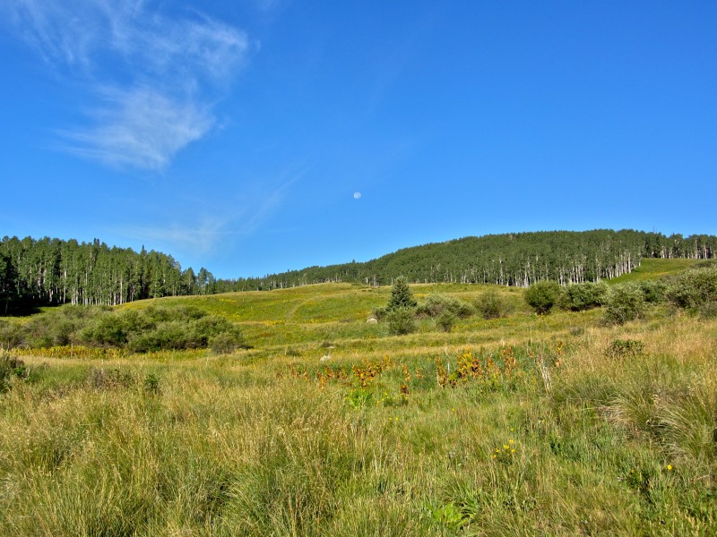
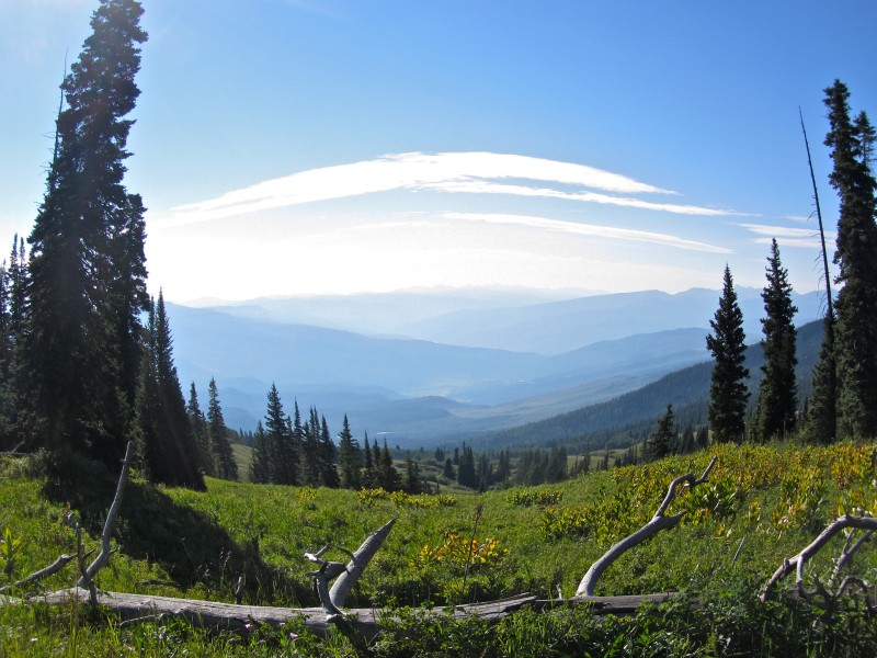
Knowing the forecast was stellar, we slept in, and got going on the trail around 8am. The hike starts out in open meadows, with sweeping views of the Vail Valley.
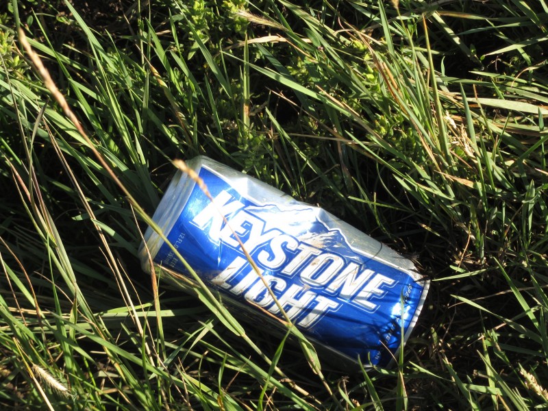
Pretty soon, we reached the limit of broville grazing range. This was the first of three signs of their presence, none further than 1/2 mile in (we packed them out on our return). Classy, brovilles
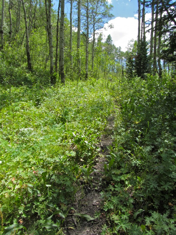
The trail winds through grassy, occasionally flowered meadows to a marshy area, where it disappears for a bit, but we found it again with little effort.
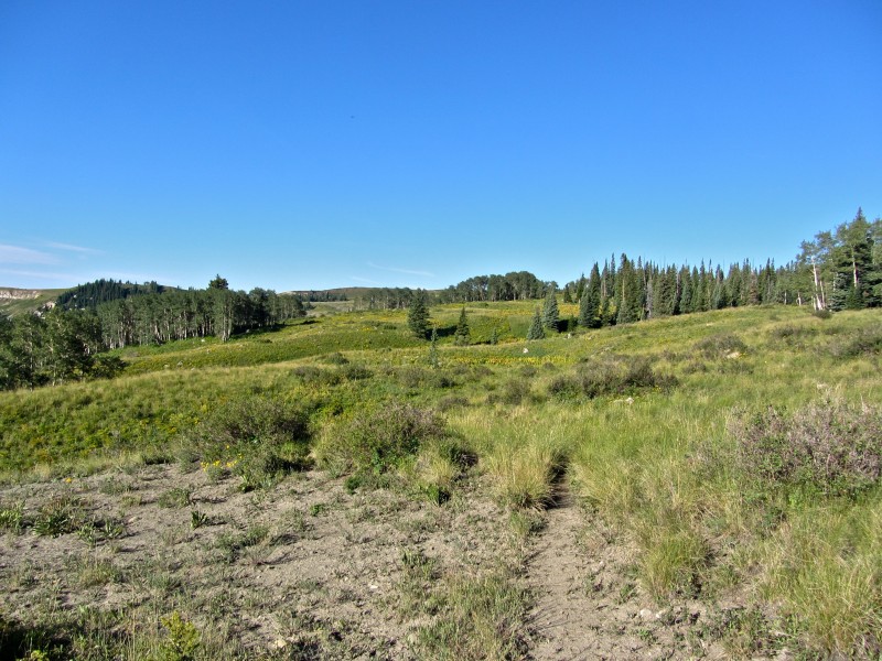
Eventually, we got our first look at the Castle, peeking out through some trees.
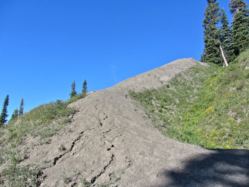
Soon after, the trail ends and the bushwhack begins--in earnest. However, we found this nifty ramp to start out on...
...got another peek at our objective...
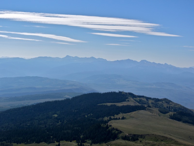
...I took a fish-eyed view of things distant...
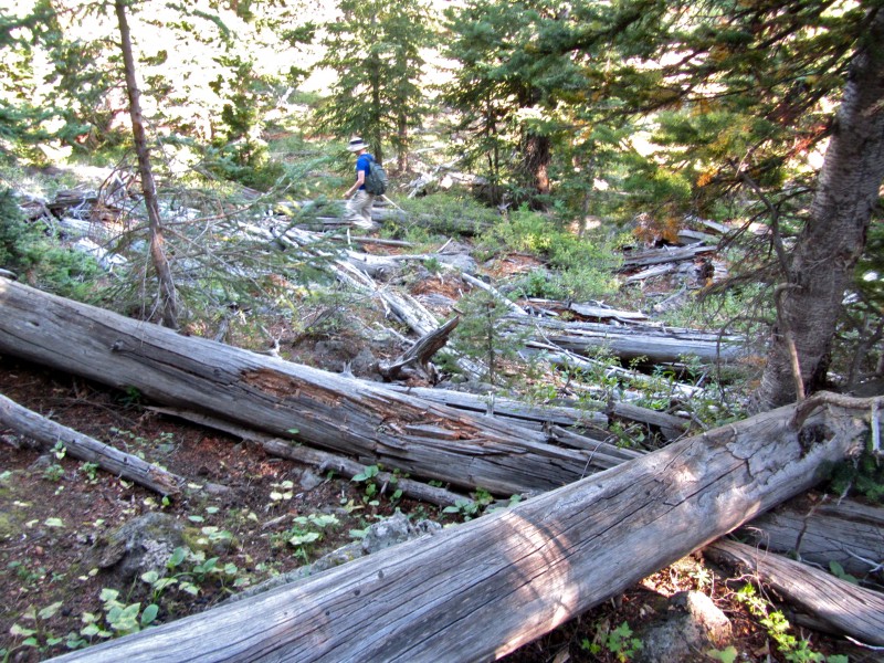
...then we really started having fun. Who loves deadfall?
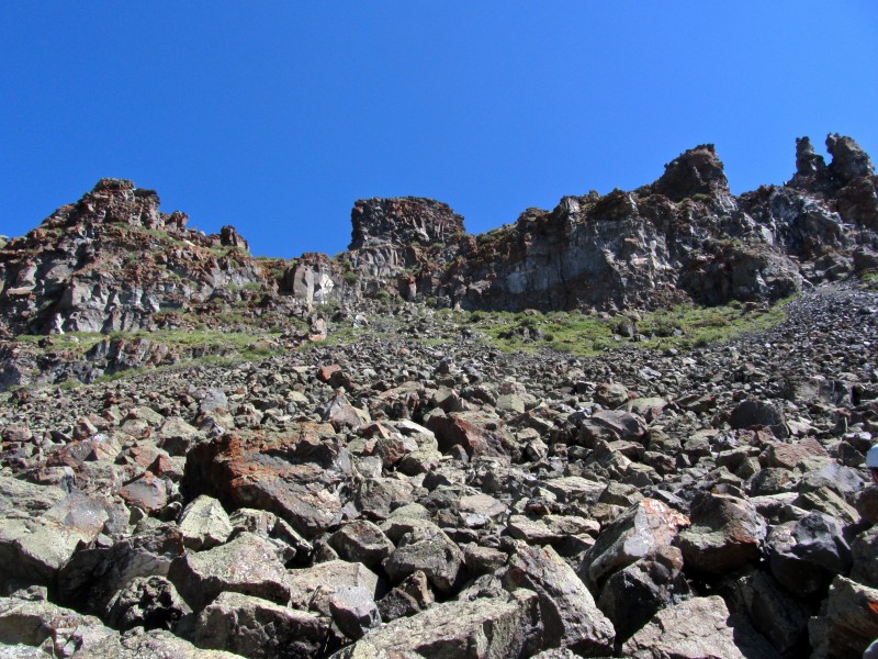
We descended one ridge, ascended another, and found ourselves at the base of some chunky, volcanic talus.
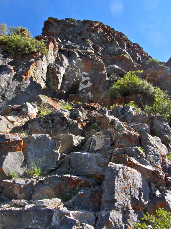
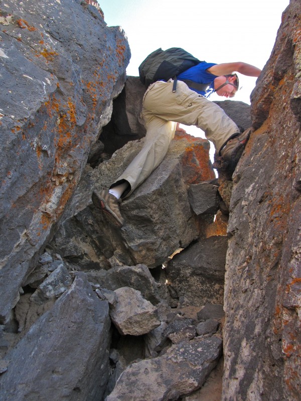
We stashed our poles and started climbing. The peak's rated class 4 on LoJ, so we went looking for the goods, and found some interesting moves on our way to the ridge.
However, on our descent, we found a much easier path, class 3 at best.
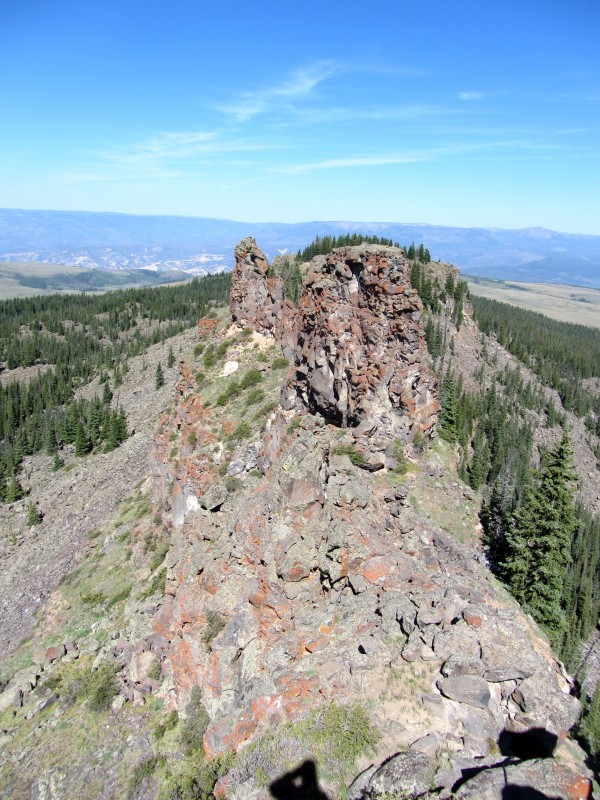
We topped the ridge between the summit tower and its slightly lower and more difficult twin.
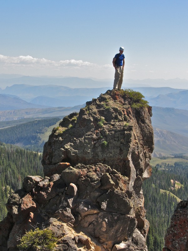
A right turn, some easy scrambling, and a few minutes later, and we were Kings in the Castle!
As I took in the views and munched on my sandwich, I felt a wave of relief cascade over me. Up to that point, I'd been torn by a decision to skip Yarmony Grass, the festival down the road at Rancho del Rio. However, as I looked out across almost limitless expanses of Colorado, it became apparent that I already had my freedom and open sky. It is good to be alive.
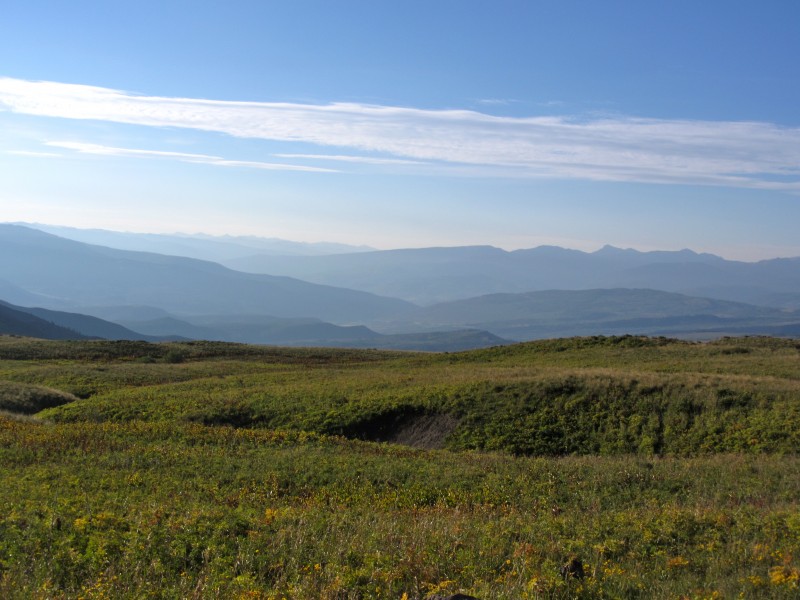
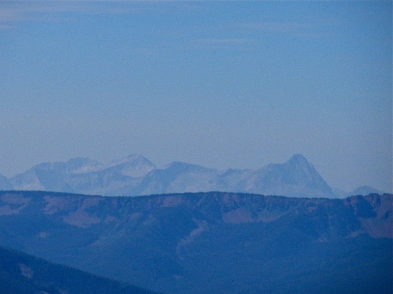
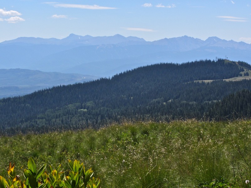
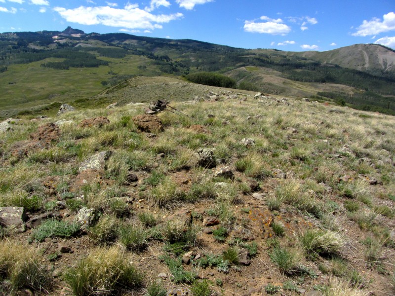
If the King of this Castle is the ruler of all that he sees, some fine mountains are under his protection. Flat Top Mountain and wilderness Capitol et al Looking at the Sawatch
Here's a look back at our short route on the summit ridge and the slightly lower tower we were grateful we didn't have to ascend.
On the way down, Chris detoured to an airy perch.
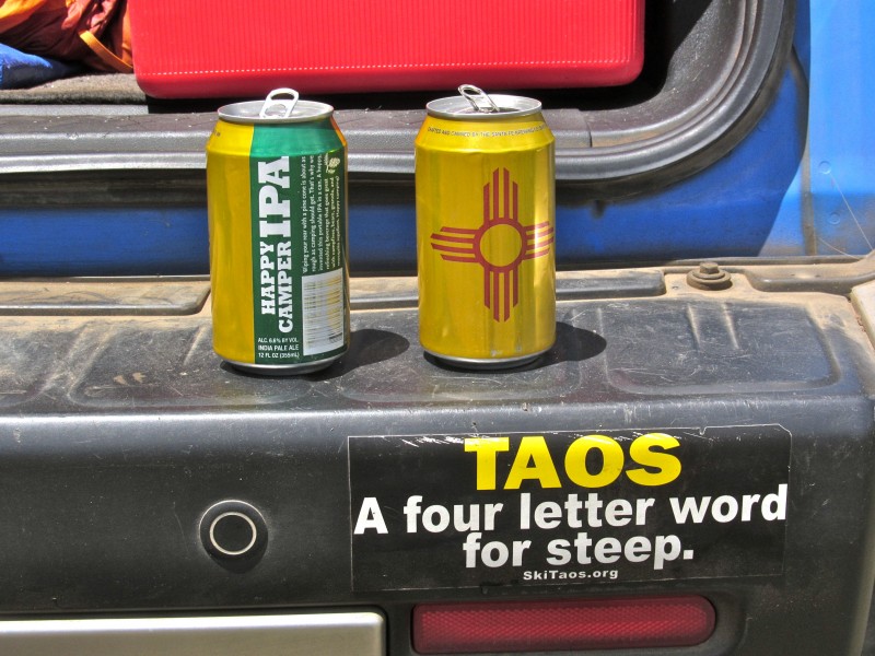
We climbed down, retrieved our poles, and enjoyed a mellow, scenic hike out to the truck, where we found some hoppy goodness.
Epilogue: Dumpster Diving on Horse Mountain
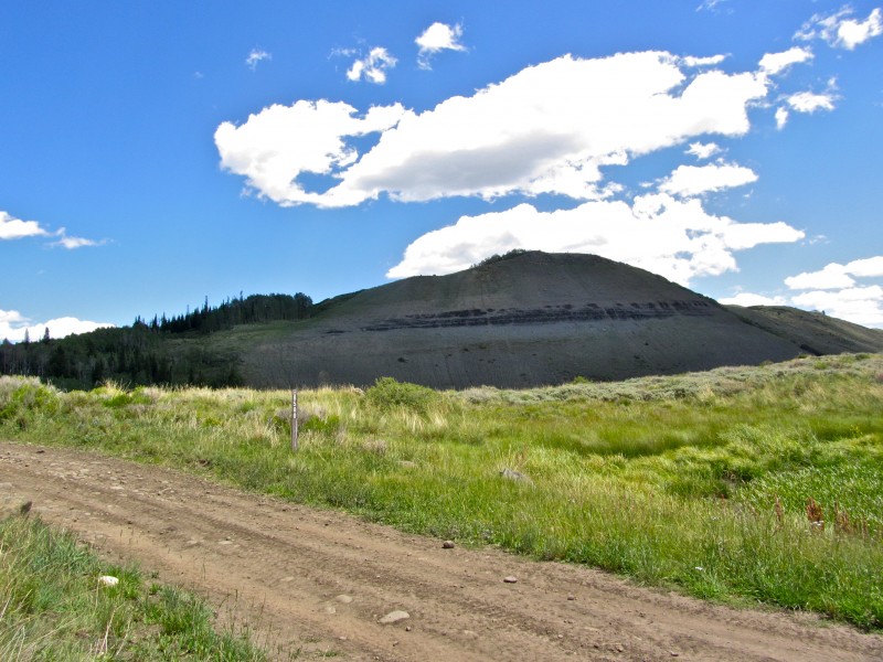
Horse Mountain, 9603'
1.2 miles, 350' gain
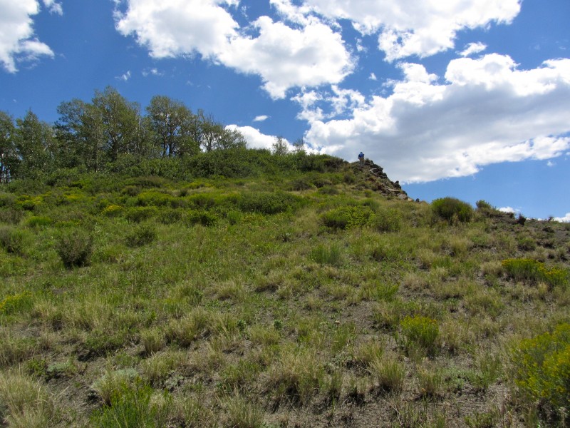
This one's pretty straightforward. We turned left at the first fork in the road as we left the Castle TH, taking it less than a mile to a pass and parking area. The route follows the ridge seen in the photo above.
Bushwhack, then find a trail Looking back down the summit ridge
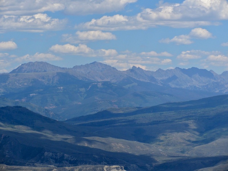
If you find no other reason to hike this peak, the following view should suffice: Eagles Nest, Powell, Ripsaw Ridge.
We stopped in at the Gore Range Brewery for some excellent pizza, tasty wings (thanks, Mel!), and a crisp summer saison. Recommended.
I'm holding this one for my Eagle County finisher, figured I should finish that list on a ”cool one”, looks like a cool peak worthy of a finisher. Was horse covered in elk crap like it was when I was up there? :lol:
suck, but apparently I learned them well enough for Monday! Thanks again for a great trip up "the other Castle Peak" and a great time.
Awesome TR, as I knew it would be, and your photos probably put mine to shame...I'll try to finish getting that SP page updated this week.
Chi transplant--I don't recall much in the way of elk crap up there, or anywhere on Castle for that matter. And Castle is definitely a worthy finisher for that list, you'll love it.
Brian,Scot,Bob-thanks. You all had pretty respectable adventures this weekend.
MtnHub-If you had to look up ”brovilles,” consider yourself lucky.
Mike-You've chosen well. Now I know why you haven't done it yet... Like Chris says, no Elk turds. There's a lot of broken glass on top of Castle, though.
Darrin-It's hard to take the blinders off when you drive so far. I was ”14er only” until moving to CO. You have done well.
Chris-thanks for a great idea and for pushing me to do something different.
That you had to be exposed to ”sh*tty” beer and the affects that it can have on some weak people who can't handle ”real” beer. :lol: :wink: What a beautiful area and unique looking peak Castle is. Great photos and thoroughly entertaining write-up, my friend. Thanks for posting (see you next week). 8) Hoppy trails! :D
Enjoyed reading this - I was completely baffled and flummoxed where this Castle Peak was. Nevermind Horse Mtn! Thanks for the intro! Great pics and narrative.
Congrats to both of you!
Borat, the 20th ranked prominence peak in Colorado and a visit to a local mountain town brewery that most local front range peeps have never heard of = KINGS OF THE CASTLE. Great TR and I can totally picture you sitting on the summit, waving your arms and quoting Borat. I love the embedded references in your TRs.
This is such a motivator to scramble up to the most prominent Castle Peak in Colorado but your bumper sticker reminded me of a bigger goal in the southern Sangres... TAOS Powder road trip!
Presto-I am trying to convince you to hike at low altitude...
Sunny1-Thank you!
Tom-Thanks for noticing the link. Taos is a solid weekend trip. Let's do it (and Jackson and Snowbird)
Furthermore-Maybe 101 peaks from now, you'll give it a shot? Maybe even sooner?
Dave-I think contributing to ”the literature” is one of the biggest reasons to post TRs. This peak was perfect for that.
9 years later and the peak still exists... well barely. Let me clarify - I was up there on 06/27/2021 & totally enjoyed the class 3 on the south side. The north side is night and day different on rock quality. I tested all my holds & safely summited. On the return I had a block (about the size of a 2 drawer filing cabinet) decide to go for a ride. Luckily both my hands & my other foot stayed put. I carefully felt my way down the mountain on the remaining flake. It was loose but it got me down. Once it pulls off the mountain I'm guessing the route will jump to class 4 or 5. Also - I did attempt the road slick (not recommended) on 06/26/2021. I ended up bailing down a bit and trying again the next day with success. All in all a very fun mountain outing. Thank you for the TR - it helped a bunch!
On a related note of 11ers with 14er names - give Pyramid Peak in the Flat Tops a go if you liked Castle. They have a similar feel (Pyramid is easier though).
Caution: The information contained in this report may not be accurate and should not be the only resource used in preparation for your climb. Failure to have the necessary experience, physical conditioning, supplies or equipment can result in injury or death. 14ers.com and the author(s) of this report provide no warranties, either express or implied, that the information provided is accurate or reliable. By using the information provided, you agree to indemnify and hold harmless 14ers.com and the report author(s) with respect to any claims and demands against them, including any attorney fees and expenses. Please read the 14ers.com Safety and Disclaimer pages for more information.
Please respect private property: 14ers.com supports the rights of private landowners to determine how and by whom their land will be used. In Colorado, it is your responsibility to determine if land is private and to obtain the appropriate permission before entering the property.


 Castle Peak, seen just off CO 131")
 TH and boundary of Castle Peak Wilderness Study Area")
")
")
")
 Classy, brovilles")
")
")
")
")
")
 Who loves deadfall?")
")
")
")
")
 Flat Top Mountain and wilderness")
 Capitol et al")
 Looking at the Sawatch")
")
")
")
")
")
")
 Bushwhack, then find a trail")
")
 Looking back down the summit ridge")
 Eagles Nest, Powell, Ripsaw Ridge.")