Download Agreement, Release, and Acknowledgement of Risk:
You (the person requesting this file download) fully understand mountain climbing ("Activity") involves risks and dangers of serious bodily injury, including permanent disability, paralysis, and death ("Risks") and you fully accept and assume all such risks and all responsibility for losses, costs, and damages you incur as a result of your participation in this Activity.
You acknowledge that information in the file you have chosen to download may not be accurate and may contain errors. You agree to assume all risks when using this information and agree to release and discharge 14ers.com, 14ers Inc. and the author(s) of such information (collectively, the "Released Parties").
You hereby discharge the Released Parties from all damages, actions, claims and liabilities of any nature, specifically including, but not limited to, damages, actions, claims and liabilities arising from or related to the negligence of the Released Parties. You further agree to indemnify, hold harmless and defend 14ers.com, 14ers Inc. and each of the other Released Parties from and against any loss, damage, liability and expense, including costs and attorney fees, incurred by 14ers.com, 14ers Inc. or any of the other Released Parties as a result of you using information provided on the 14ers.com or 14ers Inc. websites.
You have read this agreement, fully understand its terms and intend it to be a complete and unconditional release of all liability to the greatest extent allowed by law and agree that if any portion of this agreement is held to be invalid the balance, notwithstanding, shall continue in full force and effect.
By clicking "OK" you agree to these terms. If you DO NOT agree, click "Cancel"...
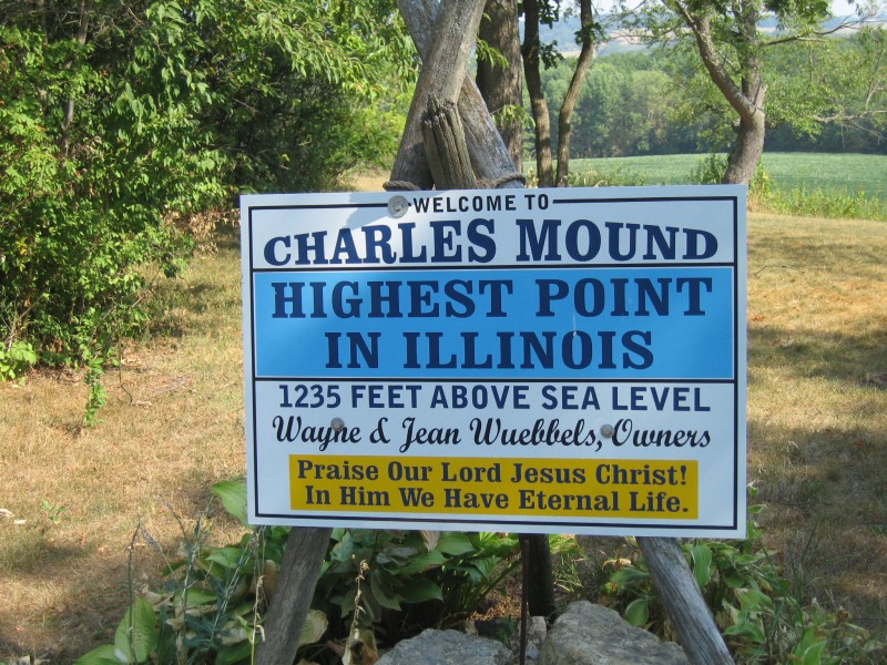
Peaks Climbed: Charles Mound via Cornfield Route Start Time: 9:35am End Time: 10:37pm Total Mileage: 2.6 miles Total Elevation Gain: 255ft
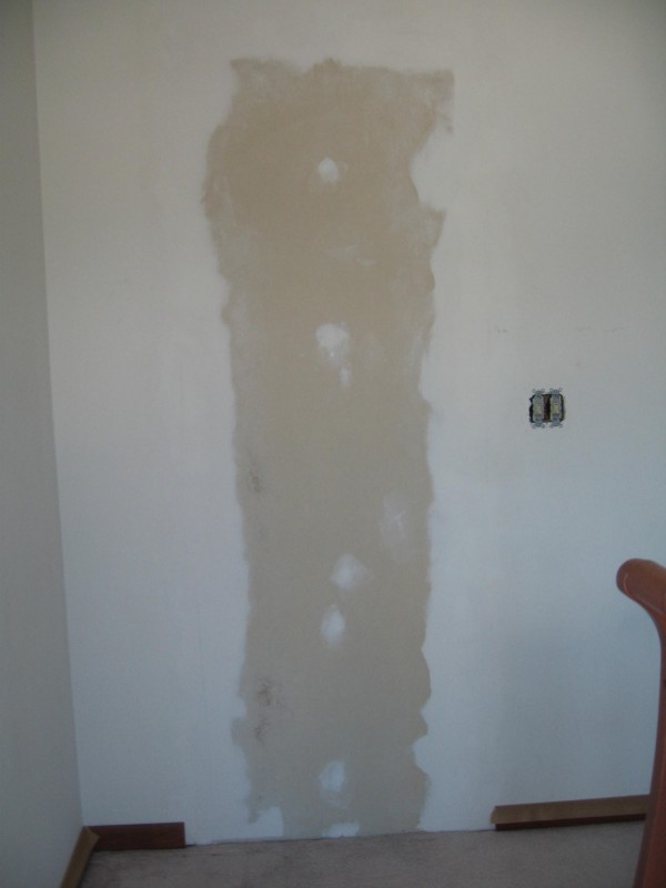
After volunteering countless hours at my parents house which included servicing 3 cars and painting a room of their house (without their permission), I figured the 14er community would give me their begrudged approval to go climbing after giving back. The Before...The After... Fischer Painting Inc. Available for hire.
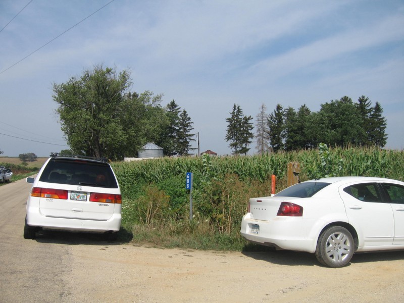
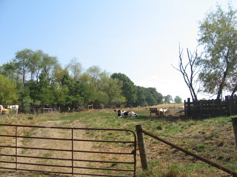
So after attending a wedding in the middle of a cornfield - and really, that could be ANYWHERE in Illinois - Kim and I headed for Charles Mound. The worst part is finding the damn place. Saying the entrance is "right across from a cornfield" leaves open a voluminous amount of incorrect choices. Thankfully, we weren't the only idiots climbing the Illinois highpoint today as the two cars park on the roadside with out-of-state licenses plates (Washington and Nevada) were a clue that we were in the right place. Park at THIS cornfield. It's like every other cornfield only... F it. They're all the same.Parking
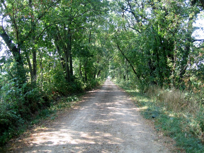
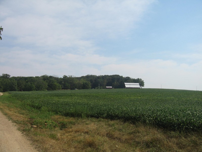
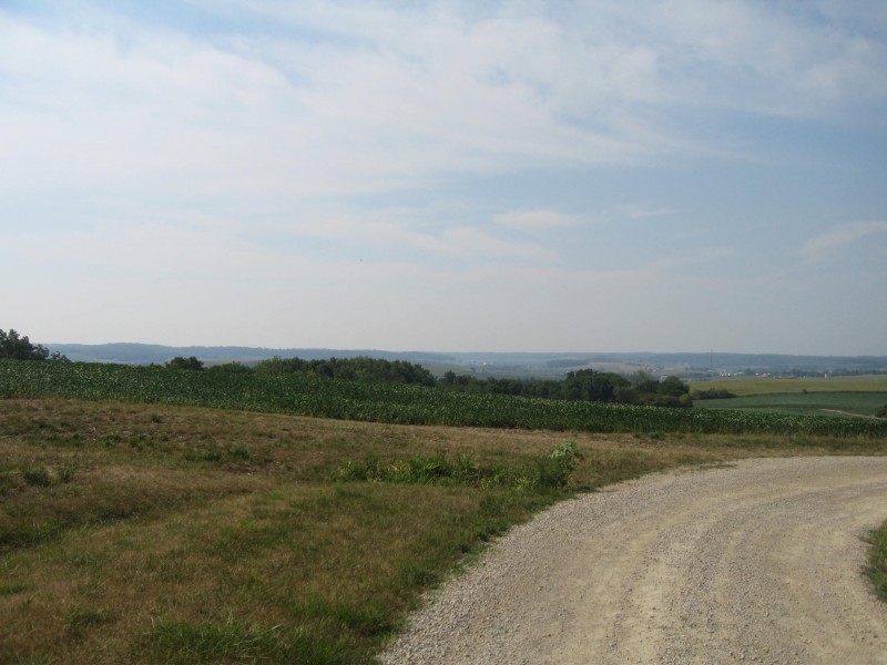
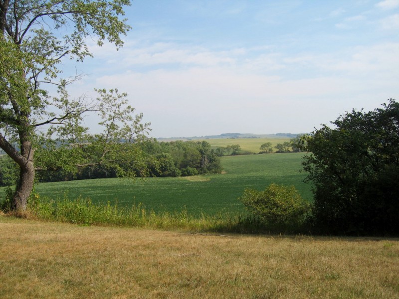
The approach: It's like the Lake Como Road only different; it's flat, straight, and gains minimal elevation. The gravel road is truly symbolic of Illinois - it goes straight as far as the eye can see and there's corn. The state of Illinois should promote me to the head of their Department of Tourism. If you look hard, you might be able to see Little Bear.Wildlife!!!
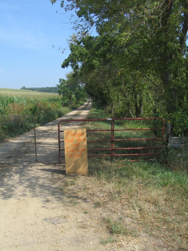
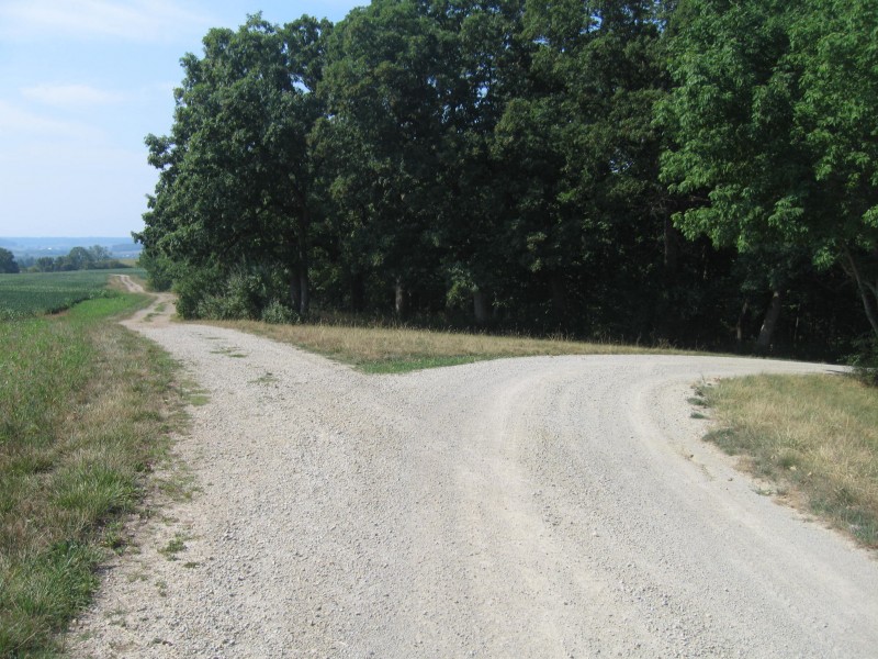
Here comes the tricky part: the gravel road winds around a soybean field en route to the barn on the far side of the field. There's also a fork in the gravel road without a cairn, so it becomes quite complicated. A GPS device would be very useful to ensure you're on the correct route. I don't want to be responsible for anyone getting lost on the Bermuda triangle of IL climbs. The tricky part: The Soybean TraverseThe road fork. Beware: No CairnsNorthwest Illinois Scenery
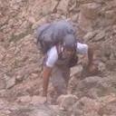
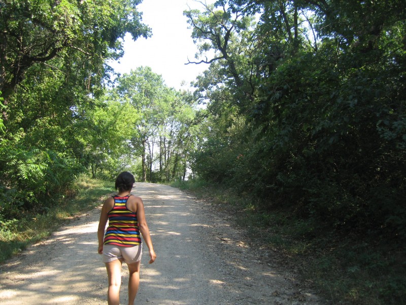
Near the barn, you pass a pond and have the final summit push. Make sure you have a good weather window since the exposure is extreme and the only "ditch" option is to retrace your 25 steps to relative safety. It's like the Knife Edge and Capitol only different. I put in my climbing pacifier and Kim took the lead on this part. High Apline Lake. Swimming NOT advised.Kim free-soloing the 5.13d summit massif.
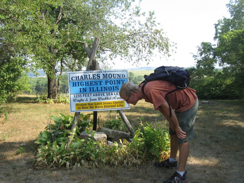
Our hike out was far to straightforward for my take as we didn't take a cirque route due to restrictions; Charles Mound is privately owned. It's like Culebra only different; it's FREE!!!
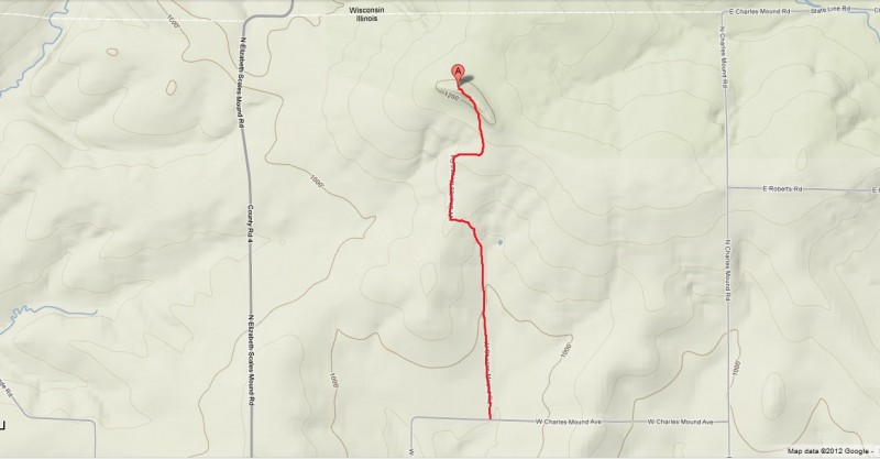
*I had to do something with the title to grab people's attention. Otherwise, how else was I going to waste 10 minutes of your life that you'll never get back? Isn't it sad that I actually took the time to make the map???
Thumbnails for uploaded photos (click to open slideshow):
Greg, thank you for telling us about your trip. While some people here are swayed by elevation, few understand how difficult low elevation routes can be. For someone who aspires to one day summit the mound, this is some very helpful beta. I'll be sure to bring my harness and helmet when I summit (I don't mean to be presumptuous, when I attempt).
This TR style is big time played out and tired. Next? I know a few folks on this site who hike state/county high points but they are far from unoriginal. Try it.
I think I'll leave the route time as is. Adds to the fun.
Tommyboy360, you're more than welcome to try a different spin on a Midwest state highpoint. Anyone whose username references an over-played 90's movie must have some untapped comedic writing talents.
Caution: The information contained in this report may not be accurate and should not be the only resource used in preparation for your climb. Failure to have the necessary experience, physical conditioning, supplies or equipment can result in injury or death. 14ers.com and the author(s) of this report provide no warranties, either express or implied, that the information provided is accurate or reliable. By using the information provided, you agree to indemnify and hold harmless 14ers.com and the report author(s) with respect to any claims and demands against them, including any attorney fees and expenses. Please read the 14ers.com Safety and Disclaimer pages for more information.
Please respect private property: 14ers.com supports the rights of private landowners to determine how and by whom their land will be used. In Colorado, it is your responsibility to determine if land is private and to obtain the appropriate permission before entering the property.


 Look! We're not the only fools to hike the Mound!!!")