| Report Type | Full |
| Peak(s) |
Kit Carson Peak - 14,167 feet Electric Peak - 13,618 feet De Anza Peak - 13,391 feet Teocalli Mountain - 13,213 feet Unnamed 13048 - 13,048 feet |
| Date Posted | 08/03/2012 |
| Date Climbed | 07/28/2012 |
| Author | mennoguy |
| Part 4: The electrifying finish |
|---|
|
Day 13: Okay, the Monsoon season Really Sucks Unnamed 13,051 Unnamed 13,016 14 miles 3300 feet After the previous days early exit from the mountains I was hoping for better weather. We started from the Fall Creek TH and quickly hiked to Fall Creek where we crossed the frigid water and ascended the long north ridge of 13,016. The crux of the day was hiking up the steep wet slick moss and pine needle covered forest floor. Once above treeline and the first ridge bump we realized we forgot to bring a frisbee. The broad slopes of 12,703 would be perfect for a frisbee game. I headed straight for the summit of 13,016 while tdawg made a detour up the sub summit. He said he found an old register with no names he recognized on 12,999. I guess all LOJ people just leave the false summit alone and all the boy scouts climb that obscure point but not the actual highpoint. Clouds were already looking menacing at 8:40, wtf. We boogied to 13,051 where is started to hail on us at 9:40. We debated for a while whether we could make it to Silver, the long exposed hike out made our decision for us. Fall Creek is a beautiful valley, but the trail is very exposed and never seems to end. After a little over an hour in the valley we made it to falls of fall creek. For a very short while we discussed a consolation prize 11,773. However, a lightning strike near the summit and a very loud boom told us to move. I guess the mountain Gods wanted us out of the San Juans. We ran to the car and tore down camp in record time before heavy rain and hail struck us. We drove to Crested Butte to see if the mountain gods would behave in the Elks.  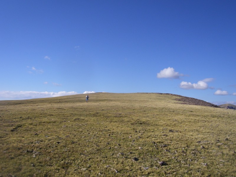 Day 14: The long and winding road Teocali Mountain13,208 Unnamed 12,938 16 miles 4600 feet We camped at the spot where my car could go no further. The Teocali Ridge trail is well marked and easy to follow, but boy is it long. After 2.5 hours we finally popped above the trees. The use trail continues until the step in the ridge. I agree with others that this is not class 1+, I would call it class 2. This is when my camera died, after six years of loyal service to me it finally died. There were no more difficulties on the ridge, I left a new register and we headed towards 12934.   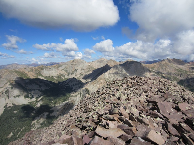 The ridge off Teocali rivals some of the loose crap in the San Juans, nothing more difficult than class 2+. I didn't know what the rest of the ridge to 12934 would hold, it looked like it would be class 3, but whether it would be solid or not would soon be solved. The rest of the ridge turned out to be some of the most enjoyable scrambling of the trip. There was a short knife edge section near the summit.      Next up was an attempt of 13,162, we didn't make it, the ridge from 12934 is mostly class 2 with some class 3 mixed in. However, time was of the essence. At the saddle we descended the Twin Lakes trail because we wanted to find a decent campsite for Kit Carson. We made the long walk back on the road.  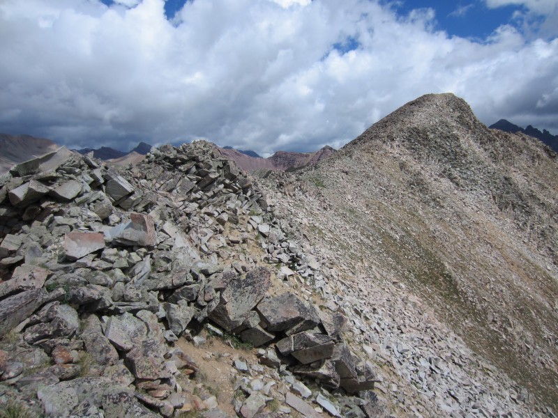  Day 15: 2000 feet in a mile after 15 days sucks Kit Carson Peak 14,165 Challenger Point 14,081 13 miles 6300 feet These are some more peaks I've put off for way too long. They always fall out of my summer plans. This year they would not. The Willow Lake trail is long and never seems to end, but I've grown accustomed to these long approaches in the Sangres. Climbing up Challenger was the most challenging part of the trip. 2000 feet in a miles sucks. It sucks even more after hiking for two straight weeks. The slog never seemed to end. I was glad to get a short rest on Challenger. Kit Carson was a quick climb from Challenger, but we couldn't stay long because of more weather moving in. If the ascent of 2000 feet in a mile sucked the descent was downright awful. I haven't felt my joints scream at me like that since the last half of my last trail marathon. 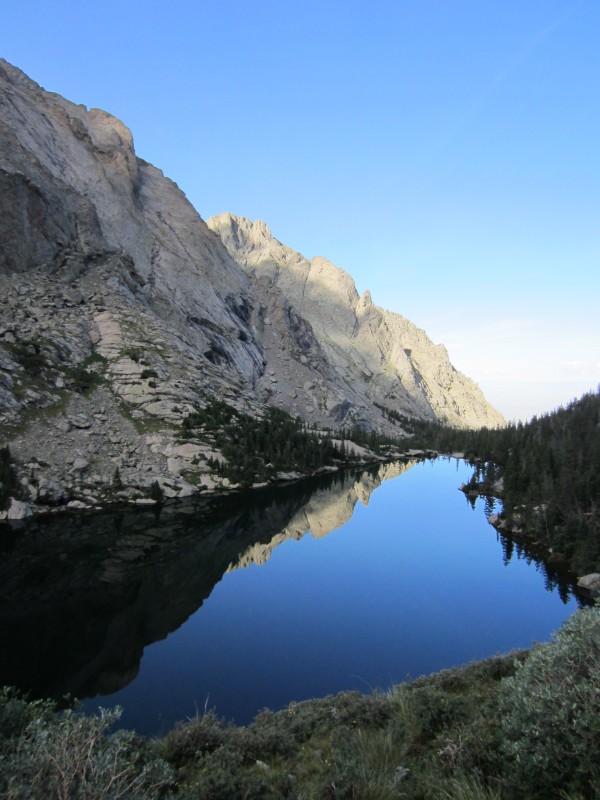   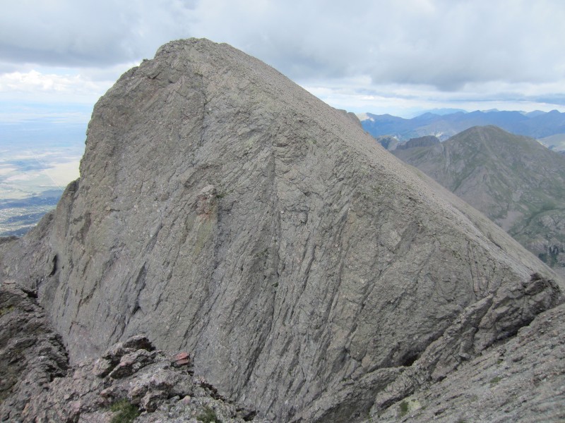 If the long hike in was a pain in the ass, the long walk out was actually pleasant and allowed my joints and muscles time to cool down for our 20 mile finisher. Day 16: The electrifying finish Electric Peak 13,598 Lakes Peak 13,372 De Anza Peak 13,362 20 miles 7000 feet The trail up Major creek starts by descending about 200 feet. At a pit stop I got back to my pack and noticed fresh scat maybe 10 feet away from my pack, then I heard a rustling in the willows which was not the wind. I put two and two together before I saw the black fur. It is a gradual climb to 10,400 before it gets steep again. Lakes peak was painful, it was a steep 800 foot climb in .4 miles. The descent wasn't much better. 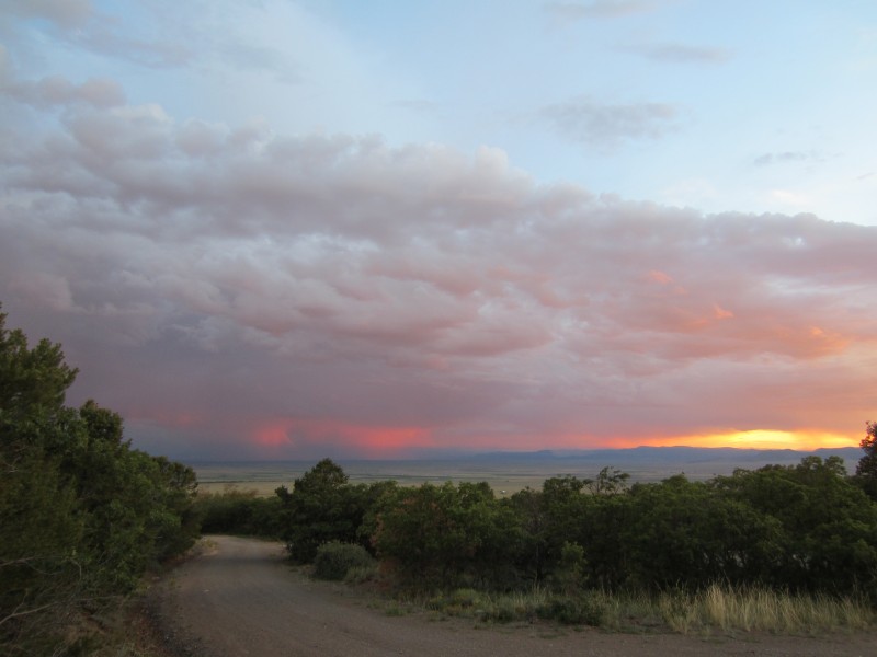 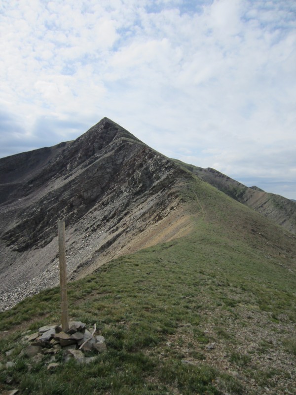 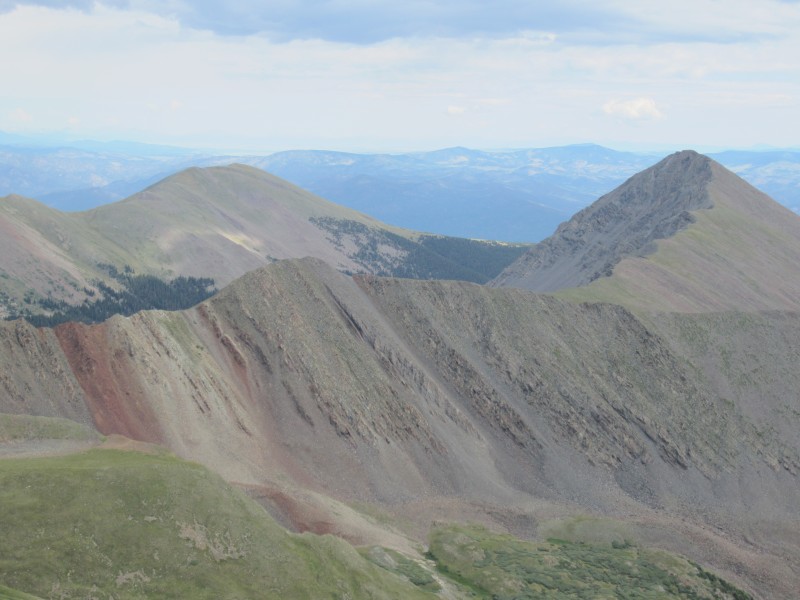 Electric is an easy 1000 foot climb in a mile from the saddle. I was a bit worried about the south ridge of Electric, not knowing if it was grass or talus, luckily for us it was grass, and therefore less painful to descend.    De Anza went quickly from the saddle, it was all grass with a little talus near the summit. I knew it would be a long hike out but 5.5 hours long. we found the Cotton Creek trail and followed the nice trail through the valley where it rained on us for about an hour. No electricity with this storm. At the TH we took the northernmost of three roads. It is marked as a public road on the Trails Illustrated map. We found out otherwise, although none of the locals bothered us, they actually waved and smiled at us. Back on the main road it was a long and tiring walk up to the car. I was glad we were walking in rain cooled air. It would have been miserable in the normal hotness of the Valley. 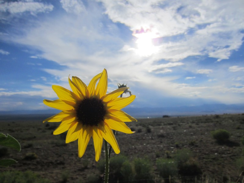 Thoughts on the trip: After day seven it became a lot easier to summit peaks everyday, the steep parts still hurt. I would totally do this again. Working at a school allows me to do this. Thumbnails for uploaded photos (click to open slideshow): ")
 where's our frisbee")
 all photos here on out courtesy of tdawg")
")
")
")
")
")
 did I mention there was unpleasant scree")
 knife edge")
")
")
")
")
")
")
")
")
")
")
 banjo lake")
")
")
")
|
| Comments or Questions |
|---|
|
|
Caution: The information contained in this report may not be accurate and should not be the only resource used in preparation for your climb. Failure to have the necessary experience, physical conditioning, supplies or equipment can result in injury or death. 14ers.com and the author(s) of this report provide no warranties, either express or implied, that the information provided is accurate or reliable. By using the information provided, you agree to indemnify and hold harmless 14ers.com and the report author(s) with respect to any claims and demands against them, including any attorney fees and expenses. Please read the 14ers.com Safety and Disclaimer pages for more information.
Please respect private property: 14ers.com supports the rights of private landowners to determine how and by whom their land will be used. In Colorado, it is your responsibility to determine if land is private and to obtain the appropriate permission before entering the property.


