| Report Type | Full |
| Peak(s) |
Longs Peak - 14,259 feet Pikes Peak - 14,109 feet |
| Date Posted | 08/06/2012 |
| Modified | 08/27/2012 |
| Date Climbed | 08/02/2012 |
| Author | dehrlich101 |
| Additional Members | jgallo11 |
| Giants of the Front Range |
|---|
|
Giants of the Front Range Longs Peak and Pikes Peak have been on the back burner for awhile now, while focusing mostly on the Sawatch and San Juan Ranges. My friend Justin wanted to climb Pikes Peak so that he could finish up the front range. I decided to go for both in consecutive days so that I could finish the range with him. The Northernmost Monarch Longs Peak 14,255' via The Keyhole Date: Thursday, August 2, 2012 (Full Moon) Start time: 0245 Summit: 0710 End time: 1145 Elevation Gain: 5,314' Milage: 14 Company: Solo plus 100+ people on the trail I left Denver at 0100 and drove up though Boulder, and made it to the Trailhead around 0230. To my surprise the trailhead was packed with vehicles and fortunately I was able to snag one of the last spots. It was uncommonly warm for that time in the morning when I left the trailhead and never even thought about putting a jacket on. I made good time all the way to the boulder field, while chatting with a few people along the way. Once out of tree line the full moon made for some nice night photos with the silhouettes of the mountains below. Looking back down the trail there was a steady stream headlamps coming up the valley, I couldn't believe how many people were there on a weekday. Weekends must be horrendously crowded.  I made it to the boulder field pre-dawn and made good time jumping from boulder to boulder towards the Keyhole. This is one of the easier boulder fields I've crossed in my opinion because most of the boulders are large, instead of the balancing act performed on the smaller boulders on other mountains.  Once at the Keyhole I took a break with a few others and watched the sunrise. Truly in incredible sight, and once I climbed around to the ledges I caught this photo.  The ledges were easy enough and soon I made it over to the Trough. The Trough was relatively loose but made for some fun scrambling up. Near the top I ran into the "more difficult rock" as described in the route description or the chockstone. Going to climbers right had some slick rock that my boots weren't grabbing onto. I opted to go to climbers left instead and climbed up a narrow ledge, then an easy class 3 move up above the rock. I used this way to get down as well.   After gaining the ridge between Longs and Pagoda Mountain, it was time for the NARROWS! DUN DUN DUN! I do get nervous on parts with lots of exposure but the narrows were all solid rock and felt completely safe the whole time.  Finally I was in the Homestretch. I followed the route markers up, along the cracks and was soon standing atop of the football field sized summit. After taking a few pictures and taking with the people that had summited before me, I started back down to the Trailhead hoping not to run into the crowd of people coming up in the narrows. 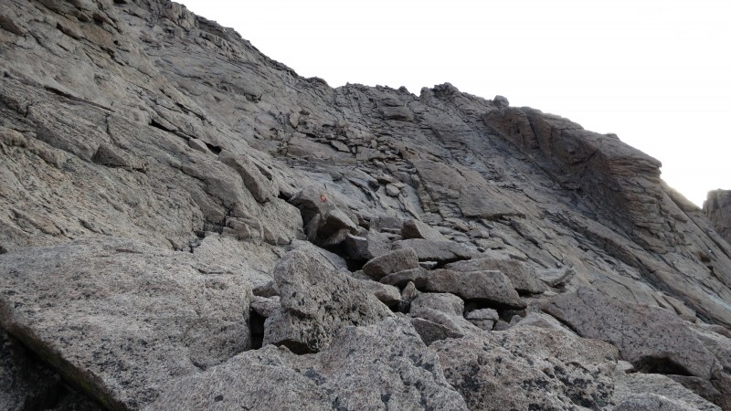   Coming down wasn't much faster than coming up, because you must use caution in the Trough not to send rocks down the gully onto the conga line ascending it. While making my way back to the Trailhead the sights I missed in the dark were outstanding.     I made it back to the Trailhead around 1145, and headed back to Denver to get ready to head south for Pikes the next day. Longs was one of my favorite mountains that I have done so far, and cannot wait to try one of the other routes. 180 South - Front Range Finisher Pikes Peak 14,110' via the Northwest Slopes Date: Friday, August 3, 2012 Start time: 0500 Summit: 0845 End time: 1200 Elevation Gain: 4,366' Milage: 13.75 Company: Justin and Clyde 2 am always comes to early.. I roll out of bed, eat a bowl of cherrios and head over to pick up Clyde and then roll over to Justin's. After packing all the gear in the car we are off to the town of Divide. We got to the Crags Campground around 0445, donned our gear and set off down the trail towards Devils Playground.   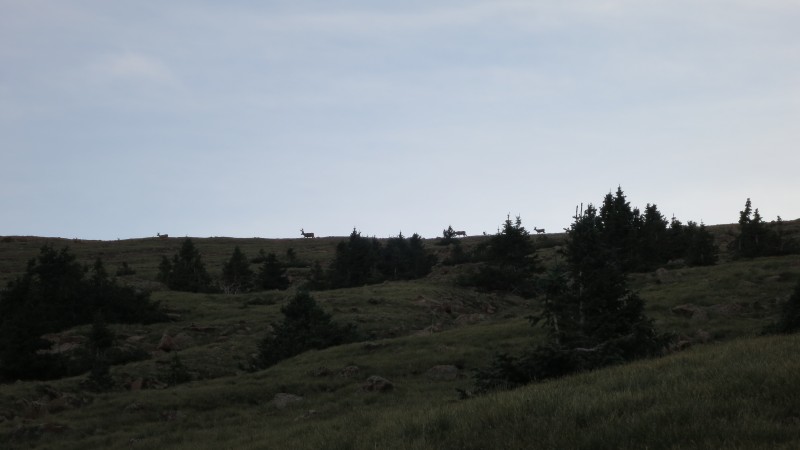 I was pleasantly surprised about how nice the area was around Pikes Peak. Previously I always thought of the City of Colorado Springs when Pikes was mentioned but you don't see much of the city until you reach the road after the Devils Playground.   The North side of Pikes had some rugged cliffs once you join the trail along side the road. Follow the well constructed cairns along the road then up the final slope though the boulder field. Once on top we were greeted by numerous vehicles and people getting ready to bike the road down Pikes.   We took a picture with the Summit marker, ate one of the freshly made donuts from the restaurant and headed back to the Crags Campground. Once back in Manitou Springs we stopped at my favorite brewery in Colorado TRiNiTY Brewing. They have excellent food, and even better beer. I tried the house saision, slap your mammy double IPA, and a 120 minute IPA from Dogfish head. All were great beers. They had changed their menu from the last time and they did not have poutine (Pronounced (pu-teen) it is the most delicious cheese and gravy covered food ever invented, THANK YOU Canada!) Instead I had the Chorizo and Sweet Potato Burrito which was a prime substitute.  Now that I am finished with the Front Range its time to finish the Sawatch in the next few weeks! Thanks for reading. Dan P.S. for those that maybe wondering about the Migraines this makes three peaks in a row migraine free! Thanks for everyones suggestions. I've really been hydrating well before, during, and after climbs. Starting using Butterbur, and watching what I am eating during and before hikes. Thumbnails for uploaded photos (click to open slideshow):  Full moon over Longs and Mount Lady Washington")
 Keyhole")
 Alpenglow on Glacier Gorge and the Ledges")
 The Trough")
 Topping out")
 The Narrows")
 Homestrech")
 One of the many summit markers")
 Agnes Vaille Shelter")
 The diamond, Longs Peak, and the Keyhole")
")
 Park service Llamas")
 Saint Malo Chapel")
 Good morning")
 Alpenglow on the valley")
 Deer on the ridge")
 Dance with the devil")
 Pikes ain't no joke")
 Going up..")
 Summit")
 Trinity chorizo and sweet potato burrito, Slap your mammy IPA, and DFH 120 minute IPA")
|
| Comments or Questions | ||||||
|---|---|---|---|---|---|---|
|
Caution: The information contained in this report may not be accurate and should not be the only resource used in preparation for your climb. Failure to have the necessary experience, physical conditioning, supplies or equipment can result in injury or death. 14ers.com and the author(s) of this report provide no warranties, either express or implied, that the information provided is accurate or reliable. By using the information provided, you agree to indemnify and hold harmless 14ers.com and the report author(s) with respect to any claims and demands against them, including any attorney fees and expenses. Please read the 14ers.com Safety and Disclaimer pages for more information.
Please respect private property: 14ers.com supports the rights of private landowners to determine how and by whom their land will be used. In Colorado, it is your responsibility to determine if land is private and to obtain the appropriate permission before entering the property.


