| Report Type | Full |
| Peak(s) |
Copeland Mountain - 13,183 feet |
| Date Posted | 08/01/2012 |
| Date Climbed | 05/20/2012 |
| Author | cougar |
| Copeland Cabana |
|---|
|
Thought I'd take advantage of this year's low snowpack and get up higher earlier, and a 13er climb in before 14ers the following weekend. Well, there was plenty of snow still up there, and the approach was a bushwhacking and postholing nightmare. Started from the Wild Basin TH - and quickly made it to Ouzel Falls in under an hour. From there, we broke off trail, intending to head for the meadows that line up with the approach to Copeland's east ridge. In the trees, even below 10,000 ft, there was 3-4 ft of snow, and lots of fallen trees. My mistake was not heading directly south from Ouzel Falls. Instead, it was too tempting to head directly towards Copeland, through more difficult terrain and snow. We exited the burn area too quickly, following just one cairn. For anyone doing this approach, head directly south and up the ridge from the top of Ouzel Falls instead of contouring west, to reach the meadow. Too often it's tempting to go in a straight line when you're off-trail, but this is one of those cases where it would be better to make some turns. There were enough dead trees in the burn area to make it slow to navigate, but no postholing at least. Here is a view of the intended approach as seen from Copeland. It should follow the dry meadow center distance, then the snowy meadow closer, with a shorter band of trees in the middle. 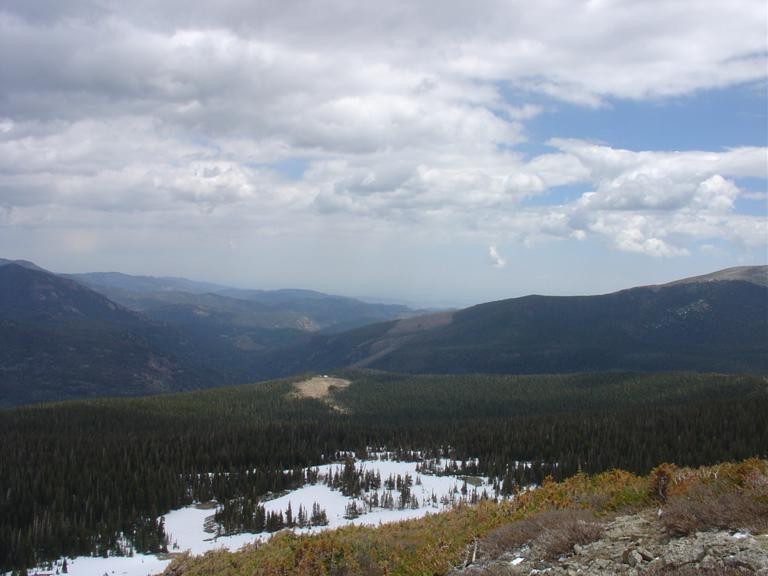 After a couple hours and 3 miles or so of nasty postholing over the knees in the dense forest, we arrived at the end of the second meadow, which was still heavily snow covered, but it was firm snow. This was also very close to treeline, and a couple minutes later we popped out at treeline at the base of the east ridge, exactly as intended. From there it was just a steep tundra and talus walk up - 2000 ft of elevation gain in under a mile. Great views of the Indian Peaks, and not much snow above treeline. It was mostly wind-packed and crusty where present, and avoidable. Overcast at the top, but fantastic views of all the surrounding peaks, still covered in snow. It was snowing very lightly up there later, but still nice.  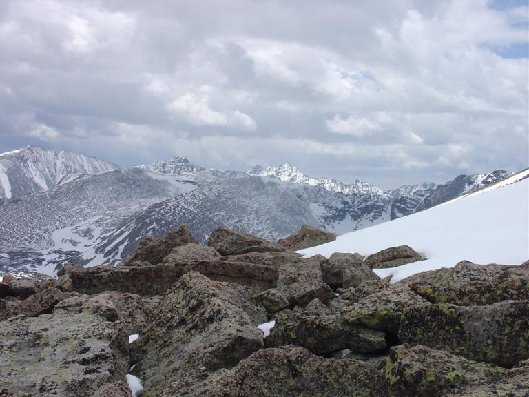 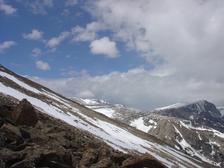 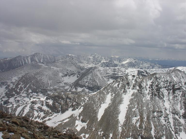 On the descent, we opted to head to Ouzel Lake and pick up the trail there, to minimize bushwhacking. While the lake is visible for a long ways while heading down, it's still quite a bushwhack to get to it. Making a beeline straight for it worked for a while, until hitting the cliffs on the northeast side of Copeland. From there we had to detour some, south and away from the lake, to find a viable descent line. There were some couloirs more towards the east ridge, with a bench of sorts in the middle. The first glissade was short and had to dodge some rocks as it didn't have much of a runout. Then we traversed over a bit more and found a long couloir that had a good runout at the base, and ended at an old stream bed/talus gully. This was a fun glissade and dropped several hundred feet very quickly. The snow was pretty soft. 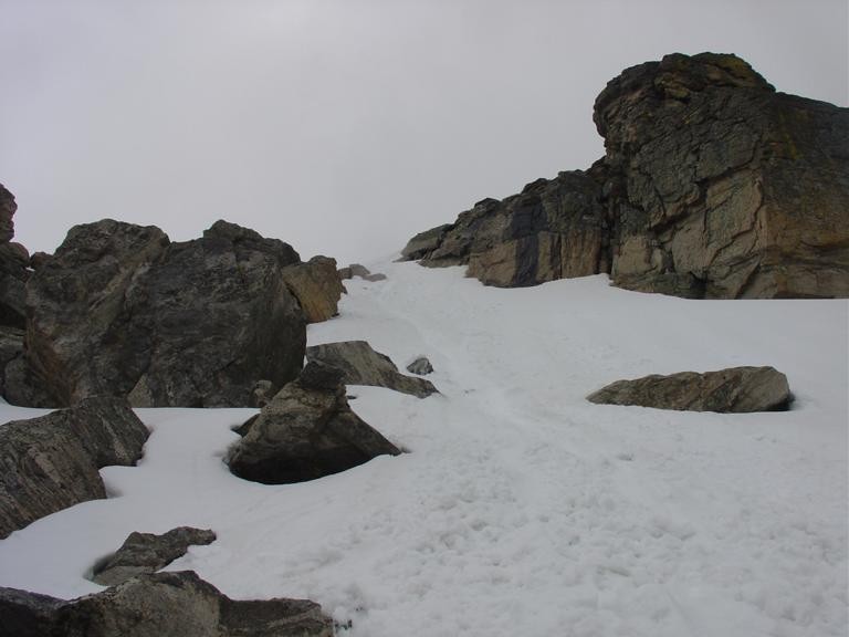 From here, Ouzel Lake seemed close, but it still took considerable bushwhacking and more postholing in the trees to reach it. Once there, the trail was still about a mile away as this was the further lake, and there was more postholing and mud. Finally, we got to the main trail, which was dry the rest of the 4 miles or so back to the trailhead. 9.5 hours after starting, we returned. Longer day than expected, and it took a lot of perseverance. Fantastic views from the top and a well-earned summit. As far as which approach was better/easier (falls or lake), I think any approach will have difficulty, but it should be easier without snow, or with snow gear in winter, and finding and using the meadows would be more pleasant. Lots of fallen trees would make a ski approach difficult unless on the main trail. The snow chute descent was fun. The main challenge on this peak is the approach and finding the best descent line when going to Ouzel Lake. Thumbnails for uploaded photos (click to open slideshow):  meadows for the intended approach route. The one in center should be due south of Ouzel Falls.")
 Copeland's east slopes seen from treeline")
 Indian Peaks")
 average slope angle")
 view south from summit")
 part of the long glissade chute")
|
| Comments or Questions | |||
|---|---|---|---|
|
Caution: The information contained in this report may not be accurate and should not be the only resource used in preparation for your climb. Failure to have the necessary experience, physical conditioning, supplies or equipment can result in injury or death. 14ers.com and the author(s) of this report provide no warranties, either express or implied, that the information provided is accurate or reliable. By using the information provided, you agree to indemnify and hold harmless 14ers.com and the report author(s) with respect to any claims and demands against them, including any attorney fees and expenses. Please read the 14ers.com Safety and Disclaimer pages for more information.
Please respect private property: 14ers.com supports the rights of private landowners to determine how and by whom their land will be used. In Colorado, it is your responsibility to determine if land is private and to obtain the appropriate permission before entering the property.


