Download Agreement, Release, and Acknowledgement of Risk:
You (the person requesting this file download) fully understand mountain climbing ("Activity") involves risks and dangers of serious bodily injury, including permanent disability, paralysis, and death ("Risks") and you fully accept and assume all such risks and all responsibility for losses, costs, and damages you incur as a result of your participation in this Activity.
You acknowledge that information in the file you have chosen to download may not be accurate and may contain errors. You agree to assume all risks when using this information and agree to release and discharge 14ers.com, 14ers Inc. and the author(s) of such information (collectively, the "Released Parties").
You hereby discharge the Released Parties from all damages, actions, claims and liabilities of any nature, specifically including, but not limited to, damages, actions, claims and liabilities arising from or related to the negligence of the Released Parties. You further agree to indemnify, hold harmless and defend 14ers.com, 14ers Inc. and each of the other Released Parties from and against any loss, damage, liability and expense, including costs and attorney fees, incurred by 14ers.com, 14ers Inc. or any of the other Released Parties as a result of you using information provided on the 14ers.com or 14ers Inc. websites.
You have read this agreement, fully understand its terms and intend it to be a complete and unconditional release of all liability to the greatest extent allowed by law and agree that if any portion of this agreement is held to be invalid the balance, notwithstanding, shall continue in full force and effect.
By clicking "OK" you agree to these terms. If you DO NOT agree, click "Cancel"...
During the last week I'd been wondering what I'd do come the weekend, so despite knowing better I turned to the best resource I had: the 14ers.com forums! Heard from emiller that he planned to go up Father Dyer Peak and over to Mt. Helen, and I thought that sounded like it'd be a blast, so I decided to join him.
We met just after 5 in the Walmart parking lot in Frisco, then headed up the highway to Spruce Creek road and on up to the trailhead. The road isn't too bad, most 2wd cars that have a reasonable amount of clearance should make it no problem (for reference, I drove a 1998 subaru outback up, no problem, just felt the need to dodge certain potholes).
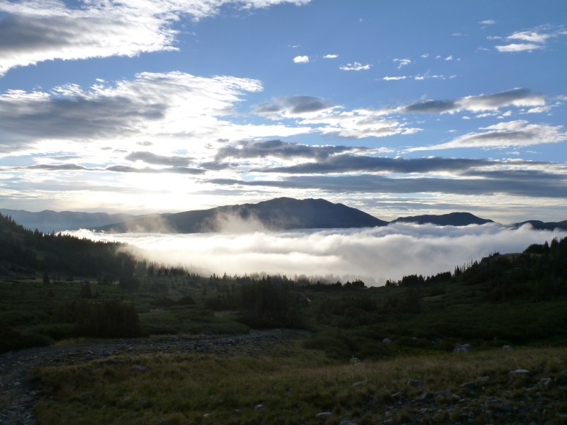
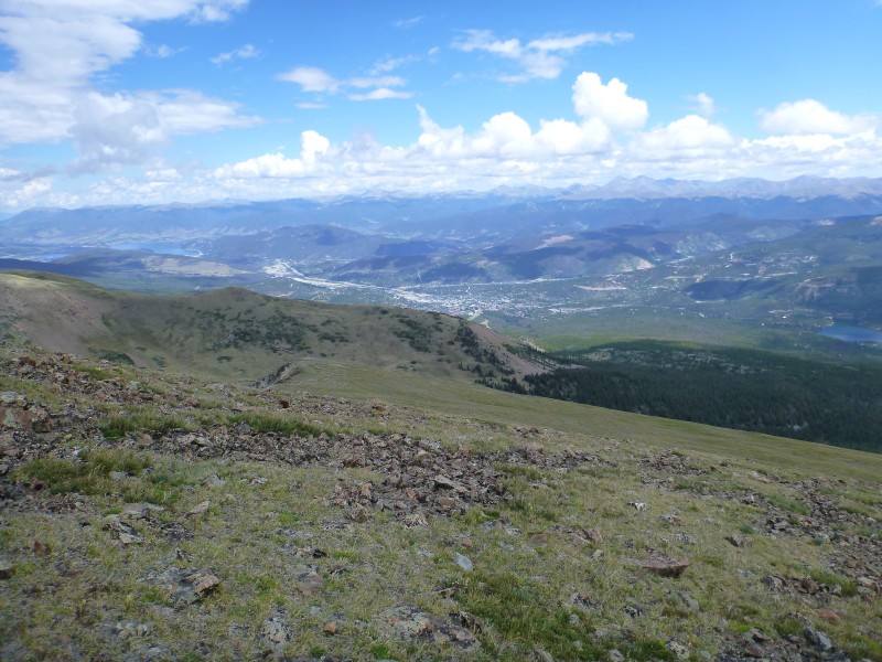
Started up the trail sometime just before 6. Broke above treeline with gorgeous views of the valley below covered in clouds about 6:40:
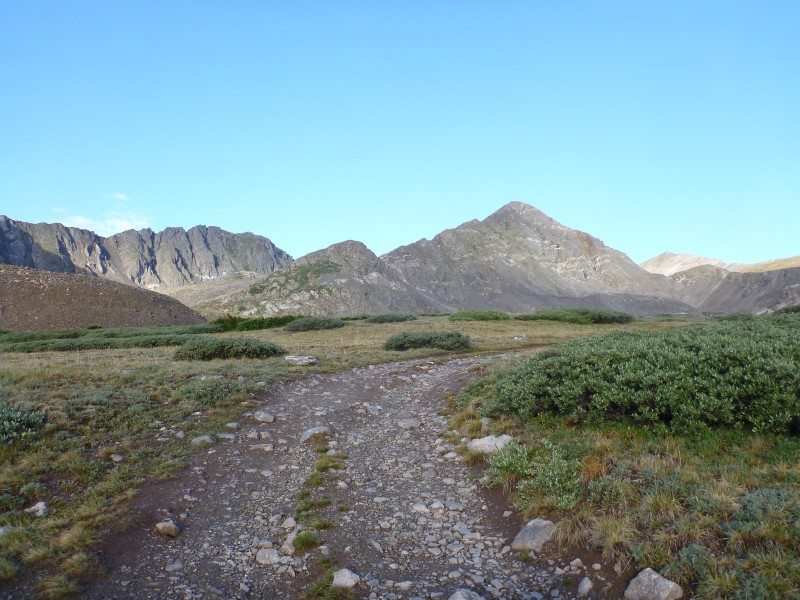
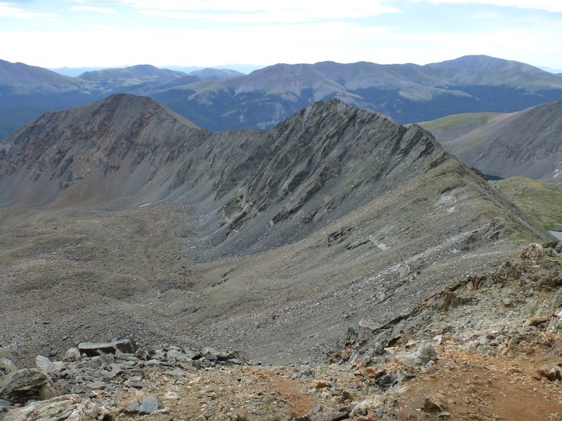
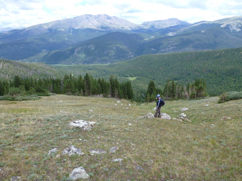
Also had some nice views of Father Dyer and the ridge leading up it:
Here's emiller coming up one of the last stretches of class 3:
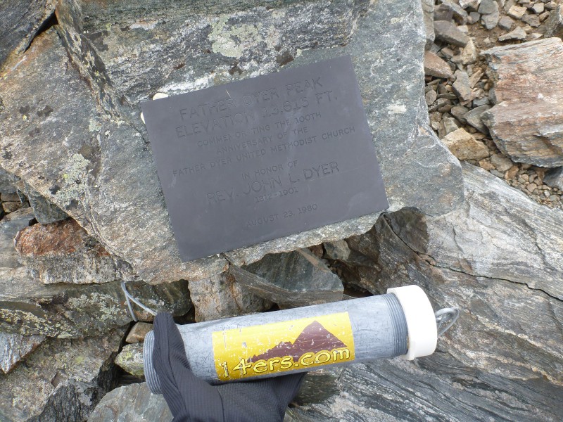
And we summited Father Dyer right around 9 AM.
Summit dedication plaque and summit register tube (appropriately labeled, but missing the endcap, register, and writing utensil - the next folks up might want to fix that):
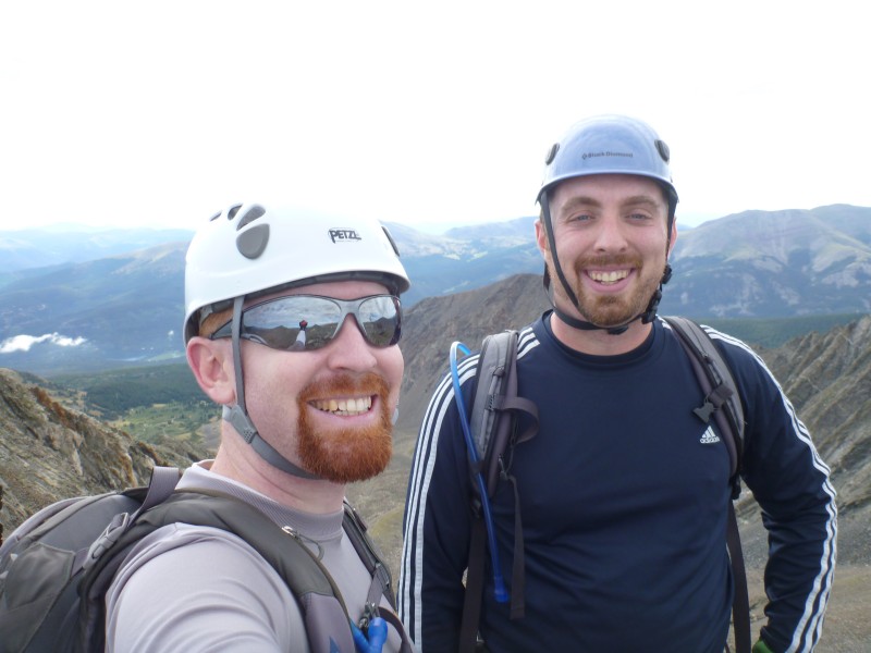
Gratuitous arms length shot:
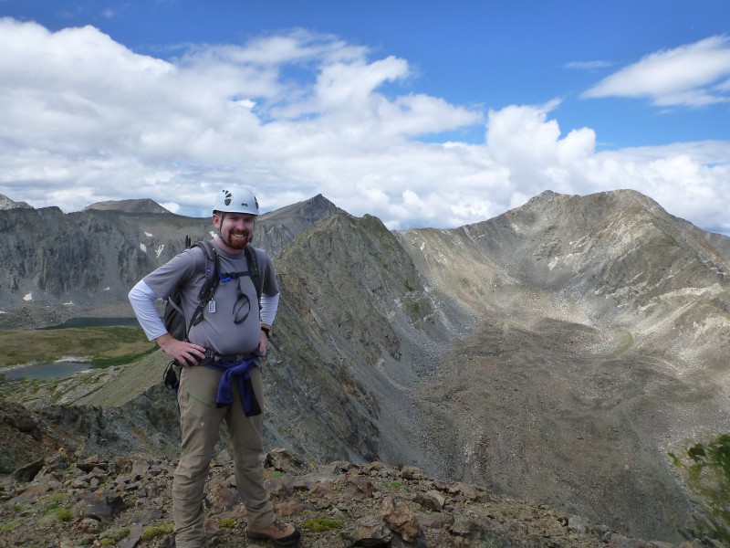
And then, we turned our sights toward the ridge:
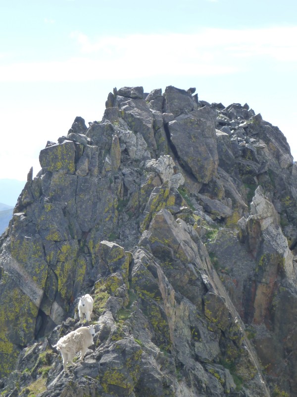
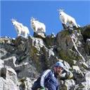
About halfway over the ridge, about 50-something feet away we see two mountain goats. "Okay", we thought, "we'll keep heading in their direction, and if they don't move off the ridge we'll detour around them.":
Next thing we know, the 4 kids are popping up right in front of us: (the 4th is just below the other side of the ridge)
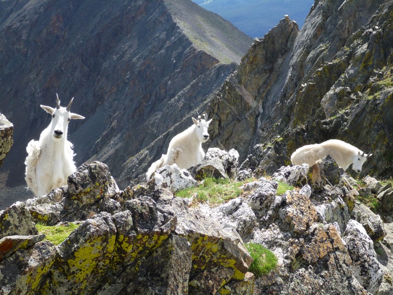
Not wanting to get accidentally shoved off the mountain, we decided to go down a bit, and traverse around the lot. Apparently we were rather interesting though, because they kept an eye on us for a while:
Eventually made it back up to the ridge, just in time for emiller to drop his camera, which proceeded to bounce to a rest about 50 feet down. I, being the slightly more used to scrambling/climbing (or more stupid/gullible), was tasked with going to get it:
And thankfully found it in good health! (emiller, you should put the name of it down below, because I whole-heartedly recommend it as a durable camera - not a ding or scratch outside of the reinforced outer edge).
We proceeded without much further drama over to Mt. Helen, summiting at about 12. Summit register over there was complete, if a bit moist (a little water had gotten into the tube).
We then proceeded down the east face of Mt. Helen, eventually aiming for this gully, which took us more or less back to the trail.
And got back to the cars right about 1. Where there had been no one parked there before us, there were 10 or so (I'd guess) cars at the upper parking lot, with dozens upon dozens on the side of the road going down from there.
As far as difficulty, I'd definitely call the East (NE?) ridge of Father Dyer a good beginner class 3 ridge, nothing too complicated, and it's all quite solid. The ridge between Dyer and Mt. Helen is definitely a difficult class 3, with the potential for class 4 if you get off route for whatever reason. I'd say stay on the ridge if at all possible, it's where we made the best time and had the best views from.
Roundtrip distance was 7.57 miles, according to mapmyrun on my iphone. I'd guess it was a little closer to 6 or 6.5 miles, especially if you didn't have to take the detour due to goats.
NOTE FOR GPS TRACK: Ignore the off-ridge bits on the ridge going up to Dyer, don't know how those got in there.
My GPS Tracks on Google Maps (made from a .GPX file upload):
Yikes,
Are you the guy we talked to in the parking lot that also went over Crystal and pk 10?
Caution: The information contained in this report may not be accurate and should not be the only resource used in preparation for your climb. Failure to have the necessary experience, physical conditioning, supplies or equipment can result in injury or death. 14ers.com and the author(s) of this report provide no warranties, either express or implied, that the information provided is accurate or reliable. By using the information provided, you agree to indemnify and hold harmless 14ers.com and the report author(s) with respect to any claims and demands against them, including any attorney fees and expenses. Please read the 14ers.com Safety and Disclaimer pages for more information.
Please respect private property: 14ers.com supports the rights of private landowners to determine how and by whom their land will be used. In Colorado, it is your responsibility to determine if land is private and to obtain the appropriate permission before entering the property.