Download Agreement, Release, and Acknowledgement of Risk:
You (the person requesting this file download) fully understand mountain climbing ("Activity") involves risks and dangers of serious bodily injury, including permanent disability, paralysis, and death ("Risks") and you fully accept and assume all such risks and all responsibility for losses, costs, and damages you incur as a result of your participation in this Activity.
You acknowledge that information in the file you have chosen to download may not be accurate and may contain errors. You agree to assume all risks when using this information and agree to release and discharge 14ers.com, 14ers Inc. and the author(s) of such information (collectively, the "Released Parties").
You hereby discharge the Released Parties from all damages, actions, claims and liabilities of any nature, specifically including, but not limited to, damages, actions, claims and liabilities arising from or related to the negligence of the Released Parties. You further agree to indemnify, hold harmless and defend 14ers.com, 14ers Inc. and each of the other Released Parties from and against any loss, damage, liability and expense, including costs and attorney fees, incurred by 14ers.com, 14ers Inc. or any of the other Released Parties as a result of you using information provided on the 14ers.com or 14ers Inc. websites.
You have read this agreement, fully understand its terms and intend it to be a complete and unconditional release of all liability to the greatest extent allowed by law and agree that if any portion of this agreement is held to be invalid the balance, notwithstanding, shall continue in full force and effect.
By clicking "OK" you agree to these terms. If you DO NOT agree, click "Cancel"...
In late August 2006, I attempted Handies after an early morning rain in Lake City. I could see snow on the summit, but perservered until about 13000. There was intermittent thundersnow with clearing off periods. I had never seen such rapid weather shifts. Handies with snow above 13000 in August 2006
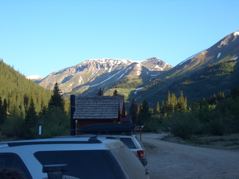
In July 2012, the weather was much better. Handies was by far the easiest 14er remaining on my list, so it looked like a good warmup for the 2012 season. We took the Ford Fusion (5" clearance) up the shelf road to Grizzly Gulch trailhead with no problems, just going slow and careful. Handies from trailhead in September 2008Important Trailhead Info--Restrooms
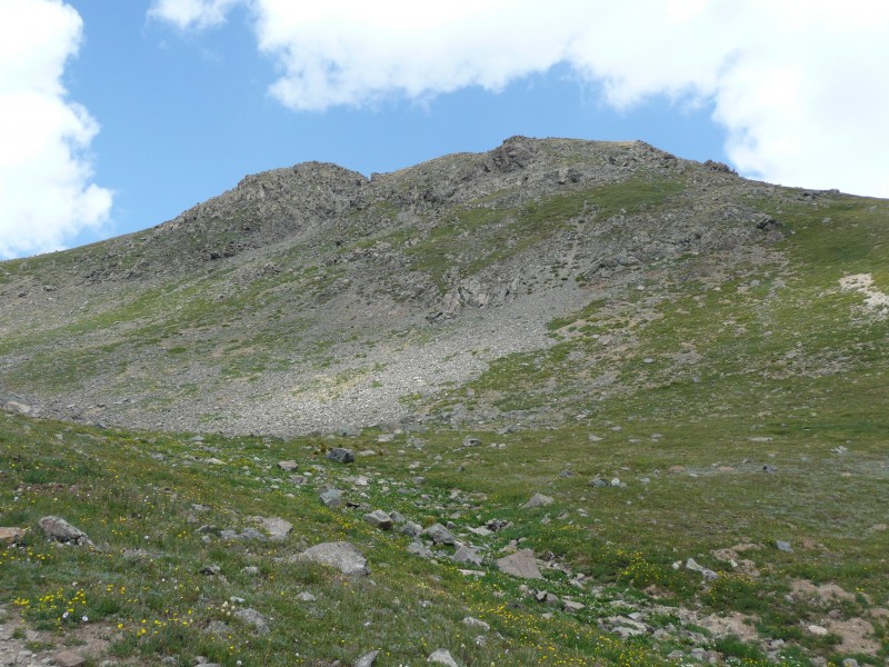
Going up Handies was a treat this time around. We reached timberline in an hour Handies Peak in July 2012--no snow and the summit in a little less than four hours. There was excellent scenary in all directions with profuse wildflowers. Wildflowers along the wayHandies from TreelineBeth climbing through the upper 12's Such a change from Kansas where it has been quite hot and dry.
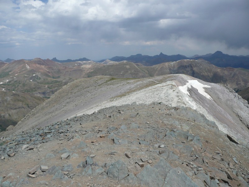
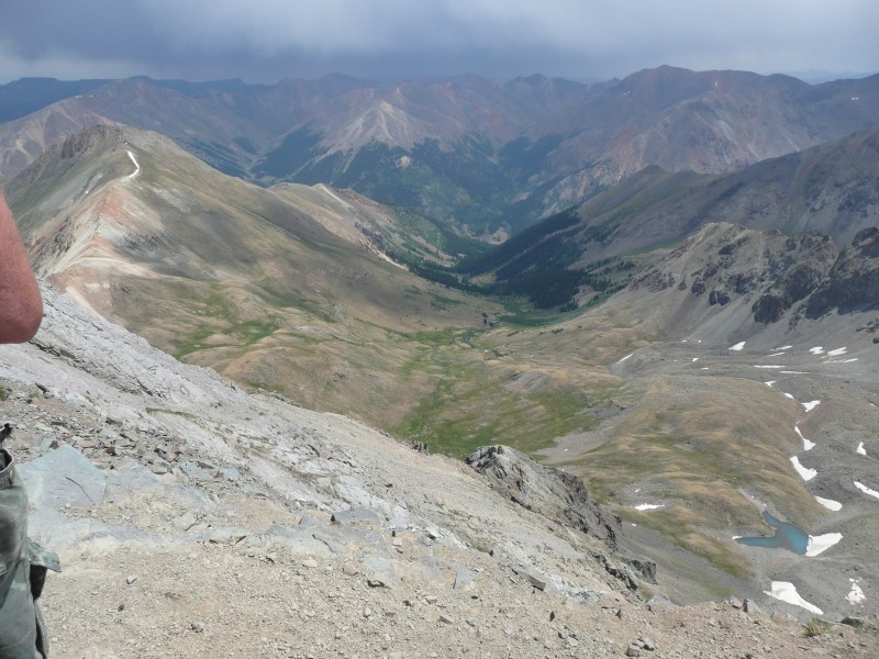
This route was not particularly busy for a Monday. There were even a few runners training for a long trail run that included the top of Handies. Although I run a couple of miles a day at 1300 feet, I am not up to running that distance, at this elevation, and on rocks. Kudos to them. The surrounding peaks that I have not climbed: WetterhornWetterhorn from 13000--one of the targets for next year and the Wilsons from about 25 miles away The Vermillion Group from the summit. Someday, Maybe As well as old friends: UncompahgreUncompahgre from a hazy summit. The last 1000 feet to the summit went fine as well. Wildflowers higher upApproaching the summitLooking down the summit ridge
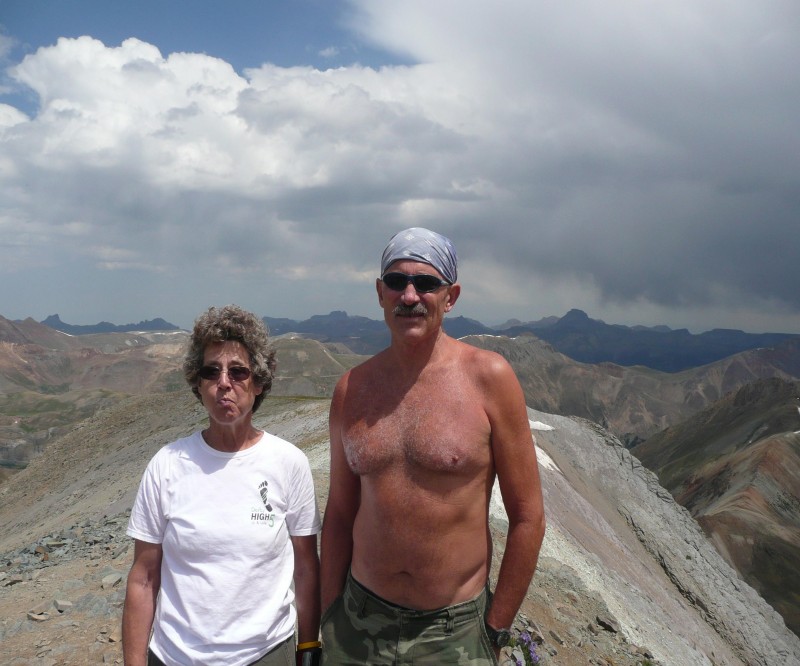
What do you do atop a 14er? I eat and take pictures;Wetterhorn from a hazy summitSloan LakeTogether on the summit however, if you are an athletic young man, you do pushups, lots of pushups. Sean--first 14er--planning on pushups I am not sure that I can do pushups at sea level, much less at 14000 feet. Kudos to him as well. A family of Michiganders who had ascended from American Basin joined in the picture swapping. Michiganders on the summit
Looking west to Jones & NiagaraLooking toward American BasinViewing descent route There were good views of Redcloud and Sunshine on the descent Heading down toward Redcloud and SunshineRedcloud and Sunshine from farther down
On the descent, it clouded up and began to sprinkle at times. Descent toward Lake Fork I was hoping the road would stay dry since the Fusion would more likely have trouble on a muddy road. We reached the trailhead in a little under three hours, for a round trip of 6:50. Close to the trailhead, I saw a wild horse and a colt. They spooked quite easily.
Good day and #32 in the peakbagging bag. Tired but not anguished. #32
Thumbnails for uploaded photos (click to open slideshow):
Comments or Questions
Caution: The information contained in this report may not be accurate and should not be the only resource used in preparation for your climb. Failure to have the necessary experience, physical conditioning, supplies or equipment can result in injury or death. 14ers.com and the author(s) of this report provide no warranties, either express or implied, that the information provided is accurate or reliable. By using the information provided, you agree to indemnify and hold harmless 14ers.com and the report author(s) with respect to any claims and demands against them, including any attorney fees and expenses. Please read the 14ers.com Safety and Disclaimer pages for more information.
Please respect private property: 14ers.com supports the rights of private landowners to determine how and by whom their land will be used. In Colorado, it is your responsibility to determine if land is private and to obtain the appropriate permission before entering the property.


 Handies with snow above 13000 in August 2006")
 Handies from trailhead in September 2008")
 Important Trailhead Info--Restrooms")
 Handies Peak in July 2012--no snow")
 Wildflowers along the way")
 Handies from Treeline")
 Beth climbing through the upper 12's")
 Wetterhorn from 13000--one of the targets for next year")
 Wildflowers higher up")
 Approaching the summit")
 Looking down the summit ridge")
 The Vermillion Group from the summit. Someday, Maybe")
 Descent toward Lake Fork")
 Uncompahgre from a hazy summit")
 Wetterhorn from a hazy summit")
 Tired but not anguished. #32")
 Together on the summit")
 Sean--first 14er--planning on pushups")
 Michiganders on the summit")
 Looking west to Jones & Niagara")
 Looking toward American Basin")
 Viewing descent route")
 Heading down toward Redcloud and Sunshine")
 Redcloud and Sunshine from farther down")
 Sloan Lake")

