| Report Type | Full |
| Peak(s) |
Handies Peak - 14,058 feet Sunshine Peak - 14,004 feet Redcloud Peak - 14,037 feet "Sundog" - 13,437 feet |
| Date Posted | 07/24/2012 |
| Modified | 07/25/2012 |
| Date Climbed | 07/19/2012 |
| Author | Fisching |
| Handling the Handies |
|---|
|
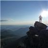
Day 1: Peaks Climbed: Redcloud, Sunshine, Sun Dog (via Silver Creek) and Handies (via American Basin) Start Time: 4:00am End Time: 2:00pm Total Mileage: 20 miles Total Elevation Gain: 8200 Trip Totals: Peaks Climbed: Redcloud, Sunshine, Sun Dog, Handies, Uncompaghre, Wetterhorn, Kit Carson, Columbia Point, Katty Kit Carson, the Prow, Challenger Point, Yale, and Mascot Peak Trip Length: 4 Days Total Mileage: ~60 miles Total Elevation Gain: ~25600ft A Foreword (if you're interested only in the route beta, please skip this portion): This 4 day trip would not have occurred had it not been for a tragedy. When my wife and I first moved out to Colorado 23 months ago, we knew no one; our families were both 1000 miles away to the east and west. When we join St. Pius X Catholic Church in Pueblo, we were immediately greeted and by Gordon and Kathy Redmond. Gordon was the first person to truly make me feel at home away from home and was an affable person who made you feel comfortable. Our friendship with the couple grew throughout the year as they assisted us as our babysitters for our infant son, Chris, who was born in November of 2010. For us, it was an immense relief knowing we had found someone to watch Chris when we needed it and on a moment's notice too. Gordon and Kathy became our biggest cheerleaders as we continued to search for employment for the both of us for 2011-12 (I was unemployed and mainly played the role of Mr. Mom after Chris was born) as well as taking an immense interest in our application process with Maryknoll Lay Missioners the past few months. Gordon and Kathy became our Colorado parents and Chris's Colorado Grandparents as we were truly blessed to know them. Sadly, Gordon passed away on July 14th after having a 2 month battle with an intestinal infection. The loss was devastating for us. Kathy asked if I would do one of the readings at his funeral and how she asked me made it sound like Gordon had specifically planned the funeral and requested me to do this. How do you say "no" to such a request? Kim and I were supposed to fly back to Chicago the day of the wake; unfortunately, we couldn't bare the financial burden to change both flights (cursed capitalism) so she went back while I stayed. I'm still kicking myself for this as I'm as cheap as they come - I throw pennies around if they were manhole covers. If I had just stayed with my original plan of driving to Chicago, we could have been there as a family. Sigh... After the wake and funeral, I felt like I needed to clear my mind and certainly didn't want to spend the remaining week till my new flight date in my empty house, so I planned a long car camping trip to the mountains. During that trip, the Aurora shooting happened. I found out in the aftermath that someone I attended high school with, John Larimer, back in Crystal Lake, IL, died in the shooting. I won't go so far as to see we were friends, but I knew John and liked him. We were in band together and many of my good friends knew him through the plays and musicals at the school. John was one of those guys who could find humor in any situation. While many people wrote long biographies of their "acting careers" or elaborate" thank yous" for the Playbills of the school plays/musicals, John would take a different approach. His would always read, "This Space for Rent." Hearing that John was a victim and died shielding his girlfriend (http://www.chicagotribune.com/news/local/suburbs/algonquin/ct-met-colorado-shooting-illinois-20120724,0,878170.story), shocked me as it hit close to home, a home which was 1000 miles away from where I met John. This trip became a way for me to clear my mind from a terrible week.  Trail Beta: I drove to the Silver Creek TH the night before and car camped. The road to the TH is rather rough, but passable for a 2WD car. A little extra clearance is useful since the recent mudslide left at least one dip in the road which was less than pleasant to cross. Knowing there was a 70% chance of T-storms after 2pm that day, I wasted little time in setting out at 4am. My initial plan was to scale Sun Dog, continue to Sunshine and Redcloud, and descend the standard route. I ended doing the exact opposite. Trying to find the turnoff over Silver Creek in the dark was much harder than expected. The only portion of the trail which was difficult to follow in the pitch black was near the creek where the trail turned to rock. Since I couldn't find the creek crossing for my intended route, I decided to waste little time and go for Redcloud via the Northeast Slopes. Even if you lose the trail in this section due to its disguise in the rocky terrain, it's easy to pick back up as long as you continue to head up stream. 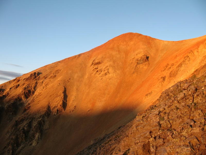 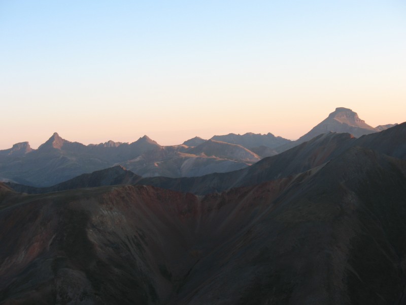 The trail heads all the way to the back of the basin and gains the saddle. From, the saddle the remaining route is quite clear. It's also clear that some dumb schmuck thought it would be better to cut some of the switchbacks to save time and/or distance. I can guarantee you that it will do no such thing. The slopes up Redcloud are filled with loose scree and trying a direct assent will result in the proverbial "2 steps forward, 1 step back." Just stay on the trail and your feet will thank you. Estimated time from TH to Redcloud summit: 2 hours 15 minutes.  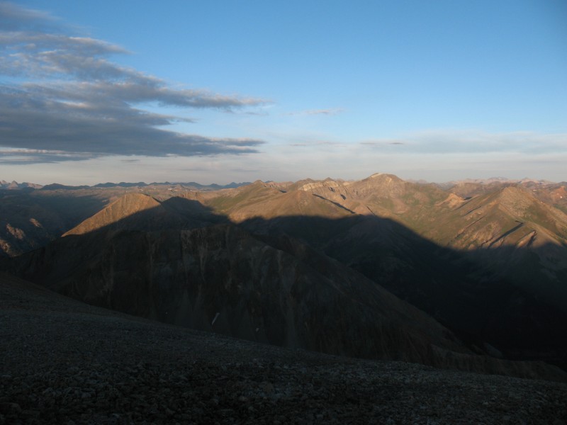 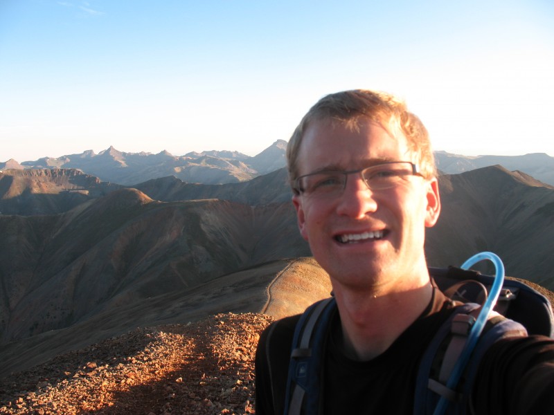 From Redcloud, the ridgeline path to Sunshine is easy to follow. It's listed as a Class 2 route, and I would agree. The first portion of the route is probably Class 1 and has defined path to the bottom of the connecting saddle. However, from this point it becomes a scree trail to the summit. Just trudge through it; it's not too bad. It took me about 40 minutes to traverse from Redcloud to Sunshine. 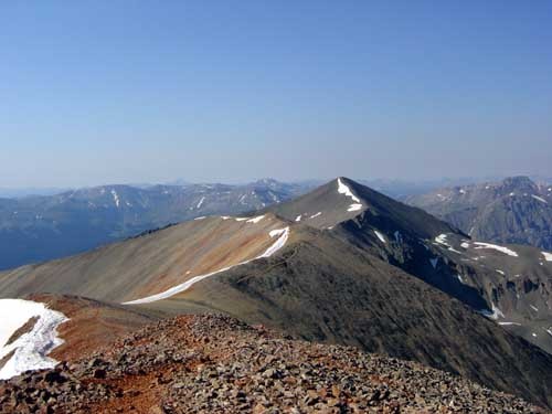 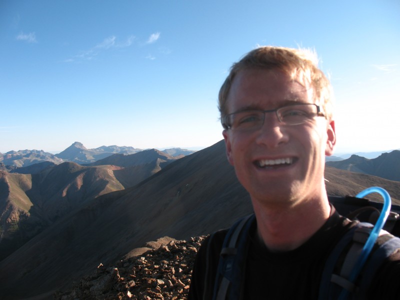 Since I wanted to make a cirque tour of this group, I had to descend the Northwest Slopes of Sunshine. Make no mistake about it, this part sucks. It's rated as Class 2+ which might not do it justice; the slopes are steep, there is no trail, and the scree is entirely loose. You should expect to lose your footing a few times based on the nature of this unstable, rocky slope. At the bottom of the slope, the cairns reappear marking the way back towards the Silver Creek trail, however, I had a different goal in mind - Sun Dog, a 13er that had a connecting ridge with Sunshine. Sun Dog requires some Class 3 climbing to bag its summit from the saddle. The immediate portion following the saddle is the class 3 portion and requires careful hand placement due to the loose nature of the rock. Many of the handholds I tested were unstable and required me to find a different hold. Thankfully, the exposure isn't "Maroon Bells Traverse" extreme. Once over this portion, the remainder of the route to Sun Dog's summit is Class 2. There are a few false summits along the way, so be sure to continue following the ridge towards the Silver Creek trail (far below) as you'll grab the summit en route to the trail. Like many 13ers, there is no defined route or cairns on Sun Dog. Rather, there is a vague path of where other climbers have stepped marking the way. When I followed the descending ridge to the trees, this vague "trail" disappeared. I knew, based on Roach's book, that the trail was supposed to descending the ridge to the right and meet back up with the route off of Sunshine. I didn't see anything definitively leading that way, so I decided to head straight down the slope into the trees. It was steep, but doable. The soft dirt caused me to lose my footing a few times.  Near the bottom of the ridge is where it became "interesting" (and I mean interesting in the sense Roach uses it). I had to full-on bushwhack my way through some of the dense shrubbery to reach the Silver Creek trail. Once on the trail, it was a quick walk out. Estimated time back at the TH: 9:05. I really didn't want this trip into the Handies Group to become a 2-day foray and knowing that a storm might be moving in that afternoon, I wanted to give myself the best chance at bagging Handies. To do that, I attempted the American Basin side of the 14er. I jumped in my Accord and began to make my way up Cinnamon Pass Road, which was becoming increasingly difficult. I believe I bottomed out on 1 rock and spun my tires twice, but I never felt like I shouldn't be attempting that road in my 2WD sedan. About .2 of a mile below the 2WD parking for American Basin, I saw a section of road that I didn't feel capable attempting; thankfully there was a nice pull-off on the right side of the road for 3 cars that I used. Using this pull-off also guaranteed that I'd be able to gain the needed 3K vert for the summit. Handies from this TH is very easy. Even if you cannot make it up to the standard 4WD parking spot, hiking the road is the antithesis of the Lake Como Road. The downside to the relative ease of this peak is that you're going to see many the prototypical summer Grays/Torreys hikers. If I may pass judgment on a few hikers... I saw one couple, in their 20's, going to the summit. The guy was wearing flip-flops and his girlfriend was wearing fleece-lined moccasins. I wasn't sure if I should laugh or be angered that they made the summit. When he told me that he was a super-super-super senior at Western and called me "Bro" a few times, I figured laughing at him was the better course of action. On my descent, I came across a party of 10 people. They were heading for the summit and still had another 1500 vert to gain at 1:15pm. It was clear that clouds were starting to gather and some grey underbellies could be seen even from a limited view in the basin. I told them without telling them that they should turn around since storms were expected and looked imminent. However, they decided to keep going on even though they had an 11/12 year old girl with them. Way to go, Bro! 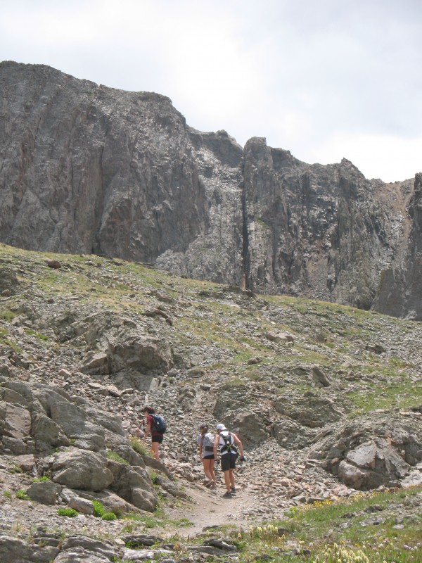 Anways, the trail... It's easy - Class 1 the entire way and is HIGHLY recommended during wildflower season; it's a very pretty area. 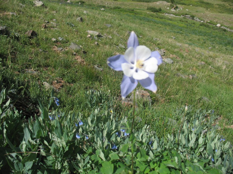 It took me 2 hours to get to the summit and 1hour 20minutes to descend to my car. I considered adding on Whitecross, but with the weather looking iffy and unsure what a descent of Whitecross would entail, I decided to leave it for another day.  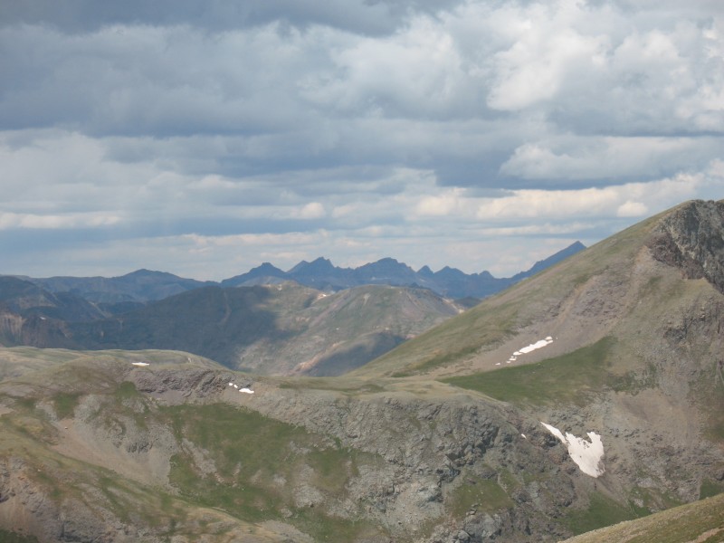 The day (and subsequent ones) turned out to have the therapeutic effects I hoped for as I recalled the brief time I knew Gordon and got to spend in his company. He was truly a great man and affected many lives in a positive way both in his profession as a Social Worker in Pueblo County and as my "Colorado Dad." Miss you, Dad.  Day 2 Trip Report: www.14ers.com/php14ers/tripreport.php?trip=12424 Thumbnails for uploaded photos (click to open slideshow):
")
|
| Comments or Questions | |||||||||||||||
|---|---|---|---|---|---|---|---|---|---|---|---|---|---|---|---|
|
Caution: The information contained in this report may not be accurate and should not be the only resource used in preparation for your climb. Failure to have the necessary experience, physical conditioning, supplies or equipment can result in injury or death. 14ers.com and the author(s) of this report provide no warranties, either express or implied, that the information provided is accurate or reliable. By using the information provided, you agree to indemnify and hold harmless 14ers.com and the report author(s) with respect to any claims and demands against them, including any attorney fees and expenses. Please read the 14ers.com Safety and Disclaimer pages for more information.
Please respect private property: 14ers.com supports the rights of private landowners to determine how and by whom their land will be used. In Colorado, it is your responsibility to determine if land is private and to obtain the appropriate permission before entering the property.