Download Agreement, Release, and Acknowledgement of Risk:
You (the person requesting this file download) fully understand mountain climbing ("Activity") involves risks and dangers of serious bodily injury, including permanent disability, paralysis, and death ("Risks") and you fully accept and assume all such risks and all responsibility for losses, costs, and damages you incur as a result of your participation in this Activity.
You acknowledge that information in the file you have chosen to download may not be accurate and may contain errors. You agree to assume all risks when using this information and agree to release and discharge 14ers.com, 14ers Inc. and the author(s) of such information (collectively, the "Released Parties").
You hereby discharge the Released Parties from all damages, actions, claims and liabilities of any nature, specifically including, but not limited to, damages, actions, claims and liabilities arising from or related to the negligence of the Released Parties. You further agree to indemnify, hold harmless and defend 14ers.com, 14ers Inc. and each of the other Released Parties from and against any loss, damage, liability and expense, including costs and attorney fees, incurred by 14ers.com, 14ers Inc. or any of the other Released Parties as a result of you using information provided on the 14ers.com or 14ers Inc. websites.
You have read this agreement, fully understand its terms and intend it to be a complete and unconditional release of all liability to the greatest extent allowed by law and agree that if any portion of this agreement is held to be invalid the balance, notwithstanding, shall continue in full force and effect.
By clicking "OK" you agree to these terms. If you DO NOT agree, click "Cancel"...
Took my wife and two boys (2y.o. and 4.5y.o.) down to Westcliffe to experience the Sangres for 6 days last weekend. Stayed in a really nice cabin in Rosita. It was cloudy and rainy for the first 4 days we were there with only occasional glimpses of the peaks. Highlight of the trip for my boys was all the chances they got to fulfill their RDA of throwing rocks in any creek or lake or sand dune we could find for them. I might have joined in and threw maybe one or two...hundred rocks or so along with them...
The last 2 days the weather finally cleared up somewhat, at least for the mornings w/ afternoon thunderstorms. My wife kindly let me escape to climb a couple peaks I'd been salivating over in the Northern Sangres that I could bag quickly and get back by mid-morning.
Got up at 2AM and headed towards the 4WD road ( FR198 ) that heads up to Cloverdale Basin. Driving a 4WD road in the dark is an interesting experience to say the least. This road is incredibly bumpy and rocky. Not too technically difficult as 4WD roads go but rocky as all get out. Plus, when the Forest Service came through and cleared the fallen trees, they only cut the trees just barely wide enough for my Pathfinder to fit through. Talk about the need for precision driving!
Arrived at the old mine buildings along the road about 4:30AM and walked up the road to the TH by moonlight. Good thing there was moonlight as I thought I had packed my headlamp but couldn't seem to find it anywhere. Found the trail up to Silver Lake, which is an old mining road with HUGE 4' high hills dug in it when they closed the road. Cruised up to Silver Lake by 5AM and then up grass and dirt slopes to the saddle between Cottonwood Peak and Wulsten Baldy. The pre-dawn light was just incredible. Beautiful morning light
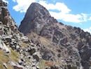
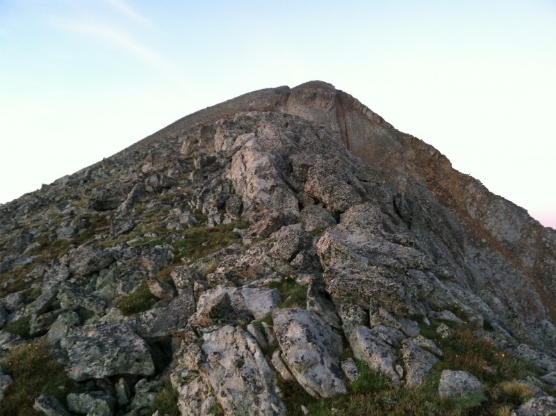
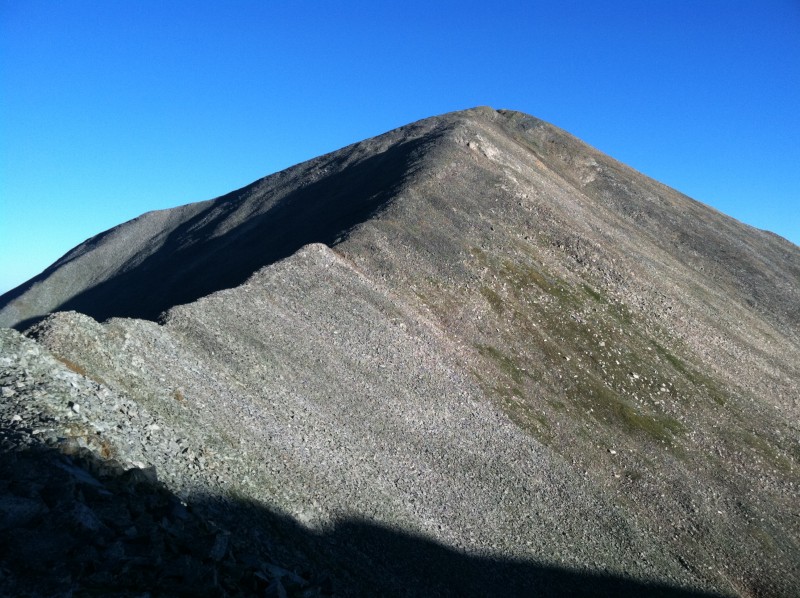
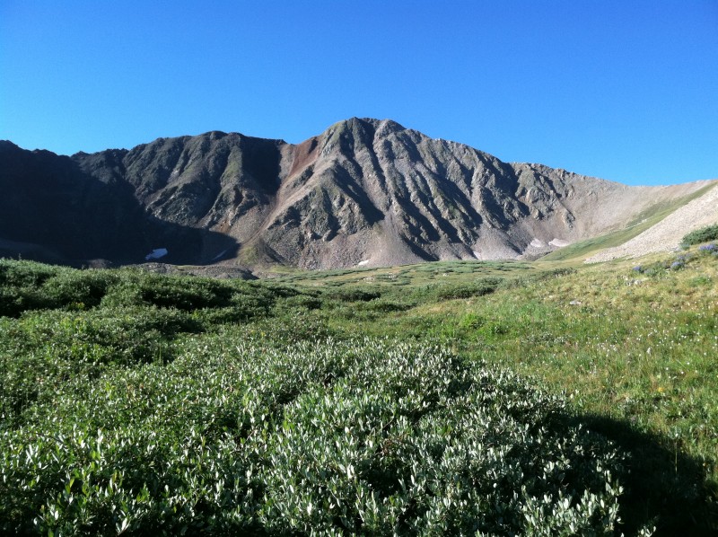
Cottonwood Peak's East Ridge was easy Class 2 with mixed grass and rock and I made excellent time up to the ridge crest in the quiet and serene morning light. Cottonwood Peak's grassy East Ridge
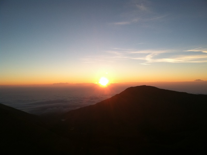
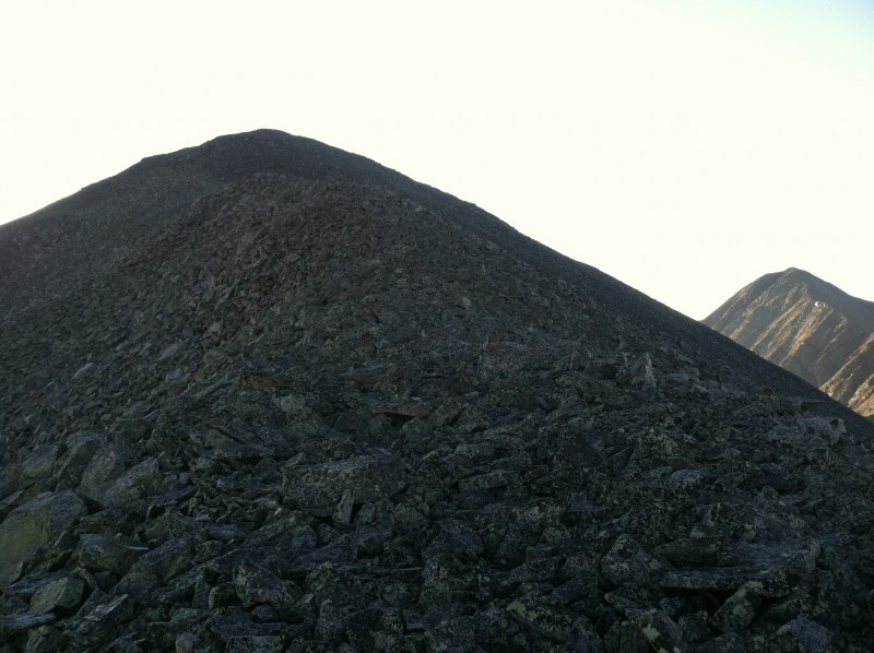
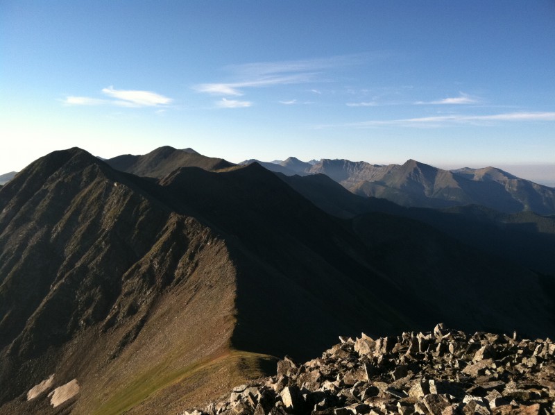
The North Ridge of Cottonwood Peak was mixed grass/rock and I made quick progress towards the summit where the sun finally caught me and cast its golden and warming glow on the beautiful world around me. Cottonwood Peak's North Ridge Here comes the sun! Golden glow on the crest of the Sangres from summit. Crestones and Blanca visible.
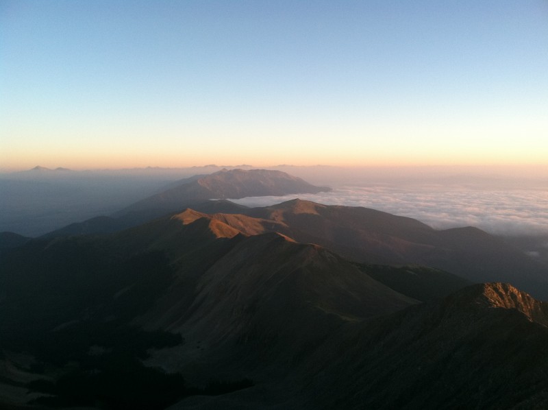
While it was clear down in the valley when I left the cabin a cloud layer had now formed at 10,500' and filled the Wet Mountain Valley but hadn't formed in the San Luis Valley. So it gave the appearance that the Sangres were a sort of a "cloud dam". I could also spot peaks in the Sawatch all the way up to Harvard/Columbia.
Sangres Cloud Dam. Sawatch 14ers visible. Peak shadow
I spent about 15min on the summit soaking in the awesome views to be had in every direction and then headed down towards the saddle with my next objective, PT13,123B. Nice soft tundra led to fairly stable Class 2 talus at the saddle
On the way down to saddle w/ 13,123B Looking back at Cottonwood Peak Basin above Silver Lake
The climb up PT13,123B was quick and easy and I reached the summit around 6:45am. Easy talus to PT13,123B View South from 13,123B summit Interesting summit cairn on 13,123B
Hung out on the summit for another 15-20min and then headed down to Garner Pass. Thirsty Peak
Here I found a nice trail down into the upper part of Cloverdale Basin where it disappeared. I couldn't stop looking at the spectacular view of unranked Thirsty Peak's North Face as I traversed the lush, green basin. Thirsty Peak's North Face lords over upper part of Cloverdale Basin
I avoided the willows as much as possible and traversed along the willow-talus boundary back to tree line. Talus-Willow interface. Talus is preferred.
The forest was nice and open allowing easy navigation back to the TH where I followed the road back to where I parked. Cloverdale Basin
I stopped and looked at the Cloverdale Mine buildings across the valley below the impressive cliffs of Eagle Peak. They were in surprisingly good shape probably due to the cliffs actually protecting them. Arrived back at the car around 8AM. Cloverdale Mine
What a sweet and wonderful quick sunrise hike in the beautiful Sangre de Cristos.
My GPS Tracks on Google Maps (made from a .GPX file upload):
Thx for the info about the trail down from the Pt 13123-Thirsty saddle. I was recently up in Cloverdale Basin and looked for the end of that trail/road. Going by the topo, that should be near the current end of vehicle travel. But I couldn't find it. I figured it had been overgrown by the willows. However, sounds like it's still viable to descend that way. I'll just have to be resigned to some willow-bashing at the end. Sound right?
Caution: The information contained in this report may not be accurate and should not be the only resource used in preparation for your climb. Failure to have the necessary experience, physical conditioning, supplies or equipment can result in injury or death. 14ers.com and the author(s) of this report provide no warranties, either express or implied, that the information provided is accurate or reliable. By using the information provided, you agree to indemnify and hold harmless 14ers.com and the report author(s) with respect to any claims and demands against them, including any attorney fees and expenses. Please read the 14ers.com Safety and Disclaimer pages for more information.
Please respect private property: 14ers.com supports the rights of private landowners to determine how and by whom their land will be used. In Colorado, it is your responsibility to determine if land is private and to obtain the appropriate permission before entering the property.

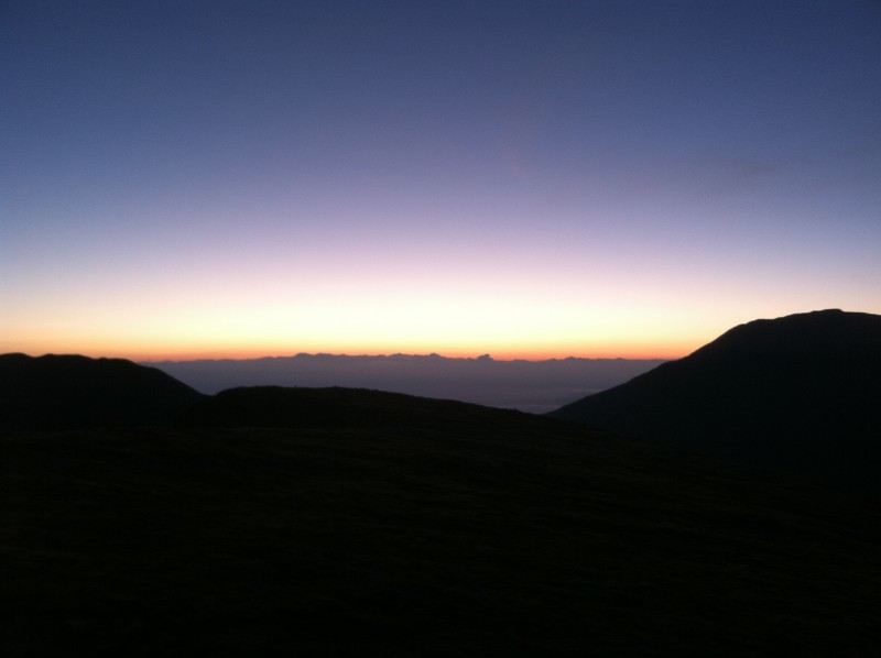


 Beautiful morning light")
 Illuminated clouds above Eagle Peak")
 Cottonwood Peak's grassy East Ridge")
 Cottonwood Peak's North Ridge")
 Here comes the sun!")
 Golden glow on the crest of the Sangres from summit. Crestones and Blanca visible.")
 Sangres Cloud Dam. Sawatch 14ers visible.")
 Peak shadow")
 On the way down to saddle w/ 13,123B")
 Looking back at Cottonwood Peak")
 Basin above Silver Lake")
 Easy talus to PT13,123B")
 View South from 13,123B summit")
 Interesting summit cairn on 13,123B")
 Thirsty Peak")
 Thirsty Peak's North Face lords over upper part of Cloverdale Basin")
 Talus-Willow interface. Talus is preferred.")
 Cloverdale Basin")
 Cloverdale Mine")