| Report Type | Full |
| Peak(s) |
Gannett Peak - 13804 |
| Date Posted | 07/07/2012 |
| Date Climbed | 06/30/2012 |
| Author | ChrisinAZ |
| Additional Members | TerryLiv |
| Peaking in Wyoming (part 2) |
|---|
|
Click here for part 1... Day 3 - Continued How scary is the final summit ridge, you wonder? The answer is, "it depends". It depends on what time of year you're there, how much snow is present, what time of day it is, your comfort level with exposure and sidehilling snow, and even what part of the ridge you're on. The NOLS group had described it as "a four-foot-wide flat path with exposure on either side", which isn't entirely accurate. It's more like "hundred-foot-long, slightly upill sections on mild-to-moderate slanted snow with some exposure, punctuated by ten-foot-wide flat areas". On your left, there are a few rock shards between you and a precipitous drop. On your right, a sloping snowfield that ends 200-300' later in a precipitous drop. Most of the ridge traverse isn't technically challenging at all--flat, mildly uphill, or on mildly sloping snow--but a fall would be disastrous if you can't self-arrest. We heard repeatedly about a man who'd died after slipping and not being able to self-arrest on this ridge, and in fact our guide Tonia had driven him and his son in last year. She'd made us promise not to do the same, and in honoring that promise, I cramponed up for the last section. 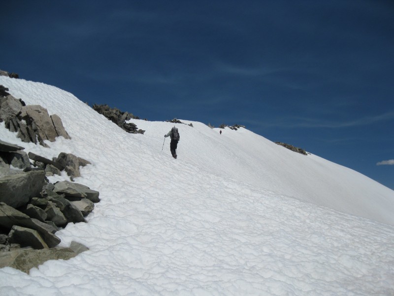 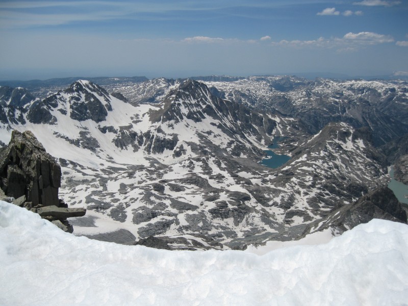 Partway up, the other solo climber passed us on his way down. He reported the last bit before the summit as being sketchier, but claimed he'd kicked good steps for us. He was out of food, and bummed a few granola bars off of Terry, then went on his way. We reached the last section, which necessitated sidehilling 35-degree snow slopes for a hundred feet or so, with decent exposure. At one point, I made the mistake of looking down, but mostly just focused on the few feet in front of me and the task at hand. 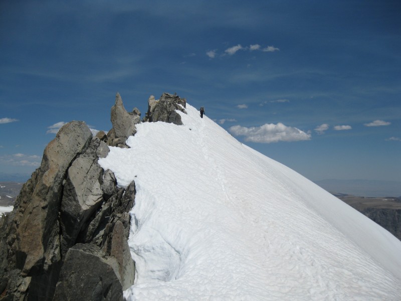 Meanwhile, Terry was pulling ahead of me, feeling far more at ease on the snow. At last, I passed the difficult section, and all that lay between me and the summit rocks was a flat patch of snow. We were home free! 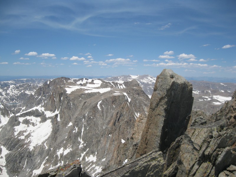   I took off my crampons, scrambled the last few dozen easy feet uphill, and found myself atop my 30th state highpoint.  Around us, the skies were slightly hazy and the endless valleys on either side of the range obscured by smoke, but we could see up and down the Wind Rivers a ways. The range looked to become less severe only a few miles to the north and south, but Fremont Peak and the nearby spires of rock were incredible. To the east, we could see the twin peaks of Washakie Needles, another technical Wyoming county highpoint. To the west, a gentler snow-covered range that probably held Wyoming Peak, and to its right, rising like a dream, the impossible snowy summit of the Grand Teton. A horseshoe adorned the highest rock, and the summit register was about the largest I'd ever seen. Terry and I spent a half hour or so reveling in the beautiful day and the views, but we were both ever mindful that the climb was far from over. We both decided to try to call loved ones, and to my utter surprise, we both got through! This is the same phone that didn't work atop Mt. Evans with a direct line of sight to Denver, so you can imagine my astonishment. At around 2 PM, we started down, and it went better than expected. The summit ridge wasn't quite as scary on the descent, and we were soon on rock again, making decent time. 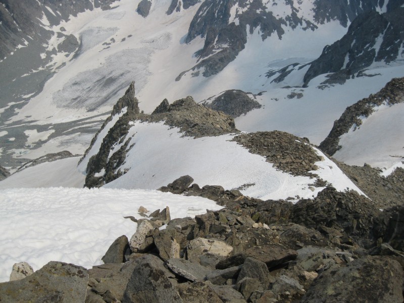 We both ran low on water at this point, but I wasn't too worried--we weren't doing as hard of work, had abundant snow around, and I had iodine tablets if we really needed them. Our progress ground to a halt at the top of the two steep snow chutes, and on a whim, I scrambled around to see if the lower saddle I'd seen in the left chute was reachable from our higher position. Nope! The way was guarded by a technical cleft in the ridge, no dice. We returned to the upper part of the glacier and got our rope and gear on again, as I idly wondered about the Gooseneck Pinnacle. It looked like it might be 4th or low 5th class to attain, but that'll be for someone else to find out... 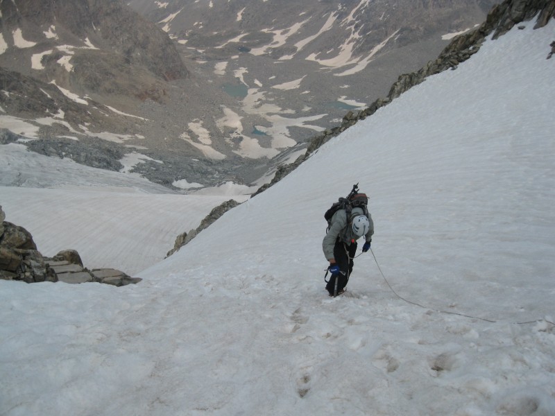 I'd never descended snow as steep as this part before, but it turned out to go well enough. Terry and I both just faced in, kicked good steps, and essentially reversed what we'd done in the morning, this time with me occupying the upper position on the rope.  Like an idiot, I'd neglected to throw gloves on before this section, so I found myself using my bare hands to hold onto the snow--a chilling proposition! Slowly, we made downhill progress, Terry passing over the 'schrund, then me. Just after crossing the snowbridge, I let out a whoop--we'd done it! We'd actually climbed Gannett, and from here on out, the rest was a cakewalk in comparison. I took off my crampons, no longer needed, and made a slow glissade down to the rock band.  From here, the descent went relatively quickly. I tried to convince Terry to glissade the lowest snowfield, but he didn't seem very open to the idea. I told him I'd wait for him to get out of the way, glissade, then wait for him at the bottom near our stash point. Terry went ahead as I picked my way down through the rocks to find a good launching point. Much to my surprise, I suddenly noticed he was glissading! I yelled down, asking how the glissading was, and got a thumbs-up in response. He then glissaded the second portion of the snowfield and made his way over to our cache. I followed soon after, and met him back at the cache, where I found out both of his glissades had been accidental! Ah, well...we both took healthy swigs from the water I'd had at the stash point, then we proceeded down the last bit of glacier, onto the rock and talus around the stream, and down the mountainside to the NOLS campsite. They'd gone down to Gannett Creek that day to resupply with food, but were already back, and we stopped and chatted a while as the group congratulated us. They offered us some backcountry pizza, but we declined, both just ready to get back to camp. 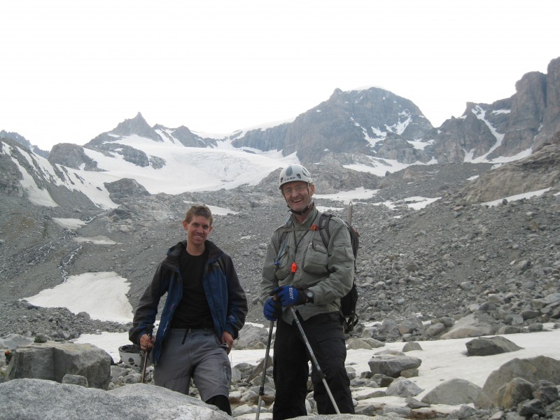 Around 8 PM, 15 1/2 hours after we'd started, we stumbled back into camp. Only three things were on our mind: filtering water, eating dinner, and sleeping, and we did all three in short order, sleeping like the dead.  Day 4 - Hallelujah, It's Raining Ash We awoke on our own time, ate breakfast, and left camp at the late hour of 11 AM. 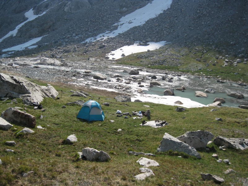 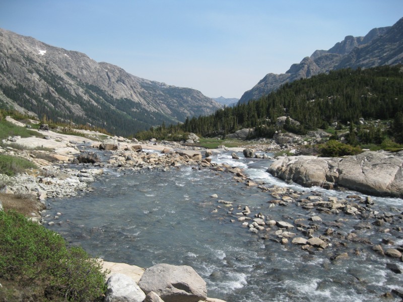 We found the snow and water obstacles on the trail slightly more negotiable on the way down, though my shoes still got wet. An hour later, we were crossing Gannett Creek, and soon after, making our way down the Glacier Trail along Wilson Meadows. 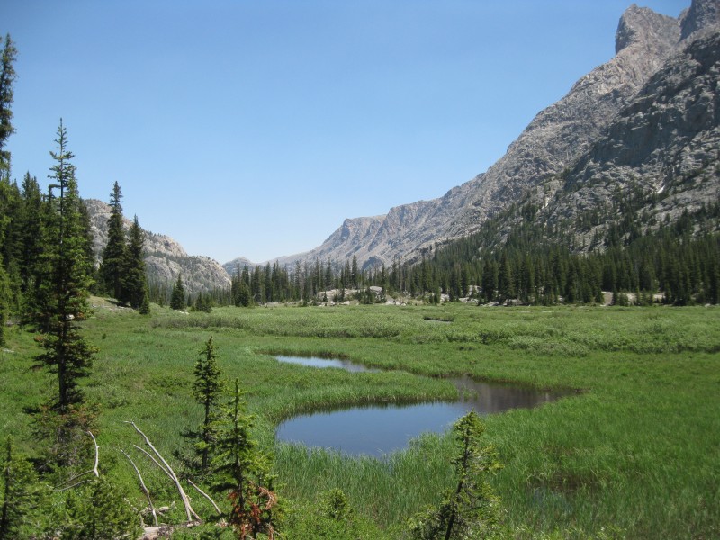 The day was warm, and in spite of the generally easy terrain, we were taking plenty of breaks. During one of them, I'd spaced out when I suddenly heard Terry address someone who wasn't me--I looked and noticed a man heading up the trail! He turned out to be a highpointer from Vermont, attempting Gannett as his 44th state. We chatted with him a short while, and answered his questions about the route ahead. He mentioned a large group coming up behind him who we was planning to glom on with, and I wondered if we'd see them. Sure enough, once we'd reached the bridge and trail junction back up the Ink Wells route, we noticed several people setting up camp on the opposite bank. After filtering water, the group leader, a man of about 60 hailing from Casper, came over to ask us where we'd come from. When we told him we'd done Gannett, he asked what the route was like, and we told him. He was overjoyed at the news, and practically wanted to hug us! As it turned out, he was an experienced mountaineer making his fourth trip to Gannett, and was leading several flatlanders up the peak. They'd brought quite a bit of mountaineering gear with them, but now knew they could stash it since the 'schrund was still closed. Another friendly group, though apparently several of them were still struggling with altitude at 9600', even after two or three days in the mountains. Hope they had a successful trip... Meanwhile, Terry and I started up the 800' back to Echo Lake. Smoke and clouds helped keep the sun off and the temperatures a bit lower, which helped, but it was still slow going. White, ashy flecks periodically floated down from the sky and settled on us and the ground. 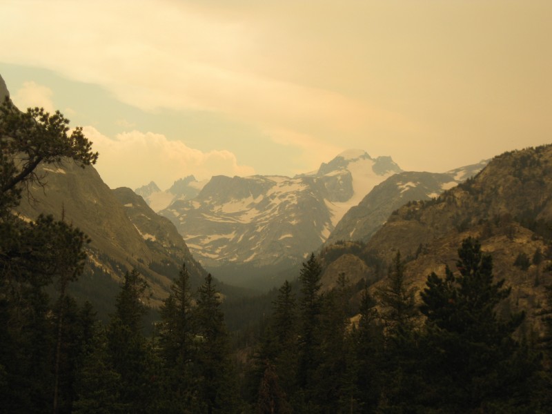 We were both tired, and concerned our tent site from before might prove to be occupied, but when I crested the last hill ahead of Terry, I saw it was blissfully empty. I wasted no time in setting up the tent, and soon our gear was strewn about and our bags unpacked for a lengthy stay. I made another side trip up into the rocky hills above camp, taking a roundabout way over the class 3 rocky knolls to the patch of snow I'd found the last time. Scooping some up into a plastic bag, I carried it back to camp. Voila! Instant refrigerator for my summer beef sausage. I ate about half, sharing some with Terry, and we went to sleep shortly after. Day 5 - You Snooze, You Lose? Like my 6-day climb of Mt. Whitney a few years before, our fifth day proved to be a sedentary one; unlike that trip, the day was a pleasant and happy occasion. Terry and I both slept in, though by mid-morning he'd decided to take a stroll a mile up the trail back toward the trail split. With it being a cooler day than usual, and my sleeping bag feeling just too damned cozy, I stayed in the tent and enjoyed a few hundred pages of The Brothers Karamazov. Terry came back, and we both drifted in and out of sleep for the next few hours. Finally, around noon, I roused myself, put on my headnet, and left the tent. First, a refueling of summer sausage and repacking fresh snow. Then, time to filter enough water for the rest of the trip with Terry's water filter. Still feeling tired, I hemmed and hawed a while, but finally got myself ready for the day's main objective: trying to climb the big rocky knoll south of camp. What I knew was that the summit was in the 10,700' range; what I didn't know was the difficulty of the easiest route, and whether it had sufficient prominence to be considered a ranked peak. My sincere hope was that it was; in my 13 years of climbing and peakbagging, and the few hundred summits I'd attained, I'd somehow never climbed a single 10er. Not in Wyoming, not in Colorado--not anywhere! I was hoping to break that streak, but didn't know what I was up against, and so brought my climbing helmet just in case. As it turned out, I needn't've worried. I hiked about five minutes south of camp, and spotted the peak--a mostly-bare rocky protuberance that dropped off steeply on the northeast side, with a more gentle southwestern aspect. 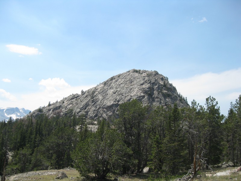 Most importantly, I noticed what looked to be a vegetated gully heading straight up the side to a bench high on the side of the mountain. I headed for it, considering it probably my best shot at easily gaining the summit, and it indeed turned out to be a trivial class 2 scramble for perhaps 200'. I topped out at the flat bench, surmounted a quick bit of class 2+, and made the remaining easy walk to the summit which was adorned with a cairn and stick. The views were wonderful--360-degree vistas toward Gannett, innumerable rocky and snowy pinnacles, the valley a thousand feet below, Horse Ridge and Scenic Pass to the east, and the Washakie Needles again in the distance. A worthy summit for the first 10er of my life, and yes, it turned out to be ranked. 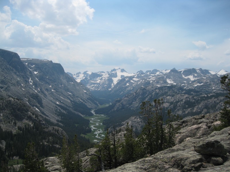 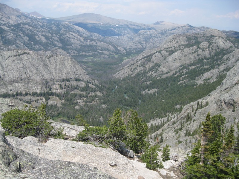 I spent some time admiring the views on top, then returned to camp. Five days in the wilderness can make one rather smelly, so I opted to dip in Echo Lake after shouting a few times (yes, the lake DOES live up to its name!). Even though the water temperature was well above glacial, probably in the high fifties, I found myself struggling to brave the cold and submerge myself. Chalk it up to burning off all my body fat in the previous few days, I guess...I finally "took the plunge" and dunked my head underwater, then immediately got out and changed into dry clothes. 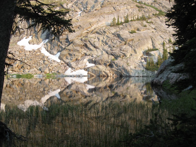 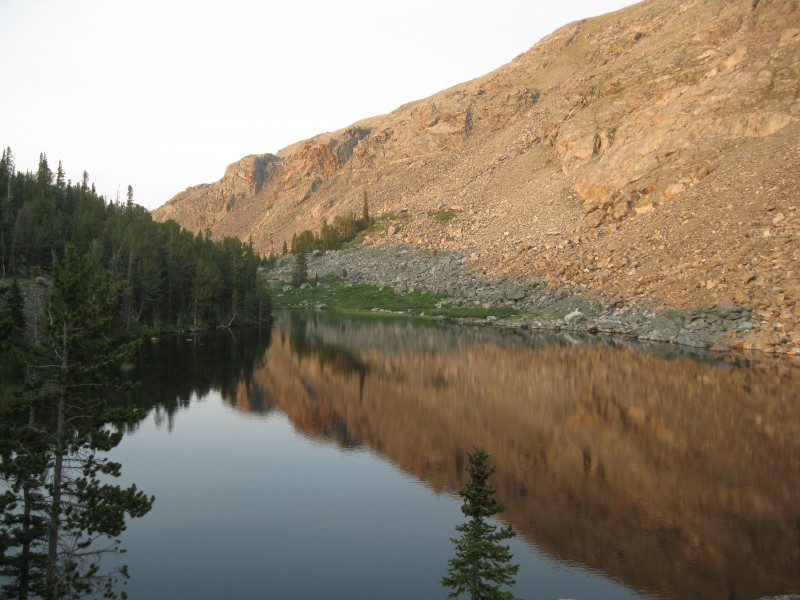 Dinner was the remainder of my summer sausage, and I was pleased that it looked like I'd be able to save my last MRE, as I had no more of them after this one. After dinner, while Terry was away fishing, two younger guys passed by our camp. For some reason, I didn't trust them, and I was glad when they disappeared down the trail. Bedtime approached, but one potentially major issue remained: waking up on time. As it happened, my craptacular $10 alarm clock I'd bought at Pamida worked for all of three days, then conked out. It wasn't a battery issue, as it would still light up when the snooze button would press--but the display didn't work, and even setting the time and alarm blind didn't work. I was rather ticked, but even more so, worried that we'd miss our noon pickup time the next morning. If we missed it, we were SOL, since the outfitters took the 4th off for a big celebration in Lander; our earliest opportunity to get out would be the 5th, IF any climbers were coming that day! Neither of our cell phones would work, and I finally figured out how to set an alarm on Terry's wristwatch, but it was too quiet for him to hear. He's a light sleeper, so we decided on a plan of setting his alarm clock, both of us checking our GPS units for the time during the night. We ideally wanted to wake up at 4, but decided if we woke up anytime after 3, it would be go time. Uneasy, I drifted off to sleep as the skies darkened... Day 6 - Getting the Elk Out of There A bit after 3 AM, Terry luckily woke up, and finally roused me around 3:30. I'd done most of my packing the night before, and so was pretty much ready to go after 20 minutes. We left at 4:15, early enough that I had no worries about us getting back to Cold Springs in time. We reached the trail junction, went right on the upper branch, and were above treeline before long. After the initial mile or so, the trail became very gradual and manageable, and thanks to our day of refreshing relaxation, we both felt fresh and were making good time. 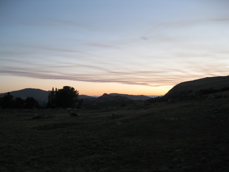 As sunrise approached, we took a lengthy break on the grassy hillside and watched one of nature's greatest shows: sunrise on the jagged peaks and granite faces of the Wind Rivers. The mountains glowed pink, then orange with alpenglow as the sun slowly rose--a wonderful sight. 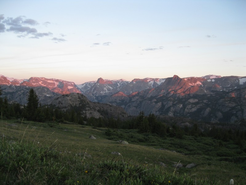 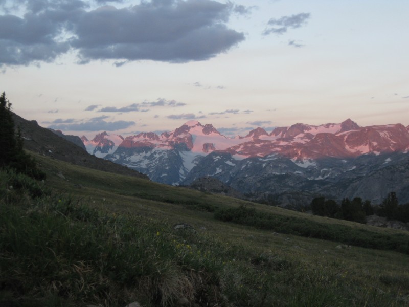 However, we were still freezing, as the sun had not crested the gentle ridge we were ascending. We continued on... A short distance later, we noticed a few elk on the mountain ahead of us. By "a few", I mean "over a hundred"! They made their slow progress a half-mile ahead of us, meandering along the mountainside and bugling all the while. While I'd heard the term before, I'd never actually heard elks bugle, and the term seemed inaccurate to me; the sound was more a chorus of high, reedy yips, something between the sound of a flock of birds and a pack of coyotes. According to Terry, who's had extensive experience hunting elk, most of the bugling was that of mother elks crying out for their calves. 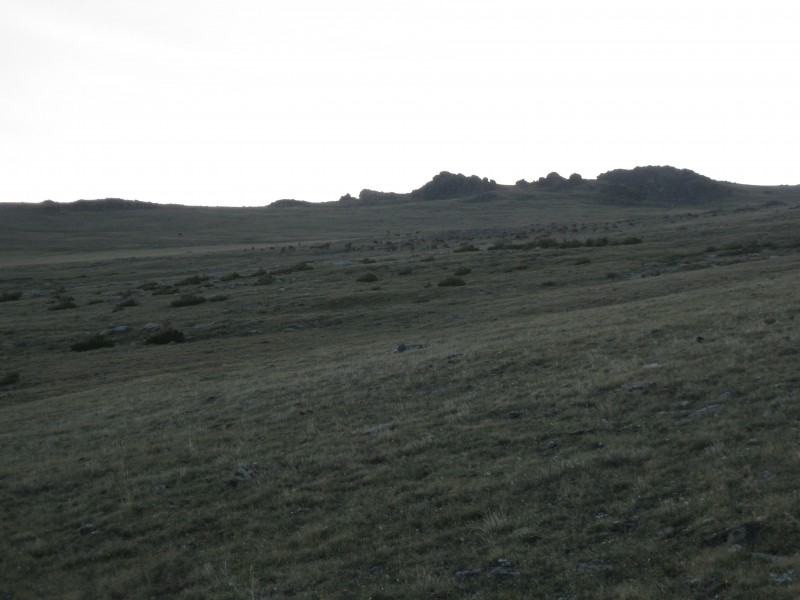 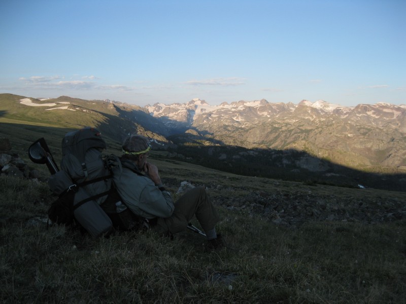 The sun came up, at last, as we reached the rejoining of the trail. From here, there was little elevation to gain to Scenic Pass, but we still took a while to get there. At the top of the pass, I decided to make another trip up to the rocky knob with a view of the range, and this time I was not disappointed. Snowy peaks stretched across the horizon, Gannett standing proudly in their midst and rising above all. I made a silent thanks to the mountain for allowing us safe passage, took one last look, and began the descent toward civilization. 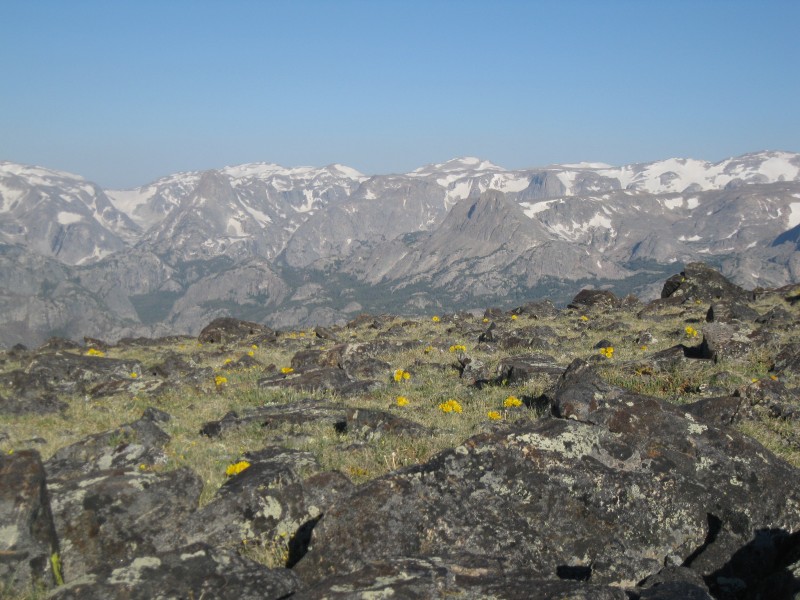 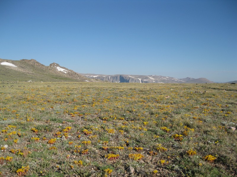 This time, Terry waited till I returned to our packs, then went ahead a bit. After refueling, I started down the pass shortly after 8 AM. We now made excellent time down the easy, gradual trail, and the miles flew by. We entered the trees, passed our troublesome meadow where we found the correct route, reached the reservation boundary, and were back at the meadow less than a mile from the trailhead--all in the seeming blink of an eye. 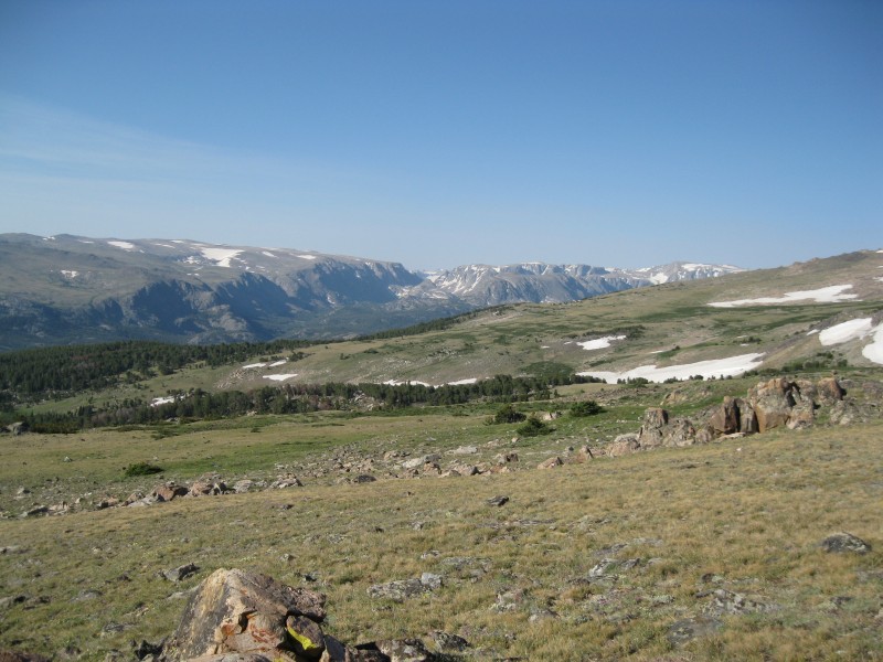 At the meadow, we noticed one or two figures in green hanging about by the boundary fence along the other trail. They soon caught up with us, and proved to be a grandfather and grandson from Longmont and Windsor--towns 20 minutes from us!--and had been on a fishing trip. They mentioned two others in their party were coming out, perhaps 45 minutes behind, and they followed us as we made our way along the last bit of faint trail through the forest. Just a few tenths of a mile from the pickup point, we ran into two hikers who turned out to be attempting Gannett. We gave them a few tips, and they mentioned that the driver was waiting for us just beyond. We crested a small hill, and there was the truck, and Tonia ready with cold drinks! Terry and I set our packs down and collapsed a few minutes, welcoming the end of an adventure. As it turned out, the other two members of the other party showed up almost immediately, so we had little time to relax--by 10:30, we were on our way down the mountain, an hour and a half ahead of schedule! Terry and the grandfather and I rode in the cab, while the other three sat in the bed of the truck with all the gear. In an hour and a half that seemed like no time at all, we were back in Crowheart, and after exchanging pleasantries with the rest of the group and Terry getting Ramona's address, we were back on our way to Lander, where the mercury was topping 96 degrees. First stop: the community pool, where we took showers and I shaved. Clean, and in fresh clothes, I felt like a million dollars. Next stop: Tony's Pizza, where I had a small lunch--two 9", 2-topping pizzas and a lasagna dish. Gotta love carb-loading. Last stop: gas, and a large slushie. Then we had only to drive home. The return was nearly as boring as the drive up, punctuated by the occasional small mountain range or ramshackle town like Jeffry City, which looked like the set of a small-western-town slasher flick. We caught up on some of the news we'd missed over the past week, I dozed a while, and the miles melted away. We switched off in Rawlins, where I drove until Laramie, and we finally rolled into Fort Collins around 7 PM. It seemed surreal to be back home when I'd been high in the Wind Rivers that morning. Even more surreal, and what hasn't fully sunk in yet, is that we climbed one of the most difficult major summits in the lower 48 states. As I start medical school in a few weeks, I will look back on this trip with fond memories, and the continued realization that we were very lucky to have made the summit as easily as we did. Afterword: Gannett is a beast of a mountain, and nothing in Colorado really compares. The approach from Ink Wells, ignoring heavy packs, is not particularly onerous; the summit day is manageable if you've had sufficient snow climbing experience. However, it's the combination of the two, in conjuction with Gannett's remoteness and potential for nasty weather, that makes this peak such a challenge. It didn't feel like the hardest summit I've ever climbed, but that can probably be attributed more toward having gained experience and stamina after earlier climbs than to it actually being easier than them. Gannett demands much of those who climb it, and those attempting to reach her summit must be able to handle the rigors of summit day AFTER a multi-day, pack-laden approach. A climb of Gannett should include the following indispensible items: crampons, ice axe, harness, carabiners, rope, climbing helmet, headnet and DEET, small summit pack, maps and GPS, at least one rest day, entertainment (books, cards, fishing rod, etc.), tent and such, water filter or iodine tablets, sunscreen, sunglasses or ski goggles, sufficient food, bear canister, and the ability to carry 3 liters of water. Terry and I made do without a cooking stove or campfires, but you may want to bring them (particularly the former, given the wildfire situation as of recent). A camera is, of course, highly recommended. Some may wish to further protect snowy sections with pickets. Trails are faint, but most of the time, several seconds of surveying the surrounding terrain will lead you to the correct option. Bears are present, almost all of them black bears, and are apparently almost never an issue--but still, hang or safely stow your food. Marmots, mice, chipmunks, and squirrels are around, but in lesser numbers than some Colorado peaks. Time your climb during the summer so that the approach has melted out, but the 'schrund is still intact--basically, right now in a low snow year like this one, probably mid-to-late July in a typical year. Those of you with August plans for Gannett this year should probably bump your trip much earlier if at all possible. Most importantly, bring competence, experience, dogged persistence, and a sense of adventure with you--you'll be drawing on all of them! Terry, it was a pleasure climbing with you again, and you've proved yourself to be even more of a badass than before. My immense thanks for making this trip possible for both of us, and all the best of luck to you on Rainier and the Grand Teton this summer... Thumbnails for uploaded photos (click to open slideshow):
|
| Comments or Questions | |||||||||||||||||||||
|---|---|---|---|---|---|---|---|---|---|---|---|---|---|---|---|---|---|---|---|---|---|
|
Caution: The information contained in this report may not be accurate and should not be the only resource used in preparation for your climb. Failure to have the necessary experience, physical conditioning, supplies or equipment can result in injury or death. 14ers.com and the author(s) of this report provide no warranties, either express or implied, that the information provided is accurate or reliable. By using the information provided, you agree to indemnify and hold harmless 14ers.com and the report author(s) with respect to any claims and demands against them, including any attorney fees and expenses. Please read the 14ers.com Safety and Disclaimer pages for more information.
Please respect private property: 14ers.com supports the rights of private landowners to determine how and by whom their land will be used. In Colorado, it is your responsibility to determine if land is private and to obtain the appropriate permission before entering the property.